DC Dept. of Transportation Historic Photos

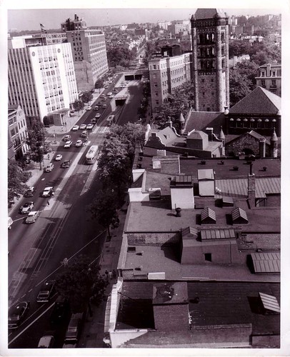
Connecticut Avenue, NW, below Dupont Circle looking north. Note the separate tunnel for streetcars and the Church of the Covenant tower. (ca: 1958).
From Erik Linden, DC DDOT (via Steve Pinkus):
The District Department of Transportation (DDOT) has posted 25 historic photographs on the DDOT website. The people, buildings, street signs, cars, streets, highways, trucks, streetcars, traffic patterns and street lights are captured as they were in the 1940s, 1950s and 1960s.
"These historic images are a fantastic way for the traveling public to view the history of transportation in the District of Columbia ," said Emeka Moneme, acting Director of DDOT. "From New York Avenue, Northeast to Minnesota Avenue, Southeast , these stunning images provide a snapshot of our city's transportation history. Keeping an eye on history helps us learn from the past and move forward to the future." ...
The images help document the District's transportation history and are one aspect of DDOT's preservation efforts to collect and conserve photos, studies, reports, plans, design and construction documents, drawings, and artifacts. These preservation efforts are part of a history project sponsored by the DDOT Research and Technology Development Office with support from the Federal Highway Administration (FHWA).
To see the Archival Historic Photos, go to the DDOT website, click on "Transportation Planning & Research," and then on Historical Photo Archives
Index Keywords: transportation


0 Comments:
Post a Comment
<< Home