The Golden Arches of Girard Avenue, Philadelphia
(Flickr photo of the Girard Avenue Streetcar by K Gradinger.)
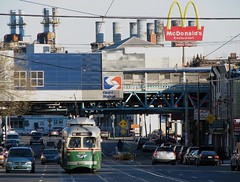
Girard Avenue is wide. But I was talking with someone today. He remarked that in the past he disagreed with me that a streetcar could work on 12th Street NE (a CUA urban design studio suggested a couple years ago that rather than have a crosstown streetcar end in Brookland, it could loop on 12th Street, connecting to Rhode Island Avenue station and Providence Hospital on the north--I suggested additionally that the streetcar could be extended out Michigan Avenue, Queens Chapel Road, and Adelphi Road to the University of Maryland, and more recently that streetcar service be required as development linkage/community benefits as part of development on the McMillan and Armed Forces Retirement Home), but after seeing the streetcar on Girard Avenue a few weeks back in Philadelphia, that it could work.
WRT streetcar service in DC, there is nothing to prevent them from also using historic and historic replica cars like the PCC cars. (For one thing, they could get such cars a lot more quickly than the Inekon Trios.)
Note that in the streetcar map printed in the Comp Plan, the crosstown line with service between Woodley Park --maybe further west to include Georgetown and AU from different strands -- and Brookland was dropped.
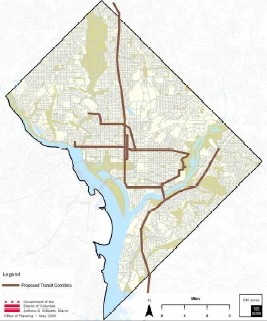
DC Streetcar Map as depicted in the Comprehensive Plan
The Sierra Club intends to lobby for the full original proposal.
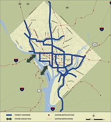
Proposed streetcar system as part of the original DC Transit Future study.
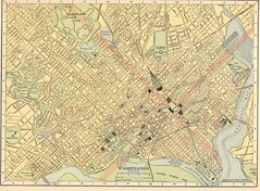
Map of Washington, DC , 1908, showing streetcar lines, railroads, and steamship docks (Hammond Company)
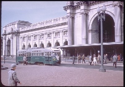
Trolley stop, Union Station, Washington DC. (Photo source unknown.)
posted by Richard Layman @ 7:07 PM&Permanent Link
![]()
![]()


0 Comments:
Post a Comment
<< Home