Interesting transit map #1: NYC Subway system underground service network
Winter weather wreaks havoc on above-ground transportation systems.
I have argued in the past that it would have been worth building more of the Metrorail system underground to ensure that it would function in bad winter weather.
At the time the system was built, that didn't seem necessary, but as Global Warming makes weather more unpredictable and violent, circumstances may be changing (not that we can go back and rebuild the system).
Of course, DC is not Montreal, which has a fully underground subway system which functions in all weather conditions. (In fact, I am a bit skeptical of the proposed multi-line light rail system there, because it won't necessarily be resilient in the face of big winter snows. See "Caisse's REM light-rail project: 3 stations added to proposed route through Downtown Montreal," Montreal Gazette.
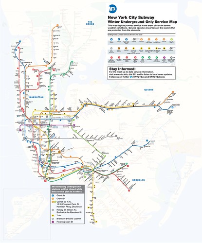
While this past week we got some snow which bollixed things up a bit, it was 1/3 to 1/4 of the amount of snow that fell in NYC. In advance of the storm, MTA announced that the subway system would shift to underground only operations, and they published a map showing that network.
Labels: emergency management planning, provision of public services, risk management and redundancy, transit operations, weather
posted by Richard Layman @ 1:39 PM&Permanent Link
![]()
![]()


0 Comments:
Post a Comment
<< Home