Star-Spangled Banner Historic Trail public meetings
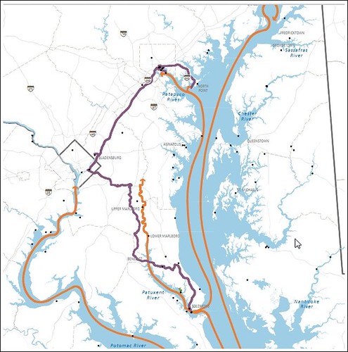
Map showing a portion of Star-Spangled Banner National Historic Trail and Byway. Purple is land-based, orange is water-based. From the Star-Spangled Banner National Historic Trail interpretive Plan.
The City of Washington was attacked in 1814 during the "War of 1812." British troops landed in Bladensburg, fought there, then marched up Bladensburg Road to Washington, and continued onward up Maryland Avenue, to the Capitol, White House, and other federal buildings, which they destroyed. Allegedly, the troops bivouaced on the Capitol grounds and in the vicinity of H Street and Bladensburg Road afterwards.
I always thought that the intersection at Maryland Avenue, Bladensburg Road, H Street, and 15th Street would be a good place to have a small interpretation center. (Now, I am not so sure it would get used.)
The Star-Spangled Banner National Historic Trail and Scenic Byway is land-based and water-based, and is focused on interpretation of the events associated with the War's battles concerning DC and Baltimore, the writing of the National Anthem, etc.
The National Park Service Chesapeake Bay Office will present alternative concepts for developing the Star-Spangled Banner Trail and Scenic Byway at a series of workshops. These trail alternatives will propose management objectives, policies, and actions that could guide the development of the trail and byway over the next 15 to 20 years.
The latest edition of the trail's newsletter describes the alternative concepts; and, the accompanying activities report details trail building projects already underway. You may find it helpful to look at these before attending a workshop. Copies will be available at each workshop location.
Join us at one of these locations and tell us what you think!:
Monday April 18 (DC area)
4 pm to 6 pm
Bladensburg Waterfront Park
Visitor's Center
4601 Annapolis Road
Bladensburg MD 20710
Wednesday April 20 (Baltimore area)
4 pm to 6 pm
Creative Alliance at the Patterson
3134 Eastern Avenue
Baltimore MD 21224
posted by Richard Layman @ 6:23 AM&Permanent Link
![]()
![]()


0 Comments:
Post a Comment
<< Home