DC's high profile road diet initiative in the Metropolitan Branch Trail
Road diet is a term describing the process of rebalancing road right of way to mobility uses (transit, walking, biking) other than for motor vehicles.
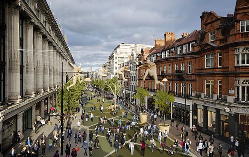
Rendering, pedestrianized Oxford Street, London
It's not so high profile at the level of the King Street streetcar prioritization in Toronto ("King Street streetcar, Toronto (and Seattle's urban mobility planning") or the Oxford Street pedestrianization program in London being developed alongside the Crossrail program, which is expected to bring one million more people each week to one of London's leading shopping districts ("We have no choice about a pedestrianized Oxford Street," editorial, Evening Standard), but that being said, the next segment of the Metropolitan Branch Trail, where for about three blocks it will be placed in a very visible way, on street on the northbound section of Blair Road NW, is a big deal.
The process of getting the neighborhood council to agree has taken almost eight months (I am on the public works and infrastructure committee for that group), and was initially challenged by prominent members of another committee, on design, over concerns about reducing motor vehicle capacity on a main arterial and that the area has traditionally been car-centric and suburban and should remain so etc.
It happens that this ward, Ward 4, in what I call the "outer city" ("DC as a suburban agenda dominated city") is the city's most car dependent, with 3-4 Metrorail stations (because of some geographical quirks and primary bus routes that go to the Silver Spring station, even though the station is in Maryland, it also serves DC residents) and major bus routes on 16th Street, 14th Street, and Georgia Avenue. (Connecticut Avenue is in Ward 3, but a bit of Ward 4 bumps up close to it).
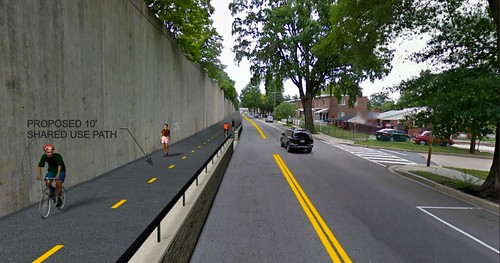
In internal communications I argued quite vociferously about the value of the project as a traffic safety measure--because of the "race track" walls from the railroad abutment and the extra northbound lane, traffic tends to move at speeds much higher than the posted limit, and often recklessly, passing cars from the right lane, etc.
And that changing the nature of Blair Road to be more complementary to the neighborhood has a variety of advantages. And the reality is that northbound, with two lanes, only moves about 1,000 more vehicles daily compared to the single southbound lane. It would also make the road width congruent with the section between Aspen Street and the DC line with Montgomery County, where the road is only one lane in each direction.
Our committee held 5 meetings--the last one took five hours--including walk throughs in the field, and worked to engage the four commissioners within whose "single member districts" the project will run.
On Monday night, the Commission voted, surprisingly unanimously, in favor, but at a marathon meeting of their own which went on for almost five hours.
It's true that the Pennsylvania Avenue bike lanes in the middle of the street are the most prominent example of high profile cycling infrastructure in the city. But by being placed where they are, it didn't take away any highly visible traffic lanes.
Putting a cycletrack on a highly visible arterial--it serves Montgomery County mostly, and by continuing on as North Capitol Street further south, provides a direct connection to Downtown--is a big deal. Not huge like Toronto or London, but a big deal, and DC's Department of Transportation deserves some props for this move.
====
It's an example of what I call the "Signature Streets" approach, although not intentionally.
Interestingly, the MBT was proposed in the late 1980s and will take more than 30 years to come to fruition, which is an illustration of how long transportation infrastructure issues can take.
A big problem is that it was conceptually easy to lay out--a line along the railroad track between DC and Silver Spring, but right of way needed to be acquired, the National Park Service needed to agree to use of their land (and they haven't been super favorable), and in already developed places, it's been hard to figure out how to place it.
The last part yet to be planned is less than one half mile, between Piney Branch Road and Aspen Street, but it is the most difficult to thread, and there are no great solutions on how to do so.
The thing I had to realize is that recognizing that difficulty shouldn't be used to delay development of other parts of the program, nor to not consider any and all ideas.
Labels: bicycle and pedestrian planning, car culture and automobility, sustainable mobility platform, urban design/placemaking
posted by Richard Layman @ 3:57 PM&Permanent Link
![]()
![]()


1 Comments:
Congrats---that's great news!
Post a Comment
<< Home