Rebuilding Place in the Urban Space

"A community’s physical form, rather than its land uses, is its most intrinsic and enduring characteristic." [Katz, EPA] This blog focuses on place and placemaking and all that makes it work--historic preservation, urban design, transportation, asset-based community development, arts & cultural development, commercial district revitalization, tourism & destination development, and quality of life advocacy--along with doses of civic engagement and good governance watchdogging.

Thursday, February 07, 2013

That problem again: conflating the city and the metropolitan area and the annual report on traffic congestion

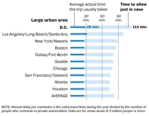
The Texas A&M Transportation Institute released its annual study, the 2012 Urban Mobility Report, on traffic congestion in the nation's metropolitan areas.

2012 Urban Mobility Report on CongestionBut because the center city of a metropolitan area and the metropolitan area are referred to by the same name, typically people think it's "the city" with the problem when usually (not always) the biggest problems are on the freeways and in the suburbs.

The Washington Post story "Washington rated the worst for traffic congestion — again" (Post graphic right) doesn't distinguish between the city and metropolitan area in the headline, but does, sort of, in the article, although it goes back and forth.

For those of us not relying on driving to and from and within the city, we do just fine.

What concerns me about the reporting is how it shapes perceptions of the issue and proposed solutions.

For example, people might think that "Washington, DC" proper should do a congestion charge, to deal with congestion (actually I think HOV-2 requirements on rush hour streets would go pretty far in terms of having a positive impact on traffic within the city), but the reality is that most of the real "congestion" is outside the city, and a charge in the city, but not outside of it, would end up diverting more commerce to the suburbs away from the city.

Or people would argue that we need to spend more money on roads for motor vehicles, when people throughput, at least in the city of Washington, is best maximized by transit, complemented by walking and to some extent biking.

As Jane Jacobs once said, when someone asked her "why aren't there enough roads?" ... "You're asking the wrong question.  The right question is 'why are there so many cars?'"

Etc.
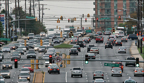
Rockville Pike, looking north, which Montgomery planners want to transform into a network of urban villages.  
Rockville Pike in the White Flint area.  Washington Post photo by Bill O'Leary.

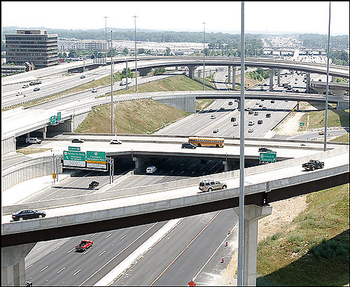
Springfield mixing bowl
Springfield mixing bowl (I-395).  Washington Post photo by Richard Lipski.

Labels: , , , ,

Monday, March 12, 2012

Missing the most important point #2: WMATA, real-time service information needs to be available at station entrances

Yesterday's Dr. Gridlock column, "Metro Riders ask what they're paying for," recounts the experience of Colin Helmer of Bethesda, who entered the Foggy Bottom Metro station to catch a train. But there were multiple problems on the Blue, Orange, and Red Lines (his intent was to transfer to the Red Line at Metro Center) with concomitant massive delays, so he left the station and took the bus instead. He grouses because going in and out of a station without riding still triggers a cost.
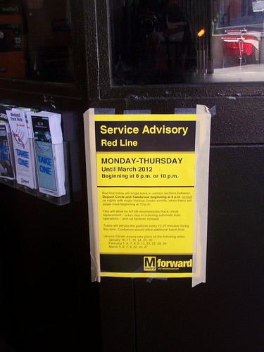
WMATA Red line subway service maintenance advisory notice
In the region, we all know about the degradation of service on the Metro system. This came up in the context of the recent hearings on fare increases ("Metro riders blast fare hikes as unjustified" from the Post). The degradation results from a number of reasons:

• the impact of under-funding maintenance (not WMATA's fault really, they predicted the result, but the jurisdictions funding WMATA didn't address the problem) for many years reached the point where it can't be ignored, and there are many years of repairs ahead of us, resulting in track and station closures at nights and weekends;

• the need to run the Metro trains on manual, for the most part, slowing the system and reducing ride quality (this is a result of the need to replace track circuits that monitor train placement, a circuit failure caused the crash in June 2009 that killed 8 people);

• more trains go out of service during the week because the cars are old;

• and because the system was set up with limited redundancy--only two tracks--a train failure can have significant increasing and cascading negative effects on the system, delaying service and riders across the system;

• not to mention how budget problems have led to reductions in service, especially in the evenings and weekends, increasing wait times and train "overcrowding."

So many times, it makes sense to take a bus or bike (bike sharing creates options if you don't have your own) instead.

Now it stinks that a small charge was deducted from Colin's SmarTrip card and he doesn't have any recourse.

While WMATA has been heralded in the trade press ("New media marketing" from Mass Transit Magazine) for its excellent communications, local bloggers and transit watchers don't have the same opinion, despite WMATA's hiring of a social media manager ("WMATA hires new social media manager" from the Post) under a more empowered and visible communications manager ("The Social Subway: Dan Stessel, WMATA's Twitter guru, wants to make Washington fall back in love with the Metro" from the Washington City Paper).

In any case, WMATA, like most transit systems (see "Attracting Riders in the new normal: For transit agencies, the 'operate and they will come' mantra is giving way to a marketing-based approach" from Progressive Railroading), needs to reorient its culture and approach concerning customer service and marketing.
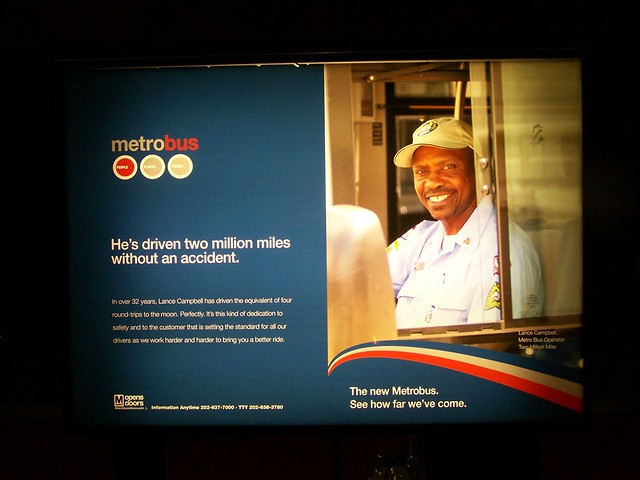
Metrobus image advertising campaign, WMATA
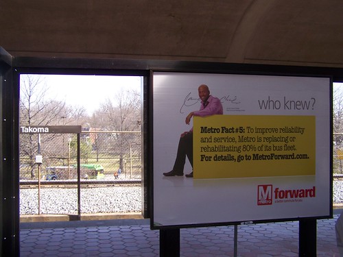
Metro Forward image advertisement, Takoma Metro Station

Granted WMATA communications staff have a difficult, almost impossible job.

But if the system wants to maintain support during this trying period, it needs to do more than run image ads in the Express and on Metro cars and in stations--they need to make fundamental changes to how they provide information to customers so that customers can make better decisions about their options on how to get around.

1. Change number one would be for WMATA to employ people as journalist-reporters to report on system status in real-time, just like how radio and television stations provide traffic reports during rush hours.

If trains are down and service is impacted, people need to know.

And the "reporters"--even if WMATA employees--need to be empowered with the authority to put the information out in real-time.

2. The information needs to be pushed out in a variety of ways--on the website (it is, but isn't always accurate), in social media venues, in real-time status displays that aggregate various mobility information (WMATA trains and buses, local buses, bikesharing, other transit options).

And the feeds should also be made available to local radio and television broadcasters for rebroadcast on air, because information on transit availability/uptime/downtime should be made available just as widely and as prominently as information about road status and traffic conditions.

(Of course, people need to get in the habit of looking for this information before going out to catch transit.)

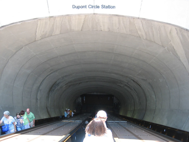
3. And these displays shouldn't just be in the station at and behind the gates, theses displays should be installed at station entrances on the surface--so that people have this information well before they descend into the bowels of the system, and it becomes incredibly hard to get accurate information and a pain in the butt to turn around and get out to embark on another mobility option. Plus, it can cost you, as it did Colin Helmer.
Dupont Circle Station2.jpg
Flickr photo by JG Gordon.

4. DDOT and Arlington County's Mobility Lab (see "Experimental real-time transit screens come to Arlington and DC" from the MobilityLab blog) has piloted real-time transit information displays located in public and private buildings so that people can know when the next train or bus is going to arrive. (By setting up "transportation zones" you can push out this feed to buildings in areas served by specific transit stops.)
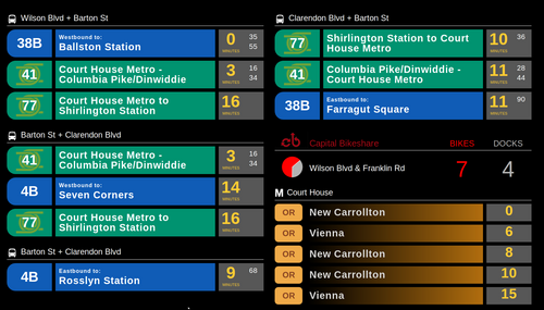
Arlington County Mobility Lab real time transit information display, Java Shack, Arlington
Arlington County Mobility Lab real time transit information display at Java Shack in Arlington shows information for subway trains, buses, and bike share.

MTA in New York City is piloting similar kiosks in a number of train (subway and railroad) stations across New York City. Obviously, in certain areas, you want to incorporate railroad transit information also.
MTA On the Go kiosk
MTA On the Go kiosk photo by Dan Nosowitz, from "Video: Hands-On With New York's On the Go Mobile Station, a 47-inch Touchscreen Subway Map" in PopSci.

5. Note that with information displays, WMATA is moving in the direction of real-time digital display of information, as they have released a RFP for the installation of such displays at bus stops, presumably high profile locations linking subway and bus service, around the region. See "Real-time bus arrival signs are coming to Washington, D.C." from TBD On Foot. The entry includes a link to the RFP documents.

Labels: , , , ,

Friday, December 11, 2009

(un)intelligent transportation systems (#2)

100_9290.JPG
I didn't read the paper til I got on the train today, so I didn't see the article in the Post on traffic backups at Bladensburg Rd. and New York Avenue because more time was added to the walk cycle to enable pedestrians to get across the street. See "Retimed traffic lights snag New York Ave. commute : Rush-hour woes grow after D.C. officials give pedestrians more time."

As a bicycling and pedestrian planner at the moment, I suppose I could categorically advocate in favor of pedestrians and bicyclists in every situation. But very few people walk or bicycle on Bladensburg Road at that location.

-- map view

Sure you could say it's because the conditions for walking or biking are so bleak. And they are.

If you are a fan of the joke:

Q: why did the chicken cross the road?
A: to get to the other side

then you have to recognize that walkers especially don't cross Bladensburg Road there all that much because they have no reason to do so. It's an area of the city that is automobile reliant. New York Avenue functions like a freeway. Most of the uses on the street are either industrial or oriented to people in cars (gas stations, fast food restaurants, cheap hotels).

Even if you make the walk cycle longer (there is enough time for bicyclists to cross the road in the current cycle), no one will use it. Or at least few people will use it. So does it make sense to impede everybody, at all times, to provide more time to pedestrians a few times a day? (This is comparable to keeping right turn slip lanes in place, when they are used by 2 cars/hour, as was the case at Benning Road and Maryland Avenue. DDOT recommended eliminating the lane. A vocal resident said no. Rarely, in a public meeting, a DDOT official told the resident that they were making the change, that the usage of the lane did not justify its continued existence--this was in something like 2004 or 2003.)
Right turn from Benning onto Maryland Ave. north
The now deceased slip lane from Benning Road to Maryland Avenue.

So even though some commenters on the WTOP website beat me to it, it's logical that if you are going to make the change, put in a walk cycle signal that is only activated when pedestrians are there, and able to push the button.

Note that if the Abdo Development goes through, and sometime in the future New York Avenue is converted into more of a boulevard than a traffic sewer, more pedestrian-friendly and bicycling-friendly placemaking improvements make sense.

- New York Avenue Corridor Study Final Report (2006)
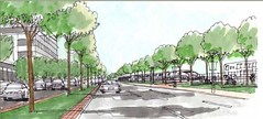
New York Avenue as a boulevard
New York Avenue as a boulevard. Image from the 2006 study.

Labels: , , , , ,