How Metro Shapes D.C. (an op-ed in the Post)
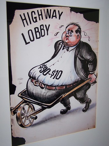 Highway Lobby, drawing by Sammie Abbot, Emergency Committee on the Transportation Crisis. The 90/10 refers to the split in cost for constructing Interstate freeways. The federal government paid 90% of the cost. Image at the Washingtoniana Collection, displayed in the DDOT exhibit at Union Station.
Zachary Schrage, an assistant professor of history at George Mason University and author of The Great Society Subway: A History of the Washington Metro, has a nice op-ed in the Sunday Washington Post, entitled "How Metro Shapes D.C." The piece starts out:
Metro to Dulles! Metro to Tysons! Metro to BWI! Purple Line! Silver Line! Light rail for Arlington and the District! All over the region lately, officials have been making tracks to propose additions to Washington's popular rail transit system, promising that such expansion will spur carefully orchestrated, sparkling new development and offer a comfortable alternative to commuter-clogged roads.
At a time when local governments are struggling to maintain and operate the existing Metro, some of these schemes may seem rash. The grand promises that accompany calls for more rapid transit aren't always fulfilled, and the multibillion-dollar costs of realizing them can be prohibitive. Yet as Metro celebrates its 30th anniversary, it's clear that it has brought significant -- and mostly positive -- change to the Washington area. Since the first train pulled out of the station in 1976, the system has transformed places such as downtown Washington, U Street, Ballston and Bethesda, making them vibrant, thriving and walkable.
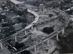 SE-SW Freeway under construction near the Marine Barracks, 1971. DDOT photo.
Read it. It's good.
There are many issues, one being the transit system enabling sprawl versus focusing on infill and compact development. (Something that Steve Belmont discusses in Cities in Full, which I have discussed in the past.)
DC would be much worse off without this system. It should be no surprise that the traditional center cities that are holding their own, albeit with some problems in the case of Philadelphia--DC, Boston, Chicago, and of course NYC--all have excellent transit systems.
And the cities protect and enhance the transit infrastructure (well, not Philadelphia...) and development gets focused around transit, and office rents are higher around transit, etc.
OTOH, look at cities like Detroit, St. Louis, and Pittsburgh. Had Pittsburgh kept its extensive streetcar system, would things be different today?
Cleveland does have pretty extensive transit, but on the other hand, the region hasn't experienced any population growth in decades. Baltimore is improving but I bet if it had a system of heavy rail transit comparable to DC, that outmigration would have been stanched and it would have been easier to retain businesses.
Tough questions. If all the center cities would have retained their streetcar systems, would they have been more competitive vis-a-vis suburbs? It's hard to say because of outmigration, deconcentration, and decentralization. Although I would argue that more efficient public transportation would have allowed cities to be more competitive. Still, other policies would have been required to force links between new development and extant transit infrastructure/compact development.
According to the original DDOT press release, the exhibit of images is supposed to end this weekend. If you can, high-tail it over to Union Station tomorrow.
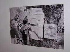 Washington Star photo, presumably of a protest over the "Three Sisters" bridge.
 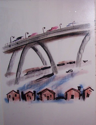 Drawing by Sammie Abbott, Emergency Committee on the Transportation Crisis (ca. 1970). Image at the Washingtoniana Collection, displayed in the DDOT exhibit at Union Station.
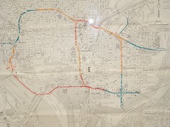 Proposed DC freeway map, 1955.
Index Keywords: transit
posted by Richard Layman @ 8:12 PM&Permanent Link
![]()
![]()


0 Comments:
Post a Comment
<< Home