Almost getting it
Today's Post editorial "More Houses, More Traffic" gets at least 1/2 of it right in its discussion of transit and land development issues in the outer suburbs of Prince William and Loudoun Counties. They write:
...first, that Loudoun's Board of Supervisors should zone intelligently; the county hasn't devoted enough money or time to the road and rail improvements needed to accommodate growth that's already slated, let alone the demands 28,000 more homes would place on the region.
But the policy implications extend well beyond Loudoun. As the VDOT report makes clear, new homes in one county affect roads in neighboring counties. The state needs to get serious about transportation.
But the editorial doesn't fully explain the point about "zoning intelligently." Density makes all the difference in terms of the ability to reduce car trips and to make transit economically viable.
In "A road doesn't run through it," the Boston Globe reports on the redevelopment of 42 acres of the former grounds of the Boston State Hospital, to include 500 new dwelling units.
42 acres developed along the lines of single family housing in the L'Enfant City of Washington DC, would yield about 60 buildings per acre, or over 2400 buildings. If developed with a greater variety than is typical for Washington, as flats, or as three-story plexes, which are not common to DC, they could provide more dwelling units. And in an area with great bus and subway service, and near to jobs within walking or biking distance, there are fewer reasons to use cars to being, and there are car sharing services like Flexcar and Zipcar which provide additional options.
The same goes for the outer suburbs, where according to various Post articles over the past few weeks, Virginia planners use the metric that each household makes 10 car trips/day.
In the city, transit-sustainable land use and resource planning-"smart growth" advocates take for granted that mobility options other than the car are abundant, (relatively) easy-to-use, and time and cost efficient.
We forget that in most places, such alternatives are few and far between, and likely to be inefficient.
This was driven home to me (so to speak) on a walking tour where we discussed a development on West Blvd. (I think). It is mixed use, with office, retail, and housing, and I think a 1,200 space parking structure. People are bitter about this project and the impact on traffic.
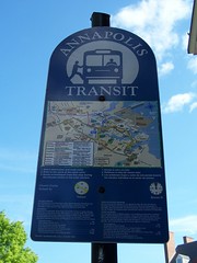
I can understand their frustration. Because Annapolis Transit is a very limited service, and there are not other options for transit over longer distances, although walking and biking are options for people wanting to go to the waterfront or State Capitol area, it's an easy and nice walk.
They need more and better transit service. Which is why I suggest that a "branch" of the Purple Line light rail proposal could start at New Carrollton and go to Annapolis, and loop around there. I wrote about this before, in "A thought or two about Annapolis and another thought about "nimbyism".
Index Keywords: transit; sprawl; urban-design-placemaking
posted by Richard Layman @ 12:38 PM&Permanent Link
![]()
![]()


0 Comments:
Post a Comment
<< Home