Streetcars, street widths, and Anacostia
One of the complaints that Anacostia's anti-streetcar types make is that the streets are narrow, and that the proposed streetcars can't be adequately accommodated. I hate to admit that they have a point about the narrow streets, at least with regard to two-way tracking.
But, not every place that has streetcars or light rail uses the street ways in an excessively corpulent, typically American fashion.
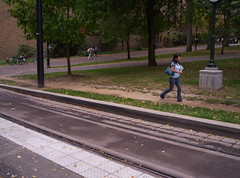 Streetcar stop near Portland State University, Portland, Oregon. For the most part the Portland Streetcar is a single track, unidirectional system, except in the waterfront area. Click here for a map.
 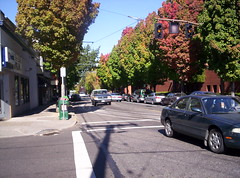 Streetcar track, turning from NW 23rd Avenue onto Lovejoy Avenue, Portland.
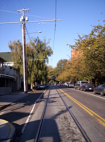 I can't remember if this is "upper" NW 23rd Street in Nob Hill, or Northrup Avenue.
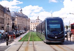 The Citadis Tram (Alstom), with in-ground power, in Bordeaux seems to be well-accommodated with a "minimalist" insertion into the physical environment. Photo courtesy of Ken Sislak, DMJMHarris.
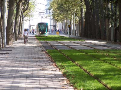 Same with Light Rail in Barcelona. Photo courtesy of John Norquist.
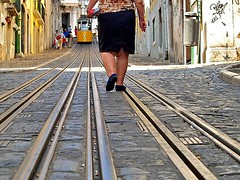 And with this extant historic streetcar line in Lisbon. Flickr photo by Isolano.
I don't why this can't be done in a similar fashion in Anacostia, accommodating people and their automobile-centricity with transit expansion and greater connectivity.
Same thing with New Orleans (photos pre-Katrina) even though they use, for the most part, boulevards. Still, they appear to use land pretty efficiently.
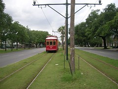 Flickr photo of the Canal Line by Jonathan Simmons.
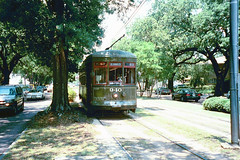 St. Charles Streetcar line, center boulevard, probably Carrollton Avenue. Flickr photo by tspauld.
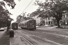 Two cars abreast. St. Charles Streetcar line photo by Modern Artifacts - T2 (Flickr).
Streetcars sharing the street requires less room. It does restrict the ability to park cars. And that could be an issue. Click here for more Flickr New Orleans Streetcar photos.
Index Keywords: transit
posted by Richard Layman @ 12:43 AM&Permanent Link
![]()
![]()


0 Comments:
Post a Comment
<< Home