Tourists: Travel by public transportation
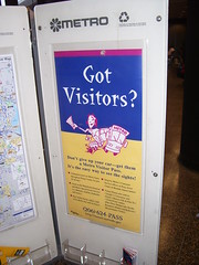
King County Metro Bus promotional poster at an information rack at the Seattle-Tacoma Airport.
From "Secrets of travel insiders: Our three pros offer 26 tips to make your trips easy," from USA Weekend.
Choose public transportation
Instead of renting a car when you're on vacation, try using public transportation, renting a bike and/or exploring on foot. You'll get to know your destination in a way that drivers can't, you'll work up an appetite for those decadent vacation meals, and you'll help contribute to cleaner air. Most cities now have their bus, subway and bike routes available on the Web, so make sure to check before you go.
1. Of course, that means visiting places where public transit exists, and is extensive and usable (the public transit system in Annapolis stops running around 7 pm).
2. And being familiar with the processes of how to use public transportation.
If you're not familiar with how to use public transit to begin with then it makes it harder to use it. (And there is always time required to understand how to use transit in other places, even if you know how to use it in your home town.)
Places with heavy rail systems, especially DC, which is visited by more than 15 million tourists annually, get a lot of tourist riders, but I think we could do much better in providing wayfinding and explanatory information systems within stations.
And maybe it should be every station, e.g., a couple years ago I left town for a trip to a conference, the same day as a major demonstration in DC, and tour buses were disembarking at the Greenbelt station (created a definitely problem for people buying tickets for the train... But normally, you wouldn't think that this station has a need for explanatory signage.
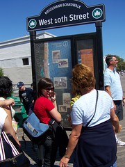
Wayfinding signage, Coney Island boardwalk, Brooklyn
At a minimum, stations like Union Station, Metro Center, Gallery Place, Dupont Circle, Arlington Cemetery, King Street, National Airport would be key for having such signage. (And information desk attendants who are skilled in questions about transit also. E.g., the airport in Philadelphia is connected to the Septa train system.)
But most systems do not explain how to get all day passes or weekly passes. Systems that are based on Smart Cards tend to set up charging systems that penalize visitors. (Although it may be worth it to buy a smart card when you travel.)
3. Speaking of printed information, the Commuter Page blog via the Permanent Campaigns Consulting blog, calls our attention to an article in the Journal of Public Transportation, "Study: Teaching Nonriders How Transit Works Turns Them Into Riders."
We need to make the information simple. At the bus stops in NYC, each stop has a schedule posted that is specific to the stop. And it's pretty easy to read. (So simple I seem to have neglected to take a photo.)
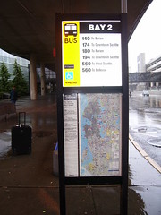
The front and back sides of bus stop signage at main locations explains most of what you need to know to get around Seattle and how to negotiate the King County Metro Transit system (but not necessarily about how to get around with and use the other systems that provide service to Seattle from other counties...). And most key public places (Central Library, City Hall, Municipal Building, Pike Place Market, etc.) have full-scale transit information racks with schedules. However, the signage and information is mostly in English. When appealing to tourists, multiple languages are required, especially in a city like Washington, which gets many international tourists.
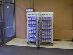
Transit Information Rack, University Book Store, University of Washington, Seattle.
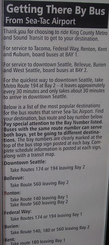
Transit information, bus stop sign, Seattle-Tacoma Airport.
Labels: tourism, transit, transit marketing, wayfinding


0 Comments:
Post a Comment
<< Home