Rebuilding Place in the Urban Space

"A community’s physical form, rather than its land uses, is its most intrinsic and enduring characteristic." [Katz, EPA] This blog focuses on place and placemaking and all that makes it work--historic preservation, urban design, transportation, asset-based community development, arts & cultural development, commercial district revitalization, tourism & destination development, and quality of life advocacy--along with doses of civic engagement and good governance watchdogging.

Saturday, October 30, 2021

Downtown is not a word without meaning: renaming the Largo Town Center to Downtown Largo is without meaning

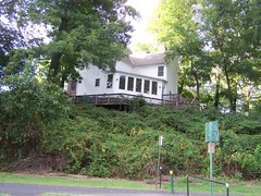
Wikipedia photo.

Prince George's County Maryland wants to rename the Largo Town Center station as Largo, Downtown Largo, or Downtown Prince George's County.

-- Proposed Station Name Charge, Largo Town Center, WMATA

Comments are due by 5pm Monday.

The definition of the word Downtown is 

of, in, or characteristic of the central area or main business and commercial area of a town or city.

While PGC is somewhat center-less more generally, the closest it has to a center is New Carrollton, and I've suggested for years that if PGC wants to truly become a "transit oriented development" kind of place, it should re-center its government functions there ("Setting the stage for the Purple Line light rail line to be an overwhelming success: Part 4 | Making over New Carrollton as a transit-centric urban center and Prince George's County's "New Downtown"," 2017, first published 2014).  

Instead, it has the belief it is doing so around Largo and the Largo Town Center Metrorail station, and it has moved a bunch of government agencies there, but few that are citizen-facing.  

Most football stadiums are surrounded by a sea of parking lots and FedEx Field is no exception.

But for the most part, the land uses are de-concentrated, there is a failing retail center ("Redeveloping Largo shopping center aims to be the Pike & Rose of Prince George’s," Washington Business Journal), a new hospital ("University of Maryland could seed a complementary biotechnology and medical education initiative in Prince George's County"), and the FedEx Field stadium is a 1.5 mile walk away.


Rendering for an intensified Largo.

The hospital building is the tallest, but there is nothing that speaks of a concentration of business activity.  

Although to be fair, there is a long term plan for intensification, and the reality that such a plan is a couple decades away from realization -- for example, PGC Planning created a transit oriented development plan for the West Hyattsville station that 25 years later, still hasn't been realized.

I suppose from the standpoint of "rename it and they will come," a name change could be justified.

But it seems incredibly premature.

The reality is that renaming the station by including the word "Downtown" diminishes the meaning of  the word.

The core of Silver Spring's shopping district is branded as "Downtown Silver Spring."

By comparison there are many conurbations in the metropolitan area besides Downtown DC -- Rosslyn, Crystal City, Tysons Corner, Reston, Bethesda, Silver Spring, some parts of Alexandria, even the Southern Towers apartment complex in Fairfax County -- that have the kind of density and concentration that justifies being called a Downtown, but is lacking in Largo.

In order to promote "legibility" and accuracy within the Metrorail system, using the word Downtown to describe station areas which have few if any of the characteristics "of the central area or main business and commercial area of a town or city." should not be countenanced.

Labels: , , , ,

Sunday, November 24, 2013

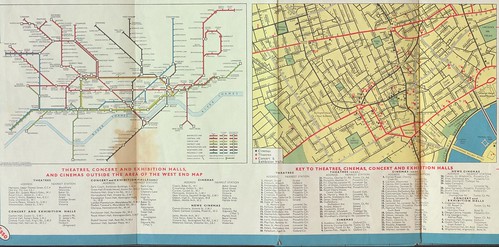
1964 Esso road map of London shows subway map

I think this road map is interesting, because it includes a map of the London Underground, London's subway system.  I've checked Esso maps from around the same period for Boston and New York City and the road maps don't include a map of the subway.  Granted, at least for NYC, they've always made subway maps widely available, so maybe there wasn't the same level of need.

The current Washington area map from the American Automobile Association does show the area subway map, but I haven't looked at earlier editions.  Around when the DC subway system became operative, gasoline station companies stopped making private labeled maps, instead shifting to the sale of maps branded by the producer, such as Rand McNally.

Inset, London Underground and key sites in London's core, from a 1964 Esso gasoline station road map of London, UK

This section of the map sadly has a bit of discoloration. Then again another copy I have of the map has holes, so this is better.

I came across this map as part of a grouping of maps, which I bought mostly for an old Esso map of Heathrow Airport, which is interesting because it shows plans and how aviation gasoline is stored and transported to airplanes--I am interested in how "road maps" were used by oil companies to communicate non-standard information so some maps I have along these lines include:

- a boat cruising map of Ontario (and another in England, but I haven't yet managed to snag a copy of a River Thames Esso map)
- a Conoco map of Yellowstone National Park
- an Esso map for the 350th anniversary of Williamsburg, Virginia (remember that the Rockefeller Family, which still owns a lot of Exxon stock, funded much of the creation of the historical park at Williamsburg)
- the London Heathrow Airport Map
- lots of pictorial-tourism promoting map styles (Esso did this in the 1940s and 1950s especially; Gulf too)
- a map of the Presidential election process
- a bunch of cool Esso maps on heritage trails, the Civil War, etc. (they also have maps of WWII battles, but I haven't been too interested in that stuff)

Labels: , ,

Monday, September 26, 2011

Calgary non-statutory Center City illumination design guidelines

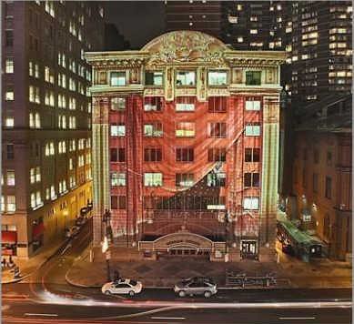
Merriam Theater, Philadelphia
Merriam Theater, Philadelphia. Philadelphia Inquirer photo by David M. Warren. Architectural lighting project, Holidays 2007, by Center City District BID, with Lightiing Practice, Artlumiere, Phillips Lighting, and Vitetta.

For architectural lighting and other illumination questions: CENTRE CITY ILLUMINATION GUIDELINES: Illumination Solutions within the Context of the Centre City Plan

Interestingly, they use a framework based on the concepts expressed by Kevin Lynch in Image of the City, a study of how people make sense of their community, and what Lynch calls "legibility." According to Wikipedia:

Lynch reported that users understood their surroundings in consistent and predictable ways, forming mental maps with five elements:

• paths, the streets, sidewalks, trails, and other channels in which people travel;
• edges, perceived boundaries such as walls, buildings, and shorelines;
• districts, relatively large sections of the city distinguished by some identity or character;
• nodes, focal points, intersections or loci;
• landmarks, readily identifiable objects which serve as external reference points.

In the same book Lynch also coined the words "imageability" and "wayfinding".

The Calgary Illumination guidelines refine this list by adding heritage resources and entries/gateways as additional categories.

Labels: , ,

Thursday, November 25, 2010

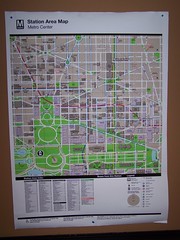
New WMATA station area map, Metro Center

I have discussed the WMATA maps before, which generally are pretty good, but have one glaring glaring omission that make it hard for commercial districts to benefit from transit and transit maps.

For some reason, government agencies are very very very very very reticent about listing "for profit" entities on maps, even if these are high profile activity centers and destinations with high attraction for transit users, such as grocery stores.

So these maps don't list key commercial destinations. (I have photos of the maps for Metro Center, King Street, and Bethesda.) In the Metro Center area, the map does includes the Downtown Macy's Department store, but in neighborhood stations like at Takoma, the nearby and adjacent commercial district is not included, nor are grocery stores.

This makes no sense.

The categories that WMATA includes on the maps are:

- Places of Interest (historic and other sites)
- Civic/Government Buildings
- Transportation sites (such as other subway stations)
- Hospitals/Medical Centers
- Schools/Colleges/Universities
- Parks/Open Space

Now, this isn't a station area map in the same way, but STM in Montreal has more fanciful station area maps that identify destinations around subway stops, including commercial districts.
Station area map, Montreal subway
Station area map, Montreal subway, Guy Concordia station

The travel book publisher Ulysses publishes a travel guide to Montreal based on these maps.

Labels: , ,

Thursday, October 21, 2010

The real question is far broader than the state of the DC area subway map

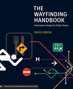
The Wayfinding Handbook by David Gibson
As usual, the Housing Complex blog of the Washington City Paper has a good article, "Metrobusted: D.C.’s subway system needs a new map. Is anything worth saving?," this one on how WMATA is looking to redesign the "iconic" subway map.

--------
Note to City Paper: Housing Complex has a much broader coverage area than housing. It is the first worthy successor to the Cityscape column written by Mark Jenkins (and I think Bill Rice) in the 1980s and early 1990s--a column that certainly educated me about urbanism. I recommend changing the title of the column and the beat. If anything, Lydia DePillis should be called the Urban Affairs or Urban Design and Transportation writer.
-------
The article discusses at least three things that capture my interest:

1. wayfinding
2. mapping
3. and what to put on the map

and it doesn't discuss adequately what I think is the most interesting question, that is connecting these elements into a broader framework of information design, branding, identity, and communications.

The people focusing on the map interviewed for the story, Cameron Booth and Larry Bowring, who also did their own versions of what they see as the ideal map didn't really contribute all that much, if you ask me, to the discourse on whether or not the map should be changed, even if they don't like the iconography, which dates back 30+ years. At least, their maps don't do much for me.

One of the things this reminds me of is that WMATA did commission the Project for Public Spaces to do a wayfinding study in the early part of the decade. I had a copy once but I lent it to someone who never returned it.

There is an opportunity to do an overall graphic/identity system of which mapping is a part.

But mapping too should be hierarchical. The overall subway map ought to stick with rail connections (subway and railroad) with parking AND I WOULD ARGUE taxi stands (because that information does matter and people's choice of which station to exit at, e.g., Fort Totten or Silver Spring vs. Takoma, or New York Avenue vs. Metro Center can be dependent on that knowledge, which isn't present on the current maps), with sub-mapping for the other kinds of layers people say they want (circulator buses, yogurt shops, or whatever).

The thing is that the questions being asked still probably aren't broad enough. There are many ways wayfinding could be improved. I have advocated for a few years for the need of a city (but it could be regional) wayfinding conference because there are more than one dozen separate wayfinding systems in place within the City of Washington.

- National Mall "stuff"
- Florida Market proof of concept wayfinding signage and the need for a wayfinding conference

And I have argued for the necessity of having a transit wayfinding system to explain the various transit options, especially at locations likely to be used by new users such as tourists (e.g., Union Station).

-Union Station as a key visitor entry point into Washington

A number of past blog entries might help people begin to think more broadly about the issue:

-Wayfinding with manhole covers
-Bethesda Trolley Trail wayfinding signage
-Signs (wayfinding, etc.) and planning
-New book on Wayfinding looks to be particularly great
-Tourists Travel by Public Transportation
-Design as a tool for rethinking and reconfiguring services (including transit)
- More on Metro and rethinking transit marketing

Recently, the City of Alexandria has developed a master framework for wayfinding signage that likely is the best plan for wayfinding systems in the region at present. The Better Bikeway project offers some food for thought in terms of bikeway wayfinding systems.

The general post about linking the design method, social marketing, integrated program delivery systems wrapped up in a complete identity system built on a foundation of civic engagement and participatory democracy is in this blog entry:

-Social Marketing the Arlington (and Tower Hamlets and Baltimore) way

I could be hopeful for this process, but I guess I am not really, because the first major public planning process that WMATA ought to be engaging in concerns transit overall, the role of the WMATA system within the region's transportation system, and the need to rebuild trust in the system in the face of massive service problems, deaths of customers and workers including in the terrible accident of June 2009, which resulted from systemic failures in management and operations, not to mention massive fare increases in the past 6 months.

I wrote about that about one year ago, in this entry:

-St. Louis regional transit planning process as a model for what needs to be done in the DC Metropolitan region

But I guess in some respects this is a follow on from a 2007 post:

- We need a transit users conference, now!

Also helpful is my presentation on hierarchical metropolitan transportation systems planning which I have been writing about for years and builds on a variety of work including "Updating the mobilityshed / mobility shed concept," as this question is finally making it onto the radar of bloggers at GGW ("How should the region's transit grow?" and "Should DDOT or WMATA control the streetcars?").

When I do plans and proposals elsewhere I joke that they are a form of "gap analysis" of how things are done in the DC area. Such is the case for the metropolitan transportation planning framework. It develops a framework based on what isn't done in the DC metropolitan area:

- true "regional" transportation planning
- differentiating between the transit operator and transportation planning in terms of setting goals and objectives
- laying out networks, subnetworks, and metrics according to goals and objectives for the metropolitan region as a whole as well as the various jurisdictions.

A branding, information systems design and wayfinding planning process really needs to be the second metropolitan transportation planning process, following the overall rethinking, revisioning, and trust building exercise that ought to be first.

Labels: , , ,

Wednesday, September 01, 2010

Thematic trail guides

the Southeast Tennessee Tourism Association publishes a number of interesting thematic trail guides spanning their region, on Music, Farms, Art, Native Americans, Religion, and the Civil War.

The "new" (over the past 20 years) development in cultural tourism is the focus on narrative themes that make connections between places and telling the whole story, rather than a focus strictly on specific places which generally tell but a portion of the overall.

DC's neighborhood heritage trails are cool, but they are place-specific and generally aren't making the kind the broader links and connections that the urban sociologist inside me would like to see.

DC also has trails, such as the African American Heritage Trail, that are more thematic.

Labels: , , , ,

Wednesday, August 11, 2010

More great work by the VisArts Youth Design Team

The VisArts Center in Rockville (technically the "Metropolitan Center for the Visual Arts") is an arts training and education nonprofit based in the Rockville Town Center. It gets space support from Montgomery County, and is considered one of the key civic assets at the Town Center (along with the library and the public square).

One of their projects is the Youth Design Team, which teaches graphic and computer-based design to teens and young adults.

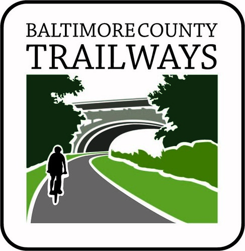
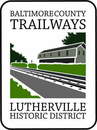
I asked them to help me out with an idea on a crunch deadline--coming up with a "design and wayfinding system" for signage for civic assets in Baltimore County, focused of course on bikeways and trailways, since I was working on a pedestrian and bicycle plan, and I thought that coming up with a branded identity for biking assets would be an important element in developing the support for building and maintaining the necessary facilities.

We didn't have the time to work through various iterations and come up with a complete system--I dropped this on them less than 3 weeks before the end of the grant, the project, the due date, and the ending of my position--but I think that Kelly Holland captured very well the idea that I was trying to express and achieve. If I go back and do more work there, this is a project I want to continue to push.

Thank you Kelly Holland, the Youth Design Team, and VisArts! Note that the YDT provides design services for nonprofit projects... and they could help you out too.

Fwd: Baltimore County Signs

Fwd: Baltimore County Signs

Labels: , ,

Wednesday, July 28, 2010

It pays to be connected

Following up the branding theme, The Washington City Paper's Housing Complex column reports on a similar type of initiative for "Mid City DC" in the article "Neighborhood Making in Midcity."

Carol Felix has done some great work, but we don't know yet how much of it was luck (really, how hard was it for Whole Foods to figure out that a location on the 1400 block of P Street NW, in the Dupont Circle neighborhood, was likely superior to a location at 13th and V Street NW), but $200,000?

Holy s***! That's more than what most consulting firms get to do small area plans for the Office of Planning. And it's $150,000 more than what is supposed to be the maximum grant from the Neighborhood Investment Fund.

I don't deny that Georgetown, Mid-City, Columbia Heights, Capitol Hill, etc., need broad-based "commercial district revitalization framework" or "destination development" plans along the lines that I've done for smaller communities. (On the other hand, districts like Georgetown or Capitol Hill are "smaller communities.")

How does one get on that gravy train?

Or am I destined to be doing such plans for small communities like Brunswick, Georgia or Cambridge, Maryland and the like, and never the big city.

n.b., I was part of a consulting team which bid on a NIF grant for Mount Pleasant commercial district revitalization. Instead, our application was denied, and the Office of Planning turned around and gave a different consulting firm a contract to do the same kind of project. I don't think their final report, clickable here, is as impressive as the report done for Cambridge, Maryland, at far less cost and with a lot fewer resources...

I guess it doesn't "pay" to tell truth to power...

Labels: , , , ,

Wednesday, July 21, 2010

Bethesda Trolley Trail wayfinding signage

One of my complaints about the new Metropolitan Branch Trail in DC is that thus far, the signage is almost completely inadequate.
Metropolitan Branch Trail sign with MBT spelled out

First, the signs don't explain what the "MBT" is is--some signs abbreviate MBT if they are interim trail signs because the city evidently didn't want to pay for larger signs and spelling out "interim trail" and "Metropolitan Branch Trail" required a bigger sign.

Second, on the shared use path section, while there are some mileage-directional signs (I haven't uploaded photos yet) at entryways, there is no explanatory signage, no rules signage, and no what we might call "branding-identity-marketing" signage. Third, at the major entryways onto the trail on L Street NE and M Street NE there is no "trailhead" signage nor signage around directing bicyclists to the entry points.

A few years ago, Toole Design produced a wayfinding study for the Bethesda Trolley Trail in Montgomery County. It's been many months since I've been out to the Twinbrook Metro Station, which is proximate to where the trail begins/ends, and this time, I noticed a new wayfinding sign that is very good.

One side is interpretative.
Bethesda Trolley Trail wayfinding sign, interpretation side

The other side has a map of the trail and other regional trails--this is really important as it outlines the concept of a regional bikeway network, lists rules for using the trail (including "staying on the right" which I find is a real problem for pedestrians especially but also some bicyclists on the Metropolitan Branch Trail so far), and a discussion about the status of construction for the trail. The graphic identity is strong as well.
Bethesda Trolley Trail wayfinding sign, map, regional plans and rules side
All in all they did a good job.

A few years ago, DC did do a tender and got proposals for creating a wayfinding signage system for the Metropolitan Branch Trail. While the winning proposal was interesting, I had some reservations about it (the signage proposal focused more on developing neighborhood specific signage rather than an overall signage concept for a regional shared use path facility). But it hasn't been executed in any case.

Labels: , , ,

Sunday, May 16, 2010

Wayfinding with manhole covers

Imprinted manhole cover, Minneapolis
I have always been interested in the idea of using manhole covers as a distinguishing factor in urban environments. Here and there across the country (Minneapolis; New York City, now around Eastern Market in DC) there are good examples. Tokyo is really known for it. (See the book Designs Underfoot: The Art of Manhole Covers in New York City.)

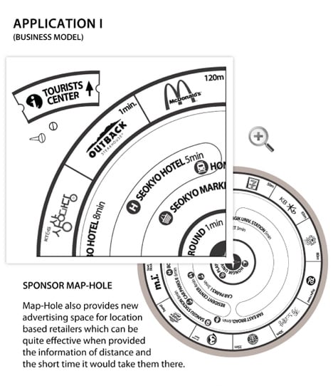
Steven calls our attention to this blog entry, "Map Hole Points The Way," from Yanko Design.

maphole4

The entry discusses a manhole cover based wayfinding system. Of course, you can also do this with "disks" embedded in the sidewalk. After all, there is something to be said for not having to wander out in the middle of the street to figure out where to go.

It's still a cool idea though.
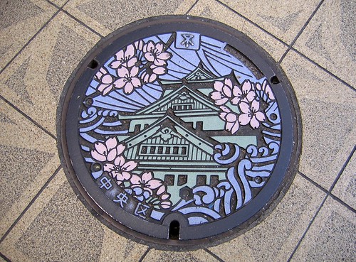
Chuo-ku Manhole Cover by jpellgen.
Flickr photo of Chuo-Ko manhole cover in Osaka by jpellgen

Labels: ,

Thursday, March 04, 2010

Signs (wayfinding, etc.) and planning

Christopher points us to a series on signs-signage in Slate Magazine, "The Secret Language of Signs," which has many parts.

In my planning work, be it commercial district revitalization, or now in bicycling, walking, and transit, I am always focused on signage, the need to consider it systemically and to make it a coordinated system, providing not just information about directions and services, but also the opportunity for interpretation (community, historical, cultural) and promotion (developing a brand and identity for bicycling and a bikeway network or for transit through the signage system).

Alexandria is developing an interesting wayfinding signage system focused on the commercial district there and pedestrians, and Good Magazine ran a feature, "Better Bikeways: Turning a City Street Into a Bike Corridor" by Joseph Pritchard on his ideas for a coordinated system of signage for bikeways.

The reason that I am not blogging very much is that the planning study for which I serve as project manager (Western County Pedestrian and Bicycle Access Plan in Baltimore County) is on an incredibly short time line, is understaffed for the area we are covering, and covers more territory than either the entirety of DC or Baltimore City, which means that the amount of stuff that has to be accomplished week in and week out ends up being considerable--meetings with interested people, presentations, presentations for the Advisory Committee, and draft sections of the plan.

The written plan will probably be:

- introduction, history, planning process - 10%
- engineering/facilities/management and operations - 20%
- education, encouragement, enforcement - 20%
- planning, management and coordination, funding, implementation, measurement and evaluation - 20%
- facilities improvements recommendations - 30%

and I have about 40% done at the level of a decent draft (e.g., these sections Part One and Part Two on facilities--but there is a lot missing, I want to take out and expand two subsections which I crammed in other sections due to lost work time during the snowstorms, and add in management and maintenance of facilities into that section, not to mention so much more.).

But the 30% on recommendations is more than 30% of the work. We have to measure the roads and sidewalks and perform calculations on pedestrian level of service and bicycle level of comfort and then prioritize improvements based on the need for right of way and the cost of construction vs. the type of improvement and the cost-benefit.

Not to mention that "I am trying to figure out how to reorganize the government and its system" in order that sustainable transportation can be prioritized rather than be ignored. We'll see how much of those recommendations ("management and coordination") get to stay in the draft, let alone the final draft produced before the inter-agency and public comment review period.

And work to get best practices in, dealing with the realities of extremely tight budgets, a dominant focus on automobility, and push some of the envelope on county and state requirements on complete streets, public facilities siting and walkability, school district planning for walking and bicycling, college campus master planning and sustainable transportation objectives, influencing as much as I can the transportation element of the master plan, not to mention transit network planning in Baltimore City and Baltimore County, and a branding concept for the Baltimore County bikeway network, 5 public meetings across the study area next month, presentations to community groups, etc.

all by June 30th (for the final draft -- then the summer for review and a public meeting in September, and then transmittal to the Planning Board for consideration and approval and then to the County Council for approval + this is an election year and the landscape of elected officials will be changing significantly).

Which means less blogging.

Labels: , , , , , , ,

Friday, December 25, 2009

Wayfinding redux

Mike Licht directs our attention to the website Oddly Specific, which focuses on humorous specificity in signage.

Funny Signs - Stickman 4 way

Labels: ,

Saturday, November 14, 2009

Airports and transit

I was so impressed by the operations at the Phoenix Airport a couple weeks ago, how they have a steward at the bus stop for buses to the rental car center. The steward gets people onto the bus, helps people with baggage, gets the bus filled as much as possible, and then tells the driver to leave, and then the steward starts the process anew on the next bus. This increases throughput speed considerably.

Similarly, there is an elementary school in the Baltimore region with a national best practice program in supporting walking to school where one of the parent volunteer positions is as a kind of valet. The parent ends up treating the line of cars dropping children off just like that steward at Phoenix Airport--opening the car doors to get the kids out quick, making sure the cars move up to the front of the line, and getting them quickly on their way.

Every time I take the subway to National Airport, I always comment to myself that the escalators should be extrawide to better accommodate luggage, and the faregates should be extrawide as well.

I do wonder if that will be considered and worked into the plans for the Silver Line station at Dulles Airport. I tend to doubt it.

I definitely thought at Midway Airport given the long distance from the station to the airport and the voluminous amount of baggage I had (I wasn't expecting to fly back, but to drive and stop off and visit a potential client, but the meeting was rescheduled), that I wished there had been luggage carts available for rent at the transit station.

According to today's Seattle Times, in "Light rail to airport to begin Dec. 19," the light rail station at Sea-Tac Airport will include a luggage cart rental station. From the article:

The walk from the station — which sits between the parking garage and International Boulevard South — is about one-quarter mile, depending on which airline people take.

After getting off the train, passengers will descend one level to the mezzanine and walk across a new skybridge into the garage's fourth floor, where a yellow-trimmed corridor leads to other skybridges at the terminal.

Baggage carts will be available at the station. Also, there will be 32 seats and an arrival/departure screen in the mezzanine, where people can wait for friends flying into Sea-Tac.

Similarly, at National Airport, there could be better information on the station platform about which exit to take, depending on which airline you are flying. I also like the idea of the arrival/departure screen in the station area, as will be installed at the Sea-Tac light rail station.

Labels: , , ,

Tuesday, November 03, 2009

Deja vu all over again: the "other" as trail user

The Gazette (via Greater Greater Washington and Washcycle) reports on anti-recreation trail sentiment in Prince George's County, including--horrors--having the trail run on "private" property through easements. See "‘We just don't want them in our backyards'."

In the project I am working on to create a pedestrian and bicycling master plan for part of a county in Maryland, I've come to see the necessity of having, if possible, a comprehensive plan for recreational trails. (As part of a comprehensive pedestrian and bicycle plan.)

For years, I've been freely expressing my biases in favor of street riding as opposed to separated riding on trails, and my bias towards transportation/utilitarian bicycling as opposed to recreational riding.

But guess what, planning isn't about your biases, it's about being expansive, thorough, complete, and structured--it's about serving everyone, not just people like yourself.

I've come to learn that many cities across the country have extensive recreational trail programs to accommodate both bicycling and walking. There are many great resources for trail planning (National Trails Training Partnership). And of course, on the East Coast, one of the augurs of trail development is the East Coast Greenway project, which works to provide a bicycle route along the East Coast somewhat comparable to the hiking route, the Appalachian Trail.

And yes, you can mix trails and transit.
Light Rail in Barcelona
Light rail in Barcelona. Photo by John Norquist.

Even the DC Parks "plan" (more about that later), Capital Space, proposes as part of one of its six "big ideas" that a greenway trail be created as part of the development of the Fort Circle Parks series of circle parks around the city. Plus there is the Anacostia Trail under development as well as the Metropolitan Branch Trail.
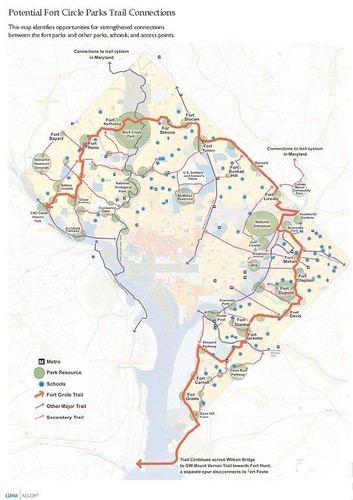
Fort Circle Parks, DC, proposed trail network

And the city has begun to place signage on the interim segments of the Metropolitan Branch Trail.
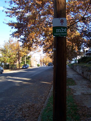
Interim route sign, Metropolitan Branch Trail, east side, 6100 block of 3rd Street NW, DC
However, as Suzanne pointed out, the signs only communicate to people who already know about the trail and/or bicycling. They do nothing for people unfamiliar with the trail. MBT? To me, having been born in Michigan, when I see the acronym MBT, I think "Michigan Bell Telephone." Spell it out...
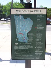
Anacostia Trails Heritage Area wayfinding sign, College Park Metro
Anacostia Trail Heritage Areas wayfinding map sign.
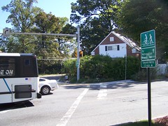
Metropolitan Branch Trail in Montgomery County, Maryland
Trail signage in Montgomery County depicts images of cyclists and walkers, better communicating the purpose of the trail, compared to the equivalent signs in DC.

Wayfinding systems for bicycling and walking are very important. There is a good plan for wayfinding for the Bethesda Trolley Trail that can be used as a model to guide similar efforts elsewhere. And the Feet First organization in Seattle has developed amazing maps for neighborhoods, walk to school, and trails and districts.

And Baltimore is developing a number of trails (Gwynns Falls, Jones Falls, others), while in Montgomery County and Prince George's County, there is an integrated set of recreational trails already extant including the Northwest and Northeast Branch Trails, Sligo Creek, Capital Crescent, etc.

Prince George's County has a great brochure on the Anacostia River Tributaries recreational system, including trails, etc.

In talking with a colleague who used to work for the Chicago Bicycle Federation, we've both come to agree that for families, recreational trails are often the entrypoint for reintroducing bicycling as a accepted means for mobility, and as a way to practice and get comfortable with biking before going out to the roads.

This is the flip side of the point made in the Tyee article, "Portland's Bicycle Brilliance," that you have to find ways to make bicycling comfortable and safe for the 59% of people who are willing to ride transportationally, but aren't ready to mix with serious traffic.

And I have to say, riding on the streets defensively, always on the lookout to avoid dangerous situations with vehicles, is stressful. There is something to be said for riding on trails and not worrying about cars.

But you get this attitude that ‘We just don't want them in our backyards', which we have discussed before ("Criminal Bicyclists").
House abutting the Northwest Branch Trail, Prince George's County (Hyattsville/Mount Rainier)
This house immediately abuts a small park and the Northwest Branch Trail in Prince George's County. I intend to go knock on their door at some point and interview them about these kinds of issues.

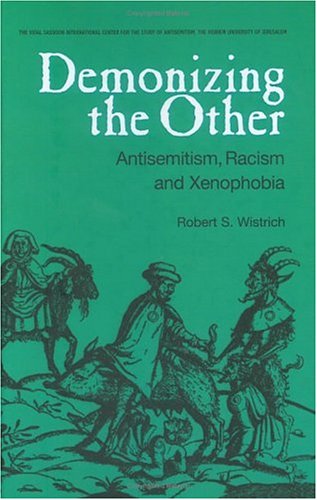
The basic idea behind the attitude is that anyone different from you (someone who doesn't drive a car--that means transit users, bicyclists, and walkers), especially from outside of your neighborhood, is to be feared and demonized as "the other," someone "not from around here" and likely to vandalize your property, break into your house, etc.

-- The Other as a philosophical concept.

The funny thing is that trails can be a great economic development tool (see the meta study of economic impact of trails from Rails to Trails Conservancy) and so many communities promote trails, recreational cycling, and cycle touring as an economic development initiative and an integral part of tourism promotion planning (Carroll County Maryland, Great Delmarva Bicycle Trail on the Eastern Shore of Maryland and Virginia, as well as Delaware, Caroline County Maryland, and the report Trail Towns: Capturing Trail-Based Tourism).

But at the same time, they are well focused on the provision of trails and greenways as an integral element of placemaking and quality of life for residents, investors, and visitors.

The reality is that crime on trails is not an issue generally, when compared to typical crime statistics. Although lightly used trails, or dark trails at night (see "Darkened Part of Park Trail Near Metro to Get Lighting" from the Post about crime problems on the Northwest Branch Trail in the vicinity of the West Hyattsville Metro Station--the area has had problems because it is in a relatively isolated location with limited "natural surveillance"--eyes on the street!) can be a problem.

The issue is to design trails right from the outset. For example, DDOT has done a great job by including lighting on the Metropolitan Branch Trail in areas abutting the railroad tracks and less traveled industrial areas. (I don't have photos yet.)
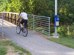
A call box for emergencies, bridge on the Northwest Branch Trail, Prince George's County
In the West Hyattsville area, emergency phones have been installed in some places on the Northwest Branch Trail.

All communities should have a trails network, if possible, to link parks and neighborhoods. The problem is that retrofitting such a system is very expensive. And that doesn't even get into the fear of the other questions. And for the most part, best practices parks and recreation planning includes trail planning.

Still, like for most park assets, living by trails ends up increasing residential property values (see the report by Professor John Crompton, The Proximate Principle: The Impact of Parks, Open Space and Water Features on Residential Property Values and the Property Tax Base).

In
the case of the Baltimore and Annapolis Trail among others, has helped augur commercial district and neighborhood revitalization in places like Severna Park, Maryland, and they are incredible opportunities for volunteerism and civic engagement.

But as long as we focus on the other, the more we try to keep our neighborhoods isolated, the reality is that the more isolated--and less safe--we become.
http://ecx.images-amazon.com/images/I/516X40GFFHL._SL500_.jpg

Labels: , , , , , ,

Thursday, October 15, 2009

Public meeting on (DC) Union Station Intermodal Transit Center Feasibility Study

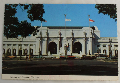
National Visitor Center (Union Station, DC), postcard
National Visitor Center (Union Station, DC), postcard. In the 1970s, the Union Station building was used for a time as a "National Visitor Center." This was during the period when cities were declining and DC had serious problems of its own, and the NVC eventually failed. The building was successfully renovated in the late 1980s and today is one of the most successful retail properties in the Washington Metropolitan region, not to mention a thriving intermodal transportation center.

From email:

The District Department of Transportation (DDOT) will host a final meeting Tuesday, October 20, 2009 at 6:00pm at Union Station in the Columbus Club to present the recommendations of the Union Station Intermodal Transit Center Feasibility Study.

The Union Station ITC Feasibility Study is a DDOT study designed to analyze the feasibility and impact of creating enhanced access to multiple modes of transportation at Union Station and the surrounding transportation network. The study focused feasibility reports/products on the following areas:

o Baseline Transportation Improvement Studies

o New Rail Passenger Concourse

o Upgraded Amtrak passenger concourse

o Improved Emergency Access & Egress

o Improvements to the Existing Rail Concourse

o Tour Bus & Commuter Parking Accommodations

o Streetcar Integration

o Pedestrian Tunnel from Union Station to 1st Street, NE

o New Metrorail Entrance from the H Street Bridge

o Baseline Environmental Requirements Study

Upon completion of the feasibility study, DDOT will determine if further analysis is necessary and/or plan for the phased implementation of the study's recommendations.

For more information on the study or community meetings please visit the project website, Union Station ITC Feasibility Study.
---------------
LOOKS LIKE THEY MISSED the need for a complete and integrated transit wayfinding and information presentation system. Don't know if I'll be able to make the presentation.
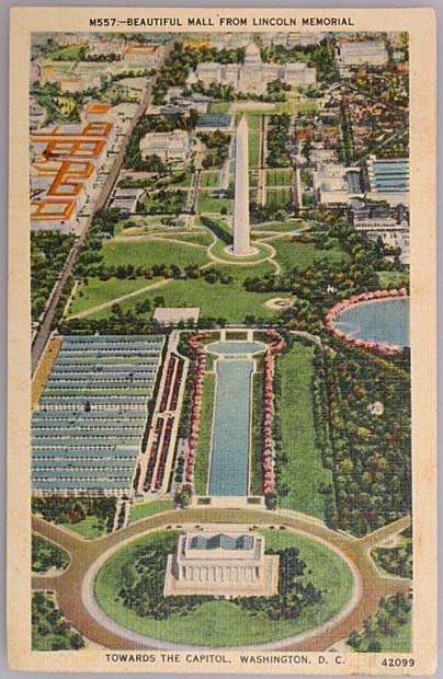
See for example these past blog entries, which discuss wayfinding issues
-- Final version of the Florida Market "Guerrilla" Wayfinding and Directional Signs
-- Florida Market proof of concept wayfinding signage and the need for a wayfinding conference."
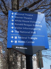
Union Station has "unique" special needs for the provision of an integrated and comprehensive transit-mobility wayfinding system because the station is the most intermodal of any transit center in the region, providing subway and local bus service, intercity bus service, private touring bus service, separate commuter train services to Maryland and Virginia, a bicycle station, intercity passenger railroad service, parking for automobiles, and taxi services.

Union Station is "visited" by more than 20 million people each year.

I once heard a tourist exclaim in shock: "$20 to get to the White House!" Because he went up to one of those tour services like Old Town Trolley, and asked how much it cost, how to get to the White House. There was no independent source to get information about the various options on how to get around. (For example, at National Airport, if you want to take a taxi you are handed a sheet that explains the process, with estimates for the cost of reaching various locations in the Metropolitan area.)

(Note by the way that I have mentioned before that the voice announcement systems on other bus systems, certainly the tourist shuttles in Colonial Williamsburg, but also bus services in Baltimore through MTA, announce prominent landmarks as part of the information provided on upcoming stops.)

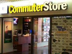
And I think I have written before that because of the prominence of the station as a transit center, it should be a place where there is the equivalent of Arlington's "Commuter Store" somewhere on the site (although I think it should be rebranded and broadened a bit to focus on "mobility" or "sustainable transportation" although that's a mouthful to try to brand), which fits in with the reality that Union Station is a major retail destination as well.
Arlington County Commuter Store

In fact, it should be a primary location for a "DC Visitor Center" too. While I do believe that the primary DC visitor center could be combined with a City Museum, many cities have multiple locations for visitor support services. DC does not. (At least not in an organized fashion. The DC Chamber of Commerce had one. There is one in the Smithsonian Castle, primarily for their museums. Now there is the U.S. Capitol Visitors Center too. Etc.)

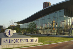
Baltimore gets the Visitor Center right. And with their new Heritage Trail, like DC's extant trails in places like Downtown, Southwest, and Capitol Hill, they actually run the tours from the Visitors Center. Imagine if the City Museum had been central as a staging point for heritage tours around the city of Washington. But Union Station could be such a staging point as well.
Baltimore_VisitorCtr
Baltimore Visitor Center
. Lots of tourist information and printed materials, staff (and trained volunteer staff), and a film. The film needs work and needs to be listenable in languages other than English, at least for a DC version. And they need a diorama explaining Baltimore's public transit options. No history though, other than brochures.

Labels: , , , , , ,

Friday, September 18, 2009

Easy print (8.5x14) retail directory of the Florida Market

In preparation for the Florida Market retail tour tomorrow, as part of WalkingTown DC, designer Christopher Taylor Edwards has prepared an 8.5x14 (print on both sides) map and directory of the market.

In the past we have given out an 11x17 version of the prototype sign that we have, which is 32x48 inches, the same size as the wayfinding-cultural interpretation signs that have been erected around the city. But the text is too small and it doesn't really work in a black and white print.

This version is still designed in color but prints fairly well in black and white.

Florida Market Directory Handout

Labels: , , , ,

Thursday, May 28, 2009

Florida Market proof of concept wayfinding signage and the need for a wayfinding conference
The links of the signs that Christopher and I have created have been down for awhile. They've been restored:

- Florida Market Map & Directory
- Florida Market History Sign

We are still doing some tweaks and changes, but the changes to come aren't too significant from what's in the current version. But if you have any comments they'd be appreciated.
One of the reasons that DC has been reticent about creating directory signs of this type is that they have to be updated frequently, and this is costly.

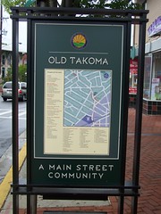
While I haven't priced it out yet, it turns out Takoma Park's directory signage is done in vinyl appliques and is meant to be updated and replaced. I expect this is less expensive than the DC signs (about $6,000 including the base).
Takoma Park street sign, business directory
Speaking of wayfinding, Christopher writes:

That book on Wayfinding just gets better and better. I just love the way it combines our thinking I also like that it confirms many of the steps that we've done. I think our own project is especially interesting as we've done a prototype and testing phase -- something that seems to be completely missing from all wayfinding projects.

He's referring to this book, Wayfinding Handbook by David Gibson, which masterfully covers the topic.
The Wayfinding Handbook by David Gibson

In a blog entry a couple months ago I wrote:

There are at least 10 separate wayfinding "systems" in the city. They aren't coordinated. We need a wayfinding conference as a start, and then a concordat to start integrating signage into one wayfinding system within the city. (And it's time to assess and update the "blue" wayfinding signage program. Plus, how many years should it take to get the Children's Museum listing taken off signs since it hasn't existed in the H Street neighborhood for at least four years.)

The wayfinding systems (not in ranked order necessarily):

1. The street and highway signage system generally (DDOT);
2. The "blue" wayfinding signage system (DDOT pays for it, the Downtown BID coordinates the system under contract);
3. The heritage trail signage (CulturalTourismDC);
4. signs within areas controlled by the National Park Service;
5. The Architect of the Capitol;
6. Signage/information on bus shelters and in subway stations;
7. DC Department of Parks and Recreation for city parks (they don't really seem to have much in the way of signage, but they should);
8. Intra-campus signage systems such as for the Library of Congress or Catholic University (there are many examples within this category--every college in the city, hospitals, etc.);
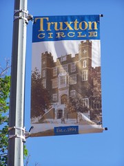
9. Banner programs within Business Improvement Districts and commercial districts, and neighborhoods;
Truxton Circle banner
Truxton Circle banner, 1st Street NW

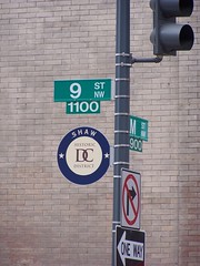
10. The hideous looking signs that DC uses to demark historic districts;
Historic District Sign
Maybe I am wrong to think these signs are so ugly.

11. While it doesn't exist in a coordinated fashion, a parking wayfinding signage system ought to exist as well (within the context of mobility, not just automobility).
100_6444.JPG
This sign, on 14th Street NW in Columbia Heights, is the first parking wayfinding sign I've seen in the city that actually lists specific parking options/destinations.

In the forthcoming 2009 transportation-mobility wish list (sometime next week it will really be published in the blog, in 4 parts), in the entry on the ideal and complete transportation plan, there is a section on wayfinding systems.

Labels: , ,

Tuesday, April 14, 2009

National Mall "stuff"

National Mall, from the Lincoln Memorial
1. There are a bunch of books on the subject. I am thinking that should use this fact as the impetus to finally get a "DC/urban issues" reading group going:

-- The National Mall: Rethinking Washington's Monumental Core
-- The Washington National Mall
-- Worthy of the Nation: Washington, DC, from L'Enfant to the National Capital Planning Commission
-- (journal article) "Politics, Public Space, and Memorials: The Brawl on the Mall"

Plus National Capital Planning Commission reports, plus even some journal articles and such about museums such as these:

-- Grasping the World: The Idea of the Museum;
-- Continuing dialogues: Evolving views of the National Museum of the American Indian (journal article);
-- The National Museum of the American Indian as Cultural Sovereignty (journal article).

2. The American Society of Landscape Architects has released today "recommendations of a panel of design experts who convened to address plans to revive the National Mall. The panel's findings report is in response the National Park Service’s recently published preliminary preferred alternative and addresses specific features of the Mall including: additional memorials, water features, Union Square and the downtrodden grass and walkways.

A full copy of the findings report as well as the executive summary and video clip of the panelists’ working session can be found on ASLA ’s Web site (www.asla.org/nationalmall).
Tourists determinedly taking on Washington on the National Mall
(Photo source unknown.)

3. I find one of the panel's recommendations:

-- The panel calls for an end to additional centers of interpretation for monuments and memorials. They propose centralizing these needs in a National Mall orientation center. Renovation and remediation of the Smithsonian Arts and Industries Building , now empty yet near a key Metro stop, could serve this purpose.

to be particularly intriguing although I can't imagine special interests not being able to get to Congress, and get "special exceptions" for their "unique" circumstances. And it would require working with the Smithsonian Institution, which has their own problems.

4. But then again, one of the big problems is that the Mall is under the purview of the National Park Service and the buildings bracketing the Mall are for the most part under the purview of the Smithsonian (plus the National Gallery of course, and the Architect of the Capitol) and I don't know how much these institutions interact.

5. The aforementioned National Park Service’s recently published preliminary preferred alternative is online here. It was released a couple weeks ago.

Looking at a map at the Takoma Metro Station
6. Plus, the National Park Service is implementing a wayfinding system according to the Washington Post, "Here, Even Icons Need IDs: Park Service Wants Tourist-Friendly Signs for Mall Monuments," and you see evidence of this in markers starting to be installed in parks such as Logan Circle (I don't have photos yet).

But this in part is the impetus for my future post on wayfinding. There are at least 10 separate wayfinding "systems" in the city. They aren't coordinated. We need a wayfinding conference as a start, and then a concordat to start integrating signage into one wayfinding system within the city. (And it's time to assess and update the "blue" wayfinding signage program. Plus, how many years should it take to get the Children's Museum taken off signs since it hasn't existed in the H Street neighborhood for at least four years.)

The wayfinding systems (not in ranked order necessarily):

1. The street and highway signage system generally (DDOT);
2. The "blue" wayfinding signage system (DDOT pays for it, the Downtown BID coordinates the system under contract);
3. The heritage trail signage (CulturalTourismDC);
4. The National Park Service;
5. The Architect of the Capitol;
6. Signage information on bus shelters and signs and in subway stations;
7. DC Department of Parks and Recreation for city parks (not really, but they should);
8. Intra-campus signage systems such as for the Library of Congress or Catholic University;
9. Banner programs within Business Improvement Districts and commercial districts, and neighborhoods;
10. While it doesn't exist in a coordinated fashion, a parking wayfinding signage system ought to exist as well (within the context of mobility, not just automobility).
Wayfinding Sign

Labels: , ,

Another way to think about wayfinding in DC

I am going to write a longer piece on this subject sometime within the next few weeks but this comes out of a conversation on Sunday (we had people over).
The Wayfinding Handbook by David Gibson
We were talking about street signs and wayfinding signage because I showed off the book by Daniel Gibson to Christopher, who is the designer of "my" proof of concept signs for "intra-district" directory wayfinding signage.

I said hmm, maybe the street signs for each quadrant in DC (NW, NE, SW, SE) could be a different color.
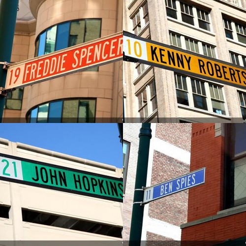
Street sign mosaic, Indianapolis, signs honoring automobile and motorcycle racers
Mosaic created with fd's" Flickr Toys. Original images are street signs honoring automobile and motorcycle racers, in Indianapolis, home of the Indianapolis Speedway race track. Images from motogp.com

But then yesterday I thought about this a bit more deeply. There are four things we could try to communicate through street signs in DC:

1. Quadrant;
2. Direction;
3. Neighborhood;
4. Historic District.

Direction. Numbered streets are north-south and lettered streets are east-west. Why not make north-south street signs one color and east-west signs another color? Avenue streets could remain green.

Neighborhoods. I have always liked how Pittsburgh indicates the neighborhood on street signs at major intersections.
Street signs on the border of the Bloomfield and Lawrenceville neighborhoods, Pittsburgh
Street signs on the border of the Bloomfield and Lawrenceville neighborhoods, Pittsburgh.

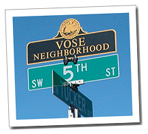
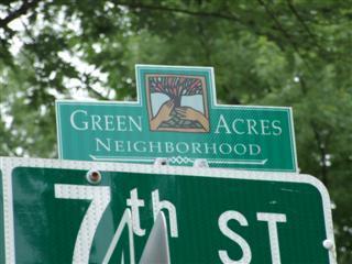
Other cities, such as Bloomington, Indiana or Beaverton, Oregon, allow for sign toppers, on street signs within neighborhoods, not just for major intersections.
Vose Neighborhood street sign topper, Beaverton, Oregon
Vose neighborhood sign, Beaverton, Oregon. (City of Beaverton image.)

Historic Districts. I think this is important. It happens that I think the DC street signs signifying historic districts are hideous. And I think they should be on every street corner anyway.
Capitol Hill Historic District street sign marker
I think sign toppers are more elegant than the current system.
Green Acres Neighborhood street sign topper, Bloomington, Indiana
Green Acres neighborhood, Bloomington, Indiana. (City website image.)

If I had to choose between signifying quadrants through specific colors or north-south and east-west directional signs, I would choose the latter.

And yes, 5-8% of men and 1% of women are color blind. So by putting N and W indicators on the street signs, you can provide information for people who are color blind.
Color coded street sign, Old Towne Historic District, Petersburg, VA
Petersburg, Virginia color codes street signs according to historic district. So street signs in Old Towne are brown, in Courthouse are blue, etc.

Labels:

Sunday, March 22, 2009

New book on Wayfinding looks to be particularly great

The Wayfinding Handbook by David Gibson
Yesterday, at the National Building Museum bookshop, I picked up a copy of The Wayfinding Handbook by David Gibson and published by Princeton Architetural Press. It is an excellent tome, laying out the definitive framework for approaching the subject.

It's organized into four chapters: the discipline; planning wayfinding systems; design of wayfinding system; and practical considerations.

Page spread from The Wayfinding Handbook
Image from a blog review at designnotes.info/?p=1694

I am quite fond of books that lay out the model approach for addressing projects. This book is it. All the images are in color which is a nice plus, and a major failing in the book Signage and Wayfinding Design: A Complete Guide to Creating Environmental Graphic Design Systems by Chris Colari.

The book edited by Craig Berger, Wayfinding: Designing and Implementing Graphic Navigational Systems, is also very good, with good images, but it doesn't lay out the way toward a structured approach in the same manner as The Wayfinding Handbook. The Berger book is a set of chapters by different authors and can be a bit spotty as a result, although the chapters on Transport Systems, Museums, College Campuses, Heritage and Parks, Hospitals and Urban Systems are each excellent. (He organizes these chapters on two dimensions: internal to structures and external, or outside.)

Speaking of books that lay out the thorough approach so that you don't necessarily need to take a number of courses in graphic design and advertising in order to understand how to go about initiating and/or managing branding-related processes, I also recommend Designing Brand Identity by Alina Wheeler and WorldBranding.

WorldBranding by Hiro Minamiyama and the World Brandking Committee

Designing Brand Identity by Alina Wheeler

Labels: , ,