Rebuilding Place in the Urban Space

"A community’s physical form, rather than its land uses, is its most intrinsic and enduring characteristic." [Katz, EPA] This blog focuses on place and placemaking and all that makes it work--historic preservation, urban design, transportation, asset-based community development, arts & cultural development, commercial district revitalization, tourism & destination development, and quality of life advocacy--along with doses of civic engagement and good governance watchdogging.

Monday, January 24, 2022

The building blocks of neighborhood revitalization (reprint from 2005)

For the past few years, I've tried to append in the comments threads on entries of relevant articles, resources, etc., that I've come across since (so long as I remember the article).  While searching for an article to append I comment, I came across this one, from March 2005.  

I didn't blog in earnest til February 2005, so it's one of my earliest entries.  Meaning I've been blogging for almost 17 years.

The book House by House, Block by Block: Rebuilding America's Urban Neighborhoods, by Alexander von Hoffman, details success stories in urban revitalization. According to the book, there are five common threads to stitching a challenged community back together: 

  • A sense of place. A community has to see itself as worth saving. It needs a central idea around which people can coalesce - whether it's a history visible in cobbled streets and gaslights, a central church or school about which people who've stayed in the neighborhood have fond memories, or something as simple as a name. 
  • A group of tenacious leaders, reflective of the whole community. Reviving neighborhoods need "people with a certain kind of courage - maybe even foolish courage - in the face of devastation," says von Hoffman. That doesn't mean one charismatic leader. It means a broad coalition, including the "usual voices" - activists, religious and political leaders, philanthropists, developers - and voices less commonly heard: members of all the area's major ethnic groups, ordinary citizens who've never been politically active in their lives. 
  • A problem, and good conversation about it. Groups start with a shared sense that their community has a problem. They probably don't agree on what that problem is, and they certainly don't agree on what to do about it. So the first step is to facilitate an exchange in which every voice gets heard, every grievance aired. This is a slow process, as everyone who's taken part in such a conversation acknowledges, because fundamentally it's about trust, and trust doesn't happen on a deadline. If participants have the patience to see the process through, however, they almost invariably arrive at a common sense of the problem they're facing - and a common vision of how to tackle it. 
  • A sustainable plan, and the people who can implement it. At some point, though, it's time to stop talking and get practical. Community groups that aim for less - rehabbing a single building, constructing a swimming pool, repaving a street - often stop there, having failed to look systemically at what their area needs and what steps might really get them there. 
  • Political support. The strongest coalition with the best plan is worthless without political leaders who take it seriously. Realistically, Chrislip says, you can't expect politicians to be behind every new neighborhood initiative that starts up. But the sooner they start coming to meetings, seeing a group's seriousness about change, and being engaged in the process, the better for that neighborhood's future.
Coyotl-Coyote, a 14-foot sculpture done by artist Larry Gonzalez Rivas, is unveiled during the Willits & Sullivan Beautification Project celebration at the intersection of Willits and Sullivan Streets in Santa Ana on Saturday, January 22, 2022. The sculpture is the first to be commissioned by the city’s Arts & Culture Office. (Photo by Mark Rightmire, Orange County Register/SCNG).

The article I wanted to append is from the Orange County Register, "Santa Ana unveils new sculpture, part of a neighborhood beautification effort," because it's relevant to this series:


White Tower, Thessaloniki.  Photo: Herbert Frank, Wikipedia.

Another very interesting article in my email feed yesterday is "Conceiving monument networks through lighting design" (Academic Letters, 2021).  It's relevant to various past entries on lighting as an element of activation and master planning:

Labels: , , , , ,

Thursday, October 08, 2020

Chestnut Hill, Philadelphia, "Night of Lights" public history and art event

Via the Philadelphia Inquirer

From October 9th-2th5, Chestnut Hill’s Germantown Avenue turns into an outdoor public art exhibit celebrating the area’s history and architecture. 

Called "Night of Lights," businesses display historic photos and films from the archives of the Chestnut Hill Conservancy while lights illuminate buildings throughout the neighborhood. 

Note that the Georgetown Business Improvement District in DC sponsors a similar kind of event in December and January called "Glow," focused on outdoor, lighted public art.  It's equally cool, but  doesn't specifically aim to promote local history as part of the exhibition.   

Public art projections, public history projections, architectural lighting of buildings, church steeples (Cleveland has a program that assists churches in the cost of implementing and operating the ongoing lighting of steeples), etc., should be considered as part of neighborhood cultural history planning, public art planning, and community and commercial district activation planning.

-- "Planning programming by daypart, month, season: and Boston Winter Garden, DC's Holiday Market, etc.," 2019

Labels: , , , , ,

Monday, January 06, 2020

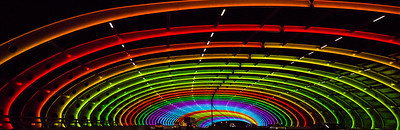
CityLink Sound Tube bridge, Melbourne

One of the things about watching tv programs from other countries is that you can spy interesting urban design measures, such as on Newcastle and Tyne on "Vera"--the Bird of the North, the Tyne Metro system, the river waterfront and the pedestrian bridge (which I knew about anyway) and the wayfinding system along the waterfront.

Brighton_and_Hove_Regency_Route_Scania_OmniDekka
I saw a Brighton and Hove bus at the end of an episode of a Gordon Ramsey show and it clued me into graphic design treatments of a routes major destinations on the bus.

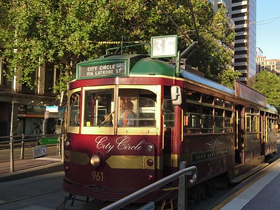
"My Life is Murder" is set in Melbourne, and Melbourne/Victoria State, Australia are world leaders in transit and transportation demand management (they invented it). Besides tons of shots of streetcars, because Melbourne is one of a handful of world cities that kept its streetcar system, one of the episodes showed the CityLights Sound Bridge lit up at night. Wow.
Colourful Sound Tube

CityLink Sound Tube at night

It illustrates my point ("Transportation Infrastructure and Civic Architecture #3: Rhode Rhode Island Avenue Pedestrian Bridge to the Metrorail station") that we could be using our bridges, tunnels, and transit station platforms a lot better as elements of civic architecture, public art and high quality urban design.

As far as trams are concerned, Melbourne is a good example too of having both modern and heritage vehicles in their fleet.
Yarra Trams 6005 [Melbourne tram]

Melbourne Tram

Labels: , , , , , , ,

Thursday, June 28, 2018

Philips Lighting changes name to Signify

As a leading firm manufacturing lights and lighting systems, Philips has encouraged cities to develop lighting master plans and has a variety of initiatives supporting architectural lighting programs and public art-related lighting projects. The company was spun off from the main firm in 2016 and has changed its name to Signify, although it will still use the Philips brand (press release).

One of the firm's recent projects involved an LED lighting scheme implemented across 24 buildings alongside the Pearl River in Guangzhou, China.

From the press release:
Signify (Euronext: LIGHT), the world’s leader in lighting, announced today that it completed the illumination of 24 buildings in Guangzhou’s central business district along the Pearl River area in China. The large-scale connected LED lighting project, which includes façade lighting and animations projected onto buildings, further underlines the company’s leadership as the lighting company for the Internet of Things.

Sightseeing in technicolor: Home to a population of over 14 million, Guangzhou is one of the most populated and fastest growing cities in the world. The 2,000 km Pearl River runs through the city and is known for its vibrant waterfront and high-rise buildings.

During the night the lights from the buildings are reflected in the river, creating spectacular watercolors to enchant citizens and tourists. As well as highlighting architectural features, the connected LED lighting is used to create dynamic light effects and images to be projected on the buildings such as blossoming flowers.

“Connected architectural lighting unifies technology and art, unlocking new possibilities for urban lighting projects and designers. By lluminating the city’s riverside buildings, a dazzling urban artform has risen to enthrall citizens and visitors alike. The beautiful lighting is also highly energy efficient and illustrates our leadership in connected lighting and lighting for the Internet of Things.“ said Jacques Letzelter, Global Business Leader Public Segment at Signify.
Eindhoven, Netherlands, where the firm is based, was one of the first cities to create a comprehensive master plan, although the document no longer is accessible online. The plan identified six categories of light:
  • urban lighting (streets, public areas)
  • buildings and objects
  • art (indoor and outdoor)
  • events and festivals
  • information
  • advertising.
More recently I came across another exemplary example of a lighting master plan, for Bath, England:

-- CREATING THE CANVAS FOR PUBLIC LIFE IN BATH: Pattern Book | Lighting Strategy

and I discussed it in the context of planning for "Night time as a daypart and a design product" (December 2017).

Chicago announced an initiative to create a Citywide Lighting Framework Planning Process, with elements comparable to those in Eindhoven's plan, with an emphasis on artistic lighting, but it isn't clear if a formal plan document has been made public.

-- A Search for the Design Team for the Lighting Framework Plan for Chicago, presentation, City of Chicago
-- "The Chicago SkyLine and the Citywide Lighting Framework Plan: Unveiling of Two Visionary Urban Projects for the City of Chicago," Davis Brody Bond
-- images

Interestingly, Chicago first developed a lighting master plan in the late 1990s ("Daley's Light Plan Hopes To Bring Bit Of Paris To Loop," Chicago Tribune)

Cities replacing traditional streetlight networks with LEDs are motivated more in terms of saving money ("Several Cities Convert To LED Streetlights In Conservation Efforts ," NPR).

Cities should also be thinking about upping their approach to lighting in a more comprehensive manner and take the opportunity to do so in the context of streetlight conversion planning.

Lighting Urban Community International (LUCI) is an international association for cities addressing lighting matters.

Labels: , , , , ,

Tuesday, March 07, 2017

Webinar on street lighting: LEDs, networks: Thursday March 9th

Typical "cobra" style streetlight.

Many cities are considering the conversion of their lighting infrastructure to LED lighting and sensor-based networks to reduce costs and add capabilities.  LED lighting allows for more even lighting at half the cost of the current technology.

Because lighting involves a cost stream (payments for electricity), it's possible to use private financing (frequently called a "public private partnership") to pay for the capital costs of the conversion.  At the same time, many cities are looking to off-load the management and operations of the lighting infrastructure in a long term deal.

-- Smart Lighting: The Gateway to a Smarter City, Sensus
-- Smart Outdoor Lighting Alliance
-- "Business case for smart street lighting," Silver Spring Networks
--  the TALQ Consortium "aims to set a globally accepted standard for management software interfaces to control and monitor heterogeneous outdoor lighting networks"
-- "San Diego installing 'Smart City' network with sensors on 3,200 streetlights," Times of San Diego

Along with the ability to calibrate lighting in a more localized fashion and with online monitoring of system uptime and individual outages, LED sensor-based lighting networks can integrate other capabilities can be added, ranging from free wifi connectivity to Shot Spotters to detect gunshots.

Marketplace did a story ("Chicago puts sensors to work taking its vitals") on a test underway in Chicago on the use of streetlight-based sensor networks, which they call the Array of Things.  For example, sensors at intersections can record every traffic accident. From the story:
The city, in partnership with the University of Chicago and the Argonne National Laboratory, recently began constructing the Array of Things — a network of 500 data sensors that will track the city's vitals.

Perched on traffic signal poles, its sensors will monitor things like traffic flow, pedestrian traffic and air quality. The Array of Things is funded largely by a $3.1 million grant from the National Science Foundation, and is set to be fully installed by 2018.
DC is one of the cities with a process underway for doing the conversion.  Although at this point, it's at the "Request for Expressions of Interest" stage, and it will probably be a 3-4 year process of information gathering, putting out a tender, selecting a contractor, and starting the conversion.

-- DC Launches Smart Lighting Project
-- Streetlight Policy and Design Guidelines, DC Department of Transportation

AMA recommended guidelines for LED lighting specify a different light from the current industry standard
. LED street lights are also in the news because typically, the industry standard for LED lighting for street lighting is 4000 Kelvin, but the American Medical Association recommends 2700 Kelvin ("Citing Health Concerns, Some Cities Consider Dimmer LED Streetlights," Stateline), and the industry hasn't settled on a lighting solution that puts out that frequency of light while balancing cost and longevity of the fixtures.  However, some cities appear to have found lighting solutions that meet the AMA guidelines.

Most cities don't have lighting master plans.  Ideally, the conversion of the city's street lighting network would have been preceded by the creation of a lighting master plan ("Lighting as an element of urban design and community identity: Cleveland chandelier + Chicago lighting design framework plan design competition," 2014), which could have prioritized lighting in terms of sustainable mobility.

But lighting from the standpoint of a master planning process is more complicated. For example, the Eindhoven Lighting Master Plan identifies six categories of lighting:
  • urban lighting (streets, public areas)
  • buildings and objects
  • art (indoor and outdoor)
  • events and festivals
  • information
  • advertising.
Yet another reason to consider the creation of a lighting master plan is the controversy over the addition of digital billboards ("advertising lighting")  to the city's visual landscape as many people argue against billboards more generally from aesthetic concerns ("Fight over electronic billboards' place in DC moves to Nationals Park," Washington Post).

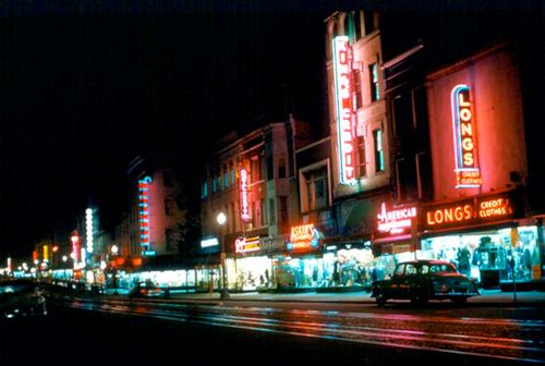
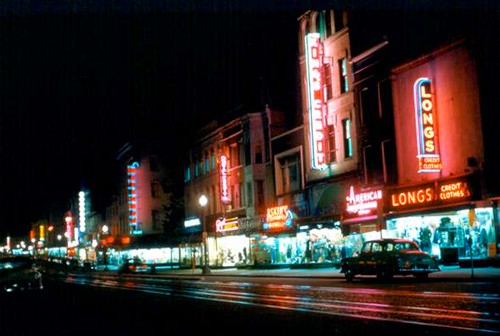
On the other hand, some argue that such lighting is an element of urban vibrance and vitality.  When DC had a more vibrant set of independent retail businesses, bright signage was an element of the identity of those businesses and the city's downtown business district.
F Street, Downtown Washington, 1950
F Street, Downtown Washington, 1950.

LUCI | Lighting Urban Community International is an international association of cities interested in lighting as an element of community identity.

Washington Globe lights on 8th Street SE. are focused on lighting the sidewalk, not the roadway, although the density of the lighting plus illumination from the buildings provides adequate lighting for the roadway as well.

Looking at neighborhood lighting issues more broadly. It happens I am on the "Public Works and Infrastructure" committee of my neighborhood commission, we have been dealing with the issue for a few months in a wide-ranging way.

Along with the LED issue that has been brought up by some residents, I have been pushing to identify lighting issues in primary pedestrian corridors and commercial districts and near schools and other civic assets (see "Night-time safety: rethinking lighting in the context of a walking community," 2014).  Perhaps not surprisingly, it seems as if the city does not have a standard protocol for addressing this.

We have also discussed the issue in terms of lighting "street furniture" as an element of community identity systems and "branding," specifically in DC this means using what is frequently referred to as the "Washington Globe" light pole and fixture.

Part of the neighborhood is a historic district, which would justify the use of that light, but because we are in the Outer City, such lighting fixtures compete with the network of "telephone poles"--really they are electric utility poles--that line most streets.  (On the major arterials, even in the Outer City, the infrastructure is placed behind the buildings and isn't visible from the main avenue.)

In Washington's "L'Enfant City"--the core of the city--overhead utility wiring is forbidden (with an exception for the streetcar wiring infrastructure on H Street/Benning Road NE) on the face blocks (typically telephone and cable utilities are strung from the interior of blocks, while the utility infrastructure for electricity is underground, the Washington Globe street light is standard.


Wikipedia photo of a teardrop style street light.

In the outer city, where the more traditional wooden pole utility infrastructure is present, installing Washington Globes is difficult, even in a historic district, because the city doesn't want to have two different lighting systems up, and the cost to underground the utility infrastructure is exorbitant.

Rather than rely on the street-focused "cobra" light and in keeping with the city's historical and architectural identity, the city has added the "teardrop" light for use in these areas.

Even those these lights are still focused on motorists, by positioning the light fixture closer to the street, sidewalks also receive better light.

To provide even more lighting, mostly deployed in commercial districts,  "sidearm" lighting has been added in some locations, placed at a height much closer to the sidewalks.
12th-St-NE-Retail-050-crop-1200x500
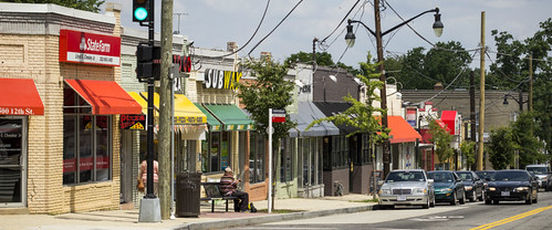
Sidearm sidewalk lighting using the teardrop fixture in the Brookland 12th Street NE commercial district.

However, separately, there is a program to underground certain utility infrastructure in the Outer City, to improve reliability and resiliency of the system in the face of weather events--for the most part, aesthetic concerns aren't a primary consideration.

-- DC PLUG (Power Line Undergrounding), Pepco
-- "$1 Billion project to move D.C. power lines underground to begin soon," WJLA-TV/ABC7
-- POWER LINE UNDERGROUNDING – Frequently Asked Questions, Office of the City Administrator, DC Government

============================
American City & County Magazine is offering a webinar later in the week on LED street lighting, called "Will LED Street Lights Give Your City the Blues?" on Thursday, March 9, 2017 - 2PM ET / 11AM PT.

According to the webpage during this webinar, participants will:

  • Review from a historical perspective, how outdoor LED luminaires have evolved from the early installations nearly a decade ago to the products of today with an emphasis on both economic need and the human experience.
  • Examine the American Medical Association’s recommendations as it relates to community-based LED lighting and its concern with blue-rich light.
  • Describe the many known benefits of LED lighting and its positive impact on communities.
  • Identify LED streetlight implementation risks as it relates to the human experience and describe strategies that can help communities succeed in the eyes of their residents.

Sounds opportune.

Labels: , , , , , ,

Tuesday, January 31, 2017

DC and the food desert issue revisited

I've written about this topic a bunch over the years (e.g., "Um, where are DC's food deserts?" and "Supermarkets: innovation and equity planning").

Last week's Washington City Paper has an article about it, "In Wards 7 and 8, Feeding the Food Insecure is a Team Effort."  According to the article, Ward 7 has two grocery stores and Ward 8 one, although both wards are served by grocery stores located on the other side of the DC-Maryland line.

From the article:
DC Greens and D.C. Hunger Solutions are two of many community groups unwilling to simply wait for full-service grocery stores to break ground and address the crisis. Instead, they’re collaborating to tackle a problem so complex that it calls for creative, multi-faceted solutions.

And what all these local initiatives share is a repudiation of backwards stereotypes that suggest the poor aren’t interested in fresh food.

“Politicians across the country and citizens have been perniciously stereotyping, allowing cities to take no action because they’ve vilified low-income folks,” Biel says. “We’ve seen lines a hundred deep of people waiting in 100-degree weather to get $10 to spend on fruits and veggies. There’s lots of interest in healthy food, but healthy food does not exist in these neighborhoods.”

Indeed, food options east of the river are dominated by corner stores and carryouts because they are cheap to operate. At a carryout, food goes from freezer to fryer, requiring little labor and producing little waste. “This leads to extreme disparities in diet-related health outcomes,” says Philip Sambol, director of partnerships for Good Food Markets, which is planning a new location in Ward 8. “You can have obesity rates five times higher in wards without access to fresh food.”
A big problem is how advocates define the issue--"a grocery store within one-half mile walking distance" otherwise it's a food desert--is counter to how the industry is organized.

Supermarkets are set up to market and sell food within a 5 mile radius retail trade area, although in cities the RTAs tend to be smaller. Not to mention the fact that carrying a lot of groceries while walking, even with a cart, is a major pain in the butt.

Looking at Ward 7, we can say there are 2-3 major travel corridors to and from the core of the city--Benning Road (H Street), East Capitol, and Pennsylvania Avenue.  The H Street/Benning and Pennsylvania corridors are nearby primary retail arteries.

H Street/Benning corridor.  If you take the Benning Road Metrorail Station as a center point for calculating a retail trade area--a four mile radius is just a few blocks short of the Walmart at New Jersey Avenue NE, but along the X2 bus line on H Street/Benning Road, within the four mile radius you can reach four other grocery stores:
  • Harris Teeter Supermarket (1st and M Streets NE)
  • Giant Supermarket (300 block of H Street)
  • Safeway (Hechinger Mall, Maryland Avenue)
  • Aldi (901 17th Street)
Later this year a Whole Foods will open on the 600 block of H Street, and the Union Market district, including some wholesale businesses that also sell retail, and soon a Trader Joe's, is accessible via the 90s busline, which intersects with the H Street bus lines at 8th Street NE.

Yes, it's true that there are only two grocery stores in Ward 7, but there are five, soon to be six, supermarkets on or nearby the H Street corridor accessible by bus (and eventually an extended streetcar line).  Plus the Union Market district on nearby Florida Avenue, served by the 90s bus line, is accessible too, and soon that will include a Trader Joe's.

It is relatively easy to stop at a grocery on the way home via the bus (although still a pain to carry groceries while walking or maneuvering on transit).

Frankly, the only store that people might want to access that won't be located within that corridor is a Wegman's.

Pennsylvania Avenue corridor: choices, but fewer.  The 30s line serving Pennsylvania Avenue SE doesn't have access to as many supermarkets as the X2, with access to a Harris-Teeter (1400 block) and a Safeway (about 1/4 mile from Pennsylvania Avenue and the Potomac Avenue Metrorail station), and a Yes Grocery is within a block,at 410 8th Street SE.  Eastern Market, the city's public market, is at 225 7th Street SE, a long block from the Eastern Market Metro Station.   And Trader Joe's is coming to the 700 block, across the street from Metro.

Pricing.  When Washington Consumer Checkbook studied supermarkets, Giant's prices were higher than Safeway, although I never found that to be the case.  (I do like some of Safeway's private brand items better than the other stores though.)

Since that study, Safeway has significantly increased pricing and reduced the pricing attractiveness of their weekly specials.  Aldi's prices are about 40% lower, cheaper than Walmart in fact.  Giant is cheaper than Safeway, and Trader Joe's pricing, depending on the items, tends to be higher than Giant.

Ward 7 residents having access to Aldi can save a lot of money compared to traditional grocery stores.  (I shop there regularly myself, mostly for produce and standard items like milk, cream cheese, and other staples.)

Smart shopping between the stores can cut food costs too.  For example, while Harris-Teeter is relatively high priced, their weekly specials and long term low pricing on certain items (e.g., $1.88 for 3 pounds of oranges) makes them worth shopping at as well.

In short, Walmart not opening a store in Ward 7 isn't the end of the world.

Delivery of food-customers.  Note that the PanAm International Latino Market on 14th Street NW and the Megamart Latino markets in the suburbs will drive a customer home so long as they purchase $50 in food.

DC's new jitney type transit service in Wards 7 and 8, called Neighborhood Ride Service by Taxis, could be adjusted to include travel to and from grocery stores in nearby Ward 6.

Were I working on supermarket recruitment efforts in Wards 7 and 8, I would consider trying to land PanAm or Megamart because of their willingness to drive people home.

fresh_moves_busAnother option for nonprofits would be to create their own equivalent of Instacart.

Others support the creation of mobile food sales, using buses ("Bringing food to people as a response to food deserts," 2011).

Conclusion: access has multiple meanings.  Although there is no question that we should work towards expanding grocery sales options in Ward 7, taking proximity and transit access into consideration, based on how the supermarket industry is organized, Ward 7 residents have a wider range of access to supermarkets than most residents elsewhere across the metropolitan region.

(Biking is an option too, although I'll admit sometimes bags have broken on the trip, which is never fun...)

=====
Technically, I live in a food desert because no store is within a one-half mile walking distance--the Walmart (I don't shop there) is 3/4 mile away, and a Safeway and a Giant are both 1.25 miles away in different directions.

But since I bicycle, getting to various supermarkets is no big deal, especially since I plan supermarketing around my various trips to and from the core, such as at the stores clustered around H Street on my way home from doing things in the Capitol Hill/Downtown area.

Labels: , , , ,

Monday, November 16, 2015

Lampshades for streetlights in Quebec City: an architectural lighting installation by Lightemotion

Lightemotion is an architectural lighting firm based in Montreal.  One of the three Illumination Awards they received this year in the program sponsored by the Illuminating Engineering Society of North America is for an installation of night-lighted lampshades for streetlights on Cartier Avenue in Quebec City.

Commissioned by the city and the Quebec Tourist Information Bureau, as conceptualized and suggested by Lightemotion, the lighting project is now an element of the city's plan to brand itself as the winter capital of North America, and was piloted on Cartier Avenue in association with the Montcalm commercial district revitalization program.

Working with the Musée national des beaux-arts du Québec, they featured work in the style of Québcois artists Alfred Pellan and Fernand Leduc on 34 different "lamp shades" fashioned after Chinese lanterns.

The artworks can be changed out annually and can feature different artists.  The intent is to expand this program to other streets in Quebec City.

Labels: , , , , ,

Tuesday, October 06, 2015

Newmarket Railway Station, Auckland New Zealand

While looking up something else, I came across this.  The station was rebuilt in 2008-2010, and won an Auckland Architecture Award for 2010. .

It'd be another example of how to make a statement in design of a transit station and would have been another reference for the aesthetic approach to creating the design of the facades for the Silver Spring Transit Station.

First three photos by Patrick Reynolds, for "Newmarket Railway Station Redevelopment, Auckland," E-architect.  The fourth photo is from Wikipedia.


Labels: , , , ,

Transportation bridges as an element of civic architecture, urban design and placemaking

I use the example of the Tempe light rail bridge a bunch as an example of how transportation infrastructure can be an element of civic architecture rather than merely an enabler of conveyance.

In the DC context, spurred on by my involvement in the 11th Street Bridge Park project, I wrote a piece ("Anacostia River and considering the bridges as a unit and as a premier element of public art and civic architecture") suggesting that DC Department of Transportation consider the city's bridges in unison and make aesthetic attractiveness a key element in the design and construction of the city's bridges.

Now that bridge design is the precinct of the local department of transportation, DC doesn't take this kind of approach, which was typical during the time when the federal government ran the city.  By contrast, in cities like San Francisco and New York City high quality bridge design has become a key element of community visual identity and brand--the Golden Gate Bridge in San Francisco and the Brooklyn Bridge are in fact internationally known landmarks.

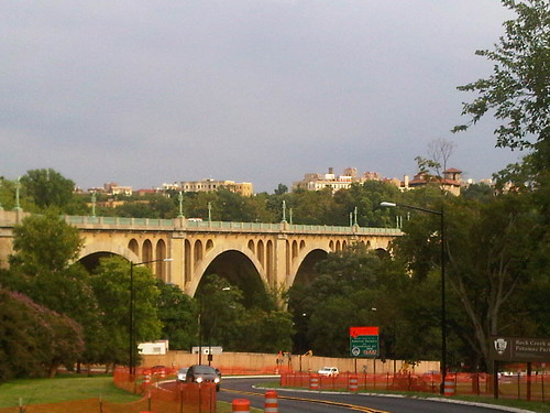
Connecticut Avenue BridgeFlickr photo of the Connecticut Avenue Bridge by Jon D.

DC has a mix of bridges in terms of their contribution to civic architecture.  The older bridges constructed to cross city parks and rivers generally were constructed in a time when design mattered.

An example would be the Memorial Bridge between DC and Virginia or bridges crossing Rock Creek Park, especially the Connecticut Avenue Bridge.

The newer highway related bridges are utilitarian, and that includes the newest bridges, such as the 11th Street Bridge or the New York Avenue bridge across the Union Station railyard in Northeast DC.  The latter bridge has a particularly hideous piece of "public art," at least compared to more signature design elements of bridges constructed elsewhere.

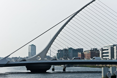
Dublin Docklands - Samuel Beckett BridgeDublin Docklands - Samuel Beckett Bridge. Flickr photo by William Murphy.

In terms of modern bridges, many cities are choosing to build new bridges that are visually distinctive, many designed as it happens by Santiago Calatrava.

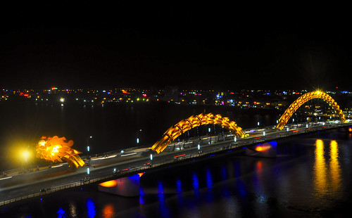
The lighting company Philips works with communities in creating cost effective but stunning architectural lighting projects on bridges and one of the company's websites features some of these projects, including the Dragon Bridge in Da Nang, Vietnam, which is becoming a key element of the city's identity and a tourist attraction.
Cầu Rồng Đà Nẵng
Dragon Bridge, Da Nang.  Flickr photo by Nghi Nguyen.

Similarly, Philips has produced a great video on the relighting of the Harbor Bridge in Corpus Christi, Texas and how this is creating a new focal point and placemaking element within the community.


They have done many many great projects, including in Little Rock, Arkansas and Louisville, Kentucky among others.

But check out the Meydan bridges in Dubai.

Wow.

Labels: , , , ,

Thursday, April 02, 2015

Autism Speaks Light it Up Blue campaign launches tonight (Thursday April 2nd)

Normally, it being outside of the scope of the blog's focus on urbanism, I wouldn't be writing about autism, although there is no question it is important, as autism currently affects 1 in 68 children in the United States and millions more worldwide.

But I am a sucker for temporary and permanent architectural lighting projects and tonight, the month-long awareness event,

Held every April, Autism Awareness Month is kicked off by their Light It Up Blue campaign event, where buildings throughout DC, Virginia, Maryland, across the United States and in other countries will call attention to autism through special blue night-time lighting treatments.

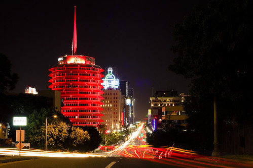
Capitol RecordsShown in red in this Flickr photo by John Lovell, the Capitol Records Building in Los Angeles will be participating in tonight's campaign.

Autism Speaks worked with Bethesda-based real estate advisors, Bentall Kennedy, to recruit 50 area properties for the campaign, which was joined in by other real estate-related firms including CBRE, LPC, JLL, MRP, DTZ, Colliers, and Transwestern.

More than 15,000 iconic buildings and landmarks in cities across all seven continents are participating, including the Empire State Building, One World Trade Center and Rockefeller Center® in New York City; Niagara Falls in Canada, the Christ the Redeemer Statue in Brazil, the Great Pyramid of Giza in Egypt, Taipei 101 in Taiwan, the Tokyo Tower in Japan, Trafalgar Square in London, and even the British Antarctic Survey’s Halley VI Station on Antarctica.

Buildings in the DC area that are participating include:
  • The Gannett Building and Tyson's Overlook, Tysons, Virginia
  • in the Golden Triangle Business Improvement District, The Millenium Building at 1909 K Street NW, 1828 L Street NW, 1707 L Street NW, and 1111 19th St. NW
  • Washington Harbor on the Potomac River in Georgetown
  • Pike and Rose in the redeveloping White Flint district of Montgomery County, Maryland
Trafalgar Square - London NightTrafalgar Square in London is a participant. Photo by David Gutierrez on Flickr.

Throughout the month of April, residents in the area can lend their additional support and get involved by:

-- Light a Building Blue
-- Host a Blue Event
-- Donating

See the Light It Up Blue campaign website for more information.

Labels: ,

Monday, November 17, 2014

Saturday's Vancouver BC election

Vancouver is one of North America's leading examples of high density urbanism.  (Image from Destination BC.)

Starting in the late 1950s, the city began encouraging high rise multiunit apartments, while also focusing resources on creating and maintaining parks, access to the waterfront, and recreational and civic facilities ("The Vancouver Model," Places Magazine; "High density living in Vancouver, British Columbia").

In transportation planning circles, the city is "famous" for not allowing freeways to be constructed within the city.  The Translink transit system operates at the metropolitan scale, and is highly respected.

The city began gaining population with the handover in 1997 of Hong Kong to the Chinese. Residents were able to move to other British Commonwealth countries and many chose Vancouver. The city continues to add population and to build more housing towers.
The metropolitan area is constrained by mountains and seas and like other similarly constrained cities (Seattle, Salt Lake, etc.) perhaps this is a factor in an enhanced sense about the environment.  That being said, residents aren't happy with the "Growth Machine" and what they see as the complicity of elected officials in stoking it.

On the other hand, Vancouver interestingly shows the difference between being a city-state, like DC, and being a typical municipality with "ordinary" financial capacity.  Last year, Vancouver's government budget surplus was $5 million while DC's was in the hundreds of millions--because DC collects income taxes as well as property taxes, and has a stronger commercial real estate market, not because it's better managed or a better place to live.

Vancouver elections.  Canada doesn't allow the national political parties to organize and run affiliates at the municipal level.  Ontario doesn't allow the creation of local parties, while British Columbia and Quebec do.  Yesterday was election day for provincial and local offices in British Columbia.

Unique characteristics for voting and governance.  Saturday elections make British Columbia unique across North America.  Provincial elections are held on a schedule different from local elections.

But Vancouver has other unique electoral qualities.  The city has four active political parties, three of which won offices yesterday.  All of the Council positions are elected at-large, which makes it easier for the Council to act for the city as a whole.  The City also has an elected park board, unique in Canada, which has been in place since the late 1890s.

Saturday's election had three strong mayoral candidates from 3 of the 4 major parties (10 parties ran candidates for City Council), the incumbent, Gregor Robertson, of Vision Vancouver, the center-left party, Kirk LaPointe, former editor of the Vancouver Sun, for the Non-Partisan Association, the conservative party, and Miriam Wong of COPE (Coalition of Progressive Electors), the left party.  (One of Wong's platform positions was a suggestion that transit be practically free "Universal transit in Vancouver for $1 a day, pitches mayoral candidate," Vancouver Sun).

The continued densification in Vancouver, along with the hollowing out of the middle class, put the majority party at risk, and Kirk LaPointe ran a better campaign.

Results.  Despite that Gregor Robertson was re-elected and Vision maintained a Council majority, but NPA has 4 of the 11 seats, one of which went to the Green Party--candidate Adriane Carr got more votes than any of the candidates, and Vision lost control of both the Parks and School Boards--the Green Party picked up seats on both.

Note that Vancouver's population is a little smaller than DC's (603,000+ to 630,000+) but they had a slightly larger turnout, 44% and 181,000 voters, compared to DC's recent results of about 164,000 and 35.5%).

So in Vancouver, while two parties (Vision, NPA) dominate local politics, a third, the Greens, is a viable third party, with seats on the City Council, Parks Board, and School Board, while the fourth (COPE) is still viable (COPE was the majority party on Council before Robertson's first victory).   Vision controls the City Council, NPA controls the Parks Board, and the School Board is split between Vision and NPA, with the Greens having the deciding vote.

It results in a much more vibrant polity than is typical of US cities.

-- "Gregor Robertson re-elected mayor of Vancouver," CBC-TV
-- "Re-elected Mayor Robertson Vows 'We Can Do Better'," The Tyee
-- "Vancouver Election: The Tyee's Four Big Questions," The Tyee (the questions are affordable housing, balancing density with neighborhood character, campaign finance reform, and the city's role in oil pipeline issues)
-- "Vision's Angry Voter Double Whammy," The Tyee (the prime funder of the NPA is a railroad executive)
-- "Why Vision Deserves Vote of Progressives in Vancouver," The Tyee
-- "Kirk LaPointe and Gregor Robertson — the politician and the ideologue," Vancouver Sun

Labels: , , , , ,

Friday, June 20, 2014

Lighting as an element of urban design and community identity: Cleveland chandelier + Chicago lighting design framework plan design competition

I have been enamored of architectural lighting and neon and electric signs as an element of the built environment for quite some time.  But I hadn't considered the issue as systematically as I should have, for example along the lines of the six elements identified in the Eindhoven Lighting Master Plan discussed below.

The six categories of light:

  • urban lighting (streets, public areas)
  • buildings and objects
  • art (indoor and outdoor)
  • events and festivals
  • information
  • advertising.

F Street, Downtown Washington, 1950F Street in Downtown Washington, DC in the 1950s.  Image from Reston Paths.

In the days of thriving center city commercial districts and neighborhood theaters, electric and neon signs were distinctive elements of the visual identity of these districts.

And even when the stores were closed at night, attractive signs denoting the businesses and their wares were typically lighted.

Some interesting architectural lighting programs and events I've come across over the years include the program in Cleveland to light church steeples (Steeple Lighting Program, Cleveland Restoration Society), various lumiere festivals--mostly in Europe (e.g. Lux Helsinki), and light art and temporary lighting installations.


Of course, Times Square in New York City, NYC's Broadway Theatre District and the lighted marquees, "The Strip" in Las Vegas, and the entryway to Reno's casino district are prominent examples of places that continue to define themselves through "out of this world" lighted signage.

Image from NYC Loves NYC blog.

On Broadway, the McDonald's Restaurant has incorporated a lighted marquee into the facade as an element of its store design, to leverage and connect to the area's cultural and architectural heritage.

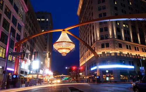
New chandelier in Cleveland's Playhouse Square.  Playhouse Square is a national best practice example of arts, in this case, theater, based revitalization.  Playhouse Square had four large theaters that by the 1960s, had largely been abandoned in response to suburbanization.

An architect assigned to figure out what to do realized that the theaters could be combined into an integrated operation by creating a common entry-foyer system.  Since then the Playhouse Square Foundation has been organized as a community development corporation and has been spearheading the revitalization of that area (see the past blog entry, "The Howard and Lincoln Theatres: run them like the Pittsburgh Cultural Trust/Playhouse Square Cleveland model").

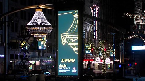
Playhouse_Chandelier_illuminated_1554410000_4282710_ver1.0_640_480
Image from Channel 5, Cleveland shows the various elements of the lighting project, which are not limited to the new chandelier.
New outdoor chandelier, Playhouse Square, Cleveland
Image: Joshua Gunter, Cleveland Plain Dealer.

The latest element introduced to the Playhouse Square district by the Foundation is a chandelier, the world's largest outdoor chandelier, placed at "the center of Playhouse Square" at 14th Street and Euclid Avenue.  It was lit in an opening ceremony on May 2nd, an event which attracted over 20,000 people, place at the intersection of , as a way to further define the visual elements of the area, by playing off how the old grand theaters typically had chandeliers as the centerpiece of their foyers.  See "Playhouse Square's chandelier succeeds as an instant icon for Cleveland's theater district" from the Cleveland Plain Dealer.

-- Video from PlayhouseSquare Foundation about the "Dazzle the District" project

While some criticize the chandelier as kitschy and popular, by all reports it is popular with residents and visitors and is becoming a signature landmark and a place to meet and be seen.  From the article:
... the 20-foot-tall outdoor chandelier – officially declared by Guinness last week as the largest in the world - is already helping to create the visible vitality that Playhouse Square has long sought and never quite achieved. 
Even though the theater district has attracted a million visitors a year to its revitalized 1920s movie palaces and Vaudeville houses, the liveliness has never seemed to reach out to Euclid Avenue, the city’s once and future Main Street.
The chandelier is part of a broader set of streetscape improvements and identity elements, including gateway arches, kiosk signage, etc.

Chicago lighting design/plan competition.  The City of Chicago takes the Playhouse Square initiative a couple steps further, by proposing ("A bright idea: City aims to light up architecture to boost tourism," Chicago Sun-Times) to enhance and use distinctive architectural lighting as an element of the city's identity..

To illustrate and develop the lighting-identity concept (rendering of a concept for the Chicago River, left), Chicago has announced a design competition ("Emanuel launches design contest to make Chicago 'city of lights'," CST)
to spotlight five Chicago signatures: the Chicago River, iconic buildings, 180 bridges, a CTA L system that’s one of the most “physically striking” in the world and Lower Wacker Drive
as a step towards the creation of a lighting framework master plan.

-- RFP for Chicago's lighting design competition, due July 7th

Lighting master plans.  A handful of cities have moved beyond light festivals and have created lighting master plans to address night time lighting, architectural lighting, and events, as well as energy savings and other issues. From the article:
This holistic approach to illuminating cities has come to be known as a lighting master plan. While few cities outside Europe have a plan currently in place, the steps involved in creating one help officials evaluate how the layers of lighting – street-level, marquees and directional signage, and monuments or cultural landmarks – should work together and be energy efficient.
Eindhoven, Netherlands is probably the furthest along of any city in terms of lighting planning, partly because the city is the headquarters of Philips Corporation, which has had lighting as one of its core business lines since the company's founding more than 100 years ago. From "Master Plan | Eindhoven, the Netherlands: An integrated approach to urban lighting melds Eindhoven's past, present, and future":
While light has been a part of Eindhoven's history since the founding of Philips in the late 19th century, only recently has urban lighting gained such a prominent role in the visual identity and experience of the city. In 2004, the city council asked van Stiphout to rewrite the existing lighting master plan, then 9 years old. The highly technical (and outdated) document, according to van Stiphout, “only focused on the public lighting of the city.”

In discussions with then-mayor Alexander Sakkers (who served 2003–07), it was decided a new approach for Eindhoven was needed to address (and market) the unique identity of the city. In particular, Sakkers wanted to call attention to the importance of having a company like Philips in Eindhoven and to the role of the city as a “Brainport”—leading to a brand campaign to promote the region's leadership in technology and research. Van Stiphout, realizing that it no longer was appropriate to just “rewrite” the existing master plan, composed “a future vision for Eindhoven, with respect to light, and how we can be different from other cities in the Netherlands, Europe, and even the world.”

The project began with analysis of all aspects of lighting in the city to define a set of goals for the next decade. With this research, van Stiphout identified six categories of light: urban lighting (streets, public areas), buildings and objects, art (indoor and outdoor), events and festivals, information, and advertising.
-- Light-S, lighting design innovation program, Eindhoven

In North America, San Diego (Downtown Lighting Master Plan) and the Quartier des spectacles in Montreal ("Axel Morgenthaler on the Quartier des spectacles," Spacing Magazine).

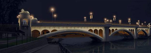
While Calgary doesn't have a full-blown lighting master plan, they have created the Centre City Illumination Guidelines as an element of the city's urban design and revitalization program for their downtown.  They are using an architectural lighting project for the Centre Street Bridge (below) as a way to illustrate these principles.
centrecity-night-bridge-610

Festivals.  Lyon, France has had a lighting festival, Festival des Lumières, since the 1850s. According to the Christian Science Monitor article "Cities shed artful light on the canvas of night,"
building facades become moveable feasts of color and familiar landmarks take on an animated aspect. Street performances and music round out the celebration, and people are seen strolling and admiring the magically transformed cityscape.
Night time lighting and safety.  Earlier in the year I wrote a couple of pieces on this ("Night-time safety: rethinking lighting in the context of a walking community"), advocating for structured programs for addressing night time lighting issues in "the walking city."

Association.  There is an association, LUCI | Lighting Urban Community International, linking those cities addressing lighting as an identity element.

Electric sign, Tochterman Tackle Shop, Baltimore.  Image from Pops and Mojo Photos

Signage.  Many cities have programs to assist businesses with the development of high quality storefront signage, which can be a distinctive element of business, commercial district, and community identity.

-- Thrive: Guide to Storefront Design in the District of Columbia, DC Office of Planning
Typically, the focus isn't on electric or neon signs, which cost a lot more to construct and there are few craftspeople with the skills to do so.

Still, last year I saw a presentation by people associated with the American Sign Museum in Cincinnati, and they were working with the city on a sign project involving artists, in a particular commercial district.

Image:  Inside the American Sign Museum.  City museums in Richmond and Pittsburgh also display electric and neon signs from defunct but memorable businesses that once operated in their respective cities.

However, the program didn't promote the development of neon and electric signage specifically, and it occurred to me that they could extend the sign program city-wide, but focused on neon and electric signage exclusively, as a way to promote the museum and better tie it into other cultural and tourism promotion objectives.

-- Museum of Neon Art, Los Angeles
-- Exhibition at the AIA/Philadelphia

Night lighting as light pollution.  Separately there are initiatives to reduce lighting at night, because of the impact on the environment ("Light pollution," National Geographic Magazine). Those issues have also been raised in the context of the Chicago initiative ("Environmental group takes dim view of Emanuel’s night light plan," CST).

-- International Dark-Sky Association

A Helsinki tram is specially lighted as part of the Lux Helsinki Festival.  Wikipedia photo.

Labels: , , , ,

Friday, January 24, 2014

Night-time safety: rethinking lighting in the context of a walking community

Last night, instead of going to a forum in Arlington on the future of WMATA, I felt obligated to go to a neighborhood meeting organized in response to a night-time robbery of two teachers from the nearby charter school, and an unconnected burglary of that school, plus an uptick in some other crime categories.

Having lived in the H Street NE neighborhood at the height of the crack-related crime and murder epidemic in the late 1980s and early 1990s, I am pretty inured to low levels of crime, although I am still very much interested in the etiology of crime, the field that is called "crime prevention through environmental design," and the general realization that most police departments, including DC's, despite the rise in the use of statistical analysis to fight crime, and definitely police officers, don't seem too capable of taking a planning approach to crime reduction (e.g., see "Planning applied to crime reduction," "Crime prevention through environmental design and repeated burglaries at the Naylor Gardens apartment complex," and "Suburban building forms in the center city--Does this contribute to crime?"). 

Night-time lighting as an element of placemaking and the walking city.  But just like how I argue that the walking-biking-transit city needs a transformational approach to snow clearance ("Upping the expectations on snow removal," "A "maintenance of way" agenda for the walking and transit city," and "Level of service and maintenance requirements in planning #2: winter maintenance of bike paths"), we need to think more clearly about night-time lighting for neighborhoods, commercial districts, schools, and transit stations and stops.

This image from the Elizabeth Dickerson, State of Maine Representative, shows a globe light streetlight with the light set to illuminate sidewalks and a streetlight at a different height, set to illuminate the roadway.

Crime everywhere--not just in urban areas-- is abetted by poor lighting... and empty places.  I am not going to get into the details of how street robberies are normally enacted, but the robbery that happened a couple blocks away happened on a street by the school where teachers park their cars, where the lighting is minimal, and where one side of the block is a relatively empty park--so it's an order vacuum besides the problems of limited lighting.

The area of activity that matters is larger than the entrance to the building.  Parents, of course focused on where they go in and out of the school, at the school's entrance, are only focused on that part of the school's "catchment" area, and not the other parts of the catchment area, beyond the school.  This came up at last night's meeting.  Frankly, the block of Peabody Street NW abutting the school is the safest place to be, because it has a great deal of activity throughout the hours that the school is open.

Safe routes to school programs inadequately consider night-time issues.  And "safe routes to school" planning materials don't address night-time lighting much because of a presumption that the school day ends around 3pm to 4pm when it is daylight. But many urban schools offer a wide range of afterschool programs, and more attention needs to be paid to ensuring there is enough light around the school when it's dark.  

For example, I consider this State of Washington guidebook, School Walk and Bike Routes: A Guide for Planning and Improving Walk and Bike to School Options for Students, to be definitive, yet it fails to address night-time illumination to the level of detail the topic deserves.

We need systematic approaches to improving night time lighting in walkable places.  The problem is that we haven't extended the ideas of "safe routes to (and from) school" or "safe routes to and from transit," by daypart, to address evening-related issues, which affect students but also parents and personnel like teachers.

(Some communities have more systematic programs addressing "safe routes to transit" (e.g., NYC DOT - Safe Routes to Transit, Safe Routes to Transit Program, San Francisco Bay region, Safe Routes to Transit BRT planning guide, pedestrian section, ITDP).


This Wikipedia image of a block in Adelaide, Australia shows how the issue of "streetlights" being focused on illuminating the roadway is not unique to the U.S.

Resources exist but are limited.  There are resources out there, such as Improving Street Lighting to Reduce Crime in Residential Areas from the Department of Justice. (The FHWA publication Pedestrian Facilities Users Guide: Providing Safety and Mobility is somewhat inadequate when it comes to the night time lighting issue, although it does provide limited guidance.)

Unfortunately, according to the DOJ guide:
There is no published step-by-step guide on how to improve street lighting to reduce crime and, in any case, every problem-oriented project is unique.
I don't agree about uniqueness being a big issue.
Left: Washington Globe lights on 8th Street SE. are focused on lighting the sidewalk, not the roadway, although the density of the lighting plus illumination from the buildings provides adequate lighting for the roadway as well.

Traffic safety countermeasure protocols need to be enhanced to better cover night time illumination.   Just like how we have "counter-measure" protocols for dealing with pedestrian (Pedestrian Safety Guide and Countermeasure Selection System) and bicycle (BIKESAFE: Bicycle Countermeasure Selection System) accidents, it's pretty clear how to respond to many of the conditions that tend to support street robberies (other than people not paying attention).  And the PEDSAFE website does have a section on Lighting and Illumination:
Roadway lighting has often focused on the needs of the motorist and not necessarily the safety of the pedestrian. ... Adequate roadway lighting enhances the safety of all roadway users, while pedestrian-scale lighting improves nighttime security and enhances commercial districts.
The solution: focusing on sidewalk lighting systematically, separately and distinct from roadway lighting.  The primary problem is that "street lights" are mostly focused on lighting streets and the lights are placed much higher than they need to be to be useful for pedestrians (except at crosswalks).  As a result, it's better to discuss streetlights in terms of their function as roadway lighting, and to call for additional lighting focused on serving pedestrians--"sidewalk" lighting--where the lighting fixture is placed closer to the sidewalk.

Left: this image from a document from Chapel Hill, North Carolina shows a traditional streetlight with the addition of a separate arm to provide more focused pedestrian lighting.

Where to prioritize sidewalk lighting.  It's pretty simple, start with schools and transit stations and stops, and other areas with pedestrian activity adjacent to and/or through order vacuums like parks.

For example, Delegate Eleanor Norton pressed the National Park Service to install sidewalk lighting in Sherman Circle, after a bicyclist was robbed and murdered there a few years ago ("Norton Presses NPS to Light the Darkness in Sherman Circle," press release, "D.C. hosts ribbon-cutting for new Sherman Circle lights," WJLA-TV).

But the murder could have been prevented in all likelihood, had this area been lighted not after the fact, but as the result of a systematic and proactive evaluation of neighborhood needs for safe night time walking environments.

Labels: , , , , ,