Rebuilding Place in the Urban Space

"A community’s physical form, rather than its land uses, is its most intrinsic and enduring characteristic." [Katz, EPA] This blog focuses on place and placemaking and all that makes it work--historic preservation, urban design, transportation, asset-based community development, arts & cultural development, commercial district revitalization, tourism & destination development, and quality of life advocacy--along with doses of civic engagement and good governance watchdogging.

Tuesday, May 26, 2026

Talking to strangers | Modern shotgun style houses as workforce housing for firefighters in Ketchum, Idaho + playgrounds

I take a lot of photos in public places, or not so public places, and people wondering if I am up to no good challenge me.  Because "I can talk" (your ear off), usually it's not a problem. 

There's an article in the Washington Post, "The mental health benefit of striking up conversations with strangers," about the value in talking with strangers.  For me, it's an opportunity to learn--to interview and interrogate, even if it doesn't seem like it.  From the article:
Nick Epley was commuting to work at the University of Chicago when he looked across the train and wondered: Why are all these people sitting elbow to elbow ignoring each other?

Epley, a professor of behavioral science, thought about how very lonely people are, and he challenged himself to strike up a conversation with the woman sitting next to him. It changed his life — and led him to write the book “A Little More Social: How Small Choices Create Unexpected Happiness, Health and Connection.”

After reading it, I decided to try the experiment myself. For the past month, on my commute to work, at kids’ birthday parties with my daughter, in the elevator at the office and on the street while walking my dog, I’ve been challenging myself to talk to strangers. Would it actually feel good, or just awkward?

I’ve always been a fairly outgoing person, but the idea of talking to strangers and befriending acquaintances still made me feel anxious. As I contemplated opening my mouth to talk to the stranger sitting next to me on a nearly-silent bus, I felt as if my jaw was sealed shut by fear. What if she didn’t want to talk to me? What if I said the wrong thing, or she felt like I was bothering her?
Ever since my involvement in college student government, I can "talk".  This increased manyfold as I got more involved in urban planning.

In my recent playground study for a grant application, I talked to people at "playgrounds," like the "senior" Fitlot at Columbus Center in South Salt Lake.  

Even though it was built with money from AARP, it turns out an Instagram group called  #slc.calisthenics organizes meetups there and at similar sets of equipment, and lots of people of all ages end up using it--part of my observation is that people/kids play with what's there especially when "more appropriate" equipment isn't present.  I saw a four year old doing pull ups on the same set.


I talked to little kids like this one.  She said the monkey bars are her favorite element at playgrounds.  (So did an older boy at a different playground.)  So I aim to have more types of monkey bars present at the playground.


Observations, analysis, and conversations made the application so much stronger.  Going to about 15 different playgrounds in a couple days educated me fast and deeply about playgrounds--including realizing I needed to be there when kids were, because I didn't know how they used certain equipment.

Young children like learning to bicycle on soft surfaces because it doesn't hurt when you fall.

We need wider sidewalks around the playground oval because there is mixed traffic--kids on scooters, bikes, skates, skateboards, adults on bikes (because we have inadequate bike parking, people walking, people sitting to the side, etc.

Greenhorn Fire Station Workforce Housing, Ketchum, Idaho.  When I was taking photos of these buildings at what turned out to be the Greenhorn Fire Station, I learned the back story, which I wouldn't have known otherwise.

I took the photos because I thought the buildings were an interesting interpretation of the New Orleans shotgun style house, and years ago, I helped write a chapter in a book compilation about the type.


I learned after being challenged, not realizing it was a fire station, and photographers could be would-be terrorists, one of the tenants came out to ask me what I was doing.  As a result, I learned the back story of the complex, for which I would have had no idea about otherwise.

In an area of ever increasing housing costs because of its being a resort area, it's an effort by the North Blaine County Fire District to provide workforce housing.  They rent the land from Idaho DOT, for the Greenhorn Fire Station, and built eight prefabricated units, mostly with donated funds.  


The 870 s.f. units are rented below market rate to tenants who agree to serve as volunteer fire fighters ("Final housing units arrive at Greenhorn Fire Station" Idaho Mountain Express, "Greenhorn Firefighter Housing Fully Occupied," Wood River Weekly).

What an interesting and important project.

Labels: , , , , , , ,

Thursday, September 18, 2025

A point about pedestrianizing streets: Boulder; Alexandria, Virginia, Cleveland Park, DC

This post is spurred by Alexandria, Virginia expanding the pedestrianization of King Street from the 100 block to the 200 block.

======

When I first got involved in urban revitalization, I learned more about pedestrianized streets.  I already knew some, because I had visited Kalamazoo, Michigan, home to the first pedestrianized downtown street, created in 1959 ("Kalamazoo Mall, nation's first pedestrian mall, opened 60 years ago today," Kalamazoo Gazette).  It still exists, but now provides for car access, not just on the cross streets.

Such pedestrian malls were created as a way to compete with suburban malls, which had taken a lot of the retail out of the city.  Although in the 1950s and 1960s downtown department stores still reigned, although many firms started suburbanizing along with their customers, adding branches in the suburbs.

Usually, a pedestrian mall wasn't/isn't enough to attract people downtown on its own because most people are satisfied by the retail options they have closer to home, so the spaces seemed pretty empty.  And because they were empty, it provided an opportunity for the development of disorder. 

When I moved to DC, there was a pedestrian mall on G Street in front of the Martin Luther King Library.  I don't remember when it was removed.


Some still exist.  One variant is transit malls, pedestrian, but with transit, such as in Portland, Minneapolis, and Denver.  But my experience is that filled with hulking, usually noisy buses, those spaces aren't particularly congenial.  Portland's was very urban renewal architecture, and recently has been renewed with more current urban design and street furniture.  

Many have been redesigned ("Revised Nicollet Mall redesign is unveiled," 2014, "Plentiful ideas to fix Nicollet Mall show it has a bright future," Minneapolis Star-Tribune).

The most successful pedestrian malls are in Boulder, Burlington, Vermont ("History of Church Street Marketplace," Burlington Free Press), Madison, Wisconsin ("Madison Wisconsin should be rethinking its pedestrian "district""), and Charlottesville, Virginia.  

All are college towns so they have a lot of students without cars, making it a natural draw for pedestrian activity.

Plenty of other places have them, more than I know, including Cumberland, Maryland ("I didn't know Cumberland Maryland "had" a pedestrian mall"), Winchester, Virginia (it has a college, but isn't that big and isn't that close to downtown), and the Pacific Oceanside tourist destination of Santa Monica, California.

And some places are adding them, like Newark Avenue in Jersey City, New Jersey, which is a small, but very dense, highly urban community across the river from Manhattan ("Pedestrianization of Newark Avenue in Jersey City").

Pedestrians walk past vacant retail storefronts for lease along the Third Street Promenade in Santa Monica on March 20, 2023. (Patrick T. Fallon / AFP via Getty Images)

Even the successful ones tend to peter out at the ends, with more vacancies there.  

Santa Monica's mall has been devastated by the closure of anchoring department stores, first Sears, then Nordstrom ("Third Street 3.0 in Santa Monica," Los Angeles Business Journal, "Santa Monica’s Third Street Promenade is a retail relic. Can it be saved?," Los Angeles Times).

Programming is essential.  The thing I learned from Boulder is how important it is to heavily program and manage the space, which I wrote about in 2005 ("Now I know why Boulder's Pearl Street Mall is the exception that proves the rule about the failures of pedestrian malls").  Plants aren't enough.

Modern proposals for pedestrian malls.  With the revival of cities, many people have suggested pedestrian malls for their communities, not understanding whether or not they have good preconditions for success.  

I had been skeptical in the past about proposals for 18th Street in Adams Morgan (because of the topography there it's the only major arterial into the district going east-west, and is a major bus route) and 17th Street NW.

Pedestrian districts.  Europe has dozens if not hundreds of pedestrian districts ("No Cars Allowed: The 10 Best Pedestrian Streets Around the World," Axios).  But there are plenty elsewhere including Australia, China, Japan and even in Montreal, which has a mix of pedestrian districts like Old City and around McGill University and Summer only streets like Saint Catherine ("Walk Montréal's car-free streets all summer long!," "Rue Sainte-Catherine Ouest: A renewed pedestrian experience," City of Montreal, "Montreal walks back pedestrian-only plans for sections of Ste-Catherine Street West," CBC-TV, "Beset by troubles, Ste-Catherine St. in Montreal’s Village will become a year-round pedestrian zone," Montreal Gazette).

A one-kilometre stretch of Ste-Catherine Street East will be redeveloped to become a pedestrian street year-round, with added greenery, amenities and an illuminated canopy. (Ben Shingler/CBC)
Photograph: Eva Blue.

Ironically, the street considered to be the first in Europe,Strøget in Copenhagen, came after Kalamazoo.

Since Copenhagen’s Strøget area eliminated cars in 1962, its popularity has influenced other global cities to implement the same type of pedestrianized areas. Photo by Kirk Fisher/Shutterstock

Such districts aren't a linear mall, but multiblock districts, often emanating from train stations, with retail and entertainment, and sometimes housing.

Capturing roadways to add pedestrianized space.  In the US, New York City, under transportation commissioner Janette Sadik-Khan, was a pioneer in pedestrianizing former roadways, starting with Broadway around Times Square in Manhattan ("Times Square's transformation into a pedestrian-friendly space captured in photos," CurbedNY, 

Start with a block.  I think it was getting exposed to pedestrian districts that I came to realize that while it is overwhelming to think of pedestrianizing many blocks in places that can't support it, why not start with one block, to pedestrianize places where it can be successful.

-- "Extending the "Signature Streets" concept to "Signature Streets and Spaces"," 2020
-- "From more space to socially distance to a systematic program for pedestrian districts (Park City (Utah) Main Street Car Free on Sundays)," 2020
-- "Why doesn't every big city in North America have its own Las Ramblas?," 2020
-- "Diversity Plaza, Queens, a pedestrian exclusive block," 2020
-- "Planning urban design improvements at the neighborhood scale: Dupont Circle, DC," 2019

and build out as it becomes more successfulAlexandria, Virginia's waterfront is a perfect example.  King Street emanates from it, but the street was always open to cars.  

With a process that started in 2020 ("Alexandria Virginia looks to pedestrianize the foot of King Street abutting the waterfront (public meeting tomorrow)," Lower King Street Pedestrianization Project), they tested making pedestrian the foot block of the street.  

Now they are extending it by one more block, after piloting it since last fall ("Another section of Old Town Alexandria is now car free," WTOP-AM, "New expansion to the King Street Pedestrian Zone opens today in Old Town," ALXNow).  From the article:

According to a city survey of people who live in the area, 87% of locals approve of the car-free zone, and 12 of 16 businesses most directly affected are also in favor. A city council report on traffic impacts also concluded that “dedicating more space for people walking, relative to vehicles along these three blocks of King Street, is an equitable allocation of public right-of-way.”

That could work for 17th Street NW in DC, maybe just on weekends as a start, even as it wouldn't work in most areas of the city.

-- "More about making 17th Street between P and R a pedestrian space on weekends," 2019
-- "Planning for place/urban design/neighborhoods versus planning for transportation modes: new 17th Street NW bike lanes | Walkable community planning versus "pedestrian" planning," 2021

A variant is Cleveland Park in Washington, DC.  It's a less ambitious example, but just as important to the neighborhood's residents and a more graspable and comparable example for most cities as they lack NYC's density and pedestrian traffic.

Its main retail block on Connecticut Avenue was split with sidewalk, roadway, parking, and more sidewalk, with parking on the curb lane.

After years of advocacy, in the face of some opposition by retailers, the city agreed to fill in the parking lane with an extended sidewalk.

Silver Spring, Maryland has a pedestrian block, which has great potential for expansion ("Making "Downtown Silver Spring" a true open air shopping district by adding department stores").  Perhaps many places are equally fecund.  And you don't have to go to Europe to see the potential.

Diversity Plaza in Queens ("Diversity Plaza, Queens, a pedestrian exclusive block") is another example of pedestrianizing a block.


Sugar House, Salt Lake City.  Like Cleveland Park, a large section of street and parking offset from the main street of 2100 South was converted into Monument Plaza in 2015 ("Monument Plaza enlivens Sugar House after years in the making," Salt Lake Tribune).  

The Monument is art deco, dedicated to the area's history of growing sugar beets.  A water feature calls attention to the area's history of having canals to bring in water and support commerce.

It looks like it's been there for years, but all in all is pretty recent.  It's used for restaurant patios, public space, and events.


Mare Street/Narrow Way in Hackney, London.  London has multiple pedestrian districts and pedestrian streets.  Mare Street was pedestrianized in 2016 but it looks like it's been there for a few decades ("Going Dutch in Hackney Central," Hackney Cyclist).  It emanates from Hackney Central Overground rail transit station and is part of the borough's "downtown."

Still, there can be conflicts between pedestrians and micromobility modes like bicycles ("Pedestrians urge cyclists to be more cautious down Hackney’s Narrow Way," Hackney Gazette).

Residential examples: Milwaukie Avenue in Minneapolis.  Created in the 1970's, it's an example of a residential street converted to a pedestrian block, as part of a neighborhood historic district ("Milwaukee Avenue a model for change," "1970s Mpls. activists saved Milwaukee Avenue's modest homes from teardown," Minneapolis Star-Tribune).  This year is the 50th anniversary of the creation of the historic district ("Minneapolis residents celebrate the 50th anniversary of Milwaukee Avenue Historic District," Minnesota Public Radio).

The city wanted to tear down the block for urban renewal, residents fought that off and as part of the reinvestment in the community, a two-block historic district was created, as well as the conversion of the street into a greenway.

Both articles have a photo gallery, and at the time yes, the houses were decrepit and you can see why the city wanted to demolish them.  OTOH, the condition of the houses today is a perfect example of why historic preservation works.  The houses needed new investment, not demolition, and the creation of the historic district provided the framework for that to happen.

Many houses along Milwaukee Av. were built as temporary homes for railroad workers. The State historical society wants to preserve the area as an example of a "common man's neighborhood in the 1880s. Built as temporary homes for railroad workers in the 1880s, many of Milwaukee Avenue's buildings have lost some of their original character through patchwork repairs.


Courtyard housing.  Some communities have similar blocks, but usually offset from the street, so that there is a greensward and sidewalk in the front, and alleys in back, connecting to the grid.  Salt Lake's Boulevard Gardens is one such example ("Salt Lake City’s ‘street without a street’ is a 90-year-old hidden gem —one that homeowners and historians hope to preserve," Salt Lake Tribune), but there are many others throughout the city.

(Trent Nelson | The Salt Lake Tribune) Boulevard Gardens, a unique Salt Lake City subdivision near 1800 South between Main Street and West Temple, on Friday, Nov. 16, 2018. The homes were built between 1929 and 1931 and face into a large landscaped courtyard, which runs the entire length of the development.

Marshall Court farewell potluck.  Photo: Ryan Stanton, Ann Arbor News.

Not realizing I was a trendsetter, I lived in two different sets of courtyard housing when going to college in Ann Arbor.  On Marshall Court ("Saying goodbye to Ann Arbor's Marshall Court," Ann Arbor News), which is now part of a large assemblage of property being converted into a new dorm.

And on Mary Court, off Mary Street, near the intersection of State Street and Packard Avenue.  The other side of the 8 house block is being consolidated into a 32 unit apartment building project, which has not yet commenced construction.  (Ann Arbor is going through a massive intensification of real estate development now, "50-plus Ann Arbor developments to watch in 2025," Ann Arbor News).

Urgh.
Bye, charm of Mary Court.

A book called Pocket Neighborhoods covers more modern examples of courtyard housing.

Open Streets events as a way to pilot pedestrianized blocks.  Streets closed to traffic for special events are often considered what is called an Open Street, which is a tactical urbanism intervention.  They can be a way to change people's thinking about what is possible ("Could Philadelphia’s embrace of the Open Streets program spur more civic innovations to come?," Philadelphia Inquirer) when it comes to shifting space from motor vehicles to people ("Open Streets DC as an event versus an agenda").  From the PI:
The initiative — a plan to promote more pedestrian traffic by temporarily closing some of Center City’s most vibrant commercial corridors to motor vehicles — is an example of Philadelphia leaders thinking big — and sticking the landing.

The concept of Open Streets is simple. Taking advantage of lower weekend traffic numbers, the Center City District takes space usually used by cars and trucks and gives it over to pedestrians, creating a plaza-like atmosphere. The idea is that with less noise and pollution from vehicles and more space to stroll, shoppers and diners will have a nicer experience, replicating pedestrian zones in cities like Paris, Tokyo, and Bogotá, Colombia.
A leisurely Sunday chat in the middle of the street: Michael d’Amico and Leah Parentela (rear) who live in the neighborhood, are joined by Karen Tracy of Center City and her granddaughters Thia (left), 9, and Kahlan, 7, visiting from the suburbs. The 1700 block of Walnut Street was among blocks that were car-free on four September Sundays. Tom Gralish / Staff Photographer, Philadelphia Inquirer.

31st Avenue, Astoria, Queens, New York City.

In Minneapolis, bicycle advocates used the Milwaukee Avenue street as an example of how to create a greenway on the northside of the city ("Proposed North Side greenway encountering some bumps," Minneapolis Star-Tribune).  It's taken 10 years, but the city is planning to create it now ("Minneapolis is ready to design the Northside Greenway. Do residents want it?," MST).

Pilot of a Northside Greenway at an Open Streets event in 2014.

Labels: , , , , , ,

Wednesday, October 02, 2024

Change takes a long time: Parks edition

Today we had a ribbon cutting for the new Fabian Lakeside Pavilion at Sugar House Park in Salt Lake, where I am on the board.  One of seven pavilions, they are about 60 years old.  The Park is about 70 years old, a regional park, and unusually, owned by the City and County jointly but overseen by an independent board.

The pavilion project is interesting for a bunch of reasons:

  • the original pavilion study dates to 2016.  So it took 8 years to construct the first new pavilion.
  • the park, being jointly owned by the city and county, has interesting problems with capital funding, as the agreement calls for joint and equal funding, leading to lots of paper and accounting issues.
  • But the two different governments work on different Capital Improvement Planning (CIP) schedules and only last year did I figure out how to make the two separate processes congruent--for our purposes, the equivalent of one process
  • the city started putting money aside for this pavilion 4-5 years ago.  The county a bit more recently.  
  • the original design for the pavilion was very modern and execrable (a lot of architecture firms aren't interesting in referencing architectural history).
The latter made me blow up the meeting and we had a special session later where we worked out a style that was a bit more balanced, with some cues to historic park architecture.

After the board meeting, I happened to go to a conference with a session on historic park architecture, featuring buildings and structures of the US Forest Service, and I ended up writing a long paper about park architectural history.

And I realized for the first time that most park system master plans fail to discuss park architecture generally, let alone park architectural history ("I discovered a massive omission in local parks master planning: it fails to discuss architecture and design in an overt way," 2023).  Which dates to the late 1800s with railroads creating lodges to serve the large western national parks.  This approach to design was continued by the National Park Service when it was created in 1916 ("parkitecture"), and was updated in the 1950s for modernism.

For various reasons, state and local park systems tended to adopt this approach, abetted by the New Deal, when many state and local parks were built by various federal government works programs, using design guidelines developed by the National Park Service as the lead, but also the US Forest Service.  (Other federal agencies like BLM use the same guidelines.)

This issue was one that inspired my series of articles on gaps in park master planning:

-- "Gaps in Parks Master Planning: Part One | Levels of Service"
-- "Gaps in Parks Master Planning: Part Two | Utilizing Academic Research as Guidance"
-- "Gaps in Parks Master Planning: Part Three | Planning for Climate Change/Environment"
-- "Gaps in Parks Master Planning: Part Four | Planning for Seasonality and Activation"
-- "Gaps in Parks Master Planning: Part Five | Planning for Public Art as an element of park facilities"
-- "Gaps in Parks Master Planning, Part Six | Art(s) in the Park(s) as a comprehensive program "
-- "Gaps in Parks Master Planning: Part Seven | Park Architectural (and Landscape Design) History
-- "Gaps in Parks Master Planning: Part Eight | Civic Engagement"

and specifically with architecture and the cultural landscape (""Gaps in Parks Master Planning: Part Seven | Park Architectural (and Landscape Design) History").

I suppose there are a couple more I should write, on transportation access ("Revisiting: Access to Theodore Roosevelt Island, a national park in Washington, DC," 2022), on planning for multiple agencies owning parks in particular jurisdictions ("Federal shutdown as another example of why local jurisdictions should have more robust contingency and master planning processes," 2013), and including for profit actors in the sector as part of master planning ("Why community recreation plans should include for profit actors: What do you do when important assets face dissolution?," 2021) which I've written about for even longer.

Still, 8 years.  One of the other board members really helped push this along in the past 18 months, so it does show the value of having independent boards.  Again, it puts in perspective how long change takes.  That's the equivalent of two political terms.  I always laugh when after 6 months or so people are complaining about the failure of newly elected public officials to do anything.

.... But you've got to invest in those boards.  The city and county have failed to do that.  Luckily, we have a couple of more engaged board members, and the board is becoming more active and less passive.

====
I fought to keep grills as part of the program.  Our park manager (the County) has been removing grills.  But because we are independent, they had to do what we wanted. I argued grills are part of equity. Similarly, we've developed some nice signage for the pavilion, although it's not quite installed.

Labels: , , , , , ,

Saturday, March 23, 2024

Missed design opportunity with bridges as aesthetic elements of neighborhoods

 I do write about bridge abutments and underpasses as marketing and urban design-placemaking opportunities.  I had this concept to do public art lighting of the underpasses in Takoma (Piney Branch, Aspen, Van Buren, and Kansas Avenue, not Cedar Street because it has wall tile public art project already, but lighting would have been better) as a system.

Birmingham Light Rails, Alabama, Bill FitzGibbon

The Elvert Barnes photo feed on Flickr has this photo of a bridge in Southwest DC as part of a "walk to the Tidal Basin" to see the cherry blossoms.  Can't remember what street this is.


It's also keeping with the 1800s "railroad beautiful" movement by Richardson and Olmstead, although it was more focused on stations and their grounds ("A Railroad Beautiful" and "The Treatment of City Squares--III; The Square Before the Railroad Station," House and Garden (2) 1902 and "Railroad Gardening," Standard Cyclopedia of Horticulture

And what I call transportation infrastructure as an element of civic architecture.

DC does understand they can do this.  But I think this example on Florida Avenue NE promoting the Metropolitan Branch Trail is the only one I know of in the city.


But I think it needs to be more in your face and visible.  The MBT example is a bit timid, and therefore easy to miss.  This is from the Great Rivers Greenway program in St. Louis.


Similar examples include Camden, London.  In your face is better and a better marketing tool.  And it's also an urban design and quality of life and anti graffiti measure.


Other treatments can be more arty.

Outside the Vauxhall Underground Station, London promoting the nearby Brunel Museum

Hartford Connecticut

Underpasses too.

Spring Garden Station, Philadelphia.

And under freeways.

Great Rivers Greenways, St. Louis.

Which can include placemaking initiatives like the Bentway in Toronto and the Underline in Miami.


Labels: , , , , , ,

Tuesday, November 28, 2023

I didn't know Cumberland Maryland "had" a pedestrian mall

 I've written a lot about pedestrian malls in the US (versus pedestrian districts in Europe).  It's hard to make them work because our mobility paradigm is dominated by the car, and because Downtowns are no longer leader centers and destinations within metropolitan areas, the way they were before the rise of suburban shopping malls.  But some cities, in particular college towns like Boulder and Burlington, Vermont, and to some extent Charlottesville, have them.

I've come to realize that the point isn't necessarily to have a long pedestrian mall, but to start small, where you can be successful, even with one block.  And to heavily program and manage it

-- "Planning for place/urban design/neighborhoods versus planning for transportation modes: new 17th Street NW bike lanes | Walkable community planning versus "pedestrian" planning," 2021
-- "Extending the "Signature Streets" concept to "Signature Streets and Spaces"," 2020
-- "From more space to socially distance to a systematic program for pedestrian districts (Park City (Utah) Main Street Car Free on Sundays)," 2020
-- "Why doesn't every big city in North America have its own Las Ramblas?," 2020
-- "Diversity Plaza, Queens, a pedestrian exclusive block," 2020

-- "Now I know why Boulder's Pearl Street Mall is the exception that proves the rule about the failures of pedestrian malls," 2005

That being said, many places, including DC, have removed pedestrian malls over the years.

The DMV region has two pedestrian malls that I knew about, in Charlottesville and Winchester Virginia.  Both tend to peter out at the ends.  (As does the pedestrian mall in Santa Monica, especially as it has over the years lost department stores as key anchors.)

I didn't know about Cumberland Maryland, which was mentioned recently on the Reddit Walkable Streets thread.  

However, they are tearing up all that beauty and investment, and adding a traffic lane, which makes it less than a stellar example ("Downtown mall work on schedule," "Downtown construction includes unexpected challenges,"  Cumberland Times-News).

-- Reimagine Cumberland

It's a shame because photos indicated that the mall was super well executed, managed and maintained.  That being said, I guess infrastructure improvements are necessary, and for the most part, they will be keeping the overall focus on walking, not driving.

Flickr photo by Jacqui Trump.

Photo: Steve Bittner/Times-News.com 
Construction continues on Baltimore Street on Thursday, July 13, 2023.

Rendering of the newly constructed pedestrian mall

Labels: , , , , , ,

Friday, March 24, 2023

Transit as a formula for local economic success and improvements in regional quality of life: Salt Lake's Rio Grande Plan

There is an article at Building Salt Lake, "Why isn’t Utah Transit Authority supporting the Rio Grande Plan?," opining about why the Utah Transit Authority isn't all in on the concept of reviving Rio Grande Station as the "central station" for Downtown railroad and transit service.

In the late 1990s, they moved railroad service from the Rio Grande Station to a little building a few blocks behind it.  That's where the Trax light rail main station is too.  Later they built an Intermodal Center, providing at the time a bike shop and inter city bus connections too.  But it failed for a bunch of reasons, not just the homelessness issue, but mostly because it is located where people aren't.  Now the Intermodal Center just houses intercity bus services.

-- Rio Grande Plan

The plan proposes a tunnel to redirect the railroad passenger services back to the station, as well as a rerouting of the Trax Green Line, with railroad service in a tunnel  behind the station and light rail service in front of the station.

I think it's a visionary concept along the lines of "transformational projects action planning" especially in advance of Winter Olympics in Salt Lake in 2030 or 2034, would be a catalyst to further drive transit improvements across the region and state, ideally shifting the transportation paradigm more towards sustainable mobility (meanwhile the Utah DOT wants to widen the I-15 freeway through Salt Lake City).

For links on TPAS applied to transit service, just look at the discussion and links in "Florida's Brightline passenger rail as an opportunity to rearticulate and extend transit service in cities like Orlando."

In fact, light rail here in Salt Lake was spurred by the 2002 Olympics, it's a small system and doesn't go to all the places it should, but it's complemented by a developing commuter rail program, a dinky streetcar line on the south side of Salt Lake and South Salt Lake, and a decent enough bus system.  All in all, if it goes where you want to go, it works reasonably well.

I was thinking about it, that it's because transit agencies don't think much or focus on how what they do improves places, adds to economic development, reduces motor vehicle use, etc.  

Sure they talk about it, in fact all the time, but the reality is maybe if they own some land promote transit oriented development--more intensive use--around stations, which increases transit use.

I was watching Japan Railway Journal yesterday morning, and the program was about the Chōshi Electric Railway in Chiba prefecture--about 55 miles from Tokyo--and all that the railroad is doing to promote itself, pay for itself, and increase ridership, in the face of rising automobile use and population shrinkage.  It's only about 4 miles long, connecting to JR, with a few trains each day, but a lot of creative marketing.

-- "Choshi Electric Railway: Turning Creative Ideas into Profit," video

One of the things that the president of the railroad said is that "when the community economy does well, so does the railroad, and when the railroad does poorly, so does the community" [paraphrase].

Frankly, this is not a new argument.  When streetcar systems were first created, usually they were associated with real estate development, in fact they were often owned by the developers (and later by utilities, because electric streetcars were their biggest customers).

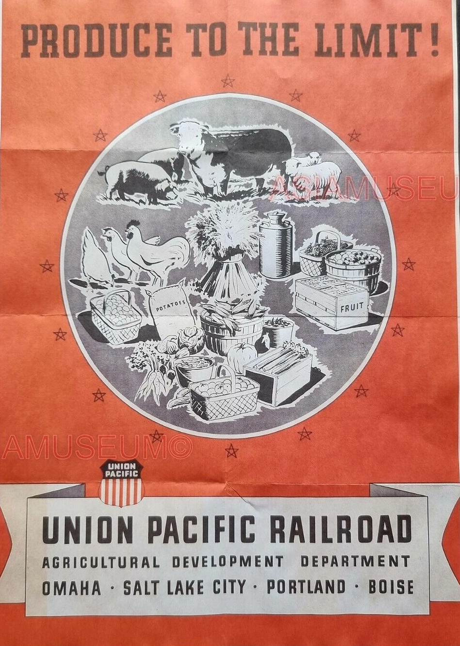
Railroads too were active in promoting economic development, especially the recruitment of manufacturing plants, the growing of crops, etc., in their region, to boost use of their freight and passenger system, but also to build up the communities they served.  They produced reports, advertisements, brochures, guides, and all kinds of materials promoting their business development functions. 

Advertisement

poster
 
 publications
 
railroad postcards, distributed on passenger trains, promoted tourism and economic development too, 
printing specific messages on the back of the card

and of course, the tourism posters

I have mentioned how the VIA transit agency in San Antonio has an urban design unit ("VIA urban planner wants to build a better San Antonio," San Antonio Express-News) nd that city transportation departments should have a "chief thoroughfare architect" to focus on the design and placemaking qualities of streets.  

Admittedly, many transportation agencies are investing a lot in urban design, livable streets, sustainable mobility, etc.  But even in the best agencies, a lot of the time sustainable mobility and urban design elements are overlooked, or removed from plans because of the cost.

Probably the best expression of this idea is this piece, "Planning for place/urban design/neighborhoods versus planning for transportation modes: new 17th Street NW bike lanes | Walkable community planning versus "pedestrian" planning," where I make the point that in planning by mode, we often miss the point when it comes to place qualities, that instead of doing pedestrian planning, we should be planning for walkable communities.  From the entry:

A walkable community plan would incorporate other treatments or elements besides sidewalks such as intersections, plazas, pedestrian "malls," parklets, laneways and alleys, walking as an element of commercial districts, "safe routes to school," night time lighting issues,  wayfinding signage, the walking element of trails/shared use paths and transit, bus shelters and stops, street furniture, events and programming ("Events and programming in a systematic manner," 2017, "The layering effect: how the building blocks of an integrated public realm set the stage for community building and Silver Spring, Maryland as an example," 2012), etc.


Some communities like San Francisco and now Salt Lake City are moving to integrate urban design and multi-modal planning (like my Signature Streets concept) into their pedestrian-focused programs, sometimes called Livable Streets.  Parklet and other initiatives are related.

-- "Salt Lake wants its streets to evolve," Building Salt Lake

This presentation has been superseded, but when I first saw it eleven years ago, I was impressed.

-- Sustainable Mobility & Climate Action Strategy, San Francisco Municipal Transportation Agency
 
Walk (and Bike) to School initiatives can be a good way to bring walking focused improvements to neighborhoods in ways that improve the walk to school experience for children and the neighborhood more generally, and simultaneously.   


Advocacy groups like Feet First of Seattle and Starkville in Motion (Mississippi) have utilized walk to school initiatives as a way to drive pedestrian improvements more broadly across their respective  

Safety is a key element.  It's important that the plans also acknowledge the issue of safety, loitering, homelessness, camping in public spaces, noxious uses, etc. ("Los Angeles Goes to War With Itself Over Homelessness," New York Times).

And that's the issue with transit agencies.  They need to be thinking about and planning for how transit strengthens and improves communities, rather than just thinking about transit in terms of modes or engineering or budgets.

There is an article on how the Dean of Engineering at the University of Michigan is becoming the Provost of Duke University and I like what he said about encouraging change and innovation:

Gallimore said as dean, he is most proud of the culture he was able to be a part of, which focused on being highly collaborative and collegial while maintaining a focus on education and research.

“We also have a, ‘how do we get to yes?’ attitude and a can do attitude,” Gallimore said. “We don’t have to make a huge amount of fanfare with what we do, we just get the work done, and do it with excellence and with grace. I saw that in my 10 or 12 years as academic leader here at the College of Engineering.”

To me, government is more about denying, saying no.  I joked that under the Trump Administration, Brand America became: Can't Do. Won't Do. You Do.  F*** You.

And I've written about what I call a "bias for inaction."  From "Revisiting Vision Zero in DC and NYC":

Government has a bias for inaction*.  A big issue is that transportation agencies (and government agencies more generally), even very good ones like NYCDOT, aren't always that proactive, and tend to not have "a sense of urgency" when it comes to action.  

It varies depending on the mayor.  It's fair to say that in NYC Mayor De Blasio cares a lot less about this than former Mayor Bloomberg ("A Playbook on the Politics of Better Streets," Bloomberg), and in DC, most elected officials are from "the outer city" where the automobile remains dominant ("DC as a suburban agenda dominated city," 2013).

That's why too often, improvements are implemented after someone dies rather than systematically addressing problems beforehand ("Salt Lake City paints crosswalk where children were struck on way to school," Salt Lake Tribune).

A key point in the iterative improvement of my writings on Vision Zero is focusing initiatives in terms of the "6 E's" of sustainable mobility planning ("Updating Vision Zero approaches," 2016). 

 One of the reasons for failures in improvement resulting from Vision Zero "initiatives" is the lack of a systematic approach.

* A bias for inaction is a riff on the "bias for action" element of forward-looking corporations as discussed in the book The Search For Excellence.("Putting a Bias for Action into Planning Agency Management: A Practitioner's Perspective," Public Administration Review, 1986).

The Rio Grande Plan should be seized upon by UTA and state officials, alongside local officials, as a way to strengthen, extend, expand, and improve transit, in a generationally transformational manner.

(I have been preparing on what Utah should do from a transformational projects action planning perspective vis a vis the Olympics, with this being one of the projects, and unfortunately Blogger "ate" the draft, so I have to re-create it.)

Mayors as systems integrators.  Years ago I had a conversation with Jeff Tumlin, a transportation planner, author of Sustainable Transportation Planning: Tools for Creating Vibrant, Healthy, and Resilient Communities, then a principal of Nelson Nygard, an innovative planning consulting firm, and now director of transportation for the City of San Francisco, and we were talking about cities as platforms for innovation.  

(This when I was trying to do bike sharing systems, and integrating other services into it, like parking management and electric vehicle charging.)

He thought that mayors are the would be systems integrators, the agent that has the ability to bring agencies together, to force them to do things, etc.

And while it is a more collaborative process, the Metropolitan Area Projects infrastructure development process in Oklahoma City, as discussed in the book The Next American City: The Big Promise of our Midsize Metros, has some of those elements.

But I wonder if the problems of the here and now, and the unplanned things that come up like earthquakes, pandemics, etc., make it almost impossible for mayors to play that role. 


Labels: , , , , , ,