The revised revised People's Transportation Plan/2008 Transit-Transportation wish list
Significant revisions 2/22 (hopefully the last iteration.)
This blog entry began as A 2008 Transit/Transportation Planning Wish List for DC and was complemented by this entry, Michael's Proposed Brown Line.
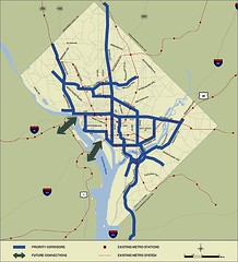
This is a revised version that adds ideas based in part on comments from readers, and is powered by the great conceptual transit expansion map graciously produced by David Alpert of the Greater Greater Washington blog.
Thank you everyone for reading and commenting.
--------------------------
AMNew York, the free daily in NYC published by Tribune Publishing, and unlike the Express, it is a publication with a lot of locally produced and generated stories about the city, has a story "MTA, commuter advocates offer transit wish list" about a 2008 transit wish list for the New York City region.
What would DC's transit/transportation/mobility wish list be?
If people want to write wish lists for other jurisdictions, please do so and send them to me and I'll post or link to them. Note that this list is not necessarily in order and for the most part I am not going to link to previous blog entries where I've written about these specific points in the past.
The point of this is to create a transportation system that optimizes livability and efficiency for DC residents, and supports the local economy. That includes the office environment in the city, but with the intent of reducing automobile use.
DC doesn't really focus on transportation as a competitive advantage in the same manner as Arlington County or Portland, Oregon. Those are communities known nationally for their focus on transportation demand management and/or transit expansion.
Portland Streetcar was created in large part at the initiative of local business groups, which wanted to monetize the potential of the Pearl District and Downtown. (Portland Streetcar article.) Portland continues to extend transit, having added a light rail line by creating an Urban Renewal District (and bonding authority) to build it, and by adding an aerial tram to connect OHSU to Downtown. In these instances Portland State University and OHSU put up significant amounts of money to build the systems. (Imagine that in the DC region...) All the while it continues to extend the streetcar line.
(It's true that the Downtown Circulator was put forward by the Downtown DC BID and the New York Avenue infill subway station was initiated in large part by developers. But for the most part, I don't feel as if big business in DC is really pushing transit. E.g., the Downtown DC BID testimony in favor of the Comprehensive Plan completely ignored the failure to institute transportation demand management practices in the land use plan.)

The funny thing though is in terms of commuter-based walking, bicycle, and transit trips, DC far exceeds either of those communities:
DC's mode split is 45%.
Arlington's is 30%
And Portland's is 23%.
Just think if DC really tried.
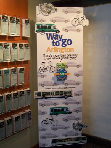
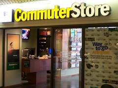
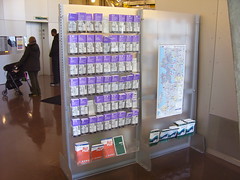
Arlington County Commuter Store information panel.
Funding
1. Creation of a transit withholding tax assessed on DC-based workers (70% of DC based workers do not live in the city). Depending on the rate, this could generate up to $250 million annually. Such a tax is assessed in certain counties in Oregon to support transit there. It would have to be used solely for transportation system improvements, and yes, that includes roads, but in the interim would likely be focused on transit improvements.
2. Dedicated funding stream for WMATA/transit. Note that this proposal for a transit withholding tax is separate from the Tom Davis initiative to match a $1.5 billion federal contribution to the WMATA system, in return for each of the jurisdictions creating a dedicated funding stream. A dedicated funding stream would merely protect the funding stream for current operations. The idea of a withholding tax is to fund system expansion and significant improvement.
Still, let's direct at the very minimum a percentage of all sales taxes (including retail, restaurant, hotel, parking, car rental) to the WMATA system.
• Washington's" Metro: Deficits by Design (Brookings report)
• Transit in Washington, D.C.: Current Benefits and Optimal Level of Provision
3. Increase the gasoline excise tax at the national level, as well as at the state level in DC, MD, and VA. Regionally, excise taxes have to be increased together, otherwise on the borders, people will cherrypick and buy gas at the place with the lowest prices. Use these funds to support transportation improvements to streets and transit.
Subway, Streetcar, and Railroad Expansion
Transit expansion in the Washington region. Conceptual map produced by David Alpert of Greater Greater Washington. Recognize that heavy rail is expensive. It can pay off when it helps intensify development and density in significant ways, and adds amenities to neighborhoods. DC's core has revitalized in large part because of the presence of transit. By adding more high capacity service at the core, DC will strengthen its competitive advantages vis-a-vis the suburbs in terms of efficient mobility that is not dependent on the automobile.

4. Commitment to the creation of the separated blue line subway, now colored Silver, in the center core of DC should be the number one priority for the use of this money including adding another NoVA tunnel crossing (which Virginia should help pay for).
-------
In this map I suggest a major reordering. First, the current Silver Line planning should be used not just for thinking about transit expansion in Virginia, it should be used to assist in further development of transit capacity in the core of the city.
In a blog entry in 2006, "The 'Downtown' Circulator and Rosslyn, Virginia," I used an idea first suggested by Damian of the Sierra Club Transportation Committee, where we figured that the Silver Line should continue on in the alignment suggested by the original separated blue line proposal, providing a new Potomac River crossing north of Rosslyn, and picking up the service suggested in the old plan.
IN THE DRAWING, David agreed to color this line Silver, and change the current routing of the blue line in a significant fashion. It becomes a Virginia only line, connecting to the yellow and orange lines (as well as the proposed brown line), with an extension to Ft. Belvoir.
-------------

Original separated blue line proposal. Washington Post graphic.
My version of a transit expansion map for Washington, DC. (Produced by David Alpert, Greater Greater Washington.) This combines the Virginia "Silver Line" with the old separated blue line proposal in DC, adding a tunnel crossing between Rosslyn and DC. It truncates the blue line into a Virginia only line, and adds a new north-south Brown Line.
5. Develop the Brown line as suggested originally by Michael S. Although, this line has changed quite a bit from Michael's original proposal. Instead of putting the line on the already congested red line, we suggest an alternate routing down North Capitol Street, which can provide service to the city's number one destination without high capacity transit, the Washington Hospital Center, as well as to the Armed Forces Retirement Home, which is going to develop a portion of their campus, and other locations.
As suggested by commenters, this line goes west from Fort Totten, and later iterations bring this back southwest into Georgetown. We also add a Lower Anacostia station, service to National Harbor, among others.
6. As can be seen from the map, additional infill stations and extensions are included such as those suggested by Alexandria for Potomac Yards (see "Alexandria officials tie development to new stations" from the Examiner) and a Yellow Line station for the Jefferson Memorial. It also adds service on the blue line to Fort Belvoir, and includes an extension of the green line out to BWI Airport and beyond.
7. In building these lines, consider double tunneling or adding a third track so that there can be express service and greater capacity than on the lines currently. (I don't understand why the WMATA system can't run trains as frequently as NYC subways can.)
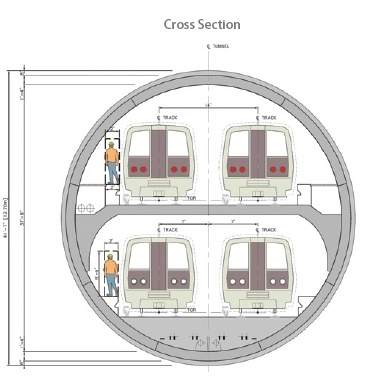
Image from Tysons Tunnel.
8. Add those walkway connections between Farragut North and Farragut West, and between Metro Center and Gallery Place (and elsewhere as appropriate with the extended system). David's map shows these.
9. Create a single railroad system for DC-MD-VA. Rather than having two separate systems oriented to commuters, although Maryland is in the process of transforming the MARC system to a 7 day system, with more service later in the evening, the region would be best served by one system that is vastly expanded. (Think of the equivalent of the Port Authority of New York and New Jersey but for the railroad system.) And connect MARC to SEPTA.
BeyondDCs conceptual railroad map for one regional railroad system for DC, Maryland and Virginia, including service to parts of West Virginia, Pennsylvania, and Delaware.
I suggest calling this system the RACER, standing for the Railroad Authority of the Chesapeake Region. BeyondDC is working on new maps for this, and is fond of calling the system the Potomac Express. And Greater Greater Washington calls it the MVX, Maryland-Virginia Express. (But they can both do graphic design, and I can't, so they may win out...)
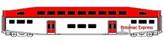
Image by BeyondDC.
10. Yep, build out the streetcar network. Although there is the "hold up" of the fact that currently there is a law preventing overhead lines in the L'Enfant City. I think we need to take the time to see how the Alstom in-line power technology works out, and go for underground powering. But in the interim there is plenty to do...
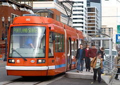
Streetcar at PSU Urban Studies Center. DC plans to use the same style of streetcar. Photo: Miles Hochstein, Portland Ground
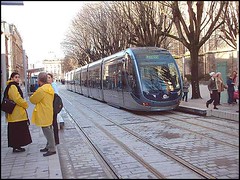
Citadis train in Bordeaux with in-ground power. Photo from the Transit Coalition.
Originally proposed streetcar line map, DC.
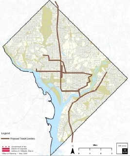
Streetcar Map with reduced number of lines as depicted in the DC Comprehensive Plan.
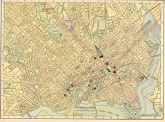
Map of Washington, DC , 1908, showing streetcar lines, railroads, and steamship docks (Hammond Company).
11. Emphasize the cultural heritage tourism aspects of streetcars. For example, the Market Street Railway in San Francisco runs streetcars from many systems around the world. Similarly, heritage streetcars (and/or replicas) can be integrated into the system to provide service at the sub-district level, such as in the H Street commercial district.
See this past blog entry: Adding cultural heritage dimensions and expanded service capabilities within commercial districts to DC Streetcar planning.
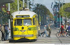
Streetcar dropping people off at the Ferry Building, San Francisco. San Francisco Chronicle photo.
12. Tunnelize the Metropolitan Branch railroad line. This is a stretch. It would cost billions and would involve creating tunnels for both the railroad and the subway. But it would allow for adding capacity to that line, which is quickly moving to capacity, and given that the subway line is bracketed by CSX railroad tracks, it can't expand except by having double stacked trains, which we can't do because of the way the tunnels and bridges exist.... (Note that a railroad, maybe CSX, maybe Norfolk Southern, is making their line from Chicago to Richmond capable of carry double stacked containers the whole route. This means adjusting tunnels and bridges...)
Note that this isn't a priority for me, but I think it should be listed nonetheless. It should have been done in the late 1960s when the subway system was built. Now it's too expensive and it wouldn't really create much in the way of new developable land, which would have been able to help fund the change.
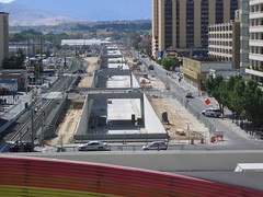
Tunnelizing the railroad in Reno, Nevada.
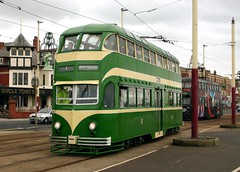
Double decker streetcar in England. Photo from Wikipedia. Hong Kong also has double decker streetcars.
13. Water taxi service. David of Washcycle suggested adding Water taxi services between Georgetown and National Harbor, Alexandria, etc. I don't know about that. First, water taxis are different than ferries. I don't know if the distance between say Georgetown and National Harbor or Alexandria is short enough for water taxi service to make sense, and is there enough demand for year-round service? Would there be enough regular riders?
But it should still be explored. Shorter routes, say between National Airport and DC, along the Anacostia, between the Baseball Stadium and the other side of the river, might make sense.
It happens I am looking into this in a cursory way for a project in Georgia, and there are federal funds available to support the development of these kinds of services. Even so, they aren't that expensive to launch, but can require some subsidy, especially over great distances, or if they are considered to be more for tourists.
Services in Boston and New York City are used primarily by commuters but with a goodly amount of tourist patronage as well, while the water taxi system in Baltimore is oriented to tourists. But since more than 15 million people visit Baltimore, most to the Inner Harbor, that system gets the volume it needs to work. Nonetheless, there were competing systems and they have since merged.
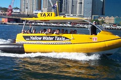
Sydney Water Taxi.
Jacqueline of JD Land Near Southeast Redevelopment points out that piers for Water Taxis are being installed. See her entries Diamond Teague Park/Earth Conservation Corps/ Old Capitol Pumphouse and "The Yards"/Southeast Federal Center.
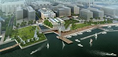
Rending of the Waterfront Park at the Yards by Forest City Washington via JD Land.
Plus, Virginia is considering ferry service between Quantico and the Navy Yard, although that is focusing on NoVA commuting needs, not DC-centric water-based transportation. See this from the Washington Post, "In Trial Run of Ferry Lie Dreams of An Easier Commute." (Ferry Boat Feasibility Study)
Roads, streets, streetscape, parking
14. Streets as places. This is a major new initiative by the Project for Public Spaces, making streets for people as much as cars, the way it used to be (Streets as Places). Bill Schultheiss, an ANC6A Commissioner and a transportation engineer, has a presentation on "traffic calming" which really is more about "streets as places," although he doesn't term it as such. We need to get him out showing this presentation around the city.
Other resources are the Living Places: Cleaner, Safer, Greener report from the UK, How Can I Find and Help Build a Walkable Community? by Dan Burden, and Portland's City Repair project.
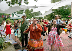
Mark Lakeman and Lydia Doleman were married in the center of the street, at the intersection they were instrumental in creating - Share-it Square. Photo by Miles Hochstein, Portland Ground. As Fred Kent says, people who kiss in public places feel comfortable there? Can you imagine wanting to marry in the middle of a typical street?
Portland Pedestrian Design Guide.
1700 block of L Street, south side.
1700 block of L Street, north side.
15. Use pavement materials more selectively to manage driving speeds. Cars are engineered to go very fast. Roads are engineered to accommodate cars. Even though the posted speed on DC's major streets--the streets downtown and those through commercial districts and neighborhoods--is 25 mph, the actual pavement installed, concrete or asphalt, enables speeds of 50 mph to 100 mph, regardless of the surrounding context. Too often, people drive to the speed that streets and cars are capable, not to the speed that is appropriate for the context.
Change the road construction materials to match the desired speed conditions, particularly in neighborhoods. It would be the best traffic calming device there is. (I don't know if this can be done on roads that receive federal funding.)
Belgian block!
Belgian block on Monument Avenue, Richmond
Also see "The GOAL Project in Graz: Promotion of walking and cycling for the citizens' personal well being."
16. Intra-city HOV requirements. (I forgot to include this before.) Alexandria has HOV-2 requirements on Washington Blvd. and Rte. 1 during rush hours.
This should be done within DC on certain roads during rush hour periods as well, to reduce the number of single occupancy vehicle trips. Streets such as Rhode Island Avenue, New York Avenue, Constitution Avenue, Independence Avenue, etc., come to mind. (This idea was first proposed by Patrick Hare in an op-ed in the Washington Post in the early 1990s. Change takes a long time. And needs champions.)

Washington Boulevard, Alexandria.
17. DC is already rolling out new bus shelters and a bike rental system. Keep up the momentum, including more streetscape improvement projects, the creation of bicycle trails including the Metropolitan Branch Trail, etc. But do better signage. Include bike map trail signs and put up bicycle maps in Metro stations and in bus shelters.
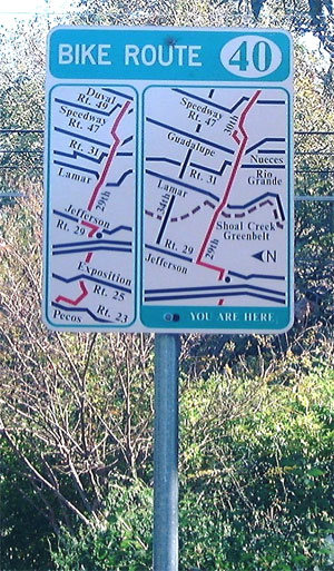
Bicycle route sign, Austin, Texas.
18. Take on the parking mafia. Do a parking study of the entire city, comparable to what Seattle did, and change requirements accordingly, including a paradigm of shared parking systems in commercial districts. As a result, Seattle eliminated parking requirements in certain areas, including around transit stations, stating:
Lower parking requirements based on local demand and to support alternative transportation. In Urban Centers and high capacity transit station areas, allow the market rather than the code to determine appropriate parking supply.
DC really bobbled an opportunity during the Comprehensive Plan revision process to address parking and curbside management, which by and large it failed to do.
19. Speaking of parking and curbside management, change the residential parking permit system in DC to one that emphasizes the privilege, rather than the right, to park. 40% of the people in DC do not own cars. Why should the 60% that do be privileged with practically free parking spaces?
a. Residential parking permits should cost a lot more generally. As you probably know, Prof. Shoup estimates that the value of the public space on the street is about $1800 annually.
b. There should be a limit on how many residential parking permits can be issued per household. Only one car can fit in front of a typical rowhouse. Multiple cars per household should be discouraged.
c. The rate for residential parking permits should go up considerably for each additional permit per household address.
d. Parking permit rates should be weighted according to how large a car is, and its carbon footprint (maybe). One of the big problems I'd say anecdotally is that people in the city may only be buying one car, but it is much much larger than it used to be (an SUV). This further reduces available parking inventory for residents.
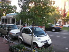
Smart Car on Pennsylvania SE, with a Metrobus in the background.
Surface Transit System Improvements
20. Improve the bus service. I say do this before thinking about streetcars. We need to make bus service exciting and sexy, in order to boost transit use. I recommend better marketing and wayfinding systems, better bus shelters (coming) and waiting stations, and probably sexier buses, which to my way of thinking, would be double deckers, on routes that could accommodate them. Double deckers are 40 feet long, and more maneuverable than 60 foot articulated buses.
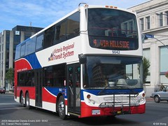
Double decker bus in Victoria, BC. Photo by Bill Wong.
21. Create intra-neighborhood transit (bus) services so that people can get to and from local services, commercial districts, schools, libraries, and to and from transit stations without having to drive. This includes delivery services of "freight" such as groceries. In my transportation and land use paper, I call this "tertiary" service (based on the Arlington model of the primary and secondary transit network, see their transportation plan). And it's not like we don't have a form of this now, at least within the city. Most neighborhoods have access to some bus service, although many people may not use it because it is circutuitous or because they feel that the bus service is beneath them.
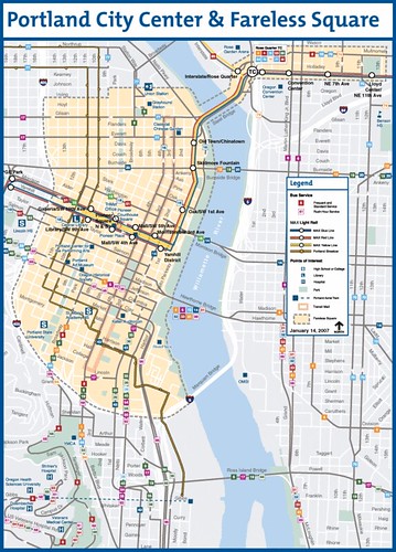
22. I don't believe that transit needs to be free, but make intra-neighborhood bus service free. Many clamor for such. But cost isn't the biggest barrier to using transit. And places like Portland have the Fareless Square--funded in part by their transit withholding tax. But I think that equity issues make a downtown oriented fareless square somewhat unfair as the biggest beneficiaries would be the people with jobs downtown, who tend to not be those with the greatest need.
However, I suggest that the intra-neighborhood transit services (tertiary transit network) suggested in the previous section should be free. I estimate this would cost $30 to $40 million annually. Also see this blog entry: An idea for free public transit within DC.
23. Dump what I call political bus service. Many of the shuttles suggested have anemic ridership, and are offered in response to plaintive cries from businesspeople, but don't have an adequate justification from a transportation ridership perspective.
This includes the Adams-Morgan Link, the N22 linking Union Station, Eastern Market, and the Navy Yard, and the forthcoming H Street shuttle service, which will not only not be only at night, duplicating service on one of the highest service bus lines in the city, it will have an insane routing, wasting 3 miles and time going from the end of H Street to the Benning Road subway station, instead of doubling back to Union Station, or to the Eastern Market station.
Flickr photo by Techne.
We have limited resources. Let's use these resources widely.
24. Improve all "transit waiting environments" in the city. (See the report from Ohio: Transit waiting environments.) DC's bus shelter program is only for bus shelters. It doesn't impact WMATA bus shelters, and it doesn't impact bus stops that don't have bus shelters.
Sub-standard bus stops communicate to people that transit isn't valued.
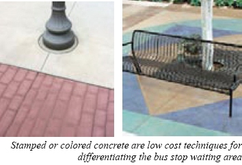

Bus stop, 900 block of Monroe Street NE.
Improving transit marketing
25. Improve marketing. For the most part transit in the region is promoted in a very stodgy way. Shake things up... Start by changing the graphic design scheme of the buses and Metro signage. Make the buses and signage pop graphically as much as the map already does.
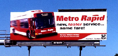
Los Angeles has done some interesting transit promotional marketing. But we need to do the same kind of marketing in office buildings, public places, hotels, and transit stations. Photo source unknown
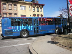
Pittsburgh uses buses as rolling billboards to promote transit.
You can really see the difference in how the WMATA and DDOT websites communicate about mobility vs. Arlington County, Transport for London, and the San Francisco Municipal Transportation Agency websites. They focus on optimizing mobility. Although the WMATA Ride Guide is great.
The Arlington County Commuter Page has great subpages including a blog promoting better mobility, and Walk Arlington and Bicycle Arlington. DC's website is for government people. And the DC attempt to be more like Arlington, GoDCGo, is okay but nothing special.
Where's the verve?
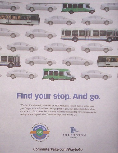
Arlington County transit promotion ad in a 2005 issue of the Arlington-Alexandria Extra edition of the Washington Post.
26. DC needs to create "Mobility" stores to market walking, bicycling, and transit to DC residents and commuters, but as a lifestyle, not merely as mode shift for commuters. This extends Arlington's Commuter Store beyond the overwhelming focus on commuters towards encouraging residents (and commuters) to utilize transit, walking, bicycling as the preferred way to get around for all kinds of trips, not just to get to work.
Also see the blog entry, "Disruptive Innovation (One Again)."
27. Improve wayfinding and transit information. It's okay, but could be a lot better, and transit stations need to be better utilized as "touchpoints" for marketing the use of the transit system, especially for tourists. Bus shelters are a key place for this especially.

Arlington has information systems for transit that it places in office buildings and public places. Portland and Seattle have extensive transit information systems placed in major public buildings and gathering places (city hall, colleges, libraries, public markets).
Add transit information systems to public buildings such as the main branch of the Public Library, Reeves Center, National Airport, Union Station, etc.
Transit information rack, Seattle Public Library.
And put maps on buses.
Transportation Planning
28. Create a transportation plan for the city that isn't wimpy, that addresses parking and curbside management, makes transportation demand management and planning the baseline standard, that sets a goal of reducing the number of single occupancy vehicle trips in the city.
Arlington County's plan is a good model, with separate sections on infrastructure, transit, parking and curbside management, pedestrians, and bicycling.
Arlington County Master Transportation Plan
29. Link transportation and land use planning in DC by revising the approach of zoning to mobility-access-land use planning, along the lines of the Dutch "accessibility planning" method. See "Utrecht: 'ABC' Planning as a planning instrument in urban transport policy."
This means that uses are not considered equal in all places in a zoning district, that uses are mapped to places where transportation demand and transportation supply are in equilibrium and/or maximized, but accommodated without significant degradation.
30. Make the Department of Transportation planning unit a part of the process in Board of Zoning Adjustment and Zoning Commission matters. Right now, BZA blows off reports from DDOT. They should be a required part of the process and considered just as important as the staff reports provided by the Development Review division of the Office of Planning.
31. Create transportation management districts centered around key commercial districts, and stressing transportation demand management planning, shared parking systems, time shifting freight delivery, shared delivery services for consumers, and include accommodations for bicyclists (lockers, showers, racks on the street, etc.), among other things. Have parking meter revenues go to the TMDs rather than the City's General Fund, for neighborhood-based mobility enhancement. This means encouraging car sharing systems.
And probably every BID district that has a significant concentration of offices should have a Bike Station with bike parking and shower facilities. (Plus places like the Rhode Island Avenue YMCA, the Gallery Place YWCA and the DC Jewish Community Center could offer special memberships for bicycle commuters.)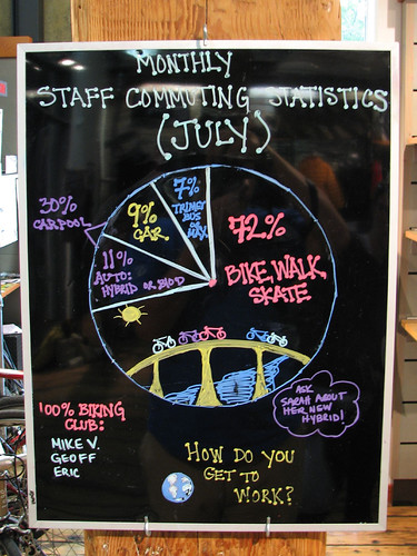
Tracking how people get to work at a retail store in Portland, Oregon. Flickr photo by Fußgänger.
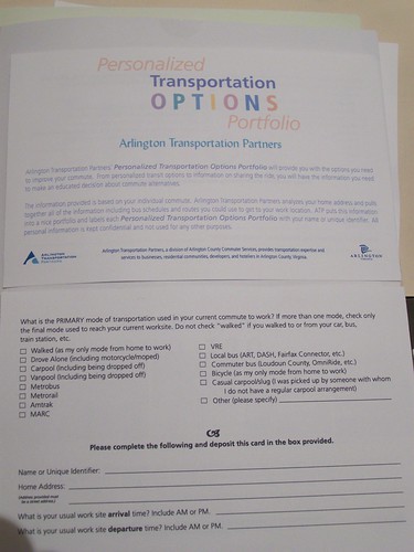
Mobility survey, Arlington Transportation Partners.
Transportation System Management and Advocacy
32. Somehow, the composition of the WMATA board needs to be addressed. I am not sure that having a separately elected board is the right way to go, because since the system is funded by individual jurisdictions, you want those people participating. But the fact is that there isn't enough long range planning and advocacy going on, and many of the decisions made are very political, rather than being oriented to maintaining and extending the best possible transit system that the region can achieve.
33. Transit Advocacy Conference. I have suggested this for awhile. Somehow we have to make this happen this year as a start.The idea is to push the transit agenda forward in citizen supportive ways. The debacle in Virginia over the Silver Line, contrasted with the success in Montgomery County especially, of getting the Purple Line light rail back on the agenda, shows the value of civic engagement and the occasional massive failure of government controlled processes.
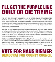
Panel from a campaign brochure for Hans Reimer, 2006. The Purple Line became a campaign issue in Montgomery County and Maryland politics in the 2006 election through the advocacy of Action Committee for Transit.
We can use the "TransitCamp" model as one way to approach this. (See Toronto Transit Camp.) Anyway, I plan to work with the Sierra Club Transportation Committee, Washcycle, BeyondDC, Greater Greater Washington, Action Committee for Transit, Virginia Association of Railroad Passengers, and others, to get this off the ground.
The original idea was to think about this regionally, to alternate meetings between the Washington and Baltimore regions, and maybe Richmond, to build a regional coalition and sensibility about these issues.
Even bigger issues
34. Somehow, and this would be best done nationally, eliminate free parking. As long as people can park for free, it will be difficult for transit to compete, because people do not calculate the sunk cost of a car into their calculations for the cost of driving vs. transit. Still, for transit to be competitive it means that the system needs to be dense and efficient in order for trips to be quick.
What I am leaving out
35. Congestion charges, or putting tolls on the bridges, or related distractions.
36. And for the most part, this is a DC transportation plan, so it doesn't look at suburban transit expansion, except in certain ways as it impacts DC in very specific ways (i.e., the "new" Silver Line or the Brown Line).
Labels: transit, transportation planning
posted by Richard Layman @ 12:15 PM&Permanent Link
![]()
![]()


5 Comments:
Richard, I re-read this while perusing some back links from Georgetown Metropolitan. Amazingly, this is still a great list over 7 years later. Just curious, would you change or add anything now?
Great question. Since you ask, yes, I'd mostly add/augment, and take out at least one thing.
1. Financing. Increase the height limit, primarily downtown, where the demand and best transit connections are located. Use the increased property value-bonding authority to pay for transportation (and certain other) infrastructure expansion,
2. especially the separated blue line in its original concept, although maybe besides a connection to the blue line around Oklahoma Ave., have another leg that goes up Bladensburg to Fort Lincoln and maybe beyond (if PGC wants to pay for it).
(a routing change).
3. I wrote about tunnelizing the Metropolitan Branch. I don't know how realistic that is and maybe I'd drop it.
4. However, I wrote a few years ago about a tunnel project in Haifa that is tolled.
I think that we should deal with traffic sewers that have negative impacts on neighborhoods. Besides the old NY Ave. transpo study concept of undergrounding the through traffic elements of that street, I'd do the same thing for North Capitol/Blair Road, and maybe 16th St.
5. add a separated yellow line with two legs, one goes up Georgia Ave., one splits out at Fort Totten and goes out New Hampshire way. The latter would be more for MoCo, so they should pay for it.
But both would interdict commuter traffic, which is the point of #2, and improve neighborhoods.
6. I didn't discuss the purple line. Extending it from Bethesda to Tysons, and from New Carrollton to Alexandria needs to go into the planning phase now.
7. WRT "local" railroad service, I am still proposing the RACER concept, but think that Union Station could play an outsize role in facilitating merger of the local services.
8. Probably one of my biggest job screwups not that they would have hired me, was not managing to apply for the planner job at Union Station. I was writing a position paper on it, and then that computer super crashed + I was on grand jury duty and distracted...
I have a lot of ideas on how Union Station could be a 21st century transpo and visitor center, beyond what "Amtrak" is thinking. (Amtrak, more than Union Station, is driving the master planning process.)
I would include a transpo-urbanism museum (at least an exhibit or two, and exhibit space) and a big visitors center.
9. I'm fine with your aerial tram proposal and willing to include it as it is complementary to streetcars, and makes Rosslyn an integral transit element for Georgetown.
10. In response to Judy Scott Feldman's stuff about the big parking garage and the Visitor element of the federal elements of the comp plan, I wrote a piece on creating an integrated visitor information and transportation system around the mall, using heritage streetcars like in San Francisco, but connecting to a new yellow line station at Jefferson Memorial and to Union Station, with a new visitor center at Union Station, and Jeff. Memorial, with JSF's parking facilities there too.
It's related to the Union Station idea, but strong enough on its own.
- continued -
11. I would probably drop the water taxi stuff, at least as an element of "transportation" rather than as a tourism related function. The placement of the rivers and activity centers isn't conducive to viable water-based transportation.
12. To the placemaking oriented stuff, I would reshape the "streets as places" argument around my "Signature Streets"
concept, which I need to round out as a full blown concept paper.
It would include discussion on transit and placemaking along the lines of what I've written there too, but it's all based on the same point, that transportation infrastructure has fundamental civic qualities that need to be enhanced.
Since I've written that stuff, the design elements of European underground transit, e.g., the subway stations in Hamburg, or the art nouveau? influenced stations in Moscow and St. Petersburg, etc., have made me think even more broadly about this. I need to codify it into a paper...
My point about planning the bridges over the Anacostia in an integrated fashion could go in here as an example, that hideous "sculpture" on the NY Ave. bridge over the railyard, etc.
13. I've been meaning to put out as a proposal architectural lighting of the Metro canopies in a blog entry since the summer...
14. I'd probably add Vision Zero type stuff as another point in that section.
15. I'd add more focused discussion on biking as transportation, specifically the need to create an integrated bikeway network at the jurisdiction and metropolitan scales.
when I did the plan in Balt. County, I came up with six scales to do sustainable transportation planning:
- one mile radii from schools and transit stops
- three mile radii from activity centers
- 3-9 miles along corridors, connecting activity centers (there, they are "town centers")
- between corridors
- intra-jurisdictional trails network
- connections between jurisdictions
Also about weighting requirements better for the provision of support facilities, especially parking.
16. My thinking on MPO and planning expanded after this piece. I'd put responsibility for metropolitan transportation planning there, rather than within "WMATA", and set network breadth and depth preferences, LOS and LOQ standards by the TPB, and then "contract out" for service.
Hamburg's HVV (integration of service planning and operation amongst 70+ operators, granted 2 provide the most--Hamburg Hochbahn for bus and subway and Deutsche Bahn for suburban commuter rail--across all of Hamburg and adjoining "provinces" in abutting states is a model I didn't know about then.
And TfL and SFMTA are models of this to some extent too.
17. Related to that would be an emphasis on the "intra-district mobility" concept as an extension of the transit networks/ subnetworks discussion (primary, secondary, tertiary).
18. Not including as a distinct element a transitway network for buses in the city was a big omission that should be corrected. (I haven't yet ridden on the "Metroway" have you.)
19. I don't think I discussed integrating taxi planning into DDOT. Taxi planning, car sharing, ride hailing could be incorporated.
20. I didn't discuss handicapped parking issues. I haven't read the article from the weekend yet (it's in my pile). If they didn't propose transponders like with EZPass, I will blog that suggestion later this week.
Thanks For sharing this post. that was really a good job.
Much obliged to you for giving such essential data, and a debt of gratitude is for sharing this issue.
Post a Comment
<< Home