Mobility hubs and next generation transportation planning
For a couple years, I have been writing about what I call the mobilityshed or transitshed. See:
-- Update of the mobility shed/mobilityshed concept (April 2008)
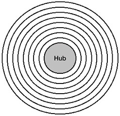
-- Mobility shed revisited (November 2007) which includes this diagram

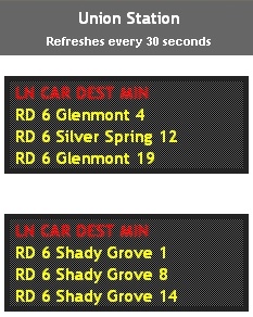
One area that they cover that I didn't think much about is the provision of real-time information on availability of the various modes, from parking spaces to bikes for sharing-rental to transit schedules and transit vehicle arrival information.

WMATA platform displays providing info on subway train arrival times are also fed to the WMATA website. I don't know if they set up these feeds so that they could be included via widgets, in other webpages (a la RSS).
Transit sheds can be thought of as centered around stations or routes, and transportation diversion programs, such as part of the Arlington transportation demand management surveys, can be used to move people towards optimal mobility based on their place of residence and location of transit services. The TravelSmart program pioneered in Australia is another way to do this.

I haven't always defined each: "Transit shed or transitshed" and "mobility shed or mobility shed" in a particular way.
Mobility is about getting around. I think the transitshed is about what mode you use to get around with, the service, be it legs and feet or a bus or a bicycle, etc.
Thinking about next generation transportation planning
I talk up the Arlington County Transportation Plan which is very good:
- MTP Baseline Study (44 MB)
- MTP Glossary (179 KB)
- Complete Findings of Online Survey (55 KB)
- MTP Goals and Policies
- Pedestrians Element
- Bicycles Element
- Transportation Demand and System Management Element
- Parking and Curbspace Management Draft
- Transit Element Draft
- Streets Element Draft
The Main Street Approach has the same problem with the "Design" point. I describe it by stating that the design committee deals with all aspects of the external environment. This means the way buildings look, the street network, etc.
But I think we could change this a bit and say the design committee deals with all aspects of the built environment, including the transportation and street network, and the quality of the public spaces.
The same goes with transportation planning. It needs to be about "mobility" not merely "transportation" and the quality of public spaces, i.e., urban design and placemaking, needs to be part of the plan.
And, I am thinking that as great as the Arlington plan is, it also needs a section on wayfinding and interpretation signage to cover directional, informational, and historical-cultural signage needs for a community.
Labels: mobility, transportation planning


0 Comments:
Post a Comment
<< Home