Tips for urban revitalization, including transit
Nigel sends us a link to this blog entry "A 10 Step Plan To Fix K Street Or The Legend of the Skyscraper Fairy" from the Sacramento Press blog. The ten lessons are pretty good:
1. Accept that the Skyscraper Fairy does not exist.(This has to do with expectations about the value of the land.)
2. It’s time to leave the shopping mall in the past. (Focus on the street and street-based retail.)
3. Cars, no. Bikes, yes.
4. Shrink light rail to streetcar size.
5. Legalize street life. (Has to do with vending and busking. DC is trying to regiment this. Business improvement districts tend to favor "order" rather than a wee bit of flexibility and chaos when it comes to these issues.)
6. Tours bring tourists. (I make a similar point all the time. If you don't highlight and call attention to your cultural assets, particularly buildings, how will people know that they are valuable and why should they care? It's why I focus a lot on wayfinding and heritage interpretation systems in the planning work that I do.)
7. Bring on the nightlife.
8. Shop local, even if you’re from out of town. (Independent businesses become attractive in and of themselves, because they are truly unique and unvisitable anywhere else.)
9. Living on K Street shouldn’t mean sleeping directly on it. (Deal with homeless and "vagrancy" issues.)
10. Have faith, be good, and the Skyscraper Fairy will come. (If you do 1-9, land and building values will increase "astronomically" after all, but not without private and public investment in improvements.)
So then Nigel wrote:
A theory that I have heard bandied around is the concept of " build a light rail/ subway station, and it will attract development." I can understand that idea in theory, but does it work out that way in reality?
Are there any good case examples with the DC or Baltimore subway/light rail network where this has worked well? Are there any examples of where this theory has NOT happened?
New Zealand doesn't have any subways or light rail, and the 2 urban rail systems we have has not expanded or opened new stations, so I can't test the theory within NZ.
My response:
it's not that easy or simple. The station and as importantly the transit line has to be placed in such a way that it is attractive for development. That means both that the rail line generally connects activity centers/destinations, and it also means that the area around the station is conducive to being reworked.
It's the primary reason why using freeways especially or old railroad lines through industrial areas because the trackage is available tends to be a terrible strategy for generating transit use and neighborhood and commercial district revitalization
These two publications from Reconnecting America are quite good on the general topic:
- CAPTURING THE VALUE OF TRANSIT
- TOD 101: Why Transit-Oriented Development And Why Now?
You've been to the DC-Baltimore region... 1. It has taken upwards of 25 years to begin to see the full advantages of having the subway system in DC. 2. However, the system and its stations demonstrates that transit stations don't automatically lead to development if the station isn't located within a kind of urban fabric oriented to blocks and the grid. Stations in DC's core generally are showing great improvements. Stations outside of the core vary in terms of the success of achieving add'l development.
The Georgia-Ave.-Petworth station area is being redeveloped somewhat on the Avenue. Specifically the transit system sold some of the land over one of the exits, for multiunit buildings. Those buildings are just coming online now, and they are leading to some redevelopment of "underutilized" sites within a couple blocks. But still, the adjacent old strip/corridor commercial district is hurting, and is somewhat derelict (with a couple jewels) despite the fact that the station has been open for 8 years. It takes a long time.
(And there was never a systematic building and business revitalization plan put in place for the commercial district adjacent to the station. Hence trickle down redevelopment is very very very very very slow.)
So a couple lessons are: (1) put the stations in places with the right morphology. This includes a focus on active streets and streetscape. (2) have a station area plan, especially if the spatial patterns need to be changed. (3) have an economic development plan focused on sparking new development where appropriate, and improvement of existing buildings and businesses.
These publications (the first four from the planning firm Crandall-Arambula, the fifth is from the DC Office of Planning, and the last is from Reconnecting America's Center for Transit Oriented Development) are good resources on the topic:
- Pedestrian Friendly Streets
- Downtown Plans
- Station Area Planning
- Build Out Analysis
- Trans-Formation: Recreating Transit-Oriented Neighborhood Centers in Washington, DC
- TOD 202: Station Area Planning
This article from the New York Times on Arlington, "An Oasis of Stability Within the Downturn" illustrates the value of tightly coupling transit access to more intense development.
The funny thing about "station area plans" is that you have to be careful what you wish for. At the time the subway system was developed in the early 1970s, there were such plans. The problem then is that the urban renewal paradigm of hulking buildings reigned supreme back then.
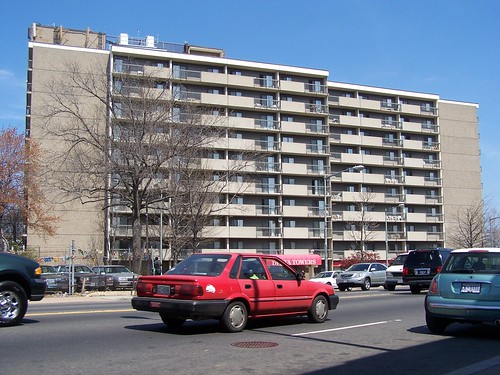
Delta Towers on H Street NE is one of the many successful realizations of the H Street Urban Renewal Plan. Most every project outlined in the H Street urban renewal plan came to fruition, but H Street still languished without substantive improvement, until the addition of focused private investment to revitalize still bombed out buildings--the Atlas Theater and then an investor decided to make his claim to the area and open a bunch of nightlife establishments, as well as the construction of an infill subway station (New York Avenue) on the north side of the neighborhood, which drew an influx of new residents, leading to significant improvements in the residential environment north of H Street.
Fortunately the decades it has taken for some of the areas to become attractive for development (DC had/has many other problems that limited interest in rebuilding for many years) to some extent, it has been recognized that to best reap the benefits of urban locations you need to build for the pedestrian and the street experience, and that some investment in quality design pays off over time.
This is still a problem in distressed and emerging neighborhoods where the desire to value engineer properties to reduce risk is high, and the desperate cries for development tend to not include parallel desires for quality. This ends up being short sighted because the development that comes doesn't have the kind of increasing marginal returns that the neighborhoods need as it doesn't spur additional development.
Columbia Heights and Petworth are getting quality developments, maybe because they are in the northwest quadrant, while other neighborhoods in northeast, earlier, hadn't been so fortunate. But maybe it's just a matter of the times.
You asked about the Baltimore region. Baltimore County is a good example. It is 33 times larger than Arlington County so you can't make a direct comparison, and more than 1/3 of the county is rural, but the county has something like 11 light rail stations (plus 3 abutting but located in Baltimore City or Anne Arundel County), 3 subway stations (plus 1 abutting in Baltimore City), and 3 railroad stations. The Maryland Transit Administration runs all these lines and stations, and provides bus service to Baltimore County, providing service within the County as well as connections to Baltimore City.
Arlington has 10 subway stations on three lines, and one commuter rail stop. Plus they are planning for a streetcar line, and they have a County-based bus service which complements regional bus services provided by WMATA.
The Baltimore County transit station assets except for 1 railroad station are located in the west and northern sections of the county. The major areas of development, Towson and White Marsh, have no fixed rail transit service. (And neither does Columbia, in Howard County, which also lacks fixed rail transit connections to the region.) Arlington does have issues with north-south connections and fixed rail transit. In part their bus service was created to provide the connections that the subway system did not provide.
But the Baltimore light rail line was built because of the availability of alignment (an old railroad) not because it best connected key destinations. Most of the stations in the north are in industrial places, and it would have required major economic and planning changes to bring change forward. (Like how Arlington County did it.) The 2 stations in the south of the county do abut neighborhoods.
And the Baltimore subway is one line, not a system (unlike DC which has 5 lines connecting 6 counties/DC) so it doesn't have the same kind of ability to draw patrons, significantly reduce traffic, and spur development.
Baltimore City is another example that I have written about extensively. It continues to leak population to Howard, Baltimore, Harford and Anne Arundel Counties. It has a light rail line and a subway line, but they don't connect well, and many of the cities potentially vital and vibrant neighborhoods don't have fixed rail transit. Even the area around Penn Station, the Amtrak and commuter railroad station, has blocks and blocks of underutilized or decrepit and vacant housing and other buildings.
But getting back to Baltimore County, and granted Montgomery and Prince George's Counties are located in a more economically vibrant metropolitan region, Baltimore County for a couple decades was the state's largest jurisdiction, as Baltimore experienced serious declines in population. Now it is #3, after Montgomery and PG. Had there been a better transit system both in Baltimore City and the County, it's likely that there would have been less population outmigration to points beyond.
This presentation from Reconnecting America, Creating a Transit Region, gets to the point of why creating a linked transportation and land use planning paradigm is necessary to maintain and extend livability and placemaking within our communities, by reducing the need for automobility, and by focusing transit and other public investments in ways that increase the quality of life for residents, and the value of our places for working, investing, and visiting.
Labels: sustainable land use and resource planning, transit and economic development, transportation planning, urban design/placemaking, urban revitalization
posted by Richard Layman @ 5:52 AM&Permanent Link
![]()
![]()


0 Comments:
Post a Comment
<< Home