Incremental change can be as easy as starting with a sign
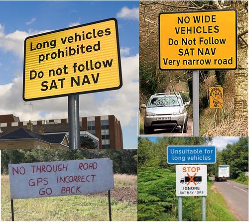
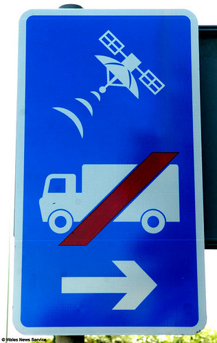
Personally, I don't think this sign is very explanatory... (Image credits to come.)
I thought it was pretty funny to read an article in the Examiner, "Faulty GPS makes Va. neighborhood a truck obstacle course" about how bad GPS directions for the area around Rte. 1 in Fairfax County are directing large trucks into streets unable to accommodate them. Residents are calling for the streets to be declared closed to trucks.
But because most local roads are under the control of the Virginia Department of Transportation, it is a relatively long process to get such a regulation in place.
The same thing happens in many other places. In the UK, they've created signs to warn drivers when GPS directions are incorrect.
Why not start with a sign? You can do one for under $200...
From the article:
Stranded semi-trucks, sent astray by errant GPS systems, have fouled up a tiny 1940s-era neighborhood tucked between South King's Highway and Route 1 in Alexandria, leaving Fairfax County and the state to find a fix for fallible technology.
Several times a month, tractor-trailers and other enormous vehicles miss a tricky turn from North King's Highway onto traffic-heavy Route 1, home to mega-destinations like Target, Office Depot and Lowe's. Instead, the vehicles wind up on South King's Highway, neighborhood resident Edward Walker recently told the Fairfax County Board of Supervisors. From there, GPS technology sends the truckers on a shortcut back to Route 1 - on narrow, steep Pickett and Franklin streets, where the trucks and buses simply can't fit.
Walker approached county supervisors armed with photos of a truck jack-knifed, another in a ditch, another forced to back out onto busy South King's Highway, as well as pictures of broken trees, mangled fences and rutted lawns. ...
Labels: cartography, GPS, information technology and systems integration, transportation planning, wayfinding signage systems
posted by Richard Layman @ 12:29 PM&Permanent Link
![]()
![]()


0 Comments:
Post a Comment
<< Home