Signage (on bike trails)
Image of a Minuteman Bikeway entrypoint sign from the Technomasochism blog.
I have pointed out for a few years that signage on the Metropolitan Branch Trail needs to be better. (See "Shared use paths (trails) and safety and marketing" and "Bethesda Trolley Trail wayfinding signage.")
For one, rules signs aren't posted and pedestrians often walk on the wrong side. And it would be nice for there to be security/emergency signage.
Mostly I wish there were prominent signs at entrypoints, maybe not to the extent of the Minuteman Trail in the Boston metropolitan area, but prominent enough, complemented by signage within neighborhoods that gets people to and from the trail.
There was a big wayfinding plan for the trail (I can't find the document online anymore) but most of it hasn't been implemented. (And in my opinion there were problems with the conceptional framework, but whatever...)
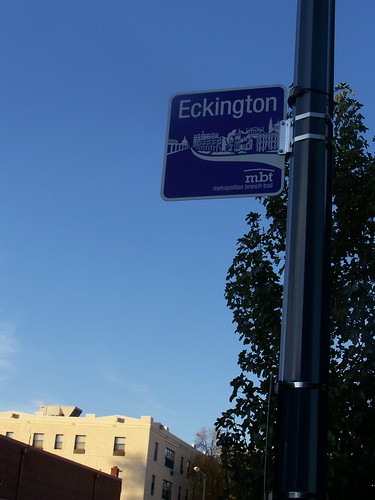
 One element has been implemented in part of Eckington, neighborhood-specific identifying signs that are supposed to communicate local identity in the context of the trail.
Anyway, a map and events signboard is being installed at the Rhode Island Avenue entrypoint. I like the self-help aspect of the "You are Here" element.

 Like in New York City, I wish that DC's bike maps were posted in more places such as at all Metro stations in the city.
Originally, the maps at bicycle sharing stations functioned as a kind of wayfinding map for the city more generally, because the map originally covered the entire system (city).
New maps installed this year at each station cover smaller areas, around where the station is located, rather than the entire city, so they don't serve this more general function.
Of course, the maps are still incredibly useful for the area in which the map covers, since only in subway stations and bus shelters are maps of the city normally available.
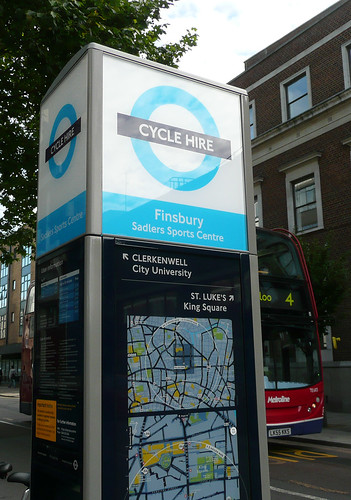
London has an integrated wayfinding system (Legible London) and their installation of the bicycle sharing system was used to further extend the provision of wayfinding information systematically. (If my firm is ever in the position to deploy a bike sharing system, I think that's the way I will suggest that kiosks be handled.) In effect, this is happening with the local bicycle sharing system in DC, but a bit more by happenstance.
DC bicycle sharing station map

London bicycle sharing station kiosk with map. (Flickr photo by EZTD.)

Labels: bicycling, transportation planning, wayfinding signage systems


1 Comments:
Thank you for providing such a valuable information and thanks for sharing this matter to get Online medicine store from Dose Pharmacy medicine.
Post a Comment
<< Home