The real question to ask isn't "What to do about WMATA?": The maps
Paul Meissner has created for us an integrated map showing metropolitan and regional fixed rail transit services as they are offered currently, or are under construction.
DC's streetcar, not being a metropolitan service isn't included, nor is the Purple Line light rail for Montgomery and Prince George's Counties, because embarking on construction is held up in court proceedings.

Integrated rail transit map for the Washington DC Metropolitan area by Paul J. Meissner.
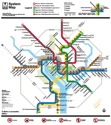
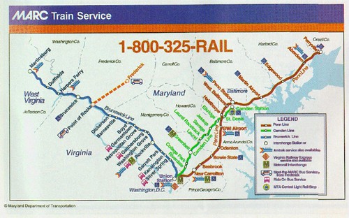
I asked Paul to create this map to help me demonstrate the disconnection between services in the present day--although the WMATA map does show connections to the railroad services on their map, the railroad maps--Virginia Railway Express and MARC--do not show Metrorail, and Metrorail maps don't show VRE and MARC.
WMATA map
VRE map (Washington Post graphic)

MARC map
Labels: fixed rail transit service, government oversight, provision of public services, railroads, transit marketing, transportation planning, urban design/placemaking
posted by Richard Layman @ 4:47 PM&Permanent Link
![]()
![]()


0 Comments:
Post a Comment
<< Home