Water quality regulation in terms of the "pollutionshed"
I am not the first to coin the term, although I came up with it before doing a Google search, and there are a number of hits, although not usually combined in one word.
For example, this paper, "The Exposure of Disadvantaged Populations in Freeway Air-Pollution Sheds: A Case Study of the Seattle and Portland Regions," proposes the concept of "Freeway Air Pollution Sheds."
I was thinking about this because of a press release from the Rock Creek Conservancy in DC, which is the "Friends" organization for the federal Rock Creek Park, which I will be writing about in a subsequent entry.
Anyway, conservatives generally and the Trump Administration specifically are up in arms calling it "regulatory overreach", about the EPA and its desire to regulate water quality in terms of broadest possible definition of waterways to include wetlands, which is called the "Waters of the United States" rule, under the Clean Water Act.
Instead, conservatives argue that only "navigable waters" should be subject to the regulation.
But so many other sources of water enter rivers, that's why there is the term watershed to begin with, which is defined thusly (from How Stuff Works):
A watershed is an area of land that feeds all the water running under it and draining off of it into a body of water. It combines with other watersheds to form a network of rivers and streams that progressively drain into larger water areas.Think of the various water sources that end up in rivers that aren't navigable--meaning, a boat can use the water:
Topography determines where and how water flows. Ridge tops surrounding a body of water determine the boundary of a watershed. Imagine turning an open umbrella upside down in the rain. Rain that hits anywhere within the umbrella's surface area would go to the bottom at the center of the umbrella. Any rain that didn't hit the umbrella would fall to the ground. The umbrella is like a watershed; it collects everything that falls into it.
-- run
-- creek
-- stream
-- canals
-- water pipe
-- drainage canal or ditch
-- water retention pond
-- water and sewer pipe systems.
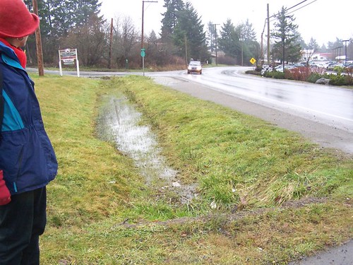
Runoff into and from a drainage ditch impacts watershed and river water quality. It has nothing to do with the ditch being navigable.
I think making the point that rivers are the primary source of drinking water supplies across the US and terming this in terms of a "pollutionshed" rather than a watershed, would better position the regulation in terms of the public interest.
I also think we need to develop a wider range of cultural and explanatory signage systems to explain how this stuff works and why it matters. The highway signs that say X stream or river is part of a watershed aren't enough. Nor are notices at sewer entry points stating that this drains into X River.
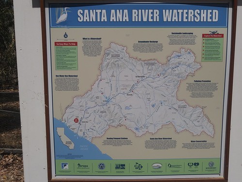
This is a sign that was on a trail in Santa Ana, California.
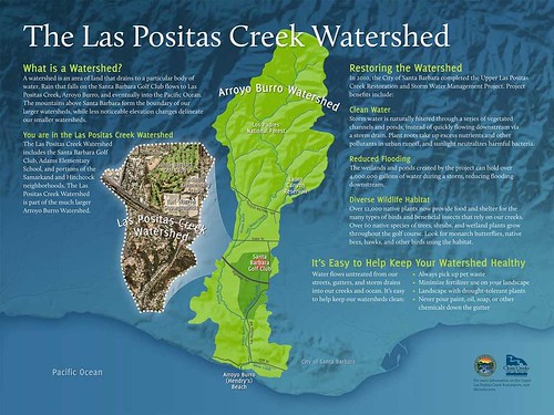
The Watershed Company is a design firm that specializes in interpretative signage systems for water-related green "infrastructure." This is a sign they did for the Las Positas Watershed in Santa Barbara.
Highway signs in the DC region.
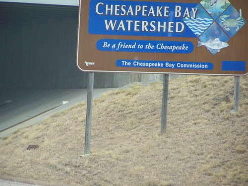
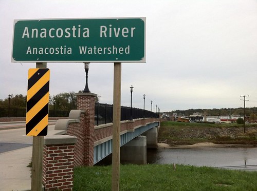
State Highway Administration sign in Maryland.
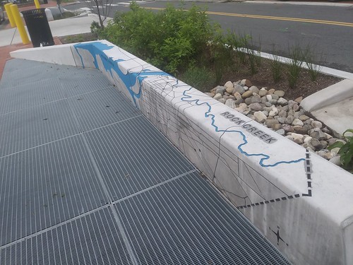
As part of the rebuilding of the Kennedy Street NW streetscape, which in part was done with green infrastructure principles, they incorporated some signage/public art into street furniture.
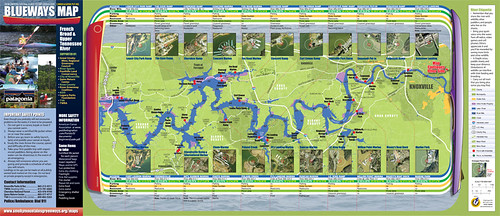
One model is the Knoxville Blueways system.
More communities need to create "Adopt-A-Stream" programs. Virginia has a program. But so do many other states. DC should develop a similar program.
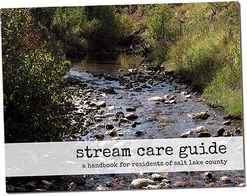
Among a number of best practice examples, Salt Lake County's Watershed Planning and Restoration program stands out. They have a great handbook, Stream Care Guide: A Handbook for Residents of Salt Lake County.
Salt Lake County and a number of watershed conservancy groups, sponsor annual Watershed Symposium as a training and advocacy measure.
In DC, Advisory Neighborhood Commissions, the neighborhood councils that are organized by ward and sub-district, should create Environment Committees.
Committees in ANCs with runs, creeks, streams, and rivers should include purview of these bodies of water in their charge. DC's waters drain into two rivers ultimately, either the Anacostia River or the Potomac River. In turn, these rivers and their watersheds are part of the Chesapeake Bay Watershed.
There are a number of watershed stewardship training programs. Anacostia Watershed Society runs such a program, called the Watershed Stewards Academy, but most of the participants are outside of DC. It would be nice to do a special type of program in association with the development of ANC committees on the environment.
In Baltimore County, the Watershed Public Charter School is being created, with an outdoors curriculum ("Watershed Public Charter School finds a building in Baltimore County," Baltimore Sun).
In New York City, The New York Harbor High School has a waters-focused curriculum. They organize a lot of their program around a campaign to put one billion oysters in the New York Harbor, as a water filtering initiative. There was a great documentary about it, recently airing on the Discovery Channel, called "Take Back the Harbor."
I've argued that schools along the Anacostia River, such as River Terrace Elementary School and Anacostia High School, should develop similarly focused environmental curricula.
Labels: green-environment-urban, litter, pollution, regulation/regulatory policy, rivers
posted by Richard Layman @ 3:50 PM&Permanent Link
![]()
![]()


0 Comments:
Post a Comment
<< Home