Rebuilding Place in the Urban Space

"A community’s physical form, rather than its land uses, is its most intrinsic and enduring characteristic." [Katz, EPA] This blog focuses on place and placemaking and all that makes it work--historic preservation, urban design, transportation, asset-based community development, arts & cultural development, commercial district revitalization, tourism & destination development, and quality of life advocacy--along with doses of civic engagement and good governance watchdogging.

Tuesday, May 12, 2026

Daylighting creeks in Salt Lake City: Creating the Three Confluences Park

Last Saturday was the Celebrate at the Confluence event sponsored by Seven Canyons Trust, held at Three Confluences Park on Salt Lake City's West Side.

Seven Canyons Trust worked with the city to create the park by daylight the confluence of Red Butte Creek, Emigration Creek, and Parley's Creek at 900 West  ("Salt Lake City’s newest park is now open — see where three creeks meet on the west side," Salt Lake Tribune).  It opened in 2021.

The Trust grew out of a University of Utah planning design studio, which focused on the concept of daylighting creeks throughout Salt Lake Canyon.

The Wasatch Front is full of canyons and creeks.  The creeks, fed by snowmelt and rain, empty into the Jordan River which in turn flows into the Great Salt Lake.  Area communities capture this for the bulk of their water consumption.  (Once they are past the canyon, rain and stormwater, plus water releases from the canyons, make up the water flow.)

An 1800s citizen movement to protect the watershed.  Because of citizen concerns in the late 1800s about the quality of water supplies because the creeks and rivers were mostly used for dumping waste including dead animals, and the denuding of canyon forests for wood, they advocated for the creation of national forests as a way to protect the water supply.

Phillips Arch in the boundaries of the Grand Staircase-Escalante National Monument.  Photo: Tim Petersen.

Today Utah is a leader in trying to overturn federal ownership of public lands.  These days that's particularly ironic, because at the State level and the State's representatives in Congress, including the particularly odious Senator Mike Lee, Utah is a leader in trying to get federal public lands given to the state.  And the state (and Senator Lee) want to develop these lands as much as possible ("Thanks to Utah, Americans are about to lose their public lands," Moab Times-Independent).  

For example, the State supports the reduction in size of the Grand Staircase-Escalante National Monument ("Grand Staircase-Escalante National Monument Under Attack from Utah Members of Congress," Earthjustice).  And it suggested that the federal lands in the Big and Little Cottonwood Canyons--also used by for profit ski resorts in the winter, should be converted to state control.  To what ends...?

The State of Utah funded an ad campaign promoting its preference for federal lands being "returned" to the state.  Note that the State Constitution says federal lands should always be federal ("Here’s how much Utah is spending on a public relations campaign for its lawsuit seeking control of public land," Salt Lake Tribune).

Forest Service changes to increase for profit use of forests at the expense of conservation and public use.  Moving the US Forest Service to Utah ("The Forest Service Is Moving to Utah. Here’s What That Means for Our Public Lands," Outside) and the firing of scientists there ("Forest Service Sheds Research Capacity in Move to Utah," PEER) furthers this agenda.

How the Trump Administration is selling the move: "USDA Prioritizing Common Sense Forest Management, Moves Forest Service."

Undergrounding into pipes creeks and rivers.  But I digress.  In many urban areas, starting in the 1800s, creeks and rivers were covered and diverted into underground pipes.  

In DC, that's happened with Tiber Creek.  Someone who worked in a building abutting the old creek said you could hear it sometimes.  

In my Manor Park neighborhood, a creek at Fort Slocum was undergrounded--but the area still has a high water table and flooding--we had to install two sump pumps as a result of that and increasingly "robust" rain events.

DC still has other streams, even if it doesn't have an active daylighting program.  The Anacostia Watershed Society, Anacostia Riverkeeper, and Washington Parks & People lead efforts to remove litter and improve water quality for creeks that run into the Anacostia River.

Rock Creek Conservancy does the same for the DC and Suburban Maryland sections of the Potomac River Watershed, alongside the Potomac River Conservancy.

RFK Jr. may be willing to swim in it.  I think it's still premature ("Kennedy Swims in Washington Creek That Flows With Sewage and Bacteria," New York Times).  But ever closer, at least for the River, except that it took a major step backwards when a wastewater line burst, flowing into the River for weeks before it was repaired and contained ("A Huge Sewage Spill Is Over, but Contamination Lingers in the Potomac," NYT).

Daylighting.  For 20ish years at least, there has been a movement for daylighting--restoring these creeks and rivers.  Seoul is particularly famous for removing a freeway that had been built on a river.  In 2020, the Catharijnesgel Canal in Utrecht, Netherlands, was restored after being filled in during the 1970s to create a 12-lane freeway.  Etc.  

Before and after, Cheonggyecheon Restoration Project.


I think I first came across the concept in an issue of the Urbanite, a magazine that focused on Baltimore urbanism, which sadly went defunct as a result of the 2008 Great Financial Crisis.  

In "The Urbanite Project 2010" "Architect Gabriel Kroiz and environmental lawyer Eliza Smith Steinmeier proposed daylighting Harford Run, a stream that runs under Central Avenue, and turning it into a lively community recreational space."

 3 Confluences Park today and the site in 2007.


Jordan River.  Separately the Jordan River Commission has been charged with restoring the Jordan River (and Utah River in Utah County) as it flows to the Great Salt Lake.  One thing they did that's really cool is the Jordan River Parkway trail along the River from Utah Lake in Utah County to the Great Salt Lake in Davis County--I've ridden parts of it but then I got sick and couldn't bike ride--over 60 miles.

View of the 3 Confluences from the east bank of the Jordan River/Jordan River Parkway Trail.

Labels: , , , , , , ,

Wednesday, January 09, 2019

Water quality regulation in terms of the "pollutionshed"

I am not the first to coin the term, although I came up with it before doing a Google search, and there are a number of hits, although not usually combined in one word.

For example, this paper, "The Exposure of Disadvantaged Populations in Freeway Air-Pollution Sheds: A Case Study of the Seattle and Portland Regions," proposes the concept of "Freeway Air Pollution Sheds."

I was thinking about this because of a press release from the Rock Creek Conservancy in DC, which is the "Friends" organization for the federal Rock Creek Park, which I will be writing about in a subsequent entry.

Anyway, conservatives generally and the Trump Administration specifically are up in arms calling it "regulatory overreach", about the EPA and its desire to regulate water quality in terms of broadest possible definition of waterways to include wetlands, which is called the "Waters of the United States" rule, under the Clean Water Act.

Instead, conservatives argue that only "navigable waters" should be subject to the regulation.

But so many other sources of water enter rivers, that's why there is the term watershed to begin with, which is defined thusly (from How Stuff Works):
A watershed is an area of land that feeds all the water running under it and draining off of it into a body of water. It combines with other watersheds to form a network of rivers and streams that progressively drain into larger water areas.

Topography determines where and how water flows. Ridge tops surrounding a body of water determine the boundary of a watershed. Imagine turning an open umbrella upside down in the rain. Rain that hits anywhere within the umbrella's surface area would go to the bottom at the center of the umbrella. Any rain that didn't hit the umbrella would fall to the ground. The umbrella is like a watershed; it collects everything that falls into it.
Think of the various water sources that end up in rivers that aren't navigable--meaning, a boat can use the water:

-- run
-- creek
-- stream
-- canals
-- water pipe
-- drainage canal or ditch
-- water retention pond
-- water and sewer pipe systems.

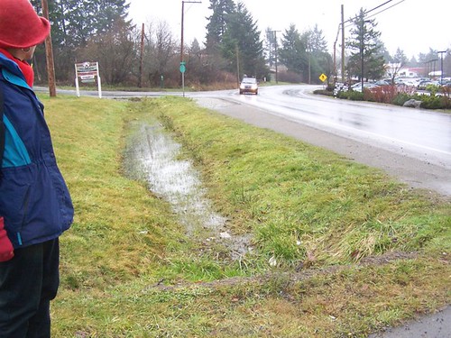
drainage towards Blain Rd
Runoff into and from a drainage ditch impacts watershed and river water quality.  It has nothing to do with the ditch being navigable.

I think making the point that rivers are the primary source of drinking water supplies across the US and terming this in terms of a "pollutionshed" rather than a watershed, would better position the regulation in terms of the public interest.

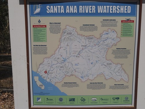
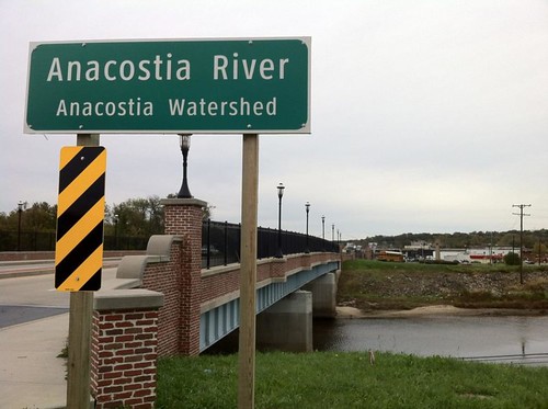
I also think we need to develop a wider range of cultural and explanatory signage systems to explain how this stuff works and why it matters. The highway signs that say X stream or river is part of a watershed aren't enough.  Nor are notices at sewer entry points stating that this drains into X River.

This is a sign that was on a trail in Santa Ana, California.
Santa Ana River Watershed interpretation sign

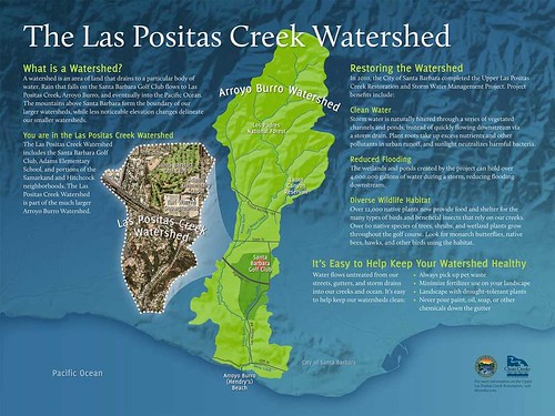
The Watershed Company is a design firm that specializes in interpretative signage systems for water-related green "infrastructure."  This is a sign they did for the Las Positas Watershed in Santa Barbara.
Las-Positas-Creek-Interpretive+Signage+-Watershed

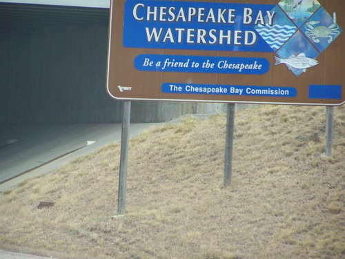
Highway signs in the DC region.
Chesapeake Bay Watershed highway sign

SHA-Sign_Anacostia-River-e1506461780979
State Highway Administration sign in Maryland.

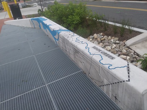
As part of the rebuilding of the Kennedy Street NW streetscape, which in part was done with green infrastructure principles, they incorporated some signage/public art into street furniture.
Kennedy Street NW streetscape improvements

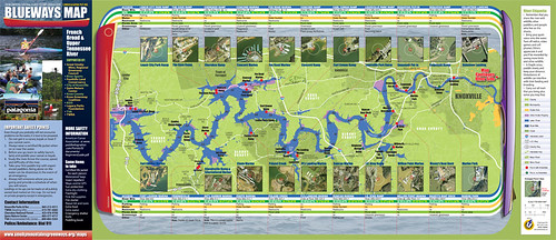
One model is the Knoxville Blueways system.
Knoxville Blueways Map_West

More communities need to create "Adopt-A-Stream" programs. Virginia has a program.  But so do many other states.  DC should develop a similar program.

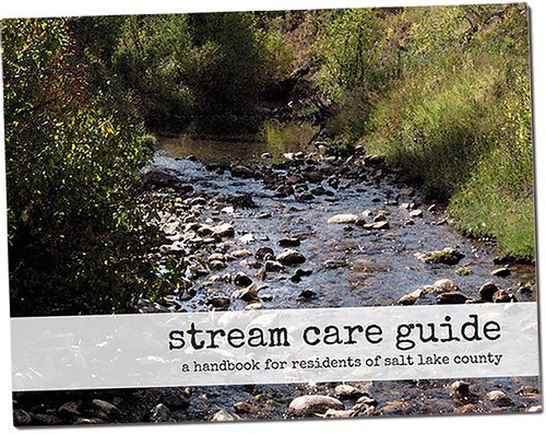
Among a number of best practice examples, Salt Lake County's Watershed Planning and Restoration program stands out.  They have a great handbook, Stream Care Guide: A Handbook for Residents of Salt Lake County.
Stream Care Guide: A Handbook for Residents of Salt Lake County

Salt Lake County and a number of watershed conservancy groups, sponsor annual Watershed Symposium as a training and advocacy measure.

In DC, Advisory Neighborhood Commissions, the neighborhood councils that are organized by ward and sub-district, should create Environment Committees.

Committees in ANCs with runs, creeks, streams, and rivers should include purview of these bodies of water in their charge. DC's waters drain into two rivers ultimately, either the Anacostia River or the Potomac River.  In turn, these rivers and their watersheds are part of the Chesapeake Bay Watershed.

There are a number of watershed stewardship training programs.  Anacostia Watershed Society runs such a program, called the Watershed Stewards Academy, but most of the participants are outside of DC.  It would be nice to do a special type of program in association with the development of ANC committees on the environment.

In Baltimore County, the Watershed Public Charter School is being created, with an outdoors curriculum ("Watershed Public Charter School finds a building in Baltimore County," Baltimore Sun).

In New York City, The New York Harbor High School has a waters-focused curriculum.  They organize a lot of their program around a campaign to put one billion oysters in the New York Harbor, as a water filtering initiative.  There was a great documentary about it, recently airing on the Discovery Channel, called "Take Back the Harbor."

I've argued that schools along the Anacostia River, such as River Terrace Elementary School and Anacostia High School, should develop similarly focused environmental curricula.

Labels: , , , ,

Wednesday, October 04, 2017

Information design -- graphic presentation of information by government: sewer pipe flow quality in Bellevue, Nebraska

A couple days ago I came across an article in the Omaha World-Herald about the process in the City of Bellevue to determine the state of good repair of their sewers ("Sonar-like analysis of Bellevue's aging sewers suggests repairs will cost millions").

It turns out most of them are blocked.  The city presents the information in a graphic.

I was struck by this, not because it is particularly unusual--most "highway departments" collect and present information about pavement condition in this matter (although DC hasn't updated its public presentation of this type of data for three years;)--but because of the animus in various sectors in many communities about rising water service bills.

-- Presentation of Pavement Condition Index data for Greater Honolulu

In most places--outside of those areas experiencing drought--water bills are rising significantly not because of the cost of water--in fact per capita water consumption is declining ("Why is water usage declining across the United States?," GreenBiz, although significant water consumption occurs through industrial usage, such as agriculture), but because of the cost of infrastructure:

(1) replacing decaying water pipe systems as most had been constructed before the 1920s and it is in need of repair ("Drip Drop: America's Crumbling Water Infrastructure," Harvard Political Review)

(2) replacing lead-based water pipe systems, as lead consumption is a public health hazard ("US water systems repeatedly exceed federal standard for lead," Associated Press; "Avoiding A Future Crisis, Madison Removed Lead Water Pipes 15 Years Ago," NPR)

(3) creating separated sewer and stormwater collection systems as many communities built integrated systems, which often leads to discharges of polluted water into rivers during major storms, and this violates Clean Water regulations--some communities like Seattle, Philadelphia, and DC are also employing "green infrastructure" as a way to slim down the requirements for underground storage tanks and piping

-- Combined Sewer Outflows, National Pollutant Discharge Elimination System (NPDES), Environmental Protection Agency

(4) creating protected water storage systems in the face of tightened EPA regulations concerning the storage of post-treated drinking water ("After 60 years, new reservoir being built for Baltimore," Baltimore Sun)

(5) building and maintaining water treatment systems generally.

From the OWH article:
Extrapolating from the early numbers, Councilman Pat Shannon said the city is potentially looking at an $80 million problem.

Bellevue’s sewer problems have proved costly for homeowners as well. Last year in the Olde Towne area, a dozen homes were invaded by brown sludge after a water line was hit when workers were trying to fix a collapsed sewer line. There’s a lawsuit pending in Sarpy County Court to determine fault.

Bellevue residents are already helping to pay for another major sewer project. Bellevue’s sewage is treated at Omaha’s wastewater treatment plant, as is much of Sarpy County’s waste. Omaha is the midst of a federally mandated sewer system overhaul, which is expected to cost more than $2 billion. To pay for the work, Omaha is charging its residents and other cities more for treating sewage at its facilities.

Bellevue raised its sewer service charges last year. Residents will see their bills jump about 30 percent between 2016 and 2018. The service charges also are the main source of revenue that Bellevue has to maintain the 360 miles of sewer pipe and 21 sewage pump stations that it owns and operates.
There is a city gadfly and perennial political candidate who tries to stir up residents on the water issue, and since I run some of the e-lists to which he sends his missives, I've replied to some of his writings making these kinds of points.

In many places, conservatives have been successful in defeating Democratic Party candidates over "rain taxes."  Such taxes aren't ridiculous or stupid, but are imposed to collect money to pay for the necessary infrastructure.

-- "When It Rains, It Pours Tax Dollars In Maryland," Forbes
-- "Bogus Conservative Media Talking Point: Martin O'Malley "Taxed The Rain," Media Matters
-- "Ellicott City flood vindicates the 'rain tax'," Baltimore Sun

Could explaining these matters through an information design approach make a difference to people's understanding of the various issues involved in maintaining clean water in our rivers and streams?

Certainly, Bellevue, Nebraska's graphical rendition of blocked pipes throughout their sewer system makes it much easier for people to grasp that there are problems that will only get worse without correction.

Another kind of example is the “What the Flush” campaign by the Maine Water Environment Association. It was a television ad public service campaign which aimed to educate consumers on what is biodegradable and what isn't. But research found that public education campaigns only have short term effects.  Therefore, more structural approaches are needed.

=====
Bonus sewer policy feature:

DC is aiming to ban "flushable wipes," because they aren't flushable and impose serious operational problems and costs on local water and sewer systems ("Bathroom wipes, moist towelettes blamed for sewer backups," Milwaukee Journal-Sentinel; "Huge Blobs of Fat and Trash Are Filling the World's Sewers," National Geographic).  Kimberly-Clark is suing the city over the ban, but while I am not a lawyer, there arguments don't seem particularly sound legally ("Fight over labeling of 'flushable' wipes headed to federal court," Washington Post).

I don't understand why such wipes aren't "banned" altogether, which is a role for our national government, which of course, these days is totally dysfunctional.

The article "How the wastewater industry can take on flushable wipes," Environmental Science and Engineering Magazine, recommends that the wastewater treatment industry redesign treatment facilities to better capture, divert, and grind so-called flushable wipes to prevent damage to the facilities and pipes.

And yes, improperly disposed of oils and fats are another problem ("10-tonne fatberg removed from west London sewer," Guardian) which combined with "flushable wipes" lead to blocked sewer lines.

Labels: , , , , , , ,

Thursday, January 08, 2009

Canada has a system that designates rivers as heritage resources

It doesn't necessarily provide any protections, but is still an interesting concept. See the Canadian Heritage Rivers System website for more information.

(Maybe we need to be in the habit of calling "historic preservation"--the term we use in the U.S.--heritage preservation or heritage conversation, which are terms used in Europe and Canada, and are more expansive than thinking mostly of buildings. Although the heritage area idea focuses on the idea of the "cultural landscape" as the organizing concept.)

Labels: , ,

Saturday, September 06, 2008

Aquaculture in DC's economic future?

Compare to "Grant-seekers see oysters, trails, grills in Mystic's future," from the Boston Globe.

Labels: , ,

Tuesday, May 08, 2007

Speaking of the Anacostia Waterfront (a/k/a another meeting I will miss)

From Jeff Davis, Ward 6 Neighborhood Planner, 202-442-7704:

Hill East Waterfront Zoning Meeting - May 16 - 6-8:30 PM
Mt. Moriah Baptist Church, 1636 East Capitol Street

Brought to you by the
DC Office of Planning in conjunction with the Anacostia Waterfront Corporation

- 6:00-6:30pm Open House (to look at boards/presentation materials
- 6:30-8:00pm Meeting ,

NEA presentation will be given on the proposed zoning of the Hill East Waterfront, also known as Reservation 13. The intention of the zoning langauge is to create a framework in which the Public Reservation 13 - Hill East Waterfront Draft Master Plan can be implemented. Please come and let us know if we have got it right. Tell your neighbors, and bring a friend! For more information or to RSVP, please contact Jeff Davis.

Labels: , , , , ,

Bike Tour: the Good, the Bad, and the Ugly!Urban Design and Transportation Planning along the Anacostia River Waterfront

From Chris Carney of the Sierra Club:

Saturday AM, May 12. Meet at Eastern Market (Orange/Blue) - Washington, DC. Join us to explore transportation, urban design, and other environmental issues (by bike!) on both sides of Anacostia River between Benning Road and 11th Street. Enjoy about seven miles in roughly two hours of scenic views with several stops to discuss the ways in which the built environment affects the quality of life. RSVP for start time: contact Chris Carney at 202-237-0754 or Ralph Garboushian at 202-674-3027.
--------
One thing I am really not up to speed on are plans for the Anacostia River. Too much to try to keep track of...

Labels: , , , , ,