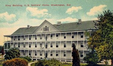
Development at the Armed Forces Retirement Home
From Reyn Anderson, Washington Central Parks:
Have you wanted to get involved in Washington Central Parks quest to get parts of the Armed Forces Retirement Home (AFRH) re-opened as public park and wondered how? Now’s your chance! Please come out THIS MONDAY, April 14, 6:30 -8 to a public meeting sponsored by the National Capital Planning Commission (at Bruce-Monroe Elementary School , 3102 Georgia Avenue ). You can download the AFRH’s development plans or view a hardcopy at the Petworth Library.
The AFRH’s plans still include:
- over 6 million square feet of development – that’s the size of the Pentagon, or ten times the DC USA development in Columbia Heights
- almost 9,000 parking spaces – that’s almost double the number of cars going out to a Nationals’ game at the new stadium, coming to our neighborhoods EVERY DAY
Come support the alternative: development along the public transportation corridors of North Capitol and Irving Streets, supported by Emancipation Park at the Old Soldiers’ Home! Emancipation Park will:
- preserve the setting of Lincoln ’s Cottage, where he worked on the Emancipation Proclamation, for generations to come
- provide a green backbone to support the neighborhoods East of Georgia Avenue, which currently have access to five times less parks and open space than neighborhoods West of Rock Creek Park!
-------------------
Note that I have suggested throughout the Small Area Planning process for Brookland, that transportation linkage be required between developments along the North Capitol Street Corridor, in particular the future development of the McMillan Reservoir, the Washington Hospital Center--the number one destination in the city without rail-based transit access, and the development on the AFRH property.
While Michael S. suggested a Brown Line heavy rail line to serve this area, streetcar service makes a lot of sense, as a form of "development oriented transit" (rather than "transit oriented development") as was pioneered with the Portland Streetcar's service of the newly created Pearl District, and Paul development of the South Lake Union district in Seattle, which also introduced streetcar service, to speed along "progress."

Conceptual map for transit expansion in the DC region, produced for Rebuilding Place in the Urban Space by the good graces of David Alpert and Greater Greater Washington. This includes the conceptual design of a brown line, as well as the revival of the old separated blue line proposal, which in this map, is colored silver, and includes the routing of the proposed Dulles Line.
BeyondDC's Transit vision suggests that this area could be serviced by streetcar as well.
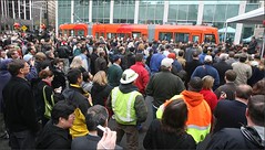
Crowds at the Seattle Streetcar Launch. Seattle Post-Intelligencer photo.
Labels: development oriented transit, parks, proffers, sustainable land use and resource planning
posted by Richard Layman @ 8:11 AM&Permanent Link
![]()
![]()


0 Comments:
Post a Comment
<< Home