Rebuilding Place in the Urban Space

"A community’s physical form, rather than its land uses, is its most intrinsic and enduring characteristic." [Katz, EPA] This blog focuses on place and placemaking and all that makes it work--historic preservation, urban design, transportation, asset-based community development, arts & cultural development, commercial district revitalization, tourism & destination development, and quality of life advocacy--along with doses of civic engagement and good governance watchdogging.

Monday, February 20, 2017

Today entrance to all US National Parks is free

Each year, the US National Park Service has free entrance days.  One of those days already past is the Martin Luther King Jr. National Holiday (January 18th).

Another of those days is the President's Day National Holiday (February 20th).

Other free entrance days later in the year are:

  • April 15-16 & 22-23, 2017 — Weekends of National Park Week
  • August 25, 2017 — National Park Service Birthday
  • September 30, 2017 — National Public Lands Day
  • November 11-12, 2017 — Veterans Day Weekend
Of course, a number of National Park Service facilities are always free.

=====
Issues concerning National Parks

The Find Your Park promotion and marketing campaign was launched by the National Park Service to celebrate its 100th anniversary in honor of its formal founding in 1916.

The Utah Office of Tourism, believing that the National Park Service wasn't adequately marketing the national parks in the state has done their own marketing program, called The Mighty Five, resulting in a significant rise is attendance, maybe even to a detriment ("The mighty wait at The Mighty Five (Utah's national parks)," Salt Lake Deseret News; "In the Footsteps of Many: Collaboration is Key to Preserving the National Park Experience," EDR blog, University of Utah).

The National Park Service has a severe maintenance backlog ("National Park Service delayed $11 billion in maintenance," Washington Post).

In DC, underfunding of NPS facilities is complicated by the tendentious relationship between Congress and "Washington."  The average Congressperson would rather fund facilities in their home districts or states, rather than in the National Capital.

WRT management of the National Mall see:


Separately, many Members of Congress have antipathy towards federal ownership of land in their states ("2 House GOP rules change will make it easier to sell off federal land," "Congress’s latest target for reversal: An Obama attempt to modernize how we manage public lands," Washington Post; "Dozens oppose resolution to release wilderness study areas," Bozeman Daily Chronicle).

Although there are legitimate issues with local vs. federal interests in managing public lands and parks:

Past blog entries:
-- "Park service land and planning woes: local vs. federal," 2011
-- "A gap in planning across agencies: Prioritizing park access for pedestrians, bicyclists and transit users compared to motor vehicle access," 2015
-- "Federal shutdown as another example of why local jurisdictions should have more robust contingency and master planning processes," 2013

The Outdoor Industry Association is moving their national conference from Salt Lake City to protest the campaign by Utah legislators at the state and federal levels to shift nationally-owned public lands to the state ("Largest outdoor gear show abandons Salt Lake City after 20 years," Washington Post).

Labels: ,

Thursday, April 09, 2015

Alleys and parklets and water and sustainability

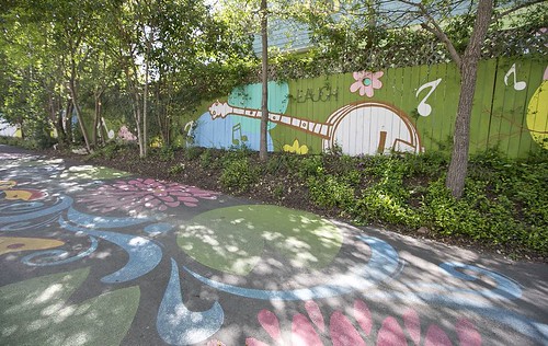
Fairy Alley, Austin Neighborhood Partnering Project
Fairy Alley, Austin Neighobrhood Partnership Program. The street is painted with sparkly designs and the fence has a mural at Fairy Alley on Thursday, March 26, 2015. The project was completed as part of the city's neighborhood partnering program. DEBORAH CANNON / AMERICAN-STATESMAN

Alleys. San Francisco has released a Living Alleys Toolkit document, in support of their alley improvement program in the Market Octavia neighborhood.  A section of the report lists/provides links to similar programs across the US, such as An Action Guide to Greening Austin’s Alleys [no longer available online, a useful list, not out of this world], produced by the Public Interest Design Studio at the University of Texas Austin, Texas.

The Austin guide lists 17 tools:

1. Permeable Pavement
2. Lighting
3. Rain Gardens and Bioswales
4. Native Landscaping
5. Alley Gateway
6. Street Graphics
7. Edge Treatments
8. Garbage Bin Corral
9. Rain Barrel
10. Address Marker
11. Compost Bin
12. Alley Furniture
13. Shading
14. Traffic Calming
15. Edible Alleys
16. Closed Alleys
17. Alley Flats

-- Guadalupe Neighborhood Alley Flat Initiative, Austin

It also provides information on the Alley Network Project in Seattle's Pioneer Square neighborhood.  They have a bunch of great resources including, "alley designs" featuring the Pioneer Square Alley Design Manual and Pioneer Square Alley Lighting Guidance .

Other noteworthy alley urban design initiatives are Laneways projects in Melbourne, Vancouver, and Toronto.

To be honest, while the projects are cool, most aren't fully applicable to DC, since most of DC's alleys are used for trash collection, which requires unimpeded throughway for heavy vehicles.

On the other hand, trash could be "walked out" to the street, which could allow for alternative treatments in alleys.

Parklets.  In Philadelphia, the University City Business Improvement District (sponsor of The Porch project at 30th Street Station), did a study of parklet projects, The Case for Parklets: Measuring the Impact on Sidewalk Vitality and Neighborhood Businesses, which challenges the conventional wisdom that parking is the most important element of commercial districts, supporting the patronage of neighborhood businesses.

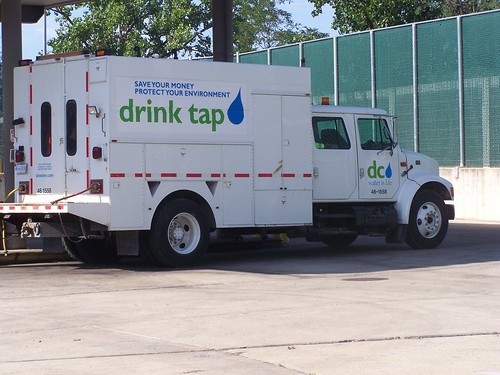
DC Water Authority truck branded with their "drink tap water" campaignDC Water Authority.  DC Water (DC Water and Sewer Authority) is doing a series of town meetings, on a ward by ward basis.  ANC Commissioner Kent Boese wrote a blog entry ("Brief Notes from the DC Water Ward 1 Town Hall Meeting").

Mandated by the Federal Clean Water Act, mostly rates will go up to pay the $2.6 billion cost to build a system to fully capture stormwater without it being combined with sewage and discharging it into the area rivers without treatment during major storm events.

Interestingly, they are proposing a "lifeline rate," of a lower charge for the first 4 hundred cubic feet of water consumed each month (each "ccf" is 748 gallons), almost like the "homestead" tax reduction for owner occupied houses.  That would save people not quite $1/month.

Also see "Saving US Water and Sewer Systems Would Be Costly," New York Times.

Sustainability in Los Angeles (and elsewhere).  The Associated Press has a story, "LA Mayor Envisions Greener, More Walkable City in the Future," on Los Angeles' new sustainability plan.  DC now faces more competition to be the "most sustainable American city" within 20 years. From the article:
Among LA's short-term goals: Install 1,000 new charging stations for electric vehicles; clean up contaminated groundwater in the San Fernando Valley and create more green jobs. 
In the coming decades, the city wants to achieve zero waste, replace its municipal fleet with electric vehicles, expand the use of recycled water and help residents cut down on car trips. 
Some of the goals were previously announced, including the call for a 20-percent reduction in the city's per-person use of fresh water by 2017 to deal with the drought.
One quote in the article irks me:
"For years, living sustainably in the urban environment has been given more lip service than action," Joel Reynolds of the Natural Resources Defense Council said in a statement.
Book cover, Green Metropolis, by David OwenThe reality is that even without special programs and accommodations, denser living in the urban core, especially in transit cities, is far more environmentally sustainable than suburban or exurban living, as David Owen makes the case in the book, Green Metropolis.

Residents in dense cities, especially in New York City, use less space per capita, and consume less energy and less gasoline, and produce less waste per capita.

Sure goods and services are trucked in, but this is the same case for suburban residents.

Labels: , , , , , ,

Thursday, September 27, 2012

Saturday September 29th is National Public Lands Day

-- National Public Lands Day website

-- The National Park Service, U.S. Fish and Wildlife Service, U.S. Forest Service and the Bureau of Land Management have all declared National Public Lands Day on September 29, 2012 as a fee-free day. The Army Corps of Engineers has waived day-use fees at their parks.
-- list of fee-free days for national public lands

From the webpage:

More than 170,000 volunteers are expected at more than 2,100 sites across the country on Saturday, September 29 to take part in the largest single-day volunteer effort for public lands in the United States, National Public Lands Day (NPLD).

Volunteers in every state will visit parks, public and community gardens, beaches, wildlife preserves or forests and chip in to help these treasured places that belong to all Americans. They will improve and restore the lands and facilities the public uses for recreation, education, exercise and connecting with nature. ...
 
Events in every state, the District of Columbia and many U.S. territories can be found online now, searchable by state or zip code. Eight federal agencies will participate—along with more than 250 state, county and city partners, and a host of nonprofit organizations around the nation.
-----
Not part of National Public Lands Day, there will be a cleanup of the Triangle Park in Takoma, at 4th Street and Blair Road NW on Saturday, from 10am to 12 noon.
 4th Stret and Blair Road, Takoma DC
The park is somewhat contentious because it is used most heavily by a group of public drinkers, most aren't homeless, who don't make the park very hospitable for use by others. 

I argue that part of the problem is that the park is designed to shield users from "eyes in the street," cloaking negative behaviors.  Others make the point that it's in such a bad location, at the triangular corner of a traffic sewer, that it's not really very conducive to being used anyway.

Labels: , , ,

Tuesday, July 12, 2011

Public space as a venue for marketing

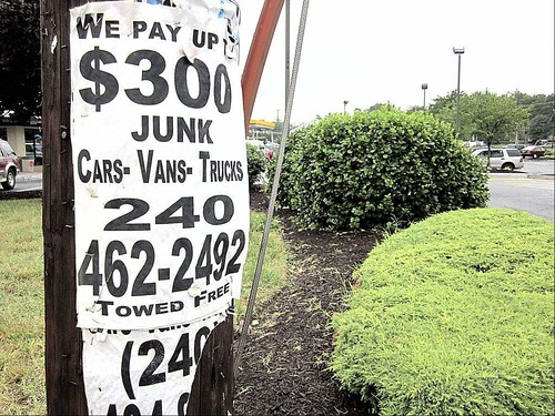
Again, in a capitalist society, we can't expect spaces to be free of marketing, advertising, and other forms of commodification. Some of it is simple if aggravating, such as the illegal posting of signs on telephone poles and other places in the public space.
Illegally posted signs on telephone poles
Natalie McGill/The Gazette Cheverly municipal code enforcement officials say signs like this one found on a Riverdale Road light pole in Riverdale Park are examples of the type of posters their employees try to crack down on with fines and warnings.

While the sign above was in Cheverly (see "Illegal signs slapped with fines, warnings in Prince George’s towns: Companies hard to trace, municipalities say" from the Gazette), I regularly rip down signs like this in my neighborhood.

In a more troubling development, a pocket park at 50th Street and Nannie Helen Burroughs Avenue in Northeast DC is becoming the site of a park installation in the shape of a peanut, sponsored and paid for by Planters Peanuts.

From the press release "MR. PEANUT GOES TO WASHINGTON! PLANTERS and The Corps Network “Plant” New Urban Park in NE Washington, D.C.":

As part of Planters 2011 “Naturally Remarkable” Tour, Mr. Peanut arrives in Washington, D.C. – by way of his new biodiesel Nutmobile – to open a new urban park, a Planters Grove, in Northeast D.C. U.S. Congresswoman Eleanor Holmes Norton, Washington, D.C. Mayor Vincent Gray and other local dignitaries join Mr. Peanut and community members to celebrate the new park on Tuesday, July 12, 2011 with a day of volunteer planting.

The Washington, D.C. Planters Grove — located at 50th Street and Nannie Helen Burroughs Avenue, NE — is the second of three peanut-shaped urban parks to be built in the U.S. this year in partnership with The Corps Network, the national member organization for Service and Conservation Corps. As part of its Tour, Planters is transforming underdeveloped and underutilized urban land into vibrant, green spaces in an effort to advance the brand’s values of healthy lifestyles and sustainability.

“Peanuts are truly a ‘naturally remarkable’ food. They have a rich American heritage and, in many ways, are both good for you and good for the earth,” said Scott Marcus, Senior Brand Manager, Planters. “Planters is excited to work with the local D.C. community to create a natural space in our nation’s capital that celebrates the peanut and promotes healthy living and sustainability.”

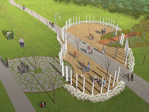
Ken Smith Planters Parklet for DC
The press release goes on to discuss how the "peanut shaped park" "features unique elements that promote sustainability and reflect the neighborhood's unique culture and heritage."

It's a peanut shaped park designed to promote Planters Peanuts. It's not about local elements, resident involvement (other than helping with the planting), and the neighborhood's unique culture and heritage (other than maybe a commonality of ideas about work and vocational education between Nannie Helen Burroughs and George Washington Carver).

Had Planters Peanuts given money to the park system to make a park, and had there been a public design effort to create the parklet, then it wouldn't be all about corporate marketing objectives.

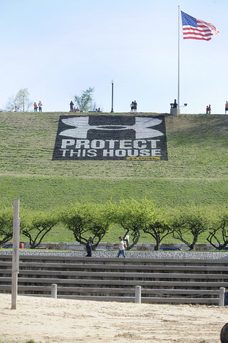
I know that local governments are desperate for money. But projects like these are definitely ones to avoid. Also see "Under attack logo disappears: Under Armour says it will replace paint with grass" and "'Welcome ad' not so welcome: Under Armour logo painted on Federal Hill irritates residents" from the Baltimore Sun, about how Under Armour clothing, a company based in Baltimore, did something similar in the Federal Hill neighborhood, under the guise of promoting a sports event held in Baltimore.

At least in Baltimore, the logo, granted much more blatant, was removed.
The Under Armour logo and slogan painted on Federal Hill in Baltimore.
The Under Armour logo and slogan painted on Federal Hill in Baltimore. Gene Sweeney, Jr., Baltimore Sun.

Labels: , , ,

Wednesday, June 01, 2011

White Flint Public Amenities Planning charrette -- tonight

One of the things that many communities don't do very well is planning the integration of civic assets such as libraries, recreation centers, meeting spaces, and various types of parks into new developments, master planning, and the creation of communities.

Well, maybe other communities do it well, DC doesn't because we don't do master planning at neighborhood-district-sector scales. We do "small area plans" but they aren't full master plans, and they aren't neighborhood plans--they are development management plans for the most part, although good things can result, we often miss things (I am no less at fault, I can point out to big gaps in terms of public space in both the NoMA and Brookland plans, and I should have been more conscious of this and worked to correct it during the plan development processes).

As I have mentioned, I believe that the White Flint redevelopment program in Montgomery County Maryland, along with the replanning and redevelopment of Tysons Corner in Fairfax County Virginia, are two of the most significant community redevelopment planning efforts across the United States.

Both are attempts to reconceptualize and redefine sub-urbanity for the 21st Century, and they are a lot more urban--without all the mess of economic and racial diversity which typifies center cities--than suburbs tend to be comfortable with (see the recent entry, especially the comments, "Montgomery no longer a homogenous suburb," from Greater Greater Washington).

One of the things that makes these kinds of re-planning efforts a bit uncomfortable for me is that for the most part, the planning is led by private sector initiatives that are most commonly driven only by the profit imperative, so integrating public spaces that aren't merely gussied up spaces of consumption and consumerism is either an afterthought or never happens at all.

The White Flint plan will be including an public amenities plan. The White Flint Sector Plan identifies several public amenities to serve the existing and future White Flint Community. These amenities include, but are not limited to:

• Library
• Recreation Center
• 1 to 2 Acre Civic Green Space
• Satellite Office for Regional Services Center
• Modifications to Wall Park
• Meeting Space
• Recreational Loop

There is a charrette for it tonight (I can't attend) and a public presentation later in the month:

Community Meeting 1: Community Perspectives
Date: Wednesday June 1, 2011
Location: Walter Johnson High School Cafeteria | 6400 Rock Spring Drive, Bethesda, MD Time: 7:00 PM – 9:30 PM

Community Meeting 2: Plan Presentation
This meeting will present a proposed amenities implementation plan based on the previous meeting.

Date: Thursday June 16, 2011
Location: Walter Johnson High School Cafeteria | 6400 Rock Spring Drive, Bethesda, MD
Time: 7:00PM-9:30PM

For more information, see the website:

- Developing an Integrated Model and Implementation Strategy for Certain Public Amenities in White Flint

Note that going to and participating in events like this, and reading and synthesizing the plans that result are great for your education in planning.

Labels: , , , , , ,

Wednesday, May 18, 2011

New wayfinding system for the National Mall (DC)

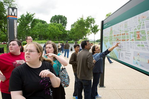
New wayfinding signage at the National Mall Smithsonian Metro stop
Friends (from left) Katie Devereaux, Laura Tucker and Kathryn Johnson discuss their next move at the detailed map of the Mall that made its debut Tuesday outside of the Smithsonian Metro Station. (Rod Lamkey Jr./The Washington Times)

While I think that a comprehensive wayfinding system for "the city" is in order, and the fact that the National Park Service, Smithsonian Institutions, DC Department of Transportation, the Washington Metropolitan Area Transit Authority, and the Architect of the Capitol all do their own thing and don't coordinate very well between each other, therefore making it hard to get around the city if you don't know where you're going, this is a step forward.

See "More-informative Mall map helps tourists find their way" from the Washington Times.

Labels: , , , ,

Thursday, April 28, 2011

Sitting Outdoors and planning for small public spaces

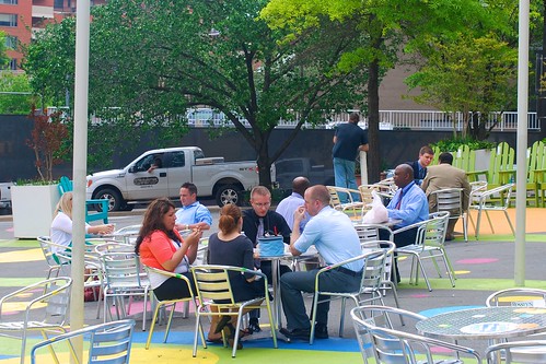
Sitting Outdoors by M.V. Jantzen
Sitting Outdoors, a photo by M.V. Jantzen on Flickr.

People sitting in the CentralSpace to CentralPlace plaza, created by the Rosslyn Business Improvement District in Arlington, Virginia. Flickr photo by M.V. Jantzen.

One of the things we don't seem to do very well is plan for small public spaces as part of our commercial districts and urban neighborhoods.

It's not that there aren't small pocket parks and such, there are, but often at least in DC they are the result of how diagonal avenues meet the more typical street grid of blocks and streets.

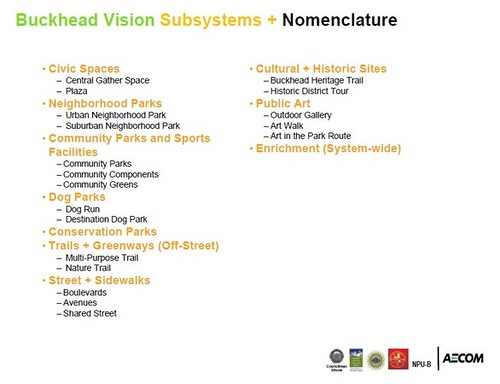
David Barth of AECOM's presentation on "Parks and Open Space System Master Plans: Tools for Sustainable Communities" provides a framework for a complete typology of parks and open spaces that a community should work to plan for.

AECOM is also doing a parks and open space plan for the Buckhead District in Atlanta, which provides a more targeted list of the right kinds of spaces needed in denser, urban places.
Buckhead Collection Parks planning initiative, nomenclature

In retrospect (although before today of course), I realize that we have inadequately planned for such places in NoMA, H Street, and Brookland, among other places, as part of the city's land use planning and transportation planning initiatives. Mostly, we didn't think about how to insert pocket parks and plazas as part of these processes, and now it becomes even harder to find the space, or buy it, as municipal budgets are increasingly stressed, stretched, and under pressure.

(Another dimension of this is incorporation of school playgrounds and greenspaces into the community parks network.)

The Sitting Outdoors photo shows us that the spaces don't have to be complicated or overly designed to be useful and appreciated.

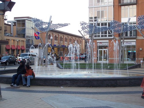
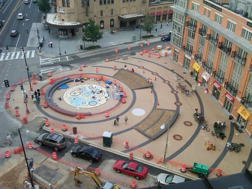
Although one part of the city where they have done a better job with this is in Columbia Heights, in the Columbia Heights Public Realm Framework Plan," which includes a cool public plaza at the convergence of a number of streets at 14th Street, about a block from the subway station and the big DC/USA retail center.
Fountain, Columbia Heights Plaza, 14th Street and Park Road NW, Washington, DC

Still, this becomes an important issue in another dimension in terms of how do we plan for public places and spaces in what are technically privately owned developments, but where the developments are specifically designed to connect to and extend the public realm, and to be for all intents and purposes, "public spaces," albeit privately owned.

One of the problems from a cultural studies or urban sociological standpoint is do all these spaces become privatized and commodified?

How do we maintain the ability for citizens to come together in public, as citizens, not as consumers, to congregate, to aggregate, to communicate, etc.

Or do we have to purchase goods and services to be able to use the space?
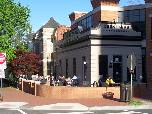
Ebenezer's Coffee Shop, 2nd & F Streets NE, DC
The patio is jumping at Ebenezer's Coffee Shop, at 2nd and F Streets NE, Washington, DC.

Will private property owners and managers only contribute to the quality of the public realm to the extent that the marginal returns from the investment in other revenues is positive?

And are methods for tracking marginal revenue contributions narrowly or broadly construed, which depending on the definition, from the standpoint of private sector expenditures, makes activities profitable or not in the context of the public realm and the public space..

Labels: , , , , , ,

Sunday, January 09, 2011

Using dog poop to fuel a park gaslight

Government Technology reports, in "Pet Poop Fueling City Park Light, Sparks Conversation," about how an MIT visual arts program graduate created a gaslight fueled by a methane digester using dog poop in one of Boston's public parks.

I do think about all the dog poop tossed in trash cans around the various parks in the city (especially around the Coolidge Recreation Center which is a couple blocks from where I live) and how it could be fertilizer or fuel.

(Suzanne confronted one of our neighbors who carries plastic bags when she walks her dogs, but doesn't use them when the dogs dump on people's yards including ours.)

More info:

-- Park Spark Project
-- "Dog Power: Matthew Mazzotta’s Park Spark Project" from the ArtSake blog of the Massachusetts Cultural Council

Labels: , , ,

Friday, January 07, 2011

Public squares and DC

Book cover, Great Public Squares by Robert Gatje
Both the Washington Post ("Where is Washington's great public square?" by Philip Kennicott) and the City Paper ("Is There Hope for D.C.’s Public Squares?" in Housing Complex) beat me to discussing Robert Gatje's book (and presentation yesterday at the National Building Museum), Great Public Squares: An Architect's Selection.

The material in the book and the presentation is short in terms of laying out the overarching principles of what makes successful squares. Most of the book and the presentation describes the public squares that Gatje thinks are some of the greatest in the world.

I didn't take many notes on the talk, only about 100 words. But these were some of the conclusions I came to, whether or not Gatje said them specifically:

- density
- crossroads and places that are connected (Gatje)
- people want to be there (Gatje)
- outside living - outdoor rooms
- integration of civic life and commerce.

The book text has short descriptions of major features including dimension, height, the facade wall/enclosure and materials, roadways, pavement materials, street furniture, the presence of arcades (covered walkways), monumental buildings and features, trees, and pedestrians/people.

The descriptions of the various successful squares showed common themes of success such as the presence of public buildings (town halls), churches, schools, commercial buildings, and housing located as part of the greater square area and on the perimeter of the square, providing a sense of enclosure but also connectedness, vitality, and integration.

Gatje didn't discuss very deeply the connection between the development of public squares and public markets--where farmers came into the city to sell foodstuffs to residents in the time when retail shops didn't exist, not to mention refrigeration, which required daily shopping.

If you look at the public squares and parks in DC that for the most part fail, it is because they are disconnected places, and that they are rarely places where commerce is allowed to be integrated--the National Park Service, which controls many of the public squares and circles in DC, has strict regulations against commerce, unlike similar but wildly successful parks in other cities such as the borough of Manhattan in New York City, Schenley Plaza in Pittsburgh, the Navy Pier in Chicago, and Campius Martius in Detroit.

Frankly, when it comes to the value of place and placemaking in public squares, the work of the Project for Public Spaces, or the wisdom expressed in the tome Creating a Vibrant City Center by Cy Paumier is more applicable, even though Mr. Gatje's book will be a great resource for city planners and involved citizens seeking inspiration.
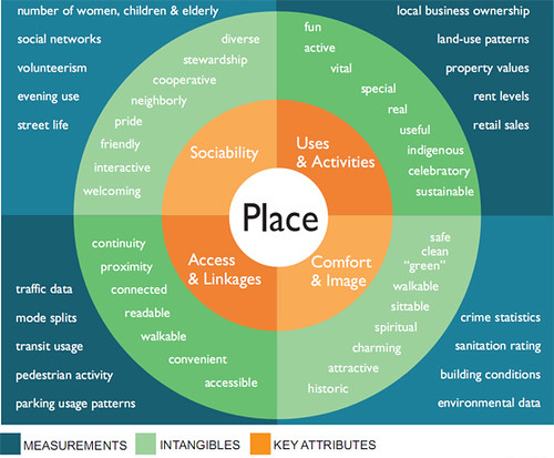
Four key qualities of a successful place - Diagram from the Projects for Public Spaces (www.pps.org)
PPS Place Making Diagram

Resources from the Project for Public Spaces


One of the points in my seemingly ignored New Year's blog entry ("New years post #5: DC City Council Committees and striving to be a world class city") laying out a potential agenda for each of the DC City Council Committees, was this point, with regard to the Committee on Public Works and Transportation:

Extend Councilmember Wells' efforts as Ward 6 Councilmember focused on placemaking and quality of life improvements in Ward 6 to the development of a citywide placemaking and quality of life improvement effort. (Note that DDOT's streetscape planning and construction efforts under Dan Tangherlini around 2000 are the foundation and first building block of this effort.)

It is important to take this up generally, but it shouldn't be focused on what we might call high art, which is what Kennicott is is focused on, and the creation of an absolutely great single square in DC.

Although years ago I thought that DC should have done the equivalent of Chicago's Millennium Park on the Old Convention Center site, which instead is mostly going to be big buildings with commercial and residential space. A separate blue ribbon task force recommended including a great public space and civic functions on the Old Convention Center site, but for the most part this won't be happening, which is one of the disappointments I do have with Mayor Williams and then planning director Andrew Altman.
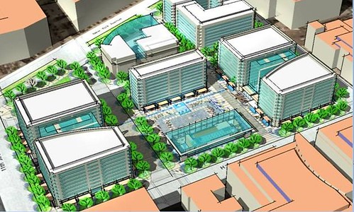
Concept for a public square on the Old Convention Center site.
Concept for a public square on the Old Convention Center site, Cy Paumier.

Instead, a placemaking agenda should focus on making great places throughout the city, not just Downtown or in the federal city such as along the National Mall, using the urban design and placemaking principles that are known but too often ignored (by the National Park Service especially).

One of the initiatives that should be included as part of such an agenda would be the restoration, creation, and extension of public squares throughout the city through improvements in the placemaking qualities of "traffic" circles, such as Dan Malouff's proposal to create Scott Square ("Let’s convert Scott Circle into Scott Square" from BeyondDC), past efforts concerning Truxton Circle ("the case for bringing back truxton circle" from Bloomingdale (for now), and others (I am thinking of one at Georgia and Missouri Avenues as a way to fix the traffic problem at that intersection and recenter commercial development on that node of Georgia Avenue).

DC has done a circle restoration at Thomas Circle, during the Williams Administration. I don't know the details, but in 1950, DC's Logan Circle was reduced in size for the addition of roads. From 1982-1985, the original dimensions were restored.
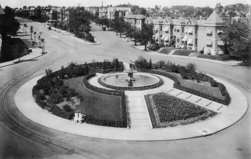
Truxton Circle before
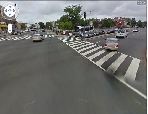
Truxton Circle before and after. The Circle was named after Revolutionary War commodore Thomas Truxtun (1755-1822), whose estate was later granted to the District. Until 1940, Truxton Circle was located at the intersection of Florida Avenue and North Capitol Street. First image: Library of Congress. Second image: Google Street View.
Google Street View, North Capitol Street and Florida Avenue NW, intersection

I was not able to attend Cy Paumier's presentation at the National Building Museum in October, Creating Great Places: A Vision for Washington, D.C.'s Center City Public Realm," which was part of the Smart Growth Speaker Series. Paumier presented specific proposals for improving the 12 most important public spaces in Washington D.C.’s center city.

Fortunately his talk and presentation is online.

His presentation focused more on the monumental, high art kinds of spaces across the city, particularly in the federal city, although not completely.

He discussed the concept of a high quality, integrated public realm, not unlike David Barth, who I frequently tout as one of the nation's best parks planners. Maybe that's the way this Council Committee agenda item should be termed, on refocusing the transportation towards the creation of a high quality public realm across the city. Note that is happening already, with DDOT's streetscape initiative, streetcar planning, and other initiatives. But it still needs a scalar change and upgrade into a more all encompassing program.
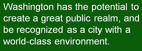
Washington has the potential to create a great public realm, and be recognized as a city with a world-class environment.  -- Cy Paumier
From the Paumier presentation.

Labels: ,

Wednesday, February 03, 2010

Dallas is building a park over the Woodall Rogers Freeway

See The Park website.

And this presentation.

Labels: ,

Tuesday, September 15, 2009

(Ir)rational planning

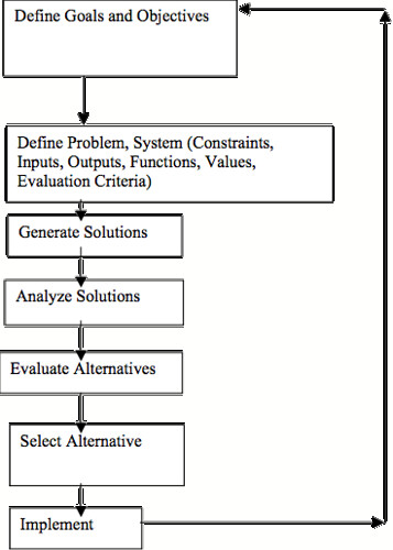
Organizational-based planning, be it land use planning for which planners go to school, or in other disciplines, is typically called "rational planning" and follows a particular method.

Rational Planning Model -- lacks a step for prototyping and feedback before final implementation
Rational Planning Model

The biggest problem with this method is that for the most part, the evaluative framework that planners use is relatively static, it's more backwards looking than forwards looking. We can all fall prey to this (e.g., in a study I did in a county on Maryland's Eastern Shore, while I mentioned the impact of global warming, I didn't really key in on the fact that depending on the projections, half that county could be underwater in 30 years).

Chris Argyris spent his academic career studying and working to make more effective, learning and action in organizations. This webpage discusses the basic points:

-- that people have an espoused theory of how they respond and act;
-- which usually differs from how they act in specific situations;
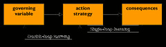
-- that single loop learning doesn't question the basic principles of an approach;
-- and double loop learning does.

From chris argyris: theories of action, double-loop learning and organizational learning:

Single-loop learning seems to be present when goals, values, frameworks and, to a significant extent, strategies are taken for granted. The emphasis is on ‘techniques and making techniques more efficient’ (Usher and Bryant: 1989: 87) Any reflection is directed toward making the strategy more effective. Double-loop learning, in contrast, ‘involves questioning the role of the framing and learning systems which underlie actual goals and strategies (op. cit.).
Single loop and double loop learning (Argyris)
This graphic from the website shows the difference between the two forms of learning. In short, in double loop learning there is a feedback and consideration loop (feedback loop is the term used in systems theory), and there is no feedback loop in single loop learning.

I think we are a single loop society, one where for the most part, our organizational systems, especially political and governance institutions, are resistant to learning and improving.

Through discussions with blog commenter and colleague Christopher, I have become much more clued into the design method combined with principles from social marketing, which is the planning method that Arlington County has been developing around its transportation-related planning activities. (See the blog entry "Social Marketing the Arlington (and Tower Hamlets and Baltimore) way.")

Design Method
Design methodology

The design method is more anthropological, and anthropology-based design methods are all the rage in industry. In fact, there is a developing design discipline called design anthropology.

Without the ability to go beyond constrained scopes of work, most planning efforts have the tendency to produce somewhat static results.

Some examples...

1. While not an urban issue, the problem of grizzly bear management in the Greater Yellowstone eco-region is one issue. The Post had a travel story about this on Sunday, "Into the Wild," and PBS's Nature show on Monday was about the same broad topic, The Good, the Bad, and the Grizzly.

The issue is about constraints and conflicts. These bears need a fair amount of land on which to roam. If the same lands are used for other purposes, such as running cattle on national forests, conflicts are created, and the bear generally loses out, when it comes up against people. The Dept. of Interior, under President Bush, declared that in the Yellowstone region, the grizzly bear is no longer an endangered species, meaning a management plan isn't necessary, that the bears aren't protected.

But how do you resolve the conflicts that will continue, whether or not the Dept. of Interior changed the regulations?

2. In the Sunday Post, there is a short op-ed piece, "The New Walter Reed: Less Than 'World Class'?," about the impact of the Base Realignment and Closure Commission (BRAC) process, which called for the merger of DC-based Walter Reed Hospital into the Bethesda Naval Center, and the failure to re-engineer processes, systems, and facilities as a result of the merger. From the article:

There is much to commend in the work that has been done so far. For example, the view of the facility from Wisconsin Avenue will be very pleasing, with the iconic 1930s tower flanked by a new outpatient building and a revamped, extended inpatient building -- and these will provide not only good but excellent care. But a master facility plan has never been done for the campus, which serves multiple functions and includes many older buildings that, over time, should be replaced in an orderly manner. During our review, we were told that such a plan was not within the scope of the BRAC budget.

Similarly, no analysis has been performed to determine needs based on future local demographic changes (the number of retired military personnel in the area is increasing), changing types of wounds (such as from improvised explosive devices) or advances in the delivery of medical care. Instead, the consolidation was planned using a static approach, whereby the functions performed at Walter Reed were simply shifted to the future facilities. Again, the rationale we were given for this was that the BRAC law did not allow for any other approach.

This is a perfect example of a planning failure resulting from static legislative and planning processes.

3. Today's Health section in the Post has an article, "Study Gives High Marks To Retailers' Clinics," about the success of for profit walk in clinics to provide low cost basic health care services.

I have been writing about this for 3+ years as an example of how communities can reengineer basic public health service provision, to move a lot of this kind of care out of hospital emergency rooms, to better manage chronic conditions at the community level, and to provide broader wellness services (which are needed, see "Obesity a Major Issue For Many Minorities" also from today's Post) within neighborhoods.

See the past blog entries "Disruptive innovation (once again)" and "Bods/Cuerpos."

This is an example of what isn't being discussed in the national "debate" about health care "reform."

Without refiguring how health services (not "health insurance") are conceived and how they are delivered, providing effective health and wellness care for all will continue to be out of reach.

Labels: , , , , , ,

Wednesday, September 02, 2009

The new Columbia Heights public plaza on 14th Street NW

is featured in an entry in the Prince of Petworth blog. I can't figure out why the bulk of the reader comments are so negative.
IMG00027-20090827-1757
Photo by an anonymous reader of Prince of Petworth.

I think we need more pocket park and small neighborhood/commercial district plaza type spaces, and this seems like a step forward to me.

Also see, from the Project for Public Spaces, "Ten Principles for Creating Successful Squares."

-----------
P.S. I should have mentioned that this is one of a number of public realm improvements planned for as a result of a particular DC Office of Planning process, which resulted in the Columbia Heights Public Realm Framework Plan.
Rendering, Columbia Heights plaza, from the DC Office of Planning Public Realm Framework study
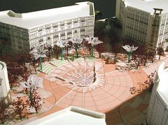
This is a rendering from the plan. You see that the imprinted brick design was extended to the abutting streets, although after this plan was done, DC's Dept. of Transportation made a ruling that such pavement imprinting wouldn't work in the DC street environment. (This idea was also expressed in the transportation plan for H Street NE.)

Labels: ,

Tuesday, August 18, 2009

New Online Tools to Win Park Funding Initiatives

From The Conservation Campaign of the Trust for Public Land:

The investment of substantial public funding-typically through voter initiatives for a bond or a small dedicated tax-has fueled a nationwide movement to revitalize cities through the creation and restoration of parks, greenways and other outdoor space. Now advocates seeking park and trail funding for their communities have a comprehensive new resource: The Conservation Campaign Toolkit.

This web-based portal of tools, information and advice includes a step-by-step guide to running and winning a conservation funding ballot initiative, stories from successful campaigns and more.

The Conservation Campaign is the only national organization that focuses solely on political action to gain public funding for conservation. Since its founding by The Trust for Public Land (TPL) in 2000, TCC has supported more than 300 conservation funding initiatives in communities around the country, helping to generate billions of dollars for land conservation. The Toolkit draws from the lessons learned by these local campaigns as well as the expertise of TCC and TPL field staff.
-------------
And of course, the tools are applicable to campaigns on other topics and issues.

Labels: , , , , ,

Friday, August 14, 2009

Parks and recreation best practices

Parks and open space issues are somewhat of a cause célèbre in response to a blog entry by Matthew Yglesias, on parks in DC. His post, "How Many Parks Do You Need?" was in response to repetitive clamor for more open space and parks in considering how to reuse deaccessioned school buildings. His post was characterized in themail, an e-letter on DC good government (an oxymoron if I ever heard one), as saying that all pocket parks etc. should be converted to buildings.

Frankly, I have similar concerns, at least in my experience participating and commenting on plans for redeveloping the Hine Junior High School site which lies across the street from the Eastern Market Metro Plaza on Pennsylvania Avenue SE and kitty corner from Eastern Market on the east side of 7th Street SE.

In response to community priorities for more open space, the RFP issued for this project called for the provision of open space, and the developers responding to the proposal dutifully plugged in such space as part of the program, to be located on the 700 block of C Street SE, into their proposal.

Within 1.5 blocks of the former Hine School, there are six public spaces (Eastern Market Metro Plaza, related park space north of Pennsylvania and east of 8th Street SE, Seward Square between 5th and 6th Streets, the North Plaza adjacent to Eastern Market, Turtle Park north of North Carolina Avenue and across the street, and the large sidewalk space adjacent to Port City Java on the east side of 7th Street at North Carolina Avenue).

For the most part, these spaces are poorly designed and/or managed. In total they add up to a fair amount of space.

It makes no sense to add even more "public and open space" to this area (I didn't mention the nearby open spaces at the library, the Old Naval Hospital, and the medians of the Pennsylvania Avenue "boulevard").

Instead, put efforts into making the extant sites better and successful.

One of the problems that results from not producing "neighborhood" plans within the regime of land use and quality of life planning in DC is that there is no coordinated approach to maintaining, enhancing, and extending the characteristics that contribute to improved quality of life within neighborhoods, both in terms of managing public and civic assets and coordinating how government agencies and other stakeholders conceptualize, manage, and deliver services.

Sure the Department of Recreation has ward coordinators and organizes services by wards, but I don't see substantive coordination and management of these spaces within the agency, especially in ways that deliver services of qualityin response to community needs rather than government agency convenience, upwards of 18 hours/day service, every day.

In April I participated in a green space planning effort in Columbia Heights, initiated by Washington Parks and People, over plans to convert an interior block alley space into some sort of green space. As part of the planning exercise, we went and looked at three other community spaces at 11th and Park Road, 11th and Monroe Street, and Park Road and New Hampshire Ave. (we could have also considered the Tubman elementary school field at 11th and Kenyon, among other nearby green places).

One of my recommendations is that the park and green spaces in Columbia Heights needed to be planned and managed and operated as one system, that there could be a walking path and wayfinding signage system created to link the spaces, etc.

Providing integrated planning and integrated plans at three or four different levels in the city:

- neighborhoods
- areas (based on the Area Elements in the Comprehensive Plan, the ten defined "areas" have fixed boundaries, unlike Wards, whose boundaries change every ten years)
- districts or quadrants
- city-wide;

ought to yield a much better system than we have currently. And it would ensure that gaps in service provision are identified and addressed.

Here are some good web resources on parks and green space planning:

- What makes Open Space work? (GreenPlan Philadelphia)
- Six Parks We Can All Learn From and Ten Principles for Creating Successful Squares which synthesizes the lessons from the six parks (Project for Public Spaces)
- Park Practices website, which includes many good case studies
- Best practices website/Minnesota Parks
- Measuring the Economic Value of a City Park System, Conservation: An Investment That Pays, the Center for City Park Excellence, and this article published in Landscape Architecture, "Shoehorning Parks Into Cities: Squeezing innovative green spaces into crowded cities requires looking for land in unexpected places," from the Trust for Public Lands
- "Too Cool (Just) for School," an article from Landscape Architecture about making public school playgrounds into assets for the entire community, not just for students during the hours when school is open
- Places Journal special issue on Parks, Volume 15, Number 3 (2003)
- REBAR San Francisco art design activism, initiators of the PARK(ing) project of temporary retaking/art installations in parking spaces promoting alternative public space community usess for urban public space
- Baltimore Parks and People, which has a variety of community programs aimed at improving neighborhoods and building the capacity of residents to participate in local affairs, while helping themselves by improving their communities
- Baltimore's Cleaner Greener Baltimore program and the greening activities of the Department of Recreation and Parks are built around community involvement and substantive participation by citizens, which is a very different approach from DC

----------------
One thing I don't get. Some of DC's pocket parks are well taken care of and managed, while others languish. And some of DC's recreation/park centers are cesspools of trash and disorder (i.e., the area behind Taft Junior High School in Woodridge) while others are models of quality, usage, and beauty (the recreation center and park adjacent to Coolidge High School in Manor Park/Takoma DC.).

All the spaces should be great. And there should be a combination of active and passive areas, to meet the needs and interests of a variety of parks users.

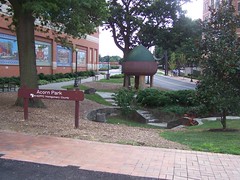
Acorn Park on East-West Highway in Silver Spring, Maryland.
100_8302.JPG

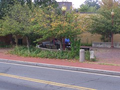
Pocket Park at 4th Street and Blair Road NW in Takoma
100_8317.JPG

Labels: , , , , , ,

Tuesday, August 04, 2009

Putting the no in innovation

is a new advertising campaign for Post Shredded Wheat cereal. I saw a tv commercial for it last weekend and I thought it was a good title for a followup to last week's piece on creating a great active park-recreation-museums-civic place at Poplar Point to reenergize East of the River planning, leverage subway access, leverage the Anacostia River, and proximity to the Nationals baseball stadium etc.

Christopher mentioned how the Golden Gate National Recreation Area, a National Park Service multi-site installation in the San Francisco Bay area, is pretty innovative, particularly in the adaptive reuse program for the Presidio.

I countered with the story of the Army Corps of Engineers' arboretum at Chittenden Locks in Seattle. Horticulturist Carl English took advantage of being at a federal facility located 3000 miles away from Washington, DC and not being managed and monitored too closely to create a fabulous botanical garden. He wouldn't have been able to do that if he had been located east of the Mississippi River...

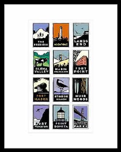
Similarly, it is likely that the GGNRA has an advantage being located 3,000 miles away from the headquarters of the National Park Service. See this interesting webpage from the Corporate Design Foundation about the development of a solid branding and repositioning campaign for the GGNRA, sponsored by the independent Golden Gate National Parks Conservancy.
brand images of sites within the Golden Gate National Recreation Area

Not to mention the Presidio Trust website, which has a fascinating description of how this installation is managed and operated:

Because of the Presidio’s city-like infrastructure, its nearly 800 buildings, and its expansive cultivated forest and natural areas, funding the Presidio’s operation and long-term care is much more costly than traditional parks. In 1996, Congress devised a management and funding model unique among national parks, and created the Presidio Trust to preserve the Presidio’s natural, scenic, cultural, and recreational resources, and to become financially self-sufficient. The Trust manages the interior 80 percent of Presidio lands (known as Area B), including most buildings and infrastructure.

The Trust receives federal appropriations that diminish each year, and cease at the end of fiscal year 2012. The Trust uses these funds and lease revenues to rehabilitate the park's buildings, restore its open spaces and historic resources, provide programs for visitors, maintain utilities and infrastructure, and fund the Presidio’s long-term care.

Sadly, DC doesn't have the kind of "out of site, out of mind" advantage possessed by places located on the West Coast, when it comes to dealing with agencies of the federal government.

Otherwise maybe something exciting could happen at Poplar Point, other than some more open space and some office and residential buildings and a water taxi dock.

------

For an interesting piece on a similar issue in Boston, about how to develop a site freed up by the Boston Big Dig and the creation of the Boston Greenway, see this editorial from the Boston Globe, "Getting to 'wow!' on Greenway" about competing proposals for Parcel 9. Most of the commercial proposals include a kind of public market on the ground floor. Another proposal puts forth the idea of a city museum with lots of good gaws.

If they had more land like at Poplar Point, they could do both.

Labels: , , ,

Thursday, July 30, 2009

Thinking really really really big for Poplar Point's park

Isn't in the three scenarios put forward by DC planners, as discussed in this entry from Greater Greater Washington, "Poplar Point planners present possibilities." (Also see this previous GGW entry, "Poplar Point and the Case of the Too-Large Park.") GGW writes:

Should Poplar Point become two separate districts, one extending the Anacostia neighborhood and one connecting across the river? Or should it be one neighborhood, centered around the Metro station leaving parkland along the waterfront, or activating the waterfront with a large park to one side? Should DC redevelop the Anacostia Metro garage, or leave it? These are some of the questions DC economic development officials asked members of the community at last weekend's Poplar Point presentation.

I'd say for a connected place, rather than two separate districts on either side of a large green space, EXCEPT that I offer a different alternative. Two "separate" districts connected by an active public-civic-recreational-educational-amusement place. In this fashion, there is nothing separate about the land use plan, it's all connective and supportive of both east of the river interests and objectives while at the same connecting to west of the Anacostia River and anchoring the east with the kinds of civic assets that the community justifiably believes have been denied to it.
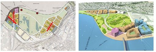
Alternative 1, Poplar Point redevelopment
Alternative 1, Poplar Point redevelopment.

Yesterday I listed a bunch of articles about recent activities of the Project for Public Spaces. PPS is a planning firm kind of, but one with a advocacy bent. It's a nonprofit, built on the legacy of William H. Whyte and Jane Jacobs, but much of their operating budget comes from fee-for-services from doing planning consulting.

One of the articles, "The Place Doctor" from Convene Magazine is a kind of summary of the PPS philosophy. There is a section of the article that is particularly relevant to Washington, DC, where we have a great deal of open space/parks (especially those run by the National Park Service) but the parks are passive spaces, rather than active. From the article:

Activity is fundamental to great places. Kent dislikes the trend toward converting urban parks into open spaces that provide few things for people to do. The park of the future, Kent said, will be more like Europe’s 19th century pleasure gardens, such as Tivoli Gardens in Copenhagen. One good contemporary example is downtown Houston’s newly opened Discovery Green, where visitors can play bocce or horseshoes, picnic, take Pilates classes, play in a fountain, attend free concerts, shop at a farmer’s market, kayak, canoe, sail, and more.

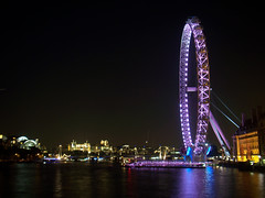
Places like Millennium Park in Chicago, Campus Martius Park in Detroit, and Discovery Green in Houston are active fun places. Hell, have a ferris wheel like the London Eye.
London Eye
London Eye photo from Flickr by Adriano Aurelio Araujo.

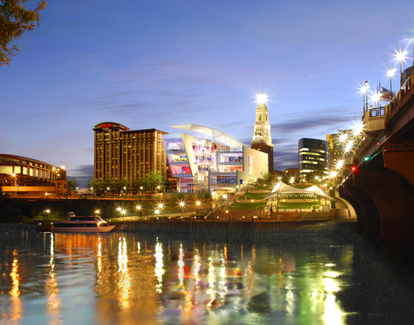
Imagine that kind of park at Poplar Point, connecting the mixed use areas, connected by transit, maybe having a soccer stadium (I am of two minds on this, but see "D.C. United back in talks with District officials" from the Washington Business Journal), other civic assets--what about a real "City Museum" or a Science Center like the new Connecticut Science Center in Hartford (see "Future shock made child's play" from the Boston Globe) or a great maritime-related discovery center and activities and a Children's Theater and Library like Charlotte's ImaginOn--instead of another passive recreation space that is under-utilized in a city with an overabundance of passive park spaces.
Rendering of the Connecticut Science Center, Hartford, located on the Connecticut River
Rendering of the Connecticut Science Center, Hartford, located on the Connecticut River. (It just opened and I haven't been able to find good photos yet of the exterior.)

Imaginon -- Children's Library/Theater, Charlotte, NC
Imaginon -- Children's Library/Theater, Charlotte, NC.

Including a kick-a** recreation center. One of the problems with recreation planning in DC is that it is plain vanilla--every rec center is pretty much the same. The "big" centers have a pool. The smaller ones don't. How about a mini-aquatic park, urban sized (like the H Street Country Club putt putt course rather than Disney World, the Post reports in "Time to Join the H Street Country Club" about an indoor mini golf course), an indoor track, and other facilities that will help make this recreation be a destination, one that serves the entire city. (And maybe a velodrome, etc.)

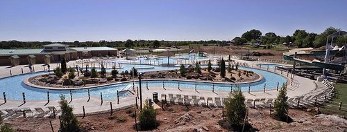
But why should the cool amenities only be available in the suburbs? See "Aquatic Center Opens in Leesburg" from the Washington Post Loudoun Extra section about the recent opening of a new aquatic park there.

Etc.
An overview of the new Aquatic Center at Leesburg's Ida Lee Park. The center features a six-hundred-foot "Lazy River."
An overview of the new Aquatic Center at Leesburg's Ida Lee Park. Washington Post photo by Tracy Woodward.

Elsewhere in the article on PPS, PPS president Fred Kent is quoted saying "Every City needs a square."

Well, the area of the city called Anacostia-Ward 8-East of the River needs that square too. And maybe Poplar Point is the place to do it.

Who needs National Harbor anyway (see "National Harbor's 'Mini-City' Takes Shape" from the Post). Or the Children's Museum when we could do a Connecticut Science Center or a Imagion (Charlotte, NC) see "National Children's Museum's Launch Zone" from the Post.

Labels: , , , , , , , ,

Monday, July 20, 2009

A breakdown in a functioning civil society

Dog walker, Columbia Heights
A dog walker in Columbia Heights.

On the concerned4dcps e-list there has been spirited discussion about "dog parks" in public spaces, which some see as a plot by whitey somehow--not stated directly but definitely seen as an unwelcome sign of neighborhood change, along with yoga studios (see "Breathing New Rhythm Into Tired Streets" from the Washington Post in 2006) and restaurants selling Tex-Mex cuisine.

I am not a dog person myself, but I am deeply appreciative of well-managed dog parks because in many urban neighborhoods, dog owners are some of the only regularly walking people in a community--many neighborhoods outside of the inner core of Washington are dominated by automobiles and there is relatively little positive pedestrian activity on often empty sidewalks.

Dog walkers contribute positive activity not just to streets and sidewalks but to parks. It's very easy for a park to devolve into a dangerous place. One technique for people committed to disorder to keep people (especially families and children generally) out of parks is to break a lot of bottles--broken glass keeps a park free of children, making it easier to conduct illicit business and activities.
Dog walkers help rebuild neighborhood groups committed to providing support and focus to neighborhood parks--parks that often are willfully or passively neglected by municipal governments overwhelmed by a variety of responsibilities, and lacking the resources to be able to provide regular maintenance and assistance and supervision.

Anyway, Sue wrote this, and allows it to be reprinted here:

Dog parks and crime aside, Susan's original point was an important one. Local institutions create a fabric of natural/casual/ recurrent interactions that foster community. When the kids in a neighborhood go to a variety of different schools, then the adults in the neighborhood are less likely to get to know each other well.

I often think that Tenleytown's rich associational life is built around its institutional core -- especially the schools, but also the churches and the library. By contrast, in Friendship Heights, whose center is commercial (and commercial on a regional scale), more people are strangers to each other and there aren't really any enduring community groups. In my block alone, the children go to three different elementary schools. School is another thing that scatters us (we all head out at different times and in different directions) rather than brings us together.

By contrast, successful neighborhood schools create a context where a critical mass of people who live near each other routinely and over a period of years work together on various projects and have a shared stake in something that is "ours" -- not just "mine." And they routinely bring new residents into the fold in ways that extend and reproduce community over time.

DCPS's failures put city dwellers more in rats-fleeing- a-sinking- ship (for any port in a storm, to mix a few metaphors!). The huge overhead William mentioned (with respect to transportation) keeps us all away from our neighborhoods longer each day and gives us less free time for activities beyond the essential daily grind.

We're all easier to manage that way, I suppose.
-----------------

One of the posters to whom I vehemently responded argued that it makes more sense to put cops on the streets than to provide dog parks. Now it costs about $250,000/year to support a police officer. And in any case, said police officer doesn't provide 24/7/365 presence in a particular neighborhood.

I often say that there is a reason that DC neighborhoods are "f"lawed up" beyond the reality of decades of underinvestment. It's because of how neighborhood leadership fails to address community building and capacity building and looks to others to solve their problems

As long as you expect government to take care of you, to not invest--in time mostly but also money--in your own neighborhood, you and your neighborhood are doomed.

The failure to focus on the nexus of school and neighborhood in dealing with the challenge of improving the local school system likely means the failure of both community and schools, because it is expected that somehow each is disconnected, and that the power of school and the power of community should not be leveraged, synthesized and intertwined, but forever remain separate

It's pretty stupid.

But not surprising.

Labels: , , , , , ,

Wednesday, July 15, 2009

3 good articles from Richmond's Style Weekly, the alternative paper there

Illustration by Ed Harrington. Style Weekly cover.

1. While I disagree with the tone, their cover story last week was on better rail service/"high speed rail" service to Richmond. See "The Magic Bullet."

2. This article, "The River Reserve" states "Richmond doesn't need more parkland. It needs better parks and better funding" making a point similar to what I have been thinking about how the RFP for the old Hine school site requires that significant public open space be provided as part of the project.
Why add another public space to a location that is within one block of 6 other public spaces, most of which languish terribly? What is needed instead is investment and management resources being focused on those extant sites, not the creation of a better managed newly constructed space.
The other spaces are:

- Eastern Market Metro Plaza
- the allied green space across the street, between 8th, 9th, D, and Pennsylvania Ave.
- Seward Square, two large spaces at 6th and Pennsylvania Ave. SE
- "Turtle Park" the small triangle park created by the intersection of Independence and North Carolina Avenues, across from
- North Hall Plaza directly north of Eastern Market
- and the space abutting Port City Java on the southeast corner of 7th Street at North Carolina Ave. SE.
3. And at least Style Weekly understands, unlike the Washington Post (see today's editorial, "Rethinking the Cities") that it isn't necessary to come up with some gee whiz technology to charge people for their per mile use of roads when driving--ALL YOU REALLY NEED TO DO IS RAISE THE GASOLINE TAX, AT THE FEDERAL, STATE, AND LOCAL LEVELS.

See "Under the Pavement" from May 26, 2009, which is abstracted as:

The only rational way to get us driving less are stronger gasoline user fees, but instead our nation spends tax dollars to make driving more attractive by building and improving highways.

But the Post argues differently:

Remember when Transportation Secretary Ray LaHood said in February that he was looking at a tax on vehicle miles traveled (VMT) as an alternative to the gas tax to replenish the nearly bone-dry Highway Trust Fund? A pilot VMT program in Oregon proved successful. But faster than you can say "Fill 'er up," the idea was shot down by the White House. Never mind that a VMT is an appealing way to reduce traffic, fuel consumption and carbon emissions, making it a worthy tool in Mr. Obama's urban policy vision.

You don't have to create individual tolling accounts for every car and a massive software and hardware program for the IT service companies (IBM, etc.). Just charge way more money for a gasoline excise tax.

Simple.

Labels: , , , ,

Saturday, March 14, 2009

Should every public space be programmed?

This article in the Boston Globe, "Not happy with restaurant offering," discusses how some residents oppose converting a pavilion on Long Wharf to a restaurant, arguing that having a regular place without glitz is worthy in and of itself, that there is room for "quite" public space.

I have some sympathy for this position. Every space doesn't need to be programmed, include piped in music, etc.

Labels: , ,

Monday, January 12, 2009

National Mall story in the Los Angeles Times

An aerial view of the Washington Mall show patches of bare ground on lawn
An aerial view of the Washington Mall show patches of bare ground on lawn. (Paul J. Richards / AFP/Getty Images)

Over the years, in some respects, the LA Times has done a better job covering the neglect of the National Mall than has the Washington Post, including this article from last week, "National Mall reflects magnificence and neglect" abstracted as:

The sad decline of the historic promenade shows in trampled lawns and unfiltered pools. With 2 million visitors expected for the inauguration and 25 million yearly, the park service can't keep up.

-- "National Mall may finally get a face lift," Nov 2, 2006. p. A.12
-- "FIVE YEARS AFTER; CRITIC'S NOTEBOOK; The continued mauling of the National Mall," Sep 9, 2006. p. E.1
-- "ART REVIEW; A memorial to forget; The $174-million project honoring World War II veterans, opening this week on Washington's National Mall, is a wretchedly conceptualized effort that plays up modern excess and discounts the common man" May 23, 2004. p. E.27
-- "CRITIC'S NOTEBOOK; Public trust, private gain; Nonprofit culture and private commercialism: Each is vital. But mixing them is becoming common and problematic," Feb 15, 2004. p. E.42
-- "COMMENTARY; America's maul; The sublime emptiness of Washington's National Mall stands for nothing less than democracy. If the nation's politicians won't protect it, the public must," Apr 20, 2003. p. E.35

In some respects it's easier for the Los Angeles Times to be critical than the Washington Post, which has to maneuver often conflicting objectives: being the critic; supporting the growth machine; not rocking the boat too much so as to be "pragmatic;" etc. For example, the Post columnist piece on John Akridge, the annointed Growth Machine connected fixer, chair of the Trust for the National Mall, "Time to Fix the National Mall," doesn't really get into counter proposals ( National Coalition to Save Our Mall) and their being boxed out of "official" channels and influence.

Roger Lewis, who writes a twice monthly column in the real estate section of the Post on urban design issues, did write about the National Mall, "Let's Not Neglect the National Mall," discussing a new book on the Mall. From the article:

One of the book's contributors, Judy Scott Feldman, founder and chairman of the National Coalition to Save Our Mall, believes that this question cannot be answered as long as fragmented oversight and ad hoc decision-making persist.

Asking "who's in charge of the Mall?," she proposes a McMillan-type congressional commission to be solely responsible for the Mall. It would bring forth a new, visionary plan for the Mall proper, even addressing more mundane issues: parking, restrooms, food service, maintenance of walks and vegetation, storm water drainage, lighting and security.

One of the "problems" we face with dealing with the National Mall is that while it is bracketed by the Smithsonian Institution's museums, the National Gallery of Art, and one of the buildings of the Dept. of Agriculture (which I think should be given over to the Smithsonian for use as a museum), the Mall is under the jurisdiction of the National Park Service, and they don't listen too well to us locals, plus they have a hard time balancing their focus on urban vs. non-urban parks.

Labels: , , ,