ASLA Potomac Chapter guide to DC neighborhoods is far better than any of the city's current tourism publications

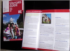
Visitor Guide and neighborhood descriptions from the Official Visitors Map, published by Destination DC.
In the blog entry "Georgetown: A subtle but important difference between branding and identity-positioning" I commented about the Montreal Tourism guidebook and contrasted it with the DC "Official Visitors Guide."
While the Montreal guide does have master listings by categories such as restaurants and shopping, for the most part the guide is organized by neighborhood/district, with descriptions of the major attractions in the neighborhood, and a map, showing where the attractions are located, and transit stations.
For the most part, the DC "Official Visitors Guide" provides alphabetical listings by categories, which isn't too helpful when you are trying to organize your trip according to the places that you are going. Although the DC "Official Visitors Map" does have a 3 panel description of neighborhoods, but doesn't really provide much information.
It is not uncommon for the local chapter of national associations to prepare area guides for national urban-architecture related conferences held in their locale. For example (although I have lost it by now), for the Congress for the New Urbanism conference in DC in 2003, the overview guide included an incredible discussion of the L'Enfant Plan and how it has shaped Washington.
These types of guides are potentially incredible resources that are produced pretty much without the assistance of the local convention and visitors bureau (Destination DC). But for the most part, the learning and effort isn't captured and retained and used beyond the duration of the particular conference for which the guide is produced.
The Potomac Chapter of the American Society of Landscape Architects has prepared a masterful guide to DC (with some inclusion of areas outside of the city).
-- City Guide (Potomac Chapter, ASLA)
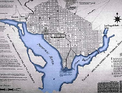
It starts with a two page map/discussion of how the city is organized by quadrant, and how to get around by subway, bus, car, and on foot and by bike. Following that is a too short discussion of the L'Enfant Plan, although they probably figure every attendee learned about the L'Enfant Plan in college, given that they are landscape architects.

L'Enfant Plan, City of Washington, District of Columbia, c. 1791.
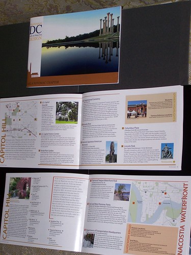
In addition to sections on the National Mall, the guide is organized by neighborhood/city district. Of course, each section focuses mostly on buildings, sites, and landscapes that would appeal to landscape architects. But each section also has a small map, a call out box listing other neighborhood highlights and attractions that aren't related to landscape architecture, and lists restaurants.
Basically, it's organized a lot like the Montreal Tourism Guide, which as I have pointed out already, is incredibly well done.
Frankly, it's a far better neighborhood oriented tourism piece than anything produced by Destination DC, which should try to license it, and should look to the local chapters of architecture/planning organizations for similar items that can be reused and adapted for broader use, usage that lasts beyond the few days of a conference.

DC City Guide produced by the Potomac Chapter of the American Society of Landscape Architects. Shown is the cover and the 3-page section on the Capitol Hill neighborhood, plus the first page of the section on the Anacostia Waterfront.
Labels: branding-identity, city-regional branding, commercial district revitalization planning, cultural heritage/tourism, cultural planning, destination management, urban design/placemaking


0 Comments:
Post a Comment
<< Home