Update to the Paul J. Meissner produced integrated high capacity transit map for the Washington metropolitan area
Earlier this year, Paul Meissner, a transit and urbanism advocate, and more recently a member of the WMATA Rider's Advisory Council, worked with me to create two different transit maps. The point was to use them to discuss various transit issues, although I haven't written all the various intended posts at this point.
Washington area integrated rail transit map
The WMATA Metrorail map is probably the metropolitan area's most commonly understood graphic design product, but the problem is that it only shows the subway lines. This map would be more useful if it also included the regional railroad commuting services.
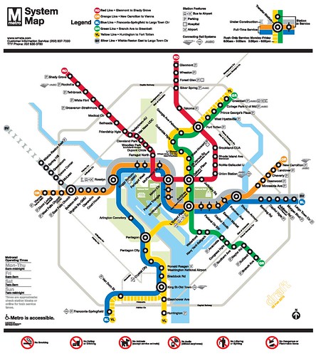
It is common in other cities with more frequent passenger rail service to have integrated map products showing railroad, subway, and light rail/tram services in one map or a set of companion maps. That it doesn't do so is in large part the result of the fact that the DC area's transit services are balkanized in terms of operation and planning.
In the DC area, Metrorail, MARC, and VRE each publish their own maps with limited depiction of the other services, although Maryland Transit Administration produces an integrated map for the Baltimore area.
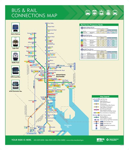
So Paul produced an integrated rail transit map for the Washington metropolitan area, showing not just the Metrorail heavy rail system and its six lines, but also other railroad services--primary the MARC (Maryland and West Virginia) and VRE (Northern Virginia) systems, but also streetcar.
I used the map to illustrate these entries:
-- "The real question to ask isn't "What to do about WMATA?": The maps"
-- "The answer is: Create a single multi-state/regional multi-modal transit planning, management, and operations authority association"
-- "Don't over focus on "fixing" the WMATA Compact. Instead create a new Regional Transit Compact, of which WMATA is one component"
That map didn't show the Purple Line light rail program for Montgomery and Prince George's Counties Maryland, which because of various controversies and legal actions, there was some doubt that the project would proceed.
Since the Courts recently gave the Federal Transit Administration the go ahead to proceed after having delayed the project in the face of a case filed against the project, and how subsequently Maryland and the US Department of Transportation signed a funding agreement, the Purple Line is moving forward and therefore should be included on the "current and under construction transit services" map.
As shown below, Paul has redone the map to include the Purple Line. The sections of lines that are under construction are shown in as hatch marked. Solid (black) blocks denote stations operating currently while white (empty) blocks show future stations.
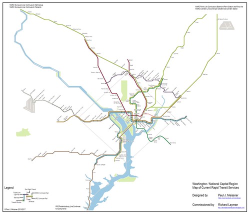
Integrated rail transit map for the Washington DC Metropolitan area, including the Purple Line light rail routing, produced by Paul J. Meissner.
Washington/National Capital Region Map of Future (Potential) Rapid Transit Services
The second map Paul produced is a "fantasy" map, with other ideas for expanding the rail-based transit system in the region.

The basic idea was to shape the map with some general but also somewhat objective organizing principles. It wasn't just about drawing lines on a map, but aiming to serve high use destinations, which is necessary to justify the heavy public investment in this type of transportation infrastructure.
Second, the more recent proposal of the Metro Forward transit expansion program doesn't do all that much for DC, so we need a better plan for transit expansion that serves city interests. Arguably, that program's recommendations were "satisficed" to focus on those expansions that could win unanimous support.
Third, it was about trying to separate the blue and silver lines, and to some extent the yellow and green lines, to reduce "interlining" which ends up reducing capacity and decreasing reliability (see the discussion of this point here, "More on Redundancy, engineered resilience, and subway systems: Metrorail failures will increase without adding capacity in the core").
Fourth, at the same time using the separation of the lines to add capacity and service and intensification of land use by using the changes to bring about more high capacity service to more areas. And to intensify service by providing infill lines and stations. Some of this is by extending some of the lines outward, and some is by adding lines within the current system footprint.
In the original map, it would add 22 Metrorail stations to Northern Virginia, 27 stations in DC, and 21 new Metrorail stations in Maryland.
We must acknowledge that this map was mostly focused on heavy rail service extension and intensification. We didn't try to go at passenger rail service extension and expansion at the same level of detail, although it does add some train stations, and proposes a first step at merging MARC and VRE by starting with the MARC Penn Line and the VRE Fredericksburg Line ("A new backbone for the regional transit system: merging the MARC Penn and VRE Fredericksburg Lines").
Ideas for expanding the railroad system start with a map that Dan Malouff of BeyondDC produced many years ago.
This is Dan's map.
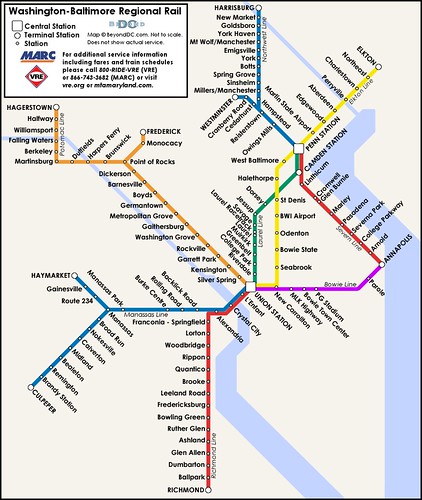
But I'd more to this map now, such as a line from DC to Southern Maryland, especially Charles County, and a line between Baltimore and Frederick.
And concurrently with Paul's mapmaking, Maryland announced plans to work with Delaware to provide "commuter rail" service connections between the end of the MARC line in Perryville, Maryland to either Newark or Wilmington, Delaware, where it would connect with SEPTA-provided commuter rail service.
And at the April Virginia Association of Rail Patrons meeting, VARP board member Rafi Guroian presented interesting ideas about expanding and intensifying the intra-Virginia railroad passenger service program that ought to be incorporated as well.
For Paul it was about using recommendations from adopted plans, as well as some key vision points, the likelihood of happening
It was something of a push-pull effort working out the "final map." Paul had his own ideas too, so the final product is kind of a negotiation. It didn't include some elements that I wanted, such as a Purple Line extension to the Tysons district of Fairfax County, hypothesized in the original map of the Purple Line, because light rail at such a distance is very slow. It would need to be given a separate right of way/tunnelized to be fast enough to motivate people to take it.
I have written about the fantasy map in three different pieces:
-- "Setting the stage for the Purple Line light rail line to be an overwhelming success: Part 2 | proposed parallel improvements across the transit network," although I didn't use the map to illustrate this piece, the concept of a program of wide ranging and wide reaching transit improvements influenced the concepts outlined within
-- "A new backbone for the regional transit system: merging the MARC Penn and VRE Fredericksburg Lines"
-- "Using the Silver Line as the priming event, what would a transit network improvement program look like for NoVA?"
But I still haven't written about it in terms of DC specifically, or Maryland, which I need to do.
Extension of the blue and/or yellow lines to Woodbridge
Something that came up in a conversation in the last week is something we hadn't discussed in the original mapmaking process, whether or not Metrorail service should be extended to Woodbridge in Prince William County.
It makes sense to consider because it is a major population center, and in the context of "corridor management" of transportation in the I-95 corridor.
It's also a good time to bring it up in the context of Virginia's current long range transportation planning process which has been holding meetings across the state and Virginia's ongoing Atlantic Gateway corridor management program for this corridor.
On the other hand, VRE service is a part of service in this corridor already, and it seemed "duplicative" to include both VRE and Metrorail service. That's why we didn't include it in the original mapmaking development process.
Metrorail, like BART in San Francisco, is a hybrid transit service, providing both long distance "commuter rail" like service but via "heavy rail" not railroad passenger service, and intra-metropolitan transit service over short and longer distances. In the core of the area, Metrorail functions as a subway, while on the outer reaches of the system it functions more like commuter rail.
Metrorail service would allow the development of a more intensified intra-area and bi-directional transit program, whereas the VRE railroad passenger service is one dimensional--to DC in the morning and back to Virginia from DC in the evening.
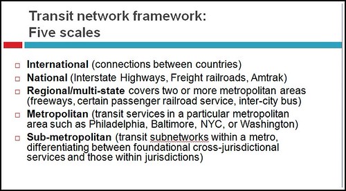
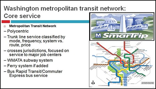
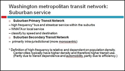
Thinking about transit service at different scales ("Metropolitan Mass Transit Planning: Towards a Hierarchical and Conceptual Framework") is why it may make sense to have both longer distance railroad services complemented by shorter distance heavy rail service, even though the ultimate destination of each service would be the same place.
The Fantasy map proposes an extension of the Yellow Line to Fort Belvoir, adding four stations in the US 1 corridor. The fantasy map extends the Yellow Line by about 11 miles. With a Yellow Line extension, it would be another 9 miles to Woodbridge. By contrast, to extend the Blue Line from Franconia-Springfield Metrorail Station would be just over 12 miles.
Comments appreciated.
Labels: fixed rail transit service, railroads, sustainable mobility platform, transportation planning, urban design/placemaking


4 Comments:
The fantasy map has some serious branching and reverse-branching problems for Metrorail that will exacerbate the current system's design flaws (too many lines sharing the same tracks, limiting capacity and hurting reliability).
The Green line has two southern branches, plus shared service with the yellow line (which still shares tracks with other services in VA). Not an great combination.
Same thing with the Pink line concept - what good does the separated Silver line do for you in Georgetown if it's paired with a service that is also unable to make the full use of the new track capacity built for it? Likewise, why route this line down to the Mall and avoid the job-heavy (and thus transit-user-heavy) land uses in Downtown?
Some service extensions seem entirely redundant. Extending the Green line north seems completely pointless if MARC's Camden line is upgraded to any sort of decent transit frequency.
Lots of deep suburban extensions; and those should never happen without guarantees of massive transit-oriented development. Extending subway-level infrastructure that far demands approriately dense land use.
I don't know that the geographically accurate map is helpful to see the actual network at the core of the system.
1. I agree about the branching problem. Paul and I didn't fully agree about separating the lines.
There is the issue of "one seat ride" which I agreed he could prioritize. That's why the blue line stays interlined within DC.
I thought that the lines, to the extent possible, should not interline. I think it's fair to say that interlining with a two track configuration spreads failure rather than contains it and because of the switching issue, reduces capacity.
However, I was ok with branching particular lines. I think that depending on the branching, it wouldn't seriously reduce overall use (not capacity), without having the same kinds of problems posed by interlining.
So yes, lines like Silver and Pink shouldn't interline. Maybe they wouldn't even in this design, by the use of stacked tunnels in what would otherwise appear to be interlined sections.
2. There is the tension on extending outward, which is the root of the criticism of the polycentric nature of the system.
Agreeing to do it depends on whether or not it can capture a fair amount of traffic, is accompanied by massive TDM programming, and various other integrated improvements along the lines of what I suggested for NoVA and the Purple Line in previous posts.
And yes, only if it is accompanied by changes in intensification/TOD.
Related to your point, while PGC talks a good game about "smart growth," it doesn't back it up. It's primary development priorities are Konterra and National Harbor. Neither is well served by transit. Konterra is far out while National Harbor shouldn't have been approved without the extension of high capacity transit service to the site.
I agree with you about the issue of redundancy between train and "subway" such as Green Line vs. MARC Camden and VRE vs. an extension of Blue/Yellow.
However, it can be justifiable depending on the nature and scale of the infrastructure, if it is used to capture and shift motor vehicle trips, promote intensification, etc.
Given sprawl, I'd say that a blue/yellow extension to Woodbridge probably makes sense, while the low likelihood of intensification beyond Laurel may not justify extension of the Green Line beyond Laurel.
3. FWIW, having an integrated map is one thing. Whether or not it "should" be geographically accurate or an iconic representation is another issue entirely.
Paul's map is one way of doing it. The Hamburg map is another.
I think we can agree that this map is more for planning than public presentation more generally.
I'd say then that planning oriented maps should probably lean to the geographically accurate while maps for public use can be iconographic, in the way that the London Underground map is known.
The Hamburg map does this for subway and various forms of railroad service. They don't have tram service.
Paris combines Metro, RER, and tram.
http://www.projectmapping.co.uk/Europe%20World/Resources/Paris%20Metro-RER.jpg
It sure is complicated.
So you can see the value of why London and New York separate subway and rail maps, although the printed NYC Transit map has the subway on one side and the regional rail on the other.
to clarify, I am ok with adding branches to lines that aren't interlined.
again, Hamburg map one of the best for subway + all forms of rail
http://www.hvv.de/pdf/plaene/hvv_linienplan_schnellbahnplan_usar.pdf
It's iconographic not geographically accurate.
London's map is very good too. I think it's more complex compared to Hamburg, but so is the system.
http://content.tfl.gov.uk/standard-tube-map.pdf
Post a Comment
<< Home