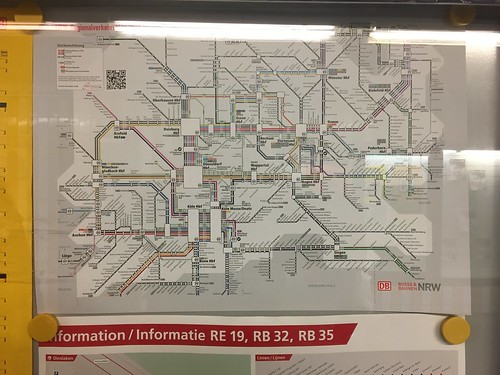
Steve Vance photo of the integrated passenger railroad network within North Rhine Westphalia state in Germany
When I was in NRW a few years ago, I never came across such a map, which is very cool. It looks like he saw it at the Dusseldorf main railroad station. I don't recall seeing such a map in Essen.
Looking at it more closely, it's a map of the intra-state railroad services, both long distance and "local," the metropolitan area suburban commuter railroad services called the S-Bahn. As he points out, the map doesn't include the intra-metropolitan area scaled transit services.
I imagine Deutsche Bahn has comparable maps for other states across Germany.
In my typology of the transit network ("Reprint (with editing): The Meta-Regional Transit Network," 2009), I'd call this a depiction of the regional transit network, at the full scale of a state.

Labels: fixed rail transit service, railroads, sustainable mobility platform, transportation planning


0 Comments:
Post a Comment
<< Home