Reprint (with editing): The Meta-Regional Transit Network
In the entry, "Second iteration, idealized national network for high speed rail passenger service," I discussed how transportation planning within the U.S. should occur on five distinct but interconnected levels:
- international (connections between countries);
- national (such as the Interstate Highway system or the proposed High Speed Rail Initiative);
- regional or multi-state (freeways sure but also railroads, such as passenger railroad service in NY, CT, NJ, and PA);
- metropolitan such as the subway and bus system for the Washington metropolitan region, which is anchored by the WMATA system and the VRE and MARC railroads; and is supplemented by
- submetropolitan transit networks at the suburban and city levels.
This framework is an extension of my other writings about the transit network within metropolitan areas. (Which in turn is an extension of ideas expressed within the Transit Element of the Arlington County Master Transportation Plan.) But when I first wrote about it, because I was more focused on the spatial scale within a metropolitan area, I called it the "regional" network. It is, but in the context of interconnected transit networks, it should have been termed "metropolitan" in scale, rather than regional.
So this is reprinted (with a couple other fixes) to correct the mistake in word choice, to make the language consistent between the scales of local, metropolitan, regional, national, and international transit networks.
A framework for an all encompassing DC-MD-VA transit network
Meta (or Multi-state) Regional Transit Network: MARC and VRE service ideally combined into one multi-state compact and system, with service as far south as Norfolk and as far north as Wilmington, DE and Harrisburg, PA, and west to Charlottesville, VA (or beyond), with intermodal stations connecting to heavy and light rail transit systems; supplemented by Amtrak. This could include railroad and water-based transportation.

(The model is the LIRR and Metro-North railroad system in the New York City region, which is managed by the Metropolitan Transportation Authority of New York, and runs 24/7/365.)
Washington Metropolitan Transit Network: Regional WMATA subway system; ferry system if added; cross-jurisdictional bus rapid transit; commuter services oriented to moving people between the jurisdiction and major job centers within the region, across jurisdictional boundaries (i.e., OmniRide from Prince William County, which provides commuter-oriented service to Metro stations and job centers, with an end point in DC [and back] or the MTA Commuter buses in Maryland).
Suburban Primary Transit Network: transit systems operated by Counties and Cities in the Washington region providing bus, streetcar, and lightrail service within the suburbs, and connections to stations within the metropolitan transit network. Transit service in this category is classified by speed and destination.

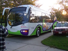
Montgomery County's RideOn bus system is one of the more successful suburban transit systems in the United States. I don't think it provides cross-jurisdictional service, other than service along Western Avenue (which technically is 100% in DC), maybe Eastern Avenue, and to the Takoma Metro station and in the Langley Park area of Prince George's County. Photo from BeyondDC
.

Rendering, streetcar service on Columbia Pike, Arlington and Fairfax Counties, Virginia.
Suburban Secondary Transit Network: service within cities (i.e., Falls Church, Alexandria) and counties (PG, Montgomery, Arlington, Fairfax) that is intra-jurisdictional.
DC Primary Transit Network: Core of the WMATA system in DC (29 stations); streetcar system; Downtown Circulator bus service; Georgetown Connector shuttle service; cross-border WMATA bus service; bus rapid/"rapider" transit.
DC Secondary Transit Network: the other 11 subway stations in the city; other WMATA bus service within the city; water taxi service if added, depending on the routes.
DC Tertiary Transit Network: intra-neighborhood bus services. Maybe private shuttle services (i.e., Washington Hospital Center to/from Brookland Metro, university shuttle services, etc.). (The model for this type of service would be the Tempe, Arizona Orbit bus service, see "Earth Day and Neighborhood Transit.")

The subway stations at the core of the city of Washington comprise the foundation of the DC Primary Transit Network.
Note that if the two new subway lines were added in the city, as proposed on the map below, then this would change the definition of the core of the DC Primary Transit Network considerably.

Conceptual map for transit expansion in the DC. Map courtesy of David Alpert, Greater Greater Washington.
Other cities in the multistate region can be incorporated into this broad framework quite simply. The meta regional network is at the top of the hierarchy, then there are metropolitan networks, divided into broad tranches within the respective metropolitan region, separated into the suburban transit network and the center city network. The center city is likely to have the densest network of service, with as many as three subnetworks (primary, secondary, and tertiary, as outlined for DC above).
Baltimore Metropolitan Transit Network: light rail; cross-jurisdictional bus rapid transit; commuter services oriented to moving people between the jurisdiction and major job centers within the region, across jurisdictional boundaries.
Baltimore Suburban Primary and Secondary Transit Networks: (however they may be differentiated), but hubs for organizing service within the system are set by the transitshed of the Light Rail and MARC lines, and the mobilityshed of individual stations.
Baltimore City Primary and Secondary Transit Networks: Primary: subway, light rail, cross city buses. Secondary: other bus service, water taxi, aerial tram. They could set up a tertiary system as suggested above for DC. Etc.
The new Baltimore Circulator bus will provide free service.
Similarly, Richmond's GRTC provides some service oriented to commuters located some distance from the city, such as between Petersburg and Richmond, and between Richmond and Fredericksburg, the latter to connect to the VRE.
Were I to create an organizational chart, the top level would be the meta regional transit network; the four major metropolitan regions in the tri-state region: Baltimore, Hampton Roads, Richmond; and Washington would have boxes on the next level; and the third level of the chart would show other areas deemed metropolitan regions, but are at a significantly smaller scale, such as Hagerstown and Charlottesville.
Regions that might normally be listed on the third level of the chart such as Petersburg, Fredericksburg, Frederick, even Harpers Ferry-Charles Town, could also be listed in a fashion subsidiary to major regions, i.e., Petersburg to Richmond, Fredericksburg to DC, Frederick to DC and/or Baltimore (although BeyondDC describes Frederick as now a suburb of Gaithersburg), Annapolis to DC and Baltimore, etc.
Under each Metropolitan region there would be organizational levels for the suburban network; under which the primary and secondary networks would be listed, with separate boxes under the secondary network for each intra-jurisdicational service; and the center city transit network, under which the center city primary, secondary, and tertiary networks would be listed.
Labels: mobility, regional planning, sustainable land use and resource planning, transit, transportation planning
posted by Richard Layman @ 5:07 AM&Permanent Link
![]()
![]()


0 Comments:
Post a Comment
<< Home