A gap in planning across agencies: Prioritizing park access for pedestrians, bicyclists and transit users compared to motor vehicle access
=====
This entry on access to parks as a planning issue is in response to the comment thread on the previous entry ("Lost opportunity to build cycletrack on Military Road"
=====
DC was created by the federal government to be the national capital and for most of the city's history, until the early 1970s, the city was run by the federal government. Certain functions, especially parks, were managed by federal agencies. The water system was run by the Army Corps of Engineers, and parks by the National Park Service, etc.
One of the results is that even after devolution and the creation of a locally elected government, most of the large park spaces in the city remain owned and operated by the National Park Service, not the local DC Department of Parks and Recreation.
DPR mostly focuses on neighborhood-serving facilities, usually anchored by a recreation center, and focused on team sports. They are active recreation facilities, not what we would think of as "regional parks," with both active and passive functions.
Even so, many interstitial spaces, such as the park spaces in traffic circles, remain under the control of NPS.
And small parks planning at the neighborhood-mixed use district level is typically neglected ("The layering effect," "NoMA revisited: business planning to build community" and "Parks: maintenance, budgeting and contingency planning") by the Office of Planning--remember that DPR is out of the picture as an effective planning agency, although the DC Department of Transportation seems to take on such projects sometimes, but not as part of a comprehensive parks and recreation plan for an entire neighborhood.
Examples of exemplary DDOT efforts include the spray park/Columbia Heights Plaza and the reconstruction of Thomas Circle. The Starburst Plaza too, but it is poorly situated in terms of "H Street" and mostly functions as a super-big bus waiting area.
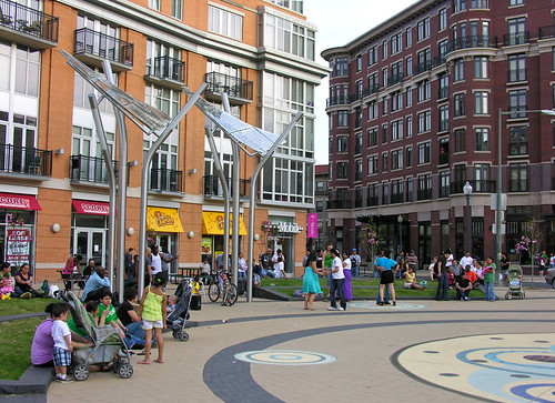
An Evening at Columbia Heights Civic Plaza in Washington, DC. Flickr photo by otavio_dc.
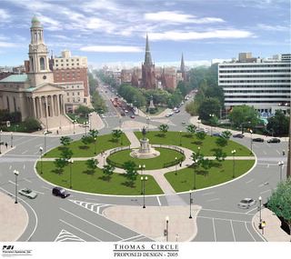
Thomas Circle was reconstructed--it had been carved up in the 1950s to provide more lanes for motor vehicle traffic--around 2005.
Generally, "Local" parks master plans usually fail to address matters concerning county, state, and federal parks within their jurisdictions. In terms of my thinking about parks planning and potential conflict between agencies and jurisdictions, the situation in DC is one of the primary reasons I argue that "local parks master plans" need to provide guidance and contingency planning for all the major parks and open spaces within its jurisdiction, regardless of who owns and operates a particular park, because otherwise, local resident-citizen needs and input can be significantly underrepresented.
If the local government won't represent citizen interests, too often, neither will anyone else.
These past blog entries discuss the issue of parks planning in the context of parks controlled by multiple jurisdictions:
-- "How surveys based on gross data can be very misleading: DC and parks" (this piece discusses the issue in terms of a framework and is a response to how surveys using gross data over-rate DC's park situation)
-- "Federal shutdown as another example of why local jurisdictions should have more robust contingency and master planning processes"
-- "Parks issues"
-- "National Parks Week"
-- "Local parks planning, the USDA's National Arboretum, and the Friends of the National Arboretum"
Note that the reason this occurs is because plans are usually more kind of "asset management" programs for particular agencies, rather than broader topic/theme-based plans covering a subject area comprehensively and creatively. Plus, agencies don't like putting in plans recommendations for agencies "above" them, like state or federal agencies.
(I was proud of a recommendation that stayed in the plan I did in Baltimore County, calling for a joint planning effort by the county, City of Baltimore, and State Parks agency to jointly plan and manage biking issues across three separately controlled but contiguous parks.)
Given that state budget cuts often affect parks, local governments should have contingency plans in place so that they are prepared for those times when circumstances change, so that they can protect local concerns with regard to "state" parks operating within their jurisdictions, especially when they are threatened by closure.
DC parks planning capacity is stunted. As a result of federal control, DC is underdeveloped in terms of its own capacity for parks planning. There have been two efforts over the past 12 years to create a parks master plan. One at the tail end of the Williams Administration was never effectuated, although a plan was produced.
Note that another parks planning process started during the Gray Administration--they even chose the parks planning consulting firm I recommended-- is still underway but I am not sure where it's at as well as whether or not they acknowledged my criticism about the need to focus more broadly on this issue and others. Instead, the scope of work--in my opinion anyway--seemed overly focused on "recreation" and related facilities.
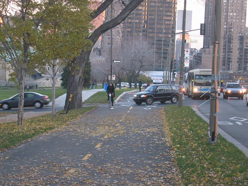
The failure to construct a cycletrack on Military Road as a bike-transportation planning failure. The previous entry ("Lost opportunity to build cycletrack on Military Road") focuses on the impact on transportational cycling from the failure to construct a cycletrack on Military Road NW in association with the just about completed major reconstruction and resurfacing project.
One commenter made the point that a cycletrack for this stretch of road is listed as a priority in the city transportation plan, which was approved by City Council in 2014. Oops. I'm sure the response will be that the design and engineering and bids for reconstructing the road happened long before the new plan was created and approved.
Even so, it is a major failure on the part of DDOT and NPS to not recognize the opportunity to address a major gap in the bicycle mobility network. That gap should have been evident whether or not it was identified in the previous plan.
The failure to construct a cycletrack on Military Road as a park access planning failure. Commenter Tom Quinn pointed out the issue is bigger than better east-west access, a cycletrack on Military Road would also make the park more accessible more generally, and is representative of a broader, structural failure to ensure convenient access to the city's parks for pedestrians, bicyclists, and by extension transit users.
He writes:
What Richard left out of the piece is that the Upper reaches of Rock Creek Park are mostly accessible now via automobile which is ridiculous and terrible policy so a bike lane on Military (or Broad Branch) is not just about creating an East-West bike path but also about improving access to RCP which is great for recreational use but also for commuting to points south.For pedestrians, cyclists, and transit users, access to many DC parks is substandard. Tom's point is extended by entries in GGW more recently ("A more accessible Anacostia Park would mean a healthier community" and "It's nearly impossible to get into one of DC's national parks by foot or bike") and four years ago about the lack of direct access from DC to Theodore Roosevelt Park in the middle of the Potomac River, which can only be accessed by bridge from Virginia ("Give DC residents access to Roosevelt Island with a ferry"), reiterate the point that more specific guidance is required for improving access for modes other than the automobile to DC's biggest parks.
Clearly, we can't expect the National Park Service to plan adequately for local needs. That's not what they do, even if they are beginning to recognize the fundamental difference between urban parks and large more wild national parks out west.
Examples of failures to be proactive include lighting in traffic circle parks--for example, Sherman Circle wasn't lit until after someone was murdered in the vicinity and in response to public outcry ("Murder Conviction in Sherman Circle Shooting," NBC4; ,"Norton to take part in ribbon cutting for new Sherman Circle lights," press release) and the difficulty in getting the Park Service to assist in the creation of the Metropolitan Branch Trail in the vicinity of Fort Totten, a Civil War-era "Fort Circle" park administered by the Rock Creek Park unit.

Note that while Virginia has developed a 55-mile bike path between Williamsburg and Richmond in 10 years, it is taking DC about 30 years to develop the Metropolitan Branch Trail from Montgomery County to Union Station, a distance of 8 miles or 1/7 of the length of the Virginia Capital Trail. While part of the problem has been prioritizing the project, a not insignificant part of the delay has to do with the need to utilize Park Service land for key segments.
-- Washington, D.C.: Metropolitan Greenways and Circulation Systems (May 2001), FHWA
As importantly, NPS is seriously underfunded, so addressing local needs for federal parks in DC competes for funding against all of the other federal parks across the country (National Park Service delayed $11 billion in maintenance," Washington Post).
DC local government must acknowledge and take on responsibility for planning for multi-modal access to parks and open spaces in the city, especially for NPS parks and the USDA National Arboretum.
DC's comprehensive land use, transportation, and parks plans should address sustainable mobility access for all relevant spaces in the city, regardless of ownership, management, and control.
DC must also commit to plan, fund, and build accordingly, because we can't expect the federal government to address these needs in a timely manner.
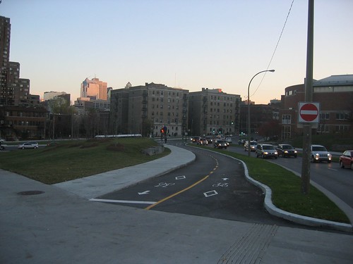
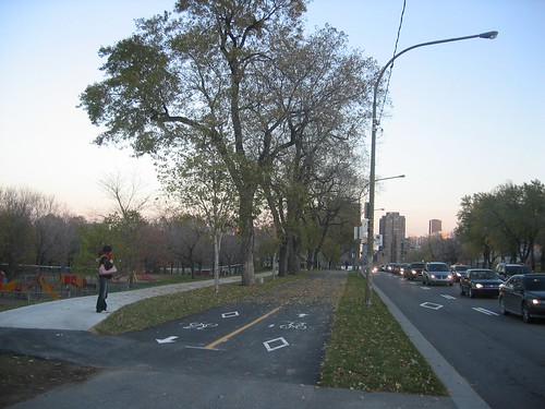
Montreal as a model for bicycle access to and within parks. In terms of bicycling access, Montreal's network of cycle tracks, both on streets and to and from parks, and within parks, is a model for DC. Montreal (and the Province of Quebec) has the most extensive cycle track and bike path ("piste cyclable") network in North America.
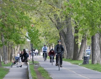
Piste cyclable/cycle track within Parc LaFontaine, Montreal. Montreal Gazette photo.
Even there, it's not always perfect. For example, the Rachel Street East cycle track bordering Park La Fontaine had design issues which contributed to accidents. But the path has been redesigned, with a concrete median added, along with widening and other improvements such as trees, which will provide shade ("Rachel St. no longer collision trap," Montreal Gazette).
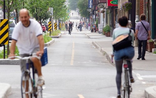
Rue Rachel/Rachel Street cycletrack. Allan McInnis, Montreal Gazette.
Still, bike access to and from and within Park La Fontaine is a good illustration to DC and the National Park Service of how to provide great bike access to major parks within a city at the single park scale, while the general practice within Montreal and the province shows the value of a more extensive bikeway network, which should be a top priority for DC both transportationally and in terms of providing multiple ways for people to access "local" parks.
Parc Avenue bike path. Image from Cycling Fun in Montreal blog.
The rebuilt Parc/Pine (pins) intersection, with new bike path. Image from Cycling Fun in Montreal blog.
Parc avenue bike path. Image from Cycling Fun in Montreal blog.
Planning for access by foot and transit. And of course, equivalently robust access needs to be provided for people on foot, and by transit as needed and identified. The comment thread in the above-cited GGW entry, "It's nearly impossible to get into one of DC's national parks by foot or bike," has many good suggestions for pedestrian access to the C&O Canal National Park. But this consideration needs to be extended systematically to all of the federal park spaces in the city, not just that one park.

WRT the above-mentioned issue of Roosevelt Park, while it is pretty small compared to Governors Island in New York City, access to the latter park has been facilitated by the creation of a ferry system run by the National Park Service (But probably access could be integrated from Memorial Bridge as well.)
Transit access. Transit access is important too, because many of the city's NPS parks are situated at the edges of the city, and they can be hard to reach. Once you're there, access on foot or bicycle may be decent, but getting there is a problem. Transit access would facilitate park use.
Past writings on transit access and the National Mall include "A National Mall-focused heritage (replica) streetcar service to serve visitors is a way bigger idea than a parking garage under the Mall" and "New DC Circulator route serving National Mall reminds us that we are neglecting connections from west to east and fail to adequately connect Georgetown to the National Mall."
Again, this issue should be considered more broadly, beyond the National Mall, across the network of park assets in the city.
Labels: bicycle and pedestrian planning, parks planning, sustainable transportation, transit accessibility, transportation planning, urban design/placemaking
posted by Richard Layman @ 11:00 AM&Permanent Link
![]()
![]()


5 Comments:
http://flh.fhwa.dot.gov/programs/flap/dc/
Federal Lands Access Program provides about $1.3MM/year for DC-based projects.
Article in the Guardian about accessing certain UK national parks by public transportation, includes a water bus, a Sherpa bus that stops at multiple places for 5 pounds/day, and a great brochure for the South Downs park which goes through the various public transportation connections to different sections of the park.
https://www.theguardian.com/travel/2019/apr/08/how-to-see-five-uk-national-parks-by-public-transport-walkers
"Two gems of Golden Gate Park will be free for S.F. residents — and more expensive for tourists"
https://www.sfchronicle.com/sf/article/Two-gems-of-Golden-Gate-Park-will-be-free-for-16987502.php
3/8/2022
https://ecos.fws.gov/ServCat/DownloadFile/170659
Urban Transportation Connections Study
for the Detroit River International Wildlife Refuge
This is about a museum in Hong Kong, not a park, but in a rare example, the author mentions that both bus and heavy rail access to the museum is very difficult.
A throbbing neon powerhouse: Hong Kong’s gigantic new billboard – with a nice museum attached
https://www.theguardian.com/artanddesign/2024/jan/23/neon-powerhouse-hong-kongs-gigantic-billboard-museum-m-herzog-de-meuron
A related example is how after the opening of the Guggenheim Museum in Bilbao, they realized that surface connections between the museum and the subway system were disjoint. They ended up creating a streetcar system between the subway, the museum and other destinations.
Post a Comment
<< Home