Systematic neighborhood engagement
I mention from time to time my belief that neighborhoods should create their own plans, or at least, develop a systematic understanding of their places, in order to be proactive. I keep meaning to write about this, listing a variety of survey forms that I like to use, or tools that structure how I think about and approach other places for assessment purposes.

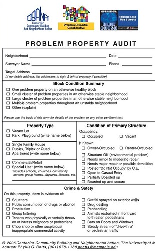
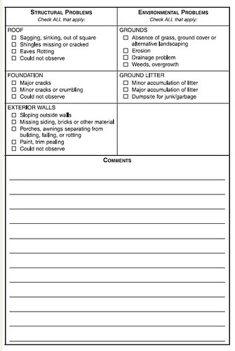
1. Problem property audit (University of Memphis)
2. NYC BID Needs Survey
3. Litter Survey Form from Keep Australia Beautiful (adding a couple things makes this an excellent overall public space evaluation tool -- gum and other markings on sidewalks, graffiti--on street signs and buildings, and signs posted in the public space)
4. Open space survey tools such as the Community Gardening Survey Form from the Garden Mosaics program at Cornell University
and for evaluating development proposals
4. Urban Design Evaluation Tool & Glossary of Terms from the Design Advocacy Center (Philadelphia)
5. Community Design Assessment: A Citizens' Planning Guide from the National Trust for Historic Preservation. (It comes with the assessment form on CD.)
There is an article, "Voices of Freedom," in today's Society Guardian about citizen journalism, and among the mentions is this website, NeighbourhoodFixit.com, which provides a good model for neighborhoods tracking issues.
The DC City Government does this through the Service Request Center, but it isn't systematic--merely based on what is reported, and they don't appear to make the data available publicly.

The other "tool" I use is based on work done for HUD in the 1970s, and used by most jurisdictions around the country. In a way it's pretty basic, you assess neighborhoods based on whether the neighborhoods are:
1. Healthy
2. Transitioning
3. Emerging
4. Distressed.
I think this works for communities with at least 30-50,000 population and higher. (I think the researchers contracted by HUD came up with 5 categories. Philadelphia uses 6. DC 4--although they don't necessarily use the same terms to classify neighborhoods. Charles Buki uses 3 categories. But I think 6 is probably the best, or you can have high medium and low grades within each stage.)
But, you need to do three other things, which most places (including DC) don't do:
1. Evaluate separately and simultaneously the commercial district and the residential parts of the neighborhood -- your ability to move the commercial district up the ladder is dependent on the density and economic capacity of the residents. (And with regard to traditional community development strategies-- building more housing--not usually working, it's because more housing for lower income people isn't the strategy necessary to build the economic capacity of the neighborhood, it's building the base of microenterprises employing neighborhood residents and rebuilding the commercial district, see the Community Economic Development Handbook by Temali.)
2. You can also use the general criteria to evaluate places block-by-block as well, to help develop more focused strategies for specific needs.
3. Overall, cities should develop differential policies for places based on this criteria. (This is something I am gonna write up tomorrow probably, in regards to Baltimore's proposal to make neighborhood corner stores illegal.)
Point (3) is crucial and the cause of most failures in government policies and programs. By creating one size fits all programs, and not really understanding the nuances and details of a place, and the levers at your disposal, failure is much more likely.
E.g., emerging and distressed commercial districts aren't likely ready for street furniture, and need more assistance in developing organizational capacity, compared to healthy districts, or those in later stages of transition. Similarly, it's much harder to move distressed commercial districts up the ladder when the residential neighborhood is also distressed.
There are more techniques I use, but I need to write them up into a monograph...
And speaking of credit, Rachel MacCleery, the then Ward 6 Transportation Planner, and I figured this out together, that commercial districts and residential areas need to be separately and simultaneously evaluated, in order to figure out the likelihood of success.
We were trying to figure out why the investment in streetscape improvement "worked so quickly" on Barracks Row -- 8th Street SE. Most people don't really understand that the success there isn't merely a function of the investment, but in the overall condition and economic capacity of the greater neighborhood (within which the investment was made).
Because much of the property in our commercial districts has absentee ownership, improvement in commercial districts tends to lag improving residential areas, unlike the impact of residential improvement on other building owners (see Building Neighborhood Confidence and Understanding Neighborhood Change both by Rolf Goetze, for more insight into this process).

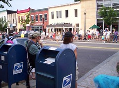
4th of July 2005 on Barracks Row.
Labels: capacity building, civic engagement, good government, neighborhood planning, urban design/placemaking


0 Comments:
Post a Comment
<< Home