Zero lot lines
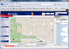
DC Map screen capture, Downtown DC. Beige depicts buildings. Gray depicts city streets. White is public space or interior alley type space that is open.
Definition of zero lot line buildings:
- The construction of a building on any of the boundary lines of a lot, but usually referring to the building facade and lot line presented to the major street on which the lot faces.
Cy Paumier writes in Creating a Vibrant City Center that the pattern of downtowns (central business districts) developed around pedestrian-scaled streets, blocks, and buildings because of:
Concentration and Intensity of Use: "The intensity of development in the traditional central area was relatively high due to the value of the land. Maximizing site coverage meant building close to the street, which created a strong sense of spatial enclosure. Although city center development was dense, construction practices limited building height and preserved a human scale. The consistency in building height and massing reinforced the pedestrian scale of streets, as well as the city center's architectural harmony and visual coherence." (p. 11)
Organizing Structure: "A grid street system, involving the simplest approach to surveying, subdividing, and selling land, created a well-defined, organized, and understandable spatial structure for the cities' architecture and overall development. Because the street provided the main access to the consumer market, competition for street frontage was keen. Development parcels were normally much deeper than they were wide, creating a pattern of relatively narrow building fronts that provided variety and articulation in each block and continuous activity on the street." (p. 12)
The street grid, transportation practices and construction technology of the times, and the cost and value of the land led to a particular form of development on city blocks that focused attention on the streets and sidewalks, creating a human-scaled, architecturally harmonious built environment.
As construction technology advanced and taller buildings could be constructed, and as the walking and transit city was supplanted by the automobile, the scale of block development changed significantly, with a focus away from the pedestrian and towards the car.
Typically in a central business district, a building is constructed at the lot line on at least three sides of the lot. If 100% lot coverage is allowed, then a building could be constructed to the lot line on each side of the building.

Southeast corner, 14th and G Streets NW, Washington, DC. Image from PQ Living.
In order for 14th Street to be widened, to meet the demands of Congressman James Moran of Alexandria and Arlington(Arlington!!!!!!!!!!!!), buildings will have to be torn down on both sides of the street.
Is Congressman Moran really that dense?
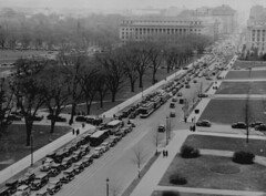
Aerial view of a traffic jam, 14th Street and the Mall, Washington, D.C., 1937.
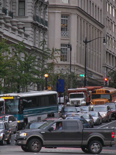
14th Street NW in the evening...
posted by Richard Layman @ 9:01 PM&Permanent Link
![]()
![]()


0 Comments:
Post a Comment
<< Home