Another supermarket retail trade area map
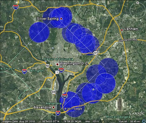
This map shows the retail trade areas of stores located across the DC-Maryland border in either Montgomery or Prince George's Counties, where the retail trade area of the store serves both DC and Maryland. The stores mapped are Giant, Safeway, Shoppers Food Warehouse, and Whole Foods supermarket locations (in the stores along Queens Chapel Road, only the Giant was mapped), plus the Takoma Park-Silver Spring Co-op branch on Grubb Road (but not in Takoma Park) and the Glut Co-op in Mount Rainier. It's possible that I might have missed some store locations in the Capitol Heights area. Independent supermarkets were not mapped. Nor were stores deeper into Montgomery County beyond Friendship Heights (Bethesda).
Labels: commercial district revitalization, economic development, food-agriculture-markets, supermarkets-groceries, tax incentives
posted by Richard Layman @ 8:14 AM&Permanent Link
![]()
![]()


0 Comments:
Post a Comment
<< Home