Rebuilding Place in the Urban Space

"A community’s physical form, rather than its land uses, is its most intrinsic and enduring characteristic." [Katz, EPA] This blog focuses on place and placemaking and all that makes it work--historic preservation, urban design, transportation, asset-based community development, arts & cultural development, commercial district revitalization, tourism & destination development, and quality of life advocacy--along with doses of civic engagement and good governance watchdogging.

Monday, September 23, 2024

I finally figured out how to ride buses in my greater neighborhood in Salt Lake City

Salt Lake City and the core of the County have decent transit, although it's best in the light rail transit shed which I don't live in.

The problem for me is that my mobility mindset is really shaped by the bike and point-to-point movement, that is going directly from origin to destination.

While there are a bunch of bus lines serving my area, and I can get within 5 miles pretty easily riding buses--since my congestive heart failure I am not supposed to drive, and I don't have the stamina to bike--mostly I get driven places.


The problem with point to point thinking is when bus routes aren't point to point.  In the eastern side of the city, the University of Utah Union is a key bus transfer point.  (The campus is also served by 3 light rail stations, and students get free transit access as part of their ID cards.)

But I only know the routes as they are, where I go to and from.  But there are bus stops for two major routes within a few blocks of my house and one of those routes takes me to my hospital.

UTA transfer ticket.

But when the line "breaks" and deviates from the main road, I get hyper and off the bus, to walk to the place where I know I can transfer, back to a different main road.

But it's really hard because of CHF, so I have to stop a lot and rest.

Saturday, after doing this to come back from the 9th and 9th Festival, I realized that my point to point approach doesn't work up here, that it's significantly easier if I go with the flow and when the bus route deviates to go to the University of Utah, so should I, because I can still catch the transfer bus there, and I won't need to walk as much.  It will also shorten many trips for me in terms of time, even if the distance is longer.  From the University website:

A new transit hub, located in front of the Union, will accommodate more frequent UTA bus service coming to campus. The Transit Hub construction project includes: 

• Expanding the bus stop and staging area 

• Relocating the ADA stalls to the pay lot 

• Creating a new entrance to the Union pay lot, which will be located at the north end.  each week.

Being less focused on point to point makes it easier to go to my primary hospital if I have to and other places.  Many of my primary destinations are within a 5 mile distance, and if you use the online transit trackers, pretty easy to get to and from.

Labels:

Tuesday, October 10, 2023

Really cool real time display of the NYC Subway system

 -- Real-Time New York City Subway Map

Labels: ,

Friday, September 23, 2022

In Downtown Logan, Utah, some of the bus stops also provide information on walking

 The London Underground is noteworthy in how it's created a map with a list of walking distances between stations, in part to communicate that in some cases, rather than transfer between lines, it's faster to get out and walk.  They have maps for specific lines, as well as for all the stations in Central London.

Many transit wayfinding maps are typically organized around presenting a walkshed at 1/4, 1/2, and 3/4 mile distances.

Separately, there are walking oriented wayfinding systems like Legible London (which actually is based on the system first created in Bath, England).  Although London uses the same wayfinding system for transit, walking, and biking.


There are "guerilla wayfinding" systems encouraged as an element of tactical urbanism, to call attention to walk distances wrt locally-available amenities.

But I haven't seen bus stops and shelters conceptualized as an element of the walking network, or at least incorporating walking information as well as transit information in one place.  But the Cache Valley Transit District has done that at some--not all--bus stops in Downtown Logan.

It orients riders and tells them in which direction are the major destinations and how long it will take them to get there.


This would be an easy addition to bus stop signs and shelters. And it's a small transit system with a national best practice.

-- "Arlington County's bus shelters and a public realm framework of quality," 2013

Labels: , , , ,

Friday, January 07, 2022

I-95 stories of being stranded communicate that most Americans are unfamiliar with transit

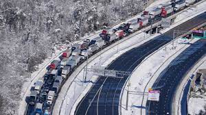
Cars and trucks are stranded on sections of Interstate 95 Tuesday Jan. 4, 2022, near Quantico, Va. Close to 48 miles of the Interstate was closed due to ice and snow. Steve Helber/AP

There are a couple of interesting stories out of the stranding of dozens of cars for not quite a full day on a snowbound I-95 near Fredericksburg, Virginia because of a winter storm earlier in the week ("I-95 reopens in Virginia after winter storm forced closure that stranded motorists," "Calls grow for examinations of Virginia’s response to hours-long I-95 backup," Washington Post).

The first, a guy from California flew into Dulles and then took an Uber (a taxi), from the airport to Richmond, a distance of over 120 miles ("Uber rider stuck on I-95 hit with $600 bill," WTOP radio, "An Uber rider who got stuck in the Virginia traffic jam ended up with a $600 bill," AP)).

The second, a college student took an Uber from Union Station in Washington to Williamsburg, Virginia, a distance of 150 miles ("DaVante Williams, Uber driver stuck on I-95 in Virginia snow storm, honored for helping passenger get home safely," Washington Post).

Who in their right mind would take a "taxi" on trips of that distance, as such a trip should cost hundreds of dollars?

I guess people for whom money is no object--although the dude at Dulles could have taken a connecting flight to Richmond for another $100--or who have almost zero knowledge of non-automobile based mobility--although I think the woman probably took a train that arrived at Union Station, and if so I don't know why she didn't continue the journey by train to Richmond--would take a "taxi" for such long distances.

The guy flying into Dulles could have taken bus + subway ($11) to Union Station and a train ($26) or bus ($15) ride  to Richmond.

The woman at Union Station could have taken a train or bus to Richmond, and a connecting bus to Williamsburg.  

Granted these trips would have taken longer, but would have cost less than $50, as opposed to $200 or more.

But if you don't have any experience taking local buses, subways/heavy rail, trains, or inter city buses, why would you even think to look at those for options?

Local transit is the "gateway" for understanding transit more generally.  If you can figure out how to get around by transit locally, it's not harder--although the options tend to be paltry--to figure out that you can use trains and inter city buses to get around too, at least to complement airplane travel at a minimum.

====

At the same time, this indicates gaps in regional transit options and transportation planning, which I will write about in another post.

Labels: , , , , , ,

Saturday, October 30, 2021

Downtown is not a word without meaning: renaming the Largo Town Center to Downtown Largo is without meaning

Wikipedia photo.

Prince George's County Maryland wants to rename the Largo Town Center station as Largo, Downtown Largo, or Downtown Prince George's County.

-- Proposed Station Name Charge, Largo Town Center, WMATA

Comments are due by 5pm Monday.

The definition of the word Downtown is 

of, in, or characteristic of the central area or main business and commercial area of a town or city.

While PGC is somewhat center-less more generally, the closest it has to a center is New Carrollton, and I've suggested for years that if PGC wants to truly become a "transit oriented development" kind of place, it should re-center its government functions there ("Setting the stage for the Purple Line light rail line to be an overwhelming success: Part 4 | Making over New Carrollton as a transit-centric urban center and Prince George's County's "New Downtown"," 2017, first published 2014).  

Instead, it has the belief it is doing so around Largo and the Largo Town Center Metrorail station, and it has moved a bunch of government agencies there, but few that are citizen-facing.  

Most football stadiums are surrounded by a sea of parking lots and FedEx Field is no exception.

But for the most part, the land uses are de-concentrated, there is a failing retail center ("Redeveloping Largo shopping center aims to be the Pike & Rose of Prince George’s," Washington Business Journal), a new hospital ("University of Maryland could seed a complementary biotechnology and medical education initiative in Prince George's County"), and the FedEx Field stadium is a 1.5 mile walk away.


Rendering for an intensified Largo.

The hospital building is the tallest, but there is nothing that speaks of a concentration of business activity.  

Although to be fair, there is a long term plan for intensification, and the reality that such a plan is a couple decades away from realization -- for example, PGC Planning created a transit oriented development plan for the West Hyattsville station that 25 years later, still hasn't been realized.

I suppose from the standpoint of "rename it and they will come," a name change could be justified.

But it seems incredibly premature.

The reality is that renaming the station by including the word "Downtown" diminishes the meaning of  the word.

The core of Silver Spring's shopping district is branded as "Downtown Silver Spring."

By comparison there are many conurbations in the metropolitan area besides Downtown DC -- Rosslyn, Crystal City, Tysons Corner, Reston, Bethesda, Silver Spring, some parts of Alexandria, even the Southern Towers apartment complex in Fairfax County -- that have the kind of density and concentration that justifies being called a Downtown, but is lacking in Largo.

In order to promote "legibility" and accuracy within the Metrorail system, using the word Downtown to describe station areas which have few if any of the characteristics "of the central area or main business and commercial area of a town or city." should not be countenanced.

Labels: , , , ,

Saturday, September 28, 2019

Great transportation wayfinding information from Experience Columbus, the "destination marketing organization" for Columbus, Ohio

In writing a piece that will publish tomorrow, I was looking for an image from Columbus.  I couldn't find what I was looking for, but I did find a webpage on transportation options from Experience Columbus.

The webpage isn't the greatest design-wise but it has great content.  The printable version is great in both content and design.

It's a model for the kind of "transportation wayfinding" information that I think should be provided in Metrorail stations, other transit stations, at hotels, etc. 

Also see "(US) National Travel and Tourism Week, 2019: Transit Wayfinding lessons from Japan" for other examples of better practice.


Labels: , , , ,

Friday, April 26, 2019

London's Stansted Airport provides digital information on transit options and times

I can't say I go to lots of airports.  But it is fair to say that most don't have great information about transit options, although they are improving with internal wayfinding signage directing people to transit connections.

BWI Airport outside of Baltimore is one of the best I've been to in terms of having a digital screen information system that describes the various mobility options available.

It does provide real-time schedule information on some but not all of the services: Amtrak and MARC train service; and certain MTA bus service.
BWI Arrival/Departure screens include a screen on ground transportation options, MTA Baltimore light rail

It would be easy enough to provide a full set of real time scheduling information, using the TransitScreen application or an equivalent.
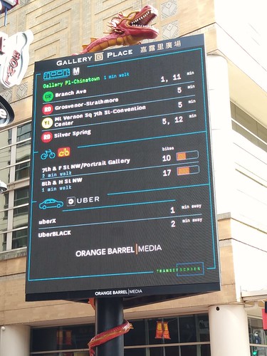
Real time transit information via TransitScreen and the Orange Barrel Media digital billboard outside Capital One Arena
The TransitScreen app is used by the Orange Barrel Media digital billboard outside Capital One Arena to display transit information.


TransitScreen information displayed at Fenway Park, Boston
TransitScreen information displayed on a large screen outside a parking structure at Fenway Park, Boston.


Fare machines too.  Airports are also not always so great about having farecard machines proximate to the area where buses stop to pick up passengers.  This isn't a problem for trains, light rail, and subway connections, because those areas always have fare machines.

At BWI Airport, this is a problem in terms of bus service.  All they need to do is install an MTA fare machine in this area, because the CharmCard it dispenses is inter-operable with DC's transit system.  That card can be used on the WMATA B30 Metrobus that serves the Airport.

Stansted Airport.  Our NZ correspondent Nigel shared with me an article from Railway Gazette International, "Travel information and adverts at Stansted Airport" on a new transit information + ads screen application at Stansted Airport in London. From the article:
The baggage reclaim area at Stansted Airport now has digital screens which show live car, coach and rail journey time comparisons for travel to London Liverpool Street station.

The project was jointly devised and created by train operator Greater Anglia, creative agency LIDA and DOOH.com, with ads appearing on media owner Primesight’s Digital Arrivals Network and Digital 6-sheets.

‘We appreciate this part of the journey is a fine balance of excitement and frustration for passengers, particularly as navigating transfer options can be tricky’, said Chris Ford, Marketing & Digital Manager at Stansted Express. ‘By harnessing different sources of real-time data into one we can provide reliable and digestible information to help customers make informed decisions on how to get to and from central London.’

‘Applying live data is a fantastic way of turning an otherwise general advert into a functional utility that saves passengers time and effort during what is often a stressful part of their journey’, said Neil McKenney, Managing Partner at DOOH.com. ‘Using our platform, it becomes easy to infuse digital out of home ads with the ability to function in the same way as a webpage.’
More airports need to consider more systematically providing this kind of information as a form of serving more of the total "customer journey".

-- ACRP Report 157: Improving the Airport Customer Experience

1099
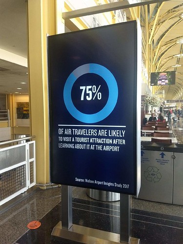
Speaking of my ongoing complaints about the need for tourism centers at airports, especially at the airports in the Washington area, I thought it very ironic that the digital screen advertising system at National Airport states "75% of air travelers are likely to visit a tourist attraction after learning about it at the airport." Then why don't the jurisdictions get together and address this?

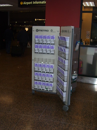
Two places that stand out for decent visitor centers at airports are Denver and Orange County, California.  Before light rail served the Seattle Airport, it was a standout for the provision of transit information.  Ironically, that was eliminated with the Light Rail Station addition, which doesn't provide the same level of information as was provided previously.
Public transit information rack, Seattle-Tacoma Airport
Public transit information rack, Seattle-Tacoma Airport, 2007.

Labels: , , , ,

Thursday, September 27, 2018

World Tourism Day, Thursday September 27th: Regions need to work together more on delivering tourism information

-- World Tourism Day, September 27, 2018

Because jurisdictions have very specific boundaries and revenue generating systems, it's difficult to get multiple jurisdictions "to work together" at the metropolitan scale on tourism matters, because it's seen as a zero sum game.

I admit I wasn't happy when a previous director of DC's convention and visitors bureau thought it was reasonable to promote National Harbor in nearby Prince George's County as part of "DC," or how Montgomery County in Maryland had a "DC days, Montgomery nights" campaign to promote staying at hotels there, or how Fairfax County in Virginia says they're just outside of DC in their tourism promotion etc.

On the other hand, from the tourist's perspective, they are visiting the area, not necessarily just one specific jurisdiction, and it would be helpful to have information from "the area" at a visitors center rather than just the one community.

This isn't a problem limited to the Washington, DC area which is split across "three states."

I was surprised when visiting Liverpool in June that the city's visitor centers only had information for Liverpool, not for any other parts of the Merseyside region (except for bike maps at the transit information centers).  The same was true for London--but those centers barely had any information for the city's various boroughs let alone the immediate area outside of the city.

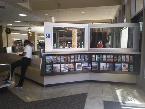
Tourist/visitor information desk, John Wayne Airport, Orange County, CaliforniaJohn Wayne Airport tourist information desk.

Airports are a good place for delivery of tourist information at the regional scale, and this is the case for many places, not just the Washington-Baltimore area.  (The John Wayne Airport in Santa Ana/Orange County, California does a pretty good job on this dimension.)

In the I-95 Corridor, many of the states offer comprehensive visitors center which include information from the entire state, as well as sometimes, info on DC, because DC is a primary destination for travelers.

Maryland and Pennsylvania are standouts in terms of the quality and breadth of information presented in their visitor centers.

These centers are models for what can be done at the regional scale.

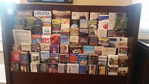
Washington DC section of attraction brochures, City of Fairfax Visitor CenterWashington DC section of attraction brochures, City of Fairfax Visitor Center.

In the DC area, on the Virginia side, Alexandria, Fairfax City, and other jurisdictions have particularly good visitor centers.

The Fairfax City visitors center goes out of its way to get information for various DC attractions, because they find that many of the visitors to the center are most interested in DC destinations.

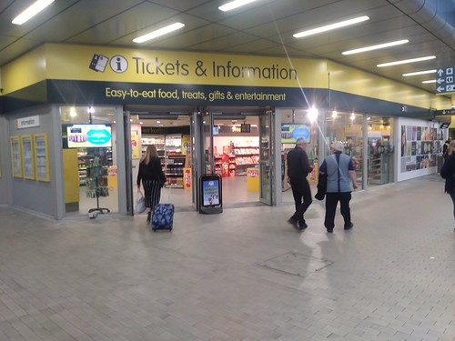
Merseyrail Liverpool transit ticket officeTransit information delivery.  The Brits seem to do the best job of delivering transit information as part of ticket sales.

The centers in the Liverpool train system (pictured at right) even sell sundries and food--the magazine section in one had at least one magazine focusing on railroads (because of the extensive railway network there used for commuting, this is still a matter of high interest), Rail Magazine is published twice/month.

Transport for London's information centers also had some tourist information.

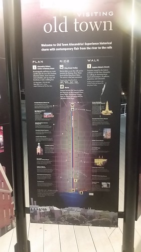
Transit wayfinding for visitors generally has a great deal of room for improvement.  The City of Alexandria, Virginia does a nice job with signs outside the Metrorail station and on the waterfront.  Newcastle
Mobility wayfinding signage, Alexandria, Virginia waterfront

======
Problems special to DC

1.  Federal visitor centers won't distribute non-federal information and sometimes won't even distribute information from different agencies.

2.  In one of yesterday's posts on this subject, I suggested that the National Park Service create "regional visitor centers" in the Greater Washington region, to deliver services and information beyond that of a specific park or site.

3.  The area is served by three airports, two in Virginia and one in Maryland.  There are "traveler's aid" desks in the airports but not comprehensive visitor services.  (The same is true for Union Station in DC.)

4.  Unlike many other cities, DC does not have a program that supports the development of visitor brochures for sub-city neighborhood destinations such as "Downtown," "Georgetown,or "Capitol Hill."

Labels: , ,

Monday, October 10, 2016

London Underground walking times station map

I mentioned this map before ("Showing walk times on transit maps")  London Underground produced a station map listing the walk times between stations, because people unfamiliar with the system don't necessarily realize that rather than transfer between lines to get to a final destination, sometimes rather than transferring it's faster to walk.  (This is the case in the DC Metrorail system between Gallery Place and Metro Center in particular.)

But I bring it up again because I was introduced to a great online tool which converts pdfs to jpgs, created by Investintech. Investintech also produces a desktop program which can extract individual pdf pages from large files and convert them to jpgs too, as part of a long list of other useful online conversion tools.

Here is the pdf version of the London Underground walking map, with the jpg format shown below, as converted by the Investintech software tool.

Labels: , ,

Wednesday, September 14, 2016

Rome 2 Rio is an incredible website integrating all forms of mobility to get from one place to another--globally!

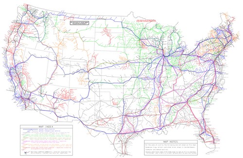
US intercity bus service map produced by Michael Buiting.AIBRA bus and Amtrak map, 2014-01-15

In a back and forth set of comments spurred by Larry Littlefield's post which in passing discussed inter city bus service in New York State, we were talking about bus route network maps.

In the old days, railroads and intercity bus systems like Greyhound and Trailways published complete maps of their route systems.

Now it's very hard to find such maps. Michael Buiting produced one on his own.  See the past blog entry, "Inter-city bus services are typically a gap in transportation planning."  The entry references some academic research and other writings on the subject.

Larry said you can't find these kinds of maps for Coach USA/Megabus services at the scale of a state or region, let alone a complete network map.

Yes you can plug in stuff online, but you can't get a sense of the full system and all its possibilities, counter to "the old days."  (Similarly, regularly published complete guides for railroad passenger and airline service provided this function, showing all available services.)

Mein Fernbus/Flixbus, Germany.  I mentioned that when I was in Germany, I saw a variety of intercity bus companies in service, near train stations in Essen and Hamburg.  (In Hamburg the Intercity bus terminal, ZOB, is in close proximity to the train station.)

Because some of the Mein Fernbuses I saw had rear-mounted bike racks, I looked into their services more--note they have since merged into Flixbus.

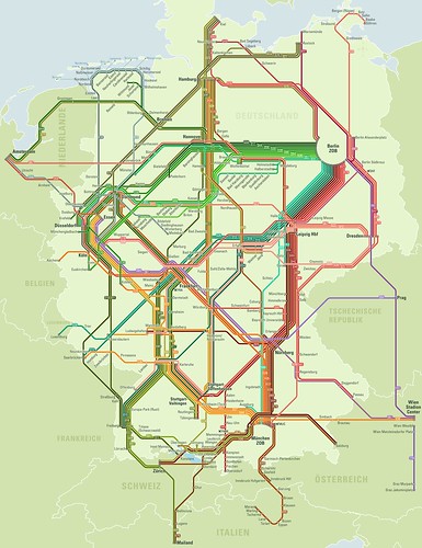
They publish route maps comparable to the maps once published by Greyhound and Trailways, even differentiating between their day and night networks, but I like best an earlier version of their night map (below).
Older version, Mein Fernbus night bus network map
It turns out their website and computing systems are developed by stfalcon, a Ukrainian firm.

Were I in charge of finding a programming team to set this up for a transit system, they'd be one of the contenders, clearly.  This webpage discusses the work stfalcon has done for Mein Fernbus.

Rome2Rio Global Travel Planning website. While tracking done some URLs, I came across Rome2Rio, a travel search and ticketing website that has managed to integrate airplanes, trains, intercity bus, ferry, local transit services, and taxis into one system.

It's pretty remarkable.

US and Canadian inter city bus service map, based on route information collected by Rome2Rio.

But they don't have a function where you can produce and print out master route systems maps as a website user, although on occasion they have blogged about doing it themselves, such as when they added US and Canadian inter city bus coverage to their system.

Wanderu.  Note I have mentioned/used Wanderu to do bus trip planning in the US, as they have a master set of information.  But Rome2Rio takes integration and mode coverage to a whole new level.

Labels: , , , , , , , ,

Friday, April 29, 2016

Another example of a discoordinated transit system in DC proper: maps in bus shelters

I wrote last week about how the various separate BRT planning efforts around the metropolitan area are an example of a lack of metropolitan-scaled transit planning.  The maps displayed in DC bus shelters are another example.

DC has four types of bus transit service.  The primary service comes from Metrobus, the bus service delivered by WMATA, which provides the bulk of intra-city bus service on major and minor routes and some transit between DC and other jurisdictions.  (Many of the lines end at the boundary between DC and Maryland, reflecting age-old service patterns.)

Unlike the suburbs, DC doesn't provide an extensive intra-jurisdictional bus network separate from WMATA, but the five-route DC Circulator is an example of such a service.  (Note that in a couple of instances, RideOn, the bus system for Montgomery County, provides service to DC locations, including a route to Sibley Hospital.)

The third public transit service is inter-city long distance bus commuter service from distant locations in Maryland and Virginia.  Maryland Mass Transit Administration coordinates this service on the Maryland side, while Loudoun County, Prince William County, and the Fredericksburg area each provide commuter bus services from Virginia.

A fourth service is the various shuttle services provided by government agencies, businesses, and other institutions.  Shuttles operate between buildings, campuses, and Metrorail stations mostly.  Major examples include universities like American, Gallaudet, Georgetown, and Howard, the Smithsonian, and Washington Hospital Center.  These systems are not fully public, and are open only to employees, students, patients, etc.

Except for WMATA-owned station properties, the bus shelters in each of the local jurisdictions are run by the respective jurisdiction.  So DC is in charge of the city's bus shelters. 
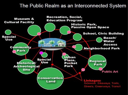
Public Realm as an Interconnected system, Slide from presentation, Leadership and the Role of Parks and Recreation in the New Economy, David BarthTransit shelters as a marketing touchpoint.  From "Arlington County's bus shelters and a public realm framework of quality":

A point I make is that bus shelters are the primary marketing touchpoints for transit, for users of the system as well as for non-users, who travel by and around the bus system and its physical manifestations.  The information posted in shelters about bus service markets the service--or not.

You see this attention to the service as a whole and its marketing and branding aspects, in the implementation of bus rapid transit service, where they tend to focus especially on providing modern, attractively designed bus shelters and quality information services ranging from real-time arrival information, wayfinding in the stations, and marketing of the service.

More recently I have extended these arguments about the quality of the physical and wayfinding elements in the transit system, influenced by a concept articulated by David Barth (now of AECOM) which he calls the "integrated public realm framework."  ....

(1) transit riders deserve high quality amenities and infrastructure too, such shouldn't be the exclusive province of motor vehicle operators;

(2) transit shelters are an integral element of an integrated public realm framework;

(3) transit shelters are key touchpoints for marketing transit, especially surface transit.
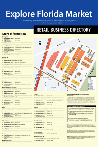
Explore Florida Market: Business DirectoryProof of concept business district wayfinding signage.  Many years ago, Christopher Taylor Edwards and I created a conceptual business district map that among other elements, showed transit routes using the same graphic design treatment WMATA uses on their own map products.

Even WMATA's bus shelter maps use a different design treatment from the Metrorail map.  I think that's a mistake.

Lack of common graphic treatment across different map products.   Maps produced by entities other than WMATA don't use the WMATA design treatment, other than the colors of the lines and the M Metrorail symbol.  The variety of methods mostly fail--not the Circulator, because it depicts lines showing complete bus routes, but only of its own routes.

The maps displayed in bus shelters that are served by multiple local bus services should include information on all of the bus lines that serve that station and the sub-city district served by the station.  For many of the transit stops, this is not the case.

Sub-city transit mapping.  When the new system of bus shelters were launched in 2006, local business districts and neighborhood associations were given the option of putting in localized maps and promotional information in the shelters, but outside of the business improvement districts, most haven't had the financial ability to pull it off.  DC didn't think to set aside money from the shelter advertising contract to assist local districts in providing such information.

There are three types of maps displayed in DC's bus shelters.  Most are provided by WMATA and show bus routes serving the transit stop and the city .  The second type are maps of the DC Circulator bus system. The third type are business district maps, mostly created by Business Improvement Districts.

At least in Downtown, WMATA maps don't show Circulator routes, Circulator maps don't show WMATA routes.  And the Downtown BID map doesn't show the Circulator either, even though an entity managed in part by the Downtown BID runs the Circulator bus service!

The Downtown BID map doesn't have bus and subway route lines on the map either, which makes it very difficult for people to get their bearings.

The photos are the Downtown DC BID map at a shelter at 7th and E Streets NW; a WMATA map on 7th Street at the Archives Metrorail station; and a DC Circulator map at a combined WMATA/Circulator bus stop at Massachusetts Avenue NE at 3rd Street.


The maps at the Pronto bike share stations in Seattle show both walksheds and bikesheds--the distance that can be covered from the station in a five-minute walk or bike ride.  Photo from Geekwire.

Maps aren't provided at bus stops for the long distance commuter services.  Only recently have these services been more consistent in putting up bus stop signs.  The presumption is that people who want to use these buses already know about them.

MTA produces a single map showing all their commuter bus services, but there is not a comprehensive map on the Virginia side showing all of their long distance commuter bus services on one map.
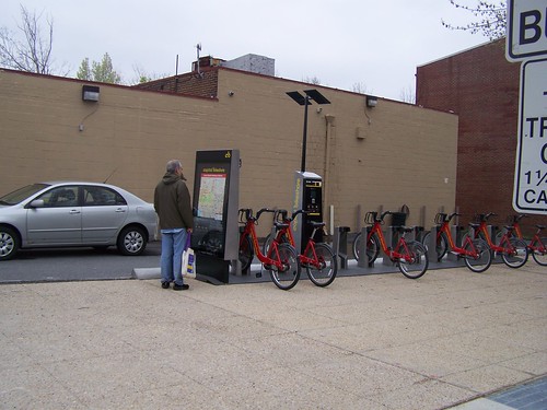
Non bicyclist using the map at a bicycle sharing station in DCMaps at bike sharing stations end up being used by pedestrians as well.

The area's bike share stations have their own mapping system, while bike share station maps in cities like London and New York are elements of the city's overall wayfinding signage system.

DC's wayfinding signage system is not nearly as comprehensive as other systems, and is complicated by the fact that various federal entities like the National Park Service, the Architect of the Capitol, and the transit agencies have separate systems. 

Note that the comprehensive wayfinding signage system developed in Bath, England is the model and foundation for larger systems in London and New York City.
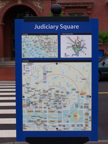
Judiciary Square Metro, wayfinding map sign
Showing walksheds on bus shelter maps.  Maps in Metrorail stations show the walkshed from the station at one-quarter, one-half, and three-quarters of a mile--5 minutes, 10 minutes, and 15 minutes.

Some signs in the DC wayfinding signage system are posted outside of stations.  Intended for use by tourists, these maps include walkshed information.

Bus shelter maps within districts such as the Central Business District/Downtown should also show walksheds.  Some people will find it faster to walk to a destination than to wait for a bus. 

Conclusion.  Sadly, at the intra-city scale, as reflected by transit maps used in the city's bus shelters, transit planning can be as dis-coordinated as it is at the metropolitan scale.

Labels: , , , , ,

Thursday, April 28, 2016

Showing walk times on transit maps

Because transit system maps are a rendition of the system that isn't mapped exactly to scale, people unfamiliar with the system may not know that certain stations are better for certain destinations than other, that it is faster to walk from a particular station to your final destination rather than take the time to transfer to another line to get to the seemingly closest station, etc.("8 London Tube journeys that are quicker by foot," London Evening Standard).  From the article:
Leicester Square to Covent Garden. Have sympathy for the person that queues for 15 minutes to get into Covent Garden station, waits another five for the lift and boards a packed tube to Leicester Square at rush hour, when they are only 250m away from one another.
People have created such walk time maps for the London Underground and Toronto subway systems.

Transport for London created an official walk time map last fall ("TfL has released the first official 'walk the Tube' map for London," London Evening Standard).


A professor at Queens College has created such a map for the Toronto subway system ("Map shows walking times between TTC subway stops," BlogTO). In the Downtown core, it's faster to walk between the west and east legs of the subway than to stay on the train.


Because the WMATA system is more of a hybrid between a commuter railroad in the suburbs and a subway system in the core of the region, and because outside of DC's core, most areas aren't served by a criss-cross network of transit lines, like New York City, London, or Paris, and so the walk times between stations aren't so relevant at every point on the system.


But in the core, especially in the Central Business District, knowing walk times between stations would make sense.

Like in London, it's easier to walk between lines at some places than to transfer between lines, such as Metro Center to Gallery Place or Farragut West to Farragut North (since 2011 people have been able to exit from one station and walk to the other to transfer between different lines and get back on without paying a separate fare).

While a longer walk, maybe rather than deal with crowds at the Navy Yard station after a Washington Nationals baseball game, it'd be easier to go to the Capitol South Station, especially if you would be riding on the Blue/Orange/Silver Lines anyway.  It's six-tenths of a mile, or just a bit longer than 10 minutes.

Labels: , ,

Sunday, March 02, 2014

Intercity bus services are typically a gap in transportation planning

NotionsCapital reminded me of the recent coverage ("This Map Shows How To Get Anywhere You Want In America Without Taking A Plane," Fast Company) of the effort by Michael Buiting, operating as the "American Intercity Bus Riders Association," to create a map of the Continental United States showing most of the intercity bus line connections and how it intertwines with Amtrak (but not metropolitan railroad commuter systems), producing a map that shows "how to get around the US without taking a plan," and as importantly showing how to get around to small communities that lack airport or train service.

The map does look like an old style railroad map from 80-100 years ago, showing the various local passenger railroad services operating across the country.

Intercity buses are usually ignored by transportation planning.  While this map has been written up elsewhere already, it's important for us to take the opportunity to consider that inter-city bus service generally isn't actively addressed by transportation planning at national, multi-state, and regional scales, other than at the local level as a matter of regulation and siting.  

Local authorities address issues such as where the buses pick up and drop off passengers, charging fees for charter buses entering the city, making sure that they can be parked (DC DOT Tour Bus Parking webpage) in ways that don't create problems, vehicle safety, etc.--but generally don't take up  transit access and system issues.

I made that mistake too in my discussion of transportation planning here, "Second iteration, idealized national network for high speed rail passenger service,"where a commenter pointed out I left off intercity bus services.

The map also motivates me to separate out and add to the right sidebar a dedicated section of "Dr. Transit's Intercity Bus Links."

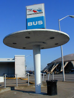
Station and stop accommodations are often substandard.  I have been meaning to write about this because last year the Post travel section had an important article, "The Navigator: Greyhound, leaving passengers out in the cold," about the dearth of standards for "station and stop accommodations" for intercity bus services.  From the article:
Singh’s experience offers a glimpse into a corner of the travel industry that receives practically no coverage or concern from the travel media: the conditions faced by hundreds of thousands of people who travel by bus.

After Singh’s motorcoach, which originated in Minneapolis, left them at the station, the passengers huddled together outside the closed building. Singh opened his luggage and added layer upon layer of clothes in an effort to keep warm. ...

“Greyhound terminals and agencies are open when buses are scheduled to arrive or depart,” she said, adding, “We will work with the interline carriers to help ensure that their hours are consistent with the scheduled arrivals and departures.”

Singh has been waiting a while to hear that. In February, he launched a petition on Change.org asking Greyhound to keep its terminals open, and this policy shift seems to address the loophole. It’s one that has existed for a while now, and it’s one that I should have exposed years ago.
This is exacerbated by the fact that most of the new intercity bus services don't use stations but provide service at the curb, and this can be very chaotic.

Megabus bus stop with sign, New York City. A Megabus boarding site on 34th Street in Manhattan. It serves 90 cities, compared with 40 two years ago. Ruby Washington/The New York Times.

Curbside bus services and rising demand for intercity bus service.  While Greyhound and Trailways have been operating as national intercity bus systems for many decades, those systems have tended in recent years to focus on transporting lower income passengers as higher income long haul passengers take planes.

The rebirth of intercity bus service serving different demographics was a response to the so-called "Chinatown" bus services, which originally were created to bus Chinese restaurant workers between Chinatowns (such as between Philadelphia, New York, Washington, and Boston) and casinos.   Non-Chinese started riding the buses as well and ridership grew considerably ("The Indomitable Chinatown Bus," New York Magazine).

The chaos and problems associated with Chinatown bus service ("Federal Officials Shut Down 26 Bus Operators," New York Times), created an opportunity for the major bus companies to step in and offer comparable services, but with more reliability and amenities like wifi access. 

Major bus companies--BoltBus is a nonunion carrier owned by Greyhound and CoachUSA created Megabus--are now leading this market, both in the Northeast corridor and in other parts of the country ("Buses fastest-growing form of intercity travel," USA Today).

Research studies.  The Institute for Public Administration (IPA) at the University of Delaware has been researching the "curbside bus industry," called such because the new services often don't operate out of terminals but pick and drop people off at curbside stops near train stations and subway stations, and they have produced a report and a masters thesis on the subject:

-- Curbside Intercity Bus Industry: Research of Transportation Policy Opportunities and Challenges
-- The Curbside Bus Industry: A New Era of Bus Travel, masters thesis by Eileen Collins

The Chaddick Institute for Metropolitan Development at DePaul University in Chicago has done a fair amount of research as well, in part focusing on the Midwest.

-- Intercity Bus Research webpage
-- The Return of the Intercity Bus: The Decline and Recovery of Scheduled Service to American Cities, 1960 - 2007

Integrating intercity bus services into local transit infrastructure.  In "the old days," when bus service was more widely used, many communities had bus terminals, most often provided, owned, and managed by Greyhound or Trailways operators.  Back then, with privately operated transit systems, it was rare for transit services--railroad or bus--to coordinated their service from a single station.  (Washington's "Union" Station was an exception for railroad service.)

But as ridership declined, many of these terminals have been closed. Some larger cities like Toronto, Montreal, and New York City do still provide support for intercity bus terminals, but in the US, operators can't be forced to use these facilities.

The Salt Lake City Intermodal Hub connects Amtrak, commuter rail, light rail, bus, and intercity bus transit services.  Wikipedia photo.

In some communities, intercity bus lines work with local transit services for access to a main station, which provides for better service for patrons but at the same time, can create problems as intercity bus terminals tend to have some loitering, vagrancy, and crime issues.

That's why in Baltimore relocating the Greyhound terminal next to Penn Station was ultimately unsuccessful ("Mayor vetoes city bus terminal," Baltimore Sun, 2001). In DC, the services have been relocated to Union Station after many years of hoping for it, in large part because the Greyhound terminal--located about 5 blocks from Union Station--was worth more as a redevelopment site.

But many places provide minimal accommodations for people traveling by intercity bus and this should be addressed at the scale of metropolitan, regional, and multi-state transportation planning.

Bus departures screen, Gare D'autocars, Montreal.  Wikipedia photo.

Improving station accommodations.   I have argued that the bus services need to be better integrated into Union Station than they have been ("Union Station bus terminal"), such as with coordination departure and arrival information displays, such as are provided at the intercity bus terminal in Montreal.

Conclusion.  It would be nice to see more support for the efforts of Michael Buiting-American Intercity Bus Riders Association, not just for the creation of a map, as well as greater focus by planners on some of the issues that he and others raise with regard to the quality, breadth, and depth of intercity transit as it relates to buses.

Labels: , , , , ,

Tuesday, August 02, 2011

More on Union Station DC and the need for innovative master planning

Union Station, Washington DC, USA
Flickr photo by Bencito the Traveller.

As mentioned in a blog post over the weekend, Union Station has committed to integrating inter-city bus services into the station, something that has been discussed for 20+ years...

Delegate Eleanor Holmes Norton sent out a press release about this, "Intercity Bus Service at Union Station to Begin After Years of Norton Hearings and Persistence." From the release:

Norton, who has pressed for years for intercity bus service at Union Station, chaired the first hearings in recent memory on Union Station after she became chair of the Subcommittee on Economic Development, Public Buildings and Emergency Management, and began a sustained effort to bring intercity bus service to Union Station.

In response to pressure from Norton’s subcommittee and from the bipartisan leadership of the House Transportation and Infrastructure Committee, USRC initially moved forward only with a pilot intercity bus service program in January 2010, but Norton continued to insist on permanent service, in keeping with the congressional mandate to make Union Station a fully intermodal facility. Norton finally asked the USRC chair, Deputy Secretary of Transportation John Porcari, to become active in negotiations with intercity bus carriers in order to get permanent intercity bus service at Union Station.

Norton said, “Union Station is behind other big cities in promoting fully intermodal travel, but today’s economy, environmental necessity and public demand for inexpensive travel have now made intercity bus service a public necessity.” Norton continues to take a strong interest in Union Station, demanding a master plan for the station and, just last week, introducing a bill to require the first annual public audit of USRC.


I guess a big problem with Union Station is that the "public"-private partnership agreement that was created for the building's rehabilitation and resuscitation is probably pretty one sided, which shouldn't be a surprise given that the agreement was made in the mid-1980s. The Union Station Redevelopment Corporation has always been pretty insulated.

But it's exciting (although I won't hold my breath in terms of expecting a super creative and innovative approach) to see that Delegate Norton is arguing that there needs to be a master plan for Union Station.

It needs to cover the station in terms of at least three functions:

1. Its role as a primary gateway to Washington, DC, and as a key entry point for visitors;

2. Its role as an intermodal transportation center, not just for visitors, but for residents and workers as well;

3. Its role as a place to shop, since a big part of its revenue stream comes from the retail operations there.

A master plan should cover these issues creatively and comprehensively.

For example, I argue that Union Station is a key place to interpret transit and explain how to use it (transit wayfinding). See "Union Station Intermodal Transportation Meeting" (2008) and "Public meeting on DC) Union Station Intermodal Transit Center Feasibility Study" (2009).

Union Station ought to be one of the locations for a major visitor center. (More on this in a couple weeks.)

It ought to have retail plan that prioritizes the city and local business. Instead, it focuses more and more on chain development and seeks tax breaks to do it. See "Tax Breaks, Developers, etc., and Union Station" and "Interesting Union Station Business Story."

It ought to have a cultural interpretation program that explains the building and its history and the history of railroad transportation.

You'd think that the Union Station Revitalization Corporation would care enough about the quality of the visitor experience to have developed sometime within the last 25 years a memorandum of understanding with the National Park Service covering snow removal from Union Station Plaza.

Etc.
Union Station doesn't clear the snow in the plaza in the front of the building

Labels: , , , , ,