Wayfinding signage for Florida Market
Tonight there is a hearing on Zoning Case 06-40 on the Gateway Market. I'll be testifying, and others, including Frozen Tropics, in "ANC 5B meeting and Thursday's hearing," have written about the issue.
Regular blog commenter Christopher and I collaborated on creating what I think of as "guerrilla" wayfinding signage for the Florida Market. It's why I haven't been blogging much lately...
---------------
One of the big problems for the Florida Market District is what Kevin Lynch called legibility. People need an introduction in order to understand what appears to be a chaotic place, a place that was described by a tour goer once as "the anti-Whole Foods."
The front side of the sign is a retail business directory. It's a way to make the Florida Market understandable. It has a map of the district, shows the businesses that sell to retail customers, and includes specifics about how to get around and how to shop the "Florida Market way."
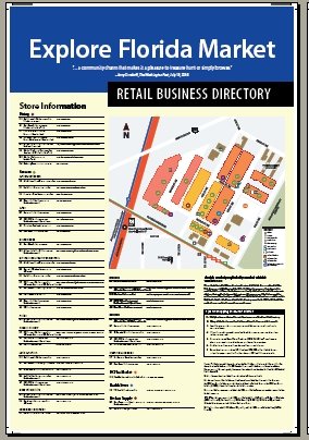
2. Creating the signage was also an opportunity to address a gap in DC's wayfinding signage heirarchy. There are three purposes for wayfinding signage: informational; directional; and historical-cultural.
Except for some map signs outside of Metro stations, the DC wayfinding signage system doesn't provide map-based directional-information signage within districts.
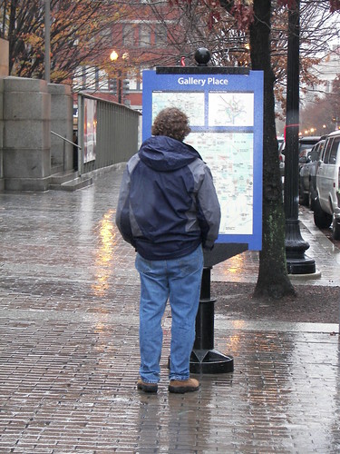
This sign is designed to provide a model of how it can be done. (Although Takoma Park, Maryland also has something similar.)
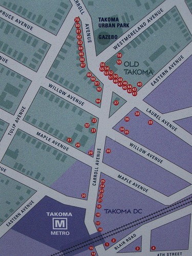
Inset, Takoma Park street sign, business directory
3. One of the conceptual breakthroughs we had was incorporating design elements from the WMATA subway and bus maps onto a non-transit map. After all, the most recognizable map in the region is probably the WMATA subway map. (Then maybe the "diamond' of DC. Then maybe the L'Enfant map.) That means we used the red line of the subway map instead of a railroad track to denote the line.
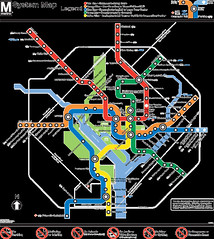
This isn't a first exactly, but it is still rare. DDOT and DCOP maps don't do this.
4. Most maps, including Google, and I informed them about it, but they haven't bothered to change it, as well as DDOT! (for the Metropolitan Branch Trail map) put the New York Avenue station in the wrong place. We didn't.
5. This came out of the back and forth with Christopher that I really enjoyed. The design method, one incorporating prototyping, feedback, and modification throughout the process, in early stages, is far superior to the more rigid rational planning model with constrained scopes and limited ability to be creative.
6. The back side of the sign is historical, information about the Florida Market, as well its place within the city's market system, and the broader food production and distribution system.
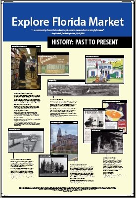
That was a cause of some conflict within the process of developing the narrative, because the thinking about representing the history within these three dimensions was inchoate, not fully articulated.
At the end of the process, now we understand better what we were doing.
7. The sign is a melding of the Cultural Tourism DC history trail signage program and the Discover DC signage program managed by the DC Department of Transportation.
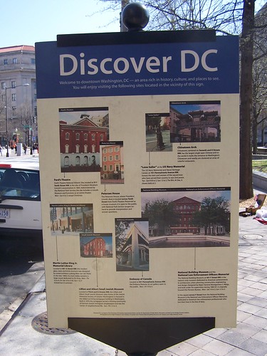
We tried to get from DDOT the PMS color numbers to best match the colors on our faux signage, as well as information about the typesizes, but the person responsible for the DDOT wayfinding signage program never responded. I guess they don't feel a sense of urgency to respond to email...
However, rather than call the sign Discover DC, we call it Explore DC, but replacing the DC with the particular district being discussed.
We think that Explore, rather than Discover, is more inclusive, and includes those of us who live here too, but don't necessarily know every nook and cranny in the city.
8. This effort could also be thought of as the beginning of the creation of a thematic history trail about food production and distribution within the city. There is a marker as part of the Barracks Row trail at Eastern Market.
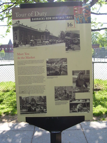
But a directory like the one in the sign that we created for Florida Market could be added to the Eastern Market district. And at the Maine Avenue Seafood Market. And at places where markets were once extant, like the Center Market downtown--which served as the foundation of the retail and entertainment district downtown, or the O Street Market in Shaw.
9. We don't have permission to erect these signs at the present. If we did, we would add "you are here" markers on the map side of the signs, at the various places it would be erected.
We could also have a couple variations of information on the back of the sign, so that we could use some of the other information we came up with, but weren't able to use due to space limitations.
One place I'd like to be able to install a sign is at the north exit of the New York Avenue subway station. If we were able to do this, we'd have to add to the map the new hotel being built adjacent to the station. And the back side of the sign there could be about the railroad history of the area, rather than the Florida Market.
10. Now off to get these printed (despite an Internet outage at home) and to revise my testimony and...
11. Thank you Christopher!
12. Note that for the last year or so, I've been quite interested in street signage in all its dimensions: directional, informational, heritage-cultural, including entryways and within-district signage, at different levels, such as for pedestrians vs. drivers, etc., wayfinding, and how a community identifies itself within a signage system, the various heirarchies, etc.
For the study I worked on in Brunswick, Georgia, I really developed this piece as it related to the downtown and the city and county more generally, even the region, even though it wasn't part of the original scope.
You could argue that what we recommended there is an indirect evaluation of the DC wayfinding and cultural interpretation signage system, because my reaction to this system, and thinking about what's missing--a gap analysis so to speak--infuses what I think about and recommend to other places.
(Also, the idea for more specific and block-by-block directory signage on the street in commercial districts has been sparked by some work we are doing in Pittsburgh, and visits to Pittsburgh's Strip District, back in March 2006.)
Labels: change-innovation-transformation, commercial district revitalization, cultural heritage/tourism, cultural planning, destination management, wayfinding


1 Comments:
I am very afraid of the situation in the country. Due to the fact that the "home mode" is turned on, this greatly affects not only everyone’s pocket, but also the global economy. Not all areas of business can afford to work from home, many companies still have to feed and dress the population. But all the same, you can slightly influence this situation, I want to say that someone still has to work from home. For example, delivery. This sphere of business was also greatly affected by the current crisis: delayed supplies, the borders of some countries are being closed, not all people can afford extra costs and much more. But all the same, delivery is the best way to boost your business if, for example, you have your own cafe. It is clear that this is not a global business and incomes will decrease slightly, but you can still stay afloat. I recently came across an article https://dinarys.com/blog/build-successful-retail-website-for-your-business and decided that it was a cool idea to create your website and sell food there. It’s clear that now you need to study for yourself online marketing and all these online things to attract customers and receive orders, but this is better than completely losing your business. Indeed, when you deliver food prepared with love to hungry customers and see their happy faces, is it not a joy for me, as the owner of a cafe! Therefore, it is very important now not to lose heart, but to learn something new! There are so many things available online. And a variety of courses, books, trainings. Therefore, I will act and I advise you not to give up, but to start doing something! Health to all!
Post a Comment
<< Home