Thanks to Will Handsfield for touching off this thread.
Center City, Metropolitan and Regional Transportation Vision and Planning
This is a new category, separate from items concerning basic city transportation planning at the end of this entry.
1.
It is time to rebuild and re-codify the regional and metropolitan consensus on the delivery of transit. I have been writing about this since 2009 in great detail. These two recent entries bring the argument up to date, and in terms of funding issues:
--
WMATA and two types of public relations programs
--
What it will take to get WMATA out of crisis
2016 is the 40th anniversary of the opening of the first leg of the Metrorail system and anniversaries can be good hooks for both looking back and planning for the future.
2. My thinking on metropolitan scale planning and the federally designated "Metropolitan Planning Organization," the Transportation Policy Board of the Metropolitan Washington Council of Governments took a new turn after the original list.
Responsibility for metropolitan transportation planning should be placed within the MPO, rather than within "WMATA", laying out network breadth and depth preferences, and Level of Service (LOS) and Level of Quality (LOQ) standards, with a separate contracting for services.
--
King County, Washington Metro (Bus) Service Guidelines
Because WMATA only plans for subway and regional bus service, there are significant gaps in metropolitan transportation planning. Plus network breadth and depth and standards of service often are satisficed for budget reasons.
Hamburg Germany offers a better model, where
HVV integrates transit service planning and operation across multiple modes (subway, commuter rail, bus, regional rail, ferry) operated by 35 different operators, serving the city-state of Hamburg and a number of the districts in the neighboring states of Lower Saxony and Schleswig-Holstein.
Transport for London and San Francisco's MTA operate similarly, although SFMTA doesn't do any contracting of transit service. TfL contracts out bus service, runs the underground, and coordinates rail planning within the region, even if it doesn't run the service. The London Overground suburban railroad service has reorganized railroad service comparable to how the Underground runs, which has resulted in significant ridership increases. Unlike HVV, TfL and SFMTA are responsible for roads and have oversight authority for taxi service.
--
Metropolitan Mass Transit Planning presentation
The MPO as currently configured doesn't have the capacity to pull this off.

3. Last year, Councilmember Cheh suggested that the city's transportation functions be split across three different agencies, some new, some old.
While it doesn't seem as if that proposal is going anywhere, it's still a bad idea and shouldn't be supported. It's important enough to mention here.
--
Proposed changes to DC's transportation agency structure as another example of acting without solid planning: Part 1, the problem
--
Proposed changes to DC's transportation agency structure as another example of acting without solid planning: Part 2, what should happen to DDOT
--
How other cities deliver transportation functions (Part 3 of the series, Proposed changes to DC's transportation agency structure as another example of acting without solid planning)
4. Despite the fact that the city's competitive advantage within the region rests on Metrorail and other transit services, for the most part, the city's elected officials and other stakeholders fail to acknowledge this, even though development around transit is one of the main drivers of the local economy.
The city needs to become a national leader in urban transportation and transit policy and practice in reality, not merely by default.
The recent wacked discourse about the value of streetcar service in the city--and note that streetcar service isn't even one of my top priorities--is an example of a massive intellectual and policy failure. How can leaders of the city question the value of transit to the city and its current success.
While this entry from 2006 is about development at the Takoma Metrorail station, the opening discussion within the piece is probably my most succinct sum up of the link between transportation, land use and urban success:
--
Comments on Proposed EYA Development at Takoma Metro Station.
Transit First planning policy is a part of San Francisco's City Charter. Here it waxes and wanes depending on who is mayor. Since most of the city's mayors and Ward Councilmembers have come from the Outer City (see "
DC as a suburban agenda dominated city"), they tend to be automobile-centric, even if they've served on the WMATA Board of Directors.
Funding/Land Use
Increased property taxes and other revenues from development adjacent to transit is one of the returns on investment from investing in transportation infrastructure, so funding and land use policy are linked in this section.
5.
Increase the height limit, primarily downtown, where the demand and best transit connections are located. Use the increased property value-bonding authority to pay for transportation (and certain other) infrastructure expansion in the city -- in addition to the transit withholding tax,
--
DC Height Study Public Meetings This Week and the long term implications for transit expansion in DC
6.
There should be a density bonus for development at transit stations, beyond what is available within the planned unit development process (a 20% boost). Outside of the core of the city, transit station adjacency isn't being fully realized.
Good examples of reasonable size are at Brookland, Petworth, and Columbia Heights Metrorail stations, while developments at Fort Totten and Rhode Island Metrorail stations are good examples of leaving density opportunity off the table.
7.
I don't think it's worth pursuing a congestion charge, independent of participation by the surrounding jurisdictions. Otherwise, other jurisdictions will recruit DC-based businesses and organizations, using a congestion charge as a club.
But the Virginia Secretary of Transportation is proposing tolls for I-66, so maybe this could be in our future.
-- "
On I-66 Inside The Beltway, Tolls First, More Lanes Later," WAMU-FM/NPR
Fixed Rail Transit (Was: Subway, Streetcar, and Railroad Expansion)
If ferries/water taxis were a significant element of the region's transportation system, the section would be titled Fixed Rail Transit and Ferries.
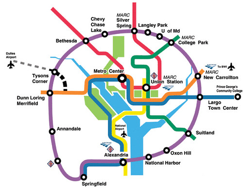
8. Since the discussion about the separated blue line in the 2008 entry, in the
WMATA Momentum plan, they have introduced a hybrid additional line that combines part of a separated blue line with part of a separated yellow line (pictured at right).
I favor the previous separated blue line proposal and not the Momentum plan proposal.
However, maybe besides connecting to the blue line around Oklahoma Avenue NE ("Bring back the Oklahoma Avenue Metro Station: infill transit"), have another leg that goes up Bladensburg Road to Fort Lincoln and maybe beyond (if Prince George's County wants to pay for it).
9.
I wrote about tunnelizing the Metropolitan Branch. It's not realistic so it should be dropped. However, if the area had the kind of density of New York, London, or Paris, it would be worth pursuing, as a way to double railroad and subway capacity on a goodly portion of the red line subway as well as the MARC Brunswick line.
10.
Add a separated yellow line with two legs, one goes up Georgia Ave., another could split from Fort Totten going out New Hampshire way into Montgomery County, at least to White Oak. The latter would be more for MoCo, so they should pay for it.
But both would interdict commuter traffic, which should be one of the primary planning principles of DC's transportation system, to improve neighborhoods by reducing the negative impact through traffic on streets that serve as both neighborhood and regional arterials.
11.
I didn't discuss the Purple Line light rail program in the original list, which is mostly suburban-supportive, but still will provide benefit city residents by providing inter-links between various legs of the subway system.
However, the original concept for the Purple Line is as a circumferential line, and the current Purple Line project will provide routing only between Bethesda and New Carrollton.
Planning for extensions west from Bethesda to Tysons, and west from New Carrollton to Alexandria need to go into the planning phase now.
I do think that the implementation of the Purple Line could be accompanied by an unprecedented economic development, urban design, and equitable development initiative, were they to take the initiative on ideas I've discussed here, which call for the creation of a TIF funded bi-county development authority for the Purple Line
transit shed:
--
Quick follow up to the Purple Line piece about creating a Transportation Renewal District and selling bonds to fund equitable development
--
Purple line planning in suburban Maryland as an opportunity
12.
WRT creating an integrated passenger railroad service for the region, I stand by the RACER concept, but think that Union Station could play an outsize role in facilitating merger of the local services.
--
Dual powered diesel electric locomotive and implications for long range regional railroad planning in DC, Maryland, and Virginia
13. Since the original list, MARC has added weekend service to the Penn Line, which is a bonus, and more recently, added bicycle accommodation to the weekend service.
MARC should offer reverse commuting service on the Brunswick Line from DC to Germantown, and maybe to Frederick. Apparently this was offered in the 1990s, but ceased after a train crash that was the fault of an inadequate signaling system.
Note that separately, VRE is expanding also, with an extension to Spotsylvania and a proposed branch line to Haymarket. However, VRE doesn't offer much in the way of reverse commuting services and no weekend service. This should be explored.
-- "
VRE kicks off major expansion plan with new Spotsylvania station,"
Washington Post
-- "
VRE proposes fare hikes, outlines long, long-term expansion," WTOP Radio
14.
The discussion on transit networks and subnetworks at the metropolitan, suburban, and center city scales should include focused discussion on "intra-district" vs. "inter-city" transit.
--
Making the case for intra-city (vs. inter-city) transit planning
--
STREETCARS ARE ABOUT TRANSIT, just in a different way from how people are used to thinking about it
--
The argument that streetcars are "imperfect transit" but "good enough" is flawed
which is particularly relevant to the current discussion on streetcars, including Arlington's cancellation of their streetcar plans.
Visitor transportation services
This is a new category, and combines some transit expansion with visitor services.
Note that the Passaic County, NJ Transportation Plan raises the idea of treating historic transportation corridors as opportunities for historic interpretation and cultural tourism, and they have further developed the concept as part of the county's
Heritage Tourism Plan.
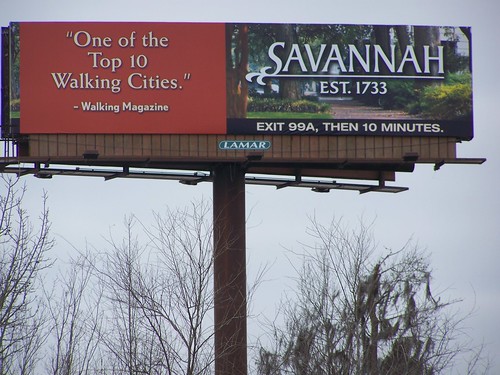
Relatedly, Savannah promotes its walking city urban design elements as a part of the city's tourism program.
The
Federal Elements of the Comprehensive Plan have an element on
Visitors, but while for many years I've suggested creating a tourism element in the local plan the city has not done so.
15. In response to the National Coalition to Save Our Mall's proposal for a big parking garage for visitors under the National Mall, and comments I had submitted on the Visitor Element of the Federal Elements of the Comprehensive Plan, I wrote a piece on
creating an integrated visitor transit and parking system centered around the National Mall, complemented by visitor centers at a new Jefferson Memorial Yellow Line station and Union Station.
--
A National Mall-focused heritage (replica) streetcar service to serve visitors is a way bigger idea than a parking garage under the Mall
16.
I have ideas on how Union Station could be a 21st century transportation and visitor center, beyond what "Amtrak" is thinking. (Amtrak, more than Union Station, is driving the master planning process.) I would include a transportation-urbanism museum (at least an exhibit or two, and exhibit space) and a big visitors center. New developments in airport terminal development are another source of ideas.
17.
I'm fine with the Georgetown BID's proposal for an aerial tram. It's complementary to streetcars, and tightly integrates Rosslyn's Metrorail station into Georgetown.
An aerial tram station at Key Bridge and M Street could also include a visitor center and community museum.
18.
Water taxi services should be moved to this category, recognizing that such services are more about tourism because the placement of activity centers-primary destinations relative to the Potomac and Anacostia Rivers and limited draft capacity on the Anacostia River east of the 11th Street bridges isn't conducive to adding water taxi or ferry services to the metropolitan area's transit system.
19.
Wayfinding systems need to be upgraded and expanded, including better use of transit stations to deliver wayfinding and visitor information.
20.
The Metropolitan Planning Organization needs to step up and shape better transportation planning and visitor services at the area's airports.
--
Night moves: the need for more night time (and weekend) transit service, especially when the subway is closed
--
More on airport-related transit/transit for visitors
--
More on transportation to the DC area airports
21. This would be aided by
the development of a comprehensive airports plan for the region. The DC and Baltimore MPOs could work together to create such a plan for the region. Dulles and National Airports are in the DC MPO while BWI Airport is in the Baltimore MPO.
 Concept by David Barth.
Streetscapes and transportation infrastructure as an element of civic architecture
Concept by David Barth.
Streetscapes and transportation infrastructure as an element of civic architecture (new category)
Note that as parklet programs have exploded across the country, DDOT is finalizing regulations to bring a similar program to DC.
22. To the discussion on placemaking, I would
reshape the "streets as places" argument around my "Signature Streets" concept, which I need to round out as a full blown concept paper.
It would include discussion
on transit and placemaking along the line of past writings, based on the same point, that
transportation infrastructure has fundamental civic architecture and amenities qualities that need to be acknowledged and enhanced.
A key point is that transit stations are entrypoints to neighborhoods and districts and that the transit system needs to acknowledge this and plan and manage the function more directly.
HafenCity University subway station, Hamburg.
Since I wrote the piece on transit and placemaking I've realized that design elements of European underground transit, e.g., the subway stations in Hamburg, or the art nouveau? influenced stations in Moscow and St. Petersburg, etc., are good models too.
My point about planning the bridges over the Anacostia in an integrated fashion could go in here as an example, that hideous "sculpture" on the NY Ave. bridge over the railyard as a counter-example, etc.
--
Anacostia River and considering the bridges as a unit
-- "
Author Carves History Out of Sculptures,"
Washington Post
 Considering the history of the city in terms of classical architecture and sculpture spearheaded by the City Beautiful Movement, this sculpture on the New York Avenue bridge is an embarrassment.
LA's People Streets and San Francisco's Livable Streets initiatives are good models too.
--
The Case for Parklets: Measuring the Impact on Sidewalk Vitality and Neighborhood Businesses, University City District BID, Philadelphia
23. Transportation departments have chief (traffic) engineers,
Transportation departments should also have a chief placemaking architect (who could be either an architect or landscape architect, but probably not a civil engineer, although there are some exceptions), with co-equal authority to the chief engineer, in charge of assuring that quality of place elements are engineered into projects rather than value engineered out.
Mill Avenue Bridge at night, Tempe, Arizona. Photo: Studio Laurent.
24. I've been meaning to put out as a proposal,
architectural lighting of the Metro canopies in a blog entry since the summer, as an element of neighborhood branding and placemaking. But this concept can be extended to other forms of transportation infrastructure.
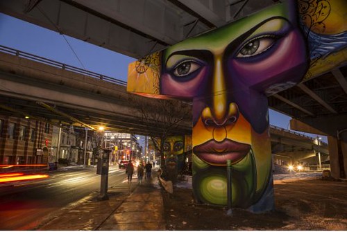 Corktown freeway underpass pylon murals, Toronto. Toronto Star photo.
Roads, streets, parking
25. This is partly a transportation infrastructure and quality of life point, but I do think
we should interdict surface commuting traffic by constructing tunnels for certain arterials. I wrote about this a few years ago, using an example of a tunnel project in Haifa that is tolled, but was done in order to address a major traffic problem posed by a mountain--the tunnels save drivers from 24 to 44 minutes over the previous situation. Another way to think of it would be an RER--the suburban commuter railroad system for Paris that is underground--for roads.
These roads can have significant negative impacts on the abutting neighborhoods. Besides the proposal in the New York Avenue transportation study which proposed undergrounding the through traffic elements of that street, I'd do the same thing for North Capitol/Blair Road, and maybe 16th Street. Such tunnels should be tolled.
--
Tunnelized road projects for DC and the Carmel Tunnel, Haifa, Israel example
--
Carmel Tunnel, Haifa
26.
DC should develop a public database for Pavement Condition of the city's streets, comparable to Los Angeles, and use this information to plan roadway improvements systematically. More money should also be budgeted annually for road improvements. The system is too ad-hoc now, and only $10 million per year is budgeted for local road improvements not part of "federal highway" agreements.
-- "
Grading Los Angeles' streets,"
Los Angeles Times. LA's road condition database provides A to F grades for 68,000 different road segments.
27. Similarly, DC's self-heralded "Green Alleys" program isn't standard practice and isn't a normal part of the capital improvements planning and budgeting process.
The Green Alleys program should be systematized in a manner comparable to a renewed road improvement program. Melbourne's "Love Your Laneway" program addresses five laneways (alleys) each year.
--
Another example of DC Government's failure to engage in sustainability practice
--
Living Alleys Toolkit, San Francisco
--
An Action Guide to Greening Austin’s Alleys, Austin, Texas
--
Alley Network Project, Pioneer Square Neighborhood, Seattle
--
Love Your Laneway Project, Melbourne, Australia
--
Laneway Project, Toronto
28. The earlier list didn't discuss disabled parking issues. Industry analyses of disabled parking permit use find about 40% of passes are used illegally. I propose
replacing placards/permits with transponders comparable in function to those used for EZPass,
29. Some jurisdictions, such as Miami Beach, charge for visitor parking passes in residential areas. Since DC's visitor parking pass system is abused likely at rates comparable to the abuse of handicapped parking permits,
DC should move to a paid visitor parking pass system.
Parking signage, Essen, Germany.
30. DC should integrate privately owned parking facilities into the parking planning process and
implement an integrated parking information signage system in major business districts and activity centers comparable to that in many cities in North America and Europe.
Digital applications aren't enough, as people need multiple information touchpoints.
Biking, walking and traffic safety (new category separated out from Roads, streets, and parking)
31.
Vision Zero traffic/safety recommendations should be incorporated into this category. These recommendations cover most of the gaps concerning pedestrian matters.
--
DC and Vision Zero revisited
32. Because the original list started out focused on transit, it didn't discuss biking very much. There are many needs, including the
creation of an integrated bikeway network at two scales, within jurisdictions, in this case within DC, and at the metropolitan scale as well as planning to achieve bike mode split to 20% of all trips.
But rather than delineate "everything" that needs to be done (and the city is doing a lot and should be commended for it), it's probably time for me to update separately the 2008 piece,
Ideas for making bicycling irresistible in Washington DC, which was written after the original wish list.
When I did the pedestrian and biking plan for Western Baltimore County (2009-2010), I came up with six scale typology for planning sustainable transportation infrastructure:
- one mile radii from schools and transit stops
- three mile radii from activity centers
- 3-9 miles along corridors, connecting activity centers (there, they are "town centers")
- between corridors
- intra-jurisdictional trails network
- connections between jurisdictions
Note that Smart Growth America considers the Baltimore County ordinance on biking and walking to be among the strongest in the country. The ordinance is based on my plan.
Relevant writings on expanding biking as transportation include:
--
Best practice bicycle planning for suburban settings using the action planning method
--
What should a US national bike strategy plan look like?
--
Are developers missing the point on eliminating parking minimums?: it's to promote sustainable transportation modes
--
Best (or at least better) practices bike parking and bicycle facilities
--
Revisiting bicycle (and pedestrian) planning and the 6th 'E': equity
33.
DC should develop better practice for safe routes planning for schools, parks, commercial districts, transit stations and stops, and other civic assets. In other words, the concepts of "safe routes to schools" need to be extended to neighborhoods and to different times of day, especially night-time.
--
Night-time safety: rethinking lighting in the context of a walking community
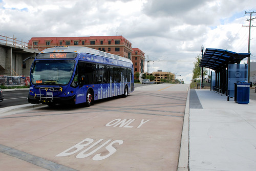 The Metroway bus line includes dedicated transitways. Photo by BeyondDC.
Surface Transit System Improvements
34. The failure to include a recommendation for
a transitway network for buses in the city was a big omission on the previous list. (I haven't yet ridden on the "Metroway" transitway in Arlington.)
It turns out 40 years ago, there was a network of dedicated busways in DC and Virginia, but for the most part these lanes were given over to cars.
-- "
We had bus lanes a half century ago and we can again," PlanIt Metro.
Busway map, 1976. Busways were recommended in the 1950 Comprehensive Plan.
35.
The new bus arrival information boards provided at certain bus shelters aren't very impressive.
A digital screen based information system would be a useful upgrade. (The screens used at Metrorail station kiosks are a good example of what should have been done.) They are an example of how slow procurement practices within WMATA make true innovation difficult.
Transit Marketing
36. I stand by the recommendations in the previous wish list, although they were expanded and better codified in two later entries:
--
Making bus service sexy and more equitable (2012)
--
Transit, stations and placemaking (2013)
Other Transportation Planning Issues
37.
DC should integrate taxi planning into DDOT. Taxi planning and oversight, car sharing, ride hailing could be incorporated into one functional area. Note that the city's comprehensive plan doesn't even mention taxis.
Labels: airports, fixed rail transit service, infrastructure, public finance and spending, transit marketing, transportation planning, urban design/placemaking, visitor services
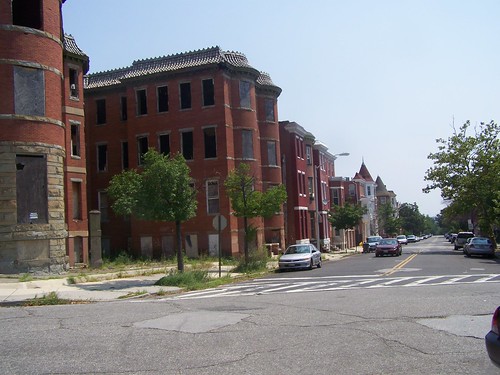 Vacant properties, Reservoir Hill neighborhood, Baltimore.
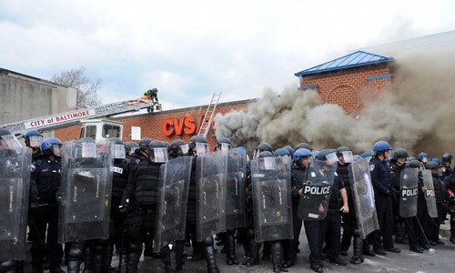
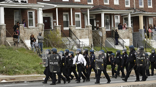
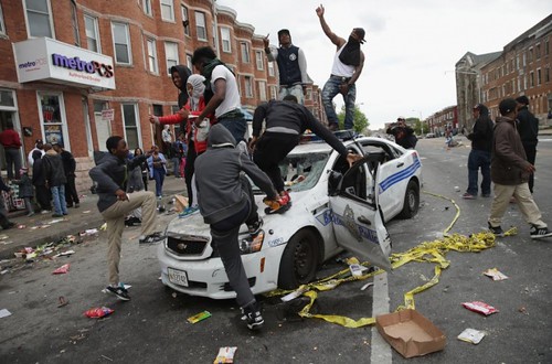 Riots in Baltimore. Photograph: Chip Somodevilla/Getty Images.
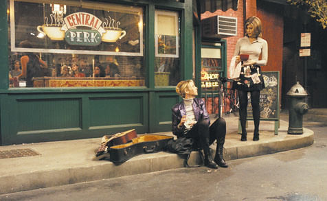 Outside "Central Perk," the coffee shop featured in the Friends tv show.
.jpg)


