Rebuilding Place in the Urban Space

"A community’s physical form, rather than its land uses, is its most intrinsic and enduring characteristic." [Katz, EPA] This blog focuses on place and placemaking and all that makes it work--historic preservation, urban design, transportation, asset-based community development, arts & cultural development, commercial district revitalization, tourism & destination development, and quality of life advocacy--along with doses of civic engagement and good governance watchdogging.

Thursday, March 13, 2025

Salt Lake City TRAX light rail is kind of both "monocentric" and "polycentric"

In Cities in Full, Steve Belmont argues for center city centralization and in his discussion about transit, he contrasts the SF MUNI system, which is completely within the city, but complemented by the subway-commuter rail BART, which serves the Greater Bay Area, and the WMATA Metrorail system in Greater DC.

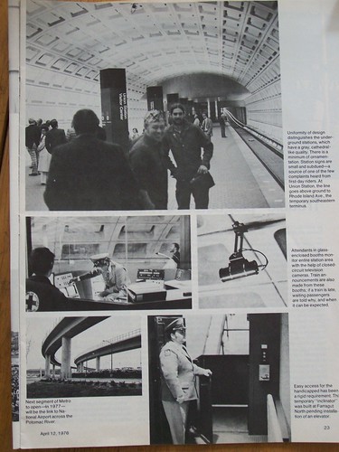
What I figured out that he didn't is that the Metrorail system functions as two different systems, a polycentric commuter rail system reaching out as far as 32 miles into the suburbs (Metro Center to Ashburn on the Silver Line), and a monocentric heavy rail subway system in the core of DC proper.  

WMATA/Metrorail core system in DC.

Full system graphic.

The smallest circle is the core of DC.  From Cities in Full.

Most every station catchment area in the DC core has revitalized, while many out-city station areas remain poorly developed ("Transit oriented development station typology revisited," "Welcome to the loneliest Metro stop," Washington Post).

I was arguing with New Urbanists about a "new urban development" in the Daybreak community of South Jordan ("Downtown Daybreak opens, a mixed-use city core," CNU), stating that an itty bit of urbanism, 200 acres, in the midst of hundreds of miles of sprawl is but a wee bit forward.

One of the counter points was that Daybreak "has light rail."  It will, but at 20 miles from the core of Salt Lake City, it's almost exurban ("Transit oriented development station typology revisited"), and research finds that the best ROI from transit is within the first 10 miles of the system.

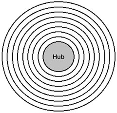
TRAX came about because of the 2002 Winter Olympics and I think it functions pretty well within its transit shed ("Updating the mobilityshed / mobility shed concept" and "Manhattan Institute misses the point about the value of light rail transit connections to airports | Utility and the network effect: the transit network as a platform").  It's just that the State Legislature has been more focused on far suburban extensions of the system, rather than more intensive additions in the core of the system.

I wouldn't say TRAX in the core is exactly monocentric, but complemented by a decent enough bus system, if you live within one half mile to one mile of a station, it works pretty well.  The main core line, on 400 South in Salt Lake, hasn't seen the kind of more intense development and urban re-design that is necessary to adequately leverage the transit infrastructure, but for a city of its size--210,000 people--it does reasonably well.

I was skeptical of the proposal for the new Orange Line ("Utah Agency Picks Preferred Route for $400M Salt Lake City Light Rail Expansion," Engineering News-Record), because it is mostly duplicative of the existing transit shed, but it does add some stations in the Central Business-Residential District as well as a couple on or near the University of Utah campus, and proposes TOD at one of the stations on the campus also.

The favored route would include 2.8 miles of new track. Map courtesy Utah Transit Authority

Interestingly, this would move TRAX a couple stations towards Foothill Avenue, which is the main arterial in my neighborhood, leading to I-215.  

The new stadium station would provide a different route from the current station at 1300 East, which is at the bottom of the stadium/park and ride lot.
The blue line on the map is I-215.  On the northeast end, it runs into Foothill Drive, about two miles from the University of Utah campus.

To my way of thinking, the best intensification effort would be to have a line on I-215, either light rail or commuter rail to the University campus and research park (the Frontrunner train is also decent, a single line though, within its catchment area).  

And then separately with a light rail along Foothill and down to Sugar House to connect to the S-Line streetcar and back to the light rail, in an orbital route.


Of course, such line extensions could happen but beyond my life time.

Labels: , , , , , ,

Sunday, November 01, 2020

NEW HARVARD/AARP REPORT FINDS MOST OLDER ADULTS DO NOT RESIDE IN LIVABLE COMMUNITIES

 From a press release from the Joint Center for Housing Studies at Harvard University about a newly released report, Which Older Adults Have Access to America’s Most Livable Neighborhoods? An Analysis of A ARP’s Livability Index commissioned by the AARP Public Policy Institute:

“While livability is ultimately subjective, the AARP Livability Index identifies key aspects of the built, economic, and social environments that contribute to community and individual well-being, and measures the degree to which those aspects are present in communities. Using data from the Index and the American Community Survey, the new report finds that renters and Asian older adults are more likely to live in high livability neighborhoods while homeowners, middle-income households, older adults with disabilities, and white older adults are more common in places of low livability. Shares of Black and Hispanic older adults hold steady across neighborhoods of all levels of livability.” ... 


 “This report illustrates the challenges that many communities face in supporting people as they age,” says Rodney Harrell, VP of Family Home and Community at AARP. “We need to ensure equitable access to the benefits that livable communities can offer, including for those living in higher-scoring neighborhoods. Every neighborhood has tradeoffs and every community can improve. Our findings support policy solutions to address barriers and improve livability for people of all ages and older adults more specifically.”

My reaction:

Probably it's true that most older adults don't reside in livable communities.  Fortunately, I do.  And I am in a situation of two households in one, including two people 83 years old, one with dementia.

In terms of communities using the index to make improvements, or for households using the index as a way to choose a place to live, I still see some problems with the way that the AARP Livability Index measurement is set up.

I can't claim I've drilled down deeply into every element of the Index, of which there are seven:

  • housing
  • neighborhood
  • transportation
  • environment
  • health
  • engagement
  • opportunity

but overall, the index is pretty impressive, with many factors captured within each category. It's pretty thorough. 

Although arbitrary at times. E.g., only counting a library if it's within a half mile. The metrics communities use for providing library "levels of service" aren't set up to provide that level of service. It'd need to be weighted to be more accurate and useful. Like a library within a half mile gets a stellar weight, but a library still within a mile still gets a positive, but lower rating. 

(Salt Lake City is 80 square miles and has a main library and seven branches.  Residents also have access to the County Library system, which doesn't have any libraries within the city limits.  DC is 60 square miles and has a main library and 25 branches.  In terms of personal experience, I'd say that both cities are reasonably served.  But DC might have too many libraries, although it'd rate more highly on the AARP Livability Index, arguably the more branch libraries, the less well stocked they are with materials.  For example, Salt Lake City's branch libraries have much better periodical collections than any of DC's branches, even in the wealthiest areas. )

Weighting for mobility and age and physical ability.  To be most useful, the index needs to be weighted mode, age and physical (cap)ability to make it truly applicable for individual households. E.g., I'd say it needs to be in tranches by age, mode, and assistance needs.   

Photo: Capitol Hill, DC.  The man used to bike by himself but eventually realized he was excluding his wife.  So they got a tandem bike.

AARP starts asking people to join at their 50th birthday. There's a big difference between a 50 year old with full faculties and physical capabilities, and an 83 year old with dementia or someone who needs an assistive device and or an "attendant" to get around.

Similarly, I understand the focus on walkability as a a primary metric, but at a certain age, it's not practical in terms of speed and carrying capacity for an 83 year old to walk a half mile to the grocery store and back.  Especially if you are impaired or need assistive devices to move around, etc.

But being able to move around your neighborhood, for exercise, is important. But even in the last year, having experienced a couple illnesses, our familial range in walking on daily exercise walks has been cut in half in terms of capability. 

We were talking with a friend about a park 1.2 miles away. She asked if we walked there. It would take at least an hour just to get there, with two 83 year olds, and then we'd have to get back. 

As much as I push sustainable mobility, it's not practical for many of the aged. Especially with transit. 

Even before the dementia became pronounced, I used to ruminate about the impossibility of wrangling two people then in their late 70s on the subway during rush hour. 

Although outside of the major city transit systems, transit isn't as rushed and crowded so it is probably less of a deal in Salt Lake as it would be in DC or NYC or Chicago or Boston. 

I write about the sustainable mobility platform as being comprised of a network of modes = walking + biking and micromobility + transit + car sharing (including access to one way and two way and a variety of vehicles to meet different needs) + delivery + taxi/ride hailing, 

In DC, with biking complemented by car share and transit and walking we didn't need to own a car. But if Suzanne's parents had joined us in DC, definitely we would have needed to get a car.

Flickr photo by Ed Yourdon, New York City.

Salt Lake's car sharing options are minimal and while the bus service is pretty extensive and we're in a good area for service, it's pretty time consuming to get somewhere.  

The light rail and commuter rail are polycentric systems, not really useful for getting around "within a place," more about traveling long distances.

I was doing an itinerant job this week, fortunately a few blocks away, while some other people working there took more than an hour to get there on transit, from a distance of 5-6 miles. For me it was a five minute bike ride.  (And it'd have been a 30 minute bike ride had I lived in the other place.)

The same goes for mobility and the aged. For our two households in one: me at 60, my partner, 53 and her two parents at 83, one with dementia, when we travel together we mostly drive, except for exercise-based local walking. 

Baltimore.

Even 7 months ago, we could manage a half mile walk with them to the grocery (we'd carry the groceries), but not now, as health conditions have changed. 

 But that doesn't prevent me from cycling on trips on my own, be it to the grocery or work or a library or whatever. (Suzanne doesn't bike.) 

Basing the index on type of mobility (mode).  Were I creating this kind of livability index, I'd make it work with a number of options, not unlike Google Maps, which gives you the option to choose four different modes to get somewhere: driving; walking; transit; and biking.  Exclusively on foot; on bicycle; with a car; need for assistance; etc. 

And the half mile thing just makes no sense in terms of how levels of service are provided. E.g., doctors or hospitals aren't built with a half mile radius. (Not that the index uses a half mile as the measure for access to health facilities). 

With Suzanne's parents, most of our life is captured in a three mile radius in terms of walking + car, albeit mostly car.

That includes access to amazing health and hospital care, a senior-rec center with a library provided by the county, another library provided by the city, an impressive array of retail, parks and walking opportunities. Even a major research university and additional recreation facilities (because of their age, they get free access to the county recreation facilities). 

The area and city is a grid but the road network is punctuated with dendrils and discontinuities in terms of the residential streets, which can break off for a block or two or more in various seemingly random ways--but the streets stay pretty straight and keep the same name.

Maybe even take into consideration topography and e-bike vs. regular bike.  E.g., as I age I may get to the point where I switch to an e-bike, especially because SLC has intense hills.  Even without age as a factor, many people here get e-bikes because of the hills.

Labels: , , , , ,

Wednesday, October 23, 2019

Sustainable mobility platform news

Mobility Hubs. Minneapolis ("Minneapolis pilots mobility hubs combining transit, scooters and bicycles," Minneapolis Star-Tribune) and Pittsburgh are getting attention for their "mobility hub" "innovations."

From the MST:
... new spots called mobility hubs where multiple modes of nonautomobile transportation intersect. Each one has a bus stop, a bench and parking for Nice
Ride bicycles and scooters that can be checked out by smartphone app.

The hubs opened this month at four busy north Minneapolis intersections and are designed to make it more appealing and convenient for people to leave their car at home, said Josh Johnson, the city’s advanced mobility manager.

“We want to get people out of their personal cars and onto low- or no-carbon transportation,” he said. “We are trying to get to those who have not considered using a bike, bus or scooter … to think about how you are moving around the city.”

Mobility shed diagramSince I suggested setting up such hubs, centered around transit stations, dating to 2006-2008 ("Updating the mobilityshed / mobility shed concept"), it doesn't seem all that innovative to me.  (When I was writing about it, so too was the University of Michigan transportation center.)

More recently, the mode listings were updated in terms of a broader platform for sustainable mobility.

-- "Further updates to the Sustainable Mobility Platform Framework," 2018

And when I was involved in a bicycle facilities firm aiming to participate in the bike sharing space, we proposed similar kinds of layering, that you could integrate bike sharing systems with parking systems, and include electric charging infrastructure, have wayfinding systems and community information centers as part of the station kiosk system, and even create "transportation demand management stores" ("") on the front end of back end repair and operations depots.

Open Parking System diagram (Urbikes)

Integrating multiple modes by requiring different providers to work together.  What makes the Pittsburgh initiative ("A Micromobility Experiment in Pittsburgh Aims to Get People Out of Their Cars," CityLab) somewhat interesting is that instead of the city doing the integrating, they put out a tender calling on the for profit providers to work together and come back with integrated proposals.
But hearing from those residents was an affirmation for Ricks that the introduction of a few hundred so-called micromobility devices was not going to make the answer for everyone. “We know that Razors on steroids are not a safe way for a mom to take her kids to school,“ she said. “So while we still wanted them, we also wanted to be able to provide something else to improve that situation.” ...

That knowledge, and the stories at Mobiliti, helped seed Ricks’ idea for what is now the Pittsburgh Micromobility Collective, a self-organized, private consortium that aims to bring a range of “new mobility” services across the city. Led by the dockless bike and scooter startup Spin, the group also includes Zipcar, Ford Mobility, Waze, the scooter parking solution Swiftmile, and the Transit app. Earlier this year, the companies collaborated in response to a request for proposals from Ricks’ department, which called for a complement of car-free transportation options that customers can access and book through a single platform.

Their winning plan, which was one of five submissions, envisions “mobility hubs” clustered near transit stops throughout Pittsburgh. There, travelers would find some combination of bike-share stations, Zipcar vehicles, Waze carpool pickup spots, and parked and charged e-bikes and scooters from Spin to rent. The Transit app would handle route planning and ticketing services to customers, and Ford Mobility would feed data analytics back to the city.
Prototyping German style transport associations.  This is tricky.  While I think that all mobility providers should have to participate in a broad transport association which integrates planning, servicer, and operations, along the lines of a German Verkehrsverbund (VV), it's not clear that there are good examples, even in Germany of for profit and government agency actors all getting along.

-- "The answer is: Create a single multi-state/regional multi-modal transit planning, management, and operations authority association," 2017
-- "Verkehrsverbund: The evolution and spread of fully integrated regional public transport in Germany, Austria, and Switzerland," Ralph Buehler, John Pucher & Oliver Dümmler, International Journal of Sustainable Transportation (2018)
-- Transport Alliances - – Promoting Cooperation and. Integration to offer a more attractive and efficient Public Transport, VDV, trade association for German transport associations

So Pittsburgh is moving things forward.

By contrast, bike share programs operated by Boston and San Francisco actively opposed "competition," even to the extent of seizing bikes ("Another example of the need to reconfigure transpo planning and operations at the metropolitan scale: Boston is seizing dockless bike share bikes, which compete with their dock-based system").

Berlin's integrated transit app: integrated apps as an element of brand leadership.  Although in Berlin, they've created a mobility app that integrates both transit modes provided by the transport association and non-transit modes offered by private firms ("Berlin's new transit app Jelbi connects all modes in one place," Fast Company).
The app, Jelbi, which will launch this summer, connects services that currently each have apps of their own, making it difficult to plan a trip or buy tickets given the number of choices. “We have eight bikesharing companies in the market, alone,” says Christof Schminke, the managing director in Germany for Trafi, the tech company that built the platform for BVG, Berlin’s public transport company. “I think it’s a good sign that Berlin has all the mobility options, but for every service you need a separate app on your smartphone.”

BVG, which runs the city’s subways, trams, buses, and ferries, wanted to become a broader mobility provider for Berlin. “They also saw a competitive threat, because there are also other players, like automotive companies or the Ubers of the world, that are also starting to integrate other modes of mobility… they didn’t want to leave it to private players to [take on] this integrator role,” Schminke says. Other companies, like the startups offering bikes and scooters, saw the benefits of connecting with a public transit platform and getting more riders.
So maybe I am wrong in my past writings where I suggest that it isn't necessary to have an integrated app linking all modes, since most people are likely to use just a couple modes and are inclined to "self-integrate."

-- "integrating payment systems in the Sustainable Mobility Platform," 2018
-- "Chicken and egg transit planning: Greater San Francisco and the Clipper Card upgrade," 2018


From a branding perspective, even if it might not be absolutely necessary to provide one integrated app, it is key for the transit agency to maintain a prominent position in the mobility landscape and not unnecessarily concede its position, by yielding coordination of the sustainable mobility platform to for profit providers.

Here you can rent bicycles, car-sharing cars, electric scooters and soon also e-scooters with the new app: the new Mobility Hub at S-Bahn station Schönhauser Allee. Photo: Gerd Engelsmann, Berliner Zeitung.

According to the BZ, Jelbi is the Berliner word for yellow, and yellow is the primary color used by  the BVG transit system.  They are using the same word and design for both the transit app and micromobility hubs ("BVG turns on Jelbi This new app is intended to revolutionize Berlin's traffic" and "First hub for mobility In Kreuzberg, the change is now easier").

The aim is to include as many providers as possible, but rather than include everyone at the outside, providers are being integrated into the app in phases, and some firms, like Car2Go, have declined to participate.

As demonstrated by Berlin and Pittsburgh, government agencies do need to step up to be able to continue to assert the primary leadership role in the sustainable mobility platform, to be innovative when media coverage tends to accord innovative practice to the for profit firms, which fueled by venture capital and other big money normally move much more quickly.

Surcharges for ride hailing trips. Ride hailing -- Uber, Lyft, and others -- shifts trips from transit to private automobiles, hurting transit agency revenues and increasing congestion. So it's reasonable to put surcharges on the trips, to pay for the negative effects.  Chicago is proposing a $3 per trip surcharge ("Mayor Lightfoot's proposed ride-share fees would be the highest in the nation. But other cities are also considering hikes," Chicago Tribune).

As I state repeatedly, it pisses me off that in DC, the tax on a ride hail trip is 6% and sales tax on a car share trip is 10%.

Scooter rides now more expensive than a bus or subway trip.  Recently, led by Bird, scooter companies have significantly increased their pricing.  Originally, the cost was 15 cents/minute plus a $1 flat fee per trip.  New entrants conformed to the pricing, but some didn't assess the per trip fee.

But prices have gone up considerably.  The Washington Post ("That scooter ride is going to cost you a lot more") made a table showing the cost of a ten minute trip.  Now the cost is significantly higher than a typical bus or subway ride.

This isn't a surprise.  It's hard to show a for profit business model for scooters that shows the likelihood of significant profits justifying the big investments made in the sector thus far, made by firms seeking extranormal returns.  The scooters don't last that long and not that many people use them.  There's a reason bike share is subsidized...

I can see scooters being integrated into community bike sharing systems, but it would be at a subsidy.  In terms of for profit operations, I don't think the business is sustainable. 

Labels: , , , , , ,

Tuesday, October 16, 2018

Brief comment on e-scooters: "personal mobility" versus "mass mobility" versus "mass transit"

Adult e-scooter users carrying children in the vicinity of the National Mall

charlie in a comment on another thread asked:
I'd be curious on your response to Alon Levy's point as well that transit rich cities can afford to do bikeshare scooter as a last mile, but it isn't a substitute for transit.
My response (edited and expanded and also infused with some articles shared by NotionsCapital):

I haven't read Alon Levy's post.

In these kinds of discussions often people mistake personal mobility vehicles, and by personal I mean a vehicle that can only move one person, or maybe 2-4 people at a time -- cars, scooters, bikes-- for "transit," when what they really mean is individual transportation versus moving large numbers of people at once, to wit, "mass transit" which moves large numbers of people at the same time on the same vehicles, e.g. bus, light rail, streetcar, train, etc.

WRT Alon's point, it depends on the trip.

As we were discussing recently, with increased density and higher income residents more amenities become present over shorter distances, reaching a kind of critical mass capability of negating the need to travel farther, maybe negating the need to use mass transit. Instead you can substitute by walking, biking, scootering, or delivery.

This likely is influencing the decline of Metrorail ridership in Metrorail's theoretically best markets of DC and along the Rosslyn-Ballston corridor in Arlington County.

When bike share was first introduced in Montreal they found it substituted for transit in something like 15% or more trips. There, where the subway vehicles are small, unairconditioned and the system is running close to capacity shifting that number of people helps to add capacity back to transit...

Mass mobility versus mass transit.  Definitionally, there's a difference between the term "mass mobility" versus "mass transit." And we should think about this. I don't think I've used this term before.

I haven't coined it but there aren't many examples of its usage if you do a Google search, but there are some, and interesting ones at that.

What I mean is moving a lot of people at the same time but not by car and not by transit--specifically walking or biking, what are sometimes called "nonmotorized transportation."

Think lots of people walking in New York City or London or Paris or Tokyo, Chinese cities, etc.
World's busiest pedestrian crossing - Large panorama of the Shibuya Crossing
World's busiest pedestrian crossing - Large panorama of the Shibuya Crossing, Tokyo.

Or in Amsterdam or Copenhagen the large number of bicyclists, where in an average day they have have mode splits up to 40% of people traveling by bike for a wide variety of short, medium, and longer distance trips.
Bike counter, bicyclists, buses, in Copenhagen, Let's Bike it! poster, Copenhagen

That's definitely mass mobility. But it's not transit. And there it does substitute for "local transit."

Are e-scooters capable of being "mass mobility"?

Photo from "Unfortunately, the Electric Scooters Are Fantastic: But can they succeed despite their essential dorkiness?," The Atlantic Magazine

In DC, theoretically, I can see personal mobility -- walking, scooters, biking, e-biking -- having the potential of accomplishing 30% or more of certain kinds of trips, but not for longer distance trips normally undertaken on transit.

A majority of trips in the US are three miles or less.  Remember that in the US, 51% of trips are 3 miles or less, and another 13% are 3-5 miles. A significant number of those trips can be accomplished by personal mobility modes that are also sustainable (walking, biking, scooter, one-way car share). In short, it's complicated. Yes, I agree with Alon's point generally.  Scooters complement but don't substitute for transit.

But last mile/first mile as an element of transit trips is probably not the primary segment of users for e-scooters.

This is the case for bike share too.  It appears that the primary users of transit in DC are nonresidents, using transit to get to and from work.  Either their station is pretty close to their final destination and walking suffices, or they are not knowledgeable about complementary bike and scooter share options, and unlikely to use them.  This is different from how bike share is used in Europe.

Thinking about intra-district versus inter-district trips versus intra-district versus inter-district transit Instead, in the US context, scooters are (1) more likely to be used in "walking and transit cities" ("Transportation and Urban Form: Stages in the Spatial Evolution of the American Metropolis," Peter Muller>)  rather than in suburban and spread out cities.

(2) These are likely what we would call "intra-district" trips and relevant concepts are my old mobility shed concept and intra-district mobility, which I had applied to thinking about  transit modes, but not so much for walking/biking/scooters/e-bikes for intra-district trips starting and ending within the district.

-- "Further updates to the Sustainable Mobility Platform Framework," 2018
-- "Updating the mobilityshed | mobility shed concept," 2008
-- "Mobility hubs and next generation transportation planning," 2008
-- "Modern streetcars are transportation projects,not merely economic development augurs: but intra-district not inter-city services," 2017 which is built on this post, ""Making the case for intra-city versus inter-city transportation planning," which dates to 2011

Not "Talking About Revolution."Just as I don't believe Autonomous Vehicles will save the world either because even if it gets used more, and remember 50% of the time ride hailing vehicles are in use they are empty, it's still using a car to move people around in a congested place with constraints on road space, I don't think scooters will do much except on the margins.

-- "Bird unveils custom electric scooters and delivery," TechCrunch
-- "Bird Will Soon Start Delivering Electric Scooters To Users' Doorsteps," The Drive
-- "Long Beach Scooter Reviews: I crashed so you don't have to," Long Beach Press-Telegram

E-scooters are evolutionary not revolutionary, because they substitute or complement a narrow range of trips.

Unless DC is an outlier. It's not like you see dozens of people on scooters at one time in what I am now calling an example of "mass mobility." I've seen maybe 5-6 scooters in use at one time. And that's then, 6 people... and in the great scheme of things, that has little impact, although tremendous impact for the users.


Photo from a Vespa rally in Urbino. Photo: Urbino Project.

Two-wheeled sitting scooters as mass mobility: in Italy.  Now that we have standing e-scooters, I guess we can call the Vespa type scooters "sitting scooters."  They are more a substitute for cars, especially in Mediterranean climates.

According to the Daily Telegraph article, "Ban on Vespas in Italian city has scooters riders in revolt," there are 180,000 "sitting scooters" in Genoa, out of 600,000 people.

Apparently the gasoline powered Vespa type scooters are significant sources of air pollution (like lawn mower engines).
====
I guess we're going to have to change the term "bicycle and pedestrian planning" to "bicycle, pedestrian, and scooter planning."

Labels: , , , , , ,

Tuesday, March 29, 2011

WMATA 35th Anniversary and rethinking mobility ... or not

Union Station, Day 1 on the Washington Metro, Railway Age
Union Station, Day 1 on the Washington Metro, Railway Age Magazine, issue of April 12th, 1976. (I found this magazine in 2005 in a used bookstore in Portland, Oregon. Too bad I didn't poke through other copies of the magazine as I am sure there were other goodies.)

I will be writing a few posts over the next couple days on various aspects of transit triggered by the anniversary of WMATA's opening 35 years ago today.

One of the things that WMATA could have done is used the 35th anniversary as a way to begin its repositioning and rebuilding of trust process through the organization of conferences and other activities. And also as a way to capture and harvest the learnings from the various aspects of the system, its operation, and its impact.

They have not done so.

A couple days ago, the Post published a story "Getting to and from new Metro stations," about the future subway stations in Tysons Corner and how they won't have parking lots and structures.

... it will take time before the shopping and employment center redevelops into a mixed-use downtown with a mass of residents who can walk to the stations from home. For now, residents of nearby neighborhoods are accustomed to driving, and there are few firm plans for how people will actually access the stations.

Fairfax County’s challenge lies in identifying the many ways in which McLean, Vienna and Falls Church residents will access the stations on foot, by bicycle and via transit. The goal is “as many options as possible that are alternatives to driving,” said Leonard Wolfenstein, a Fairfax transportation planner.

Some residents pointed out that access should have been integrated into the Metro station planning long ago. “I think this meeting is about five years too late,” said Andrew Gutowski, a real estate developer who is president of his McLean neighborhood homeowners association. “It’s the lack of planning for a continuous and seamless network of alternate transportation,” he said.

Gutowski said his neighborhood has tried unsuccessfully to get the county to build a sidewalk connecting it to downtown McLean, making him dubious about plans for linkage to Tysons.


Concerned residents are right that the planning for this should have started earlier. On the other hand, it's difficult to get people focused on making these kinds of changes in advance of the infrastructure actually opening. (E.g., DC made no accommodations for sidewalk and other improvements before the New York Avenue infill subway station opened. It only occurred to them after the station was opened that something needed to be done.)

The cost of building parking structures to support transit is astronomically expensive, such as the new $26 million parking garage at Glenmont in Montgomery County, which will add spaces for 1,200 cars. See "Glenmont station to increase parking spots for commuters by 67 percent" from the Gazette.

But by not building parking garages, Fairfax County is, in a good way, forcing a more fundamental rethinking of how people will get around in the Greater Tysons Corner area, when they use transit and how they will get around in general.

This is important because we don't want people to drive to transit, we want them to be able to use transit efficiently and effectively without having to drive.

-- Tysons Metrorail Stations Access Management Study
-- Fairfax County Transit Development Plan
-- Tysons Corner Bicycle Master Plan

As an example of rethinking, Mike Licht of Notions Capital sends us an article from the London (UK) Daily Telegraph, "EU to ban cars from cities by 2050: Cars will be banned from London and all other cities across Europe under a draconian EU masterplan to cut CO2 emissions by 60 per cent over the next 40 years," about steps the European Community is taking to reduce carbon dioxide emissions, and how that will transform how people get around in cities.

Plus Metro Magazine, a transit trade publication, has a piece about James Madison University in Harrisonburg, Virginia, "Web Extra: James Madison U. to limit on-campus vehicles to boost sustainability."

From the article:

Beginning this August, Harrisonburg, Va.-based James Madison University (JMU) will change how students, faculty, staff and community members navigate campus, with the addition of four gates, reconfigured parking lots around portions of the Bluestone area of campus, some bike lane and crosswalk modifications, and the addition of a bus staging area. ...

"The reason why we did this as a university was to support overall efforts for environmental sustainability. The goal over time being reducing the number of single occupancy vehicles on campus, reducing congestion on campus and reducing a lot of the cut-thru traffic on campus," explained Don Egle, JMU's director of public affairs. "Also, I think what we're going to see is the efficiency of the public transportation system increase, because we are reducing a lot of the vehicles on campus, allowing the buses to move more freely and stay on schedule."

Another primary reason, Egle added was JMU's goal of creating a more pedestrian friendly campus, by making it easier for those who either walk or ride their bicycles.

The gated portion of campus will be closed from 7 a.m. to 7 p.m. Monday through Friday. The gated portion of the campus will be open weeknights after 7 p.m., on weekends, during certain events and during the summer. The new gates on campus, which help control traffic flow, are expected to have little impact on JMU's student body.

"The changes this summer will have a slight impact on some of our faculty and staff," said Egle. "What I mean is they may not be parking right outside their building, but at an adjacent parking lot, for example. But, our students won't see any significant changes in parking, because their lots are located primarily on the perimeter of campus."

Another goal of JMU's program was to cut its overall environmental footprint and increase students' use of the City of Harrisonburg's public transit system.


On March 16th, 2005, I wrote this blog entry, basically about the same topic, with regard to the Virginia Railway Express:

Maybe the Virginia Railway Express and Fredericksburg can learn from Ride On?

Today's Richmond Times-Dispatch reports on the success of the Virginia Railway Express (VRE):

"With daily ridership of more than 16,000, the VRE's commuter trains have more than doubled ridership over the past decade as traffic congestion has gotten worse in the Washington area, Dale Zehner told members of Virginians for High Speed Rail at the Science Museum of Virginia. The 'real issue is the demand for service outstrips our supply of seats and parking,' said Zehner, a retired Navy captain who has worked for the commuter railroad since 1995. In Fredericksburg, the VRE's southern terminus, 'We're turning away people because they can't park.'"

Maybe, comparable to the Montgomery County Ride On system, they could consider complementing the heavy rail system with buses designed to get people to stations, and reducing the demand for parking, allowing the commuter railroad to spend more money on rolling stock? By determining critical mass centers of origination for rail trips, bus service could be provided in a relatively low cost fashion.
-------
I meant to, but was unable to attend the presentations last week in Fairfax County about access planning for the new subway stations.

But there is no question that there needs to be a fundamental rethinking about how to get to the stations, how to integrate transit in an automobile-centric place in ways that are transformational, just as how Montgomery County created the RideOn system to move people to and from subway stations once the Red Line opened.

For the 40th Anniversary of the WMATA system, which will really be a 50th anniversary if you think about it, in terms of the planning, design, and construction of the system, there needs to be a multiple day assessment and "lessons learned" conference.

Ideally, it would have people with a variety of perspectives, not just cheerleaders...

Labels: , , , ,

Tuesday, July 27, 2010

I sound like a broken record even to me when it comes to a preference for broad-based planning

Downtown Circulator
According to a DDOT press release, "DC Circulator Launches Planning Study: Six Month Project Will Map System’s Future," they have convened a transportation study to:

guide the expansion of the DC Circulator over the next five to ten years. This comprehensive study will enlist the help of riders and other stakeholders to evaluate the current system and identify future corridors for new service.

What's frustrating about this is that is too narrowly construed, and is independent of a broad planning effort for transit services in the District.

Sure there's the Transportation Element in the Comprehensive Plan + the recent DDOT Action Plan, but what's necessary is a comprehensive transportation plan which places the Circulator within a broad framework of services.

The framework as promoted in this display board (below) at various public meeting is more idiosyncratic than systematic.
100_9917.JPG

What the Circulator bus system offers is a legible service (the buses have a nice graphic treatment and the bus stop information systems are better than for traditional Metrobus services) that is frequent--every 10 minutes.

However, generally to run a bus line with that frequency you need a fair amount of ridership, I'd estimate, at least 10,000 riders/day, and most of the newer Circulator bus services don't meet that standard.

The thing that needs to be done is the creation of an overt high frequency surface transit system. We have the makings of it with certain services, but bus prioritization hasn't occurred in the places where it is needed, primarily downtown.

And high frequency bus services, other than the Circulator, aren't marketed or differentiated from other service. This needs to change.

These questions don't get addressed because of people being more enthralled with the type of bus, the graphics, and the allied information systems. Instead, quality of the bus, the graphic identity, and the allied information systems need to be improved overall. (This is happening in terms of the quality of the bus, as Metrobus has pretty much replaced the old buses with new ones.)

The other thing is that the city needs to address providing intra-neighborhood transit services in a cost-effective but comprehensive manner. Likely that doesn't mean service every 10 minutes, but there is likely a reasonable position between no service and service every 10 minutes that it cost-effective.

Providing service frequency for buses that are mostly empty (such as the Capitol Hill-Navy Yard Circulator) does not do us any favors.
The Union Station-Navy Yard DC Circulator uses 30 foot buses
The Union Station-Navy Yard DC Circulator uses 30 foot buses.

(Also see this blog entry: Metropolitan Mass Transit Planning presentation.)

Labels: , , ,