Pedestrian fatalities and street redesign
There has been a lot of coverage on the release of reports by Smart Growth America (Dangerous By Design 2019) and the Governors Highway Safety Institute, (Pedestrian Deaths in U.S. Approach Highest Number in Nearly 30 years," New York Times) about the rise in pedestrian fatalities in the US, after a period of decline associated with a decline in average vehicle miles traveled and the Financial Crash of 2008.
 The SGA report found that Florida is one of the worst states in the US in terms of pedestrian deaths, something I wrote about concerning St. Petersburg in 2014, "Educating the pedestrian vs. re-engineering road pavements to reduce accidents in pedestrian priority areas."
Gulf Boulevard in St. Petersburg Beach is a road with many hotels and visitors to the city walk along the road and between there and other destinations in the city.
Why are people downgraded on neighborhood streets? Years ago, I was crossing from one side of my street to the other and I waited for a car to pass, and I realized that the mobility paradigm is backwards in that pedestrians are expected to defer to cars, when certainly in the neighborhood street context, cars should be expected to defer to pedestrians.
Why not design streets in terms of the land use context? The transportation planning system develops all roads, to allow cars to be driven at high speeds, regardless of land use context.
That means that neighborhood streets can support motor vehicle traffic operating as fast as if they are on a highway.
Instead we need to "dumb down" roads to make them better fit their context--freeways should allow for high speeds, neighborhoods streets and community serving arterials shouldn't enable high speeds.
While it needs some serious updating and extension of the concepts presented, the Smart Transportation Guidebook does a good job in laying out a framework for reconsidering "street design values" (roadway, roadside, desired motor vehicle speed) in terms of land use context.
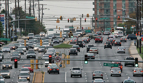
Every community has "Boulevards of Death." The Guardian article, "'Boulevards of death': why pedestrian road fatalities are surging in the US," points out something I've been thinking about and meaning to write about concerning this:
Queens Boulevard has been known locally as the “Boulevard of Death”, the site of more than 130 pedestrian deaths since 1990. Such accidents sharply decreased after the city invested $4m to redesign the street, however, creating bicycle and bus lanes.For all the talk of Vision Zero, which aims to:
achieve a highway system with no fatalities or serious injuries involving road traffic.and I've put forward various frameworks for implementing it here:
-- "A reminder about how the entitlement of automobility is embedded into law and democratizes death by accident," 2014
-- "A "Vision Zero" agenda for DC," 2014
-- "DC and Vision Zero Revisited," 2015
-- "Updating Vision Zero approaches," 2016
-- "First global benchmark for road safety in cities published by International Transport Forum," 2018
we aren't doing a lot of wholesale road redesigns to reshape the mobility paradigm away from automobile primacy, although most communities have examples here and there of some changes, although they tend to be somewhat incomplete.
For example, DC has designated some streets as "neighborhood slow zones" but without changing the speed limit. And many streets have sidewalk bulbouts.
Medellín. While this isn't a US example, and was done to promote economic and social revitalization, as much as it was to improve the social environment of the community, the way that Medellín has reconstructed roads in association with the implementation of aerial trams/gondolas is an incredible illustration of how to redesign roads to reduce car speeds and put pedestrians (the most vulnerable users) first. These photos are from the "Northeastern Urban Integration Project."


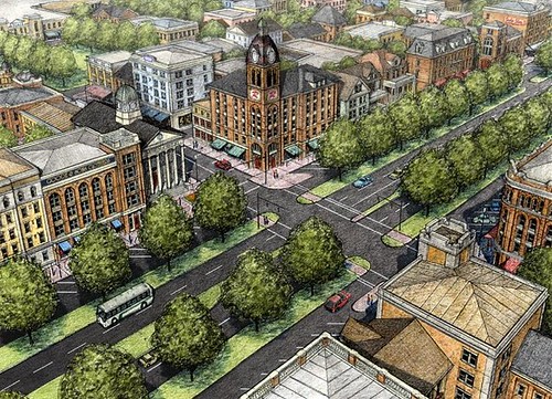
Why not implement high profile best practice examples in more places? I think more states need high profile best practice examples of street redesign which can be used to drive innovative practice across the state. For example, I've suggested that could be done with Rockville Pike in Montgomery County.
Today, Rockville Pike is a long way from what it could be.
Washington Post photo.
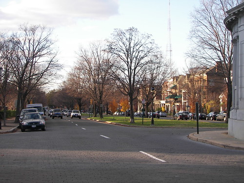
Or a major arterial in DC. And neighborhood streets.
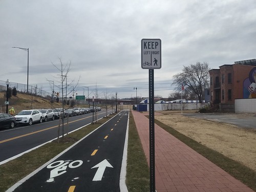
Although, while it hasn't gotten any notice, in the reconstruction of Virginia Avenue SE in association with the rebuilding of the CSX railroad tunnel, enhanced sidewalks include a "within the sidewalk right of way bike path + sidewalk" comparable to treatments in Europe, have been constructed for almost 7 blocks, from 2nd Street to 9th Street.
Asphalt block. For years, I've argued that one way to tame speed would be to use asphalt block on neighborhood streets, and in areas around parks, schools, commercial districts, transit stations, etc.
Monument Avenue in Richmond is a prominent example of this. The blocks provide visual, aural, and physical cues to drive more slowly.
Here and there in DC there are stretches of extant asphalt block in neighborhoods, mostly Capitol Hill, such as this section of First Street SE, while Georgetown still has a couple blocks done in cobblestones -- which look cool but aren't comfortable to walk or bike on.
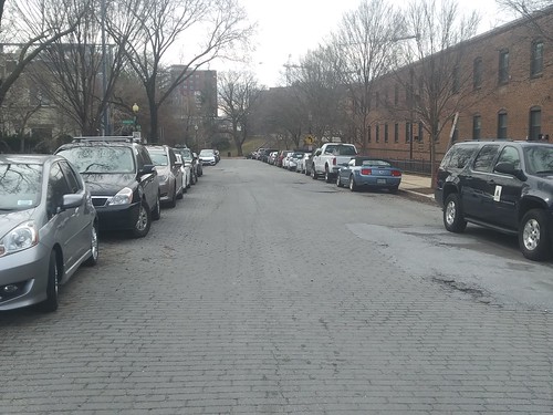
Asphalt block pavement on First Street SE, Capitol Hill, Washington, DC
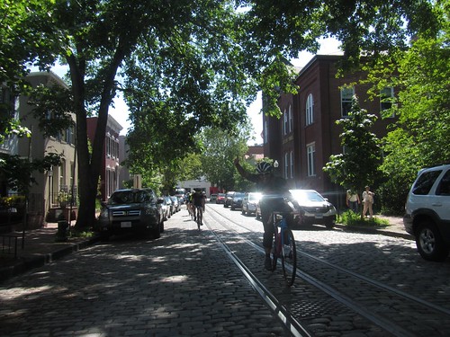
P Street NW, Georgetown

According to AN's 2014 article:
After four years of stops and starts, MyFigueroa, the $20 million proposal to transform Los Angeles’ Figueroa Corridor from a regional throughway to a bike– and pedestrian-friendly destination, appears to be moving ahead. Overseen by the Los Angeles Department of Transportation (LADOT) with design assistance from Melendrez, Troller Mayer Associates, and Gehl Architects, MyFigueroa will add separated cycle tracks or buffered bike lanes, bike racks, and improved transit shelters, lighting, and landscaping to 4.5 miles of streets between LA Live and Exposition Park.Although StreetsblogLA reports after a change in mayors and project managers, the results didn't live up to what was promised ("Muted Applause as Long Awaited MyFigueroa Officially Opens").

Like in Medellín, the improvements in LA and SF are/were made in association with transit investments, although in LA the project was paid for in large part by a special funding source, Proposition 1C, which funds infrastructure in association with affordable housing (that funding source seems a bit of a stretch for me, but ...).
These projects are comparable to what I've suggested should be done in association with the Purple Line light rail project in Suburban Maryland and creating "sustainable mobility corridors" in association with the transit stations that are created.
-- Purple Line #5: Creating a Silver Spring "Sustainable Mobility District"
- Part 1: Setting the stage
- Part 2: Program items 1- 9
- Part 3: Program items 10-18
- Part 4: Conclusion
- Map for the Silver Spring Sustainable Mobility District
The Bell Street redesign is much more radical than I am advocating, as it is the implementation of a heavy duty shared street concept.
I tend to be leery of such because in the US, cars dominate, and I don't think we're ready for sharing. Rather I'd like to see more emphasis on prioritizing pedestrians.
-- Bell Street Park, Seattle, Case Study, NACTO
-- STREETS AS PARKS: REDEFINING ROW IN BELLTOWN, Bell Street Park, Seattle, WA, SVRdesign

Here, I'm merely suggesting using asphalt block instead of traditional continuous asphalt pavement on neighborhood streets.
But I do think it's something that DDOT should consider in the context of their neighborhood transportation planning, which they call the "Livability Program."
One is going on in my greater neighborhood right now, and while I submitted dozens of ideas, I didn't submit this one, at least not yet.
Labels: bicycle and pedestrian planning, car culture and automobility, public safety, traffic engineering, traffic safety and enforcement, urban design/placemaking
posted by Richard Layman @ 1:56 PM&Permanent Link
![]()
![]()


1 Comments:
https://www.nytimes.com/2025/11/08/nyregion/nyc-cobblestone-streets.html
In a Skyscraper City, They Fix Cobblestone Streets by Hand
Meet the specialty bricklayers helping to preserve a quaint remnant of New York City’s early days.
Today, only 15 of the city’s 6,300 miles of streets are cobblestone. While that figure has remained the same for more than a decade, it was nearly ten times that — 140 miles — in Manhattan alone in 1949, according to a 2017 study commissioned by the Historic Districts Council, a preservation group.
Although they are called cobblestone streets, Mr. Berman said that most were actually made of chunks of granite, known as Belgian Blocks. Cobblestones are not a specific kind of stone, but include a variety of natural stones from places like rivers and fields that are typically rounded and irregularly shaped. Belgian Blocks, which were used as ship ballast, were extracted from quarries and cut into mainly rectangular blocks of uniform size.
The same blocks are still in use today. Mr. Cherry and his fellow cobblestone workers salvage them from streets that they tear up, putting back the ones that are in good shape. They have even turned up blocks that had been buried under asphalt and forgotten.
Many of America’s earliest cities — including Philadelphia, Boston, and Charleston, S.C. — have well-known cobblestone streets that are cherished by residents and tourists.
https://hdc.org/policy/a-study-of-new-york-citys-belgian-block-heritage/
Post a Comment
<< Home