PL #5: Creating a Silver Spring "Sustainable Mobility District" | Part 1: Setting the stage
======
Note that in the 2+ months process of developing this entry, it has expanded conceptually far beyond the original idea of special treatments for two different roads in Silver Spring that will be impacted by the Purple Line light rail line.
While the title concerns the creation of a "Sustainable Mobility District," it's probably better to call the full proposal "Silver Spring as an "Innovation District."
This post is very long. So it's broken up into four sections, plus three related posts:
- Part 1: Setting the stage
- Part 2: Program items 1- 9
- Part 3: Program items 10-18
- Part 4: Conclusion
+ Map (to come)
+ "(Big Hairy) Projects Action Plan(s) as an element of Comprehensive/Master Plans"
+ "Creating the Silver Spring/Montgomery County Arena and Recreation Center" (to come)
Parts 1-4 will be published today, Friday, Monday, and Tuesday.
======

Part 1 | the principles
Part 2 | the program (macro changes)
Part 3 | influences
Part 4 | Making over New Carrollton as a transit-centric urban center and Prince George's County's "New Downtown"
Part 5 | Fenton Street, East-West Highway, and Wayne Avenue, Silver Spring, as building blocks for a Silver Spring "Sustainable Mobility District"
Part 6 | Creating a transportation development authority in Montgomery and Prince George's County to effectuate placemaking, retail development, and housing programs in association with the Purple Line
Part 7 | Using the Purple Line to rebrand Montgomery and Prince George's Counties as Design Forward
This is the gist from point #19 from the program to make complementary improvements across the transit-mobility network, inspired by the Purple Line:
Create "sustainable mobility" corridors in Silver Spring (and other places), complementing the new PL.
This element has been on my mind for awhile, something I intended to write about almost a year ago, originally as part of a set of writings on transportation infrastructure and civic architecture ("Transportation infrastructure as a key element of civic architecture/economic revitalization #1: the NoMA Metrorail Station," "Public improvement districts ought to be created as part of transit station development process: the east side of NoMA station as an example," and "Transportation Infrastructure and Civic Architecture #3: Rhode Island Avenue Pedestrian Bridge to the Metrorail station").
Part 4 of that series was supposed to be on Wayne Avenue (not Fenton Street) and Part 5 was supposed to be on the Benning Road extension of the DC streetcar with an eye to some learnings from the Kansas City Streetcar project and the positioning of that line as a Smart City initiative.
In Silver Spring, Wayne Avenue and Fenton Street would be targeted for this treatment. Undoubtedly, other streets in the transit shed of the Purple Line are equally deserving.
Re-thinking Wayne Avenue-Fenton Street has been sparked in part by two events. First, there was a public meeting last summer about the Wayne Avenue routing ("Leader of Purple Line Construction Team Makes First Public Appearance in Silver Spring," Bethesda Magazine).
It was "unruly" as the majority of the citizens were not happy with an above-ground routing of the line on what they think of as their "neighborhood street." My thought at the time was that at some point, when it comes to urban design-related improvements in association with a new transit project, the costs need to be borne by the locality, not the transit authority.
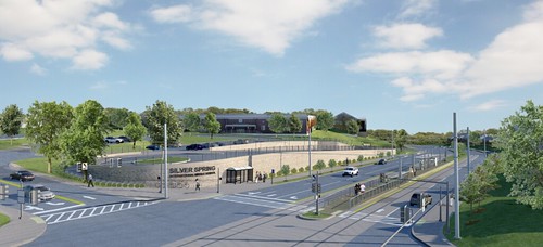
A rendering of the Dale Drive-Wayne Avenue Purple Line station in front of the Silver Spring International Middle School. Via MTA
But at the same time, why not make the street great in association with the transit project, which is the issue with the extension of the DC Streetcar further into Ward 7 on Benning Road.


More recently, MoCo's Energized Public Places planning initiative has influenced this recommendation too, specifically with regard to Fenton Street.
Note that since the February Montgomery Parks public meeting I came across the Transport for London Healthy Streets Initiative, which provides some great concepts and a framework that can be harvested for further explication of the Signature Streets concept (see "Transport for London's "Healthy Streets" approach integrates place and aesthetics considerations alongside mobility").
AFTER I WROTE THE PL#2 PIECE, a Montgomery County blogreader wrote to me suggesting that I outline this concept in more detail, with the aim of bringing it to the attention of Montgomery County elected and appointed officials.
"Signature Streets" is a call to take control of the aesthetic qualities of transportation infrastructure. The foundation of the Signature Streets concept is taking ownership of the aesthetics of your arterials, recognizing that most people drive to get around, and the main arterials and freeways in a city or county define/the aesthetics and identity of your community for good or ill.
Note that while I conceived this before coming across a presentation by parks-sustainability planner David Barth of what he calls "the integrated public realm framework," his term (and graphic rendition) outline the concept very well.
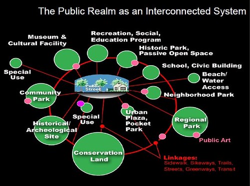
If your community's mobility system is ugly and car-centric, that's the "brand image" and aesthetic identity of your community. Instead, make the arterials comprising your community's primary road network multimodal, attractive, and supportive of quality of life goals and objectives. That's the "Signature Streets" concept in a nutshell.
For the past couple months I have been applying this concept to Silver Spring, moving from focusing on specific streets to a larger aim of accentuating and extending placemaking elements that are present in "Downtown Silver Spring" at the scale of the entire district, treating the mobility system as an integrated network.
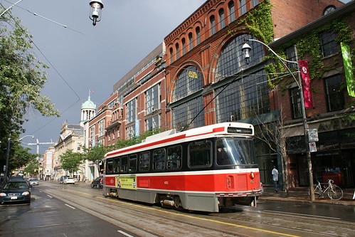
History of the Silver Spring District. Silver Spring is an inner ring suburb, on the border of DC, and had streetcar (until the system was shut down in 1962), bus and railroad connections to the city. Marked by art deco architecture which was a dominant style when the area grew, it's where the Hecht Department Store Company (now Macy's) opened its first store outside Downtown DC, and was a vibrant pre-shopping mall suburban shopping district including independent stores and regional and national chains, including a JC Penney Department Store, complemented by office and light industry including a soda bottling plant and a scientific instrumentation manufacturer.
In the 1980s, the department stores closed and the commercial district languished as people shifted to shopping at mall, and residents moved even further out from the core. Today, the old Hechts store has been remade into an interior mall called Ellsworth Place and the JC Penney store is now the Fillmore concert hall.
Various "urban renewal proposals" were floated, and the County settled on a revitalization program called "Downtown Silver Spring," leveraging the Metrorail station, some office buildings, and remnant retail buildings along with the cultural anchors such as the Silver Theatre, to which the American Film Institute moved from Kennedy Center.
Today the district is thrives as a shopping and cultural destination, although the office element of the district is somewhat stagnant. Many multiunit housing developments are being constructed as a mark of intensification and addition of population to the center, anchored by the Metrorail station and the thriving "pedestrian mall" on Ellsworth Avenue and Veterans Plaza.
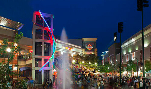
WRT Silver Spring specifically, the "sustainable mobility district" builds on something I wrote a few years ago, "The layering effect: how the building blocks of an integrated public realm set the stage for community building and Silver Spring, Maryland as an example," which outlined how the pedestrianized section of Ellsworth Avenue--the heart of the "Downtown Silver Spring" development by Foulger-Pratt and Peterson Companies (article, Terrain)--complemented by the Silver Spring Civic Building, Veterans Plaza, and the various events (farmers market, craft market, festivals) on the street and plaza, activate the spaces and draw "and produce" pedestrians.
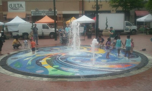
The Splash Fountain in operation during the Saturday Farmers Market on Ellsworth Avenue.
Refocusing on the core/Designating the Silver Spring Triangle. Wayne Avenue was originally to be a central point in my Purple Line writings, because it is where the Purple Line will be routed, but the fact is that east of Fenton Street it is a predominately residential street that won't change much, even with the addition of light rail.
With the exception of the importance of how Wayne Avenue connects the core of Silver Spring to the Sligo Creek Trail and Park, instead I shifted the focus, to the area bounded by East-West Highway on the west, Colesville Road on the North, and Fenton Street on the east, as a large triangle, with the apex being the Montgomery County College campus and Jessup-Blair Park on the border with DC.
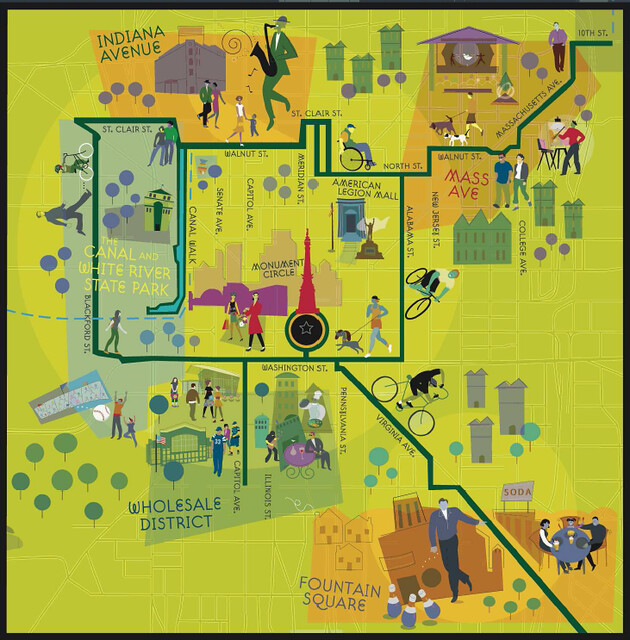
A map will be published in a later post.
The point of this post is to extend from a single street or collection of "Signature Streets"--the network of primary arterials at the city or county-wide scale--to a district.
While I am calling this a "Sustainable Mobility District," it simply proposes that the current "Downtown Silver Spring" business district and related civic and cultural initiatives be spread outward and better connected and leveraged throughout the entire district, not merely centered on Ellsworth Avenue and the restaurants and shops (Whole Foods, H&M, DSW, Ulta, Michaels, TJMaxx, etc.) and civic and cultural assets located there.
Note that Montgomery County believes that it's doing this already--and it is to a large extent--through the Silver Spring Urban District and Citizens Advisory Committees, the Regional Services Center, and its designation as an arts district. The County has invested hundreds of millions of dollars on Silver Spring's revitalization, so its commitment can't really be questioned.
And it's fair to say that the program has been quite successful.
But can more be done?
Separate from the commercial ventures, the County has invested in cultural facilities including the AFI/Silver Theatre, a black box theatre, and Fillmore concert hall, the creation of the Civic Center building and plaza, the construction of a new Silver Spring Library with an allied cultural use--the Levine School of Music--on the ground floor, and the county-managed construction of the Silver Spring Transit Center bus station next to the Metrorail station ("Multiple missed opportunities in the creation of the Silver Spring Transit Center" and "Brief follow up to the SSTC review").

The argument here is that while much has been done, there needs to be more purposive "knitting" together of these assets and investments across the district, into a network working simultaneously and in parallel, so that the whole is greater than the sum of the parts.
The addition of specific types of sustainable mobility infrastructure and additional placemaking elements will strengthen and extend the branding of "Downtown" as most of the Silver Spring district (map) and in favor of sustainable mobility, in a County where the car is still king.
(Despite the reality of the car being king, Montgomery County makes equally large investments in heavy rail and bus transportation--the County's RideOn bus system is a national leader in suburban transit--including the forthcoming addition of a county-developed BRT network.)
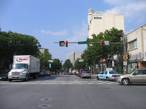
Colesville Road looking west, at Fenton Street. Photo by Andrew Bossi.
However, a significant barrier to this rebalancing is the fact that the primary arterials serving the core of Silver Spring--Colesville Road, Georgia Avenue, and East-West Highway--are very wide with up to 4 lanes in each direction.
 Other sustainable mobility initiatives as examples for Montgomery County and Silver Spring. There are a number of projects across the country which incorporate some of these concepts, which should give courage to otherwise hesitant government officials.
 A primary example is the Indianapolis Cultural Trail, which connects Downtown Indianapolis to five neighborhoods on its edge, and provides an intra-core shared use path network ("The new Indianapolis Cultural Trail is a masterpiece of bike-friendly design," Cleveland Plain Dealer).
The ICT exemplifies three different elements that are key to creating a Signature or Sustainable Mobility District:
(1) connecting neighborhoods to the core;
(2) using leading urban design principles and the use of high quality treatments and materials in the creation of the infrastructure and facilities, complemented by high quality placemaking elements like public art; and
(3) and providing an intra-core (Downtown) pedestrian and bicycle network.
Other models include Exhibition Road in London ("Exhibition Road, London – review: After years of wrangling, the new Exhibition Road in South Kensington, home to many of Britain's great museums, proves a triumph for the 'shared space' movement," Observer), the iTowpath in Akron, the Connective Corridor in Syracuse, New York, the about to be unveiled new streetcar-prioritized King Street in Toronto ("King St. streetcar plan is a cautious first step with room to grow," Toronto Star), the Washington Area Bicyclist Association proposal for the creation of an Arlington Boulevard Trail on Route 50 in Arlington County, and the network of urban parks in Calgary, Alberta.

Although there is some criticism that the project is shaped more to benefit the university, which is the primary funder.
 The description of the Connective Corridor in promotional materials sums up the elements that comprise a "Signature Street" or sustainable mobility district:
The Connective Corridor is a collaboration between Syracuse University, the City of Syracuse and Onondaga County to connect University Hill with downtown Syracuse. The project includes new streetscapes to make the city more pedestrian and bike-friendly, a free public transportation system with smart bus technology, a network of green infrastructure, public art, wayfinding systems, façade improvements and innovative illumination projects that highlight Syracuse’s beautiful historic buildings and public spaces. The Corridor also connects the city’s vibrant arts and cultural district, as well as downtown dining and the great local food scene. Take the bus, walk or ride your bike...

The King Street Streetcar initiative is relevant as an example because it is rare example of beginning rebalancing throughput away from motor vehicles to streetcars/transit on a street where streetcars move 65,000 people/daily versus 20,000 motor vehicles.
While Toronto should make King Street a transit-exclusive street (also allowing heavy goods vehicle, delivery, and taxis)--a transitway--comparable to how Nicollet Mall in Minneapolis ("James Corner–designed pedestrian street, the Nicollet Mall, gets budgetary rethink in Minneapolis," Architect's Newspaper) or the 16th Street Mall in Denver are "transit malls" that don't allow regular motor vehicle traffic (or Spitalerstrasse in Hamburg), the new King Street traffic pattern includes motor vehicles, but won't allow through trips, forcing cars to divert to the right after traveling one to two blocks.
Note that the disadvantage of transit malls is that buses are heavy and noisy and depending on the type of bus, belch out smelly exhaust. Streetcars (and electric trolley buses), being electric-powered, are quieter.
 Energized public places and Fenton Street as a major spine connecting multiple civic assets. The idea of Fenton Street as a connector came a few months back at a Montgomery Parks planning meeting for the Energized Public Places Functional Master Plan, when I realized that with some improvements, Fenton Street can work as a kind of "greenway" connecting Downtown residents to civic facilities that are otherwise located on the periphery.
 Part of the issue with parks and open spaces in Silver Spring is that many of the facilities are on the outskirts of the core, so how do you provide a comfortable and convenient way to get to and from these places, without having to drive?
Silver Spring is a state-designated arts and entertainment district and along and near Fenton Street there is a panoply of civic and cultural assets:
- Ellsworth Avenue pedestrian mall with a splash fountain and occasional stage for music, and an events program
- American Film Institute/Silver Theatre
- Arts and Humanities Council of Montgomery County
- ArtStream
- a black box theatre
- Create Arts Center
- Fillmore Concert Hall
- Regal Majestic Cinemas Silver Spring (20 screens including an IMAX Theatre)
- Maryland Youth Ballet
- Silver Spring Civic Building
- Veterans Plaza (with wintertime ice rink) and an events program
- Silver Spring Library, outdoor patio, and the Levine School of Music
- Historic B&O Railroad Station
- Catylator Makerspace
- Fenton Street Park (includes a sculpture)
- Fenton Street community garden
- Silver Spring Intermediate Park
- Montgomery College, including classroom buildings and a student center, the Cafritz Arts Center a public auditorium, a library and planetarium
- Montgomery College Falcon Hall, a recreation facility including gym, pool, and fitness facilities
- Jesup-Blair Park (accessible from Fenton Street by a pedestrian bridge over the railroad tracks, otherwise hard to reach)
- Jequie Park (in the City of Takoma Park)
- connection via Wayne Avenue to the Silver Spring Transit Center (west) and the Sligo Creek Trail and Park (east).
There is also an LA Fitness private facility on Cameron Street. (This is not intended to be a complete inventory of all the park, recreation, and cultural spaces within the core. Silver Spring Arts & Entertainment District map.)
Separately, Montgomery County has proposed creating an arena in the Silver Spring Triangle ("Montgomery eyes 5,000-seat sports arena for downtown Silver Spring," Washington Post; "Proposed Silver Spring Arena Fails To Generate Developer Interest," Bethesda Magazine. The district doesn't really have a public recreation center, but there is a YMCA closer to Beltway, a couple miles outside the Triangle.
Labels: change-innovation-transformation, green-environment-urban, parks planning, public realm framework, suburban revitalization, transportation planning, urban design/placemaking
posted by Richard Layman @ 9:00 AM&Permanent Link
![]()
![]()


3 Comments:
King Street streetcar preferencing approved, with accommodations for taxi
https://www.thestar.com/news/city_hall/2017/07/06/council-approves-king-st-pilot-to-prioritize-streetcars-but-bows-to-taxi-industry.html
Oxford Street, London, mode rebalancing to the pedestrian, including reduction of bus trips.
http://www.cityam.com/263389/oxford-street-transformation-get-underway-december-2018-tfl
These are rare examples of rebalancing towards sustainable modes and away from the car.
Fleuve-Montagne urban path, Montreal
http://montrealgazette.com/news/local-news/city-hall-says-fleuve-montagne-to-be-ready-for-inauguration-next-week
http://ville.montreal.qc.ca/375/en/legs/promenade-fleuve-montagne
http://www.cbc.ca/news/canada/montreal/promenade-fleuve-montagne-montreal-1.4208878
Post a Comment
<< Home