Map for the Silver Spring Sustainable Mobility District
This piece is the map entry of the series of Purple Line posts suggesting that making simultaneous improvements in the transit network and mobility system, spurred by the creation of the Purple Line light rail line, will improve the utility of the mobility network overall, further contributing to the success of the Purple Line at the outset.
-- Setting the stage for the Purple Line light rail line to be an overwhelming success: Part 1 | simultaneously introduce improvements to other elements of the transit network"
-- Part 2 | the program (macro changes)
-- Part 3 | influences
-- Part 4 | Making over New Carrollton as a transit-centric urban center and Prince George's County's "New Downtown"
-- PL #5: Creating a Silver Spring "Sustainable Mobility District"
- Part 1: Setting the stage
- Part 2: Program items 1- 9
- Part 3: Program items 10-18
- Part 4: Conclusion
- Map for the Silver Spring Sustainable Mobility District
- "(Big Hairy) Projects Action Plan(s) as an element of Comprehensive/Master Plans"
+ "Creating the Silver Spring/Montgomery County Arena and Recreation Center"
-- Part 6 | Creating a transportation development authority in Montgomery and Prince George's County to effectuate placemaking, retail development, and housing programs in association with the Purple Line (to come)
-- Part 7 | Using the Purple Line to rebrand Montgomery and Prince George's Counties as Design Forward (to come)
=====
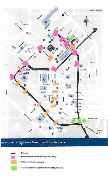
Map for the proposed Silver Spring Sustainable Mobility District showing routing for cycletracks, pedestrian scramble intersections, and crosswalk improvements.
This map differs a bit from the recommendations in Part 2: Program items 1- 9 concerning enhanced crossings generally and Georgia Avenue specifically.
Point #4 calls for creating pedestrian scramble intersections, but not so much a general approach to improving crosswalks overall, which is what the "enhanced" denotation is about--improving crossing conditions and urban design treatments whether or not a ped scramble is created.
First, I neglected to discuss Georgia Avenue in the series. Part of this is because it's a state road and changing elements of the street right of way requires negotiations with the Maryland State Highway Administration. The other is because I was focused on the light rail transit stations and the area around them. Nonetheless some urban design related changes should be made along Georgia Avenue too.
-- Main Street: When a Highway Runs Through It, Oregon Department of Transportation
Montgomery County has already invested heavily in "curbside" improvements--between the curb and buildings--in terms of enhanced sidewalks, street furniture, trees and plantings.
Because the street is so wide, with the exception of the intersections at Wayne Avenue and Colesville Road, pedestrian scrambles aren't recommended--there despite the width of the roads, the high levels of pedestrian traffic make scrambles workable.
But all the crosswalk crossings should be enhanced on Georgia Avenue, as indicated on the map. The map doesn't extend to the border of DC, which is the location of the Georgia Avenue and Eastern Avenue intersection.
For historical reasons, except for the northside crosswalk from the east to the west side of Georgia Avenue, the entire intersection is under the jurisdiction of DC, not Maryland, which is probably why it is in such bad condition compared to the intersections northward to Colesville Road. Maryland should negotiate with DC for comparable improvements to that intersection.
Second, I added a pedestrian scramble to the intersection of Fenton Street and Roeder Road (one block north of Ellsworth), and added an enhanced crosswalk to the mid-block crosswalk between Ellsworth Avenue and Wayne Avenue, at the service drive/crosswalk serving the "Whole Foods-CVS-Strosniders" shopping center. (A timed pedestrian traffic signal might need to be added to the Fenton-Roeder intersection to accommodate the scramble set up. It would enhance safety.)
Third, I added an enhanced crosswalk across Colesville Road at the Silver Spring Transit Center, connecting the two sides of the Metrorail station. There is already a crosswalk there, it just needs to be better and more prominently "pedestrian-focused."
Fourth, I added enhanced crosswalks to the various existing crossings on East-West Highway. For the most part, these crosswalks (not at Georgia Avenue) are already enhanced somewhat, but I recommend even more special treatments with pavers, etc., to distinguish the walking character on what is otherwise a very wide road.
I don't have great images of what I mean by enhanced crosswalk treatments. The ideal would be great pavers complemented by plantings.
These images from the Indianapolis Cultural Trail show what I am thinking, in terms of the crossing treatment and plantings and other elements.
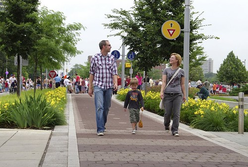
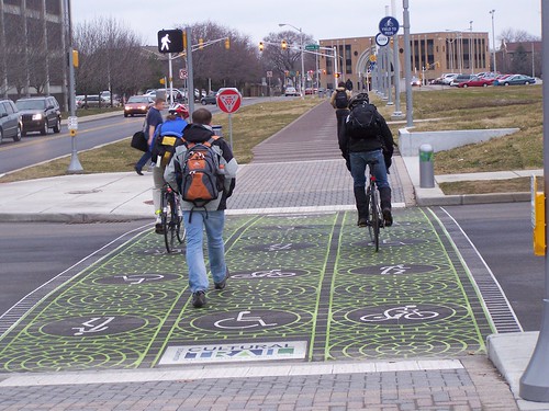
I came across these images too. Think of these sidewalk treatments as applied to crosswalks.
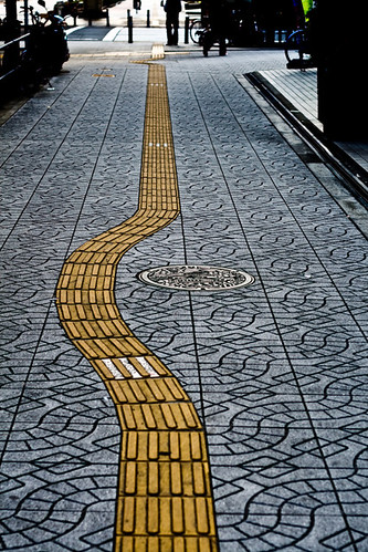
The yellow bricks are tactile to help blind pedestrians negotiate. Photo by Lachlan Hardy. Location not identified.
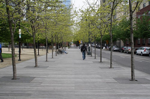
Streetside boardwalk, Portland, Oregon. From the Land Perspectives blog.
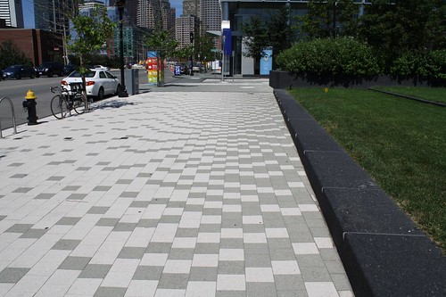
Enhanced sidewalk in South Boston. From the Lands Perspectives blog.
Labels: branding-identity, city-regional branding, revitalization, sustainable mobility platform, transportation infrastructure, transportation planning, urban design/placemaking


0 Comments:
Post a Comment
<< Home