Rebuilding Place in the Urban Space

"A community’s physical form, rather than its land uses, is its most intrinsic and enduring characteristic." [Katz, EPA] This blog focuses on place and placemaking and all that makes it work--historic preservation, urban design, transportation, asset-based community development, arts & cultural development, commercial district revitalization, tourism & destination development, and quality of life advocacy--along with doses of civic engagement and good governance watchdogging.

Tuesday, November 21, 2023

Design forward trains and streetcars: Haga-Utsunomiya Light Rail and Brightline (plus bonus)

When I first was into the idea of reintroducing streetcars into American cities, I favored re-adopting the heritage streetcar vehicle ("A National Mall-focused heritage (replica) streetcar service to serve visitors is a way bigger idea," 2013).  

But maybe 15+ years ago, I had a conversation with Dan Malouff (Beyond DC), and he made the point that for a lot of people that might mean that streetcars are dowdy and old fashioned.

His point was provocative.  And I'm sure I disagreed at the time.  But he's right.  

Today, too many people scoff at streetcars as "19th century technology."  Although cars are 19th century too.  The thing is both have improved since.  But really they are knocking mass transit for being transit while favoring individualized personal mobility.  

Design should be a key element in repatterning how people think about transit.

A lot of train design is clunky, or at least given that the trainsets are used (unless terribly faulty) for at least 40 years, it's important to try to get the design right and to be forward, recognizing it will be around for a long time.  

While I think Baltimore's light rail cars have a kind of industrial charm, they have been in service for 31 years, and likely many more.  They don't communicate "design forward."  (Note that in my writings on the Purple Line, I suggested that they replace the Baltimore light rail vehicles at the same time.  But that's expensive when the cars have years of useful life yet.)

Most governments aren't so great at this, but there are exceptions.

There's an article in the Financial Times, "Kenneth Grange: ‘The government once had ideas about how to use design’," about a famous designer in the UK, and he commented about how the UK government was once truly focused on the value of design as an element of the built environment:

He also says the Design Council, founded in 1944, was a cornerstone of his career, a government body which “approved” the right kinds of designs. “It was an incredible thing,” he says. “The government had ideas about how to use design, for how to recover from the war and for society. And it promoted industry too; everything then was made here, now absolutely everything is made in China.” 

... One thing Grange points out is that so many of his designs were the result of central or local government commissions, from the Festival of Britain to parking meters and trains, something almost unthinkable today. “Wouldn’t it be great if [Keir] Starmer, or whoever ends up trying to govern this country, embraced the idea of believing in design in the creation of real stuff that makes real lives better?”

And you have the great example of Frank Pick who incorporated design into the communications and stations and trains of what we now call the London Underground.

I do have a piece about this, "Using the Purple Line to rebrand Montgomery and Prince George's Counties as Design Forward," which includes links to scads of entries as design as an element of urban revitalization.

I watch "Japan Railway Journal" on NHK as a way to keep in touch with best practice in Japanese rail matters.  While it's a sub-channel for many PBS stations, it's also available on demand.

For the most part they cover trains and stations, but sometimes but not nearly enough local transit systems operating in Japan.

The latest episode is "Haga Utsunomiya LRT: Shaping Communities," on Japan's first new from the ground up streetcar/tram/what they call light rail in 75 years.  

HU 300 light rail car.

The line was built mostly for Utsunomiya City, capital of Tochigi Prefecture, but during the planning phases it was slightly extended to the manufacturing district of Haga, which is a major job center ("Utsunomiya in Japan: The new light rail opened today!," Urban Transport Magazine).  

Just like in the US, it took a long time to realize, about 30 years from idea to working line--about 10 miles.  And its primary purpose is urban revitalization and centralizing new development along the transit line, with the aim of promoting trips on transit instead of by the car.

There's talk about extending it to the Utsunomiya City Hall, but I think they should also extend it to Haga's center, as the manufacturing district is on the edge of Utsunomiya, and the light rail barely extends into Haga.

But related to Dan's point, the streetcars are absolutely design forward, with a great design, low floors, huge swathes of glass for the windows, and a decent livery.  

The cars are called HU 300 and are manufactured by Niigata Transys, although Alstom is a partner as they provided the bogie/wheel sets.

Similarly, Brightline ("Florida's Brightline passenger rail as an opportunity to rearticulate and extend transit service in cities like Orlando"), the "new" private passenger rail service operating from Miami to Orlando (an extension to Tampa is planned) also has well designed trains and liveries.

In "Branding's (NOT) all you need for transit," I discuss how London Underground is treated as a "design product":

The London Underground as a design product. The London Underground is an outlier for transit systems in that it has been a consistent innovator in design and usability for 100+ years.

Key to this development was Frank Pick, who started at the agency being responsible for communications ("PR") and who laid the groundwork for corporate branding by coordinating all elements of the program into an integrated and extensive transit system -- advertising, branding, station architecture, vehicle design, and mapping -- with the highest standards for "design."

That legacy had been maintained through the creation of "product design managers" for the various transportation modes managed by the successor agency, Transport for London. But more recently, because the agency has been crushed by needing to find money to pay for Crossrail, in part because the national government cut back its contribution, they've cut these positions (and many other programs across the system).
-- Product design guidelines, Transport for London

Although in our IT centric world these days maybe people think about this more in terms of what is now called UX or User Experience.  

Brightline also does that, better than Amtrak, more like how it was done "back in the day" with railroad passenger service as being a premier service by railroads.

And the ads ("American Streamlined Trains. Striking Ads of the 1940s," Ikonographia). This page classifies ads, and the elements of premier train service as:

  • the equipment
  • power and speed
  • comfort and service
  • ability to serve leisure and vacation (and commuting)
  • designing trains for the future.


Brightline's focus on first mile/last mile transportation integration with train service is unparalleled.  They even sponsor bike share in some places ("Brightline kick starts bike share rental program," Florida Weekly).  

(Deutsche Bahn was an early pioneer in bike sharing, but not in other elements of first mile/last mile.  In Los Angeles, the local transit agency is the deliverer of bike share.  This is an outlier in the US.)

Multiplicity bus system Luxembourg.  I've mentioned these buses.


And I just came across the livery for the Class 222 trains of East Midland Trains in the UK.

Labels: , , , , , , , ,

Friday, June 30, 2017

PL #7: Using the Purple Line to rebrand Montgomery and Prince George's Counties as Design Forward

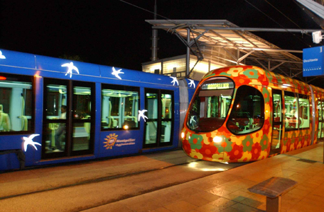
Montpellier France trams, livery design by Christian Lacroix
Images of the Montpellier tram. First photo from the Rugby Network; second photo from the transit operator.

In 2007, I saw a presentation at a Main Street commercial district revitalization conference by Lisa Fontaine, a graphic design professor at Iowa State University, about using the graphic design framework to do façade improvements on commercial buildings.

During the presentation, I had the idea that perhaps cities need a "graphic design" element in land use plans, later thinking about this more broadly in terms of a "branding-identity-design" element, which I've written about over the years.  

(1) I argued that cities need a "Graphic Design" element in their master plans but I realize now it's more a branding-identity-design element

-- Design as city branding: transit edition
-- City (and university) branding: brand deposits; brand withdrawals; brand destruction
-- Georgetown: A subtle but important difference between branding and identity-positioning
-- Identity ≠ branding or Authenticity is the basis of identity
-- The taxi livery debacle as a lead in to a broader discussion of the importance of "design" to DC's "brand promise
-- Illustration of government and design thinking: Boston's City Hall to Go truck
-- (DC) Neighborhoods and commercial districts as brands
(2) the design method may be superior to the "rational planning methodology" for planning but also for thinking about how to deliver public services

-- Social Marketing the Arlington (and Tower Hamlets and Baltimore" way
-- All the talk of e-government, digital government, and open source government is really about employing the design method
-- Best practice bicycle planning for suburban settings using the "action planning" method
-- A DC [Government agency] example of branded communications

(3) I have been developing this theme also in terms of transit infrastructure as an element of civic architecture

-- Transit, stations and placemaking: stations as an entrypoint for neighborhoods
-- DC's bad urban design as it relates to transportation inrastructure
-- Transportation Infrastructure and Civic Architecture #3: Rhode Island Avenue Pedestrian Bridge to the Metrorail station
-- Transit stations as an element of civic architecture/commerce as an engine of urbanism
-- Takoma Langley Crossroads Transit Center: A Critical Evaluation
-- Not butt ugly costs a little more: DC streetcar barn edition (transit infrastructure as civic architecture)

I made the point about design, brand, and identity in a couple commercial district revitalization framework plans I did in 2008 and 2009 (and I modified the language more broadly in terms of recommendations about "asset management," see "Town-city management: we are all asset managers now").

The basic idea is that whether or not they conceive of themselves that way, the decisions elected officials and stakeholders make shape the community's design and "brand," for good or ill, depending on the quality of the decision.

The Purple Line as a design intervention

While working through the series of articles about how we could better leverage transit infrastructure projects to further develop a wide variety of transit, economic development, and community building objectives, using the Purple Line as the example:

-- Setting the stage for the Purple Line light rail line to be an overwhelming success: Part 1 | simultaneously introduce improvements to other elements of the transit network
-- Part 2 |   the program (macro changes)
-- Part 3 |   influences
-- Part 4 |   Making over New Carrollton as a transit-centric urban center and Prince George's County's "New Downtown"
-- PL #5: Creating a Silver Spring "Sustainable Mobility District"
- Part 1: Setting the stage
- Part 2: Program items 1- 9
- Part 3: Program items 10-18
- Part 4: Conclusion
- Map for the Silver Spring Sustainable Mobility District
- (Big Hairy) Projects Action Plan(s) as an element of Comprehensive/Master Plans
- "Creating the Silver Spring/Montgomery County Arena and Recreation Center"
-- Part 6 |  Creating a transportation development authority in Montgomery and Prince George's County to effectuate placemaking, retail development, and housing programs in association with the Purple Line (to come)
-- Part 7 | Using the Purple Line to rebrand Montgomery and Prince George's Counties as Design Forward 

specifically the sub-series on Silver Spring--making the point that Silver Spring could be repositioned as an "innovation district" not merely a "sustainable mobility district"--I realized that the branding-identity-design element is relevant to that discussion as well.

====

According to the New York Times Travel Section's piece, "The 45 Places to Go in 2012," Montpellier France utilizes high quality design as a way to promote and brand the city and extends this idea to their transit system.

From the article:
France’s eighth-largest city is dressing up in designer style.

The most celebrated architect in France, Jean Nouvel, and a collaborator, François Fontès, introduced their blue and cube-like city hall in November, and early next year Mr. Nouvel’s RBC Design Center — another coolly modernist structure that will house the RBC brand’s furniture showroom — is to open its doors in this medieval, student-filled Mediterranean city.

Even more innovative, the long-awaited Pierres Vives Building from the star architect Zaha Hadid will be ready by year’s end. A long, sprawling edifice of swirly white concrete layers and green-tinted glass, the futuristic structure will hold a library, archives and municipal offices.

And to reach them, the city is installing what may be Europe’s sexiest tram system. The two existing lines sport exteriors of kaleidoscopic birds and flowers by Christian Lacroix, and two new lines with Mr. Lacroix’s trademark color-soaked style are on their way. Both will make their debut this spring with an underwater design theme and a solar theme, respectively, along roughly 17 miles of new track. Think of it as France’s longest fashion runway.
Montpellier France trams, livery design by Christian Lacroix

It is very rare that transit infrastructure is positioned in the same way in the US, although Transport for London has "design product managers" for each transit mode.   For example, I make the point often that transit shelters are the key touchpoints for marketing transit, for communicating whether or not we value transit or merely look at it as a social service.

See "Making bus service sexy and more equitable" and "(Ir)rational planning #2: sexy (Circulator) vs. plodding (Metrobus) bus service","

(1) some bus-only systems (Orlando, Boulder, Pittsburgh, Santa Monica, Columbia, SC) are known for particularly engaged livery designs.  This makes sense because in effect, the vehicles are rolling billboards, and while they are often used for advertising, the design of the bus or fixed rail transit vehicle has to be considered a key element in how transit is defined and the system is marketed.

(2) many transit systems incorporate public art, but a few systems employ public art as a key element of their branding and placemaking strategies

(3) transit systems are beginning to treat bus shelters, stations and other elements in terms of design and placemaking rather than as utilitarian appurtenances.  See "Thinking systematically about bus transit service improvements: spurred by Columbia SC, Edmonton AB, and Baltimore."

(4) some transit systems, especially for bus rapid transit services, are incorporating design forward bus vehicles, and this can be the case for streetcar vehicles too, in terms of using modern or heritage replica designs--most new streetcar systems use modern vehicles.

The Christian Lacroix tram design extends to the use of color and design within the light rail vehicles.

But in the US, light rail vehicles don't seem to be utilized as a way to brand transit as design forward.

Clearly, Montpellier, France demonstrates this is a missed opportunity, and given that we are aware of this, ideally the Purple Line could incorporate forward design in the transit vehicles as a way to better market, promote, and position transit.

By extension, Montgomery and Prince George's Counties could do the same thing, as discussed in various program elements in the Silver Spring series. 

Unfortunately, I haven't had a chance to pick up the and read the chapter on "Public Sector Innovation" in Economies of Design, or on "Branded Places" from Culture of Design
both published by Sage.

There are some articles about Montpellier, including:

-- "Montpellier: the capital of design," Tourism Montpellier
-- "Montpellier -- the big build up," Conde Nast Traveller

Also see:

-- "Political economies of design activism and the public sector," Guy Julier, author of Economies of Design
-- Cities of Design Network
-- World Design Capital program
-- Design and Creativity: Policy, Management and Practice
-- "The world's 16 best cities for design," Business Insider

Labels: , , , , , , , ,

Thursday, June 15, 2017

Map for the Silver Spring Sustainable Mobility District

This piece is the map entry of the series of Purple Line posts suggesting that making simultaneous improvements in the transit network and mobility system, spurred by the creation of the Purple Line light rail line, will improve the utility of the mobility network overall, further contributing to the success of the Purple Line at the outset.

-- Setting the stage for the Purple Line light rail line to be an overwhelming success: Part 1 | simultaneously introduce improvements to other elements of the transit network"
-- Part 2 |   the program (macro changes)
-- Part 3 |   influences
-- Part 4 |   Making over New Carrollton as a transit-centric urban center and Prince George's County's "New Downtown"
-- PL #5: Creating a Silver Spring "Sustainable Mobility District"
- Part 1: Setting the stage
- Part 2: Program items 1- 9
- Part 3: Program items 10-18
- Part 4: Conclusion
- Map for the Silver Spring Sustainable Mobility District
- "(Big Hairy) Projects Action Plan(s) as an element of Comprehensive/Master Plans"
+ "Creating the Silver Spring/Montgomery County Arena and Recreation Center"

-- Part 6 |  Creating a transportation development authority in Montgomery and Prince George's County to effectuate placemaking, retail development, and housing programs in association with the Purple Line (to come)
-- Part 7 | Using the Purple Line to rebrand Montgomery and Prince George's Counties as Design Forward (to come)

=====
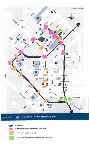
Downtown Silver Spring Map with suggested urban design improvements
Map for the proposed Silver Spring Sustainable Mobility District showing routing for cycletracks, pedestrian scramble intersections, and crosswalk improvements.


This map differs a bit from the recommendations in Part 2: Program items 1- 9 concerning enhanced crossings generally and Georgia Avenue specifically. 

Point #4 calls for creating pedestrian scramble intersections, but not so much a general approach to improving crosswalks overall, which is what the "enhanced" denotation is about--improving crossing conditions and urban design treatments whether or not a ped scramble is created.

First, I neglected to discuss Georgia Avenue in the series. Part of this is because it's a state road and changing elements of the street right of way requires negotiations with the Maryland State Highway Administration. The other is because I was focused on the light rail transit stations and the area around them. Nonetheless some urban design related changes should be made along Georgia Avenue too.

-- Main Street: When a Highway Runs Through It, Oregon Department of Transportation

Montgomery County has already invested heavily in "curbside" improvements--between the curb and buildings--in terms of enhanced sidewalks, street furniture, trees and plantings.

Because the street is so wide, with the exception of the intersections at Wayne Avenue and Colesville Road, pedestrian scrambles aren't recommended--there despite the width of the roads, the high levels of pedestrian traffic make scrambles workable.

But all the crosswalk crossings should be enhanced on Georgia Avenue, as indicated on the map. The map doesn't extend to the border of DC, which is the location of the Georgia Avenue and Eastern Avenue intersection.

For historical reasons, except for the northside crosswalk from the east to the west side of Georgia Avenue, the entire intersection is under the jurisdiction of DC, not Maryland, which is probably why it is in such bad condition compared to the intersections northward to Colesville Road. Maryland should negotiate with DC for comparable improvements to that intersection.

Second, I added a pedestrian scramble to the intersection of Fenton Street and Roeder Road (one block north of Ellsworth), and added an enhanced crosswalk to the mid-block crosswalk between Ellsworth Avenue and Wayne Avenue, at the service drive/crosswalk serving the "Whole Foods-CVS-Strosniders" shopping center. (A timed pedestrian traffic signal might need to be added to the Fenton-Roeder intersection to accommodate the scramble set up.  It would enhance safety.)

Third, I added an enhanced crosswalk across Colesville Road at the Silver Spring Transit Center, connecting the two sides of the Metrorail station. There is already a crosswalk there, it just needs to be better and more prominently "pedestrian-focused."

Fourth, I added enhanced crosswalks to the various existing crossings on East-West Highway. For the most part, these crosswalks (not at Georgia Avenue) are already enhanced somewhat, but I recommend even more special treatments with pavers, etc., to distinguish the walking character on what is otherwise a very wide road.

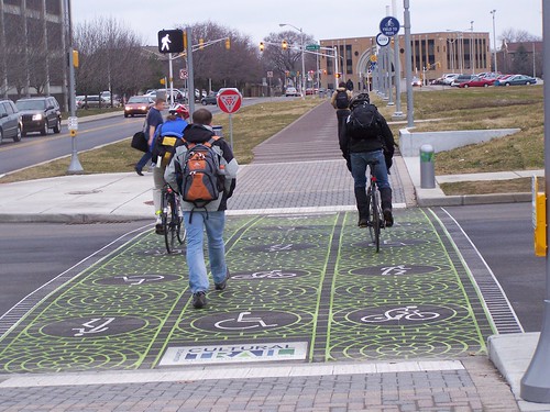
I don't have great images of what I mean by enhanced crosswalk treatments.  The ideal would be great pavers complemented by plantings.

These images from the Indianapolis Cultural Trail show what I am thinking, in terms of the crossing treatment and plantings and other elements.
Indianapolis Cultural Trail, pedestrians and flowers

Walkers and bikers crossing the street, Indianapolis Cultural Trail

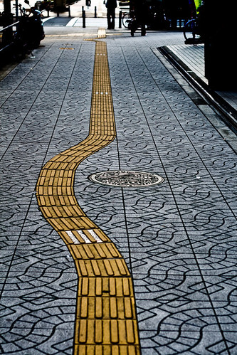
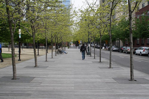
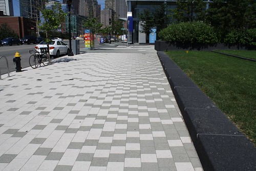
I came across these images too.  Think of these sidewalk treatments as applied to crosswalks.
Special sidewalk
The yellow bricks are tactile to help blind pedestrians negotiate.  Photo by Lachlan Hardy.  Location not identified.

streetside-boardwalk-portland-or
Streetside boardwalk, Portland, Oregon.  From the Land Perspectives blog.

streetscape-south-boston-ma
Enhanced sidewalk in South Boston.  From the Lands Perspectives blog.

Labels: , , , , , ,

Tuesday, June 13, 2017

PL #5: Creating a Silver Spring "Sustainable Mobility District" | Part 4: Conclusion

The discussion of the proposal to create a Silver Spring "Sustainable Mobility District" is very long.
So it's broken up into four sections, plus three related posts:


-- Setting the stage for the Purple Line light rail line to be an overwhelming success: Part 1 | simultaneously introduce improvements to other elements of the transit network
-- Part 2 |   the program (macro changes)
-- Part 3 |   influences
-- Part 4 |   Making over New Carrollton as a transit-centric urban center and Prince George's County's "New Downtown"
-- PL #5: Creating a Silver Spring "Sustainable Mobility District"
- Part 1: Setting the stage
- Part 2: Program items 1- 9
- Part 3: Program items 10-18
- Part 4: Conclusion
- Map for the Silver Spring Sustainable Mobility District
- (Big Hairy) Projects Action Plan(s) as an element of Comprehensive/Master Plans
- "Creating the Silver Spring/Montgomery County Arena and Recreation Center"
-- Part 6 |  Creating a transportation development authority in Montgomery and Prince George's County to effectuate placemaking, retail development, and housing programs in association with the Purple Line (to come)
-- Part 7 | Using the Purple Line to rebrand Montgomery and Prince George's Counties as Design Forward

======

From BHAGs to BHPAPs: Big Hairy Projects Action Plans.  The concept of BHAGs, or "Big Hairy Audacious Goals," comes from the writings of Jim Collins, author of a number of books analyzing businesses that are "built to last."  According to Collins:
All companies have goals. But there is a difference between merely having a goal and becoming committed to a huge, daunting challenge–-like a big mountain to climb.
Toronto as a world city.  Last fall, reading about Toronto planner Joe Berridge, in two articles by Toronto Star columnist Royson James ("Toronto needs to take one last step to reach civic greatness," "Toronto needs a new wave of world-scale projects"), I was struck by how many of the big projects outlined by Mr. Berridge came to be.  From the first article:
... what Toronto needs is a greater push toward the next transformational wave of civic improvements. Double down. Find the money that’s obviously there. Invest and grow or slip back to the tier of cities occupied by Houston, San Francisco, Manchester.
From the second article:
Berridge’s 1999 seminal report, “Reinvesting in Toronto: What the Competition is Doing” gave wings to the movement that prodded governments and civic philanthropists to invest in fixing up Toronto’s derelict waterfront, remake and rebrand its cultural attractions, and think big. ...

Berridge says it is the city’s “moral obligation” to use its taxing power, its wealth, its status as Canada’s only global city and the historical advantages of public education, public health and public services to propel Toronto into super city status.
From the first article:
Coming out of the SARS crisis, Toronto was in woeful shape. Civic advocacy — much of it centred on a platform erected in the pages of the Star and its campaign for a New Deal for Cities — resulted in a cultural renaissance.

Six new major cultural buildings popped on the architectural horizon and created a buzz that reverberated beyond our shores. Luminato arrived, as did the MaRS project. Waterfront revitalization started. The ROM, Art Gallery of Ontario, opera house and OCAD University are a testament to that time.
According to Royson James, Toronto's trajectory was significantly reset as a result of the city and stakeholders coming together to build a set of new and expanded institutions that were transformative. 

His pieces are aimed at getting Toronto's elected officials to think more broadly but also get much more focused and realistic (about funding) to achieve new transit investments, big park proposals, and other projects.

Big plans in Liverpool, Bilbao, and Marseille.  The concept of Projects Action Plans extends my analysis of the success of revitalization initiatives in Liverpool (before the UK's ill-considered austerity program and the cut of the Liverpool local budget by 50%) and Bilbao and the set of new cultural institutions and facilities created by Marseille for its Capital of Culture program in a series of pieces on European culture-based revitalization initiatives.

Those places had the equivalent of a PAP, while the typical Comprehensive/Master Land Use Plan does not include a recommended set of projects aimed to be transformational.

Adding a Vision Element/Projects Action Plans to Comprehensive Plans.  To fill that planning gap, I am suggesting that plans include a "Projects or Transformational Projects Element," what I am calling a (BH)PAP, a (Big Hairy) Projects Action Plan--listing a set of big, priority projects, organized and coordinated to achieve increasing returns on investment.  In the drier language of planning documents, calling it a "Projects Action Plan," suffices.

A Big Hairy Audacious Projects Action Plan for Silver Spring, Maryland.  The entire argument of this blog entry outlines a BHPAP for Silver Spring, Maryland, and suggests that Montgomery County needs to organize its disparate "Big Hairy Audacious Projects"--of which it has many--into a coordinated program.

MoCo BHAPs (Big Hairy Audacious Projects) include:

-- the redevelopment of the White Flint area, which is a nationally significant example of suburban business district intensification ("With development plan approved, the future of White Flint begins to take shape" and "White Flint developers hope their new branding label of 'Pike District' lures shops" Washington Post)
-- the ScienceCity initiative in the I-270 Corridor
-- the Purple Line light rail program
-- the White Oak Science Gateway anchored by the FDA and a new Washington Adventist Hospital ("Montgomery Council approves revised White Oak science center plan," Post)
-- the county's Bus Rapid Transit program ("Montgomery's bet on an ambitious Bus Rapid Transit system," Post)
-- the county's development of an Innovation Program
etc.

Past County BHAPs include

-- the Silver Spring revitalization program
-- Bethesda Row and the development of a new shopping district there
-- Rockville Town Center redevelopment including a new public library and the Center for Visual Arts
-- the development of the Strathmore Music Hall, which is a fabulous facility
-- the development of the RideOn suburban bus transit system to complement the Metrorail system originally, but is now a full fledged system not limited to moving people to and from Metrorail stations
-- the reformulation of the suburban land use and transportation planning paradigm in terms of 21st Century conditions ("Tall Talker: Rollin Stanley, Montgomery County’s new planning director, has a big personality and big ideas. Both are rubbing some people the wrong way," Bethesda Magazine; "Rollin Stanley takes planning job in Canada," Washington Business Journal)
-- creation of the Agricultural Reserve (1987) which functions as an urban growth boundary

BHPAPs elsewhere.  Other examples of communities taking on a coordinated set of projects in what we can call a BHPAP as a plan include Oklahoma City, Hennepin County-Minneapolis, Portland, and Medellin, Colombia.  (Those examples are laid out in a separate entry, "(Big Hairy) Project Action Plans as an element of Comprehensive/Master Plans.")

A Projects Action Plan as a way to coordinate existing investments.  In the tensions between "West County" -- which has the White Flint redevelopment initiative led by the private sector which aims to "urbanize" that section of Rockville Pike, and East County, which lags economically and in terms of the number of large businesses and federal agencies and facilities located there, people often assert that the County underinvests in East County.

It's not that Montgomery County hasn't heavily invested in urban revitalization in Silver Spring (and separately in transit and community revitalization in Long Branch/Takoma Crossroads). 

It has, to the tune of many hundreds of millions of dollars.

But as discussed in the above entry, outlining the Silver Spring Sustainable Mobility District program, more knitting and some different kinds of "softer" investments are required to achieve fully the intent of the various initiatives and projects, which work great individually but don't necessarily have the multiplicative impact when multiple projects work in conjunction with each other.

The expanded program would overlay and integrate the various management and planning districts (Arts, Downtown, Parking, Urban) that the county has developed for Silver Spring.

Cost.  This Projects Action Plan for Silver Spring needs to be costed out, separating out capital improvement and infrastructure costs (cycle tracks, digital kiosks, parking guidance signage system, art bus shelters, Parkiteer bicycle parking program, etc.) from annual operations costs associated with the new program (valet parking and shuttle system, retail development program, cultural and parks programming, digital community information and advertising system, etc.) and maintenance costs.

The arena-recreation center and athletic field as a separate item would cost more than the entire rest of the program, more than double.  The new Silver Spring Library (Library + other facilities) cost almost $70 million ("Take a Look Inside The New Silver Spring Library," Bethesda Magazine). 

Surprisingly, two-way cycletracks cost less than $1 million/mile according to a cost chart from Portsmouth, New Hampshire (2014).  The combined cost of the various cycletrack and street furniture and related improvements is likely pretty small, less than $10 to $15 million.

Forms of implementation and management.  Three of Montgomery County's biggest "cities"--Bethesda, Silver Spring, and Wheaton--are "unincorporated" conurbations, so rather than having a separate City Government, the County Government is the primary actor.

To provide extra-normal attention and services beyond that normally provided in "Downtown" and other commercial districts, communities often create a form of what I call a "commercial district revitalization organization." People are most familiar with "business improvement districts," which typically function in heavily commercial areas, and don't include residential properties as members.

-- "The Sub-Districting of Cities: Applying the Polycentric Model," Urban Affairs Review, May 2001

The difference between BIDs and "Main Street" type organizations is that the former primarily represents the interests of property owners and is funded by an add on to the property tax, while Main Street groups tend to not receive regularized funding streams from tax assessments. Additionally, Main Street organizations generally involve residents and business proprietors more directly in their operation. 

San Diego has a variant, which I prefer, funding all commercial district management initiatives with a property tax add on--some are managed as BIDs, others as Main Street programs.  San Francisco has a couple of variants that can include residential properties in the assessment district from the outset, Neighborhood Benefits Districts and Green Benefits Districts, he latter focused on plantings and maintaining open space.

Some DC BIDs include residential rental properties, but there is some opposition to this on the part of residential property owners ("Integrating citizen residents into "business" improvement districts" and "Testimony on adding residential buildings as paying members of business improvement districts in Downtown DC").

In the place of city or town government structures, for the unincorporated conurbations, Montgomery County has geographically designated Regional Service Centers and where needed, separate Urban Districts.  Bethesda is atypical in that it has a BID, the Bethesda Urban Partnership, but there isn't a BID in Silver Spring. 

In Silver Spring, some of the functions of a BID are carried out by the "Downtown Silver Spring" entity, and some by the County Government, while some areas get "less service" and other needs (like retail planning or programming the open space network) are either not provided or under-provided.  Separate citizen advisory boards provide input and oversight for the Urban District and the Regional District.

To realize the "Silver Spring Sustainable Mobility District" program as outlined above, the Silver Spring Urban District needs some reformulation.

Funding.  Besides general funds for certain capital improvements and transportation funds for certain transportation improvements, I recommend creating an add-on "urban district" assessment, to fund extra-normal services and programs throughout Silver Spring, by changing the definition of the conurbation's Parking District tax assessment district. 

In "Parking districts vs. transportation/urban management districts: Part one, Bethesda," I recommended that instead of terming the "Parking District" a parking district, it should be repositioned as an urban district including broader transportation functions, not just parking.  That's what the district is doing anyway, but the language of the assessment district ties everything to whether or not a building provides on-site parking, even though the property and the tenants benefit from other services.

Similarly, in "(In many places) Public improvement districts ought to be created as part of transit station development process: the east side of NoMA station as an example," I recommend that PID assessment districts should be created as a matter of course for areas around transit stations, to fund various complementary access and placemaking improvements.

Amalgamating the various service districts into a unified Silver Spring Community Services Tax District. In Silver Spring, the idea would be to combine business, transportation, greening-parks, and programming functions into a broad Community Services District,, funding through a re-terming of the Parking District into a Community Services or Benefits District.    (By comparison the budget for the Bethesda Urban Partnership is close to $5 million, but that includes funding for their bus circulator.)

The Silver Spring parking district isn't assessing taxes at present, because parking revenues cover the costs of managing and operating the various public parking facilities.

A schedule for how to assess buildings by type and by distance from the core would have to be created.  Technically, it would probably not include the current pedestrian mall on Ellsworth Avenue because to change the relationship there would require changes to existing contractual agreements. 

And figuring out how to deal with owner-occupied housing, especially single family properties, is likely to be controversial--it has been a constant source of animus among a certain segment of residents from the beginning of Baltimore's Charles Village Community Benefits District, which was created in the mid-1990s in part for public safety reasons ("Taxing district is sought Charles Village wants protection - Collections," Baltimore Sun).

Although the more recent creation of the Dogpatch and Northwest Potrero Green Benefits District in San Francisco demonstrates that this doesn't have to be the case ("In S.F.'s Dogpatch, innovative plan to pay for park upkeep," San Francisco Chronicle").

Note the walk signal-based public art on this segment of the Indianapolis Cultural Trail.
Indianapolis Cultural Trail

Labels: , , , ,

Friday, June 09, 2017

PL #5: Creating a Silver Spring "Sustainable Mobility District" | Part 2: Program items 1 - 9

The discussion of the proposal to create a Silver Spring "Sustainable Mobility District" is very long.
So it's broken up into four sections, plus three related posts:


-- Setting the stage for the Purple Line light rail line to be an overwhelming success: Part 1 | simultaneously introduce improvements to other elements of the transit network
-- Part 2 |   the program (macro changes)
-- Part 3 |   influences
-- Part 4 |   Making over New Carrollton as a transit-centric urban center and Prince George's County's "New Downtown"
-- PL #5: Creating a Silver Spring "Sustainable Mobility District"
- Part 1: Setting the stage
- Part 2: Program items 1- 9
- Part 3: Program items 10-18
- Part 4: Conclusion
- Map for the Silver Spring Sustainable Mobility District
- (Big Hairy) Projects Action Plan(s) as an element of Comprehensive/Master Plans
- "Creating the Silver Spring/Montgomery County Arena and Recreation Center"
-- Part 6 |  Creating a transportation development authority in Montgomery and Prince George's County to effectuate placemaking, retail development, and housing programs in association with the Purple Line (to come)
-- Part 7 | Using the Purple Line to rebrand Montgomery and Prince George's Counties as Design Forward

========
Proposed program

1.  Make Fenton Street the primary "east side" sustainable mobility corridor -- a "Signature Street" -- in Downtown Silver Spring/Silver Spring Triangle.  The street already has high quality roadside treatments, including brick sidewalks, some bike racks and bike share stations, some bus shelters, sidewalk bulbouts, and trash and recycling receptacles.  Fenton Street is used for certain Montgomery County Ride On bus routes, including the Silver Spring circulator, and a Metrobus route. 

The street has both "chain" and independent retailers, with chains concentrated north of Wayne Avenue, although the independent retail spaces are likely to be under threat as properties are redeveloped.

The primary section for this treatment will be from Colesville Road to Montgomery College.  It should be extended south to Takoma Avenue (Takoma Park), and a northward extension from Colesville Road to Cameron Street should be considered.

Change the posted speed limit to 20 mph in recognition of the corridor being designated a sustainable mobility priority corridor.

2.  Make East-West Highway the primary sustainable mobility corridor on the "west side" of the Silver Spring Triangle.  This would be from Colesville Road to Georgia Avenue, with a continuation of the treatment across Burlington Avenue to Fenton Street.
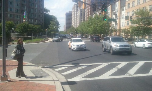
East-West Highway, Silver Spring

East-West Highway, Silver Spring

East-West has high quality aesthetics already, with wide sidewalks, tree cover, but limited retail, including the Bump & Grind coffee-record shop and the Denizens brew pub.  The street is lined with large apartment buildings, with service businesses clustering towards Georgia Avenue.  The Blairs mixed use housing and retail center will be redeveloped and intensified.  Most of the apartment buildings are fronted by plaza areas, and the small Acorn Park is at 13th Street.

This upgraded corridor will help link west side residents to retail amenities, parks, and Montgomery College, and will encourage the creation of more "shop space" on East-West Highway.

Consider changing the posted speed limit to 20 mph in recognition of it being a sustainable mobility prioritized corridor (although this is a State road).  Currently this section is dominated by the car, but over time this will change with the implementation of this program, and the posted speed limit should change accordingly.

Corridor Bike Path in Syracuse, New York.

3.  Create a cycletrack network on Fenton Street and East-West Highway.  To make each street "Signature," remove the street parking and install a bi-directional cycletrack for high quality and safe biking, with the focus on providing access to the civic and cultural facilities along the Fenton Street spine. 

Provide a connecting cycletrack on Wayne Avenue from the Silver Spring Transit Center to Fenton Street, and between East-West Highway and Fenton Street via Burlington Avenue.  


First Street Cycletrack by Union Station, Washington, DC.  Photo by Dan Malouff, BeyondDC.

Besides the obvious ICT example, closer to home is how in the NoMA district of DC, the Metropolitan Branch Trail connects to a separate 1st Street Cycletrack to Union Station, with a one block cycletrack link on M Street.

A new Fenton Street cycletrack with the connection from the Silver Spring Transit Center should be considered a high quality extension of the Metropolitan Branch Trail through the core of Silver Spring. 
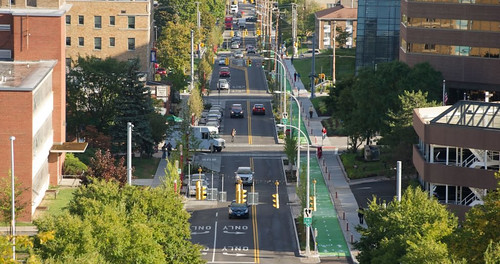
Syracuse Connective Corridor with cycle track
Syracuse Connective Corridor with cycle track.

4.  Create a network of pedestrian scramble intersections, where one designated signal phase is exclusively for pedestrians: on Colesville Road at East-West Highway, Second Street, Georgia Avenue, and Fenton Street; on Fenton Street at Ellsworth, Wayne Avenue, and Bonifant Street; and at the intersection of Wayne and Georgia Avenues.  And a more defined crosswalk treatment should be provided at the mid-block crossing at Ellsworth and Georgia Avenues, crossing east-west.
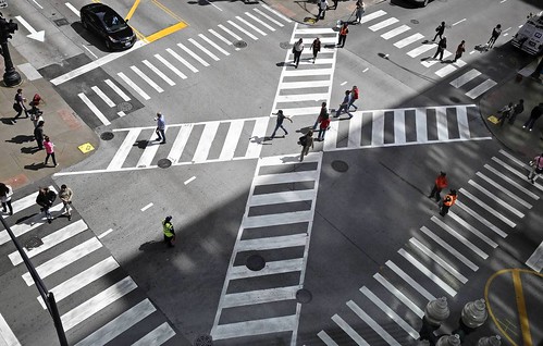
Pedestrian scramble, Jackson Boulevard and State Street, Chicago
Pedestrian scramble, Jackson Boulevard and State Street, Chicago. Photo: John J. Kim, Chicago Tribune.

While the road network prioritizes motor vehicle throughput, some places have far more pedestrian traffic than motor vehicle traffic.  One way to better balance movement for pedestrians is to provide a "pedestrian scramble" or "Barnes Dance" intersection treatment where one phase, including diagonal crossing, is exclusively for pedestrians.

Back when Downtown DC was the region's primary shopping and office district, DC had multiple such intersections.  More recently, one was created at 7th and H Streets NW and one is being installed at 14th and Irving Streets NW.  I have argued that DC needs multiple such intersections as a traffic safety and mobility rebalancing intervention ("Barnes Dance intersections as possible solutions").

Fenton Street has the best conditions for this in Silver Spring because unlike Colesville Road and Georgia Avenue, it's not particularly wide. 

Nonetheless, creating such intersections along Colesville Road will strengthen the pedestrian character of the area as well make Colesville Road a transit-priority corridor in keeping with the siting of the Metrorail Station and SSTC.  The Wayne Avenue-Georgia Avenue intersection supports both the transit center and the shopping district and one corner functions as a small square.

There is also a mid-block pedestrian crossing on Georgia Avenue at Ellsworth (which doesn't continue west across Georgia Avenue) which needs a more defined crossing treatment comparable to markings for the street crossings on the Indianapolis Cultural Trail.
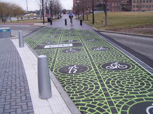
Street crossing, Indianapolis Cultural Trail
The ICT is marked by high quality markings at street crossings, making very clear the prioritization of non-motorized mobility.

5.  Rearticulate parking services on Fenton Street/across the Silver Spring Triangle to accommodate cycletracks/removal of street parking.  To create cycletracks on Fenton Street and East-West Highway, street parking will have to be removed.  There are 70 metered parking spaces on Fenton Street from Colesville Road to Richmond Avenue.

Despite the reality that within a half block of Fenton Street, between Ellsworth Avenue and Silver Spring Avenue, Montgomery County has about 4,000 parking spaces in three parking structures and multiple surface lots, as well as additional street parking on the cross streets, when I raised this concept with planners from two different sections of the county transportation agency I got incredible pushback, expressing serious fear of complaints, from businesses especially.

FRED Downtown shuttle, San Diego.

In and around the core of Silver Spring, Montgomery County's parking unit has 10,000+ public parking spaces in structures and lots, as well as street parking.

Plus there are thousands more spaces in private lots and private buildings and non-affiliated public facilities (e.g., Montgomery College has more than 800 parking spaces in two garages and surface lots).  Ideally some of this "private parking" could be integrated into a unified public-private parking network through the creation of a "shared parking" network.

Clearly, the issue isn't that there isn't enough parking, as much as it is a lack of knowledge about choices and availability, and certain restrictions on use.  Also see "Less parking in the suburbs? Some communities head in that direction," Boston Globe). 

This is less of an issue on East-West Highway--there the road is wide but for the most part, it's wide enough to add a cycletrack without removing the limited parking that exists.

Although by taking parking off Fenton Street we have to acknowledge the loss of spaces immediately in front of retail establishments, which will require a bit of walking for some patrons.

Note that the planners I spoke with argued for what they are doing currently, putting cycletracks on Spring Street and Second Avenue, as a way to build support for being more bold in the future.

I disagree that those projects will make much difference in terms of public perceptions, because for the most part, those streets lie outside the highly visible core, and most people won't see the facilities and therefore their existence won't make much difference to the support of new placemaking improvements.  For an alternative view, see the recent experience in Norfolk, Virginia ("10 months after launch, has Norfolk's bike lane loop defied the early critics?," Norfolk Virginian-Pilot).

Note that "situational awareness" is an issue in my DC neighborhood too, where we are dealing with an on-street cycletrack proposal as part of the ongoing construction of the Metropolitan Branch Trail. 

I was surprised that most of my fellow Public Works and Infrastructure Committee members are unfamiliar with the existing cycletracks elsewhere in DC, many of which I would consider national best practice.

My colleagues are involved citizens who are engaged.  If they aren't knowledgeable, how can we truly expect that the average Montgomery County car-centric resident will seize on one of these semi-invisible cycletracks as a reason to expand the cycletrack network more directly?

I think rather than being timid, the County needs to be bold, using the above-mentioned examples of placemaking-forward projects as models, and look at this as a bigger/big initiative, rather than being satisfied with the incremental addition of some infrastructure and facilities over multiple decades.
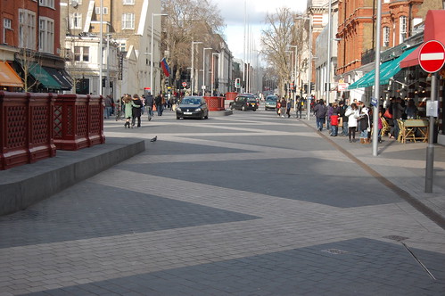
exhibition-road-south, Kensington, London, UK
Exhibition Road South, Kensington borough, London.  Exhibition Road is lined by museums and the street was repaved in a special treatment to better balance pedestrian use vis a vis the car, in keeping with the large volumes of pedestrian using the street.

The parking services program proposed below should be delivered across the Silver Spring Triangle, not just on Fenton Street, but the discussion focused on Fenton Street because of how it will serve as the spine of the civic asset network and because that is where removing street parking is likely to be the most controversial.

The solution: provide real-time information on parking, complemented by a valet parking network, and a simplified micro-shuttle service.  While digital/real-time parking information guidance is provided at most airports and increasingly at shopping centers--where information is presented on each level of a parking structure listing the number of spaces available--this is not the case in cities more generally. 

Dynamic parking information sign, Nottingham, UK, listing parking availability within five different sub-zones of the city center.

While many of Montgomery County's county-run parking structures do provide parking guidance info within the structure, including the Wayne Avenue and Town Center parking garages in Silver Spring, they don't provide feed this information to signage placed on the streets within the various "parking districts."

Some cities do provide such information systems, based on solutions offered by companies like TCS International, Swarco, and Siemens. 

Recommended components of an active parking services and guidance program:

- create an integrated parking guidance information system with signage, mobile applications, and printed materials

- precede the launch of this program with a door-to-door campaign to the businesses, as well as with residents and other stakeholders

- provide valet parking stations along Fenton Street and throughout Silver Spring as needed, so people can "drop off" and retrieve their cars at various points across the district

Sign in Downtown San Jose, California from TCS International.

- supplementing the existing VanGo circulator bus service, consider providing a micro-shuttle service from parking facilities to destinations, using small electric vehicles such as those used in Downtown San Diego ("‘FRED’:Downtown free shuttle launching Tuesday: Ad-backed service aims to ease parking panic," San Diego Union-Tribune)

- include "private" parking facilities open to the public in the digital parking guidance information network of signs, maps-brochures, and e-applications.

By providing real-time signage, mobile apps, and brochures--which should include all parking open to the public, plus valet service and shuttles, people can be trained to park and walk and think of it as a quality element of the experience, rather than a hindrance, especially when that walking takes place in an aesthetically attractive environment.

I've noticed that many commercial districts don't do a good job of listing parking options on widely distributed brochures.  Hyattsville's parking guide is an exception and a model. 

6. Incorporate greenspace improvements on Wayne Avenue between Fenton Street and Sligo Creek Parkway, treating Wayne Avenue as a "Parkway."  This street is fronted mostly by single family housing, with a smattering of apartments, some institutions like churches, and the Silver Spring International Middle School.

The wide sidewalk on the north side of the street functions as the "Silver Spring Greenway" trail connecting to the school and the Sligo Creek Trail and Park and a playground.  The Trail in turn connects to the Northwest Branch Trail and the Anacostia River Watershed trail network.

Because the street will remain primarily low density residential, I think the best treatment in conjunction with the Purple Line light rail is to accentuate its park-like qualities, treating it as a linear park/parkway, with specially maintained curbside plantings.  Below is an example from the Indianapolis Cultural Trail.
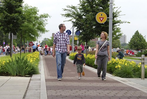
Indianapolis Cultural Trail, pedestrians and flowers

Ideally too the track right of way could be planted with grass as it is shown in the Paris example below.  Grass could be planted between the tracks and probably survive on Wayne Avenue, east of Fenton Street, because of the comparatively low amount of motor vehicle traffic. 
New Tramway Paris

Montgomery County (Rock Creek Parkway, Sligo Creek Parkway) and the area through NPS (Clara Barton Parkway, George Washington Parkway, etc.) has a great deal of historical experience with parkway development and maintenance.

A contemporary example is how St. Paul, Minnesota is extending their parkway system through an initiative they call the Grand Round.  From the Minneapolis Star-Tribune article,"Planning for St. Paul's Grand Rounds pushing forward":
The St. Paul Grand Round is a visionary project to "continue the development of approximately 30 miles of scenic parkways connecting neighborhoods across the entire city with off-street bicycle and pedestrian facilities," a website touting the project says.
It's part of a St. Paul city-specific initiative called Vibrant Places and Spaces.

The parkway concept seems to be a good model for integrating light rail routing in suburban locales, although incorporating light rail in park-like settings seems counter-intuitive, but the way Barcelona and Paris use grass in trackways shows that it can work.
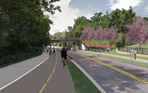
Wheelock Parkway, Grand Round Rendering Gateway
Wheelock Parkway, Rendering, St. Paul Grand Round

7.  Extension of the public realm network through a small "road diet" program.  There are opportunities to add to the open space/park space network by reworking the road network slightly.

-  Extend the pedestrianized Ellsworth Avenue east across Fenton Street to the entrance of the Town Center Parking Garage on Ellsworth Street (between Fenton Street and Veterans Place).  This would extend the pedestrian mall at the cost of 15 metered parking spaces.  As it is, sometimes this stretch is closed to traffic on weekends in favor of street festivals.

- Eliminate the "slip lanes" at the Fenton Street/Philadelphia Avenue/Burlington Avenue intersection.  These lanes are minimally used, and promote higher speed driving in what should be a sustainable mobility corridor.  Removal of the slip lane on the east side of Fenton would allow for the creation of an ornamental entry garden and the creation of a better connection to an on-road bike path.

- Extend park space on the west side of the Fenton Street-Philadelphia Avenue intersection, enlarging and connecting the Community Garden and the Fenton Street Park by using the former slip lane space as well as the stub of Philadelphia Avenue.  From the west, Philadelphia Avenue extends from Selim Road (a kind of frontage road along Georgia Avenue), but stops short of Fenton Street.  By eliminating the stub end, park space can be added, connecting the Garden and the Park.  This will require the removal of 6 parking spaces.

Similar opportunities may exist elsewhere and should be considered.

8. Create and implement a complementary set of urban design treatments. The sustainable mobility infrastructure outlined above should be complemented with high quality sidewalks, street furniture, public art, and other amenities. 

This is partly happening already.  For example, most of the sidewalks on primary streets are high quality, often brick.  There is a good collection of waste and recycling cans, some bike racks--although the ones on Ellsworth don't meet professional standards, bike sharing stations, public art installations, gateway signage, a network of historical markers, a mural at the Silver Spring Metrorail station, etc.


Bank Street, Adelaide, Australia, by Sam Songailo with Taylor Cullity Leathlean landscape architects.  Photo by Emily Taylor.  It would be interesting to use this kind of road treatment on parts of Fenton Street

Urban design/streetscape guidelines and improvements.  A big change would be to disallow anti-pedestrian treatments on the ground floors of buildings, especially since the buildings and the blocks are often quite large.

For example, despite a mural on the Colesville Road side and a park space on Wayne Avenue, and the architectural lighting display at night, from the standpoint of the average pedestrian, the Discovery Building is an impenetrable wall.  Such designs should be discouraged through urban design guidelines.

Pavement treatments.  Besides the pedestrian scrambles recommended above, it's possible to do special pavement treatments along some of the key corridors, at transit stops, or in other locations, such as the Bank Street treatment (pictured at right) in Adelaide, Australia or the Exhibition Road treatment pictured above.

Another example are the proposed transit-stop-side murals on King Street in Toronto ("Remember those eye-catching streetcar murals? They could be coming to King Street: Award-winning mural concept will be part of King Street pilot project," CBC News), which came out of the annual NXT City Prize initiative.
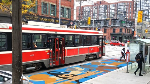
streetcar-safety-mural proposed, King Street Toronto
Proposed streetcar safety mural for King Street, Toronto.

(More) Plantings.  Silver Spring is already marked by plantings, flowers in street medians, tree cover, etc.  But there could be more.  Sherwood High School has a Future Farmers of America program including horticulture.  Perhaps somehow their program could be integrated into an expanded planting-greening program for Silver Spring.


Street furniture.  Add as needed throughout the district, not just on and around Ellworth Avenue and Veterans Plaza.  Don't install sub-standard street furniture. Push the design envelope by incorporating design forward examples, such as  the Flower Chair from the Australian-US firm, Street Furniture.

Bus shelters.  Silver Spring has a fair number of ordinary bus shelters.  Besides ensuring that the shelters do the best possible job marketing transit, in keeping with the designation of the area as an arts district, bus shelters in the district should be remade as artistic elements of the public space. 
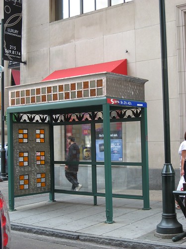
IMG_1297.JPG
Art bus shelter in Philadelphia.

In terms of non-art improvements to bus shelters, Singapore ("Jurong bus stop makes waiting fun," Straits Times) and Dubai ("RTA constructs 100 air-conditioned smart bus shelters for Dubai commuters," Emirates 24 News) are doing interesting experiments with improving bus shelter environments too, some of which are worth considering.

(More) Public art.  There are opportunities for sculptures, even an annual sculpture program like Sioux Falls, South Dakota (SculptureWalk | Downtown Sioux Falls), light projections, murals, a video screen for digital art and community messages at the Silver Spring Public Library, "complementing" the advertising-oriented video screen at Ellsworth and Fenton, etc.
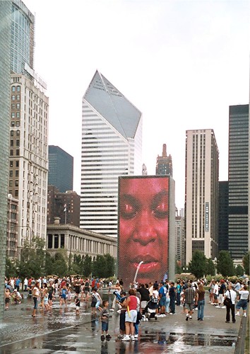
Chicago
Crown Plaza Fountain, Chicago, with video projection by Jaume Plensa. Rather than this, think setting up the Fenton Street/Wayne Avenue edge of the Silver Spring Library as a digital screen.
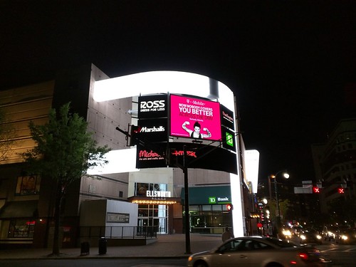
Digital screen on Fenton Street, Silver Spring
The advertising screen at the northwest intersection of Ellsworth Avenue and Fenton Street, on the facade of the Ellsworth Place shopping center.  Photo from the East MoCo blog.

Architectural lighting.  The canopy at Veterans Plaza is lit at night and there is a video ad screen across the street.  One edge of the Discovery Building has a changing color light display. 

Silver Spring Metrorail Station platform-bridge-underpass
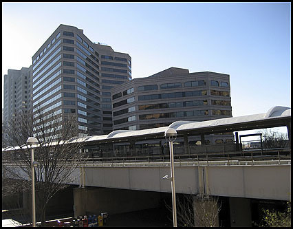
Silver Spring Metrorail Platform

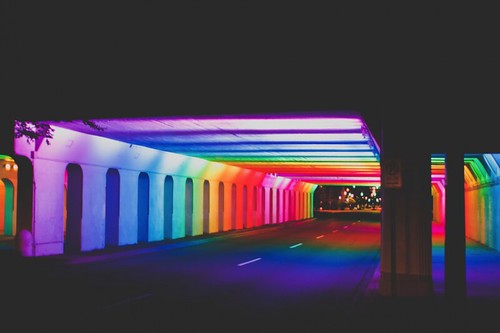
The canopy at the Metrorail station and underpasses could be similarly lit, like the light rail bridge in Tempe by Buster Simpson or the Birmingham Light Rails underpass by Bill FitzGibbons.

Tempe
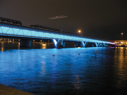
Tempe Town Lake Bridge

Birmingham, Alabama
Tunnel of Lights, Railroad Park, Birmingham, Alabama,  "Light Rails" by Bill FitzGibbons

Muralizing the rail bridges.  An alternative to doing a light treatment of the railroad bridges could be painting a mural across it, such as at the Silver Spring Metrorail Station.  One way would be to extend the current mural by Sally Callmer Thompson to the bridge overpass.  (The underpass on Georgia Avenue is adorned with a tile mosaic.)
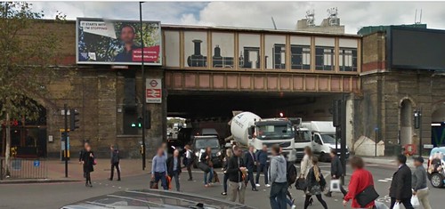
Mural of historic train on a bridge at the Vauxhall Underground Station, London

Cultural/History Interpretation.  The Silver Spring Historical Society has developed and continues to install historic markers throughout Silver Spring.  Also, historic information is displayed at the "Park and Shop."  Working with SSHS, this program should be expanded.

Wayfinding signage.  A block by block wayfinding program, modeled after Alexandria's, should be employed on the main streets. 

The Alexandria program uses four-sided signs, affixed to light poles.  Two sides have block maps, one for each direction, plus the sign lists major destinations and how far they are at the top.  The other sides address history, one side shows a historic photo, and the other includes text and photos on particular topics.  The Alexandria signs don't show individual businesses, which would be a useful addition to the system.

Arlington also has gateway marker map signage denoting its major districts, such as Ballston.  There should be a sign like this outside the Metrorail station and in other "crossroads" locations.
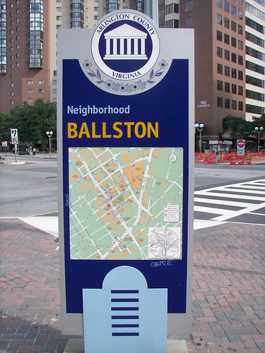
Wayfinding Sign, Ballston, Arlington County, Virginia

This can also be done digitally.  See item #10 below.  And the two systems can work together.
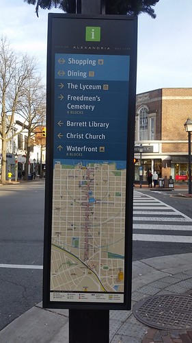
Map panel, Alexandria wayfinding system, southwest corner of Washington Blvd. and King Street

9.  Create and implement a more wide ranging set of programming.   The main point in the original piece on Silver Spring and layering is that the various spaces across Silver Spring should be managed as a network, and include programming where appropriate.  This item proposes managing and programming across the network of spaces and places.   

-- Silver Spring Events Calendar

Ellsworth Avenue and Veterans Plaza are highly programed.  Ellsworth Avenue between Georgia Avenue and Fenton Street is a one block "pedestrian mall," with many scheduled special events and programs, including a Saturday Farmers Market, and a splash fountain for kids.  Note that the Civic Building is also an indoor event space for public and private events.

While even the anchor spaces have opportunity for improvement, for example how the Boulder pedestrian mall is highly managed (2005 blog entry) and the Civic Building Exhibit Room should be more actively programmed,  it's the spaces elsewhere in Silver Spring that need greater attention.

Not that every moment should be programmed.  The strength of Ellsworth Avenue and Veterans Plaza is that a lot of the time they are unprogrammed, and used informally, where people do whatever they want, and into the evening hours--which is unique in the region.

People gravitate to the area, set up tables for chess, microphones for "spoken word" performance, just hang out, etc. 

The idea is to add programming by filling in gaps within the current spaces----as well as at the currently underutilized spaces elsewhere in the district.   

In terms of new programs in other spaces, one idea would be to set up a "summer beach" at the Silver Spring Transit Center, like the temporary beach set up in a parking lot at the Rockville Town Center last weekend. 
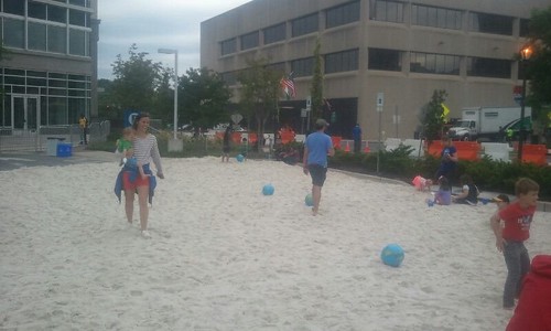
Temporary parking lot beach at Rockville Town Center
This would have been even cooler with some beach furniture--tables, chairs, and umbrellas.

It could be accompanied by a more formal pop up ("beer") garden, like the ones done by the Philadelphia Horticultural Society.  Besides plantings, and the "beer garden," PHS programs the spaces with "educational gardening workshops, family-friendly activities, live entertainment  and special events."
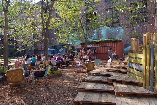
Pop Up Beer Garden, Philadelphia Horticultural Society

Another might be outdoor "Reading Rooms," like the one at Bryant Park in Manhattan, at the SSTC, Veterans Plaza, and outdoors at the patio of the Silver Spring Library, etc. 
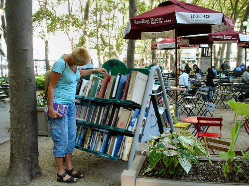
Reading Room in Bryant Park
Bryant Park.

It would be so cool to have a transit-oriented "reading room" at the SSTC, with trade publications like Metro, Mass Transit, and Progressive Railroading, Trains Magazine, Railway Gazette International, Metro Report, newsletters from organizations and fan groups, etc.  Or an outdoor reading room devoted to 'zines like the special zine collection at the Great Park in Irvine, California.  Or a reading rack of art and media related publications including Art Newspaper, BookForum, Art Forum, Billboard, Print Magazine, Communications, Variety, etc.

The Parks Department has created a pop up activities program, which could develop a more formal set of programs for sites across Silver Spring.

The parking lot at the Park and Shop is sometimes used for events too.  When space is at a premium, parking lots can be great programming resources.

Another example of extending "programming" would be to extend the hours of the Silver Spring Library, maybe just on Thursdays and Fridays initially, to 10 pm, as a way to improve access, to leverage investment in the facility, and to support the "night-time" activities within the district.

A more complete calendar of events and programs can be developed and communicated more widely as part of a digital community information network as described in item #10.

The very fun Beach Library in Albena, Bulgaria is another great example of thinking outside the "building" as it relates to programming.

Beach Library, Albena, Bulgaria

Labels: , , , ,