With the opening of the new Takoma Langley Crossroads Transit Center (TLCTC), it's worth evaluating the initial result, with the aim of improving the station and the area going forward, and providing guidance to other transit stations being developed elsewhere in the region.
-- "
Metro plans fall opening of long-delayed transit center in Langley Park" and "
‘At last!’ Riders, local leaders applaud transit center opening in Langley Park,"
Washington Post
-- "
Langley Park's new transit center opened on Thursday!," Greater Greater Washington
Current conditions. The
Takoma Crossroads/Langley Park area is split between Montgomery and Prince George's Counties, includes area within the incorporated City of Takoma Park, and is centered on the intersection of New Hampshire Avenue (north-south) and University Boulevard (east-west), both major arterials,
each with daily traffic greater than 30,000 vehicles.
It is a dense area, with a lot of bus service, is lower income with a high proportion of Hispanics and other immigrants, but with 70% of the population on the Prince George's side.
The area is the focus of various revitalization efforts, including
joint planning activities by the counties, the activities of the
Takoma/Langley Crossroads Development Authority, the City of Takoma Park's
New Hampshire Avenue Initiative, and stabilization activities on the PG County side, with Langley Park included in the
Transforming Neighborhoods Initiative,
While many of the properties are not fully kept up and "may not show well," the reality is that as a business district the area is thriving--there are few vacancies, and the retail is a mix of independent stores and chains, appealing to low income and/or ethnic consumers, ranging from Aldi the discount supermarket to independent supermarkets, furniture stores, and chains like Walgreens, Rite Aid, and Starbucks, services, and some good ethnic restaurants.
--
Takoma/Langley Business Directory
(A couple miles north is White Oak, where the Food and Drug Administration is now based, and development activities aim to develop the area into a science research area. Washington Adventist Hospital will be moving to White Oak too, a few miles from their current location in Takoma Park.)
Purple Line light rail. Of course, the biggest revitalization initiative for the district is the creation of the
Purple Line light rail line, which will run along University Boulevard in this area, although the program has faced cancellation ("
Battle for Purple Line heats up as Hogan prepares to become Maryland governor,"
Washington Post) and other delays.
Some fear that the light rail project will spur gentrification and displacement ("
Purple Line Stokes Gentrification Fears, Transportation Nation/WNYC Radio; "
In Purple Line rail project, a tale of two counties,"
Washington Post) in the Takoma Langley Crossroads area.
Past blog entries:
--
To build the Purple Line, perhaps Montgomery and Prince George's Counties will have to create a "Transportation Renewal District" and Development Authority
--
Purple line planning in suburban Maryland as an opportunity to integrate place and people focused initiatives into delivery of new transit systems
--
Quick follow up to the Purple Line piece about creating a Transportation Renewal District and selling bonds to fund equitable development
--
Inner ring suburban community improvement
TLCTC, at the northwest corner of the intersection of New Hampshire Avenue and University Boulevard,. is designed to complement an eventual light rail station at the same intersection.
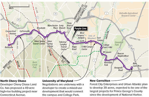 Washington Post graphic.
From the right side, looking eastbound on University Boulevard, at New Hampshire Avenue. Photo: WNYC.
The Takoma Langley Crossroads Transit Center. This new transit center is the largest non-Metrorail station bus/transfer point in the Washington area.
Four transit agencies--Metrobus, Montgomery County RideOn, one TheBus route from Prince George's County, and the University of Maryland Shuttle--serve 12,000 riders daily from the routes serving this location.
--
Takoma Langley Crossroads Transit Center, WMATA webpage
--
Station brochure
--
Station bus route map
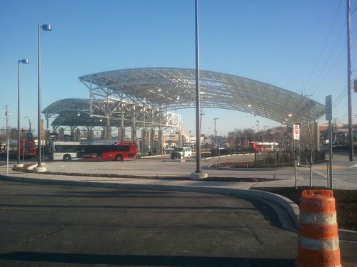 Service building.
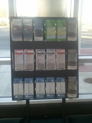
 The station includes a small service building open from 7 am to 7 pm Monday through Friday and 8 am to 4 pm on Saturday and Sunday, with a very small waiting room, easy to access restrooms, a transit information rack, and a service window. The station has one or more attendants on-site when the building is open.
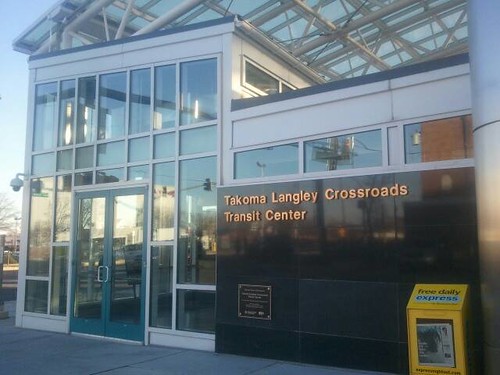
Bus station area. It's an open air station, with two metal roof sections as a canopy, with some shade panels. One roof section is partly open to the sky ("skylight"). The station makes heavy use of stainless steel and glass, with a mix of traditional and red colored concrete. The bus bay area is comparable to the "bus yards" at Metrorail stations, but with updated facilities.
There are 12 bus bays with 7 currently active, each with signs denoting the bus lines stopping there, and some dynamic information display. Each bay includes a few seats, with dividers to discourage laying down, with clear glass back panels, and lighting. There's probably somewhat more protection from the elements compared to on-street shelters.
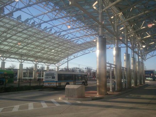
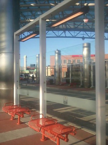
There are bays on the outer perimeter of the station (pictured at left, New Hampshire Avenue), so that southbound buses on New Hampshire Avenue and westbound buses on University Boulevard can stay on the street, rather than turning into and out of the station complex.
The glass walls at the station stops are imprinted with the Metro logo--ironically, as original plans for WMATA to run the station fell through, and it's now under the management of the Maryland Transit Administration. (Interestingly, it's the "train"logo, the block "M" that is used, not the logo for "Metrobus.")
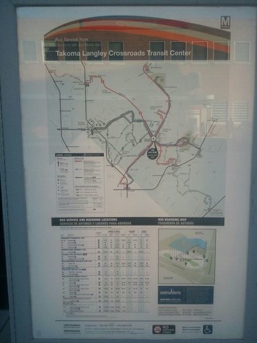
Map signage. WMATA produces two different maps for transit stations, which up til now, have only been Metrorail stations. One is a station area map, the other is a map of bus routes serving the station.
A new bus map and information sign (comparable to bus map signs produced for Metrorail Stations and bus shelters) is posted at various locations outside of the building, but not within it. The information is presented in both English and Spanish.
A station area map hasn't been produced for this station.
Bicycle accommodations. There are bike racks, and it is expected that eventually the station will include a bicycle sharing station--although this is more difficult because the station is adjacent to but not in the City of Takoma Park and Montgomery County, which are active proponents of the Capital Bikeshare program.
While Takoma Park is adding bike share to the area next year, because the TLCTC is in Prince George's County, the station isn't part of that expansion.
Review. In "
Multiple missed opportunities in the creation of the Silver Spring Transit Center," I suggested that the station should have been conceived as a significant civic asset at at least four scales. The new Takoma Langley Crossroads Transit Center needs to be considered similarly:
- as a transit portal significant within the DC regional transit network;
- as a node in the network of significant transit stations in Maryland (including subway, railroad, bus, and airports)
- as a prominent element of the public realm framework of the two counties and their portfolio of civic assets; and
- as a contributor to the economic revitalization program in Takoma Crossroads/Langley Park.
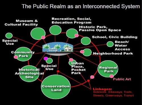 Public Realm as an Interconnected system, Slide from presentation, Leadership and the Role of Parks and Recreation in the New Economy, David Barth
The
WMATA Regional Bus Study (2003) has criteria for the provision of amenities at bus stops and stations depending on ridership volume, but a complete framework was not developed as part of the study, and it needs some updating in light of developments since then (bike stations, bike sharing, digital screen presentation, advertising opportunities, car sharing access, etc.)
The
South Florida East Coast Corridor Station Design Guidelines manual offers criteria for how to approach the design of stations generally, based on a typology of station types:
Transit station planning and design is comprised of six (6) principles delineating the parameters of a successful station. The methods include, integration into the contextual fabric, accessibility via multiple modes, functional simplicity, security, comprehensive systems sustainability, articulation of form and identity, and ... the incorporation of arts in transit. (p. 19)
Concerning station typologies, the TLCTC should be compared to similar facilities in the metropolitan area. The closest examples are the bus stations that are part of Metrorail stations, such as at Takoma or East Falls Church, along with a couple bus-specific facilities, such as the Shirlington Bus Station in Arlington County and the Reston Town Center Transit Center, in Fairfax County.
On that basis, the TLCTC is more comparable to a Metrorail station facility, not because there is a subway station, but because the station is prominently located at a major intersection and will be next to a future light rail station, rather than the Shirlington or Reston stations, which not only aren't located next to a rail station, but aren't prominently and centrally located within their districts, but instead are located on the outskirts of their respective districts.
Here's what's missing/could be improved/should be considered:
Integration into the contextual fabric
1.
Limited community serving functions. In an area with limited civic facilities, the station could have been leveraged to provide additional civic functions, such as a small library or community center, although that would have required a different design and additional financing from non-transit sources.
Pretty much that opportunity is lost, except as the area redevelops. Clearly a program for creating a more robust network of civic assets is in order ("T
he layering effect: how the building blocks of an integrated public realm set the stage for community building and Silver Spring, Maryland as an example,"
Public buildings as vehicles for community improvement (continued)" and this piece from the
Guardian, "
Work begins on Drumbrae's new library, day care centre, and youth cafe").
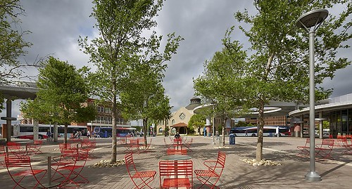 Sitting plaza, Centro Plaza bus station, San Antonio. PerkinsEastman photo.
2.
Very limited information presented about the district beyond the transit center. Other than a simple diagram in the station brochure, there is no substantive information provided about the surrounding commercial district or the economic revitalization programs underway there, or other community information.
Likely this results because those initiatives are based mostly in Montgomery County while the station complex is in Prince George's County.
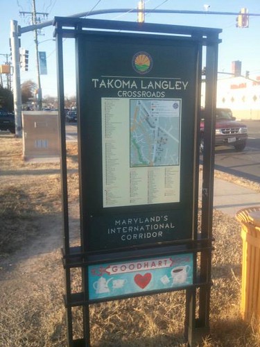
For example, the City of Takoma Park produces map signage for their commercial districts, including Takoma/Langley, and one of these signs is posted across the street from the TLCTC, but in Montgomery County.
This signage information system could be incorporated into the Transit Center, and into the Prince George's County side of the district more generally so that all four sides of the intersection have equal treatment informationally.
As mentioned above, a transit station area map for the TLCTC hasn't been produced, while such maps have been produced for every Metrorail station and MTA has similar maps for some of its light rail stations in Baltimore, such as for
Lexington Market. The MTA map tends to show more commercial destinations than do WMATA map products.
Note that I don't think there is a station area map posted at the Shirlington Transit Station in Arlington County. While there is a station area map in the Silver Spring Metrorail Station, only bus route maps and a map of the transit center are posted in the Silver Spring Transit Center, the adjacent bus terminal.
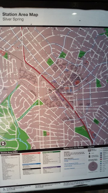
Silver Spring Station Area Map, WMATA Silver Spring Metrorail Station
The
Takoma/Langley Crossroads Development Authority produces a printed directory brochure for the commercial district. It could be placed in the information rack at the very least.
Information about planning initiatives in the area, including the activities of the
TLCDA should be on display in the station.
A digital community directory/bulletin board information system could be developed and placed at the TLCTC also.
3.
Comfort. Consideration should be made for adding heating elements and misters to the bus bays for added comfort when it is cold or hot.
Accessibility via multiple modes
4.
Bus accommodation. The station is focused on bus access and it does a fine job on that dimension.
Long term, it would be interesting if Maryland long distance commuter bus routes could serve the area and station, in association with service to White Oak. Similarly, if there is inter-city/long distance bus transit service in the area (like Greyhound) it could have used the station, but it hasn't been set up to accommodate ticket sales and the waiting area is too small.
New Hampshire Avenue northbound, a few hundred feet south of University Boulevard. Washington Post image.
5.
Pedestrian access to the station/how will the station be integrated with the future light rail station? By focusing the bus routes to the station and away from the traffic engorged arterials, likely pedestrian safety is enhanced over previous conditions.
Because the intersection experiences traffic volumes approaching 70,000 vehicles/day, an underground connection rather than one at-grade is likely to be safer as it relates to integration with the future light rail station.
At the Washington Heights Station in New York City, a long underground corridor links the station at 191st Street and St. Nicholas Avenue to Broadway.
But this idea could be extended to all four sides of the intersection. Normally, I wouldn't favor below ground connections (
Main Street: When a Highway Runs Through It, Oregon DOT).
But the at-grade environment at the intersection is so dominated by motor vehicles that very little can be done to improve the quality and safety of the pedestrian experience, even with the addition of wider and more attractive sidewalks, plantings, and other amenities.
This pedestrian tunnel at the University of North Carolina Greensboro goes under railroad tracks, connecting a student housing complex to the campus. "WMA takes first place in international design awards for UNC-Greensboro pedestrian underpass.
Why not extend the idea of an underground connection between the light rail station and the bus station to each corner of the intersection?
This would be difficult because typically transportation authorities (in this case the Maryland State Highway Administration) don't like to authorize such appurtenances in the public right of way, even below ground.
But there are examples of this in other areas, but also within the region, such as connections for the Friendship Heights Metrorail Station which go under Wisconsin Avenue on the Maryland side of the station, and how within DC the Georgia Avenue-Petworth and Columbia Heights Metrorail Stations have connections between entrances on each side of Georgia Avenue and 14th Street NW respectively.
This underground concourse connects the Essen train station to the city's pedestrianized shopping district which is across the street. It incorporates public art, a changing display of different colored lights, behind glass blocks. Photo: EVAG-OA.
Other relevant examples of creating atypical pedestrian mobility networks and infrastructure include the underground passageway systems in Chicago and Toronto ("
Hong Kong needs to create a formal and planned pedestrian mobility system," "
Toronto's PATH wanderers need direction,"
Toronto Star) and the above-ground skyway systems in St. Paul and Minneapolis, Minnesota.
6.
Bicycle accommodations are lacking. As mentioned, there are bike racks but no other bicycle facilities.
The station doesn't include an air pump or bicycle repair stand (again, the City of Takoma Park has been installing such equipment in public locations). And as mentioned, there isn't a bike share station.
Plus, the bus map for the station doesn't show any information about bike lanes and there is no bike map posted anywhere on site. By contrast, the outdoor bicycle station at The Blairs apartment complex in Silver Spring includes an area bicycle map (bike sharing stations do include a map of the local area).
Additionally, for the Silver Spring Transportation Management District, there is a bicycle map product (although it has long been in need of an update).
A similar map should be developed for the Takoma Langley Crossroads district, delivered as brochures and posters.
--
Silver Spring Bikeways Map, Montgomery County DOT
7.
There should have been a "bike hub." Beyond basic bicycle accommodations, a stellar bicycle promotion and repair facility could have been incorporated into the TLCTC. A model would be the
Los Angeles MTA's Bike Hub program, which has just been launched.
The first is at the El Monte Regional Bus Station, which is the largest local transit bus station outside of the East Coast and Chicago ("
Los Angeles County Metro/MTA gets biking" and "
A parking garage for bicycles just opened at El Monte Bus Station,"
San Gabriel Valley Tribune).
A bike hub could be the location for the delivery of programs like a bike co-operative, youth programs, "create a commuter" programs, and cycle loan schemes to assist people in trying out cycling for transportation ("
Bike share and sustainable bike share systems: sometimes other programs can have more effect for less cost" and "
Boston Hubway Bike share program expands presence in Roxbury neighborhood: insights into transportation equity").
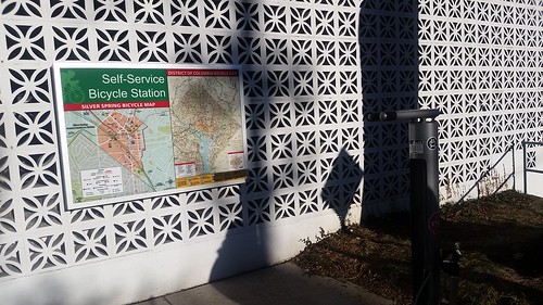 Bicycle station with repair stand, air pump, and area bike map, The Blairs apartment complex, Silver Spring, Maryland
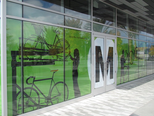 Bike hub signage at the El Monte Bus Station.
Image of the Purple Line promotional installation at the Silver Spring Library from the East MoCo blog.
Bike hub signage at the El Monte Bus Station.
Image of the Purple Line promotional installation at the Silver Spring Library from the East MoCo blog.
8.
No information is presented about the Purple Line project, and the TLCTC will be integrated into the light rail station at this intersection.
By contrast, the Fenton Street stop for the Purple Line adjacent to the Silver Spring Library has been adorned with an installation of posters explaining and promoting the project.
9.
No car sharing accommodations. It would have been nice to work with the adjacent shopping center to incorporate a car sharing "station" open to multiple vendors.
(Note that as a district, like how I suggested for Mount Rainier, "
When the one over neighborhood is in the county next door, and housing prices have been in the tank: Mount Rainer, Maryland," the Takoma Langley Crossroads district should reach out to Car2Go to get them to add this area to their service area.)
Functional simplicity
This category concerns what the Florida manual calls "clarity and ease of use." From the guide:
Crucial design components should be organized logically so the average user is able to accomplish basic tasks from reaching the station area, to identifying their transit needs, purchasing the ticket, and boarding []. The reverse situation is also applicable, where a transit [alights], is guided to other transit interchanges, the destination, or parking areas where his/her car is parked. This incorporates the use of good design, and appropriate information systems available in prevalent languages of the region (English, Spanish, etc.)
10.
There doesn't appear to be a gateway sign or sign of significance marking the station. (I realize I didn't walk all around the perimeter of the site, so maybe I missed it.) If so that's a serious omission. The roof structure does define the facility, but it's indirect.
The El Monte bus station in Los Angeles is a good counter example, both for signage and public art and other elements ("
El Monte Bus Station gets dedicated entrance for Rio Hondo Bike Path,"
San Gabriel Valley Tribune).
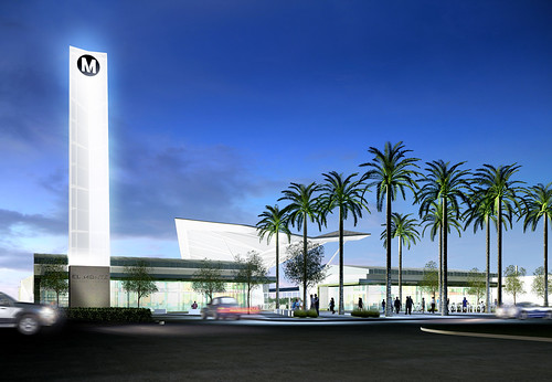 Rendering, El Monte Bus Station. (The station has been completed.)
11.
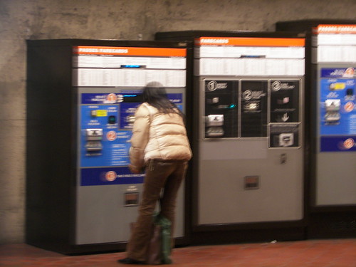
There aren't any farecard machines!!!!!
UPDATE: 4/6/2017 ---
There isn't a farecard machine, but attendants at the window have can add value to farecards with via computer. But being able to have access to a machine directly is likely faster.
All of the Baltimore and Washington area local transit systems use the same transit media card (SmarTrip and CharmCard are inter-operable) to pay fares, although buses also take cash. It's very cumbersome and slow to add money to the card via bus fare collection machines.
Sadly, this is a frequent omission in the area--there aren't farecard machines in the bus areas at BWI or Dulles Airports either. (There probably is at the BWI light rail station within the airport and of course there are fare card machines at the Metrorail station serving National Airport.)
Transit centers like the new Takoma Langley Crossroads Transit Center should include the provision of farecard machines as a basic amenity. The machines can probably be upgraded and made smaller as they no longer need to dispense paper tickets.
12.
No transit information center. While Arlington County was first in the area to create transit information centers which they call "Commuter Stores," Fairfax and Montgomery Counties have an equivalent. Prince George's County does not.
So while there are transit information centers at the Silver Spring Transit Center, Shirlington Bus Station, and the Reston Town Center Transit Station, the Takoma Langley Crossroads Transit Center lacks such a facility, which is unfortunate, especially as the station is "the largest non-Metrorail station bus/transfer point in the Washington area.." (Note that these centers also sell fare media, so not having farecard machines is less of a problem at those locations. I don't know if money can be added to fare cards at those transit stores.)
13.
The current transit information rack is inadequate. The rack only includes information on bus service and the station. Information on other modes is not available. Nor is any transportation demand management information provided. No bicycle maps are available within the station.
By contrast the Arlington Commuter Store and the Montgomery County TRIPS store provide biking information, as well as transit information for other modes (subway, train, commuter bus, bicycling) and transportation demand management information.
14.
Antiquated real-time information displays. It is unfortunate that there are so many different actors delivering transit services in the metropolitan area, because each uses different information systems.
WMATA has real time electronic scrolling data signs at various bus stops and that kind of information system is also in place at the TLCTC as shown in the photo above of the bus bay on New Hampshire Avenue. But these aren't multimedia screens.
The advantage of such signs is that they can be seen from a great distance, but they aren't very attractive and don't communicate very much information.
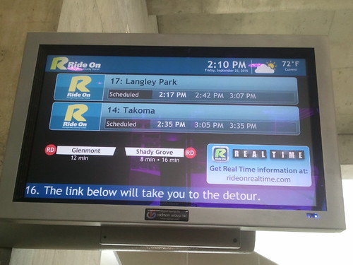
While WMATA's bus system displays uses the older technology, there is one significant exception--the bus stop displays at the Silver Spring Transit Center, which opened in 2015.
The digital screens at the SSTC displaying transit information at each bus bay were developed by Redmon Group.
But more transit systems are upgrading to digital screen displays of various sorts and it is a mistake to not avail ourselves of the opportunity to do so at the region's newest bus station.
Another best mobility information digital screen presentation product is the
TransitScreen application, used in various places across the country and in the area at residential and commercial properties, and in some government buildings such as the Silver Spring Civic Center.
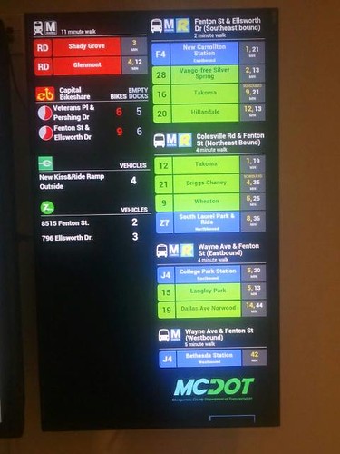 TransitScreen mobility information display, Silver Spring Civic Center
In fact, WMATA is implementing a similar system to TransitScreen but also incorporating advertising at Metrorail stations,
in association with the Outfront Media Group (this is subject of a forthcoming entry). (Previously I mentioned the failure to include advertising in the system at the SSTC, "
Multiple missed opportunities in the creation of the Silver Spring Transit Center.")
In any case, there is no excuse for the newest bus and transit stations to not employ the latest in digital screen presentation technologies (
the bus stop displays in the Metroway bus rapid transit stations in Arlington County are multimedia digital screens also). Why doesn't the Takoma Langley Crossroads Transit Center employ more modern and design forward real time information presentation systems?
15.
No posting of individual route schedules at bus bays. This is a basic need for transit stops as identified in the
WMATA Regional Bus Study and the
Transit Waiting Environments publication produced for the Cleveland RTA. It is possible that this information will be posted eventually. Presently, some of the routes serving the station have printed schedules available in the service building.
Security
It's a step forward to have on-site attendants, which is a cost not normally borne by transit agencies outside of train stations. The site has security cameras, looks as if it will continue to be well maintained, and the shelter benches have been designed to reduce loitering. The big issue will be an ongoing commitment to maintenance.
Comprehensive systems sustainability
16. It doesn't appear as if a solar electricity generation system was installed as part of the station canopy structure.
Form, identity, and public art
17.
Inadequate leveraging of the station to build and extend area identity. Arguably, while the station canopy is distinctively different from the surrounding strip shopping center architecture, that is a pathetically low bar on which to judge the aesthetic qualities of architecture.
I have written a fair amount about the failure of many transportation agencies to take seriously their responsibilities for the aesthetic qualities of the infrastructure they build or fund ("
DC's bad urban design as it relates to new transportation infrastructure"). One such example is the horrid "sculpture" on the New York Avenue Bridge ("
I think this is hideous: metal sculpture on the New York Avenue bridge").
Another is with lost opportunities, such as at the Rhode Island Metrorail Station, which presents many opportunities for architectural lighting of the station canopy, road underpass, and the associated pedestrian bridge ("
Transportation Infrastructure and Civic Architecture #3: Rhode Island Avenue Pedestrian Bridge to the Metrorail station").
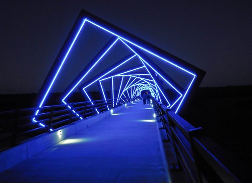 High Trestle Trail art bridge, Madrid, Iowa
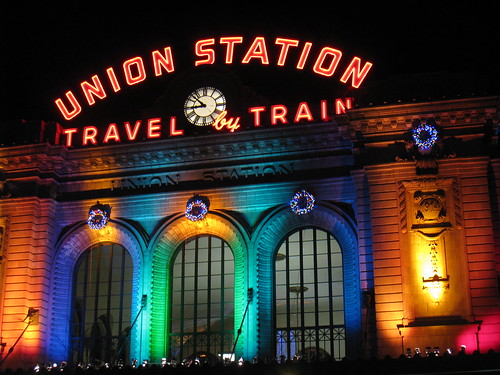
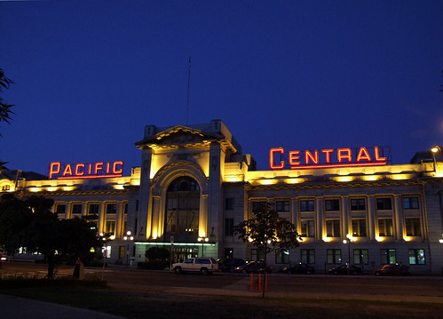
Like the Rhode Island Metro Station, the Takoma Langley Crossroads Transit Station presents special opportunities for architectural lighting of the canopy (and public art displays) that would define the station, the intersection and the district in special ways that strengthen community identity and foster economic revitalization goals.
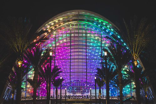 The train station in Anaheim, California uses LED lighting to distinctively light the station at night. Imagine the effect of a similar treatment at the TLCTC and the University Boulevard and New Hampshire Avenue intersection.
Closer to home, the roof structure for the ice skating rink at the Silver Spring Veterans Plaza has an architectural lighting treatment, although it was done before the LED era.
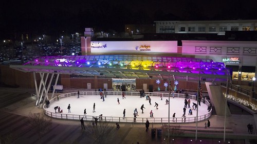
It is best to incorporate such features during the initial design and construction process. Fortunately, it is possible to add such features going forward, which should happen--but it is harder, takes a lot of time, and requires additional financing, which is harder to identify and obligate after a station has been opened, and everyone moves on to the next project.
In writings including "
Transit, stations, and placemaking: stations as entrypoints into neighborhoods," I recommend that transportation agencies employ a "Chief Design Architect" and task an urban design/landscape architecture division responsible for bringing higher quality attention to the aesthetic elements of transportation projects. Also see "
Transportation bridges as an element of civic architecture, urban design and placemaking
It's not always that agencies are constructing projects with poor aesthetic qualities. Sometimes it's the failure to think big and do something distinctive and special. Plus, they can only go so far.
Transportation agencies are focused on achieving mobility objectives and after a certain point, to get better aesthetic outcomes, local communities, not the transportation department or transit agency, may have to pay for the extra costs associated with aesthetic improvements.
Still, a greater focus on achieving high quality aesthetic outcomes simultaneously with transportation mobility improvements can make a big difference and contribute positively to neighborhood branding and identity, further contributing to the return on investment from urban revitalization and other economic development initiatives.
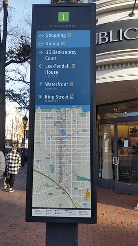 New intra-district block by block wayfinding and cultural history signage in Alexandria, Virginia. The four-sided signage has two directional panels, one for each direction, a panel showing an image, usually historically, and a panel on a particular element of cultural history.
I argue that such an approach yields much higher ROI and much greater velocity in terms of improvement, like what the NoMA Metrorail station has achieved ("
(In many places) Public improvement districts ought to be created as part of transit station development process: the east side of NoMA station as an example" and "
Transportation infrastructure as a key element of civic architecture/economic revitalization #1: the NoMA Metrorail Station").
It is so clear that thus far this opportunity hasn't been captured for the Takoma Langley Crossroads district to better use the new station as a way to jump start revitalization.
So much more could have been done to integrate distinctive and artistic features as an element of the station's design as a key node within the transit network, especially as it is the case that at this time the station is the most highly utilized bus-only transit station in the metropolitan area.
A better example of what could have been achieved is Via Transit's Centro Plaza bus station in San Antonio, which has a similar (but better) design, and instead of remaining so plain, incorporates a gateway pylon sculpture that is both art and identifier, featuring distinctive architectural lighting that serves as a beacon for the transit station.
The sculpture was created by San Antonio artist
Bill FitzGibbons, who has done similarly fabulous public art work elsewhere.
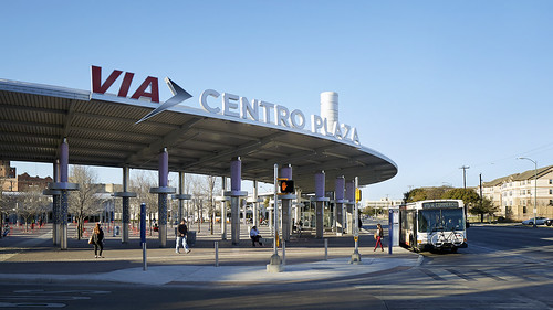
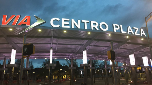
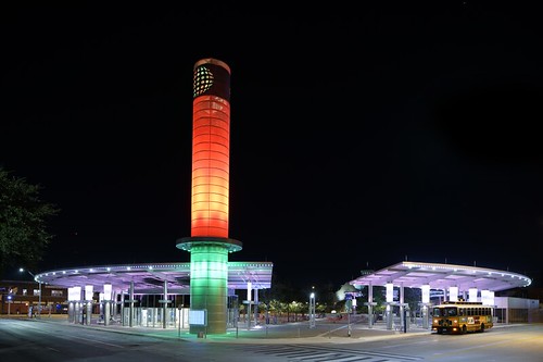 The Centro Plaza station, designed by PerkinsEastman
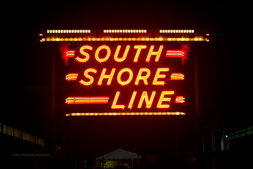
, also has distinctive and large signage on the roof structure. By contrast, the Takoma Langley Crossroads Transit Center doesn't have comparable signage, let alone signage lighted at night.
Also see the Blair Kamin piece, "
The power and beauty of gateways: They beckon, intimidate,"
Chicago Tribune.
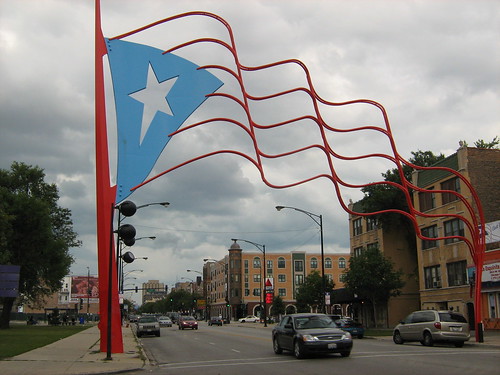
Humboldt Park Paseo Boricua Gateway, Chicago.
18. At Fenway Park in Boston,
TransitScreen has been combined with an advertising program and transit information is delivered on a huge digital screen at a parking garage serving the baseball stadium ("
A big billboard outside Fenway Park will tell you when your train is coming,"
Boston Globe).
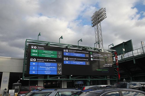
While such a screen isn't the right treatment for the TLCTC,
transit information should be delivered to multiple locations across the Takoma Langley Crossroads using the same platform and system, comparable to the display in the Silver Spring Civic Center.
19.
Take the opportunity to develop an integrated pedestrian wayfinding system for the Takoma Langley Crossroads district, between now and the opening of the Purple Line light rail station. The lack of a comprehensive wayfinding system is discussed in point #2 above, and it was suggested that the City of Takoma Park system could be used and expanded for the entire district.
At the same time, consideration should be made for point #5, creating an underpass system for the four sides of the intersection. Wayfinding isn't just about information design, signage and brochures, it can and in this case should involve physical elements and urban design.
 Business directory poster sign in a bus shelter in the Mount Pleasant commercial district in Washington, DC.
The wayfinding system should also promote business development and improvement activities for the businesses in the district.
Besides the Takoma Park example, the new City of Alexandria block-by-block wayfinding and cultural history signage is a model for intra-block signage that would supplement directory signage and brochures.
20.
Incorporate community and transportation history information in signage and presentation opportunities, including the bus bay panels within the TLCTC as well as other bus shelters in the Takoma Langley Crossroads district more generally. (The Anacostia Trails Heritage Area wayfinding and cultural history signage system is another model that can be referenced.)
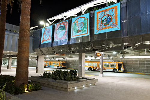 In the Meadow, public art by Phung Huynh, El Monte bus station
Public art treatment of bus shelter glass panels, Tallahassee, Florida.
In the Meadow, public art by Phung Huynh, El Monte bus station
Public art treatment of bus shelter glass panels, Tallahassee, Florida.
21.
Public art. Besides the creation of gateway public art and signage as design elements and markers for such stations, public art can be incorporated into other elements stations, including glass panels at bus bays and shelters.
Large artworks could also have been hung from the canopy.
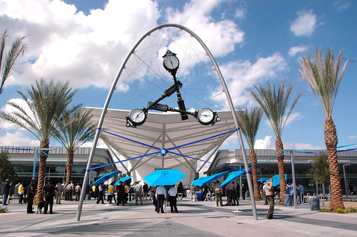 Time Piece: Iconic sculpture by Donald Lipski frames the entrance to the new El Monte Bus Station
22.
Create an integrated public realm framework for the Takoma Langley Crossroads community, with the transit station being one of the nodes. This is more of a key element of a revitalization action plan. I know the improvement plans for the area already exist, but I don't think building a network of civic assets to support community building, identity, and economic improvement was a main organizing concept within the planning process (cf. "
Go big or go home: Prince George's County needs to think big and consider better revitalization examples for New Carrollton").
General recommendations/meta lessons
1.
Create a master transit station planning manual/guide for the region.
As mentioned in the context of bus rapid transit planning ("
Route 7 BRT proposal communicates the reality that the DC area doesn't adequately conduct transportation planning at the metropolitan-scale") rather than there being cross-jurisdictional master transportation planning in the Washington Metropolitan Area, it is more the case that planning occurs at the scale of an individual project, mostly by cities or counties (with the exception of large rail projects), and therefore a lot of duplication and one-off efforts obtain, not to mention that transit in the area ends up looking very different depending on the jurisdiction you're in, with the exception of Metrorail system.
Transportation history signage, Queen Street Transit Station, Lancaster, Pennsylvania.
There should be a common facility design manual for transit stations, including recommendations for bus stations. The intent shouldn't necessarily be to make all the stations "look the same" but to ensure that opportunities aren't missed to make the station as great as possible.
A manual could be done by the Metropolitan Washington Transportation Planning Board, perhaps with the participation of the Baltimore Metropolitan Council, so that a broader regional approach could be developed. (A model would be how the Delaware Valley Regional Planning Commission, which covers parts of both NJ and PA, created the
Smart Transportation Guidebook for use by both jurisdictions.)
2.
Create an overarching cross-jurisdictional design review process for transit stations and certain types of transportation architecture to ensure projects reap all the potential present within the project.
The idea would be how in DC, the National Capital Planning Commission and the
Commission on Fine Arts, both federal agencies, have design review responsibilities for certain types of federal and local projects. To ensure the highest quality outcomes, I now believe that transportation projects need an additional level of review beyond what is normally provided, because results are often found wanting, and because the projects typically last for two to three generations before they are rehabilitated--so what you see is what you get for many decades.
Stamped metal treatment on a bus shelter in San Antonio. San Antonio Express-News photo.
Via Transit has an urban designer and it shows ("
VIA urban planner wants to build a better San Antonio,"
San Antonio Express-News). From the article:
“How can we build a better city?” Christine Viña is thinking out loud during an interview at “the Grand,” as VIA staffers refer to the transit service’s West Side executive offices in a renovated 1907 train station.
It’s the question that Viña wrestles with every day, both as an architect and urban planner for VIA Metropolitan Transit and as 2016 president of the local chapter of the American Institute of Architects.
A vocal advocate for downtown living, sustainable architecture and historic preservation, Viña says, “We have to educate people about the transportation advantages of living in the inner city. I’d like to get away from the idea of preservation as an elitist opportunity.” ...
As an architect and urban planner, I manage VIA’s joint development and public art programs, so I’m fortunate to be able to work as a liaison to creative architects, landscape architects, planners, artists and developers who we contract with to design and build our capital projects. Through good design, we increase the value of the role our facilities play in contributing to the built environment.
Clearly, planning with regard to Union Station and other rail improvements in the area, the DC Streetcar, as well as the finished products of the Silver Spring Transit Center and the Takoma Langley Crossroads Transit Center, and the various BRT planning efforts indicate a serious failure to coordinate across transit agencies, which results in an incomplete realization of opportunities.
--
Guide to station planning and design, Network Rail, UK
--
Transit Street Design Guide, National Association of City Transportation Officials
-- "
Open Transit Design: Why Stations Designed for Non-Transit Users Are Most Successful," Planetizen
Creating an overarching design and review process at the metropolitan scale within the MPO would help to fill gaps in fully realizing the benefits of transit stations and other elements of transportation infrastructure to ensure that multiple benefits are realized from each and every project.
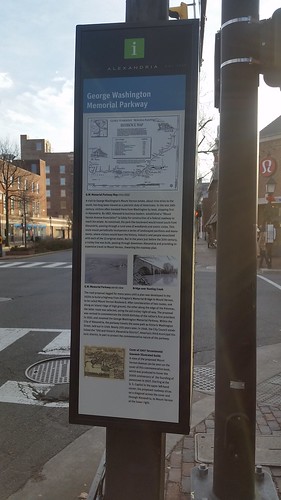 This panel of a wayfinding signage unit at Washington Boulevard and King Street in Alexandria discusses the George Washington Parkway transportation system.
3.
Provide for more creative funding mechanisms to support transportation access improvements in concert with urban revitalization initiatives.
Create a bi-county "transportation renewal district" or "public improvement district" for Takoma Langley Crossroads, to fund various revitalization activities, including transportation access improvements.
The PID model cited above about NoMA is comparable in concept to a district that would serve only the Takoma Langley District, while the Transportation Renewal District is a concept proposed for the entire Purple Line catchment area.
But creation of such financing mechanisms should have been put into place already, when the station was being planned and designed, and operative before the station even opened.
Labels: bicycle and pedestrian planning, bus, bus stations, civic architecture, inter city bus service, railroad stations, station area planning, transportation planning, urban design/placemaking