Rebuilding Place in the Urban Space

"A community’s physical form, rather than its land uses, is its most intrinsic and enduring characteristic." [Katz, EPA] This blog focuses on place and placemaking and all that makes it work--historic preservation, urban design, transportation, asset-based community development, arts & cultural development, commercial district revitalization, tourism & destination development, and quality of life advocacy--along with doses of civic engagement and good governance watchdogging.

Monday, October 25, 2021

Update: Montgomery County I-270 Corridor Transit Plan | Was: Washington Post letter to the editor on repair-related closure of Rockville and Shady Grove Stations and corridor management

The original entry, published on Monday October 11th, called for "corridor management" in Western Montgomery County, centered on I-270, the western leg of the Metrorail Red Line, the MARC Brunswick Line, and related major roads there.  In part it was an update of a series of pieces from 2016.

Unbeknownst to me, I guess after the debacle in 2016, and maybe in part because of my writings, the Montgomery County Planning Department embarked on the creation of a "corridor management" plan for that area, which has just been released, and which the Washington Post reported, "I-270 corridor needs bus lanes, Metro extension to improve transit, Montgomery planners say."

-- Corridor Forward: The I-270 Transit Plan, Planning Department, Montgomery County, Maryland

Technically, it's a transit plan for I-270, not a broader "corridor management" plan the way that I outlined originally.  Arguably it might be more ambitious (a bit more ambitious on transit, less ambitious on corridor management).  

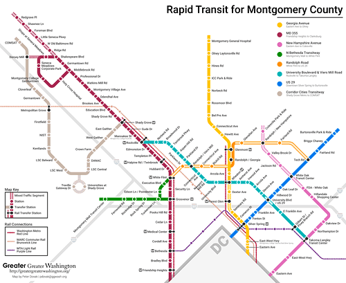
Bus rapid transit.  The big things recommended and most achievable in the near term are expanded bus rapid transit including the construction of the Corridor Cities Transitway, something that's been in planning for decades. 

Railroad.  The plan recommends bi-directional service on the MARC Brunswick Line with mid-day frequency of one hour, and 15-minute headways in the morning and evenings and new stations at Shady Grove and White Flint (this was mentioned in my Purple Line series).  

While this was recommended in an older MARC Plan, after the 2008 recession, this initiative has fallen by the wayside.  That MoCo makes it a part of their local master plan means it becomes harder for the State of Maryland to blow it off.

Although the recommendations don't call for integration between local transit and railroad service comparable to the London Overground ("One big idea: Getting MARC and Metrorail to integrate fares, stations, and marketing systems, using London Overground as an example").  

Metrorail extension to Germantown.  One thing the plan calls for that I didn't, is the extension of the Red Line to Germantown, adding two stations to Gaithersburg and a terminal station in Germantown.  

The Red Line in this graphic shows the proposed extension of the western leg of the Metrorail in Montgomery County.

This is a big deal.  I didn't make such a suggestion because this series was more focused on intermediate term achievable changes, while a Red Line extension will take decades.

Germantown is Montgomery County's largest conurbation without frequent rail transit service.

(FWIW, in 2006 in a presentation to the Action Committee for Transit, I suggested such an extension.)

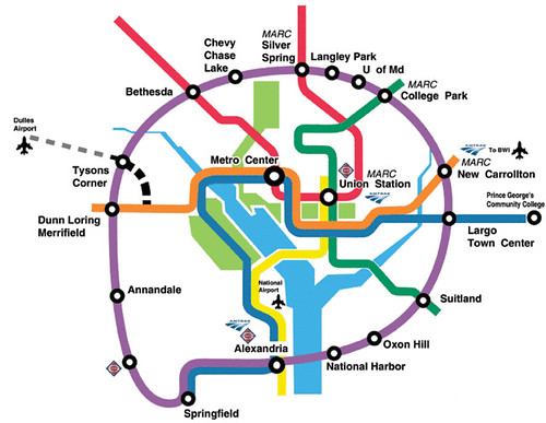
Purple Line extension to Tysons.  It calls for more detailed study of a Purple Line extension westward from Bethesda to Tysons, which the car-focused Maryland Department of Transportation hasn't supported.  Again, by putting it the local master plan, it becomes less ignorable by the state.

The proposed light rail connection from Frederick to Metrorail is shown as a blue line on this map.

Light rail extension to Frederick from Shady Grove.  The plan also suggests a light rail extension to Frederick, making the point that the Hogan Administration's embrace of a monorail proposal ("The real problem with the I-270/HOT Lanes proposal is that they've already come up with the solution: HOT Lanes," 2019) is impractical given the cost and expected ridership.  

Similarly, given the land use context which is less densely developed and populated, it doesn't make sense to extend Metrorail--heavy rail transit--from Germantown to Frederick.  Light rail could be a good compromise.

This graphic shows the multiple rail transit services in San Diego County, with Oceanside being a key hub.  Wikipedia image.

The light rail concept is not dissimilar from how North San Diego County has a rail line from the Oceanside railroad station.  Or light rail in New Jersey, in Hudson County across the river from New York City, and the River Line from Trenton to Camden, in the Philadelphia region.  But the recommended 6-minute headway is probably overkill.

Gaps.  But because it is a transit plan, not a corridor management plan, it doesn't suggest some of the other points I made, such as multi-modal corridor management and better coordination with DC, rush hour HOV-2 on surface regional arterials, etc..  Note that I didn't suggest better coordination with Frederick County, which is a must. 

It also doesn't mention growing the inter-city commuter bus program, for which Maryland generally is best practice.

Public comments and support are necessary to move these recommendations from ideas to implementation.  There will be public comment opportunities for this planning document, before it is forwarded to the Montgomery County Council for adoption.  People should review the plan and submit comments.

The Metrorail extension to Germantown, a proposed light rail link to Frederick, and extension of the Purple Line to Tysons all need a great deal of public support to move up to become actual priorities in the regional transportation capital improvements plan and budget.

Similarly, support of bi-directional service on the MARC Brunswick Line requires a great deal of public support for the State of Maryland to adopt this recommendation and add it to the regional transportation capital improvements plan also.

And making more general points about the need for corridor management involving DC and Frederick County, as well as Northern Virginia, for integration of MARC and the SmarTrip transit system, and for the consideration of cheaper pricing for MARC trips within Montgomery County

================

Recommendations from the Original Piece

Cars

1.  Figure out how to impose and collect a daily parking tax on office parking lots and structures in Montgomery County, especially for "free parking."  From the paper "THE EFFECT OF FREE PARKING ON COMMUTER MODE CHOICE: EVIDENCE FROM TRAVEL DIARY DATA":

The mode choice model predicts that with free parking, 62 percent of commuters will drive alone, 16 percent will commute in carpools and 22 percent will ride transit; with a daily parking charge of $6, 46 percent will drive alone, 4 percent will ride in carpools and 50 percent will ride transit. The mode choice model predicts that a daily parking charge of $6 in the Portland CBD would result in 21 fewer cars driven for every 100 commuters.

2.  With great ride-matching/car pooling support, for both individuals and van pool programs like vRide.

3.  Implement HOV-2 on major roads within I-270's "car shed" during rush hours.

4.  HOT Lane implementation on I-270 and I-495 should be required to include transit expansion (items #11 and #14 below). 

Bicycle

5. Support long(er) distance bicycle commuting through focused initiatives, especially with e-bikes. (By this I mean maybe an e-bike means someone willing to ride 2 miles on a pedal bike would ride 5 miles with an e-bike.  Etc.)

Passenger rail services

6.  Expand MARC passenger rail service on the Brunswick Line, in both directions throughout the day.

7.  I also argue that a MARC Line could be built as part of I-270, continuing to Bethesda, Georgetown, and Arlington County, Virginia.

8.  Market rail passenger service integrated with Metrorail comparable to the London Overground program. 

9.  Add an in-city station at Fort Totten as a way to provide extra-connection to the subway network outside of Union Station--Fort Totten is a transfer station for the Green and Yellow Lines, which would also provide redundancy to the network if Union Station were not operative for any reason.

10.  Build the proposed North Bethesda district MARC infill station.

Bus transit

11.  Develop more commuter bus solutions for the I-270 corridor.  For example, imagine if as part of the HOT Lane program ("County officials say Maryland governor made ‘empty’ threats to get toll lanes plan approved," Washington Post), an exclusive bus lane was also included.

Separated express bus lanes in Brisbane, Australia

This should include cross-border services on Wisconsin and Connecticut Avenues between DC and Maryland.  Currently, Maryland DOT is resistant to funding cross-border bus services in these corridors, instead focusing on in-state exclusive services.   

12. Make implementing the element of the Montgomery County bus rapid transit program targeting the I-270 corridor the top priority in the launch of the program.

Map of the proposed MoCo BRT program by Peter Dovak for Greater Greater Washington (blog post).

Purple Line light rail

13.  Instead of calling for another freeway crossing between Maryland and Virginia (and maybe one is needed), begin planning for the extension of the Purple Line west to Tysons/Fairfax County in association with future necessary reconstruction of the American Legion Memorial Bridge.
Purple Line Map  DC Metro
Purple Line full concept, from the Sierra Club Metro DC Sprawl campaign.

American Legion Memorial Bridge, WAMU/NPR photo.

14.  Only with the commitment to planning for Purple Line extension west should the State of Maryland consider the pursuit of HOT lanes on I-270, which does improve congestion, but generates more SOV trips, not fewer.  Still, connecting such lanes to similar infrastructure in Virginia, especially the HOT lanes on I-495, makes sense.

Labels: , , , , , , ,

Monday, October 11, 2021

Washington Post letter to the editor on repair-related closure of Rockville and Shady Grove Stations and corridor management

The Washington Post has a letter, "Metro’s closure of two Montgomery County Red Line stations was a bad decision," complaining that it's inopportune that WMATA has closed two upper Montgomery County stations for repairs.  

In 2019, Rockville had an average of 3,900 daily riders and Shady Grove, being an end of line station, had 11,300 daily riders (this tends to result from riders living further out).  (There is also a MARC train stop at Rockville and a Rockville Metro Station Visioning and Concept Design Study is underway.)

It's not a "bad decision," nor particularly noteworthy, as WMATA has been temporarily closing stations across the system for months at a time as part of a multi-year program of system rehabilitation (WMATA Capital Improvement Program website, Rockville canopy project).  

As a commenter wrote, where was the concern of the writer when other stations across the system were closed?

The need for multi-modal transportation corridor management.  But the letter does remind me of a point I made in 2016, when Beach Drive in DC was closed for many months for rebuilding, while at the same time so were Metrorail stations on the eastern leg, while in DC interrupted the trip of MoCo residents using the subway, that in the "I-270 corridor," area transportation officials and planners should conceptualize their approach to such decision making in terms of "multi-modal corridor management" and work towards minimizing disruption.

-- "Transportation infrastructure interruptions as a missed opportunity for improving transportation demand management programming"
-- "Transportation network interruptions as an opportunity: Part 2"
-- ""Transportation network service interruptions part 3: corridor/commute shed management for Northwest DC and Montgomery County, Maryland"

In this corridor you have the north-south routes between DC and Maryland of I-270, Rockville Pike/Wisconsin Avenue, Connecticut Avenue, the western leg of Metrorail's Red Line, and the MARC Brunswick Line in Maryland, and Wisconsin Avenue, Connecticut Avenue, Beach Drive, and Georgia Avenue in DC (and Maryland), along with bus services.  Plus east-west I-495, the Beltway, and connections to and from Virginia. Which in theory should be managed in a coordinated fashion.

For the most part, each mode, each agency, does its own thing.  Yes there is a modicum of coordination, but the opportunity to do significant mitigation and integration between transit systems is minimal.

Another reason for implementing German style transport associations in the US/the DC area.  This is an other example of how a metropolitan area "transport association" using the German model ("The answer is: Create a single multi-state/regional multi-modal transit planning, management, and operations authority association") would, theoretically, lead to better coordination and service.  

But in my writings on porting the German style VV to the US, I didn't consider that area highway agencies need to participate as well.   

Anyway, the major point I made then was that if the MARC Brunswick Line were bi-directional, and when necessary because of Metrorail closures, more frequent -- more the equivalent of the German S-Bahn or London Overground in terms of service frequency and integration with heavy rail transit -- closures of one could be addressed by riding the other ("One big idea: Getting MARC and Metrorail to integrate fares, stations, and marketing systems, using London Overground as an example," 2015).

Conclusion.  Were the Brunswick Line bi-directional, and you'd think 5 years would have been enough time to make it so, the temporary closure of the Rockville and Shady Grove stations wouldn't be a particular hardship.

The recommendations from 2016 are just as relevant today (combined, reordered and revised):

Cars

1.  Figure out how to impose and collect a daily parking tax on office parking lots and structures in Montgomery County, especially for "free parking."  From the paper "THE EFFECT OF FREE PARKING ON COMMUTER MODE CHOICE: EVIDENCE FROM TRAVEL DIARY DATA":

The mode choice model predicts that with free parking, 62 percent of commuters will drive alone, 16 percent will commute in carpools and 22 percent will ride transit; with a daily parking charge of $6, 46 percent will drive alone, 4 percent will ride in carpools and 50 percent will ride transit. The mode choice model predicts that a daily parking charge of $6 in the Portland CBD would result in 21 fewer cars driven for every 100 commuters.

2.  With great ride-matching/car pooling support, for both individuals and van pool programs like vRide.

3.  Implement HOV-2 on major roads within I-270's "car shed" during rush hours.

4.  HOT Lane implementation on I-270 and I-495 should be required to include transit expansion (items #11 and #14 below). 

Bicycle

5. Support long(er) distance bicycle commuting through focused initiatives, especially with e-bikes. (By this I mean maybe an e-bike means someone willing to ride 2 miles on a pedal bike would ride 5 miles with an e-bike.  Etc.)

Passenger rail services

6.  Expand MARC passenger rail service on the Brunswick Line, in both directions throughout the day.

7.  I also argue that a MARC Line could be built as part of I-270, continuing to Bethesda, Georgetown, and Arlington County, Virginia.

8.  Market rail passenger service integrated with Metrorail comparable to the London Overground program. 

9.  Add an in-city station at Fort Totten as a way to provide extra-connection to the subway network outside of Union Station--Fort Totten is a transfer station for the Green and Yellow Lines, which would also provide redundancy to the network if Union Station were not operative for any reason.

10.  Build the proposed North Bethesda district MARC infill station.

Bus transit

11.  Develop more commuter bus solutions for the I-270 corridor.  For example, imagine if as part of the HOT Lane program ("County officials say Maryland governor made ‘empty’ threats to get toll lanes plan approved," Washington Post), an exclusive bus lane was also included.

Separated express bus lanes in Brisbane, Australia

This should include cross-border services on Wisconsin and Connecticut Avenues between DC and Maryland.  Currently, Maryland DOT is resistant to funding cross-border bus services in these corridors, instead focusing on in-state exclusive services.   

12. Make implementing the element of the Montgomery County bus rapid transit program targeting the I-270 corridor the top priority in the launch of the program.

Map of the proposed MoCo BRT program by Peter Dovak for Greater Greater Washington (blog post).

Purple Line light rail

13.  Instead of calling for another freeway crossing between Maryland and Virginia (and maybe one is needed), begin planning for the extension of the Purple Line west to Tysons/Fairfax County in association with future necessary reconstruction of the American Legion Memorial Bridge.
Purple Line Map  DC Metro
Purple Line full concept, from the Sierra Club Metro DC Sprawl campaign.

American Legion Memorial Bridge, WAMU/NPR photo.

14.  Only with the commitment to planning for Purple Line extension west should the State of Maryland consider the pursuit of HOT lanes on I-270, which does improve congestion, but generates more SOV trips, not fewer.  Still, connecting such lanes to similar infrastructure in Virginia, especially the HOT lanes on I-495, makes sense.

Labels: , , , , , ,

Wednesday, May 29, 2019

Superforecasting/Don't Believe the Hype and 1 million robo taxis, Uber/Lyft trips 1/5 the current cost, and the Boring Company's tunnels or "Cities and mass transit versus personal transit"

At a Little Free Library I came across an "Instaread" (like the back in the day "Cliffs Notes" on the book Superforecasting by Tetlock and Gardner, which was quite interesting.  While I wouldn't call myself a superforecaster, I do constantly seek new information and experiences to better hone my analysis and understandings as they relate to transportation and urban revitalization.

Coming across some recent "forecasts" by businesses and stock analysts and the general hype that has accompanied them for some time, I just can't believe how much money must be sloshing around in the capital markets, to fund concepts that are not necessarily nonsensical, but are disconnected from "the market" or "how things work" in practice.


As far as cities and transportation go, there are three elements to keep in mind.

First, the road network (miles of roadway and number of lanes) is pretty much fixed (unless you add tunnels).  In turn this puts a limit on the number of vehicles which can be accommodated.  (Zurich is one of the few cities that takes this to the logical endpoint, by "metering" how many vehicles can enter the city.  See , which means that there is only so much capacity for vehicles.

The advantage of a (40 foot_ bus over a car is that while it takes up the space of three cars it carries up to 60+ people while the three cars carry 3-5 people.  Heavy rail does even better in dedicated above-ground or underground service, carrying tens of thousands of people per hour.

Various images produced that show people throughput by mode illustrate the point.
Amount of space required to transport the user the same number of passengers by car, bus, or bicycle

This graphic shows corridors, so the "mixed traffic" mode it is referring to is freeway driving, which doesn't correspond to driving within cities, where lane capacity ranges from 600 to 1,500 cars per hour (the latter on fast moving very wide arterials and one way streets), less than a freeway, because there are many more intersections crossing the street.
corridor capacity by different modes (transit/automobile)

Second, limited road capacity means that the more cars you have, the fewer number of people you can move through a constrained system.

Ride hailing doesn't substitute for a transit vehicle, which can carry 60 or more people at one time, it substitutes from a single occupant automobile vehicle.  It doesn't improve throughput even if it reduces the number of owned cars and the number of cars that are parking in on-street or off-street parking.

The third element concerns market demand, and whether or not there is enough demand to sustain a working business model. Transit/shared vehicle users are clustered in the largest center cities. Most of the rest of the US is car dependent, and people drive a lot and long distances. To get to the point of sustainable market demand may not happen in my lifetime, and hopefully I still have 30+ years to live.

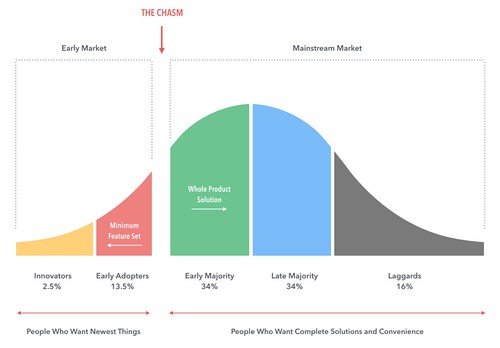
In the book Diffusion of Innovations, Everett Rogers explained the "take up" of new technologies and ways of doing things. It takes some time before the amount of use reaches level that make business operations economic.
Diffusion of innovation theory, Everett Rogers

Building on this work, Geoffrey Moore has written many books on the trough in business after innovators and early adopters have taken up new technologies, and before late adopters. In the book Crossing the Chasm: Marketing and Selling High-Tech Products to Mainstream Customers he terms this trough, "the chasm." From Wikipedia:
Moore begins with the diffusion of innovations theory from Everett Rogers, and argues there is a chasm between the early adopters of the product (the technology enthusiasts and visionaries) and the early majority (the pragmatists). Moore believes visionaries and pragmatists have very different expectations, and he attempts to explore those differences and suggest techniques to successfully cross the "chasm," including choosing a target market, understanding the whole product concept, positioning the product, building a marketing strategy, choosing the most appropriate distribution channel and pricing.

When Diffusion of Innovation theory meets the Chasm of Geoffrey Moore
Image from "Models for Predicting the Future: Geoffrey Moore’s 'Crossing the Chasm'”, Smith House Design.

"Visionaries" include financiers and stock market analysts, and like with Chinese free floating bike share, scooters, and the like, they are "touts," not necessarily independent analysts.

While concepts such as shifting from ownership to fractional use have been around for awhile (e.g., "timeshares") and in sectors now ranging from clothes to travel stays to car sharing substituting for car ownership and taxis, the idea is that the cost of fractional use renting should be less than what one pays to own and/or operate and maintain the items. For some of these markets, they don't need a "mass market," because they can charge premium prices.

Given the present cost structure, for ride hailing to work, people will have to be willing to pay more than the alternatives (transit, car ownership).  That's not how you make a mass market.

-- "Disrupting The Car: How Shared Cars, Bikes, & Scooters Are Reshaping Transportation And Cannibalizing Car Ownership," CB Insights

Note that I think the metrics are off in the CB Insights analysis, but their segmentation of the mobility market by trip length is the way to go. And the headline should be "Disrupting The Car... [in a handful of cities]."

Note that as the cost to purchase an automobile continues to rise, and if capital supporting car leasing shrinks somewhat, the cost curve can shift, for some segments of the market, to ride hailing and other alternatives.

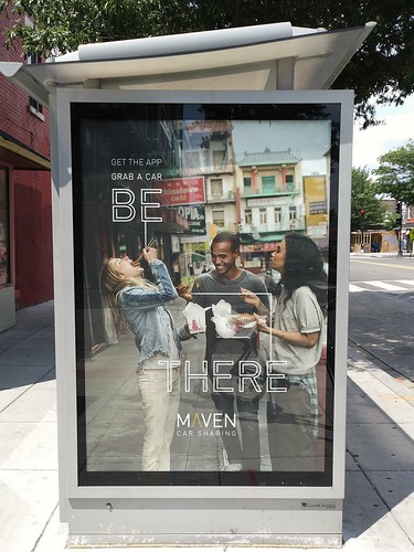
Maven car sharing (General Motors) ad on a bus shelter
Maven ad in a DC bus shelter.

In the meantime, Uber and Lyft don't forecast moving to profitable operations anytime soon and car sharing companies are merging (BMW and Daimer now jointly operate ShareNow) and GM's Maven has just downsized significantly ("GM's Maven exits show tough road for mobility," Automotive News). From the article:
General Motors and other automakers envision bringing in significant profits from alternative ownership models such as car-sharing and subscription programs. Someday.

But for now, such mobility services are generally big money losers. And executives are increasingly discovering that they don't have the stomachs to let those businesses hemorrhage so much cash while they wait for technology and demand to reach the point where the services help the bottom line instead of hurt it.

GM, after expanding its Maven mobility brand to 17 metropolitan markets in the U.S. and Canada since January 2016, last week announced a "shift in strategy" that included exiting eight U.S. cities to concentrate on areas with "the strongest current demand and growth potential," the company said.
An op-ed in the Financial Times jokingly described venture capitalists funding Uber and Lyft as "transportation philanthropists" since each trip is heavily subsidized and users don't pay the real cost--irrespective of the constant pressure on reducing driver earnings to lower costs. (Although note, Maven is a late entrant to the market.)

Extra credit.  These initiatives are still focusing on stoking automobile sales, not in shifting people to more optimal mobility ("Further updates to Sustainable Mobility Platform Approach" and "DC as a market leader in Mobility as a Service (MaaS") choices.

=======
Tesla's one million robo-taxis by 2020

Obviously, Elon Musk has to keep up interest in Tesla to stoke the stock. But that doesn't make a market.

Tesla Model 3 in a city setting.

This has two elements.  The first is demand for "taxis/ride hailing vehicles."  Data I saw from the University of Minnesota said that the base cost for an automated vehicle are likely to be $1 per mile, which doesn't include a profit margin for the operator.

Given the type and number of trips people make and the cost of gas, most people aren't going to find switching from owning a vehicle to paying per use to be cost effective, especially given the average car is driven 12,000 miles/year, and the cost to own and operate a vehicle is about $9,000 year. 

Longer suburban trips are going to be more expensive. And cities don't have the road capacity to sustain a switch from transit to the car. As Jane Jacobs said once when asked 'why aren't there enough roads?', she responded "you're asking the wrong question. The right question is why are there so many cars?"

The second is the ability of autonomous vehicles to be used legally.  While the demand "for taxi rides" is in the city, the easiest place for AVs to work is on limited access freeways. But AVs are far away from being approved for use in mixed traffic.

UBS says the cost of ride hailing trips will plummet by 80% 

According to Business Insider, investment bank UBS, in a research report, claims that in 10 years, ride hailing trip costs will decline by 80% because of robocars, making the trip cost competitive with transit.

Cost to operate a motor vehicle/automobile, autonomous versus conventionalI think the important thing is to distinguish between variable trip costs and the additional cost of buying/leasing and maintaining the vehicle.

This article, "Cost-based analysis of autonomous mobility services," from Transport Policy (64:1 2018) argues that driver wages makes up 88% of the cost of a typical trip.  Although these costs don't include the overhead of "access to app" charges and profit margins.

And the current model, relying on independent contractors to provide vehicles, offloads the cost of maintaining large vehicle fleets to the drivers.

Irrespective of the cost per trip dropping or not, as discussed above, the transportation system in cities doesn't have the capacity to expand to accommodate significantly more trips by motor vehicle.  Taking on that burden will be significant.

But the UBS simulations didn't consider another factor: per trip "sales" taxes.

For example, to encourage sustainably modes, gasoline excise taxes are very high in European countries, and the cost of a gallon of gas ranges from $6 to $8 dollars.

Slap a $5 or more ride tax on what would be a $2 ride hailing trip as a transportation system management fee and we have little to fear.

Boring Company Tunnels

While I do think we need to consider underground tunnels as an option in more places, as a way to shift commuter traffic from city-serving streets:

-- "Tunnelized road projects for DC and the Carmel Tunnel, Haifa, Israel example--tolls," 2011
-- "London Mayor proposes roadway tunnels to divert surface motor vehicle traffic and congestion." 2016
-- "Maryland HOT lane study versus "corridor management" and regional scaled transportation planning," 2018
-- "Who knew? There's been a freeway deck in Oak Park, Michigan over I-696 for almost 30 years," 2018

I doubt that Elon Musk's Boring Company has come up with a way to build tunnels more cheaply, as transportation officials from Virginia recently confirmed ("Virginia transit officials drove through Elon Musk’s tunnel. They say they’ll stick with railways and roads." Virginia Mercury).
“It’s a car in a very small tunnel,” Michael McLaughlin, Virginia’s chief of rail transportation, told members of the Commonwealth Transportation Board’s public transit subcommittee...
But as a significant capacity enhancer, mostly Musk is talking about using these tunnels as fast tracks for single cars, or for small shuttles, such as for the project just approved in Las Vegas ("Elon Musk Company To Build Las Vegas People Mover," Engineering News Record).

That doesn't add very much capacity to the transportation system, especially with his idea for connecting the tunnels to the surface through elevators, which will significantly reduce throughput.

Labels: , , , , ,

Friday, November 17, 2017

King Street streetcar, Toronto (and Seattle's urban mobility planning)

At the Washington Post Transformers presentation earlier this week on Smart Cities, one of the presenters was Jeff Tumlin, a principal at the forward thinking transportation consultancy Nelson-Nygaard. 

Jeff is a great speaker, although what sounded "transformational" to many people who came up to him afterwards was to me, merely stuff I've been hearing for the last 13-15 years, including from Jeff.

Jeff Tumlin is author of Sustainable Transportation Planning: Tools for Creating Vibrant, Healthy, and Resilient Communities, published by Wiley.

He made a couple of very important points, one of which will be covered in another piece. 

In discussing the general fall off in transit usage over the past year, which is partly in response to continued low gas prices, but also the impact of ride hailing services on transit use ("Why selling your car to take Uber or Lyft is a problem for cities," CNN), he discussed Seattle as a counter-example.

Technically, Seattle's local bus transit is provided by the county, through the King County Metro transit agency, and the agency has one of the largest bus fleets in the US, especially for a city of its size, including a network of electric trolleybuses. 

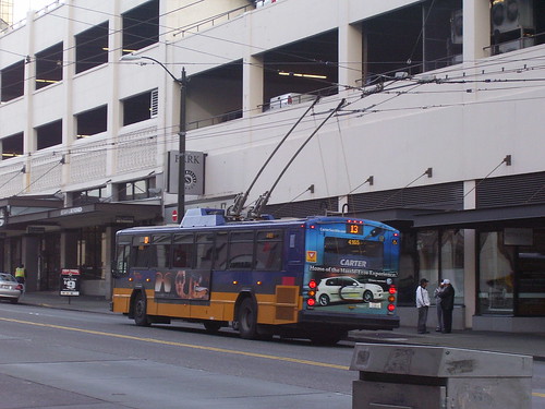
An electric bus, SeattleAmong its initiatives, the transit agency has a robust set of metrics for setting service levels, has been implementing a rapid bus network, and is working to simplify its fare system ("Metro to charge a simplified, $2.75 flat fare for bus rides next year," Seattle Times). 

The city used to have a downtown free fare zone, but it was dropped as a result of the 2008 recession's impact on transit agency budgets.

SDOT works very closely with the agency, and separately, the City of Seattle is one of the nation's leaders in innovative transportation planning.

To deal with the city's rapid growth ("Can Seattle handle its own growth," The Atlantic) in the digital economy era, Seattle has prioritized transit movement on the city's street network, making bus transit faster.  As Jeff pointed out, this has had real impact, so that Seattle is one of the only major cities in the US where transit ridership is increasing ("How Seattle Got More People to Ride the Bus," CityLab).

Mobility throughput: counting people instead of carsWhile I just mentioned the King Street streetcar prioritization test that launched earlier this week in Toronto, that touches on the thing that Jeff mentioned that seemed revelatory to people in the audience, to focus on moving "people" not cars, or overall throughput, which is what they are doing in Seattle.

In terms of its capture of total trips, King Street streetcar is an outlier, where 75% of the mobility throughput (65,000 people) on the corridor is by streetcar and 25% cars (20,000 vehicle trips), with such a high percentage of the throughput being captured by transit.

I know that on many of DC's primary bus routes, transit as a proportion of the throughput isn't quite as high, but is still above 40%, which is very good.

King St. has changed to more pedestrian and TTC friendly with cars only allowed to go a single block along the street before having to turn off. (RICHARD LAUTENS / TORONTO STAR). The TTC announces the King Street streetcar prioritization project on vehicle livery for the streetcar line.


Shawn Micaleff, a columnist for the Toronto Star, has a piece on the King Street initiative, "King St. pilot project does what big cities around the world are doing," writing:
One of my earliest memories of feeling frustrated in Toronto was riding a streetcar. The streetcars themselves were fine: elegant street ships sailing the city’s rail network like an electric nervous system.

What was confounding was that one lone car turning left, often just carrying one driver, could hold up an entire streetcar filled with dozens of people, sometimes up to 130 or over 200 people, depending on if it was a short or long streetcar. Other times there were just too many cars on the road to allow quick passage of a mass transit vehicle.

Something seemed out of whack. How could this be? Was there no political courage in this new city of mine to give vehicles carrying many people a quicker passage? My newcomer’s naïveté was soon corrected.
I think this is one of the most important surface transportation initiatives right now in North America ("A transit miracle on King St. shows how it can work," Star), because despite the headline of the Micaleff column, the fact of the matter is that most cities are not prioritizing transit in this way, because the electorate continues to be car-centric, so that elected officials don't have the cover to be able to pursue transit prioritization on city streets.

One of the people interviewed after the change said that lunchtime trips on the King Street streetcar are now three times faster.

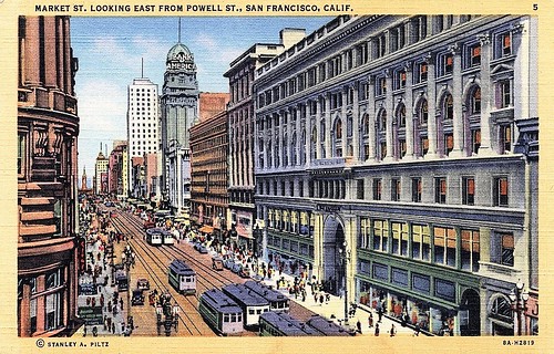
Market Street in San Francisco is another street where streetcars should be prioritized in the same way as in Toronto (discussed within this blog entry, "It's been a drawn out process, but DC is in the process of creating transitways on 16th Street NW"). 
Market Street, San Francisco, vintage postcard, showing four tracks for streetcars
Note that at one point, Market Street had four streetcar tracks. At some point, two were removed. Note too that the desire to create a subway system, which eventually culminated in MUNI Metro, was to remove streetcars from surface streets in favor of cars.

And a special L Line replacement bus service in Manhattan ought to have a similar treatment ("RPA/Transit Riders Alliance proposal to respond to the L Subway shutdown includes a dedicated transitway on 14th Street in Manhattan").

One of Micaleff's examples is the rebalancing of streetspace between pedestrians and cars in Manhattan, but that rebalancing hasn't been extended to transit-prioritized streets in the same was as King Street, even though NYC has been developing an extensive network of transit priority lanes.

Labels: , , , , , ,

Thursday, November 17, 2016

RPA/Transit Riders Alliance proposal to respond to the L Subway shutdown includes a dedicated transitway on 14th Street in Manhattan

New York City's L Line subway carries about 225,000 riders per day.  It experienced severe damage because of Superstorm Sandy and the line will be closed for 18 months, beginning in 2019, for repair, rehabilitation, and overhaul ("L Train Will Shut Down From Manhattan to Brooklyn in '19 for 18 Months," New York Times).

Corridor management in terms of person throughput not motor vehicle throughput.  Similar to how I suggested that Metrorail, NPS, DDOT, MARC, Maryland SHA, and others should have taken a broader "corridor management approach" to dealing with issues relating to I-270 capacity, shutdown of Beach Drive, and shutdowns of portions of the Metrorail Red Line ("Transportation network interruptions as an opportunity: Part 2" and "Transportation network service interruptions part 3: corridor/commute shed management for Northwest DC and Montgomery County, Maryland"), New York City's Regional Plan Association and the Rider's Alliance have joined together to create a community-centered corridor management approach to dealing with the shutdown of the L line.

-- Fixing the L Train and Managing the Shutdown

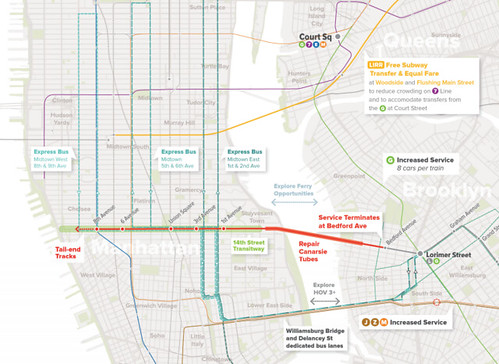
As to be expected of a report involving RPA, it is superb, with many many great recommendations, including repositioning 14th Street in Manhattan as a high capacity transitway to be used for high capacity replacement bus services, but also open to bikes and taxis, but closed to cars.
l-train-rpa-bus-rapid-transit-plan
Image showing some of the recommendations from the report concerning the transitway proposal and complementary bus services.

Attempt to create a congestion pricing zone in Manhattan as a result of post-9/11 changes in traffic management.  This reminds me a bit of how congestion was significantly eased in New York City when after 9/11, to reduce motor vehicle traffic in Manhattan, New York City instituted HOV-equivalent requirements for automobiles using the East River bridge and tunnel crossings south of 63rd Street--for rush hours, single passenger automobiles could not cross.

It had a couple of interesting effects.  Traffic was shifted to times outside of rush hour, both before and between rush periods and to other bridges outside of the restriction zone, while traffic declined overall, but congestion on feeder roads was accentuated.)

-- EFFECTS OF CATASTROPHIC EVENTS ON TRANSPORTATION SYSTEM MANAGEMENT AND OPERATIONS: NEW YORK CITY- SEPTEMBER 11, US DOT

The experience and positive impact on congestion from the restrictions on Single Occupant Vehicle trips set the stage for creating a congestion charge system in New York City, which US DOT was willing to support and provide funding for, but the State Legislature prevented the city from going forward ("New York assembly shelves Manhattan congestion charge," Guardian).
.
It also set the stage for Sam Schwartz' more recent proposal to change how the bridges are tolled in order to ease congestion ("Plan to change New York City's bridge tolls, reduce traffic hits Albany," Crain's New York Business

L Train shutdown as a corridor management opportunity.  The closure of the L train, even temporarily, if the city created a dedicated transitway in response, could be as significant a change to the city and to "North American best practice" as NYC's readjustment of road space between motor vehicle traffic and pedestrian and placemaking use, such as on Broadway Avenue and in Times Square, and the creation of dedicated cycle tracks on major roads. These highly visible actions helped to shape the vision and practice of transportation and planning departments elsewhere.

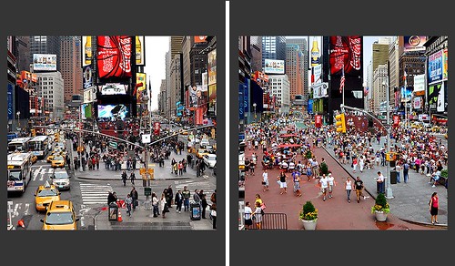
Reprioritizing road space towards pedestrians in New York City serves as a global example.  The reprioritization of road space towards pedestrians in New York City has had a dramatic effect on urban design practice across North America. Along Broadway and around Times Square, the transportation department enacted a number of "tests", which later became permanent, shifting traffic lanes to pedestrian plazas, bike lanes and related uses.

 Before and After, Times Square.  NYC DOT photo.
Before and After in Times Square, pedestrian-placemaking

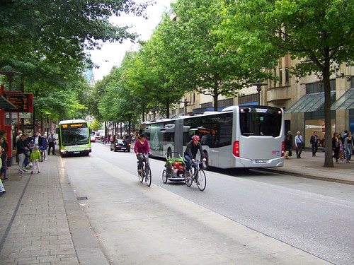
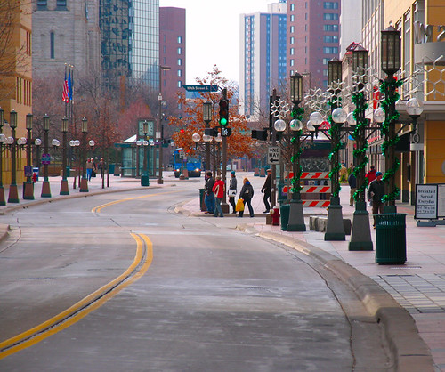
Transitways and transit malls.  Dedicated transit "malls" exist in a number of US cities, although they may vary in how much other traffic is allowed.  The Nicolett Transit Mall in Minneapolis, the Bus Mall in Portland, Oregon, and the 16th Street Transit Mall in Denver are particularly prominent examples.  Many European cities employ a variety of dedicated surface transit and pedestrian ways.

The Spitalerstrasse transitway, Hamburg, Germany, is open to cyclists and taxis.
Spitalerstrasse transit mall, Hamburg, Germany

Nicolett Transit Mall, Minneapolis
nicolett and 10th

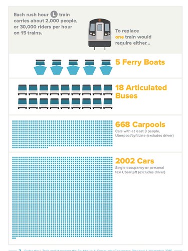
Replacing the capacity of the shut down high capacity L line subway service will be very difficult for New York City.
Capacity of different transit modes

A highly visible transitway as a communication device for best practice in transit service.  It is a struggle in many communities to create a dedicated transitway network for surface transit, especially buses (see "16th Street's traffic lights are now optimized for buses," Greater Greater Washington), and if NYC DOT is willing to create a dedicated transitway on 14th Street and if MTA responds with expanded and extended bus service--such as cross-borough high capacity bus services to stand in for the shut down subway--and complementary changes elsewhere, such as dedicated bus lanes on the Williamsburg Bridge to support cross-borough bus service, it could be equally transformative for sustainable mobility practice across the country.

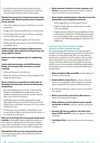
Will MTA and NYC DOT implement these concepts?  It will be interesting to see how NYC and MTA respond to the recommendations, which include other changes for the line and some of the stations to improve accessibility, access, circulation, capacity, and interlining, as well as marketing of commercial districts affected by the loss of high capacity transit service.

Some of the recommendations from the report
Recommendations, L Train shutdown, RPA

Two important ideas they overlooked: three-section buses and a free bus fare 

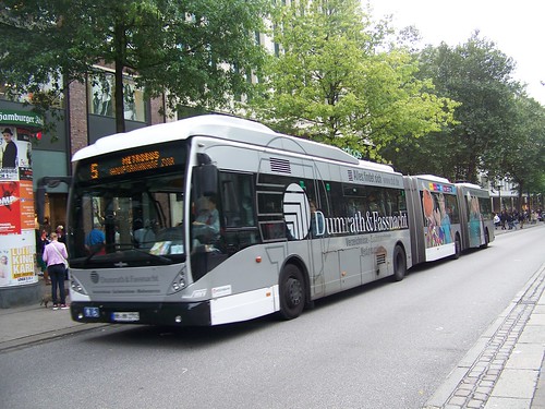
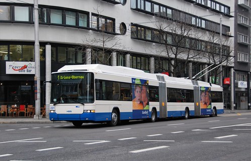
Bi-articulated bus, Spitalerstrasse, Hamburg, Germany
Bi-articulated bus on Spitalerstrasse transitway, Hamburg, Germany.

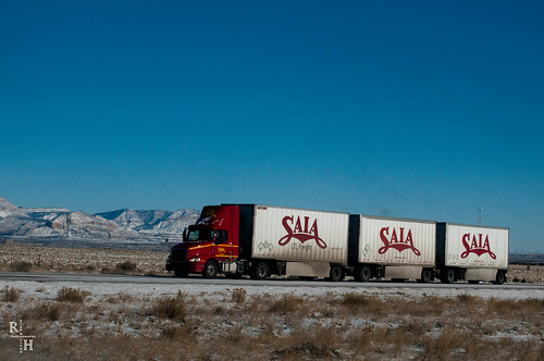
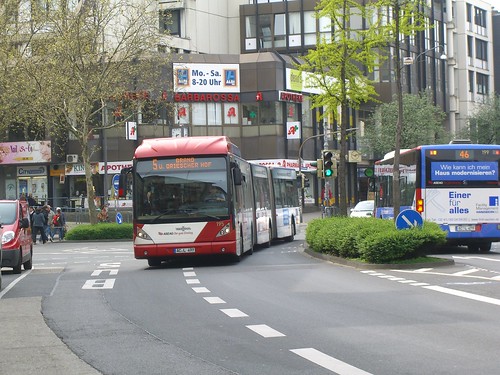
How about bi-articulated buses?  While articulated buses are allowed for use on US streets, three-section bi-articulated buses are not authorized for use on the public roadway system--even though many states have authorized the use of similarly lengthy truck and trailer units on certain roads (most often Interstate Highways) that are about the same length as a triple-section bus.

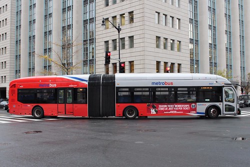
Articulated buses are about 60 feet long, while bi-articulated buses are about 82 feet long.  Depending on the seat configuration and the willingness to sit or stand very closely, bi-articulated buses can carry about 200 riders, while the capacity of an articulated bus is about 120 passengers.

Typical articulated bus, Metrobus, Washington, DC.
Metrobus

Triple trailer semi-truck  (called Long Combination Vehicles or LCVs)
SAIA Truck on I 70 Dec 26 2015-2367

But why not allow New York City to use them for a special L train replacement bus service?  This would increase rider capacity, reduce the number of buses needed to provide replacement service, provide incredible branding and marketing, and reduce the number of bus drivers needed to operate the service.  Such buses are used on "regular roads" in many cities, although many cities like Curitiba and Bogota primarily use such buses on a dedicated transitway network not accessible to automobiles.


Aachen, Germany
Двойная гармошка / Bi-articulated bus

Luzern, Switzerland
Luzern, Obergrundstrasse 25.02.2009

Consider free fare for the special cross-borough BRT service.  For the special replacement high capacity bus service only, especially if a three-section bus could be used, providing free fares should be considered, which would significantly speed entry onto buses and reduce the amount of dwell time--the time the bus sits at a stop, while passengers exit the bus and enter and pay.

For various reasons, it's not possible to create the prepayment process and dedicated stations comparable to Curitiba's bus rapid transit system ("How Curitiba's BRT stations sparked a transport revolution," Guardian). From the article:
But high ridership created a problem. Buses in the system still used conventional boarding systems, where passengers entered through the front of the bus and paid fares on board. Lerner, who was back in office for his third term as mayor, came up with an elegant solution.

He called for a revamped station design that enabled faster boarding through multiple doors, and fares would be exchanged before entering the station – similar to subway or light-rail systems. Offboard payment would also allow for the creation of transfer stations, meaning one fare would cover the entire system. To top it off, Lerner gave the stations a distinctive look by placing them in futuristic glass tubes. These new “tube stations” debuted in October 1991 as part of the first Ligeirinho express line. Today there are 357 tube stations throughout the city.

With this important addition, the city’s system became the world’s first bus rapid transit (BRT) network.
But you can accomplish the same effect with free fares.

Note that while the report does not propose free fares, it does propose free transfer between ferry and bus, which isn't the case now, as ferries are city provided services, while bus and subway services (which do provide free transfers between bus and subway for pass holders) are run by the State of New York.

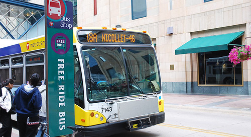
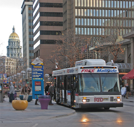
Note that certain dedicated service bus service in both Minneapolis and on the 16th Street Transit Mall in Denver are free.
Free ride bus sign, Metro Transit, Nicollet Mall, Minneapolis
Minneapolis.

Mall ride w-capitol web
Denver.

But the current shutdown schedule can't accommodate the approval of bi-directional bus services, acquisition of buses, and identification of funding for such changes.   Even though the shutdown is supposed to happen in 30 months, that's not enough time to acquire and receive hundreds of bi-articulated buses, and deal with how to store them, let alone getting FTA to approve their use in the city, to train drivers, etc.  Plus you have to line up the money to acquire the buses and you have to figure out how to use them once the L train goes back into service.

And providing a free transit service wouldn't be cheap.  But it would be temporary.  And had Hillary Clinton become President, maybe the US DOT/FTA would have funded such a service in part, as a demonstration also, in concert with the demonstration and test of the efficacy of bi-articulated buses.

But their omission makes their consideration unlikely.  By putting the ideas out there, they'd be out there.  It'd be worth delaying the shutdown for a year or more if it were possible to use bi-articulated buses and have them be free in order to create and deliver the best possible replacement service, reducing inconvenience and problems as much as is possible.

And that, by the way, is the point of planning to begin with, to make things better and easier, not harder.

=====
WRT Metrorail and MARC and I-270, one element of corridor management that should be studied is bi-directional service on the MARC train line between DC and Montgomery County. Currently the service runs in only one direction, from West Virginia/Maryland in the morning to DC, and from DC to Maryland/West Virginia at night.

 The opportunity for commuting is high between DC, White Flint, Rockville, and Gaithersburg more generally, but with subway shutdowns, riders could be shifted to the MARC railroad service, and this would help to market the service and create more demand for various service and integration improvements, including a common transit fare media system ("One big idea: Getting MARC and Metrorail to integrate fares, stations, and marketing systems, using London Overground as an example").

Labels: , , , , , ,

Friday, September 23, 2016

Transportation network service interruptions part 3: corridor/commute shed management for Northwest DC and Montgomery County, Maryland

The original piece covered what to do concerning "Beach Drive" and "I-270" both north-south commuter routes connecting Northwest DC and Montgomery County, Maryland.

I started writing a third section in the piece, on the Metrorail Red Line in association with the various SafeTrack maintenance service interruptions--for example, will be closed for 23 days between Fort Totten and NoMA Stations--but I excised the section because I didn't feels as confident about recommendations for the western leg of the Red Line.

But for the most part, as a suite of recommendations, because the commuter shed of Beach Drive, I-270, and the Metrorail Red Line overlap and intersect, we can probably come up with one suite of broad recommendations, where some pertain more to certain elements of the transportation system than others.

Tom Quinn countered with some other recommendations than those in the original post, and pointed out some key omissions.  Additions are italicized.

Note that in the section on I-270 in the previous entry, I neglected to mention the Corridor Cities Transitway project, a proposed enhanced transit service for Upper Montgomery County.  But it wasn't particularly relevant as the proposed service will be an intra-county service, while the entry focused on dealing with "through" traffic between DC and Montgomery and Frederick Counties.

Here is a revised/combined list, relevant to Beach Drive and Red Line Metrorail closures.

1.  The city could institute HOV-2 on 16th Street NW, Connecticut Avenue NW (and maybe Georgia Avenue) as an interim measure.

DC has not yet instituted HOV-2 on any surface street arterials.  In the metropolitan area, perhaps the only jurisdiction that has is Alexandria.  DC could work with the State Highway Administration and Montgomery County for parallel actions on Maryland arterials.

2.  Create temporary bus only lanes on 16th Street, Connecticut Avenue, and Georgia Avenue. (and other streets as determined).  Such lanes are being developed for 16th Street anyway.  This would be facilitated by the addition of rush hour parking restrictions so that a dedicated bus lane could be provided.

3.  Develop more nuanced commuter bus services to DC, Bethesda, and Silver Spring, as needed.  Consider developing these routes more permanently.  For various reasons adding commuter bus may be justifiable regardless of the existence of Metrorail and regional Metrobus service.

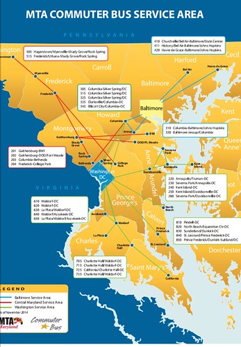
Note the gaps in coverage in the Maryland MTA Commuter Bus program as it relates to Bethesda and Silver Spring specifically.
Maryland MTA Commuter Bus Map

4.  Create better cross-jurisdictional connections by extending regional Metrobus lines that currently stop at the DC-Montgomery County border, such as extending the 30s bus line to Bethesda from its end point at Western Avenue.

Consider extending the 70s/S lines from Silver Spring Station up Colesville Avenue, Georgia Avenue, and 16th Street.

Consider creating a through bus service on Connecticut Avenue serving both DC and Montgomery County.

The 30s line buses stop in Friendship Heights (in the older days there used to be more regional service up and down Rockville Pike/Wisconsin Avenue) a couple miles short of Bethesda, a major destination.  By contrast, the "DC bus routes for 16th St. and Georgia Ave. do not stop at Eastern Avenue but are continued to the Silver Spring Transit Center.

I've written about some of this before, especially between Bethesda and Friendship Heights.

Just as Metrorail desires to cut back on night time transit service should be used to facilitate the development of an integrated overnight transit network, the various transportation infrastructure interruptions should be used to tweak, improve, and extend the "regional" Metrobus network where gaps are particularly evident.

Note that Metrorail has limited slack bus capacity which constrains the ability to exercise such service changes and increases in the short term.

5.  Further develop ride-matching/car pooling programs and support, for both individuals and van pool programs like vRide.

6.  Support where useful "microtransit" services like Bridg.  Microtransit services can be an essential addition to suburban bus hubs, as discussed in Part 2 of this series, with the Airport Corridor Transportation Association in suburban Allegheny County, Pennsylvania being a particular good model.

7.  Support long distance bicycle commuting through focused initiatives, especially with e-bikes. The Urban Cycle Loan program of the London Cycling Campaign in a number of London communities is a model for trying out biking.

This needs to be paired with greater general promotion of longer distance bike commuting.  With e-bikes, a 10 mile bike commute is realizable when most people would not consider riding such distances every day without an e-assist.

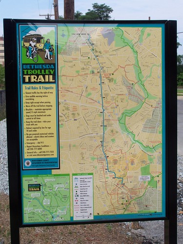
There is a decent trail network between Northwest DC and Montgomery County, but it has room for improvement.

8. Expand MARC passenger rail service on the Brunswick Line, in both directions throughout the day. The MARC Brunswick Line provides service to stations in Montgomery County, including major destinations in Gaithersburg, Rockville, and Silver Spring.

But the service is designed to move people only from north to south in the morning and south to north in the evening, making "reverse commuting" impossible.

By contrast the MARC Penn Line supports travel in both directions from early in the morning til late at night, while the Camden Line provides a limited set of bi-directional service during morning and evening rush periods.
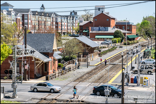
Gaithersburg MARC Station
MARC Station in Gaithersburg.  Flickr Photo by John G. Harvey.

Note that MARC has limited slack railroad passenger car capacity which constrains the ability to exercise such service changes and increases in the short term.  But organizing Metrorail closures in a manner that can be accommodated by MARC and CSX through changes and expansion in service should be explored.  SEPTA proved it is possible to "borrow" cars from NJ Transit.  That could be an option here.

9.  Market rail passenger service integrated with Metrorail comparable to the London Overground program (past blog entry, "One big idea: Getting MARC and Metrorail to integrate fares, stations, and marketing systems, using London Overground as an example").

10.  Add an in-city railroad station on the Brunswick Line at Fort Totten as a way to provide redundancy and more connections to the subway network outside of Union Station--as well as serving the Red Line, as does Union Station, Fort Totten is a transfer station for the Green and Yellow Lines, which would provide alternative routings thereby reducing some demand on Union Station as a transfer point, as well as redundancy to the network if Union Station were not operative for any reason.

11.  Make sure long term that Montgomery County BRT planning considers extension of service across the DC-Maryland border as appropriate.  Bethesda to Friendship Heights, New Hampshire Avenue to Fort Totten, etc.

12.  MARC service to Bethesda and Northwest DC?.  The MARC Brunswick Line runs on the Metropolitan Branch, and its routing follows the western leg of the Red Line between White Flint and Shady Grove, and the eastern leg of the Red Line towards Silver Spring and between there and Union Station.

An option would be to create a MARC branch that would split after the Metropolitan Branch Station and could run south along I-270 to Bethesda (and ideally eventually, underground through DC to Union Station and could maybe even provide my underground RER line to Northern Virginia, see below).

It might be that present services to Rockville and eventually to White Flint on the MARC line would be enough, using the current configuration, augmented by bi-directional service would be enough, because people can transfer from the railroad to the Red Line from those locations and continue to Bethesda or Downtown DC.

But Bethesda is a major destination in the metropolitan transportation network as is West Northwest DC and this might be a way to provide additional railroad passenger service and build a more robust high capacity transit network.

13.  It's been suggested that the western leg of the Metrorail should be extended to Gaithersburg and Germantown.  See the ACT webpage, "A Transit Vision for the I-270 Corridor."  That would obviate a large part of the need for MARC service to Bethesda and further into Northwest DC.

=====From the blog entry, "New State Rail Planning Initiative in DC"

Potential for an RER/Crossrail type railroad line to Arlington County and westward including a new Downtown rail station for DC.  RER is a suburban commuter railroad system in Greater Paris. Inside the city, the lines are almost completely underground.  Similarly, London's Crossrail will add new rail service to the city via underground tunnels and stations in Central London.

A few years ago, Dan Malouff, a transportation planner and writer/webmaster of the BeyondDC website, suggested in an offhand written comment the need to create another major railroad station in the core of the region (within the Beltway) to ease capacity demands on Union Station.


Alexandria Union Station with Metrorail in the back to the left.  Wikipedia photo by Choster.

Alexandria and Crystal City are the two train stations in Northern Virginia serving closer in destinations, focused on serving South Arlington and Alexandria (Alexandria is also an Amtrak stop).

The need for a station and service as hypothesized would be in North Arlington and points west (Tysons Corner), but there isn't existing railroad right of way on the surface which would facilitate the creation of such service.  (Perhaps the Washington & Old Dominion Trail could be returned to rail service in the modern era, but the railroad shut down long before the rise of Northern Virginia as a business and residential powerhouse)

Using the RER and Crossrail as a model, a way to provide new railroad passenger service in a northwesterly direction would be to create an underground railroad line from DC Union Station northwest into Arlington County, which could be extended further into Fairfax County and beyond.

At the same time, at least two additional stations should be constructed between Union Station and Arlington Station, one in DC and one in Rosslyn.

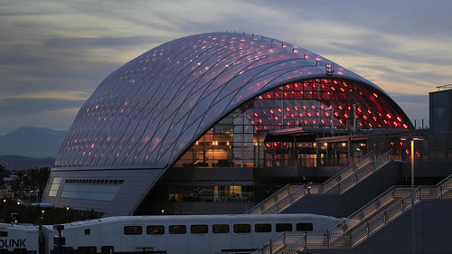
Exterior lit, with train, Anaheim Regional Transportation Intermodal Center stationNew Anaheim Regional Transportation Intermodal Center (ARTIC).  A train station in the West End of DC and in Arlington could be built on the lower floors/in the sub-basement levels of an otherwise mixed use building, with office and other uses above. Photo by Allan Schaben, Los Angeles Times.

Labels: , , , , ,

Thursday, September 22, 2016

Transportation network interruptions as an opportunity: Part 2

I was rushed writing yesterday's piece ("Transportation infrastructure interruptions as a missed opportunity for improving transportation demand management programming"), because I had a bunch of meetings, and so the piece as published wasn't as complete as I'd have liked.

I intended to augment the piece and republish it with today's date, but instead there are two follow up pieces.  This one is more about some general planning points I failed to include.  Tom Quinn's comments on the previous piece provides additional and specific solutions for Montgomery County-DC transportation network interruptions, which will be addressed in the third piece on specifics.
Corridor management as a strategy.  The biggest omission was the failure to talk in general terms about the concept of "corridor management and planning," which is a big emphasis of the Federal Highway Administration.  There's a lot of good work, published reports, etc., on the concept.

From the FHWA report, Integrated Corridor Management: Implementation Guide and Lessons Learned:
Integrated Corridor Management is the operational coordination of multiple transportation networks and cross network connections comprising a corridor and the institutional coordination of those agencies and entities responsible for corridor mobility. It will transform the manner in which transportation networks are managed within a corridor, enabling agencies to see the overall impact of multimodal transportation network management decisions and to optimize the movement of people and goods within the corridor instead of just on individual networks.
The crisis generated by the rolling Metrorail closures is an opportunity for jurisdictions to apply corridor management approaches to more sections of the metropolitan area.

Virginia DOT (VDOT) has already adopted this approach to freeways as can be seen with the addition of HOT lanes as a capacity expansion and roadway management strategy for I-95/I-395 ("Virginia to extend I-95/395 HOT lanes north to D.C. line," Washington Post) and new plans and programs for I-66 ("Virginia launches its latest HOT lanes project "on I-66," Post), which they have branded the Transform 66 program with separate initiatives for "Outside the Beltway" and "Inside the Beltway."

The previous entry mentioned Virginia's desire to extend HOT lanes to Maryland in part to deal with future needed upgrades to the American Legion Memorial Bridge.  We can criticize this proposal, but the integrated approach it represents is worthy of consideration.

I can't claim to be an expert on roadway planning in Maryland, and the State has announced an initiative for I-270, but I think it's fair to say that there isn't the same level of an integrated approach on the Maryland side.  I-270 and I-495 as freeways need to be managed as an integrated system, but the I-270 and I-495 corridors need to be managed as part of the the broader transportation network, and corridor management planning needs to be based on transportation demand management principles and the incorporation of transit as part of the toolbox of solutions.

Roadway expansion often comes at the expense of investments in sustainable mobility.  Like the tension in Northern Virginia between support of automobility versus sustainable mobility exemplified by Arlington's original opposition to HOT lanes ("Officials to consider road widening, HOT lanes through Arlington," Post) because rightly, such infrastructure promotes more single occupancy vehicle (SOV) trips, which are not prioritized in the County's Transportation Plan, this kind of transportation system management strategy has its downsides.
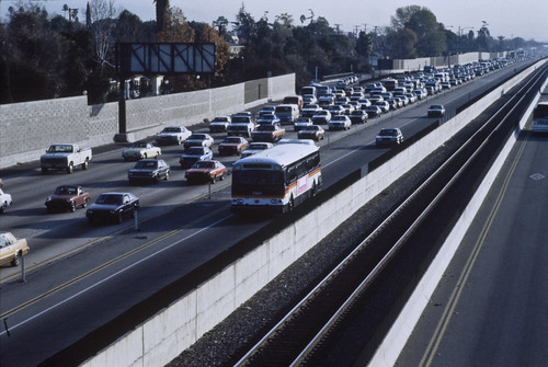
But since automobility isn't going away anytime soon, ignoring these issues doesn't help anyone either.
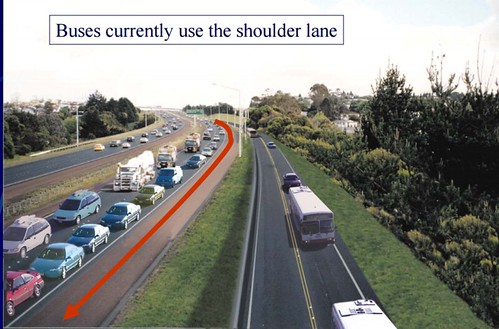
Ideally, a corridor management strategy focuses not just on expansion of capacity and management of the movement of motor vehicle traffic, it also focuses on transportation demand management and the complementary deployment of transit and other sustainable mobility initiatives as a capacity management program.

That's what needs to happen with I-270.
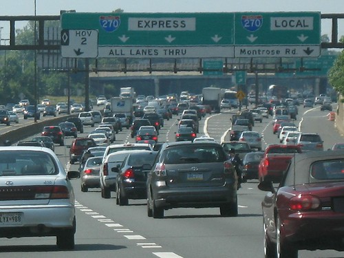
Interstate_270
I-270, Wikipedia photo.

Inter-county traffic versus intra-county mobility priorities shape the agenda for County BRT.  I think part of the issue with I-270 in terms of transit, at least for Montgomery County, is that because the road is a limited access freeway and under control of the State Highway Administration, it's not on their radar in terms of management because it doesn't have the same kind of impact on the county as do traffic-engorged arterials.

Note that as part of the FHWA development of corridor management planning approaches, I-270 was a test case, with a published report.
Rockville Pike, looking north, which Montgomery planners want to transform into a network of urban villages.
Rockville Pike is one of the corridors where Montgomery County proposes a robust BRT service. Washington Post photo by Bill O'Leary.

While the arterials that make up the bulk of a Maryland county's transportation network are mostly under state control also, because they are surface roads abutted by commercial and residential buildings, they have a much different impact on quality of life and the mobility system within the county, and that's why the County's BRT program is focused on improving transit and reducing automobile trips on these roads and not the freeways.

At the same time, it's not likely that in ordinary circumstances the SHA will be at the forefront of developing sustainable mobility approaches to I-270 improvements, so Montgomery County DOT needs to step in, and Frederick County needs to be in the mix as well.

Freeway-based bus service vs. arterial BRT.  In the US, it's generally understood that freeway-focused bus rapid transit services haven't worked out very well in terms of ridership.
MTA-Slides_0712
El Monte busway, Los Angeles County, the nation's first busway (but opened to HOV use three years later and to HOT use in 2013) opened in 1973. LA MTA photo.

In large part that's because freeway interchanges typically aren't population centers and make bad locations for gathering and concentrating bus riders.

Other places such as Curitiba, Brazil, Ottawa, Ontario, and various cities in Australia have created dedicated busway networks comparable to freeways, and those systems operate quite successfully.

But as nodes in a regional transit network, complemented by local service, perhaps in some areas, freeway-based bus transit services may deserve reconsideration.

Imagine the impact of freeway-based bus services if there were separated busways within freeway corridors, but in a manner separate from HOV and without fear of encroachment from motor vehicle traffic.

This slide from a TRB conference presentation "Integrating BRT & Freeway Operations: Experience & Lessons from Canada, New Zealand & Australia," showing the rendering for a separated busway in Brisbane, Australia illustrates the point.
Rendering, Brisbane, separated busway as part of freeway corridor.

The problem is that "highway agencies" tend to focus on freeways as infrastructure for cars and trucks, not transit, and don't conceive of freeways as one element, foundational to be sure, of a multi-modal transportation system providing service at multiple scales, and that the freeway element should be capable of and designed to serve transit, not just cars and trucks.

Minneapolis is working to put BRT service on I-35, calling the service the Orange Line.  It already has an operating station at the 46th Street Bridge.
46th Street Bridge BRT Station, Minneapolis

46th Street Bridge BRT station, I-35, Minneapolis
First photo, Metro Transit, Minneapolis.  Second photo, "Metro Transit needs business community supporters to step up," Minneapolis Star Tribune.

In terms of traditional long distance commuter bus service, it's worth considering whether or not we've captured all the opportunities for such service within freeway sheds.  That being said, Maryland has an extensive commuter bus program, as do farther out counties in Northern Virginia.  Commuter Connections produces maps of Park and Ride locations too.

My sense is because of MARC and Metrorail service in the I-270 corridor, at least in its Frederick and Montgomery County sections, there might be fewer MTA Commuter Bus lines than there is the potential.  Each commuter bus run is equal to 50 separate car trips.

Maybe there is more demand than we think, especially for west county destinations like Bethesda which aren't served now from the west.  Similarly, Silver Spring isn't a destination for western commuter bus routes, although it is a destination for routes emanating from Howard County.

Adding microtransit to the service mix for "last mile" service.  Primary transit services, like subway, railroad and commuter bus, are great for long distance travel and high capacity but in few instances take people to their final destination.

To facilitate efficient delivery of the passenger to their final destination, commuter bus stations on a freeway need to be complemented with local transit services.  Traditionally this is done with regular bus line service.

But I don't think that's enough.  Microtransit options including shared taxi services such as in "exurban" Montreal or vans and small buses such as done by Bridg or Chariot would be a good addition to the service mix, adding more support for what I call tertiary or intra-district transit needs.

These types of "flexible transit services" have been around for awhile (Operational Experiences with Flexible Transit Services, Transit Cooperative Research Program, 2004), but now rebranded "microtransit" since they've been enhanced with more flexible routing and scheduling capabilities enabled by IT and telecommunications (Shared Mobility: Definitions, Industry Developments, and Early Understanding, Berkeley Transportation Sustainability Research Center' New Mobility Discussion Paper, Metrolinx, Toronto).

Suburban intra-district transit service.  The
Airport Corridor Transportation Association in the Robinson District of Allegheny County, outside Pittsburgh provides one example of how to do intra-district transit in suburban settings.

They are in the region's "airport district" but a lot of workers come from the City.

ACTA has created demand-response transit services, service hubs, and other programs to make it easier for people to get to and from work without driving.

(These are the kinds of districts where I think microtransit services should be targeted, although the services tend to be focused on denser urban markets already served by transit.)

Besides the RideACT microtransit service, they have also created a transit hub at a major shopping district, at a transit stop with both regional and local bus service ("Transit Super Stop planned for Robinson," Pittsburgh Post-Gazette).

From the article:
The Airport Corridor Transportation Association will hold a grand opening Tuesday of what it is calling the region's first Super Stop, a hub that will serve bus passengers, pedestrians and bicyclists, at the corridor's busiest bus stop in front of IKEA in Robinson.

The stop is the transfer point for RideACTA, the free on-demand service that enables riders of Port Authority's 28X Airport Flyer to connect to workplaces within a 1.5-mile radius. Two other authority bus routes also serve the stop. Lynn Manion, ACTA executive director, estimated that 400 riders use the stop on a typical day.

The stop will have two shelters with seating and standing room, and the back walls will have a plastic film with images of IKEA furnishings so that when riders sit on the benches, it will appear as though they are in a living room. The stop will have bike racks, picnic tables, benches, trash receptacles and a bike work station where cyclists can make simple repairs.
ACTA has also published some good work on suburban district transit planning:

-- Rethinking the Suburban Bus Stop, ACTA
-- Moving Around Within A Suburban Commercial Area, ACTA (the concepts pertain to intra-district mobility more generally)

Labels: , , , , ,