Rebuilding Place in the Urban Space

"A community’s physical form, rather than its land uses, is its most intrinsic and enduring characteristic." [Katz, EPA] This blog focuses on place and placemaking and all that makes it work--historic preservation, urban design, transportation, asset-based community development, arts & cultural development, commercial district revitalization, tourism & destination development, and quality of life advocacy--along with doses of civic engagement and good governance watchdogging.

Monday, September 04, 2023

Sprawl washing/sprawlwashing

The term "greenwashing" is used to refer to organizations that announce sustainability initiatives as a way to detract from their generally poor practices.

I have been critical about the announcement of the "Utah City" development in the Vineyard community of Utah County, Utah, which will be new urbanist, mixed use, aims to leverage a commuter railroad station, etc. ("Utah City breaks ground, a very ambitious TOD: A new transit-oriented development in Utah is planned with the density and amenities of a big city downtown," Congress for the New Urbanism).

It's 700 acres.  A tad over one square mile.

Utah County has over 2,000 square miles of land--I don't know how much is undevelopable because it's mountains.  Salt Lake County 800.  Davis County 634.  Again for Davis and Salt Lake Counties, a goodly amount of land is tied up in mountain ranges

Still, that's almost 3,500 square miles, that is developed as classic sprawl ("Study: Utah has second-fastest urban sprawl," Salt Lake Tribune, 2014).

Weekend travelers join the traffic on I-15 near Point of the Mountain near Draper 
Thursday, Aug. 30, 2018. Photo: Steve Griffin, Deseret News

So a development or two here and there, using nonsprawl principles, doesn't make any difference.  Although people criticizing my stance say it's an important step forward.

Meanwhile, Utah faces incredible drought (the Governor calls for praying for rain, "Utah governor asks citizens to pray for rain to end drought," AP), isn't expanding the Trax light rail system, does plan to widen I-15, continually fails to address air quality issues, is in danger of losing the Great Salt Lake ("‘Last nail in the coffin’: Utah’s Great Salt Lake on verge of collapse," Guardian), is a state dedicated to resource extraction especially of fossil fuels, etc.

Labels: , , , ,

Tuesday, January 17, 2023

The call of sprawl: Salt Lake Bees minor league baseball team to move to the suburbs

In 2021, I participated in a planning process for the Ballpark neighborhood of Salt Lake, because I am interested in stadium and arena issues.  The minor league stadium, opened in 1994, was another example of a "throwback" design in an urban setting.

I wrote about it here:

-- "Framework of characteristics that support successful community development in association with the development of professional sports facilities" (2021)

in the process, updating my evaluative framework for siting and building arenas and stadiums.

Also see:

-- "Revisiting "Framework of characteristics that support successful community development in association with the development of professional sports facilities" and the Tampa Bay Rays baseball team + Phoenix Coyotes hockey" (2022) 
-- "Camden Yards baseball stadium is 30 years old" (2022)
-- "Does professional soccer have the same economic impact as minor league baseball in smaller cities?" (2022)
-- "Pittsburgh developer backs down on opposition to ticket fee for concerts, to be used for area improvements" (2023)

In the past few months, there were rumors that despite the planning efforts, the team was going to move.  Today, the owners, Larry H. Miller Companies, made it official.


It's not really a surprise, because in a state where sprawl is the dominant land use and transportation planning paradigm, the Miller Companies are perhaps the most prominent leader of the sprawl development contingent.  

The company was built on automobile dependence, growing into one of the largest car dealership groups in the U.S.

As a real estate developer, they've been key to suburban development throughout the Salt Lake Valley, building cinemas, car dealership malls, and shopping centers, even a community college campus, as anchors of the expansion of the development of Salt Lake County further south away from the core of Salt Lake City.  

More recently, they've sold the dealerships ("Asbury wraps up $3.2B deal for Larry H. Miller Dealerships," Automotive News) and Utah Jazz basketball team, and refocused on real estate development, buying a home builder and lots of empty land ("The Larry H. Miller Company is building communities," Utah Business, "Larry H. Miller Real Estate LLCs are buying Richardson Flat," KPCW/NPR, "Larry H. Miller’s real estate arm makes big move, buys booming Daybreak in South Jordan," Salt Lake Tribune).

Seeing the team as an activation device, the firm plans to move it to the Daybreak area, which is about 20 miles from Salt Lake's Downtown, where they have major real estate development interests.

The team as an activation device is key.  Perhaps it matters to them less that it's likely to be less successful in terms of attendance at a site in the distant suburbs.

The Ballpark neighborhood.  Interestingly, while the Bees ballpark is a great example of an urban stadium, it was poorly placed out of the belief that putting it outside of downtown would revitalize the area--"if you build it they will come"--without any substantive revitalization and development improvement plan for the neighborhood.

But I also think it's an example that the best place to put such facilities is in a city's downtown or waterfront.

Suburban locations for stadiums and arenas.  This is the same issue with suburban stadiums.  They don't do much for an area.  It's hard to activate an area beyond the days that a stadium or arena is operative, and various logistical issues make ancillary development of retail and food and drink establishments difficult.  

Certainly, the Real Salt Lake soccer stadium in Sandy doesn't seem particularly well sited or able to generate positive urban design and development energy.

This is why the 1990s and 2000s have been marked by stadiums and arenas relocating from the suburbs to the city.  Although there have been notable exceptions such as the Atlanta Braves and the San Francisco 49ers.

Metropolitan planning for key traffic generators.  When the Netherlands reset their land use and transportation planning policy away from automobile dependence, one of the things they did was add a "transportation demand" lens to their approval of new development applications ("Utrecht: ABC Planning as a planning instrument in urban planning policy"). 

 High transportation uses were shifted to locations where transit could handle the bulk of the demand.

Most metropolitan areas do not have even minimal requirements along these lines, with Portland, Oregon being one of the only exceptions.

The laws and regulations creating the metropolitan planning organization process for transportation planning under the auspices and requirements of the US Department of Transportation should be modified to have such requirements for stadiums and arenas, (and airports) among other uses.

Note that Phoenix, Seattle ("Seattle Kraken expansion hockey team sets new standard for transit benefits in transportation demand management: free transit with ticket," 2021), Chicago (for the Cubs), and San Francisco have transportation demand management requirements that mean that event attendees can mostly ride transit for free, to deemphasize the focus on automobile transportation.

This needs to be built into metropolitan planning requirements for stadiums and arenas too.

Other stadium and arena developments underway.  

  • The Oakland A's baseball team is itching to relocate to Las Vegas, although a proposal for the Oakland waterfront is still in play
  • The Kansas City Royals have released a plan to relocate to a more centrally located stadium downtown
  • The Chicago Bears football team aims to relocate to the suburbs
  • Same with the Washington Commanders, from Maryland suburbs to Virginia suburbs
  • The Buffalo Bills got over $1 billion in subsidies to build a new suburban stadium.  Interestingly, the economic comparison found minimal benefits were the team to be located in the center city
  • Interesting coverage on San Diego, since the Chargers football team left for Los Angeles ("Six years since Chargers relocation, City Hall continues to struggle," San Diego Union Tribune)
  • Philadelphia 76ers want to relocate to Downtown

Labels: , , , , , ,

Monday, October 17, 2022

"A country that runs on oil can't afford to run short," corporate ad inside a Standard Oil of Illinois map of Wyoming, 1973

I have been into maps, especially "gasoline station" maps since I was a child.  Living around the corner from gas stations in Detroit, I would pick them up.  You could even order them and they'd mail them to you.

Gas station "stuff" -- collectibles -- is referred to as petroliana.  Now I am interested in ephemera, paper goods like maps, magazines, advertisements, newspapers, tourism brochures, etc., especially those items that illustrate points about land use and transportation planning.

I always mention the book chapter, "Transportation and Urban Form: Stages in the Spatial Evolution of the American Metropolis," and I think a lot about the way automobiles were marketed and about "vintage" gas station maps and how other elements of gasoline distribution were organized and marketed (clean restrooms were a hallmark of Texaco ads for decades) illustrates the phases of development of the automobile-centric land use and transportation planning paradigm in the US.

-- "Gasoline dependent sprawl
-- "Automobile interests don't favor mass transit"
-- "Oil dependence | The US as a Petro-state and gasoholic | and war"

Maps and brochures promoting "tourism" illustrate the development of the "Recreational Automobile Era," while the commoditization of gasoline marketing, the de-emphasize on promoting tourism on the part of gasoline station brands, dropping branded maps, etc. illustrates how the automobile became both commonplace and dominant.  

I was looking at maps at a flea market yesterday, and this ad "forced" me to buy the map.  It's a photo, not a scan.

It's a great illustration of the costs of gasoline dependence.

Labels: , , , , ,

Thursday, August 25, 2022

Gasoline dependent sprawl

The Financial Times has a video, "Are high petrol prices killing the American Dream?," about the rise in oil prices and whether or not that affects the American Dream.

It's not that amazing of a video, and doesn't address the reality that we've built a land use and mobility paradigm that is automobile and therefore gasoline dependent.

Yes, electric vehicles will make a difference in terms of gasoline dependence, but not sprawl.  They're merely what I call "next generation asphalt nation."  And while they will decrease fossil fuel dependence, they have other spillover effects--on scarce minerals, battery needs, battery recycling, and the need for a more robust electricity generation and distribution grid.

The San Francisco-Oakland Bay Bridge. At least 12 other states are already in line to adopt California’s zero-emissions vehicle mandate. Credit: Justin Sullivan/Getty Images

Meanwhile, California is moving forward on banning the sale of gasoline-fueled motor vehicles as of 2035. ("California to Ban the Sale of New Gasoline Cars," New York Times).

When the first oil crisis happened in 1973, when Saudi Arabia realized it had the power because ultimately the oil in its country was controlled by it, not the American oil producers, the US did not recognize that to reduce risk from oil supply shocks, it needed to create an economy and society that was less dependent on oil.

Sure steps were taken, like "fleet economy" gas mileage requirements on automobile production, leading to the production of more fuel efficient cars.  And industry has made a variety of energy conservation steps.

And the US government created the Strategic Reserve of oil, to ward of supply interruptions.

But only by reducing demand for oil in substantive ways could the US's resilience in the face of supply and demand shocks be increased.

Although because the US is such a large producer of oil ("The Petro States of America," Bloomberg), it probably wasn't seen as a big deal.

By contrast, European countries still supported more compact forms of organizing land use, in ways that it could be well served by transit, complemented in some places by walking and biking.

Germany in particular is very much committed to the car, as BMW, Mercedes, and VW are significant contributors to the nation's economic success, employment, exports, etc.

At the same time, they recognized that cities in particular were best served by transit, not the automobile, and they maintained and increased support of transit, walking, and biking as an element of their land use and mobility policy.  Other policies--excise tax on car purchases, excise tax on oil, expensive process to get a driver's license, difficult to get parking, etc.--make car ownership expensive, and encourages alternative mobility options.

By contrast, the US believes in homogeneous mobility--the car. 

In short, US policy promotes access to oil, more than it is focused on price.  Not reduction in demand which reduces price generally.

Labels: , , ,

Wednesday, May 11, 2022

Bureau of Engraving and Printing to move to Greenbelt, disconnected pretty much from transit

Very early on into my urban revitalization involvement in DC, I met a guy who lives in Capitol Hill, is a lifelong Washingtonian, his family being multi-generational, who at the time lived in an alley dwelling (one of the reasons I'm interested in alley dwellings and accessory dwelling units).  

We even led some alley tours together as part of Cultural Tourism DC events, and have interacted ever since.

He worked at BEP, which he reminded me, is one of the city's top tourist attractions--people go there to see currency being printed ("Bureau of Engraving and Printing: Making our money since 1862," Kidspost, Washington Post).

United States one dollar bills get rotated before being cut into individual pieces during production at the Bureau of Engraving and Printing in Washington November 14, 2014. (Gary Cameron/Reuters)

BEP is unusual in that it is an industrial facility, printing money, and over the years, city locations tend to be seen as not particularly good for industrial functions.  

The BEP space is multi-story and firms like to manufacture on one floor, and it's a constrained location, it doesn't have any opportunity to grow out and reconfigure.

My friend says one of the reasons BEP has agitated for a suburban location is most of the people who work there live in the suburbs and drive rather than take transit to work ("New $1.4 billion Washington ‘money factory’ gets green light," Roll Call).

They've finally announced where they plan to relocate, to a site on the Beltsville Agricultural Station campus, which is north of the Greenbelt Metrorail Station ("Soon your money will be made in Maryland — literally," WTOP radio).  From the article:

The bureau is relocating from its historic building overlooking the Tidal Basin on 14th Street Southwest to unused 104-acre site at the Beltsville Agricultural Research Center that sits along Powder Mill Road — about halfway between the Baltimore-Washington Parkway and Maryland Route 201. 

“The facility in Washington is more than 100 years old, very inefficient for 21st century manufacturing,” said Len Olijar, the bureau’s director. 

A building that was state of the art when it opened in 1914 now “is a very challenging facility for us to produce in,” he said. “It’s hard to maintain temperature and humidity, and both temperature and humidity affect paper significantly when you’re printing.” 

... It’s a result of Prince George’s County luring federal buildings and the jobs they bring in. “It’s an enormously important project for the county,” said David Iannucci, the president and CEO of the Prince George’s County Economic Development Corporation. 

“We’ll take great pride in the idea that one of the two places in the United States [where] currency is going to be printed is going to be in Prince George’s County,” said Iannucci. 

He noted that it’s located not far from one of the county’s major employment corridors. “The [nearby U.S.] Route 1 corridor right now around College Park is probably the most dynamic area in Prince George’s County in terms of job growth; the construction of new facilities, both apartments and offices; and building around the strengths of the University of Maryland,” he said. 

The location will also appeal to many people who already make the trek to Southwest D.C. every day. “Many of these employees already live in Prince George’s County,” said Iannucci. “So we’re going to offer many of them a lot simpler commute.”

Some residents aren't happy about this ("The Beltsville Agricultural Research Center is not ripe for development," Washington Post).  

It appears that the actual site is about 3.5 miles from the Metrorail station, making it pretty unlikely that people will use transit to get there, even with shuttle bus services.  Instead they'll drive.

While the National Capital Planning Commission, the entity responsible for planning the area's federal sites and locations (see the Federal Elements in the DC Comprehensive Land Use Plan), not limited to DC proper, has serious transportation demand management requirements for siting federal facilities, increasingly it appears that they are being ignored, and agencies are moving to sites that are poorly reached by transit.

-- The Federal Employee Transportation Coordinator's Transportation Management Plan Handbook

From the webpage for the NCPC Transportation Element Update:

The Transportation Element provides policy guidance to support a regional multimodal transportation system that promotes responsible land use and development and contributes to a high quality of life for residents, workers, and visitors, while improving regional mobility, transportation access, and environmental quality. The updated Element includes a supporting Addendum which details Transportation Demand Management and Transportation Management Plans.

I understand the manufacturing requirements for BEP and why the location in DC proper is no longer suitable.  Even if it comes at the cost of DC's tourism offer ("Popular tourist stop Bureau of Engraving and Printing may move to Maryland," WTOP) and transit efficiency.

Streetcar entering Bureau of Engraving + Printing tunnel 1960.

When the area population was more concentrated, most federal workers got to work by streetcar and bus.

Negative impact on the area transit system.  But at the same time, every agency that leaves DC usually does so at the expense of transit by locating in poorly connected places with limited transit service.

This will lead to a drop in ridership and revenue for Metrorail, which needs every rider and dollar it can get, and a significantly increased number of motor vehicle trips and more road congestion.

At the very least, agencies should be required to be close to transit, ideally accessible via multiple lines, and to facilitate this, the federal government should re-commit to helping fund transit extensions for both Metrorail and the "soon to be built" Purple Line light rail which will serve Montgomery and Prince George's Counties, but was also conceptualized to include Alexandria and Arlington and Fairfax Counties.

The section of the Purple Line under construction is from Bethesda to New Carrollton. 

Note that I made the point that the military base consolidation process also affected the DC area negatively on this dimension, in that the process specifically disavowed responsibility for transportation and transit on the part of the federal government, despite changes that made the system less efficient ("BRAC and transit efficiency," 2009).

This photo shows the results of a local business tracking how its employees get to work.

It should be required that agencies that move out of the city do before and after data collection on how people get to work.

Federal agency leakage as a DC economic development issue.  This may or may not be a DC "economic development" issue.  Are there opportunity costs in having federal agencies?  

On the other hand losing any agency can be seen as a negative act for DC, given that DC isn't particularly successful in broadening its business sector ("Boeing to move "headquarters" to Northern Virginia," "Why Mayor Bowser is right to be leery of systematic lowering of taxes," 2015) and that central business districts because of covid are hurting big time ("To recover from COVID-19, downtowns must adapt," Brookings) and DC is no exception ("As offices stay empty, downtown D.C. looks for post-pandemic identity," Washington Post)

Because of security requirements, federal buildings tend to be anti-city because they require big setbacks and militate against mixed use, and federal employees don't spend a whole lot of money on food and sundries--consumer surveys for the Southwest DC Ecodistrict planning initiative found that about 65% of federal employees don't eat out.

I go back and forth depending on the agency.  There are opportunities for larger spaces but they are not in the central business district.  And actually, BEP's move could result in more space for different agencies.  Similarly, the Government Printing Office wants to move too and it has a large space.  

And the FBI, although they should do a "reengineering" of its staffing functions, keep headquarters personnel in the core, while perhaps other functions could move ("Maryland hopes revived for landing FBI headquarters," Maryland Daily Record).

Although it diminishes the primacy of DC as the home of the federal government, even if the Capitol, White House, and Supreme Court, agencies do, especially when anti-government types hold elective office.  

For example, during the Trump Administration the USDA Economic Research Service moved to Kansas City ("After the relocation gutted their workforces, USDA research agencies struggle to rebuild," Federal News Network) and the Bureau of Land Management to Grand Junction, Colorado although under President Biden its moving back ("Interior will move BLM headquarters, senior officials back to DC," Federal News Network).

For a long time, Republicans haven't been interested in investing in agencies that are located in DC ("Consumer bureau headquarters renovation plan gets GOP flak," Los Angeles Times, "Congressional dysfunction isn't battering the Washington area economy, it's the anti-government perspective of the Republicans," 2018, "Implications of a Trump/McConnell/Ryan Administration on DC's commercial real estate market," 2016).

And as the quotes in the WTOP article indicate, suburban jurisdictions are constantly recruiting agencies that are based in DC. And they have way more Representatives and Senators than DC.

Labels: , , ,

Friday, August 13, 2021

Marketing the suburban lifestyle

Suzanne and I were talking this morning about Layton, Utah, a city along the I-15 and Highway 89, north of Salt Lake City, towards Ogden, and how between the state highway (6-8 lanes wide) and the freeway, any local sense of place has been mostly eradicated, aided by the development of a very specific retail estate and retail development paradigm that operates identically across the country.

For whatever reason she was looking up Mission Viejo, where she grew up, in Orange County in Southern California.  

The community developed in the 1960s and 1970s, and they had great marketing communications promoting adoption of suburban living through the acquisition of a house in the far suburbs--Mission Viejo is about 50 miles from Los Angeles.

Orange County had been rural and agricultural.

One of the great things about newspapers and magazines from this time is that they had these kinds of advertisements, which help to track changes in a community (e.g., the advertising by then local businesses like banks and appliance stores, ads on new shopping centers and residential developments, etc.).  

Similarly, at the time when there were so few but dominant national mass marketing media -- the three television networks, major metropolitan newspapers, and national magazines like Life, Saturday Evening Post, TIME, Ladies Home Journal, Better Homes & Gardens, American Home, and Fortune (plus trade magazines such as for home builders, gas station owners), etc. -- looking at newspapers and magazines especially is a great way to get documents of these changes.  (It is unfortunate that going forward, as newspapers and magazines go out of business, but also as these kinds of businesses either no longer exist or don't advertise in this way, we lose this kind of documentation.)

The University of California has a great digital archive called Calisphere, which has digitized many of these promotional materials as it relates to land use history in the state.

There are some great ads.  (Interesting too that the City website has a page on "Advertising Mission Viejo" linking to these ads.)

This one promotes the idea of locally provided amenities, that you don't need a car to get to, that you can cycle to, on a tandem bike no less.  Although no real quality bike infrastructure was provided.  

This postcard is brilliant.  It was provided as part of a welcome packet to new homeowners, who could send postcards promoting the "new town" when notifying friends and family of changes of address.

While billboards promoting new subdivisions are nothing new, it's great that they have been documented for Mission Viejo.


Interestingly, they were promoting the inclusion of community amenities as the "re-creation" of home, implying that this kind of home no longer existed in urban places.  And not really admitting that the necessary connector between home and amenities is the car, whereas before, community implied walkability.

Labels: , , , ,

Friday, August 07, 2020

The suburbs aren't what we think: Politico interview with Thomas Sugrue

Politico has an interview ("Trump Doesn't Understand Today's Suburbs—And Neither Do You") with NYU Professor Thomas Sugrue about "the suburbs" in response to President Trump's overturning of a HUD funding rule that was supposed to encourage the production of more affordable and lower income housing in the suburbs.

I know about Professor Sugrue's work about Detroit, but haven't kept up with his writing and research otherwise.

The discussion is particularly good on how most people take for granted the various federal policy preferences and actions that subsidized the building of the suburbs and their racial demographics.

As an example, the massive developments by William Levitt, the Levittowns, were pretty much whites only.  See "A 'Forgotten History' Of How The U.S. Government Segregated America," NPR, and "Memories of Segregation in Levittown," New York Times.
Levittown in 1957, image from promotional brochure

I know that I was really surprised when I learned about this more directly, but not til about 20 years ago, in a book of papers published by the Brookings Institution.

(Recently, when the U of Michigan Alumni Magazine sent out their e-letter about recent writings about "anti-racism" I wrote an email back about segregation of dorms at the school, which I never learned about while enrolled, but uncovered a few years ago in an NYT obituary, "Jewel Plummer Cobb, 92, Dies; Led a California Campus."  They never responded.)

The basic points, besides the subsidy and creation of the suburbs as white enclaves:

  • that suburbs aren't monolithic
  • that the wealthy and most concerned about whiteness keep moving farther out more at the exurban edge of metropolitan areas
  • that inner suburbs in particular are more diverse as they decline relative to newer areas farther out
  • that immigrants increasingly are drawn to the suburbs for job opportunities, rather than first living in the city, etc.

Labels: , , , , ,

Sunday, August 11, 2019

Revisiting stories: the death of L. Brooks Patterson, County Executive, Oakland County, Michigan

======
Note: I lived in Oakland County roughly from 1971/1972-1978 and the summers of 1979 and 1980.
======

L. Brooks Patterson won 7 terms as County Executive in Oakland County, Michigan, which lies north of Detroit.  Before that he was the tough on crime County Prosecutor for 4 terms.

He was strongly pro-County and pretty much anti-Detroit, as I wrote in this piece from 2014, "The rise of Oakland County is built upon Detroit's fall."

From the Crain's Detroit Business article, "What will happen to Brooks' deputies?":
Patterson was first elected county executive in 1992 after serving four terms as Oakland County prosecutor.

His tenure as Oakland County executive was marked with myriad successes, but also controversy. The county's AAA bond rating has been reaffirmed time and time again under his leadership, and the county has a lauded three-year rolling budget. He instituted the Automation Alley high-tech cluster and the Emerging Sectors program for knowledge-based jobs. Medical Main Street and Main Street Oakland also came into being under his watch. He was honored by Governing magazine in 2013. The University of Detroit graduate and U.S. Army veteran was generally viewed as a business community champion.

While his leadership of Oakland County itself has drawn wide praise, his comments about Detroit and other issues have drawn criticism.

His career had been marked by bitter feuds with Detroit and neighboring counties over a host of issues ranging from transit to the Detroit Water and Sewerage Department. Some viewed him as an obstacle to more robust regional cooperation.
Like Trump's very parochial bilateral "Make America Great Again" push, Patterson was a block to creating more regional approaches to the area's issues.

In e-talking with Nigel, our correspondent from New Zealand, I looked up the demographic data comparing Wayne, Oakland, and Macomb Counties population from 1960 to today.

Overall, there are only about 120,000 more residents in 2018 compared to 1960--although it must be acknowledged that the metropolitan area has grown beyond these three counties.

The difference is that 1.2 million residents from Detroit have been redistributed and Wayne County's population dropped by 900,000, while Oakland and Macomb Counties roughly doubled in population.

Patterson died not quite two weeks ago, and because in the 2016 election, the County shifted from a Republican dominated electorate to a more progressive and Democratic there is jockeying between Democrats as the Party aims to capture the County Executive position.

It's not clear if there will be a special election, which if one is held will be in the 2020 election cycle, for a two-year partial term, as the normal cycle for the office is in the "off year election" from Presidential elections.

Also see:

-- "Commentary: Patterson leaves enduring legacy, but time for region to move on," Crain's Detroit Business
-- "R.I.P. L. Brooks Patterson, A racist," Detroit Metro Times
-- "McGraw: Friends Say Brooks Patterson 'Loved' Detroit, But His Record Shows Otherwise," Deadline Detroit

A couple weeks ago in a post about segregation, I mentioned that I went to school for a time in the Pontiac School District, while the school system was desegregating and where school buses were bombed in protest. It turns out L. Brooks Patterson represented one of the incendiary anti-busing activists, Irene McCabe...

Labels: , , , , , ,

Friday, December 11, 2015

American Planning Association 2016 conference in Phoenix

===From email=====

Registration is now open for the 2016 APA National Planning Conference in Phoenix, Arizona, April 2 – 5, 2016. Thousands of planners from around the country will convene for the premiere planning event of the year at the Phoenix Convention Center. This year’s honorary chair is former U.S. House of Rep. Gabrielle Giffords. Giffords holds a master’s degree in regional planning from Cornell University.

The four-day conference is an opportunity to connect with peers, share innovations and discuss how to address the challenges facing communities today, and tomorrow. Find out how Phoenix, the sixth largest city in the United States is planning to become the country’s first carbon-neutral city. Enjoy the sunshine and all the conference has to offer, including:

·         Hundreds of conference sessions designed for all attendees from the advanced practitioner to the early career professional.

·         Ten tracks that focus on specific planning topics including energy planning, housing, public health, generational planning and water resources.

·         More than 50 mobile workshops, guided by local practitioners, will take conference attendees into the community and surrounding region to learn in-depth and get an up-close experience of planning in Southwest. Topics include retirement communities, tourism, river restoration and downtown revitalization.

·         Keynote speakers who will challenge and inspire. Jack Uldrich, a global futurist, will shake up assumptions in the opening keynote. Concluding the conference is John Englander, an oceanographer that will illustrate climate change and rising sea levels mean for the economy and society.

Early bird registration rates are available through February 4, 2016. Register early to ensure your spot!

========

There are a lot of urban planning reasons to knock Phoenix, Arizona, given its poster child status concerning sprawl ("Bird on Fire: The World's Least Sustainable City," Places Journal) and the reality that much of the development in the Southwest was driven by military spending ("The Rise of the Gunbelt," book review ).

That being said, there are many pro-urban examples of best practice there that are worth checking out on the part of urban planners and other members of the placemaking profession.

-- The Phoenix light rail line has been successful in recentering interest and use of transit as well as refocusing real estate development somewhat ("$8.2B invested along 20 miles of Valley Metro," Metro Magazine) away from sprawl and towards transit-served locations.

In the November 2015 election, voters passed a referendum extending a sales tax supporting transit expansion and operations, and other transportation improvements.

Some of the older strip centers in the vicinity of the Camelback and Central Avenue Station are home to an interesting mix of independent retailers, who located there before the light rail system, attracted by low rents.  It will be interesting to see how long those buildings will remain, if proximity to the transit station will drive more intense development?

-- earlier this month, the first extension to Mesa, with four new stations, opened for service ("Arizona Rail Extension Opens Early to Connect Urban Growth") and in March 2016, just before the APA conference, the system will open its second extension, 3.2 miles and 3 stations, extending service to Northwest Phoenix

-- Phoenix is also a textbook example of lining up money in advance of the light rail's opening to fund affordable housing ("Light rail housing fund spurs 15 projects in metro Phoenix" and "Why you don't see more vacant lots along light-rail route," Arizona Republic).  This is an important advance in linking transportation infrastructure with equity considerations, as well as tighter integration between land use intensity and development and transit infrastructure


-- Similarly during the recession, to keep a development active, a Tempe developer created a senior housing development, Encore on Farmer, as an integral element of the program, funded in part by tax credits ("Rare housing mix: Affordable, new," AR).  They've since done similar projects elsewhere in Greater Phoenix.

-- Tempe in Motion, the transportation agency for the City of Tempe is a national best practice model in sustainable mobility, including bike planning, the multi-modal transportation system, the neighborhood-to-activity-center Orbit bus system, promotion of biking and placemaking, etc.

-- Tempe is the home of Arizona State University.  Mill Avenue is the main commercial district for the city, also serving the university population.  Phoenix also has a professional schools campus for the University of Arizona, which is separate from the main campus in Tucson.

-- the Phoenix Biomedical Campus is an impressive initiative linking academic institutions, medial and health firms, nonprofit research institutes, and hospitals

-- the Phoenix Public Market farmers market has a night market on Thursdays, and a cafe building (it had been a store featuring items from farmers and artisan producers, but it wasn't able to make a go of it)

-- Maricopa County--which is huge, over 9,000 square miles--has an expanding bikeways system better than many metropolitan areas


Jobot Coffee

-- the Roosevelt Row arts district, in part comprised of bungalows, is pretty cool.  The APA recognized the district as a "Great Place" earlier this year (likely in advance of next year's conference)

-- While Chandler, Arizona is noteworthy for not agreeing to provide subsidies to professional sports teams in their case for minor league and spring training facilities ("The city that said no to baseball," Bond Buyer) and they are doing just fine, Glendale can't say the same, as deals around hockey and the team arena have pushed the city to the edge ((NHL hockey in Arizona an albatross for Glendale taxpayers," Topeka Capital-Journal).

-- the Grand Canyon is close enough for a visit, so people not having been should add a couple days to their visit. On the way, Prescott, Arizona is interesting and has a number of places that prepare great huevos rancheros

-- Tucson is about two hours away, and is home to the University of Arizona and is noteworthy for launching streetcar service last year. The impetus for the program was a citizen organized effort, not a top-down process.

According to a town engineer in Suburban Tucson, already the streetcar has repositioned Downtown Tucson as a premier location for nightlife and new residential and business development, when before the streetcar it was moribund.

-- One of the geotourism efforts supported by the National Geographic Society's Center for Sustainable Destinations with the Sonora Institute is for the trans-border Sonora region linking Arizona and Mexico's Sonora State.

Labels: , , , ,

Wednesday, April 15, 2015

Let it go: Washington Redskins and Virginia

=====
*" Let it Go" is one of the songs from the movie "Frozen," for six months or more, the little girls next door took every opportunity to sing the song, the littlest, then maybe 16 months, used to sing it as "'et it go."  We use that phrase around the house now when we're talking about how we should react to things out of our control.
=====

The new Levi Stadium in Santa Clara, California.  SF Chronicle photo by Michael Macor.

The media ("Tug of war for new Redskins stadium is complicated by name debate" Washington Post) has reported that the State of Virginia is talking with the Redskins and offering them sites in far western suburbs.  The team already has its practice facility and headquarters in Ashburn, Virginia and recently relocated its summer camp to Richmond, Virginia.

While I still don't favor public financing of stadiums and arenas for professional sports teams unless the government ("the people") get a financial participation interest in the increased value a team gets from new facilities (see "Stadiums and arenas as enabling infrastructure"), I am coming around some on the value of sports teams in terms of intra-metropolitan competition for attractions, anchors, branding, etc.

However, some types of sports teams are much better at having a local financial return than others ("American City Business Journals calculates the capacity of North American metropolitan areas to support new/additional professional sports teams").  Generally, American football teams and their stadiums don't seem to provide much spillover benefit to community-urban revitalization.

So I can't see much economic benefit for cities in seeking a football stadium, notwithstanding the current events in Greater Los Angeles involving the St. Louis Rams, Oakland Raiders, and San Diego Chargers--all teams trying to get their home cities to build new stadiums.

Can you name an area around a football stadium that has improved as a result of it?  I can't.  At least, not thinking about stadiums in DC/Maryland--both the Redskins and the Baltimore Ravens; the Philadelphia Eagles, or the Meadowlands complex in New Jersey,just to name a few.

San Francisco Chronicle graphic.

There are a few reasons for this.  First, the stadiums cost so much to build.  For example, the stadium for the Dallas Cowboys cost $1.2 billion.

Second, that means football stadiums cost a lot to finance and this typically puts a huge financial burden on local and state governments who end up financing them.  The under construction stadium for the Minnesota Vikings will cost over $1 billion, with about half coming from the State of Minnesota and the City of Minneapolis, split 2/3 - 1/3 between the two).. The new Levi Stadium for the San Francisco 49'ers ended up costing about $1.3 billion, with much of the financing by a public authority.

Third, football stadiums host few events, maybe 12 to 20 including practice games and other events.  A baseball stadium holds at least 82 events, and an arena shared by basketball and hockey teams can have almost as many.

Tailgating at FedEx Field.  Photo by Joshua Yospyn via WJLA-TV.

Fourth, most people drive to football games, which taxes the infrastructure in ways that stadiums where people can use transit do not.  And they need a lot of land for parking lots, which isn't used most of the year.

By contrast an urban baseball stadium or arena served by transit needs a lot less parking, and every site not used as a parking lot can be used for buildings and other uses.

And now that arena projects are being expanded into mixed use districts, such facilities in center cities have great revitalization potential compared to single use facilities.

Labels: , , , , ,

Tuesday, December 23, 2014

Updated: Another example that school bus-based transportation is increasingly unsustainable

========
A query about the number used below, of "an average of $500 per student for annual bus transportation," which was a quote from the Indianapolis Star article, led me to make a more detailed inquiry.

According to the National Center for Education Statistics, the national average cost for bus transportation for one student in one year is $871, with data from 2009-2010, which is the most recent year available.
=========


One of the problems with moving away from a neighborhood-based elementary school planning and development paradigm is that school systems become dependent on buses for transporting students to school.

This is problematic for many reasons, including health and wellness--which has triggered the "Safe Routes to School" initiative.

But it's also problematic financially, especially as local government budgets become increasingly hard pressed, as communities reach the ceiling of what they can charge for property and other taxes. According to various studies, it typically costs at least $500 per year to bus one student to and from school.

During the recession, more school districts began enforcing regulations concerning access to bus transportation--with some exceptions, most districts won't provide bus service for students living within one mile of a school--and increasing the distance from school before bus transportation would be provided.

Some school districts have imposed transportation fees, which some residents have opposed as illegal.  There is a case pending before the Indiana Supreme Court ("Fair fees? Facing cuts, more schools charge for busing," USA Today) on this issue.  Also see the Indianapolis Star piece, "Indiana Supreme Court to hear case on school bus fees."

Missed in the discussion is how school systems developed on the sprawl land use paradigm end up being financially crushed by the financial implication--dependent on school buses, diesel gasoline, and drivers.

Buses need to be replaced at the end of their useful life, energy costs continually increase (with a current respite), and it becomes increasingly difficult for school systems to recruit and retain enough bus drivers, given the split shifts and difficulties inherent in the work.

Labels: , , , ,

Monday, April 07, 2014

Tuesday, April 8th: Book Release Party for Dead End: Suburban Sprawl and the Rebirth of American Urbanism by Ben Ross

Action Committee for Transit invites you to a “Book Release Party” for the new book Dead End: Suburban Sprawl and the Rebirth of American Urbanism written by ACT member and former ACT president Ben Ross.

The book will be in stores later this month. But you can purchase a copy at the party ($29.95) and Ben will be available to sign your copy! Come join the fun. The book has received great reviews:

When: Tues, April 8 - 7:30 pm
Where: Pyramid Atlantic Art Center
8230 Georgia Ave, Silver Spring 20910

Some nibbles and drinks will be provided.

Labels: , , ,

Friday, January 24, 2014

The rise of Oakland County is built upon Detroit's fall

The other morning the tv was on a channel showing a repeat of a Dateline NBC show on a cable channel.  It featured a crime spree in the Detroit suburbs that started with a car jacking.  The driver of the car was killed and his body was found in a burned out, vacant bungalow on Detroit's east side.

These abandoned houses, some touched by fire, are actually in Highland Park, an incorporated community separate from Detroit, but completely enclosed by it.  Photo: Patricia Beck, Detroit Free Press.   Note that this block looks way better than the area where Matt Landry's body was discovered.

Television footage of the mother of the dead man, Matt Landry, was featured in the story, plaintively calling on the mayor of Detroit "to clean up your city and tear down all those vacant houses."

Understanding her pain, I was still pissed, because she saw no connection between the exodus of 1.2 million Detroit residents out of the city to the suburbs, and how this exodus has produced the city's cycle of abandonment and failure.  Outmigration has been a plague that has been brought down on the city.  People like she and her husband have some responsibility, even if minute, for Detroit's decline.

-- "GOODBYE DETROIT: The Bulldozing And Burning of Detroit," Radiant Writing blog

2.  The connection between Detroit's abandonment and the rise of Suburban Detroit is made even more directly in the story "Drop Dead, Detroit!:  The suburban kingpin who is thriving off the city's decline," featured in the current issue of New Yorker Magazine.   (I too was part of the suburban outmigration, having finally left Detroit by 1972, for Oakland County, with interim stops in Wayne County towns along the way.)

The story is a profile of L. Brooks Patterson, Executive of Oakland County Michigan.  He has been County Executive for 20 years and for 20 years before that he was the elected County Prosecutor.

Media in Detroit have picked up on the story ("New Yorker article quotes L. Brooks Patterson with choice words about Detroit," Detroit Free Press; "'Drop Dead Detroit' remarks," Oakland Press).

The article is chilling in describing how L. Brooks Patterson-Oakland County has been systematic in taking every advantage possible from Detroit's decline--of course, the City of Detroit's leaders have made it easy for him.  Oakland County is still one of the wealthiest counties in the US, and one of the best managed.  Its economy is thriving.

But success is built in large part by Patterson taking every opportunity he can to benefit the county at the expense of Detroit, including opposition to mass transit, which if constructed, would begin to rebalance Detroit's economic opportunities at the metropolitan scale, and opposition to creating a regional water system which would offload some infrastructure costs from the city to the counties.  Rightly, he sees these kinds of steps as better balancing costs amongst the jurisdictions, whereas he would rather that Oakland County continues to benefit at Detroit's expense, in this case by actively disadvantaging Detroit.

To strengthen Oakland County's positioning, he doesn't miss an opportunity to criticize Detroit as crime-ridden and a basket case, with such jokes as:
... when asked what advice he would offer embattled Wayne County Executive Robert Ficano. He said: “Go in the garage, pull the door down, leave the engine running.”

From the article:
... From memory, she cited Patterson's governing philosophy: "If it's good for Detroit and good for Oakland County, I'm for it.; if it's good for Detroit and neutral for Oakland County, I'm for it; if it's good for Detroit and bad for Oakland County, I'm against it."

Tellingly, Patterson leaves "good for Oakland County and bad for Detroit" out of his formulation.  It is possible to see the county's success as largely dependent on the city's decline, as white flight dispersed some of Detroit's strongest resources into suburbia.  McGraw, of Deadline Detroit, said, "Patterson had a platform and he used it to denigrate Detroit and Detroiters, and to give voice to people who moved out of the city and resent what the city has become--even though their departures contributed to it.  Instead of being a leader who says, 'We're gonna work with Detroit,' he's been perceived as an enemy of Detroit, because he's acted like an enemy.  For so many years, he's been a drumbeat: 'Detroit is bad.  Detroiters are out to rip us off.  They want tax breaks, but look how well we're managing our county.'  He did manage the county well.  But it's so much easier to manage growth than it is to manage loss or blight."
Interestingly, it turns out that Patterson grew up in the same Detroit neighborhood, Rosedale Park, that I once lived in,  where our Congresswoman lived a block or two down my street (I think that's why snow was cleared from our sidewalks, but we'll never know now, 45 years later), home to public officials, business leaders, a future Mayor, etc.  It was a solid middle class neighborhood.

3.  The article points out that things are changing a bit for Oakland County, as some businesses like Quicken Loans, attracted by historic building stock and urban opportunity, have relocated to Detroit out from the suburbs.

Woodward Avenue, Detroit, 1942.  Wikipedia image.  The manufacturing prowess of the US auto industry was one of the key elements of the success of the US military effort in World War II.

Still, it will be a long time before Detroit can stabilize, in large part because of the city-suburban divide and the advantages of greater suburban population which also means more legislators in the State House and Senate to represent suburban interests.

A solution would be reorganizing how government is structured in the tri-county area (Wayne, Oakland, and Macomb Counties--Macomb County, located mostly east of Detroit, is where Matt Landry was carjacked).

There should be a hard "metropolitan-scaled" government created (1) to take responsibility for certain infrastructure and civic assets like the Detroit Institute of Arts, the Zoo, and other cultural assets that are used by the entire region, but paid for by the city (recently, a regional tax of a 10-year duration was instituted to support the museum) and (2) to re-integrate transit back into the city and suburbs, (3) if only to staunch and reduce the costs to government of sprawl and exurbanism--the Detroit metropolitan area is the most spread out of any US metro--and (4) to reposition the region for the 21st century economy (not unlike what is happening in Fairfax and Loudoun County with the opening of the Silver Line Metrorail extension there).

And I think about a merger of Detroit and Wayne County, but as the article points out, the real wealth in the region is in Oakland County.  How do you restructure the way the local municipalities and the counties are structured to correct the clear economic and political imbalances that currently exist?

4.  But it won't happen.  While the Michigan State Government could probably force a reorganization of Metro Government in Greater Detroit, comparable to how Toronto and Montreal were reorganized by their provincial governments, it would require legislation and agreement, including agreement by "out-state" legislators, legislators from outside of Southeastern Michigan.

And not unlike how the rest of New York State derides New York City, the State of Michigan has spent 40+ years deriding Detroit and the Detroit Metropolitan area, while sucking money from it--for example, one of the reasons that Michigan still has a constellation of great public universities is because they were built on auto industry money.

This is proven by the bankruptcy process foisted on the city by the Governor.

Location, location, location.  Image of abandoned bungalows on Moran Street from Detroit Unreal Estate Agency blog.  Houses like these in my neighborhood in Washington, DC are worth close to $400,000.  In Detroit, similar houses are worthless.

Not that that bankruptcy isn't necessary if only to rightsize financial obligations to the city's current ability to pay--but it wasn't the only choice and it mostly was political, another example of politicians using Detroit as a scapegoat and whipping boy, blaming the city's condition as the result of personal failures of its leaders and residents--not that they haven't contributed--rather than on the structural conditions and processes that produced the desolation that now has come to a head (see "Six decades in Detroit: How abandonment, racial tensions and financial missteps bankrupted the city," Detroit News).

5.  Parenthetically, note that L. Brooks Patterson operates similarly to Gov. Chris Christie.  Oakland County has one of the strongest County-based Main Street commercial district revitalization programs in the US.  In 2005, When the City of Ferndale opposed the widening of the nearby I-75 Freeway as not beneficial to the city (not unlike how Arlington County Virginia opposes HOT Lanes in their county as oppositional to their transportation priorities as set forth in their planning documents), they were dropped from the Main Street program, because the County Executive supported the freeway widening.

But the projects have moved forward.  See "SEMCOG approves $1 billion I-75 widening project for Oakland" from the Oakland Press and "$2.6 billion I-94, I-75 widening projects in Detroit and suburbs move forward" from MLive.

That massive highway widening projects are still being pursued in Greater Detroit (I-94 is also to be widened) demonstrates how automobility--once Detroit's biggest strength, is now its bane.
6.  Note that this process is not atypical, it's how it works in other regions across the country.  Baltimore suffers from almost exactly the same process, but it lucks out in that the County Executives from the suburban jurisdictions mostly aren't as skilled as L. Brooks Patterson, so Baltimore City still manages to compete for residents and jobs, although it still mostly loses out.

DC has been saved from a similar fate by (1) the federal government's presence in the core--a certain percentage of federal government activity is required by law to remain in DC, although suburban and West Virginia legislators do everything they can to move federal agencies to their communities--which helps to fill up Downtown office space with organizations that benefit from being located close to the government; (2) attractive neighborhoods filled with historic building stock; (3) that once subway service was added to the city, made living in these neighborhoods worth it even in the 1970s, 1980s, and 1990s, as the city became less safe and municipal services declined, because it was more "efficient" to get to work than it was living in the suburbs.

But it's still a struggle.

------
Note that I do intend to write a piece comparing the response by Pittsburgh, Bilbao, Detroit, and Liverpool to similar circumstances.  Both Pittsburgh and Bilbao lost their steel and chemical industries (Bilbao also suffered from the decline of its role as a port), while Detroit lost its role as a center of production for the auto industry--and the gas crisis in 1973 should have been a wake-up call to the city of a change in material conditions.

Pittsburgh and Bilbao responded with wide ranging revitalization plans--it helped that both cities didn't have to deal with racism and segregation--and Detroit didn't, although it was a place where a number of successful one-shot projects (Renaissance Center, casinos, People Mover, new convention center, new baseball and football stadiums, etc.) that didn't contribute well enough to an overall program for reversing decline.

In that sense, Detroit's elected leaders did fail, and do bear some responsibility for the current failures, because they didn't act to manage the city's decline in a manner that would reduce the negative impact.

Labels: , , , , , ,

Wednesday, August 07, 2013

The suburbs aren't dead, but they do need to change

Leigh Gallagher of Fortune Magazine has written a book, The End of the Suburbs, so she is getting great play with excerpts of her book in high profile media like Time Magazine ("The End of the Suburbs"), Slate ("The suburbs are dead — and that’s not a good thing"), and the Washington Post ("Have the suburbs hit a dead end?").

The book's title is punchy, but misleading, because even she doesn't argue that the suburbs are "over," just that deconcentrated sprawl isn't working any more, and needs to change. And the sub-head of the Slate article is definitely wrong:

The resurgence of cities has been awful on the 'burbs: More crime, poverty, burned-out malls and foreclosed homes

because these problems have absolutely nothing to do with the alleged resurgence of the cities, but have to do with the suburbs specifically, including fraud and structural problems with how the mortgage industry worked before the 2008 crash, overbuilding, and the fact that as a percentage of population, the suburban sections of metropolitan areas generally have significantly more population than the center city, so as a percentage, crime (but maybe not murder, depending on the area) and poverty in the suburbs is going to exceed eventually rates in the center cities, unless the center city is almost exclusively comprised of the poorest in the region. 

Gawker gets it the best and most accurately, "The End of the Age of Suburbs.

It was the suburbs time from the late 1940s to 2008.  Now trends are shifting, and need to shift.  The cities are doing better, but even so suburbs are not a spent force, because the suburbs aren't homogeneous, and some developers are very much focused on maintaining the economic relevance of their investment--which is the reason behind the creation of the Silver Line subway serving parts of Fairfax and Loudoun counties.  It's to position those places as relevant for 21st century development.

But the need for change isn't exclusive to the suburbs, and the issue isn't so much "urban vs. suburban" as it is compact, connected, sustainable mobility-enabled development vs. deconcentrated, disconnected, automobile-enabled pods of interspersed residential and commercial development spread across wider and wider expanses.

The real problem is that in the 21st century economy, a globally-connected world operates at a different scale than it did in the 19th and 20th centuries.

But our governance structures, politics, and the way we organize land use and mobility function at the level of the individual city, town, and county, the way that it made sense for the 19th and 20th centuries.

But in the 21st century, these systems need to operate at much bigger scales: metropolitan; regional; multi-state; national; and international.

And this is true for both the suburbs and the cities.  It is not exclusively a problem of either.

And we don't have a mechanism for change, other than at the state level, or the creation of metropolitan governments, usually through the consolidation of a center city with the surrounding county.  But such efforts can take decades to pull off.

The Washington DC Metropolitan area is a good place to consider these questions, because it is a region split up between three jurisdictions at the "state" level: the District of Columbia; Maryland; and Virginia.

Plus the federal government and its decisive role in the local economy, not to mention national politics.  Plus the various sub-state jurisdictions of counties, cities, and towns, and semi-independent authorities like the Metropolitan Washington Airports Authority, the Metropolitan Washington Council of Governments, the various federal planning requirements on state and local jurisdictions, and the various development and financial interests, not to mention "residents."

Suburbs aren't dead.  But they have to change.

Similarly, cities aren't the new center of the universe, but they have to change too, in order to fully reap the benefit of changing circumstances and trends favoring denser, more connected living. 

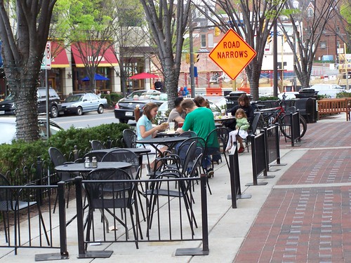
Restaurant patio, Bethesda RowBethesda Row.

The Washington Metropolitan region has plenty of examples of significant change in real estate development practices, including:

•  Bethesda Row, one of the first "Row" mixed use developments by Federal Realty, which has become a national model;
•  Rockville Town Center, also in Montgomery County;
•  redevelopment in Silver Spring in the "Downtown Silver Spring" project, arts uses on Colesville Road, etc.;
& bull;  the redevelopment of White Flint
•  and the redevelopment of Tysons Corner in Virginia both of which have been written about plenty here;
•  as is the "Arlington model" of transit oriented redevelopment along the Wilson Boulevard corridor, especially from the Courthouse to the Ballston subway stations, anchored by Clarendon and Ballston;
•  but also in a new stage in Rosslyn;
•  of course, transit oriented development in DC is key, including at the Navy Yard (Capitol Riverfront BID), NOMA, Petworth, Columbia Heights, Mount Vernon Triangle and the Penn Quarter area, redevelopment around Foggy Bottom, etc.
•  the intensification of Reston Town Center; etc.

And now even newer examples further out, from the Mosaic District in Merrifield in Fairfax County to the Loudoun Station development in Loudoun County by Roadside Development.

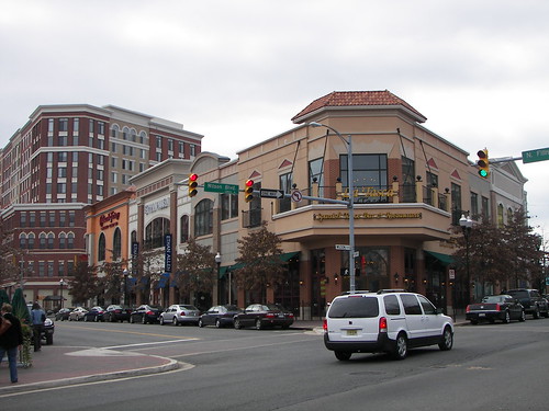
Cheesecake Factory, Market Common, ClarendonClarendon.

In either case, city or suburb, most of the time residents and elected officials seem to be resistant to considering how to develop a way forward, despite all of these examples, ranging from opposition to streetcars in the city or suburbs against light rail in the suburbs, and significant underzoning on the part of suburban officials such as in Montgomery County (as discussed in the recent piece by Dan Reed at GGW, "Montgomery nervous about density around Purple Line stops").

The Post--remember that newspapers are the first draft of history--has lots of articles about these changes, but there is no overarching analysis.

Recent articles, on Columbia Pike in Virginia, H Street in DC, and 14th Street in DC, and Clarksburg in Montgomery County all touch on this issue of change in the face of increased demand for denser development, and for living proximate to transit.  These articles offer different sides of the change, and show resistance to clarifying the planning and development rules to best shape the change. 

-- "From Bocce to a Trolley in a Washington Neighborhood," New York Times
-- "The 20-year-old plan for Clarksburg Town Center," Washington Post
-- "Farewell to Chocolate City," New York Times
-- "Gentrification in overdrive on DC's 14th Street," Washington Post
-- "Diversity and development on Columbia Pike," Washington Post
-- "D.C.'s H Street embedded with deaf culture," Washington Post

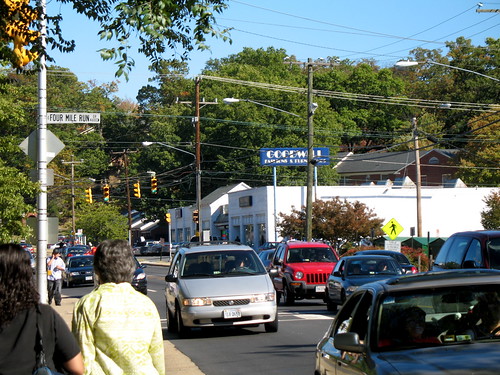
2007 - 10 - 21 - ZipCode 22204 (24) Columbia PikeLeft:  Columbia Pike, Arlington County, Virginia.  Flickr photo by Mississippi Snopes.

Most people, residing in either the cities or the suburbs, aren't willing, interested and accepting of the counter-thesis, that in the 21st century, our neighborhoods, subdivisions, cities, and counties to be competitive, the way we do things has to change. (Also see "Why Are There So Few Starbucks in Montgomery County?" from Patch.)

To be competitive, these relationships need to reorganized in ways that make better use of increasingly scarce resources, specifically land and energy.   In particular, the spatial relationships between residential choice, employment location, and transportation have to change.

And that means denser living, less dependence on the car, and more focus on walking, biking, and transit.

And changes to governance structures and planning regimes.

Again, these changes are required not just in the suburbs, but for the cities too.*

But "End of the Suburbs" makes for a much punchier title and thesis.

------
One example of how the issues are usually very similar is that I find Urban Land Institute publications on how to improve "the suburbs" just as useful for addressing city-related issues as they are for the suburbs.

Reinventing Suburban Business Districts
Reinventing America's Suburban Strips
Ten Principles for Rethinking the Mall
Ten Principles for Developing Successful Town Centers

Plus, the Build A Better Burb project out of Long Island is equally relevant to cities.  It's a great resource.

Labels: , , , , , , ,