Rebuilding Place in the Urban Space

"A community’s physical form, rather than its land uses, is its most intrinsic and enduring characteristic." [Katz, EPA] This blog focuses on place and placemaking and all that makes it work--historic preservation, urban design, transportation, asset-based community development, arts & cultural development, commercial district revitalization, tourism & destination development, and quality of life advocacy--along with doses of civic engagement and good governance watchdogging.

Tuesday, December 17, 2024

A bit about car sharing

Zipcar bought Flexcar and then was bought by a major US car rental company.

For profit car sharing has been in the US for about 20 years.  The original services were two-way--Flexcar and Zipcar--in that you checked out a car from a specific spot and returned it to that spot, paying for full use of the car from start to end, even if there were dead times within your possession.  Other companies entered the market, but have mostly ceased operations.

There were older nonprofit operations in Chicago, Philadelphia, and San Francisco.  All were sold to for profit operators as it turns out they didn't account well enough for the cost of replacing the initial fleet of vehicles.  And other fleet maintenance costs ("As fleet grows, Communauto navigates challenges of changing thousands of winter tires," CTV News).

Later, Car2Go, a Daimler Benz company with super small cars, came on the scene with one way car share.  Once you picked up the car, you could drop it and leave anywhere else in the "car zone." 

A Car2Go on Pennsylvania Avenue SE in Washington, DC.

charlie has pointed out that it was more about helping the corporation meet EPA fleet mileage standards than being an operative service.  But it was well received and for a time was in many cities including San Diego and Seattle--and I used cars in both.  Also places like Brooklyn, Chicago and parts of LA.

The great thing about Car2Go was their small size made them super easy to park in cities with parking space constraints.

I'd written quite a bit about how cities treat car share.  Many look at it as a revenue source and charge for each car, and access to parking, making it more pricey to use--e.g., sales tax on a car share in DC was more than for an Uber/Lyft trip-- in ways that both privileged car owners over car users, and failed to take into account that car share is a form of transportation demand management--each car supports 6-8 households, and reduces demand for parking.  By contrast Canadian municipalities are more focused on the benefits ("Ditch the second car, Communauto is here," QCNA)

Mostly, one way car share is now out of business in the US.  I guess Free2Move still exists (by Peugeot) in DC.  AAA of California tried doing it in SF, Seattle, and a couple other places, but I think it's shutting down by the end of the year.  Car2Go met its demise some time ago.

In 2018, I wrote how DC was a naturally occurring leader in Mobility as a Service (MaaS), in "DC is a market leader in Mobility as a Service (MaaS)."  Most of the for profit actors are out of business now, and without one way or free floating car share, MaaS is a lot less useful for people who don't want to own cars.

The fact is only some places, and certain areas within certain places, have the urban design and density conditions to support one way car share.  In the US, I'd argue that the "transport association model" ("The answer is: Create a single multi-state/regional multi-modal transit planning, management, and operations authority associatio," 2017) would be conducive to offering one way car share and e-scooters, as it is likely that like most transportation services, some subsidy is necessary for the services to succeed.

Plus, it could operate in multiple jurisdictions as one integrated service, rather than on a city by city basis, with different rules for DC versus Arlington County versus Bethesda, etc.

News that the Montreal-based carsharing company Communauto was setting up operations in Calgary was seen by many as a step in the right direction. Taylor Lambert says that all depends on where we're trying to go. (Scott Dippel/CBC)

Communauto as North America's nonprofit car share survivor.  Interestingly, Canada has a pretty successful nonprofit car share operation called Communauto, and it offers both one way, called Flex, and two way services.  

 It's in 15 cities, and Paris, including Montreal where it started, and Toronto.  When bike share was first introduced in Montreal, you could access bike share, car share and transit all with one card  ("Communauto expanding in Montreal to meet growing demand," City News). 

From the article:

According to the news release, Communauto had already expanded its vehicle fleet in Montreal in 2023 by adding 900 vehicles. Bringing the total number of vehicles in the city to 3,700 — with the expansion this year, the new total should be 4,800. 

The new cars, will also include 85 electric cars and 70 minivans. Towards the end of the year, 400 vehicles are set to be replaced with newer models. 

They say that these additions allowed 14 per cent of Montreal households to use Communauto services, an increase of 22 per cent compared to the previous year.

In Chelsea and La Peche, boroughs in Quebec, the municipality actually paid subsidies to Communauto to bring the service to their community.

“It costs residents $12,000 per year to own a car,” said Delage, referring to maintenance costs, insurance, gas and other repairs. With Communauto, residents can sign up for a number of various membership packages from as low $0 per month and $12.75 per hour, or up to $30 per month, which will allow residents to use the cars for just $2.75 per hour. And users won’t have to pay for gas. The packages are built to cover the cost of gas through membership fees. Each car will have a Communauto credit card for users to fill up when they need to. But all the cars are hybrid – 12 Prius’ and two RAV4 SUVs.  

Equity as a burden.  One of the problems with calls for equity--making the services accessible everywhere in a community--is that in many places, it's not profitable to offer, and the places where it does work don't generate the level of extranormal profits necessary to subsidize the loss making parts of an operation.  Even in Montreal, Communauto is criticized for not offering its services in every part of the city ("Is car sharing stuck in neutral in Montreal?," Montreal Gazette, "The case against carsharing," CBC).

From the CBC article:

The need to get around the city, for different reasons and at different times of day, is universal. 

So is the right to feel and be safe as we do so. But ours is a heterogeneous community, with a wide range of physical abilities, degrees of financial security, access to technology, and other important factors that influence how each of us experiences the city. 

Therefore, if we were to try to define a transportation ideal to aim for, it ought to include access to safe, reliable, frequent transportation for all people. 

This is where the shortcomings of carsharing become sharply clear. I previously made use of car2go, and I could choose to make use of Communauto. I am able-bodied, an experienced driver with a valid licence, I live within the service zone, I have good credit and a smartphone, and though my modest income means I wouldn't make a habit of using the service, I can afford the occasional trip. That's a pretty long list of personal details, but every one is mandatory — if even one of those boxes was unchecked, I would be excluded from using carsharing. 

Another way to put it is that carsharing only serves those who can check all of those boxes. Excluded are those with financial insecurity or insufficient credit ratings; people who don't have a smartphone, including many seniors; people who live or work far outside of the service zone, which only covers about three per cent of the city; and people who are unable to drive, whether due to a disability or lack of licence. That's an awful lot of Calgarians left outside the circle.

These criticisms are comparable to those of creating bike infrastructure.  I'd argue that yes there isn't equal access, but that transportation demand management requires a number of strategies and tactics.  And it is possible to add some elements of equity to a program, like how bike share has either a low or no cost rate in some jurisdictions, for low income residents.

FWIW, this negative article assumes that car share users don't use public transit, which is the ideal service to use.  By contrast, in the MaaS entry I argue that car share is a key element of a broader sustainable mobility platform (Further updates to the Sustainable Mobility Framework," 2018) where the foundation is transit, and depending, on biking.

The way that Free2Move deals with that in DC is by having three zones, two, in less profitable areas, involve additional drop off fees of either $4.99 or $8.99.  Ouch.

Electric cars can be a burden.  Like with equity, car sharing firms are often called upon to offer only or a preponderance of electric vehicles.  But this makes the service a lot more complicated and costly.  Although I will say the electric Car2Gos in San Diego drove like a dream.  Most of the e-vehicle car sharing operations in the US have shut down.

However, Communauto is adding electric vehicles in a number of cities.

Should DC invite Communauto?  I always say when asked, that it was a privilege to live in DC, where you can live quite comfortably without a car, at least in the core of the city.  Yes it meant some constraints, depending on the reach of the transit system--before the Silver Line it was easier for me to take transit to Baltimore than to Tysons in Fairfax County.

DC should prepare for the possibility that Free2Move could go out of business.  In North America now it only operates in DC,  Scenario planning means covering the possibility.  Likely, it would require subsidy and without the transportation association approach, would be less successful..  For example, RATP, the transit provider in Paris, bought a quarter of Communauto Paris, supposedly as an investment, but it was probably more of a capital infusion.

Labels: , , , , , ,

Monday, March 07, 2022

Facilitating motor vehicle traffic disfavors pedestrians and cyclists

This was on reddit, a twitter response making the point that eliminating traffic signals because of "technological miracle" of "automated driving" provides zero accommodations for pedestrians and cyclists--unless we start wearing some kind of automated device that treats us as traffic too, and interfaces with intelligent traffic systems.


I make the same point about roundabouts all the time.  They aren't an urban-appropriate road treatment in that their point is to facilitate and speed up motor vehicle throughput by eliminating traffic signals.  But they aren't designed to favor pedestrians and cyclists.

Therefore, since cities are supposed to be about alternatives to the car, roundabouts, and perhaps even "autonomous vehicles" are anti-urban, even though they are touted to be pro-urban.

Labels: , , , , ,

Wednesday, December 18, 2019

Car2Go dying: further effects from the rise of ride hailing and damage to the sustainable mobility platform/mobility as a service paradigm

I have written about what I call the sustainable mobility platform and its various components.

An element of the SMP is the concept of "mobility as a service" and I have suggested that DC is a world leader in the implementation of MaaS.

One way car share is a key element in the Sustainable Mobility Platform.

Business mergers often result in failure.  There are many many stories in business about failed mergers, because the dominant player in the merger lacked the finesse to deal with the acquired company, maybe it was really a different line of business, e.g., consumer focused instead of business focused, like Flip camera bought by Cisco ("Why Cisco killed the Flip mini camcorder," CNET).

Or it was in the same line of business and the purchaser thought they knew everything and they didn't.  Like how Safeway destroyed companies it bought in Chicago ("Dominick's owner Safeway exiting Chicago market," Crain's Chicago Business) and Philadelphia, and significantly "impaired" companies it bought in Texas.

GM's purchase of Saab.  Ford's purchase of Jaguar, Land Rover, Volvo...

Etc.

What motivated the merger of Daimler and BMW's smart mobility ventures?  I wonder if it was desperation not expertise that was going on when Daimler and BMW merged their "smart mobility" assets into one business? ("BMW Group and Daimler AG combine mobility services," Daimler press release) in 2018.

Maybe it wasn't about expertise, but about two companies not knowing what to do and figuring they should join and muddle through together, but without much of a strategy on how to move forward?

This comes up because of how the merger has handled the car sharing operations of the two companies, DriveNow and Car2Go, the latter now called ShareNow, have been or are being killed off, not unlike what happened with Safeway's supermarkets in Philadelphia and Chicago.

In July BMW's DriveNow operation was shut down, after it was put in a division different from Car2Go ("BMW ReachNow car-sharing service shuts down in Seattle," GeekWire).

In September, Car2Go shut down a number of operations in the US ("Sustainable mobility platform in view of Car2Go's dialing back of one-way car sharing in the US").

Now, they've announced they are shutting down all North American operations effective in February 2020 (plus a few in Europe), to focus on Europe ("Share Now, formerly Car2Go, is leaving North America," The Verge). From the article:
Share Now, the car-sharing service formerly known as Car2Go, is leaving North America. Daimler and BMW, the two global automakers that share ownership of Share Now, said it would cease service on February 29th, 2020. Share Now currently operates in New York City, Montreal, Seattle, Washington, DC, and Vancouver.

The decision was based on “two complicated realities,” Daimler and BMW said in a joint statement: the “volatile state of the global mobility industry” and rising infrastructure costs associated with operating a car-sharing service in North America.

While we had remained hopeful that we would be able to come to a solution — especially these last few months — we are ultimately not in a position to commit to the level of investment necessary to make the North American market successful both in the near and long term,” the companies said.
Awhile back, commenter charlie made the succinct point that probably it has been ride hailing that's had the most significant negative impact on car sharing.  I think that's true, because many people would rather be driven than drive themselves, even if driving yourself is cheaper.

That's true, sure.  Ultimately though, there are too many companies operating in this space, ride hailing will always drive "taxi service" in a race to the bottom, because even as income drops there will always be desperate people willing to drive.

And if they have to make a choice, a European company is less likely to remain committed to the US market.

Venture capital effects.  Of course, the other element of "ride hailing killing car share" is venture capital ("Is there too much venture capital?," Brookings).

Venture capital subsidization of ride hailing trips below cost not only impacts transit ("New research on how ride-hailing impact travel behavior," UC Davis) but car sharing too.

Being listed on stock exchanges, having to be more concerned about the cost of capital and the rate of return, for profit companies owning car share companies can't afford the same level of subsidy compared to ride hailing companies like Uber and Lyft ("Uber fares are cheap, thanks to venture capital. But is that free ride ending?," Los Angeles Times).

Free2Move/Peugeot.  Note that a couple years ago, Peugeot created a one way car sharing company, called Free2Move ("Peugeot owner chooses DC for Free2Move car sharing launch," WTOP-radio).  First it was an app integrating the various services into one interface.

Then it added an actual car sharing service, which at this time it only operates in DC.  Now it will be the only "major" operator of one way car share in the US. 

I wonder if they will seek to expand to some of the markets that Car2Go is abandoning?
A Smart Car in DC!, 500 block Pennsylvania Avenue, SE
The difference between Free2Move and Car2Go is the use of extremely small vehicles.  In places where parking supply is extremely tight, the smaller car is a "killer app."  Free2Move uses Chevrolet Equinox and Chevrolet Cruze vehicles, which are comparatively larger.


Labels: , , , , , ,

Tuesday, October 16, 2018

Unintelligent transportation systems/treating cyclist movement as an afterthought

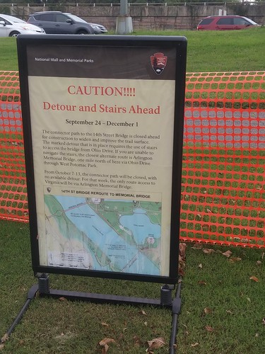
Sign announcing the temporary closing of the 14th Street Bridge bicycle/pedestrian sidepath

"Intelligent transportation systems"
aim to provide innovative services relating to different modes of transport and traffic management and enable users to be better informed and make safer, more coordinated, and 'smarter' use of transport networks.
I didn't think about this much til maybe 8-10 years ago, when I was riding south down Adelphi Road coming from the University of Maryland.  Midway on the road between University Boulevard and East-West Highway is a high school, and they were letting out around this time.

One of the intersections was closed, I don't remember why, an accident or something.  No one told the people at the high school, so buses and cars went north only to get stuck.  There were no or few police personnel out there aimed at diverting traffic to the parallel roads, to keep it moving rather than bottlenecked.  It became a quagmire--unless you were on a bike and able to divert.

It made me realize the difficultly of communicating this kind of information in real time but increasingly there are ways to do it through NFC (near field communication) and the creation of real-time network connections between vehicles, where this info can be communicated, just like an "emergency broadcast signal" on phones.

"Please Drive Safely" digital road sign, BrooklandStill, there are other ways.  Of course, the big digital signs that announce "Road Work Ahead," etc.

I was pissed off when I got up to the Bridge only to find this sign saying it was closed, and for this particular period, there wasn't an immediate workaround, instead you had to double back to Memorial Bridge to cross between DC and Virginia.

Because of the added time, and my schedule, instead, I skipped the trip.

I find that advanced communication concerning outages on bikeways tends to be an afterthought.

For example, with this particular matter, they could have posted signs at various points on the bike route starting around Constitution Avenue so that cyclists would be able to divert without having to go up to the bridge and then doubling back.

This is a problem too on the Metropolitan Branch Trail, where a building is being constructed.  Every so often they close the route when certain crane movements occur.  The closures are "brief" -- 5 to 10 minutes -- but you get stuck, they don't know how long it will take, etc.

Just like with the 14th Street Bridge matter, if there were signs posted at diversion points on either side of the interruption, people would be able to divert with no real inconvenience.

Frustrating.

====
I don't subscribe to the real-time DC Alert system but I am on the DDOT press list, and I don't remember seeing any notice of the 14th Street Bridge pathway being closed.

It was mentioned in DCist, which I don't read because the commenters are so puerile, and a different site with which I am unfamiliar, called DC Commute Times, "14th Street Bridge Entrance Closed to Cyclists Starting Sept. 24."

Labels: , ,

Monday, July 16, 2018

DC is a market leader in Mobility as a Service (MaaS)

Over the past few months, writing various pieces concerning various elements of sustainable mobility and what I am now calling the Sustainable Mobility Platform, I came to realize that while it has transpired incrementally, and while neither the industry nor the city planners may realize it, DC is a market leader in smart mobility/mobility as a service/transportation as a service.

And so far, it has nothing to do with "autonomous vehicles."  E.g., "How Driverless Cars Are Going to Change Cities," Wall Street Journal
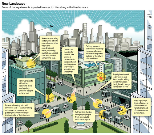
Changes in urban mobility infrastructure will come with driverless cars
Changes in urban mobility infrastructure will come with driverless cars. Wall Street Journal graphic by Peter and Martha Hoey.
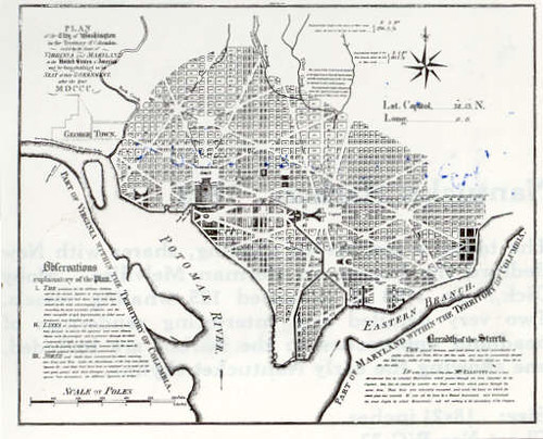
123.11_McClelland_DC_Map.jpg

A lot of it comes from leveraging the urban form of the city--the grid of blocks and streets bisected by radial arterials.

This is the benefit of the L'Enfant Plan, laid out during the era of the "Walking City"--which bequeathed to the city an urban design that fosters the use of sustainable modes--first walking, then transit, then biking, the short distances between residential areas and employment centers, overlaid by a heavy rail and bus-based transit system.

-- "Transportation and Urban Form: Stages in the Spatial Evolution of the American Metropolis," Peter Muller

While the metropolitan area has access to many MaaS services, DC is premier because of how the services are layered and intertwined by users within the city and as a result it comprises a deeper and broader service platform within the city, enhanced by the city's urban form.

DC is the MaaS superstar, not the Washington Metropolitan area.

However, Bethesda and Silver Spring in Montgomery County, the Rosslyn-Ballston corridor and Crystal City in Arlington County, and probably a couple districts in Alexandria possess similar characteristics or have the potential, although not to the same degree of breadth and depth.

In presentations on bike planning, I make three related points:

1. Mobility is a system. And just like we built a system to support driving, we need a similar kind of deep system to support biking, if we want high usage, like in European cities like Copenhagen.
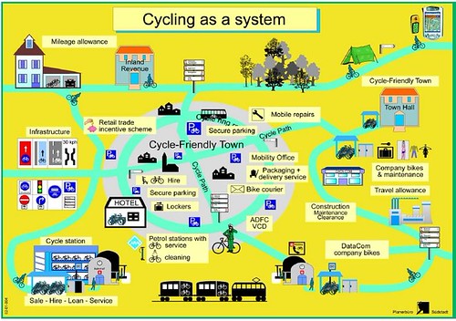
Bicycle Traffic as a system, diagram, German National Bicycle Plan, 2002-2012


2. While the US land use and transportation system preferences automobility, it took 60+ years to build the system that supports it.
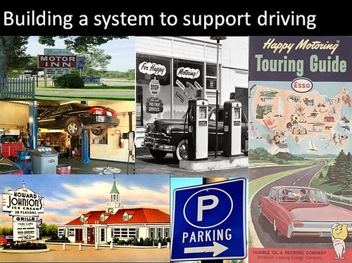
Automobility as a system (slide)
From my presentation "Best practice suburban bicycle planning".
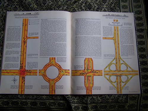
Spread on ideal highway construction, Fortune Magazine, August 1936
Fortune Magazine, August 1936, article on how to create a highway system.

3.  As an example of the length of time required to create successful new mobility environments, the sustainable mobility environment present in today's Portland, Oregon has taken 50 years to construct.
When people look to Portland, Oregon as a sustainable mobility leader and lament that their own community isn't comparable, they fail to recognize that the sustainable mobility platform in Portland present today has been constructed out of both incremental and visionary decision making that has built and reinforced the platform, starting in late 1960s ("A summary of my impressions of Portland Oregon," 2005) with the first decision, to demolish the freeway along the waterfront.

This is not the image of what people think when they think about Portland today.  But it was accurate until the very early 1970s.
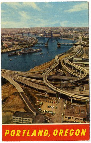
Portland's waterfront used to be scarred with freeways

The move to mobility as a service is mostly a big city phenomenon, and even so, most big cities aren't well positioned to prioritize and preference sustainable mobility/MaaS.

When it comes to smart mobility/MaaS, DC is and in fact has been a leader, at least in North America, even if the system is being developed more incrementally and less purposively.

(I'd say that Seattle is co-equal to DC, except that DC is ahead when it comes to having a heavy rail system. Arguably, Seattle has a better bus system.  Its stored value transit card is a bit more versatile and they have water-based transit services too.  Community Transit, serving Snohomish County with service to Seattle, uses some double deck buses.  And their area MPO is more innovative.)

The components of DC's Shared Mobility Platform/MaaS environment

The map, really a diagram, of the WMATA Metrorail system.

1. Multi-modal transit system (Metrorail, 1976).  DC had train service, streetcars dating to the 1860s (and ending in 1962), buses.

The Metrobus system was created out of local transit lines that went bankrupt, a few years before the then under construction Metrorail subway system began operating in 1976.

The Metrorail system now has 6 lines and 102 stations serving DC, Maryland and Virginia.

42 stations serve DC and 31 stations in the core of the city form a kind of "monocentric system" for DC proper, comparable to the MUNI system vis a vis BART in San Francisco, within the polycentric transit system that is Metrorail.

That sub-network is bounded by Foggy Bottom on the Southwest, RFK on the Southeast, Navy Yard and L'Enfant Plaza on the South, Van Ness on the Northwest and Brookland on the Northeast.

It's no surprise that not only is that section of the city the most prosperous, much of it includes the original L'Enfant City, for DC it is quite populous, and has the shortest distances between residential and activity centers.

Area jurisdictions also have their own bus systems.  Montgomery County's RideOn system is considered a national best practice for suburban systems.  Maryland took over commuter railroad services in the 1980s from Conrail and in the 1990s, Virginia launched the Virginia Railway Express.  Both systems focus on bringing commuters into Washington, but at least with Baltimore, there is some reverse commuting.

The railroad services were Monday-Friday services, although in December 2013 MARC added weekend service to the Penn Line.
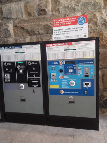
WMATA metrorail fare card machinesWMATA is unusual in that it charges fares by mode.  A trip with both subway and bus legs is two fares, with a slight discount.  (Although bus to bus transfers, even between systems, are free.)

Two stations extended the blue line further into Maryland and opened in early 2004 while an infill station on the Red Line was built in DC's NoMa district and opened later that year.

Separately, Maryland is building a light rail system in Montgomery and Prince George's County that will intersect with Metrorail and MARC and open in 2022.

An extension to the Silver Line with 6 stations including service to Dulles Airport will open in 2020.  An infill station is being developed for the Potomac Yard section of Alexandria and will open in 2022.
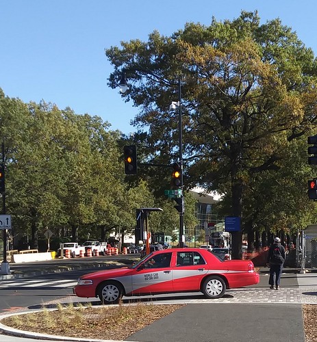
DC taxi at the Wharf, Water Street SW2. Taxis. In various forms, taxis have served DC for more than 150 years.

For a long time DC used a flat rate zone fare system preferencing short trips in the core.  Under the zone system, taxis could carry separate parties and charge each a separate fare.

In 2008, they switched to a distance based system and could no longer take multiple fares in a single trip ("D.C. Cabs Told to Switch From Zone Fares to Meters," Washington Post).  With the change, taxis were also required to accept credit card payments.

Unlike many cities, DC does not charge "medallion fees" to own/operate a taxi so the barriers to entry were few, although taxi licensing is not unlimited and there are periods when the city does not issue new licenses. In 2012, DC City Council passed a law requiring that all taxis display a red-based color scheme, similar to the DC Circulator bus.
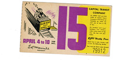
capital transit weekly pass featuring Glen Echo Amusement Park

The DC streetcar system sold weekly transit passes.  The story is that on weekends, parents would give them to their children for them to use.

3.  Discounted transit passes.  Compared to other metropolitan areas, monthly subway passes are quite expensive in the DC area. But bus passes are a bit cheaper than 10 fares, and include reciprocal use of local transit services.  MARC train passes are a good deal and include free bus transit in Montgomery County and DC and free local transit in Baltimore.

DC supports a Youth Transit Pass that covers Metrorail.  Metrorail also offers a discount pass for seniors.
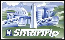
SmarTrip card, WMATA4. Stored Value Transit Fare Card (1999).  SmarTrip card was introduced by WMATA in 1999, first for subway, then bus (2002) and parking (2004).

Over time, most area transit agencies (not railroads) have moved to the system.  The Baltimore area adopted a branded version called CharmCard in 2010.

Money is added to the card at machines, online, or at certain stores set up with the proper equipment.

It hasn't been integrated with non-transit modes, although in Montreal, the STM transit agency has integrated bike share access and car share access into their fare card system.

In London, the Oyster Card can be used on local and commuter railroads and on ferry services.  Seattle's card can be used on ferry, water taxis, and railroads.  In SF Bay, on ferries and trains too.  There, the fare card system is run by the local transportation planning organization, not a transit agency.

Recently it has been reported that DC and Baltimore area transit agencies are looking at bailing on the SmarTrip system because of problems dealing with WMATA ("Greater Washington Partnership issue brief on mobility (transit) fare systems," 2018).
Untitled5.  Two-Way Car Share (2004).   Around 2004, the Flexcar and Zipcar car sharing services entered the DC market, starting out in Arlington County.

Members reserve cars in advance and access cars through smart cards and wireless telecommunications connections.

Payment is made through a credit card connected to the account. Users pay sales tax of 10% on each trip.

Two-way car sharing requires that you keep/pay for a car for the entire trip without relinquishing control of the car and it must be returned to the same place where you picked it up.

Zipcar created a preferred vendor relationship with WMATA putting cars at Metrorail stations.  (Enterprise later bought that privilege.)  Cars are available from a variety of locations throughout the city (and elsewhere in the metropolitan area), some on the street, some on private property.  The Zipcar fleet has a variety of vehicles including pickup trucks and vans, to accommodate a range of trip needs and types.

Public participation processes were required for the authorization of the use of public spaces for this "private" service ("The high cost of free parking and car sharing in DC," 2005).

Flexcar and Zipcar merged in 2007.  Zipcar was acquired by Avis Car Rental in 2013.  Other companies, Enterprise and GM-owned Maven, have since entered the DC market, but Zipcar remains predominant.

For some people, two way car share substitutes for traditional car rental.  Over time, special rates for all day, multiple day, and overnight use have been added, as well as customer benefits in association with participating retailers.


6.  DC Circulator Bus (2005)/Metrobus limited stop bus services (2007).  For decades, Metrobus has provided high frequency service for almost 24 hours on a number of DC routes on key arterials such as 16th Street, H Street/Benning Road, and Wisconsin Avenue, although these routes aren't called out as a high frequency network the way that Portland or Minneapolis brands such routes. The high frequency routes each serve 13,000 to 25,000 riders per day.

Separately, DC started its own bus service in the core of the city, with the idea that the routes would encourage people to not use cars to get around in the most congested part of the city (it's like a "fareless square" but with a charge).

The concept is that the headways would be so frequent a posted schedule wasn't needed.

The DC Circulator service started out with Van Hool buses, which were "cooler" than the clunkier buses used by WMATA, done up in a more forward design scheme.  The fare is $1, now half the cost of a Metrobus fare.  And now the Circulator uses the same buses as Metrobus, but with the Circulator livery.

Over time, bus routes have been added to the Circulator system in farther reaches of the city, and routes outside the core tend to be less efficient in terms of usage and cost.
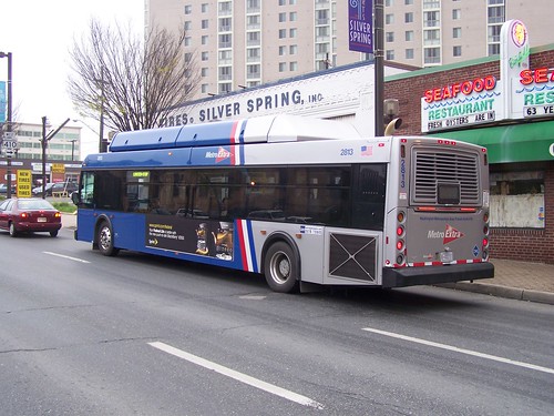
Route 79 Express bus, Georgia Avenue, Silver SpringIn 2007, Metrobus introduced the first limited stop "faster" bus service on Georgia Avenue, the Route 79, called "MetroExtra."  The buses are blue, as opposed to the red buses that denote they serve all stops.  Subsequently, similar routes have been introduced to other lines.

7. Transit information displays and apps (2009/2010).   Metrobus introduced NextBus real time bus information via phone in 2009.  

While still not implemented in a systematic way, in 2010, DDOT introduced a pilot digital transit information screen, similar to a setup previously deployed by Arlington County.  Since then, others including the independent firm TransitScreen has developed and deployed similar products, in DC and elsewhere.
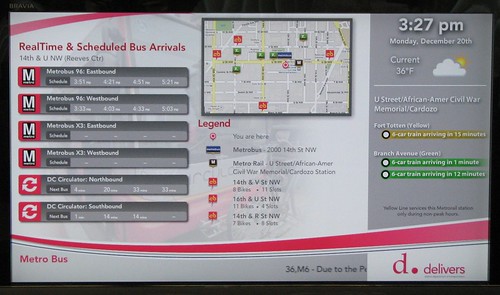
DDOT Multimodal Display

This is an area with a great deal of opportunity for growth.  Screens with this information can be displayed in office building lobbies, at bus stops, in restaurants, etc.  Geographically-set apps can display the screen on computer screens and smart phones.
Real time transit information via TransitScreen and the Orange Barrel Media digital billboard outside Capital One Arena
Real time transit information via TransitScreen and the Orange Barrel Media digital billboard outside Capital One Arena, on 7th Street NW in the Gallery Place neighborhood.  August 2017.
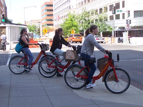
3 people riding Capital Bikeshare bikes on M Street NW, after shopping8.  Dock-based Bike Share (2010).  While an earlier pilot (2008) had been done with Clear Channel, the bus shelter contract did not require a rollout of bike share across the city and it was a 10 station system, hardly widespread.

Instead of renegotiating, DC partnered with Arlington County and launched a different system in September 2010, called Capital Bikeshare, based on solar-powered equipment developed in Montreal.

Originally, members needed a key fob to access the system.

(One of the problems with the Clear Channel system is that it used hardwired electricity connections, which made the system more costly and much slower to deploy.)

Membership includes unlimited rides for no additional charge provide that the trip is less than 30 minutes.  Longer trips trigger additional fees.

An undiscounted membership is $95/year and monthly and shorter term periods are also available.  Later the additional fee structure was changed to reduce the cost for annual members, and a single trip option for $2 was added.  The bulk of operating revenues come from fees charged to short term users.

Over time, the system has expanded to Alexandria and Montgomery County, and soon Prince George's County.
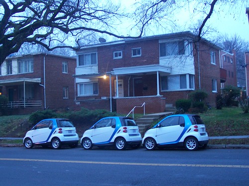
Car2Go vehicles bunched up on Hawaii Avenue NE9.  One-Way Car Share (2011).  Car2Go, using small cars, introduced one-way car share to DC.  Rather than in half hour increments with a one-hour minimum, cars are charged by the minute. Users are also charged sales tax on each trip.

Over time, a per trip fee was added and in 2015 the system switched from a card-based access system to smartphone-based systems. Payment is made by credit card connected to the account.

Paying a hefty access fee per car to the city means that the cars can be parked in most legal spaces, even resident priority areas and at meters without having to pay for no extra charge.  In 2014, Car2Go service was extended to Arlington.  In 2016, cars could be driven from one city to the other and left in either zone.  2017, Mercedes vehicles were added to the fleet.
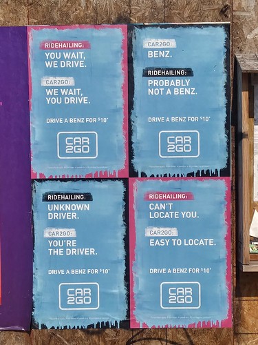
Car2Go paste up poster ads, New Hampshire Avenue NWThe advantage of the smartcars is that they are super easy to park in an environment of constrained parking supply.

To be competitive with one-way car share, Zipcar added "free parking" on DC streets to its service in 2014 ("Car Share Users Guaranteed Free Parking on D.C. Streets," NBC4).  Zipcar introduced a clunky form of one way car sharing in 2016, but dropped it earlier this year ("Zipcar drops one-way rentals in DC region," WTOP radio). Unlike Car2Go, Zipcar still uses card-based access systems.

Car2Go home zones only cover DC and Arlington County, so cars can only be used one-way when driving in those areas.

10.  Ride Hailing (2011). To me, ride hailing is no different than a taxi.  That being said, app-based ride hailing services utilizing a mix of professional and nonprofessional drivers, using personally-owned vehicles, were pioneered by Uber and Lyft.  Uber argued that somehow because they used a phone-based app system that it wasn't a taxi and shouldn't be regulated.  In many communities they won that argument.  Dispatching and payment is handled through e-commerce solutions.
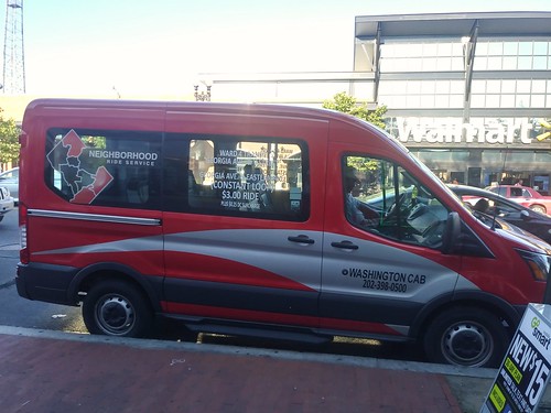
Ward 4 DC Microtransit serviceDC Government supports a taxi-based microtransit service in some portions of the outer city.

11.  Microtransit services (2015/2016).  Microtransit is the term now being used to refer to small-scale, sometimes on-demand jitney or "shared taxi" services.

STM in Montreal, and other communities in Quebec have offered shared taxi services for decades, in certain parts of its territory, usually at the edges, where traditional fixed route transit service isn't cost effective or doesn't meet the needs of its riders. Other communities in Quebec also

Most other transit systems in North America do not provide similar services.  A number of for profit services were launched, focusing not on distant areas, but in core areas, but most (Split, Bridj) have failed.

Elsewhere, Ford continues to own one service called Chariot, and UberPool, LyftShuttle and the Via service remains operative in cities like New York and Washington DC.  Payment is app based.

This Via screenshot claims that Via users reduce greenhouse gas emissions.  Probably not.  In DC, they are likely to be shifting trips from other more efficient modes like walking, biking, and transit.

My sense ("Where's the revolution?: Bridj microtransit service shuts down (a/k/a "Mobility as a Service")," 2017) and not only mine ("Microtransit: What I Think We Know," Human Transit) is that core-focused microtransit services will fail as people will have to pay a premium price for short trips, and this isn't economically viable, nor is it justifiable for such trips to be subsidized by transit agencies.

However, contracted out "shared taxi" services comparable to those of STM, serving transit systems and riders on the edges of service areas likely have upside but will require subsidy ("Beyond the Bus: 'Microtransit' Helps Cities Expand Transportation," Governing Magazine). In 2016, working with taxi companies, the city launched a microtransit service operative in some wards called the Neighborhood Ride Service. This service is more comparable to services in Montreal and is focused on parts of the city outside of the core.

In 2018, Via introduced a new membership program including four rides/day and access to dockless bike share for $159/month.

12.  DC Streetcar (2016).  The streetcar isn't particularly noteworthy yet, but it adds another mode to the city's transit mix. So far, the line is truncated, 2.2 miles long, serving H Street NE with a connection to Union Station.  The line is supposed to be extended east and west to Georgetown and perhaps Rosslyn, which would make it much more useful.
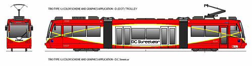
DC Streetcar vehicle proposed paint scheme
Presently, it's free to ride and advocates could use that as a way to press for the creation of a "fareless square" type of operation in the city ("Is making surface transit free the best transit investment DC can make?," 2015).

Unlike Kansas City ("Kansas City Tries to Go from Smart Strip to Smart City, Digital Trends), the streetcar hasn't been used to "drive" "smart city" improvements in that transit corridor or across the city.

I argue that such services need to be thought of as "intra-district" services ("Making the case for intra-city versus inter-city transportation planning," 2011).  Instead, streetcars are often compared to longer route services and found wanting.

13. Metrorail stops using paper farecards, shifting to exclusive SmarTrip usage (2016). The system stopped issuing and accepting paper farecards, although cash can still be used on buses, but is discouraged in favor of the SmarTrip card. This doesn't speed up Metrorail but does reduce the cost of processing payments, and strengthens the use of the stored value transit fare card as a primary MaaS payment device.
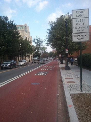
Red painted bus lane on Georgia Avenue NW, DC14. Dedicated bus lanes (transitways) painted red (2016).  Exclusive bus lanes painted red were introduced to a section of Georgia Avenue ("Georgia Avenue boasts bright red bus lanes," Washington Post).

Into the 1970s, the area had a number of dedicated busways, but over time they were removed.  Earlier in the decade an exclusive bus lane was installed on 7th Street NW but it isn't painted red and there is minimal enforcement.  More dedicated transitways are in planning.

Making bus service faster through transitways increases throughput and is the equivalent of adding new bus trips to the service. The red paint makes this noteworthy and worth listing as a MaaS element as would other bus prioritization initiatives such as traffic signal preferencing (in place for the DC Streetcar, but not buses).

15.  Dockless bike share including e-bikes (2017).  Dockless bike share was introduced on a pilot basis last fall. Multiple firms, some from China, are involved in the business.
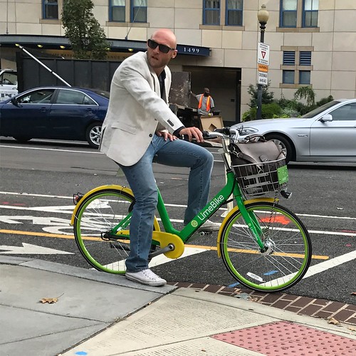
dude makes LimeBike look coolThe original trial period which was to end in April, has been extended. The advantage of dockless is like one-way car share, it is point-to-point and you can leave the bike "anywhere," including right at the endpoint of your trip.

Riders join the system through an app, which is used to pay for individual trips through a credit card link.

Interestingly, these services mostly charge per ride, $1, but $2 for the e-bike from Jump, so that regular riding would cost significantly more--ten times more or higher--than traditional dock-based bike share and at least 3 times higher than the cost of buying a bike. Likely such systems only appeal to occasional users.

They are only cheaper to use when compared to a transit ride, which is $2-$4 on a single trip basis.

Given that dock-based systems were developed for bike share in response to vandalism and theft experienced with early versions of what we would now call dockless bike share, not surprisingly many of the bikes have been vandalized ("Theft and destruction of dockless bikes a growing problem," Washington Post).  And many bikes are improperly parked.

To compete with Jump, which was recently acquired by Uber, LimeBike added e-bikes in 2018.  Note that e-bikes are overkill in the core of the city, but make sense in the outer city ("(Still) tired of mis-understanding of the potential for e-bikes," 2015).
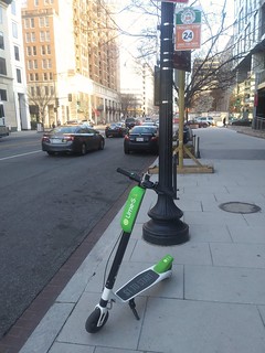
A Lime dockless electric scooter on 6th Street NW, Washington, DC16.  Dockless e-scooters (2018).  Bird, a company focused exclusively on dockless scooters, introduced e-scooters last year in Santa Monica, and after raising venture capital to fuel expansion ("Dockless scooters as an example of a lot of money sloshing around in venture capital," 2018), they and LimeBike, which added e-scooters to their program, launched e-scooters in DC in late Spring.

There is a flat fee of $1 plus a per minute use charge.  (Spin is also getting into the e-scooter market.)

E-scooters may have some advantages over bikes because they are faster and people believe they are trendy when they ride them ("The invasion of the scooter bros: A new tribe," Washington Post).

17. Transit card only bus service (2018).  Route 79, the first Metro Extra limited stop bus route, has just shifted to a card-only usage profile, no longer taking cash fares ("Metro's cash-free bus pilot aims to speed up trips, but some riders worried," WTOP-radio).  This is to speed up boarding.  (DC buses still do front-door boarding exclusively).

Surely this is a pilot with the hopes of being able to do this across the system.  But in order to do so, WMATA needs to make it a lot easier for people to put cash money on the cards ("What's remarkable about this storefront?," 2018).  I've thought for years they should put Metrofare machines in public places but that would create a security and collections cost problem.


The difference between the Sustainable Mobility Platform and Mobility as a Service.  In my SMP framework, I list elements like Barnes Dance intersections and cycle tracks.

But Mobility as a Service is about trips, usually costing money.  It's a sub-set of the SMP, not co-equal to it.

In this listing I did include items like transit information screens and transitways because they have a significant impact on the utility of certain services, or provide the kind of information that people need to make sense of their options.

Arguably, I could have included some other items.  What have I missed?

The MaaS underlying infrastructure: streets and traffic signals + computing and telecommunications.  One thing we don't think about is that almost none of this can work without roads, rights of way, and signaling systems. Those are controlled by local and state transportation departments.  In DC, they are mostly controlled by the DC Department of Transportation, although here and there certain roads and signals are controlled by federal agencies such as the National Park Service.

They are the enabling/foundational infrastructure, coupled with high quality computing applications, telecommunications systems and cloud-based hardware systems, accessed by smartphones and other computing/telecommunications devices.

What's missing or problematic

Do we need a master app integrating all services?  I don't think the lack of integrated apps pulling all the services together is a deal killer.  If it were just public agencies, it might be possible to create a master app, like the Oyster card.  But those are geographically bounded systems.

The for profit providers operate in multiple markets and it is less valuable for them to participate in regionally-specific fare systems.  It's problematic for the user too, who wants to be able to use these modes in other places--e.g., I've used Car2Go in San Diego and Seattle and Zipcar in San Francisco and Seattle.  Most Uber users use it when they travel, etc.

Nevertheless, area transit agencies must commit to using an integrated payment system.  That being said, there should be one unified fare card system for metropolitan area transit agencies, and ideally it should be managed and supported by the metropolitan transportation planning organization.  By shifting responsibility from WMATA to the Transportation Policy Board/Metropolitan Washington Council of Governments, perhaps the current problems and enmity between actors can be assuaged.

The fare card system (recognizing its moving towards being exclusively contactless or including contactless options) should work diligently to include commuter railroad services. If London, Seattle, and San Francisco can do it so can other places, including DC.

-- "One big idea: Getting MARC and Metrorail to integrate fares, stations, and marketing systems, using London Overground as an example," 2015

Don't confuse tourist water transportation services with transit.  The DC area has a developing water taxi system, but it's for tourists and shouldn't be represented as transit.  That being said, it's worth integrating the service into the SmarTrip system as one element in moving towards adding water-based transportation services to the transit mix.

Do you need a subscription covering all or a basket of services?  Anyone out there wanting to pay almost $600/month to Whim?  Whim, which started in Helsinki, is doing pilots in the West Midlands, UK, Antwerp, and Amsterdam.

To me, the point of mobility as a service is to pay less than you would if you owned a car, which is $7,000 to $9,000/year.  Whim doesn't seem to provide much in the way of savings.  I don't think the trade off of simplicity--using one app, is worth the loss of savings.

Washington Post graphic.

Gondola as a modeThe Georgetown Business Improvement District aims to create a gondola system to connect Georgetown to the Rosslyn Metrorail Station, thereby "capturing" that station and making it serve DC more directly despite being in Virginia, across the Potomac River, and accessible currently only by the traffic engorged Key Bridge ("The case for the Georgetown-Rosslyn gondola").

Interestingly, the gondola service is more important for night-time and weekend transportation, not for day-time commuter use, although that would be served by the mode as well.

That would extend the transit network/MaaS/SMP.

==========
Writing all this, I still haven't read the various Los Angeles DOT reports on MaaS.  That city aims to be a leader in the field.

-- Strategic Implementation Plan: A Plan to realize the visions outlined in the Urban Mobility for a Digital Age and Blueprint for Autonomous Urbanism document, Los Angeles DOT
-- Urban Mobility in a Digital Age, Los Angeles DOT
-- Blueprint for Autonomous Urbanism, National Association of City Transportation Officials

Labels: , , , , , ,

Friday, June 19, 2015

New York Times special section on technology and future of transportation

This section ran last week and there are about 10 articles.

-- Special Section: Transportation - Bits - The New York Times

Those of us of a certain age will remember the cartoon series, "The Jetsons," featuring a future where people drove skycars.

From "Tipping Point in Transit" (intwould have been better to use the word "mobility" in this headline):
“Cars and transportation will change more in the next 20 years than they’ve changed in the last 75 years,” said M. Bart Herring, the head of product management at Mercedes-Benz USA.
“What we were doing 10 years ago wasn’t that much different from what we were doing 50 years ago. The cars got more comfortable, but for the most part we were putting gas in the cars and going where we wanted to go. What’s going to happen in the next 20 years is the equivalent of the moon landing.”

Mr. Herring is one of many in the industry who say that we are on the verge of a tipping point in transportation. Soon, getting around may be cheaper and more convenient than it is today, and possibly safer and more environmentally friendly, too.

But the transportation system of the near future may also be more legally complex and, given the increasing use of private systems to get around, more socially unequal. And, as in much of the rest of the tech industry, the moves toward tomorrow’s transportation system may be occurring more rapidly than regulators and social norms can adjust to them.

“All the things that we think will happen tomorrow, like fully autonomous cars, may take a very long time,” said Bryant Walker Smith, an assistant professor at the University of South Carolina School of Law who studies emerging transportation systems. “But it’s the things we don’t even expect that will happen really fast.”
Of local--DC area--interest is the possibility of hacking traffic signaling systems, sending the road network into chaos.

During a strike by transportation personnel for the City of Los Angeles, which is otherwise known for being a leader in traffic signal coordination and intelligent transportation systems ("To Fight Gridlock, Los Angeles Synchronizes Every Red Light," New York Times), it is alleged that some traffic engineers deliberately hacked the system to create gridlock, by changing the constraints for only a few intersections.

According to the article cited below, Arlington County, Virginia, where the Pentagon is located, takes this issue very seriously.

-- Traffic Hacking: Caution Light Is On

Apparently, DC's traffic signal system is susceptible to hacking.

The article on the futurist working for Mercedes Benz is interesting in that, because metropolitan areas in the Western United States are still sprawled and disconnected, that he is focusing on those kinds of places.  Not said in the article, is that perhaps this focus keys on the continued strength of the car-dependent paradigm.

-- A futurist looks at where cars are going

Interesting though, he discusses cars as conveyances and transportation devices more than as vehicles owned and operated by the same person, e.g., that they could pick up and drop off people--adults going to work, children coming home from school--and even packages, without needing the high expense in either money or time of a driver.

Some of this is already happening, with the equivalent of "Uber for children," etc.

-- New Ride Services Forge Own Specialized Paths

Labels: , , ,

Wednesday, May 14, 2014

Moving towards the ultimate Parking Space Management System: License-Plate Enabled Parking from Digital Payment Technologies

The City of Miami Beach Parking and Transportation Department has just introduced "License Plate Enabled Parking" as an element of their street parking management system, using equipment and software applications from Digital Payment Technologies, a Canadian firm.

According to the press release announcing the introduction:
With LEP, consumers simply enter their license plate number at the pay station when paying for parking and then continue on to their destination. They do not have to return to their vehicles to display a parking receipt, nor do they need to remember specific parking space numbers. With DPT's integration with Parkmobile, consumers also have the option of paying using their mobile phone.
The system is explained by the infographic (left) and can be integrated with a wide variety of related services that simplify parking management, payment, enforcement etc.

The system integrates technology from three separate firms:

-- LUKE II multi-space pay stations by DPT
-- Mobile payment service from Parkmobile
-- License Plate Recognition (LPR) system from Genetec

and it happens that Miami Beach outsources parking enforcement, to OmniPark.

Reductions in citations likely?  I can see the system resulting in fewer citations being issued, because people can get notices about when the meter is supposed to expire and just add payment.  That will reduce fine revenue sure, but it will also reduce consumer aggravation, which is a net benefit.

Towards a transponder based system and implications for gas taxes vs. mileage charges.  But the system isn't designed like the EZPASS toll system where you could have a card device on the windshield that would register once you parked (maybe you'd have to hit a button) and the transaction could be initiated automatically.

It occurs to me that a transponder-enabled fee collection system dealing with parking and integrated with toll collection systems makes it easy enough to do mileage-based charging.

I've argued that it is a lot more complicated to have individual accounts for everyone instead of just charging a higher gas tax, but as can be seen with the LEP system, you only need to add a couple more elements and a fee collection system integrating parking, tolls, mileage, and insurance is "easy enough" to create.

Of course, you need a wi-fi mesh network "everywhere" to be able to integrate such a system and it has to work all the time.

Other interesting Miami Beach parking policies for residents.  Separately, the Miami Beach T&P Department has two programs that provide benefits to residents paying for parking. Programs like those in DC would go a long way towards addressing some of the resident aggravation about the various parking programs in DC.

First, the city provides a flat rate of $1 per hour for resident parking at street meters, which is a 43% discount off the $1.75 per hour rate. Second, residents using the ParkMobile online app for parking within the city are not charged the transaction fee that is normally charged for using the app to pay for parking.

Labels: , , ,

Thursday, April 17, 2014

DC proposal for HOT lanes doesn't seem to make sense

The point of HOT or High Occupancy Toll lanes is (1) adding lanes (2) accessible only by paying tolls (3) financed through private ventures expecting toll revenues to be high (4) but allowing vehicles with multiple passengers ("high occupancy") free or reduced pricing.

Basically they are HOT or "High Occupancy" or pay "Tolls" lanes -- HO/T lanes.

The lanes can be controversial because much of the momentum for creating them is ideological (such as in Virginia and Maryland, where projects were pushed forward by Republican Governors) and desperation to come up with money for freeway expansion, because they are more about generating new revenues and could be seen as inducing more driving, just for people who are willing to pay a premium price.  See "For Virginia commuters, new era begins with HOT lanes" and "Highway historian looks at HOT lanes projects" from the Washington Post.

Arlington County did not allow HOT lanes to be installed on freeways in their jurisdiction, because they believed that such lanes would be contradictory to their Master Transportation Goals that de-emphasize "single occupancy vehicle" trips ("Arlington Will Withdraw HOT Lanes Suit," Arlington Now).

Washington Post graphic showing where proposed HOT lanes in DC would be placed.

Yesterday's Post has an article "DC considers adding carpool, toll lanes to part of the 14th Street bridge," stating that DC's Dept. of Transportation is proposing some high occupancy toll lanes on the city's freeways "to reduce congestion."

HOT lanes in DC wouldn't be new lanes, but repositioning of current lanes.

But I don't think they'll have much impact on reducing congestion because driving in DC on these roads is a function of moving "between other places" and if the origin and destination points don't have comparable congestion reduction measures in place, HOT lanes in DC won't make much difference.  Also see "DC HOT lanes plan will bump into reality" from the Washington Post.

They might raise some revenue though.  And since they wouldn't involve the construction of new lanes, the costs to impose the tolls wouldn't be that great.

Still, I would argue that this is yet another proposal in need of guidance from a Master Transportation Plan.

But I could be swayed if the city would commit all the revenues to other transportation improvements elsewhere in the city.

Labels: , , , ,

Wednesday, February 03, 2010

Learn how to manage traffic

I have never been that interested in what is called "intelligent transportation systems" (ITS), which is focused on better managing the road network. But the reality is that you see how if road closures and accident scenes (and the road network impacted by a particular accident) are better managed, then traffic tie ups, especially during rush hour would be reduced.

The other crazy thing is that message boards on highways actually produce traffic tieups and slowdowns, as people slow down to read the message.

Anyway, the Center for Transportation Studies at the University of Minnesota has created an online simulation, Gridlock Buster, a traffic control game based on tools and ideas that traffic control engineers use in their everyday work.

I haven't played it yet, but I intend to as it is something that I need to know more about (without necessarily taking a class in traffic engineering, which I probably will have to do sooner rather than later).

Labels: ,