Rebuilding Place in the Urban Space

"A community’s physical form, rather than its land uses, is its most intrinsic and enduring characteristic." [Katz, EPA] This blog focuses on place and placemaking and all that makes it work--historic preservation, urban design, transportation, asset-based community development, arts & cultural development, commercial district revitalization, tourism & destination development, and quality of life advocacy--along with doses of civic engagement and good governance watchdogging.

Thursday, May 29, 2025

DC makes yet another bad decision about streetcars: will replace the one line with a so called "fancy" bus | The Vision Thing

I got an email from a pr person about a conference in September about good ideas for urban revitalization, aimed at grassroots and neighborhood types.  I will write about it but I responded saying the problem isn't lack of ideas, it's how to get them implemented, amidst all the barriers that exist to hamper change as well as the long times to deliver a finished project.

I bring this up because DC Mayor Muriel Bowser announced that the city is going to replace the streetcar with the next generation streetcar--A BUS!!!!!! ("Bowser to replace D.C. Streetcar with ‘next generation streetcar.’ It’s a bus.," Washington Post).

Funding for the streetcar ends after two more years in Bowser’s budget plan. City Administrator Kevin Donahue said at the announcement that the new streetcar would be “essentially buses that utilize” the streetcar system’s existing cables for power. It would make it possible “to more nimbly and quickly expand the streetcar line out beyond where we currently are,” he said.

Local leaders have been pushing buses as the future of the city and regional transportation network, a lower-cost and more flexible alternative to rail in a time of federal cuts that limit transit funding. The single D.C. Streetcar line, which runs from Union Station to the edge of the RFK Stadium site, took far longer to build than planned and cost $200 million. A lack of separation from car traffic means double-parkers can block the tracks, making bus service more reliable. The streetcar carries a fraction of the number of riders of the express buses that travel the same route. Planned as the beginning of a 40-mile network, it was the only two miles built.

Washington Commanders owner Josh Harris, D.C. Mayor Muriel E. Bowser and NFL Commissioner Roger Goodell pose with a Commanders helmet at a news conference on April 10. (John McDonnell/for The Washington Post) 

JFC.  It illustrates the point that Mayor Bowser has no vision ("Social urbanism and equity planning as a way to address crime, violence, and persistent poverty: (not in) DC," 2021), other than maybe a football stadium ("Questions on the Commanders stadium deal," Washington Post).

OTOH this is but one administration's failure after the failure of two others (Fenty and Gray).  I joke that DC and Seattle started streetcar planning the same year, but Seattle's first leg opened in 2007, and DC's in 2014.  

DC's failure led Arlington County to drop their streetcar planning even though Fairfax County was all in ("Arlington officials halt efforts on streetcars for Columbia Pike, Crystal City," "Arlington streetcar demise sends message to poorer residents: Keep riding the bus," Washington Post, 2014).

I used to say that were I to have pursued a PhD in planning my dissertation would have been on best (and worst) practices in civic engagement, since land issues "outside of schools, are the issues that that are most likely to get the average citizen involved and participating in local civic affairs."

Now--especially given the relative success of the area's Metrorail heavy rail system (problems there too, since 2009, but initially it was wildly successful)--I think it'd have to be transit planning failures in DC:  But that's way more topics than you can fit into a single dissertation!  

  • WMATA's operation and financial issues
  • Purple Line planning and construction failures, leading to a 40+ year period from when I first read about the idea in a Washington City Paper cover story in 1987, to operation in 2027.
  • DC Streetcar planning within the city ("Velocity of change, streetcars, and H Street," 2011)
  • and its effects on streetcar planning elsewhere, not just in nearby Arlington, but it other cities where transit opponents used it as a reason to rail against transit proposals.
Note: FWIW, Seattle has messed up with streetcar planning, expansion and operation too, but for different reasons.  Its primary supporter, Paul Allen of Microsoft fame was the major developer of the SoDo district, wanted it  as an activation device to push development, even with minimal ridership projections ("Seattle’s South Lake Union streetcar is an empty monument to money," Seattle Times).

Seattle streetcar lines active, and proposed (Mark Nowlin, Fiona Martin / The Seattle Times)

From a ridership perspective, the major problem with the streetcar is that they never built it beyond a short segment of the proposed H Street-Benning Road line, when it was supposed to be part of a network ("Irony of ironies: District Might Fast Track Georgia Avenue Streetcar to Walter Reed," 2011).  It's frequency isn't all that and the route is duplicated by the less upscale X2 bus line.

Map of proposed DC streetcar lines and bus rapid transit routes.  Washington Post graphic.

Many people complain/ed about how the line isn't grade separated, sharing right of way with motor vehicles, so the trips are slow.  But I argued those critics missed the point, that the streetcar is about intra-district transportation, not longer point to point trips, like from H Street to Union Station or to Downtown or Downtown to Georgetown, etc. ("Making the case for intra-city versus inter-city transit planning,," 2011, "STREETCARS ARE ABOUT TRANSIT, just in a different way from how most people are accustomed to thinking about it," 2014).

From a induced demand real estate development perspective, DC Streetcar has been a wild success, generating about $1 billion in development that likely wouldn't have occurred without the streetcar as a new anchor and development inducement.("Update/revision of H Street transit oriented real estate development table," 2016).  H Street NE has the highest density of any part of the city without a Metrorail station (it has stations on the edge, but not directly within the corridor).

That learning should have been applied to streetcar planning for other parts of the city:
  • Georgia Avenue
  • Kennedy Street/Riggs Road (not a planned line)
  • Rhode Island Avenue from Laurel to Dupont Circle (much more truncated in planning)
  • East of the River, etc.
Just on the basis of the likelihood of significant induced real estate generated economic development.


Buses don't have the same ability to generate extranormal and successful economic development compared to fixed rail transit done right (The New Real Estate Mantra, APTA, "NoMa: The Neighborhood That Transit Built," Urban Land Magazine).

Conclusion.  A streetcar network in DC is a way better economic development inducement than a minimally used football stadium ("Arguments in defense of a stadium at RFK fall short of a first down," Greater Greater Washington).

========

1.  When I first got involved in urban revitalization in DC, I thought that that the city economic planners were really smart.  It was merely a stitch in time.  At the time I didn't know much about economic development and they did.  With each year of involvement my knowledge base grew while theirs remained static.

2.  And I don't understand the opposition to other fixed rail transit modes in the DC area given the relative success of Metrorail.  It's as if Metrorail never existed.

3.  The Vision Thing was a quote by George H.W. Bush.  There's also a Sisters of Mercy song.

4.  One of my longest posts during the Gray Administration was my critique of the city sustainability plan.  I made the point that adopting practices not as good as the various best practice cities was not a way to be a national leader.  If you achieved those results you were still behind.  The same goes here, with streetcars.

Maybe the Williams Administration was the last one with some vision.

Labels: , , , , , , ,

Thursday, January 13, 2022

Revisiting: a proposal for heritage streetcar service on the National Mall | adding service to the DC waterfront

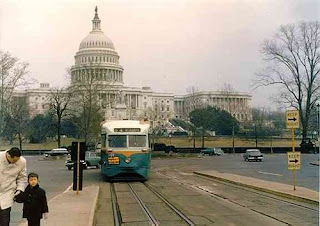
DC Transit 1101 on Pennsylvania Avenue, just west of Peace Monument Loop. This photo gives an excellent view of the third rail slot used to collect power in downtown Washington.

In 2013, as part of a more comprehensive approach to visitor services and visitor transportation in association with DC's place as a major tourist destination in the United States because it is the national capital, I suggested the creation of a heritage streetcar service on the National Mall, with a starting point at Union Station and an ending point at a proposed infill Yellow Line subway station across from the Jefferson Memorial, with service across the Potomac River to Arlington Cemetery and the Iwo Jima Memorial.  But I didn't really think too much about the routing.

-- "A National Mall-focused heritage (replica) streetcar service to serve visitors is a way bigger idea than a parking garage under the Mall"
-- Department of Interior - Visitor Access and Transportation Guide, Volpe Center, USDOT

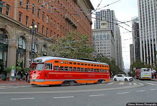
Dressed in Pacific Electric tribute livery, Market Street Railway PCC car 1061 leaves Market Street while entering Steuart Street near the Ferry Building on Sept. 6, 2019. Flickr photo by James Belmont.

Using heritage cars was suggested as a way to build tourist interest as well as being modeled after San Francisco's Market Street Railway F Line, which runs heritage streetcars of all types, with liveries representing various historic transit lines from across the country which are no longer in operation.

Last time I checked, because of its novelty, the F Street Line had a 200% farebox recovery.

Later, with the re-institution of DC Circulator bus service on the National Mall, I realized that in terms of the National Mall, we think about accessing it from the east, from Union Station and the Capitol, but not so much from the west, in particular Georgetown.  

National Park Service Map of the National Mall
Note it includes Arlington Cemetery and related destinations in Virginia.
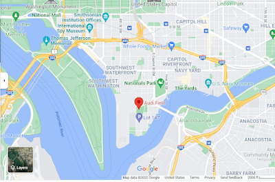
This Google map view shows the DC waterfront in SW and SE
more completely than the NPS map (which has a different purpose)

So I expanded the concept with the eastern node at Union Station and a western node in Georgetown, with an intermediate node at the proposed Jefferson Memorial Metrorail Station but again, I didn't get into routing.

-- "New DC Circulator route serving National Mall reminds us that we are neglecting connections from west to east and fail to adequately connect Georgetown to the National Mall," 2015
-- National Mall maps and planning documents, National Park Service

Note that the NPS map, surprisingly, shows the route of the DC Circulator service on the Mall (but not for Georgetown).

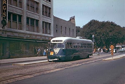
This streetcar crossed the Key Bridge from Rosslyn, and is eastbound on M Street NW

Visitor services and the idea of an under the National Mall parking garage.  Equal to the importance of the addition of transit was the creation of a set of high quality visitor centers, at Union Station, at the National Mall, at the proposed Jefferson Memorial Metrorail Station, and in Georgetown ("Today is World Tourism Day," 2016) as part of a broader  city tourism development and management plan ("National Tourism and Travel Week 2019: DC recap | DC needs a tourism development and management plan," 2019).

And later I realized that the National Park Service ought to create an anchor visitor center of its own covering all of its DMV parks and sites (see item 6, "National Public Lands Day," 2021).

A railway and tourism museum at Union Station.  Other writings suggest the creation of a railroad and tourism museum at Union Station, in conjunction with its expansion program (see the sections "More fully leveraging Union Station's potential as a portal and visitor center" and "Including a cultural interpretation element in the plan on railroad history and a museum-exhibiting program centered at Union Station" within "New State Rail Planning Initiative in DC," 2015).

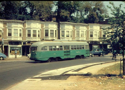
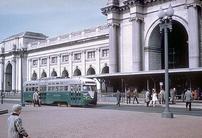
DC Transit 1516 on Route 42 at Union Station. February 22, 1957:  Joe Testagrose Collection

Of course, a heritage streetcar system along the lines of the Market Street Railway is a form of open air museum too, and could be operated in association with the National Capitol Trolley Museum in Montgomery County.

Separately, I've suggested developing tourist rail services from Union Station ("Two train/regional transit ideas: Part 2 | Running tourist trains from Union Station," 2021).

Underground parking on the National Mall.  And I am fine with the National Mall Coalition's proposal adding a big underground parking structure at the National Mall, including flood protections, to capture, interdict, and reduce visitor traffic, I just thought that it needed to be part of a bigger program ("Parking under the National Mall should be part of an integrated approach to visitor services and management," 2013).

In fact, given the increased severity of weather events in the face of climate change, implementation of this concept is even more imperative ("How and why the D.C. area was deluged by a month’s worth of rain in an hour Monday," 2019, Washington Post).

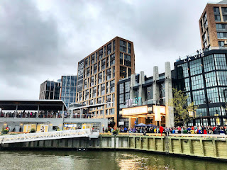
Transportation and the Wharf/Washington Channel/Southwest Waterfront.  Will just sent me another article ("Here's What Next at DC's Wharf and Fish Market," NBC4) about transportation issues around the Wharf district, which is a rebuilding of old urban renewal along Maine Avenue SW.  

Washington Channel and the Wharf district

The first phase opened in 2017, and a second phase will open later this year.  The second phase will add 1,000 more parking spaces.

The area is near the L'Enfant Plaza and 4th Street SW Metrorail stations and a free bus shuttle travels to the Wharf from the National Mall/L'Enfant Plaza.

A long time ago, when DC had expansive plans for streetcar service, one of the planned lines was a Georgia Avenue/7th Street streetcar terminating at the Washington Channel's Wharf district on the Southwest waterfront--recreating the historic route that had its destination as the "Wharves," docks for steamboats and other ships.

But DC has pretty much given up much interest in streetcar expansion beyond H Street.

But as the NBC4 article discusses, there are many trips to the Wharf district, which will only increase as the second phase opens, and transit connections are somewhat inadequate, and there isn't enough "parking" either, were everyone to drive--and of course from a transportation demand management perspective, we want to discourage driving in the city as it promotes unnecessary congestion.

Adding a Southwest-Southeast Waterfront leg to the heritage streetcar visitor transportation proposal.  Some thoughts about routing:

  • The original concept starts at Union Station and travels down Louisiana Avenue to the National Mall.
  • On the Mall, it would travel westbound on Madison Drive NW (the side of the Mall with the National Gallery)
  • and on the return, eastbound on Jefferson Drive SW (the side of the National Mall with the Smithsonian Castle, Hirshorn, Air and Space Museum) and then crossing back to Louisiana Avenue and Union Station.
  • At 14th Street/the area of the Washington Monument, westbound it would probably follow the routing of the Circulator to Lincoln Memorial (shown on the NPS map as a red hatched line)
  • But I didn't figure out how it could travel from Lincoln Memorial to Georgetown and Arlington Cemetery 
  • It could cross into Arlington over the Memorial Bridge, serving Arlington Cemetery, traveling west to the Iwo Jima Memorial and then into Rosslyn, crossing back into DC, into Georgetown at the Key Bridge  
  • From Georgetown it needs to be routed back to Lincoln Memorial, with service to the Kennedy Center in Rock Creek Park
  • Continuing eastbound from Lincoln Memorial, it would go over to Jefferson Memorial and the proposed Jefferson Memorial Metrorail Station.
  • The Circulator does this by traveling through West Potomac Park, with intervening stops at the MLK and FDR Memorials, and from the Jefferson Memorial, back to the Mall providing intervening stops at the Bureau of Engraving and Printing and the Holocaust Museum
  • From Jefferson Memorial it would return to the National Mall, 
But with the "debacle of transit" for the Wharf, as well as Buzzards Point, where the soccer stadium is, and potentially even the Washington Nationals baseball stadium and the Navy Yard, wouldn't it make sense to have another streetcar line further south as part of this network, serving those destinations as well?

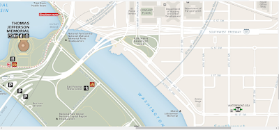
This section of the NPS National Mall map shows the Jefferson Memorial on the left.
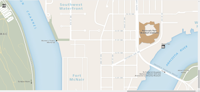
The Wharf district lies on the north side of the Washington Channel.

This section shows Washington Nationals Baseball Stadium
but not Audi Field or Buzzards Point, which is undergoing development also.

The NPS map doesn't specifically delineate the Wharf district or Audi Field, the stadium for the DC United Soccer team, although it does show the Nationals Baseball Stadium.

I am not sure it makes sense to make a streetcar service there subsidiary to a National Mall service, but one that is separate and co-equal as part of a Mall-centric visitor transportation system, linking those attractions to local transit stations (just like how you could have a little streetcar spur between Foggy Bottom Metrorail Station to Kennedy Center to make the latter easier to get to).

The SF Giants stadium is served by both heritage and modern streetcars. SFMTA photo.

When the Nationals baseball stadium was first proposed, I suggested a straight line streetcar from Union Station to the Stadium, to provide a way to get people to the Orange/Blue/Silver and Red Lines and Union Station more directly ("Baseball World Series in DC #3: Five lessons for transit," 2019).  The problem though is traveling through the US Capitol Campus, and their security issues.

More thought needs to be directed to routing. 
 
Ideally, it would link L'Enfant Plaza, SW Waterfront, Navy Yard and Capitol South stations, in a circle that starts at Union Station and travels part of the National Mall as well.

Labels: , , , , , , , ,

Friday, February 10, 2017

Will a BQX light rail along the waterfront in Brooklyn and Queens have extra-normal economic impact?

Proposed routing for the Brooklyn Queens Connector light rail line in NYC.

Notions Capital (not a fan of the DC streetcar) calls our attention to the Village Voice cover story ("Light Rail’s Dark Side: How Will NYC Pay for the BQX?") casting doubt on the economic impact assumptions of the proposed BQX light rail line along the Brooklyn and Queens waterfronts.

While it is true that development on the Queens waterfront lags other areas, there is no question that development along the Brooklyn waterfront has been on fire for a long long time.

The argument, according to the Voice, is that the economic impact is significant enough to allow for the city to pay for the system--as a local transit project, it would not be paid for by the MTA, which runs the subway and bus system in the city--conceding that the proposed line isn't addressing "transit desert" issues--or improving transit service and access in areas under-served by transit. From the article:
BQX's location far from the city's transit deserts has been one criticism of the plan, which has otherwise drawn cheers from advocates eager for any new mass transit construction. While some gentrification-wary residents suspect a stealth ploy by developers like David Walentas's Two Trees Management — which not only first concocted the idea, but continues to play a central role in planning discussions — the city has a simpler explanation: BQX may not be the transit system New York City most needs, but it's the one we can get. By building in a hot neighborhood along the waterfront, officials insist, they can use the magic of "value capture" to grab increased property tax receipts to pay for the project's estimated $2.5 billion construction cost, getting the city a new light rail line entirely for free.
Given all that I've written ("Update on the DC Streetcar program on the verge of launching Sunday service") about the DC streetcar being wildly successful in auguring development intensity and velocity at a level comparable to that of Metrorail station catchment areas, even though most of the H Street corridor is significantly outside of the Metrorail transit shed, I am not convinced that the proposed light rail line is the right choice for New York City.

(Note that when I first read about the idea in the NYT years ago, I was skeptical, because light rail has an inherent capacity limitation that doesn't make sense for such a densely populated city as New York. "Streetcars are not a good inter-borough transit choice for New York City").

1. Unlike H Street NE, the Brooklyn waterfront already is undergoing extensive redevelopment and has been for some time.  Therefore, it is arguable that a light rail line will add that much in the way of incremental development.

Does it make sense to encumber the property tax revenue stream from this area to build a light rail line, when other parts of the city are in much greater need of better and higher capacity transit service?

For example, the proposal for the Triboro RX, which probably should be train, not subway, service, to be able to interact with extant freight rail service.

-- "How About A Subway Linking Brooklyn, Queens & The Bronx WITHOUT Manhattan?," Gothamist
-- "This Commuter Rail Line Could Revolutionize Outer-Borough Transit," Curbed

From the Curbed article:
The above-ground line would intersect and connect with 17 existing subway lines and four commuter rail lines, and will also include 24 of its own new stops. RPA estimates that about 100,000 people would take the Triboro daily, which trumps the daily ridership of the Staten Island Ferry by about 30,000 people.

As with all things, the concern is: but how much will this cost? RPA nails the initial estimate at $1 billion to $2 billion (which is, er, pretty lenient) including the cost of installing signals, new track, rail cars and stations, and possibly power substations.

The plan is still in its conceptual phase, but an RPA representative said that the project's development could be partially funded through Move NY, the city's on-the-table plan to add tolls to the Brooklyn and Williamsburg bridges as well as create a surcharge for entering Manhattan by car below 60th Street.
2. Although one advantage of the addition would be another transit line directly connecting Brooklyn and Queens without having to travel via Manhattan  in between.

Today, the G Line is the only subway line that travels directly between these two boroughs.

Rendering of an in-street BQX train.

3. Is light rail even the right choice? In transit-intensive cities, light rail tends to be used in areas with significantly less ridership potential, which tend to be outside of the core, such as on the outskirts of Paris, where orbital light rail lines connect subway and railroad passenger lines, not unlike how the pending Purple Line project in Suburban Maryland will connect four legs of the Metrorail system as well as all three MARC railroad passenger lines.

On the other hand, the Docklands Light Railway in London serves about 340,000 riders daily. But over time it has grown from 8 miles of track, 15 stations and 3 branches to 7 lines, 45 stations, and 24 miles of trackage (with further plans for extension), becoming a more extensive system rather than merely a line.

When the DLR was launched, the Docklands was in the beginning of its revitalization program.

Built originally on an abandoned railway line, the system has dedicated trackage, not shared with roadways.  It's also computer controlled, cutting labor costs, and affording frequent service.  To increase capacity, the system has gone to three-car trains, which has necessitated platform extensions and other changes.

-- "Docklands Light Railway: A success story that spans a generation," Global Rail News.

4. The TransitCenter, in "What the Paris Trams Can Teach U.S. Cities," suggests that the Paris tram system offers many lessons not typically considered in the US, especially the utility of trams in transit cities as a way to provide additional connections to existing lines, the value of dedicated right of way, and fare integration practices that don't require an additional payment to use this mode.

Another key point in the article is that transportation planners there have used the implementation of tram service as a way to create new roadway and traffic patterns that emphasize sustainable mobility over privileging the automobile. This for the most part, doesn't occur in the US, putting serious capacity limitations on LR as a mode.

Labels: , , , , , ,

Sunday, June 05, 2016

An idea for Sunday streetcar service in DC: heritage streetcars


Wikipedia photo of TTC PCC car #4500.

This summer, on Sundays, the Toronto TTC is running a heritage streetcar on its Harbourfront streetcar line.  Riding that particular car will be free ("TTC offering free rides on vintage streetcar this summer," CityNews).  From the article:
Sunday-only boarding will be available from noon to 5 p.m. on the 509 Harbourfront streetcar route.

“PCC cars will travel from Union Station to the Fleet Loop, providing a scenic view along Queens Quay West. It makes stops at many tourist destinations on Toronto’s waterfront, such as the Ferry Docks, Toronto Music Garden, HTO Park, York Quay Centre, Stage in the Round, The Power Plant and numerous other attractions,” the TTC said in a statement.

The classic burgundy-and-cream-coloured streetcars were a common sight in Toronto more than 70 years ago and made their debut on the St. Clair route in 1938. PCC stands for Presidents’ Conference Committee, which was a 1930 North American transit industry committee that developed specifications for new-era streetcars. The last PCC streetcars were retired from service in 1995. Today, the TTC has two PCC cars it uses for special occasions and charters.
Image from UrbanCincy.

DC's streetcar does not run on Sundays. Currently, DC's recently launched streetcar service doesn't operate on Sundays--even though the weekend is a peak period for demand in the H Street entertainment district--because of a limited number of modern streetcars in the fleet, and the time requirements for regular maintenance of the transit vehicles.

The idea of including heritage streetcars in the city's streetcar lineup.  In "Adding cultural heritage dimensions and expanded service capabilities within commercial districts to DC Streetcar planning," more than 10 years ago I suggested that DC could integrate heritage streetcars into the streetcar service as a cultural heritage tourism element.

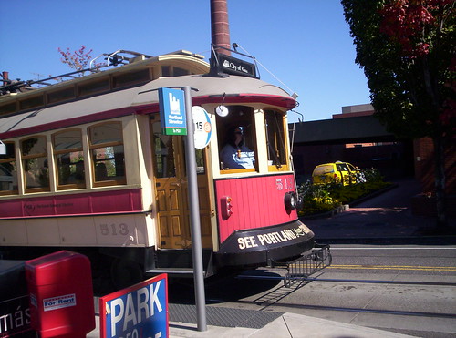
Portland historic replica streetcarThat idea was inspired by what Portland (pictured at right) used to do--they would run a heritage streetcar on weekends on the light rail line to promote developing the separate streetcar line--and what San Francisco does on its F Line, which is a line of heritage streetcars, painted in the liveries of various streetcar systems from the US and elsewhere.

Dallas and Memphis have circulator type systems using heritage streetcars, and other cities like Tampa and Little Rock have streetcar lines using heritage streetcars or replicas.

In 2012, the city announced that they were looking at this idea, but I haven't heard about it since.

Heritage streetcars as an element of visitor transportation service systems.  Later, I expanded this idea into a heritage-streetcar-specific concept of a visitor transportation system for the National Mall ("A National Mall-focused heritage (replica) streetcar service to serve visitors is way bigger idea than a parking garage under the Mall") and Georgetown ("New DC Circulator route serving National Mall reminds us that we are neglecting connections from west to east and fail to adequately connect Georgetown to the National Mall").

Flickr photo by Terry Eyres of a SF streetcar painted in the livery of DC Transit.

Why not use heritage streetcars now for Sunday service?  But I needed the Toronto example to realize that heritage streetcars could be the solution to lack of Sunday service in the present.  DC could get a heritage streetcar or two and run them on Sundays, in order to provide 7 day/week service.

Public-private partnership as an opportunity for Sunday service using heritage streetcars.  This would be a great project for a "public-private partnership" involving (1) H Street Main Street, the commercial district revitalization organization on the corridor; (2) the Ward 6 City Councilmember; (3) developers with projects in the corridor, especially the Akridge Company, which is developing Burnham Place, a mixed use district over the Union Station Railyard; (4) the National Capital Trolley Museum, using the Market Street Railway organization in SF as a model--they procure and rehabilitate cars for use in the F Line service; and (5) potentially other stakeholders such as transit organizations, Union Station, etc.

Amazon example.  Note that in Seattle, as part of proffers related to development proposals, Amazon bought a streetcar for the Seattle system, and paid towards additional service hours, to expand streetcar service in the district where their headquarters is located ("Amazon to Buy 4th Streetcar, Fund 10-Minute Headways," Seattle Transit blog).

Image from the Trolley Dodger blog.

Other points. There's no need to make this entry longer by discussing how implementing this relates to cultural heritage promotion, design as an element of city branding, transportation vehicles as an element of urban design, transportation infrastructure as an element of civic architecture, and a way to generate positive attitudes towards the city's streetcar program, after a difficult period of gestation ("Saturday launch of the DC streetcar").

But those elements and others would be enhanced by implementing this idea.

Labels: , , ,

Tuesday, March 01, 2016

The streetcar and the new potential for H Street retail revitalization

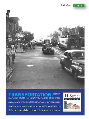
Talk about H Street campaign: Transportation
An ad for an image campaign for H Street that ran in the Hill Rag and Voice of the Hill circa 2003, created by Kevin Palmer and myself.

The biggest thing I forgot to write about in the Sunday piece was the opportunity to spur retail revitalization on H Street because of the streetcar.

As has been discussed here ad infinitum, the organization of the retail sector has changed significantly, with e-commerce decimating many categories more recently, and consolidation and chaining up marking the sector more generally.

Increasingly, retail outside of major shopping centers has declined in favor of food-oriented eatertainment--restaurants and taverns mostly.

H Street's resurgence is the result of similar actions.  Mostly what has come in are restaurants and taverns and business activity occurs at night, when retail stores typically wouldn't be open anyway.

To be successful, retail needs lots of potential customers, and people going out to drink aren't shopping for shirts and furniture.

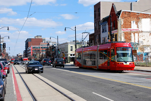
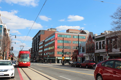
Streetcar on H StreetFlickr photo by Dan Malouff/BeyondDC.

But with the launch of the streetcar and the coming of a Whole Foods supermarket on the 600 block of H Street, it will be possible to revive H Street's retail offer, as opposed to the nightlife orientation--bars, taverns, restaurants--it has developed over the past 10 years.

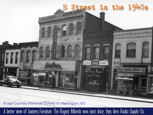
Before suburbanization and riots took their toll, H Street was once one of the city's main commercial districts, not as upscale as downtown, and more friendly to African-American customers.

It was home to Sears and 5 and 10 stores like Kresge, Woolworth, and local firms, and the Morton's regional department store chain, car dealerships, appliance stores, apparel shops, etc.

For the most part, that intensity of retail was lost after the riots, and the corridor repositioned its retail offer towards satisfying the needs of low-income consumers.  Hechinger's the old regional equivalent of Home Depot, was successful at beating down Sears, but they never were able to remake their site over as a shopping center comparable in regional dominance to decades before.   Many years ago I made the point too that Hechinger Mall repatterned shopping in the corridor towards the car and away from the pedestrian.

127Flickr photo by Matt Johnson.

The streetcar can be the means to restore the pedestrian nature of the corridor.

And in the modern retail era the advantage of grocery stores is that everyone eats and so they experience a great amount of customer traffic--thousands of visits per week.  It will be possible to develop some retail, although I can't say how much, in association with the Whole Foods.

I would go for broke and try to attract stores like Primark and Barnes & Noble, repositioning the retail district towards Union Station, which will grow over the decades as the Burnham Place development is constructed over the railyards.

This would recenter the retail segment of the corridor towards to its original "100% intersection" of 8th Street and H Street--which was a major transfer point between different streetcar lines.

Photo source unknown.  90s streetcar going south on 8th Street NE, crossing H Street.   The H Street streetcar line was abandoned in February 1949, but the 90s line remained in service for many more years.

It reminds me of an old column on Main Street-related commercial district revitalization by Neal Peirce ("Main Street Niches in Mass Sales World"), who used to write about state and local issues for the Washington Post Writers Syndicate, where he made the point that commercial district revitalization planning was never-ending, it is a continuing process, and that at a minimum, it takes 15-20 years to show significant results.

In keeping with the idea that commercial district revitalization is a long-term and phased process, streetcar service might make realizable the positioning for the H Street corridor I suggested during the revitalization process in December 2002,

Although I will note that DC's high rents--rents on the H Street corridor are more than double the rents of successful "independent" commercial districts in places like Baltimore (Hampden) and Richmond (Carytown), so it will be much more difficult for retail as opposed to restaurants and bars to succeed.

Relatedly, in 2007 the New York Times had a piece on upscale chains moving from Manhattan into regionally-serving traditional commercial districts in Brooklyn and Queens. The article, "Now, Big-Name Retail Chains Will Take the Other Boroughs, Too,"has a great map of Steinway Street in Astoria, Queens, which shows the impact of the influx of chain stores on the nature of retail there. However, cross streets, such as Broadway, are still heome to significant numbers of independent businesses, but increasingly they are food-related.

========
Excerpt from 12/2002 email.  It still reads well enough...


500 block south, H Street NE-- I don't think HOK understands the extent of the competition between Hechinger Mall and the H Street commercial district. When Hechinger Mall opened it snatched away from H Street three of the most important generators of pedestrian retail traffic on the corridor--the U.S. Post Office, the Safeway supermarket, and People's Drug Store (now CVS). It also took a key African-American men's clothing store, Cavalier, which at that time was part of a regional chain.

CVS's relatively new stand-alone store at Bladensburg Road and H Street eliminated other stores that previously served the neighborhood. CVS's acquisition and consolidation of stores in the neighborhood over the past few years has replaced three stores--600 block, 1100 block (originally Standard Drug), and Hechinger Mall-- with the one store present today.

-- THESE CHANGES negatively affected the quality of the shopping experience in the H Street commercial district by forcing would-be pedestrian shoppers into their cars, to drive outside of their immediate neighborhood, in order to be able to satisfy their most basic shopping needs.

The Sears store was demolished in the early 1990s.  Later, the Atlas Flats apartments were built on this site, although the Hechinger Company wanted to build another shopping center here.  Across the street is a CVS.  At one time the site had a Giant Supermarket, which was one of the company's early stores also.

DEVELOPING DESTINATION RETAIL

I also have a question and some follow up points about your statement at the Revitalization Study presentation last week that the H Street retail market analysis shows the ability to support only 35% of the space we have. The question is where is that 1,000,000 sf? Is it just on H Street or does it include Hechinger Mall and related properties? If the latter, what is the breakdown?

-- I agree that focusing strictly on "neighborhood serving retail" would make it unlikely that we could successfully bring retail to all the spaces on the corridor. However, historically the retail district did not serve just the immediate neighborhood; it was one of the only major shopping districts in the region, probably until the late 1940s. At some point, it became a commercial district particularly hospitable to African-Americans as well.

-- Part of H Street's success was that it had "mall hours" long before there were malls. No later than the 1920s, many H Street stores (including the Sears store on Bladensburg Road, which published its address as "15th and H Streets") were open until 9 pm Wed-Sat. This was particularly important to working people since downtown stores closed at 6 pm. Sears also advertised that its location was convenient to downtown offices, but without the traffic congestion that typified downtown.

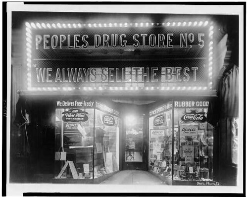
Peoples Drug #5, 802 H Street NE, Washington, DC
One of the earliest People's Drug Stores was located at 802 H Street NE.  The chain grew to over 800 stores before it was acquired by CVS.

-- My concern is how can we successfully revive as much of the retail district as is possible? The other 65% of the retail space continues to exist, much of it in significant 19th and 20th century historic buildings. What are we going do with it? I certainly wouldn't suggest demolishing it. I also wouldn't suggest encouraging the use of first floor spaces as offices.

-- I think the way to use the "extra" 65% is to promote destination retail options that attract shoppers from a much greater area than the immediate neighborhood. Such destinations strengthen the overall mix and bring people in who may patronize other stores and services while they are shopping in the neighborhood.

-- Destination stores, as single entities or as part of themed "clusters," could include music instrument stores with classes (like "The Guitar Shop" at 18th and Connecticut), the Washington Uniform Store (now at 11th and I Street NW and likely at some point to move), or stores that can help support certain categories of business.

For example, there is a franchised chain of stores that sells just batteries, but batteries of every type imaginable. A store like that in the vicinity of Park's Hardware and Sonny's Plumbing would generate sales for those stores as well (see story/1 below). Similarly, stores with an Afro-centric theme (galleries, bookstores, etc.) could be another focus. ...

Labels: , , ,

A brief streetcar followup: miscellaneous

1.  I forgot to mention that Congressman Earl Blumenaur of Portland, Oregon, the leader of what we might call the sustainability caucus oin Congress, was at the launch.

A company he helped get some federal monies to manufacture streetcars in the US, later called United Streetcar, was one of the vendors for the DC program, although United Streetcar is now defunct, as the market for streetcars in the US didn't turn out to be particularly rosy, and other firms manufacturing rail-based transit vehicles are more diversified and able to withstand vagaries in demand for any one mode.

179Flickr photo by Matt Johnson.

2.  The Post had coverage on Saturday ("D.C.’s tortured quest to bring back streetcars: Boon to some, affront to others"), Sunday ("D.C. streetcar makes its first voyages on H Street. ‘Is it really happening?’"), and today ("Theory no longer, streetcars scrutinized by commuters, partiers").  GGW has a nice piece ("DC Streetcar's exuberant opening day, in photos and video") on the launch with lots of photos.

3.  More real estate development.  When I was cycling down Florida Avenue NE to the launch, I noticed three residential developments of significant size, likely each project is worth upwards of $20 million.  So that makes a total of greater than $800 million in new real estate development in association with the streetcar, up from my earlier estimate of $779 million.

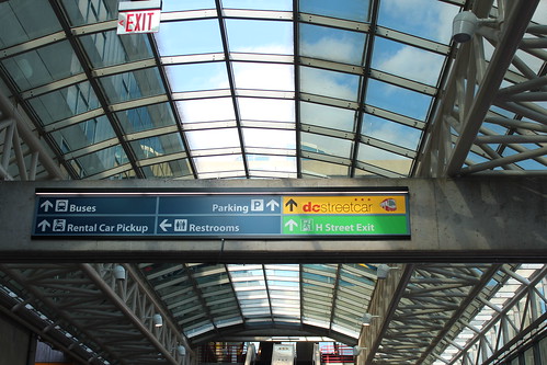
4.   Urban design treatments to better mark the path between Union Station and the streetcar stop.  One photo in the GGW group (Flickr photo by Matt Johnson) shows signage at Union Station for the streetcar, which "shocks" me because it was installed before the streetcar started running.
173

I'm glad they got this element right(er), because this is usually missed--for many years I've suggested the need for a rethink of transit wayfinding information there and other hub sites within the regional mobility system (e.g., main Metrorail stations downtown, airports, train stations, etc.).  See the 2011 entry, "Master planning and DC's Union Station intermodal transportation center."

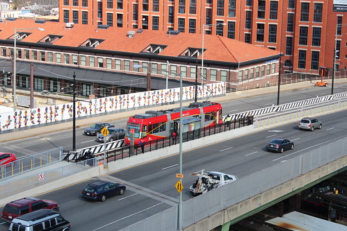
But because the streetcar stop is not well connected to Union Station, I'd have suggested a more visually distinctiveness treatment of the sidewalk environment between Union Station and the streetcar "station" on the bridge, although this would have necessitated some expensive reconstruction.

For example, blue architectural lighting is used around the main train station in Essen, Germany, to link the bridge supporting the train station platforms, local and inter-city bus stops around the station, as well as the subway platforms within the station.

One set of sidewalks includes blue lights embedded into the pavement, making a trail to the station.

Red sidewalks connecting Union Station to the streetcar stop, given the red painting scheme for the streetcar, might have been something I'd have recommended as an interim measure to get people between the train station and the streetcar stop--as it is people will have to come up from the subway platform to the main floor, then go up one more level to the entry to the parking garage/bus station, and then through the bus station to the bridge on H Street.  The sign that's posted is not enough.

Red colored concrete sidewalk on Ocean Drive in Miami Beach.

Labels: , , , , ,

Monday, February 29, 2016

Saturday launch of the DC Streetcar

There were many hundreds of people at the launch of the DC Streetcar this past Saturday.  I don't think there were as many as 1,000 people.

The Eastern High School Marching Band played, and the remarks by political officials were brief.

The major news from the event was that Mayor Muriel Bowser and Director of the Department of Transportation Leif Dormsjo stated that this was only the beginning and that the streetcar would be extended both east to Ward 7/Benning Road and east (to Georgetown, although Georgetown wasn't mentioned specifically).
-- "This is a great addition to the transportation system [in the city] with Metrorail and the DC Circulator.  We will continue to look for opportunities to extend the streetcar east to Benning Road and west.  So everybody, let's ride.  Congresswoman Norton reminds me to tell you the rides are free for the next six months."  -- Mayor Muriel Bowser
Ward 7 Councilmember Yvette Alexander also commented on the extension of the streetcar east to her ward.

The marching band was cool, but the music got in the way of conversation.

Why neighborhood pain in the a** Robert Pittman of the Linden Neighborhood Association (a one block neighborhood) was one of the speakers is beyond me.

There aren't many neighborhood residents who have been more obstreperous concerning improvement than he (although he has been good on policing issues).  (For people in the know, having Robert Pittman on the dais would be like having Calvin Gurley on the dais...)

I figure he must have been a supporter of the Bowser campaign and because at the time Anwar Saleem director of H Street Main Street, the commercial district revitalization organization for the corridor, was not, that's why he didn't speak.

Congressional Delegate Eleanor Holmes Norton and Ward 6 Councilmember Charles Allen also spoke.

After the remarks the crowd lined up to ride the streetcars and people got their first ride.

Nobody mentioned the almost $800 million in new development that has been triggered by the streetcar.

Riding down Florida Avenue to the meeting, with the many projects underway there, which I did not include in my previous tally ("DC and streetcars #4: From the standpoint of stoking real estate development, the line is incredibly successful and it isn't even in service yet, and now that development is extending eastward past 15th Street" December 2015) demonstrates that the economic development effect of the streetcar is even bigger than I thought.  There were at least three major projects underway, and a number of smaller projects.

In a report for H Street Main Street on housing possibilities that I wrote in 2003 I had suggested opportunities on Florida Avenue including the site for a then car repair shop, Jimmy's Tire, which later burned down. Now it's an apartment building.

Rick Gustafson of Portland Streetcar was there and we had a chance to talk for a bit.

He said that DC and Cincinnati (there were lots of anti-streetcar referendums to get through but the system will launch in Cincinnati next year) have been the most problematic of streetcar implementations nationally, but because of Washington's visibility as the national capital, implementation problems here have been much more visible and were noticed across the nation and have hurt the argument for streetcars elsewhere.

He said that the DC city government was never interested in working that closely with the private sector--the Portland Streetcar and the first streetcar line in Seattle were launched primarily at the behest and with the financial support of the real estate industry--and that one major development firm had organized 11 other major development firms to work with the city on streetcar implementation but nothing came of it.

(Relatedly, the city put out a tender for a concession agreement for implementing and operating streetcars in DC, but never carried out the contract.)

The other thing we discussed is the focus on speed in what we might call "anti-streetcar" discussions.

As pointed out in my past blog entry "Making the case for intra-city vs. inter-city transit planning," the point of streetcar service is connectivity and access within sub-districts of city, not in making trips of long distance relatively quickly.

We talked about how as population is added to neighborhoods in turn retail and other amenities are able to succeed, and the addition of such services reduces the demand for longer trip travel.

Gabe Klein, left; Karina Ricks, middle; Harriet Tregoning, right.  

In the crowd were now "regular people," like former DC planning directors Andrew Altman and Harriet Tregoning, former DDOT director Gabe Klein, and former chief of transportation planning for DDOT, Karina Ricks--who was one of the city's first community planners, assigned to Ward 6 and H Street around 2000.

There were people from the neighborhood and the "city improvement" community, ranging from friend and former ANC commissioner Drew Ronneberg to David Cranor, erstwhile blogmaster of Washcycle, the region's go-to blog on bicycling.
There were people I'd hoped to see but didn't, including Joe Fengler, mentioned here frequently as the person who got the rails installed in the street to begin with.

It's possible some of those people were at the Streetcar "after party" set for later in the afternoon.  I didn't go.

I also saw Alex Eckmann (in the middle in the photo at left), who now works for the Federal Transit Administration, but had been director of the "Mass Transit Administration" unit of DDOT back when the DC Alternatives Analysis planning initiative which laid out the options for streetcars in the city, first launched in 2003.

I congratulated him.  He deserved some of the credit.

In any case, what is happening on H Street these days, from the construction of large residential housing buildings with retail on the ground floor, to a real restaurant cluster and a nightlife center, to streetcar and the coming of a Whole Foods supermarket is far beyond what anyone could have imagined back in 2001 when we created the H Street Main Street initiative, in hopes we would get selected for the city's then new commercial district revitalization program that was being launched in 2002.

It's times like this that remind me that my positivity in the face of my "glass is half empty" perspective since I endeavor to be a relatively objective analyst and critic isn't always dashed.

A funny bit.  Many of the opponents of streetcars call one of the advantages--tracks--a disadvantage, saying that buses are maneuverable in case of a tie up while streetcars are not--although tracks help with quality of the ride and provide a permanence that attracts investment whereas buses do not.

One of David Cranor's children asked him about the tracks in the road, why streetcars run on tracks, and why don't cars run on tracks?  I thought it was funny.  In a nutshell it summarized many of the oppositional arguments.

They also passed out pennants.  I got a couple.

Labels: , ,

Tuesday, January 26, 2016

Seattle Streetcar starts running on the First Hill route

One of my jokes about the debacles (which kill me) of the creation of streetcar service in DC is that DC and Seattle started planning for streetcars at the same time, in 2003, but Seattle's first line opened in 2007, while DC's single line will open finally in February 2016.

First Hill streetcar line, SeattleThis past weekend, Seattle opened its second line, connecting Pioneer Square and the International District to Capitol Hill ("75 years later, streetcars return to Capitol Hill," Capitol Hill Seattle).

In March, the Sound Transit Light Rail extension to Capitol Hill will become operational, so the streetcar will expand the intra-city catchment area of the new transit station.

Although oddly, the streetcar stops one block short of the station, although there are plans to extend the line to the station and beyond.

Also see "STREETCARS ARE ABOUT TRANSIT, just in a different way from how most people are accustomed to thinking about it," for discussion on the difference between intra-city and inter-city transit systems.


Right now, riding is free, but soon enough the line will start charging fares.

It's a bit odd that the two lines aren't connected, but there is planning underway for the "Central City Connector" to link them. Construction could start on this segment of Seattle's streetcar trackage next year.

The new line would have opened more than one year earlier, but there were problems with the manufacturing of the cars, which led to significant delays ("Almost ready to ride: tours of delayed First Hill streetcar line begin," Seattle Times

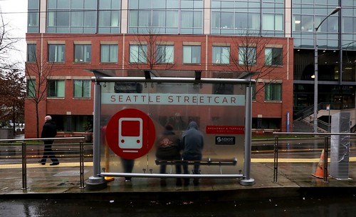
I am impressed with the strong graphic treatments used on and in the transit shelters for the streetcar line.

Attractive graphic treatment on the transit shelters for the Seattle Streetcar

Including the map graphics.
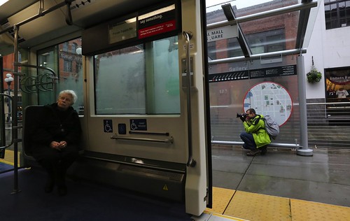
Part of a Seattle Streetcar transit shelter

Currently, Seattle doesn't allow advertising in bus shelters and elsewhere in the public space, although they are aiming to change this ("Seattle plans to declutter street furniture with private help," Seattle Times), and in the interim they were looking to sell sponsorship of streetcar stops, although it's not clear that they have sold any.

Note that based on the article about "street furniture" and the peer examples listed, I expect that Seattle will make the same kinds of mistakes that DC did with its "bus shelter" contract, which limits the upside for the city in terms of being able to integrate innovative programs over time.

Labels: , , , , ,

Sunday, December 20, 2015

DC streetcars move to simulated service: passenger service expected within a couple months: DC streetcars part 1

Just after I listed the ongoing trials and tribulations of DC's launching of streetcar service as #6 in the "Top DC area transportation stories of 2015, "the city transportation department announced that the streetcars were going to start simulated service ("DC Streetcar Pre-Revenue Operations Scheduled to Begin December 16, 2015," press release), the last testing step before beginning operation.

This testing phase will last 21 days, followed by evaluation and further approvals.

This led to a spirited discussion of the issue in a private e-mail group, and it's worth pulling out some of the points.

Almost there... A streetcar sits on the rails along H Street NE near the intersection with 4th Street in Washington. (Eva Russo/For The Washington Post)

It sure is taking a long time.  While the streetcar has been a debacle, planning started in 2003, not 2000. The city didn't make a commitment til 2005, when they agreed to install tracks in the street as part of the streetscape reconstruction. That didn't happen for a few more years. Still, they bobbled the program many times over the years, especially by not designing the power infrastructure in advance of the streetscape reconstruction.

Right: development map along the Cincinnati streetcar route.  I wish I had the ability to produce quality graphics.  No one has created a similar graphic rendition along the H Street streetcar route, development announced, underway, or soon to be announced that is directly attributable to the streetcar is approaching $750 million.

Cincinnati.  It's ironic that the Cincy program will go operational 4 years from start of construction. They are in testing mode now, although they aren't committing to revenue operation til 9/2016. The reason it's ironic is the manager of the effort in Cincinnati was John Deatrick, the former chief engineer for DC's Department of Transportation. He also spearheaded "around the turn of the century" a systematic repaving program for the alleys.

Seattle.  DC and Seattle started streetcar planning at the same time, in 2003. Their first line went operational in 2007. Their second line is just about operational now--delays are due to problems on the streetcar manufacturing side, otherwise the line would already be in service.

That says a lot. I don't know about the launch of the new line in Seattle, but the first line was launched successfully because they hired the same firm that did the launch of and (still) operates the Portland Streetcar.
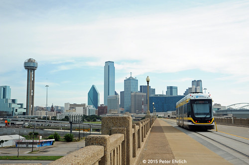
DALLAS--302 on Trinity River Bridge IBFlickr photo of the Dallas streetcar on the Trinity River Bridge by Peter Ehrlich.  

The testing and safety requirements are the same for all streetcar operators.  The fault in getting it operational isn't the fault of regulations from FTA and others, it's almost completely and entirely failures by DC Government, primarily DDOT, but more recently a lack of commitment from elected officials (and therefore, the city's business community is indifferent too). Note that the Dallas streetcar went to revenue operation last year, after only 6 weeks from receipt of the vehicles.

In response to streetcars vs. buses, vs. trams/light rail vs. heavy rail, etc.  There is a place for streetcars in the transit network. I was re-reading a piece I wrote last year, and I have to say, it's damn good [it is reprinted in the next entry]. It discusses the place of the streetcar in a city like DC as transit, not just economic development, but focused on intra-district mobility.

FWIW, I was a super strong proponent for a long time. Now I think it's a distraction, that DC should have focused on the separated blue line, given the limited resources. That being said, there are equity issues, it's better to improve transit service for the transit dependent, etc.

Will ridership increase in streetcars over bus?  The thing about the expectation of a ridership increase of 40% of streetcar over bus, the reality on H St. might be different. The H St. buses already get between 14K and 15K daily riders. I don't see 4-5K new daily riders because of streetcar (especially because they won't be run at the same frequency). I don't think there are that many trips capable of capture.

No Sunday service.  .. not to mention that DDOT announced the streetcars will not run on Sundays.

That to me indicates that as a transit service, it's not being taken fully seriously.  From the Washington Post article "District says streetcars starting final dry run but still need safety sign off":
A spokesman for the District Department of Transportation said Tuesday that when the doors open to the public, streetcars will run six days a week, with no passenger service after 2 a.m. on Sundays. The city had already rolled back the frequency of daily service, which officials say will run every 15 minutes instead of every 10 minutes.

“Going with six days provides a recovery day for the system. We’ll have a day we can perform track and vehicle maintenance without impacting service,” said DDOT spokesman Terry Owens, adding that officials think such an arrangement “will enhance the reliability” of the 2.2-mile line. “We want to deliver a system that’s safe, sustainable and makes efficient use of our resources. It’s a more conservative approach. But we will always have the option of expanding the days of operations.”
With regard to the streetcar running in mixed traffic: yes, streetcars (and buses) should be prioritized, but we already know that thinking in DC is backwards as it relates to sustainable mobility (walking, biking, transit).

Likely the majority of trips in the city are conducted by sustainable modes, but the mobility priorities of the city do not recognize it (as I wrote before, DC's politics are dominated by the greater automobile-centricity of the outer city). That's an impetus behind my annual "maintenance of way" post for winter weather in the context of the walking-transit-biking city--if the city is pro-sustainable mobility, why do snow clearance practices privilege the motor vehicle?

DC's implementation problems hurt the case for streetcars and transit elsewhere. One of the participants (a railroad planner in the south) wrote:
this project is being hailed by all the anti-rail critics as an example of what could happen to "X" community if "X" community pursues this type of project. Of course, if you believe the Republicans, no one in the hinterlands of the USA believes Washington can do anything right anyhow.
I responded:

The other thing because it is taken so long in DC (I used to promote streetcar service in DC by saying "why wouldn't you want to be the first place for modern streetcar to be implemented on the East Coast?" but Atlanta beat us to it by more than one year) and because of how rail is like fairy dust in bringing out all the opponents, including the latent automobility proponents -- by latent I mean they live in the city and so you'd think they would be predisposed to support transit, but it seems not to be the case -- it makes it f*ing hard and poisons the entire issuespace for transit.

Do people criticize streetcars in part because of how they have been associated with Portland and its reputation as a green-progressive-alternative place?  Image: Portland.

I wonder if it's worth it.  How many of these kinds of articles and editorials in the local newspaper (e.g., "Another wasted year for D.C.’s streetcar to nowhere," Washington Post) can transit withstand?

It's easy for media to jump on the bandwagon and criticize transit, considering how dependent they are on the automobile industry for advertising revenue.

But it's sick for me to be pushed to thinking that it would have been better not to do streetcars because the city wasn't up to the challenge of being able to implement it, that it's easier to drop it.

It's not just DC. It's Arlington with the streetcar, although there it was people in North Arlington who already have subway not caring about improving transit access and equity for south arlington. And then all the b.s. in Montgomery County/Chevy Chase with their opposition to light rail, which almost, but not quite scuttled LR there.

But other areas benefit greatly from streetcar, so DC shouldn't be an outlier.  Besides the streetcar examples of Dallas, Portland, Seattle, Salt Lake City, San Francisco (which is creating a "new" heritage streetcar line, the E Embarcadero line, with new track and some light rail routing and it will enter full-time service next year), and Seattle, all of which are comparable to DC, I forgot to mention Tucson.
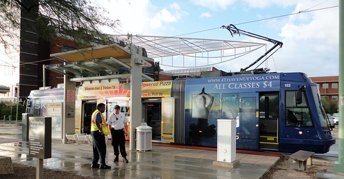
Tucson Sun Link StreetcarTucson Sun Link streetcar.  Flickr photo by Larry Synerson.

Tucson.  According to a suburban town engineer I met a conference a couple months ago, the Tucson streetcar has been electric already (it's been operating for 15 months or so) in terms of resuscitating and repositioning Downtown Tucson as an exciting place to be, to invest, to live, etc.

Orange County, California is moving forward with a streetcar in Santa Ana although of course there is opposition.

But when I first learned about the OC Streetcar project, it made me think of streetcars as an important "priming" and (re)positioning device--not that this is a new realization--for communities not capable of supporting heavy rail, streetcar service is a way to help communities reposition for economic and residential activity in the 21st century vis a vis sprawl,.

This is comparable to the piece I wrote in Spring 2011 making the point that people focused on "the Silver Line and Dulles access" missed the point, it was really about making more of Fairfax County and now Loudoun County relevant in terms of 21st century expectations of how to live, work, and get around.

Fairfax didn't care all that much about the airport, but about making more of its property eligible for federal leasing, attracting TOD, shifting mobility primacy from the car, at least in the Silver Line catchment area, etc.

Orange County has Metrolink railroad commuter service, but it will never get light rail probably, and never ever will get heavy rail.  Streetcar is a way for cities like Santa Ana in Orange County to remain relevant and competitive in the context of transit expansion in Los Angeles County.

FWIW, a lot of the area in Fairfax County that is poorly served by transit generally and heavy rail specifically, especially automobile-dependent industrial space/office space, is in bad shape. There are eminent REITs deeding properties back to their mortgage holders, etc. In. Fairfax. County. in 2014/2015.

Little Rock/North Little Rock is another example. There, the recent I-30 expansion proposals aimed to destroy a necessary bridge for the streetcar ending service in the eastern section of the line and the State Department of Highways and Transportation did not propose taking responsibility for replacing it (like what happened to the Seattle Waterfront streetcar which lost its maintenance yard due to the Seattle Art Museum sculpture garden, and the SAM wasn't required to replace it, and they junked the line).

Negative public response appears to have forced them to change their plans, to keep the full streetcar line in operation.

Heritage streetcar at River Market in North Little Rock.

(Tacoma , Washington also has streetcar service, but it hasn't been particularly successful at spurring revitalization.  I haven't seen the city or the service, so I can't offer scintillating analysis on why this is so.  In large part it's because increasingly, agglomeration benefits connote to locating in Seattle.  One example is how a large firm, Russell Investments, relocated to Seattle, when it had been the shining example of business success in Tacoma.)

MAJOR REALIZATION FROM THE THREAD.  H Street is the only area in Washington DC outside of catchment areas served by Metrorail stations that is experiencing the construction of buildings taller than 4 stories. It's pretty clear this is because of the streetcar.  More on this two posts from now.
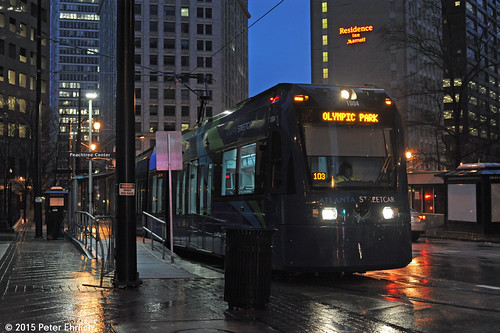
ATLANTA--1004 lv Peachtree Center IB
Atlanta streetcar leaving Peachtree Center at night.  Flickr photo by Peter Ehrlich.

Labels: , , , , , ,