Rebuilding Place in the Urban Space

"A community’s physical form, rather than its land uses, is its most intrinsic and enduring characteristic." [Katz, EPA] This blog focuses on place and placemaking and all that makes it work--historic preservation, urban design, transportation, asset-based community development, arts & cultural development, commercial district revitalization, tourism & destination development, and quality of life advocacy--along with doses of civic engagement and good governance watchdogging.

Monday, July 07, 2008

Speaking of pedestrian master planning

From email:

DDOT to Host Final Public Meetings on Draft DC Pedestrian Master Plan

Residents Encouraged to Come and Voice Support and Concerns

The
District Department of Transportation (DDOT) announced the third and fourth of four public meetings inviting public comment on the recently released final draft of the District of Columbia Pedestrian Master Plan. The plan is a culmination of 18 months worth of study that examined all aspects of the District’s pedestrian environment, from policies to design guidelines to specific safety improvements in the city’s highest pedestrian crash corridors.

The Plan has two primary goals:

· To reduce the number of pedestrians killed and injured in crashes with motor vehicles; and

· To increase pedestrian activity by making walking a comfortable and accessible mode of travel throughout all parts of the District.

The
Pedestrian Master Plan is scheduled to be implemented over 10 years at a total cost of over $18 million. The policies and design standards that are established and/or recommended in the Plan are anticipated to improve the safety and walkability of the pedestrian environment in the District.

Meeting Information:

What: Pedestrian Master Plan Public Comment Meeting

When: Tuesday, July 8th
6:30-8:30 pm
Where: St. Peter’s Church, 313 Second Street SE (Ward 6)

When: Wednesday, July 9th
6:30-8:30 pm
Where: Columbia Heights Recreation Center, 1480 Girard Street, NW (Ward 1)

Labels: , ,

Monday, June 30, 2008

Multiple use recreational and biking trails

I don't ride on bicycle-walking trails very much as I am a city bicyclist and I ride on the roads. But there is discussion in other places, including the always excellent Washcycle blog, about bicyclist-pedestrian issues on these trails, including the Capital Crescent Trail, which is imposing speed limits.

I think the issue is really weekend use, with weekend bicyclists and weekend walkers, vs. use during the week. But daily bicycle commuters get tagged by the proposed solution to deal with weekend problems.

I did watch bicycle-pedestrian conflicts on the trail in Battery Park in NYC. There the problem is the size of the trail-walkway and the number of users. The issue isn't much different in the DC region. The problem is that bicyclists and walkers are on the same trail when they should be separated during peak use periods... probably.
Bicycling in Bogota
Cyclists ride along the bicycle path in Bogota June 23, 2008. The 270 km (168 miles) bicycle path by the sides of the main roads of the Colombian capital have turned cycling into a transportation alternative in Bogota. Advocates say the safety and convenience of the bicycle paths are encouraging the environmentally clean form of transportation. Photos by REUTERS/John Vizcaino (COLOMBIA)

Note that the trail here has a section for bicyclists and a section for walkers. Also note the bicycle taxis.
Bicycle taxi in Bogota
In this photo you can see passengers in the bike taxi.

Labels: , , , , ,

Traffic medians as public art

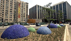
are discussed in this piece, "New traffic median decorates downtown Los Angeles," from the Los Angeles Times.
Whimsical traffic median
The installation, at the intersection of Main, Spring and 9th streets, is made of low-maintenance plants and recycled materials. Ken Hively/Los Angeles Times.

Labels: ,

Saturday, June 28, 2008

Peopling Places in Chicago (and elsewhere)

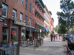
Washington Avenue, Hoboken, New Jersey
Washington Avenue, Hoboken, New Jersey. Photo by Steve Pinkus.

is a new blog (which I found because from time to time I check out the blogs that link to mine) focusing on the Logan Square area of Chicago.

It's a particularly interesting read for me because the author has read some of the same books as I (I bought City: Rediscovering the Center from Common Concerns in the early 1990s, although I wasn't involved in local revitalization activities then, I was just interested in urban issues) and it seems as if Logan Square has many of the same issues and conditions as does H Street NE, where I got particularly involved starting in 2000.

I lived within one block of the main drag, H Street, just as the blogmaster of Peopling Places lives within one block of Milwaukee Avenue. For me, many of his entries appear to parallel the kind of learning and experiences I went through on H Street. It's almost eerie.

Anwar Saleem, now the director of H Street Main Street, but originally the board chair and like me, one of the founders of that group, and I talk all the time about "what we know now" vs. the "what we knew then" back in 2001 when a group of us started to bring resident energies into the revitalization equation, first working with the merchants association, and later creating a Main Street organization, after the city under Mayor Williams, launched a city-wide Main Street program.

Sadly, for many reasons the Main Street program isn't working out so well in DC. It's impolitic for me to discuss why in great detail.

It's partly the organizations and the level of community capacity. It's partly how the city government deals with the programs and how long it takes to release funding as well as funding recissions. It's also because I don't think people really understand how difficult it is to reseed retail generally--as an industry traditional retail is amongst the most concentrated of U.S. industries--especially when you want it to be independently owned and operated so that it is distinct and contributes to the unique identity of neighborhoods, commercial districts, and center cities.

-- (Yesterday's) Testimony on the DC Main Streets program (2007)
-- I hope New Orleans('s urban Main Street program) can learn from DC (2006)
-- Yesterday's testimony on the DC Main Streets program (2005)
--Main Street and getting schooled in politics, constituency building, and building support for your program (2006)

In fairness to all the stakeholders, it's also hard. These neighborhoods have experienced as much as 60 years of disinvestment, some of the commercial districts are scarred by riots, and it was unreasonable to expect--after many years if not decades of failed government initiated attempts to induce improvement--that volunteers with a wee bit of money and government support could turn things around in a couple years. (Of course, that was the expectation of many.)

And at the same time, local commercial districts and retailers compete within a vibrant and hyper-competitive regional retail landscape.

-- (Why aren't people) Learning from Jane Jacobs revisited (2006, 2005)
-- Signs, signs, and the necessity of design review (2005)
-- Forcing Retail Displacement by the disconnection of tax assessment models from public policy goals (2005)
-- Why the future of urban retail isn't chains (2005)

E.g., in the DC region, DC has just gotten clomped by the opening of National Harbor in nearby Prince George's County, which creates major competition for conferences and small and mid-sized meetings, especially because the conference center operator, Gaylord, has other facilities (such as the Grand Old Opry in Nashville) so they are able to leverage their relationships developed elsewhere to steer new and more business to their facilities instead of it going to DC.

See "National Harbor's 'Mini-City' Takes Shape," from the Washington Post. Both Gaylord, and the master developer, Peterson Companies, are hardcore competitors. National Harbor is being programmed every weekend with special events, farmers markets, etc. (Peterson Companies is the master developer for Silver Spring, and they also own some shopping centers in the region.)

As I say to retailers and restauranteurs, "to stay the same is to fall behind, because your best competitors are always working to improve. And your customers are also their customers. Your customers are constantly learning about what is quality retail and what isn't and they will shop where their needs are best met."

And DC just isn't quite big enough for local retail to stay local. Even Hecht's, one of the more successful department store chains in the U.S. (it was owned by May), which grew from a store in Washington and in Baltimore (where it started) to a 70+ store chain from Pennsylvania to North Carolina (mostly through acquisition), has been rolled up into Macy's. So the local support network and infrastructure to support local retailers isn't very strong.

But I didn't know any of this in 2000, when I started getting involved in the revitalization of H Street NE. Now I tend to focus on issues with more "city-wide" import, and I do some consulting, some local, as well as in locales outside of the region.
-------
Other good resources include reports from the Urban Land Institute:
David Milder's report on urban retail business recruitment, Business Recruitment Handbook; Karl Seidman's report on urban revitalization programs, Revitalizing Urban Main Streets; and the Downtown and Business District Market Analysis Toolbox from the University of Wisconsin Extension Service's Center for Community Economic Development.
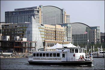
National Harbor, Prince George's County, Maryland
National Harbor, Prince George's County. Photo: John Mcdonnell -- The Washington Post.

Labels: ,

Thursday, June 26, 2008

Another take on automobile-centric planning paradigms

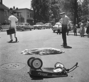
Child struck by car 1959 Pulitzer Prize winner
Child struck by car 1959 Pulitzer Prize winner.

From the Urban Runner blog:

I met Antonio today, shortly after he left

I met Antonio today. I had never met him before but he seemed like a hard working family man. He looked older than I, although he was younger; some people end up leading harder lives than others I guess. Later I met his neighbor and roommate who had nothing but good things to say about him; hard working, never smoke or drank. Antonio came here from El Salvador and was supporting his wife and two daughters back in his home country. He worked full time at a metal plant in the next town over and was due to go back home soon. He had been working here for several years.

Antonio was on his way to his second job before I met him. He had worked all day and was now on his way to his night job at a local restaurant. Antonio was taking the back way to the restaurant. At the intersection of a state highway he was on the cross street and was proceeding on a green light. A car was stopped at the red light inbound on the highway and across the street another driver was stopped. At the same time a 17 year old boy was inbound on the highway in his SUV and talking on his cell phone to his mother. The boy did not notice the red light until it was too late. The SUV smashed into Antonio’s car, directly into the driver’s side. Antonio never stood a chance and probably never knew what hit him. There were no skid marks before the impact point.

Antonio was at peace now, although the blood and mangled car disturbed this image. Antonio now joined the sad number of over 42,000 others who die similar transportation deaths each year in America. This was the very same intersection that one of my co-workers had pulled a man from a burning pickup truck on New Years Day after a similar accident. That man lived, Antonio did not, sometimes it happens that way. 42,000 of sometimes is too much I think. My co-workers and I get to meet a lot of Antonio’s each year. They are young and they are old, and they all have different life stories, until they leave and then all have a similar story.

I commented to the judge who arrived on scene to pronounce Antonio’s death that I suspected that this intersection met all of a transportation engineer’s requirements. After all, our new high school is located just down the street from this intersection. Later, while on the way to deliver the news of Antonio’s death to his roommate, co-worker, and friend from El Salvador, I mentioned to our Victim’s Services volunteer that it’s a shame that we have to drive everywhere in our lives as Antonio did. It doesn’t have to be this way. We could build our communities differently. Maybe then I could have met Antonio before he left.

Labels: ,

Monday, June 23, 2008

The difficulty of creating congruent government policies

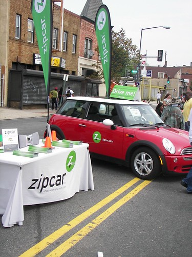
The WSJ also reports, in "If Your Zipcar Is Costing More, The Taxman May Be to Blame," about carsharing services such as Zipcar, and increased costs. See, some jurisdictions are forcing carsharing companies to charge car-rental taxation fees.

Typically, these fees are pretty damn high, because for the most part they are assessed onto non-residents, like restaurant sales taxes and hotel taxes and parking taxes. These taxes are seen as convenient and easy to assess, because there tends to be little fallout (except for restaurant sales taxes).

On the other hand, a center city wants to properly manage its parking and curbside management. Arlington County is particularly good at this, with an element devoted to Parking and Curbspace Management present in their Master Transportation Plan.

Cities need to recognize that the "public space" devoted to parking needs to be better managed. I don't know how much space is occupied by this in DC, in San Francisco, it's 15%. So making sure that all policies are congruent, and that car purchasing is discouraged rather than encouraged, is key. (I do wonder though if carsharing nonprofits and cooperatives could get out of this, by having true membership rather than a for-profit relationship.)
Zipcar, H Street Festival

Labels: , , ,

The costs of living when gasoline is no longer cheap

School bus infrastructure is costly
Robbie Sutton, an employee with Nash-Rocky Mount Public Schools Transportation Department, fills a bus with diesel fuel at Southern Nash High School in Bailey, N.C., Thursday, May 29, 2008. Every three and a half school days, Nash-Rocky Mount School buses consume 7500 gallons of fuel. (AP Photo/Gerry Broome)

We are likely at the very beginnings of a shift in the dominant land use and transportation "planning" paradigm of one built on cheap oil. Cheap oil enabled segrated uses and the great distance between activity centers and destinations (shopping, school, work, education, other services, friends) was made up through driving.

This doesn't just impact individuals but institutions as well, including school systems and freight delivery. Moving from having walkable communities to driving-required communities meant that school systems had to create transportation infrastructures (school buses) to bring children to and from school. When the cost of diesel fuel quadruples, that puts organizations with constrained budgets in a picke.

This is but one of the things that's going to have to change. The Wall Street Journal wrote about this last week, in "Yellow Buses Put Schools in the Red." And the Baltimore Sun wrote about a desire for neighborhood schools in Baltimore County, in "The next big thing: smaller schools." Baltimore County, like most suburban counties, places schools in a fashion where they are distant from the houses of most of the students enrolled at the school.

Sadly, in DC, we are developing a school bus infrastructure to address federal mandates for the transport of special education students. This is a huge hard to manage cost. Otherwise, city-based students can walk to school or take transit although young children generally can't get to school without being chaperoned. (I don't remember if I walked to school by myself in kindergarten and first grade. I think I did. The schools were a few blocks away on city streets in Detroit.)

People might say that DC is going in the wrong direction by closing schools. But there is a difference. DC has a school building infrastructure built for a time when there were more than 100,000 students in the schools. Now the number, including charters, is less than 75,000. There is a careful balance required with rightsizing the system, with maintaining neighborhood-based schools. While I don't think that the DCPS is probably dealing with this perfectly, it does need to be done. However, it's unfortunate that it is being done in a fashion which maximizes rather than minimizes the costs and difficulties of change, in a school system that is already experiencing massive dislocation.

Labels: , , , , ,

Wednesday, June 04, 2008

If we surveyed DC residents on their satisfaction with livability and transportation how would the city rate?

mobility icon
This thought inspired by this blog entry, "How Much Does Transportation Affect Your Quality of Life?" from the Commuter Page blog. Arlington County's regular survey of residents on these questions: see the questionnaire and the results page from the Commuter Page website.

From the entry:

Overall, 78% rated the transportation system and services in Arlington a four or five on a five point scale. According to researchers this is much higher than in most cities. Among the key drivers of satisfaction cited were overall ability to get around the county, ability to get around by bus, choice of transportation options, safety, convenience, and the time required to make trips.

Arlingtonians’ affection for choice is borne out by their usage of other modes than driving alone. For work trips only 50% drive alone, compared to 74% average for the DC region, and much higher nationwide. Twice as many take transit in Arlington (26%) as in the rest of the region, six times as many walk (6%), and three times as many bike to work (3%).

For non-work trips Arlingtonians’ dependence on the car is even lower. In the 2006 survey, only 45% of trips were made by driving alone, and an amazing 33% were made by walking! And of course, the less we drive alone, the more we all benefit from less traffic congestion, less pollution, less parking demand, etc.

Note that generally, DC kicks Arlington off the map in terms of mode shift--walking, bicycling, and transit trips--and the city pales in comparison to Arlington in terms of offering focused transportation demand management and mode shift programs. Just think if we tried! Of course, it helps that the core of the city has 29 subway stations in 15 square miles plus L'Enfant's pedestrian-centric street grid--after all, who doesn't get lost in Arlington looking for "Glebe" Road?

(Although I would also do special panels within such a survey of tourists/visitors, as well as commuters. Maybe qualitative surveys even. You can get a lot of insight into things that way, even if they say seemingly stupid things. For example, I doubt with all the bicycle planning in DC that there was ever a focus group conducted with bicycle messengers.... I keep meaning to go out one day at the end of the day to Farragut Square and ask bicycle couriers some questions.)
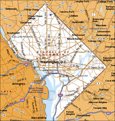
washington dc map

Labels: , ,

Arlington-Alexandria Community Bike Ride this saturday

Road trip street sign
For the second year in a row _I won't be able to attend this event_. I think it's great, if not a bit too big (but Arlington is small, 23 square miles...). We need to rebuild familiarity and comfortability with bike riding, what better way that a community bike ride, sponsored by the municipality?

I have argued in the past that we need to do this in DC, but at the Ward level -- in other words, instead of one big bike ride at the outset, how about 8 smaller, regularly scheduled events.

Barring that, it can be by neighborhoods -- Capitol Hill, Georgetown, Anacostia, Deanwood, Tenleytown, Brookland, Takoma (although also with Takoma Park, MD), etc.

For more information on the Arlington-Alexandria Community Bike Ride (maybe I will pop over to the start just to see how it is set up) this Saturday, June 7th, click here.

It's being coordinated by the Washington Area Bicyclist Association.

Arlington and Alexandria Community Bike Ride, logo

Labels: , , ,

Sunday, June 01, 2008

Car Free Cities Conference

(A good opportunity to challenge and extend your thinking.)

June 16-20th, Portland, Oregon

The
World Carfree Network is holding the eighth annual Carfree Cities Conference. This year the event, which raises awareness of the social, environmental, economic, and public health impacts of private cars, will be held in Portland, Oregon, marking the first time the conference series has ever been hosted in the United States.

The theme of this year's conference is "Rethinking Mobility, Rediscovering Proximity" and intends to promote discussion of urban livability, mixed-use development, local agriculture, pedestrianization, strong neighborhoods, accessible public space, and sustainable transportation.

Registration is still open for the full conference and Public Day. For more information on the conference, programming schedule, and how to get involved please visit the Car Free Portland website.

Labels: , , ,

Guerrilla maintenance of neglected public spaces

in Los Angeles (well, Long Beach). See "Guerrilla gardeners take root in L.A." from the Los Angeles Times. There is a companion photo feature on creating "seed bombs" to drop in extremely neglected public spaces.

Labels: , ,

Sunday, May 25, 2008

Most endangered places, U.S., 2008

Last week, I blogged about the DC list of the most endangered places. The National Trust for Historic Preservation released its national list for 2008 earlier in the week:

- Michigan Avenue Streetwall in Chicago:
- Boyd Theater, Philadelphia: Vacant Art Deco movie palace.
- California’s State Parks: Many may close because of state budget cuts.
- Charity Hospital and adjacent neighborhood, New Orleans: Historic hospital closed after Hurricane Katrina.
- Great Falls Portage, Great Falls, Mont.: Landscape along Lewis and Clark Trail might be marred by power plant.
- Hangar One, Moffett Field, Santa Clara County, Calif.: Dome-shaped hangar built in 1932 to house U.S. Navy dirigibles isn’t being preserved.
- The Lower East Side, New York: Development threatens theaters, other remaining structures in this cradle of immigration.
- Peace Bridge Neighborhood, Buffalo: Local bridge authority wants to widen Peace Bridge, eliminate historic homes.
- The Statler Hilton Hotel, Dallas: Once-modern hotel, now 52 years old, sits vacant.
- Sumner Elementary School, Topeka, Kan.: City Council has authorized demolition of school central to U.S. Supreme Court’s desegregation ruling.
- Vizcaya and the Bonnet House, Fla.: Miami museum and Ft. Lauderdale house museum threatened by out-of-scale high-rises.

NTHP press release: 2008’s 11 Most Endangered Historic Places Announced
-------------
The one thing we have to remember is that we need to strengthen the links between these places and the issues they represent, and situations in various places across the country. For example, the designation of the Michigan Avenue Streetwall as threatened is an inspired listing. However, many similar places in strong real estate markets are being threatened similarly. Now it's not Michigan Avenue, but a stretch of historic(ally eligible for listing) buildings at the northwest corner of North Capitol and New York Avenue are slated to be demolished. It ends up being death by 1,000 cuts. Downtown DC for the most part has already been lost.

See Blair Kamin's architecture blog (he is the beat writer, Pulitzer Prize winner, for the Chicago Tribune) entry on "Chicago's Michigan Avenue 'streetwall' named to list of nation's 11 most endangered places."
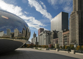
Michigan Avenue streetwall
Michigan Avenue streetwall. Chicago Tribune photo.

Similarly, what state (or the National Park Service) _isn't_ seriously disinvesting in public parks? It's a disgrace for the most part, in most cities and state, and really needs to be addressed--it's not just a problem in California. It's ironic that in some respects the formalized profession of urban planning got its start and developed around the creation of public parks such as Central Park in New York City.

Similarly/2, other state and city listings of endangered places are useful guides to people elsewhere. Preservation Chicago's list is always thought-provoking.

Labels: ,

Monday, May 19, 2008

A few things that make civic engagement difficult

#1 -- is that everyone doesn't necessarily agree, and won't, ever, making consensus impossible. This can be "property rights" vs. "community concerns," "neighborhood-serving" vs. regionally attractive retail, height issues, traffic issues, car-centricity, etc.

#2 -- people think they know everything, that X or Y or Z is "common sense" and they don't want to spend some quality upfront time learning about the issues and backstory so that they can be more knowledgeable and have a more nuanced approach to the issue at hand.

#3 -- people aren't willing to spend the time that really needs to be spent in order to work through issues. You can't "resolve" a contentious issue in a couple hours...

------
I have spent some time in some community planning iniatitives in different parts of the city recently, and besides the fact that I am still learning how to be a "facilitator" and so I could be a lot better than I probably am, the fact is that #1, #2, and #3 makes it an unfun process.

Labels: ,

Thursday, May 15, 2008

Special membership prices for WABA for Bike to Work Day/Month

Since 1972 WABA has been fighting for the rights of cyclists throughout the DC area. We'd like to thank you for your particiaption in this event by offering you $10 off a one year WABA membeship. We heavliy rely upon the generosity of our members and supporters to advocate for better bicycling ghout the Washington region. Join today for only $25>>
MOM_No28_woo-covergirl.jpg
The True Story of an Adult Bicycle Beginner

Labels: ,

Monday, May 05, 2008

Walk this way...

From "JANE'S WALK: In praise of the lost art of strolling," in the Toronto Star:

... As much as anything, he realized, walking defines us. It is one of the things that make us what we are. Unlike running, marching, crawling, hopping, skipping, jogging, walking is essential; left foot, right foot, left foot ... And so it is a measure of how far removed we have grown from ourselves that many of us now see walking as extraneous. It is viewed as a kind of hobby, a pastime, a luxury, certainly not essential, and definitely not a means of transportation.

Indeed, we have reached a point where we classify ourselves according to whether we walk or drive. Thus we are either drivers or pedestrians. Because walking is not considered necessary, we give precedence to those who travel in cars and trucks. From their perspective, people who walk are obstacles, in the way.

As the French realized 150 years ago, walking – specifically urban walking – is about much more than getting from one place to another. It is a mode of being, a way of relating, of existing in the world. The mere act of going out onto the street opens up a whole set of possibilities that lie at the heart of urban life.
--------
Fred Kent (PPS) says "When you design for cars and traffic, you get more cars and traffic. When you design for places and people, you get places and people.”

See "Impresario of the Village Green" from the New York Times.

Labels:

Saturday, March 22, 2008

Imagine your local newspaper seeking citizen ideas for urban redesign...

(Note to Washington Post...)

The Seattle Times is doing it. See "Design your own Seattle Center." The page includes a number of site plans as created and written up by readers.

You could argue that this is a takeoff of the Project for Public Spaces "place game" where groups work together on "urban design and placemaking" approaches to making their nieghborhoods and communities better.

Labels:

Friday, February 01, 2008

A great piece on why one way streets can be real problems

"Time to end one-way thinking," by Matt Hanka and John Gilderbloom, from the Louisville Courier-Journal.

In response to the piece from the paper, Jackie Green wrote to Professor Gilderbloom:

Cars and trucks killed 23 pedestrians in Jeff County in 2007. Two way streets are slower.

Slower is safer. Mine is a vote for 2-way streets. In the words of Barry Zalph: downtown Louisville has a damnable random mix of 1- and 2-way streets, making it very difficult to navigate unless you have the streets and their directions memorized. It is frustrating for a visitor to know that a destination is within a short distance but to have no idea how to get there by car or bicycle because of an irrational street network. More importantly, drivers inexperienced with the lack of a Louiville street pattern make the current Louisville downtown street grid needlessly dangerous. It might be wiser to see the downtown street grid reconfigured into some orderly pattern, e.g., ALL streets 2-way, or all E-W streets 1-way with all N-S streets 2-way, - some pattern that an ordinary driver could easily memorize.

In favor of 2-way over 1-way:

1) 2-way reduce temptation for bicyclists to ride against traffic on 1-way streets to avoid going 2 or more blocks out of their way.
2) 2-way reduce the distance motorists and right-way cyclists need to travel between nearby points, because 1-way streets often force users to go blocks out of their way to find streets going in the appropriate direction.
3) A left-turning bicyclist on a 2-lane, 2-way street does not need to cross multiple lanes of overtaking traffic to position him- or herself for the left turn.

In favor of 1-way over 2-way:

1) On a multi-lane 1-way street, a bicyclist can almost always occupy a full lane without delaying motorists at all. I choose one-way streets for almost all of my downtown riding for that reason.
2) A bicyclist or motorist making a left turn from a 1-way street never needs to stop in the middle of moving traffic on both sides to wait for an opportunity to make the turn. Once you merge into the left lane, you're good to go. Slower is safer.

Make them all 2-way.

Labels: , , ,

Friday, December 07, 2007

Economic returns from getting rid of freeways

From "Lessons of Boston's Big Dig: America's most ambitious infrastructure project inspired engineering marvels and colossal mismanagement...The Big Dig's story is an invaluable lesson: How can America invest in infrastructure and do it smart?" in City Journal:

Investors and residents are responding positively to the infrastructure improvement. As the Boston Globe reported in 2004, commercial properties along the old Artery increased in value by 79 percent in 15 years, nearly double the citywide increase of 41 percent. Owners have reconfigured buildings to open views where they once bricked up windows, and are renovating property in other newly accessible parts of Boston. The North End’s Italian restaurants are putting sidewalk cafés where they once hid from the Artery. The North End won’t be the North End of 1950, though, just because the Artery is gone. “The Artery preserved us,” says Fredda Hollander, a longtime resident. Tourists and well-heeled potential residents once put off by the physical and psychological barrier now happily wander over from other parts of the city, pushing up both commercial and residential prices.

Labels: ,

Saturday, December 01, 2007

Condo-fication

Christopher Hume, urban design writer for the Toronto Star, makes the point that:

So far, the transformation has been handled with mixed success; rather than integrate the new projects into the city, we have been content to plunk them down willy-nilly. Architectural issues aside, the more pressing questions are those of planning. We need to create the infrastructure that can support this development, and even enhance it.

That means paying attention to the spaces between buildings, as well as buildings themselves. It also means ensuring connections, adding new blocks and extending the street grid. To be fair, the city has made some effort; Bremner Blvd. now extends west from the Air Canada Centre past the CN Tower and it's not surprising it has already become the site of several condo schemes.

Given the proximity to Union Station and the subway, the advent of these residential projects is very sensible. But surrounded by the Gardiner Expressway, Lake Shore Blvd. and the whole downtown traffic network, the area will have a hard time becoming the kind of urban village we find so appealing.

Then there's the architecture itself, which too often seems to have come out of the box – devoid of originality or basic individuality. This isn't true of everything we've seen, but given the height of some of what's been built and the fact these towers are landmarks whether or not they're worthy of attention, the need for better design is more critical than ever.
------
While Tortti Gallas is capable of great work, I think the point of desiring better design could apply equally to their proposal for a mixed use primarily multiunit housing building at 8th and H Streets NE. See this post from Frozen Tropics.

Labels: ,

Tuesday, August 07, 2007

What Makes a Neighborhood Great?

The latest issue of the Project for Public Spaces online newsletter is about neighborhoods. The title of this blog entry comes from a specific article.

Labels: ,