Rebuilding Place in the Urban Space

"A community’s physical form, rather than its land uses, is its most intrinsic and enduring characteristic." [Katz, EPA] This blog focuses on place and placemaking and all that makes it work--historic preservation, urban design, transportation, asset-based community development, arts & cultural development, commercial district revitalization, tourism & destination development, and quality of life advocacy--along with doses of civic engagement and good governance watchdogging.

Tuesday, May 19, 2026

A treeless expanse of 1700 South on Salt Lake City's west side | We need "Safe Routes to Parks" and "Nice Routes to Parks" initiatives

For her first term, Mayor Mendenhall ran on a platform including planting lots of trees, especially on the West Side of the city where the population is a preponderance of people of color, and there is the belief that the area was systematically disinvested (I happen to think it's more complicated than that, but that's another conversation-blog entry).  

The city aims to address this disparity by making the area preferred for new public investments in infrastructure.

The unexpected agenda imposed by real time and ever changing conditions like a massive windstorm, earthquake, and covid pushed that aside.  

But a street like this shows the need is still present.

The street is now the main route to a new regional park in West Side's Glendale neighborhood.

We don't plan for this because all government agencies tend to plan only for elements that it controls directly and the roads outside of a park are a transportation department's responsibility.  But as I said when I worked for a County, if we don't tell other agencies what we want, think, or have learned wrt intergovernmental matters, they won't ever know what we want.

Being out and about a couple weeks ago I realized a particular street is a main route in and out of Sugar House Park, especially for bicycles, but without a "Safe Routes to Parks" and a "Nice Routes to Parks" program we don't think about it enough.  And Departments of Transportation rarely think about it--although in Salt Lake the City has built nice enhanced bike lanes next to two parks.   But.... they don't think much about further enhancing decent enough crosswalks.

900 South next to Liberty Park.

900 East next to Fairmont Park.

Crosswalk on 900 West connecting to Three Creeks Confluence Parks.

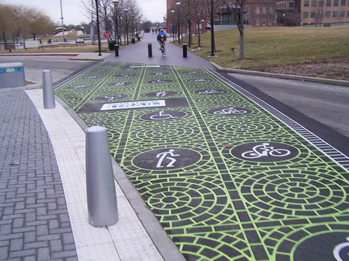
Enhanced crosswalk for bicyclists and pedestrians on the Indianapolis Cultural Trail.

WRT Sugar House Park I do have plans to try to recapture elements of the eastbound side of 2100 South with a similar lane to Liberty Park, but with big additions of median plantings, plant-themed bus shelters, and a public art treatment of the main intersection into the Park.  

Top:  Median and main intersection into Sugar House Park
Middle:  Median plantings near Red Butte Gardens, Salt Lake
Bottom: Crosswalk in San Isidro, Lima (Perú) 2018 by Carlos Cruz-Diez, Venezuelan artist

It would be complemented by a new entry into the Park with dynamic signage.

1700 South to and from the new Glendale Regional Park deserves a similar treatment.

ESPECIALLY, because it abuts the Jordan River Parkway, which is the trail alongside the River (Blueprint Jordan River Action Plan).  

It's a multicounty trail that goes from Provo in Utah County, through Salt Lake County, and ending in Davis County for a total of 48 miles.  But it connects to the Legacy Trail which then connects to the Denver and Rio Grade Trail ("Denver and Rio Grande Rail Trail in Davis County, Utah: a great foundation, full of (missed) opportunity"), adding an additional 35 miles.  How cool is it that you can move over 80 miles from Provo to Ogden mostly on protected trails!.

Right now there is no integration between the two parks, but that seems to be slated for a later phase. I still have to read the Glendale Regional Park Master Plan ("Pool? Pickleball? Skating? Basketball? Here’s what SLC’s big new park will have," Salt Lake Tribune).  

There is the Exchange Club Marina for launching canoes and kayaks but it seems decrepit and unused.  It could be replaced and enhanced with equipment for rent, even paddle boats.

And there could be a nature center of some sort like the one by Tracy Aviary at 3900 South and the River in the City of South Salt Lake (Vision).

I guess there are plans to revive the decrepit marina, offer kayak rentals and such.  At that point, the River is wide enough.

On Saturday I took this photo there, on the Jordan River section.  

There was also a feral but cute black cat on the west bank, but I wasn't fast enough to photograph it before it snuck away through the plantings.

Labels: , , , , ,

Monday, February 10, 2025

Donald Shoup, professor famed for his innovations in parking policy, dies

Donald Shoup, a professor at UCLA, is best known for his magnum opus, The High Cost of Free Parking, and his work on more careful charging for parking as a way to better use scarce resources, and to use the revenues for community improvements.  The basic points:

  1. Parking cash-out. [Allows a developer to not include parking on site in return for a cash payment]
  2. Eliminate requirements that force real estate developers to accommodate a minimum number of parking spaces per construction project, a practice that Shoup viewed almost as “an established religion” in the planning profession. 
  3. Charge drivers for parking on city streets and in city lots, setting the price to ensure one or two open spaces on every block. 
  4. Make the practice of paying for parking politically popular by dedicating the revenue to additional public services. “So, if anybody puts a dollar in a parking meter, it comes right out the other side to clean the sidewalk or repair the street or plant trees,” Shoup explained.  ("Long road to success," UCLA webpage)

-- original journal article from 1997
-- full text book on Dropbox
-- preface from the book
-- Parking Reform Network
-- "Donald Shoup Wasn't Just About Parking. He Was About The Economics Of Public Goods," California Planning and Development Report

I crossed paths with him in person only once, when he participated in a DC "Great Streets" conference, where under then DDOT director Dan Tangherlini, they aimed to foster urban revitalization through streetscape improvements.

He addressed parking as a public good for a long time...

We were also on the same e-list, and I interacted with him on a couple issues.

Photo: Robert Gauthier, Los Angeles Times.

On transportation demand management and stadiums and arenas, basically free transit access with ticket.

And sidewalk networks and improvements--he advocated that when a house was sold, if it didn't have a sidewalk or the sidewalk was in desperate need of repair, it should be replaced at that time, or that if repaired earlier, postponing payment until sale which he called "pay on exit" ("How L.A. can fix our scary sidewalks for the Olympics," Los Angeles Times).

I'm sure he was a thought leader involved in other urban planning matters too.

He will be missed.

Labels: , , , ,

Tuesday, July 21, 2020

Interesting idea from Professor Donald Shoup about how to improve house-fronting public spaces

UCLA planning professor Donald Shoup, best known to the more general but planning knowledgeable public for his book The High Cost for Free Parking and his consultation with many communities, starting in Pasadena, on parking, transportation, and commercial district revitalization, wrote this post below in a discussion on the pro-urb e-list. (Reprinted with permission.)

[Interestingly, here, I write that cities should take on the financial responsibility for sidewalks, "A walking (or sustainable mobility prioritized) city should take responsibility for constructing sidewalks, 2016." But this offers a different approach.]

From Professor Shoup:
Most cities need safer sidewalks and more street trees, but many cities can’t or don’t want to pay for them.

One way to solve the finance problem is to require property owners to repair any broken sidewalk or plant any missing street tree in front of their property before they sell the property. This pay-on-exit policy systematically improves all streetscapes in a surprisingly short time at no cost to taxpayers. Owners who sell their property and leave the neighborhood make all the public improvements.

-- "Op-Ed: A big step toward safer sidewalks," Los Angeles Times, 2014
-- "Let a Tree Grow in L.A.," Los Angeles Times, 1996
-- "Fixing Broken Sidwalks, Access Magazine, 2016
-- "Regulating Land Use at Sale: Public Improvement from Private Investment ," Journal of the American Planning Association, 1996
-- "Putting Cities Back On Their Feet," Journal of Urban Planning and Development, 2010
100_1723.JPG
This sidewalk has a section made of rubber, to allow for tree root upthrust.


End of Donald Shoup post.

Conclusion.  I wish that I had known about this concept--many of the articles are from the 1990s--when I was doing the Western Baltimore County Pedestrian and Bicycle Access Plan.  I would have included this as a policy recommendation.

I know for sure it would have never made it out of the internally circulated draft, but it still would have pushed the discourse forward.

Note that this idea should should be extended to include putting in sidewalks where there is a gap in the network.  Astute jurisdictions--this includes Baltimore County but not DC--add easements to lots when plans call for the construction of trails (and presumably sidewalks.
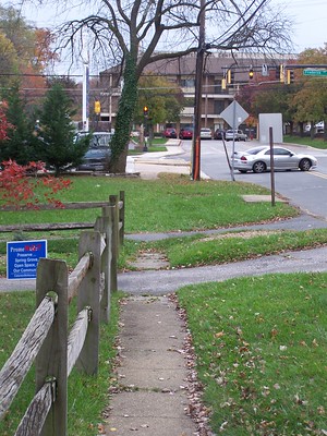
No sidewalk, Catonsville

No sidewalk, Catonsville
Catonsville, Baltimore County, Maryland.


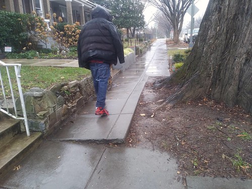
Crumbling sidewalk, 1800 East 1700 South, Salt Lake City
Salt Lake City

That way when they properties get developed, the trail/sidewalk can be added when it's constructed.  (Although typically they provide outs for the developer to avoid doing this.)

But usually this is for commercial properties and large tract new developments, not individual residential properties.


July 26th is the 30th Anniversary of the Americans for Disability Act

Note that this post is pretty timely because this week is the 30th anniversary of when the Americans for Disability Act went into effect. See "Building Accessibility Into America, Literally," New York Times.

Labels: , , , , , , , ,

Wednesday, July 01, 2020

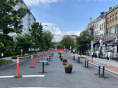
Revisiting pedestrianizing the 1500 block of 19th Street NW in Dupont Circle

Recently, the entry "" discusses how to make pedestrian and bicycling right of way expansions in the wake of the coronavirus a more permanent condition.

In 2019, the entry "Planning urban design improvements at the neighborhood scale: Dupont Circle, DC," discusses a systematic program for urban design improvements in and around Dupont Circle.  It was an outgrowth of my Purple Line series-thinking, although it took me a couple years to get around to writing about it.
One of the recommendations, Item #5, was pedestrianizing the 1500 block of 19th Street NW, which is the block with the Dupont Plaza Hotel on the east and the block of businesses on Connecticut--many have rear entrances, anchored by Kramerbooks and Afterwords Cafe, the combined bookstore-cafe that is open 24 hours on weekends (in normal times) and a very busy Starbucks.

5. Make 19th St. between the Circle and Q Street a permanent pedestrian street
(but with access for deliveries.)

Joe Flood, via Flickr, shares with us his photo of this block, set up for expanded restaurant patio service.
Untitled

I made a similar recommendation, starting with weekends, for 17th Street:

6. Make 17th Street between P and R Streets a pedestrian district on weekends.


17th Street NW, Dupont Circle

And from an update standpoint, instead DDOT and the Washington Area Bicyclists Association, is pushing the addition of a cycletrack to 17th Street, which would get in the way of pedestrianizing it.

Given the pedestrian volume in the area, and the need for this commercial street section to have a positioning that is more distinct vis a vis neighboring 14th Street and Dupont Circle as a way for its establishments to be more competitive, emphasizing and strengthening its pedestrian character should be prioritized over cycling--especially given nearby parallel routes, and let's face it, relatively low volumes of bicyclists.

In the past I've suggested that WABA reposition from a cyclist-exclusive orientation to a more expansive "sustainable mobility" agenda like Transportation Alternatives in NYC and Active Transportation Alliance in Chicago (formerly the Chicago Bicyclists Federation), they haven't done so.

So there isn't a good pedestrian advocacy group in the city--robust examples elsewhere include Feet First in Seattle, Starkville in Motion in Mississippi (although they do biking too), Walk Boston and Walk Denver--and therefore in DC the pedestrian agenda can too often be neglected.

Labels: , , , , , , ,

Wednesday, December 05, 2018

President George H.W. Bush

Yes, it bothers me that when past presidents die, most of the media coverage is hagiography and glosses over the bad stuff.  Such is the case with President George H.W. Bush, who among other things used highly racist campaign message and was involved, somehow, with the Iran-Contra affair.

There are some pieces out there saying that yes, President Bush was a gracious person, but that's not enough.

-- "The Media Got George HW Bush Wrong in Life and Death," New Yorker
-- "The Ignored Legacy of George H.W. Bush: War Crimes, Racism, and Obstruction of Justice," The Intercept

WRT transportation, mobility and accessibility, his administration wasn't against transit, the way the current Republican administration is, and he signed the Americans for Disabilities Act, which among other elements, requires that public spaces including streets, sidewalks, and transit, be accessible to the disabled.

-- Introduction to the ADA, ADA.Gov website
-- "Remarks of President George Bush at the Signing of the Americans with Disabilities Act," Equal Employment Opportunity Commission
-- Accessibility, US Department of Transportation

It turns out too that accessibility is helpful to everybody.  People with packages, people crossing streets, bicyclists, people pushing strollers, etc.

While most communities have made progress with this in terms of the sidewalk network, not all transit agencies have, including the New York City Subway system.

Sidewalk uplift, Kansas Avenue NWSidewalk uplift on Kansas Avenue NW.

Although communities may still miss important aspects.

For example, DC has an extensive program making sidewalks at intersections accessible (a lot of this is upgrading already existing ramps), but for the most part, doesn't address mid-block sidewalk problems, even when doing projects in close proximity.

I think that simultaneously, cities should prioritize mid-block repairs as well as intersection upgrades.

Labels: , , , ,

Tuesday, February 21, 2017

Custom decorative concrete developed by Aggregate Industries brings hockey imagery to life in sidewalk and square pavements at the Boston Bruins practice facility (Warrior Ice Arena)

1. Aggregate Industries is a multi-site concrete manufacturer. One of their plants is on Fort Totten Drive NE in Washington, DC, on the west of the CSX Metropolitan Branch railroad/eastern leg of the Metrorail Red Line.

2. I believe in utilizing opportunities for urban design treatments, public art, and aesthetics presented by "transportation infrastructure," in this case concrete for sidewalks and plazas, to promote placemaking and atractive public spaces. See "Ricardo Burle Marx streetscape treatments."

3.  WRT the project discussed below, the practice facility for the Boston Bruins hockey team, the Warrior Ice Arena ("Bruins unveil dazzling Warrior Ice Arena in Brighton," Boston Globe), is part of a mixed use development called Boston Landing in the Brighton neighborhood of Boston.

Boston Landing will include a new MBTA commuter rail station, office and residential buildings, and retail.  The Ice Arena complex includes other athletic facilities including a gym, indoor track, and an outdoor park. The Boston Celtics basketball team will also be building their practice facility in the development ("Celtics break ground on new practice facility," BG).

The athletic shoe manufacturer New Balance (also a sponsor of the Hubway Bicycle Sharing system) has their headquarters at Boston Landing ("New Balance opens new world headquarters at Boston Landing," BG).  The development agreement includes NB's title sponsorship of the arena, and partial funding for the rail station.  They've also opened a flagship/concept store featuring their products.

======================================================
From a press release from Aggregate Industries and LafargeHolcim:


When the Warrior Ice Arena was built, the architect wanted to bring the imagery of hockey from the interior to the exterior of the complex. With a landmark 68-foot-high hockey stick, the new 75,000-square-foot practice complex of the Boston Bruins hockey team includes an ice rink with seating for 660 fans, a lobby featuring displays of Bruins accomplishments, a modern locker suite and team lounge and expansive training and weight rooms. Aggregate Industries US (AIUS), a subsidiary of LafargeHolcim Ltd., designed and developed the product that allowed the vision to come to life.

To achieve the aesthetic and LEED-certification goals of the project, AIUS created custom-designed mixes of its Artevia® brand of decorative concretes that contained unique colors, aggregates and textures, as well as treatments to reduce the urban heat island effect.

The Warrior Ice Arena hardscape was awarded the Scofield Decorative Concrete Award during the 2017 World of Concrete show in Las Vegas, Nevada for its creative and sustainable sidewalks and courtyards.

“We’re proud to have played a part of this project which, for Boston, is closely tied to our passion for sports,” said René Marais, Ready Mix sales manager for the Northeast Region of Aggregate Industries US. “The hockey imagery concepts for the arena’s main entrance were very detailed and creative. For example, the curvature lines by the hockey stick reflect the lines a player makes when he cuts hard on the ice, and the additional exposed white stones illustrate ice shavings kicked over by the skating blade.”

To achieve the design goals for the hardscape, AIUS developed Artevia® Color and Artevia® Exposed samples with white and gray cement. The specialized concrete mix incorporated an integral coloring admixture from L. M. Scofield Company to create vibrant solar-reflective colors that conform to LEED 2009 requirements for reducing the urban heat island effect.

This cool pavement technology helps keep concrete temperatures lower and provides a high solar reflective index value that qualifies the Warrior Ice Arena for a credit under the sustainable sites section of LEED.

AIUS also collaborated with Massachusetts-based Triad Associates, Inc. to produce mockup panels to ensure alignment with the design the customer intended. Due to uniform aesthetics and consistency, the finished decorative hardscape included Artevia® Color and Artevia® Exposed aggregate concretes, which combined design flexibility and strong visual appeal with low maintenance and durability. The Artevia® Color concrete, with onyx black and custom gray alternating strips, was placed at street level, while the Artevia® Exposed concrete, with colored stones and glass, was used for the elevated 2,000-square-foot courtyard.

“The vibrant color and textured effects of our Artevia® concrete enabled the architects to create visually stimulating and architecturally exceptional hardscape that is built to last,” commented Marais.

“All this landscaping creativity helps make the Warrior Ice Arena a unique, desirable and a pleasant place to visit and watch Boston Bruins hockey.”

Labels: , , , , , , ,

Friday, June 17, 2016

Ricardo Burle Marx streetscape treatments

Because there is a retrospective of the work of modernist landscape designer Ricardo Burle Marx at the Jewish Museum in NYC, there has been a lot of coverage of the exhibit in the national arts press.

Most of the articles included a photograph of his signature public space work, the tiled sidewalks of Avenida Atlântica along Copacabana Beach in Rio de Janeiro in Brazil, dating to 1970.


In 1988, he was commissioned to do a similar treatment for Biscayne Boulevard in Miami ("Brazilian Burle Marx Celebrated in Miami for his Streetscape Design," Passport Miami).


Talk about an incredible example of "transportation infrastructure as an element of civic architecture."

I don't know much about the history of using tile and decorative treatments in sidewalks and plazas in Brazil, but it derives from similar treatments in Portugal called Calçada Portuguesa (Portuguese Pavement Art), which according to the humanscaled blog, dates to 1842.


Labels: , , , , , ,

Friday, February 19, 2016

A walking (or sustainable mobility prioritized) city should take responsibility for constructing sidewalks

Samantha Powell and her children, Ford, 5, and Chloe, 7, walk between sections of sidewalk during their daily trek to Cory Elementary School on Thursday. Powell says the inconsistency of sidewalks in the neighborhood has her and her children crossing the street at intersections that don't have crosswalks and going through the alleyway behind their home just to make the roughly three-block trip each day. (Aaron Ontiveroz, The Denver Post)


In a majority of jurisdictions, property owners are responsible for paying for sidewalks, because the sidewalk is considered an improvement that primarily benefits the property owner.

However in the biggest cities, usually, the city government is responsible.

Denver must not be a big city.

According to the Denver Post ("Denver residents push city to take charge of needed sidewalk fixes") in some neighborhoods, residents are calling on the city to take responsibility for installing sidewalks in the gaps that exist, rather than waiting on individual property owners. From the article:
The neighborhood is among several pockets of the fast-growing city, including both working-class and well-to-do areas, that still lack sidewalks along hundreds of miles of streets. Elsewhere, pedestrians in places with aging sidewalk networks — from downtown to the Capitol Hill neighborhood and most older areas — often face cracked or disjointed pavement and stone walks.

This bus stop near Madison Street and Martin Luther King Boulevard has no sidewalk. Denver leaves the responsibility and liability to adjacent property owners for maintaining and building sidewalks, which has many neighborhoods lacking consistent walkways. (Patrick Traylor, The Denver Post)

Neighborhood and walking advocates and City Council members point the finger for both problems at a decades-old city ordinance that makes adjacent property owners responsible for building and maintaining sidewalks. The result has been widespread deterioration, minimal city enforcement unless people file complaints and frustration from homeowners who often can't afford needed fixes.

But appeals from the advocacy group WalkDenver and residents across the city are gaining new traction at city hall. Officials have resisted big changes in the past, in part because of concerns over liability and costs that potentially could run into the hundreds of millions of dollars.

"There's simply no way to get from A to B without being in the middle of the street at some point," said Powell ...
For communities with Vision Zero agendas, like Denver ("Denver working toward zero traffic-related deaths," DP), as much attention needs to be paid to extending the infrastructure for sustainable mobility--walking, biking, transit--and strengthening the urban design around "Walking City"/"Transit City" spatial conditions, as will be spent on dealing with motor vehicles. (To its credit, Denver's Vision Zero agenda will focus on improving physical infrastructure.)

This is complementary to the "Maintenance of Way" argument about rebalancing priorities for "street" maintenance to include pedestrians and transit users.

Probably the solution would be to do a bond referendum, with the money to be used for eliminating gaps in the sidewalk network as well as other improvements to the sustainable mobility infrastructure. From the article:
Writ large, Public Works estimates that concrete costs alone to build sidewalks where they're missing could run from $50 million to $75 million — before considering expenses to relocate utilities, regrade land and buy strips of land where the city doesn't already have right of way.

Unlike some smaller suburban neighbors, including Westminster and Englewood, Denver doesn't assess homeowners a regular fee of some kind to pay for sidewalk maintenance. Instead, the city tackles the sidewalk problem selectively, leaving most of the problem alone and springing for new ones when money becomes available, with a focus on transit corridors and school routes.

Meanwhile, city parks and golf courses often lack sidewalks along their perimeters. Bus stops are planted in the dirt or grass, and riders trudge what advocates call "desire lines" into the ground leading to them. Along major transit routes, including Sheridan and Colorado boulevards, there still are notable stretches lacking sidewalks.
Being able to successfully win bonding referendums to improve streets, sidewalks, biking environments, and transit connections is the point of my "Signature Streets" concept, which positions sustainable mobility as a key element of a community's infrastructure, brands it, and uses the brand and position to justify and win the vote on bond referenda to pay for it.

=====
As an aside, I've found one of the reservations by property owners in snowy climes to adding sidewalks is that they don't want the responsibility for snow clearance.  It is possible to set up systems, like in Rochester, New York, to clear neighborhood sidewalks in a systematic way at a relatively low cost.  Rochester does this only for snowfalls greater than 4 inches.

When it snows 4 inches or more, residents are only responsible for clearing sidewalks and driveways on their property, and digging out their cars if they are on the street.  But they are also responsible for snow shoveling "public" sidewalks when the snowfall is less than 4 inches.

Note too that WalkDenver is likely a community organization we need to pay more attention to as an example of national best practice examples.  Check out this infographic on the West Colfax neighborhood, calling attention to gaps in sidewalk network there.

-- West Colfax Walk Audit final report

Labels: , , , , ,

Tuesday, April 16, 2013

Waste in not using products for the normal "useful" life: sidewalks and trash cans

One of the things that bugs the s*** out of me is the replacement of sidewalks that have 5 to 15 more years of useful life (along with the installation of sidewalk across the planting strip, presumably to serve cars and people walking between the planting strip and sidewalk but it is impossible to get a parking spot immediately at that point, so instead it makes a bit more of the landscape impervious).

Note that the idea of maximizing the use of a product during its useful life is the whole point of "collaborative consumption."

Dirt alley on the 6200 block of 3rd Street NW with serious run off problemsLast fall I pointed out to my Councilmember, now a candidate for Mayor, that this alley (left) on the 6200 block of 3rd Street NW is a prime candidate for the city's "Green Alley" program.  I never got a response.  Meanwhile, the runoff problem continues unabated.

It's a waste of public money to replace this kind of infrastructure early.  Especially when there are more pressing needs such as to put sidewalks in places where they don't exist and should, or to fix sidewalks, alleys, curbs, and roads that are in much worse condition.

There are two reasons this happens.  (1) DC allocates funds for this activity by ward, not need.  So you have to spend the money...

Sidewalk strip, Quackenbos St. NW(2) DC DOT hasn't upgraded its information systems (instead of using GIS it uses an Excel spreadsheet) to include in the master "street side" database places without sidewalks.  It only includes places with sidewalks.  So the sidewalk "replacement" program is only focused on replacement.  It doesn't focus on or prioritize the installation of so called "missing" sidewalks.

Because it is happening year after year in my neighborhood, it's at the top of mind.  Although I did just notice that on the 5900 block of Blair Road, the city did install sidewalk at the corner, replacing a narrow path asphalt strip.  That's a good thing.

But some of the residential streets coming up to Blair don't have sidewalks on either or both sides of the street and that problem isn't getting corrected.

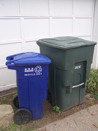
Garbage and recycling cans, DCExtending the city's wasteful replacement practices to  trash and recycling cans

The Examiner reports, in "Talking trash: D.C. begins search for the new Supercan" that the city wants to spend $10 million to replace the trash and recycling cans, because the ones that are out there are old models, some are broken, and can't be fixed.

Again, I ask, (1) why not just replace the broken cans?  (2) although potentially, you can augment the recycling cans, and give people larger ones if their usage justifies it.  Currently, the city's recycling cans are all one size.  I know it's not big enough for our household.

(Getting people to actually recycle is another issue.  Many people don't, or they don't recycle maximally.)

Just now, I went out and did a "survey" of the houses on my alley. There are 25 houses on my block with alley access and 7 without alley access. Of the 25 lots on the alley, it appeared as if there were only 2 trash cans with missing lids. And 2 buildings without any cans at all (one has been vacant, in the process of being "renovated" for going on to 5 years, and maybe the cans are in the basement, the other is a church and not eligible for city trash pickup).

 Some houses had missing recycling cans (although it is more likely the can was located elsewhere on their premises). There were four extra trash cans at three different households, one of these cans was also missing a lid.

Trash can missing a top, DCOn our block at least, new trash cans would replace more than 21 fully working cans, consigning them to a landfill, ideally recycling, or Fairfax County's waste-to-energy plant.

Only replace the cans that need replacing.

Above: my trash and recycling cans are fine, although I'd like a recycling can as big as the trash can.  Right: my neighbor across the alley (and my next door neighbor) both have trash cans without lids.  When I first moved in, my neighbor across the alley used our trash can because they didn't have one.  I did a service request for them, so they could have their own can.


A partial sidewalk on the north side of the unit block of Quackenbos Street NW
Inadequate sidewalk on the north side of the unit block of Quackenbos Street NW

No sidewalk on the south side of the unit block of Quackenbos Street NW

Replacing sidewalk and road (the road needed repair, big time) on the 700 block of Quackenbos Street NW
New sidewalks and concrete road repair, Quackenbos St. NW

Labels: , , , , , ,

Tuesday, November 13, 2012

Action Committee for Transit November meeting: pedestrian safety

From email:

We invite you to join us at the upcoming meeting of Action Committee for Transit on Tuesday, November 13, 2012 at 7:30 pm.

Please note
: Our original speaker for the November ACT meeting, Shyam Kannan, WMATA Assistant General Manager for Planning and Joint Development, had to reschedule at the last minute. We hope to reschedule him for early 2013.

Instead our program for November will be “Montgomery County doesn't want you to cross the street - three examples” with speakers:

Ed Rothblum, Vice President, Gateway Commons HOA - unmarked crosswalks on Observation Drive, Clarksburg
Miriam Schoenbaum, ACT Vice President - Route 118 and Wisteria Drive, Germantown, where a student walking to school was killed on October 30
Tracey Johnstone, ACT Secretary - Wisconsin Ave. and Stanford Street, Bethesda, in front of Trader Joe's

ACT’s monthly meetings are held at the
DHHS Silver Spring Center, 8818 Georgia Ave 20910, in the Woodside Conference Room.

----------
I hope that this meeting will spark a move forward on developing an agenda to better represent pedestrian needs generally and in the suburban setting specifically.  Recent accidents and deaths involving pedestrians in Montgomery County have sparked the program, see "Transportation Advocacy Group To Discuss Death of Germantown Teen" from Germantown Patch.

- "Two Montgomery County teens struck by car, hospitalized," Washington Post
- "Germantown Teen Dies In Accident While Walking To School," WAMU Radio
Montgomery County has a Pedestrian Safety Initiative but I don't think they have a county-wide pedestrian plan, although mobility--pedestrian, biking, transit, and motor vehicles--are covered in sector plans.

Here are some resources that would be useful for advocates working to improve conditions for walking:

- Walking Strategy, City of Toronto
- PEDSAFE: Pedestrian Safety Guide and Countermeasure Selection System
- How to Develop a Pedestrian Safety Action Plan
- Pedestrian Road Safety Audit Guidelines and Prompt Lists
- School Walk and Bike Routes: A Guide for Planning and Improving Walk and Bike to School Options for Students, State of Washington
- A Resident's Guide for Creating Safe and Walkable Communities
- Walkability audits

And good examples to learn from of best practice pro-walking advocacy include Feet First in Seattle, WalkBoston, and Starkville in Motion.  Locally, the way that Arlington County packages, delivers, and brands walking programs as "WalkArlington" is another good example.

The Pedestrian program of the Pedestrian and Bicycle Information Center is a national clearinghouse for walking promotion.

Of course, walk to school programs are a good place to start. 

Labels: , , , , , , ,

Thursday, June 14, 2012

A five foot sidewalk in a tunnel next to the light rail is a bad idea

Street crossing, Indianapolis Cultural Trail

Washcycle ("Purple Line likely to have 5-ft sidewalk through "tunnel", says MTA transportation planner") and the Examiner ("Small sidewalk possible for Purple Line tunnel under Wisconsin Ave ") report on a statement from a Maryland Transit Administration planner that perhaps a 5 foot wide sidewalk could be built in the tunnel at the proposed Bethesda light rail station.

I wrote about this general issue in February, in "Purple line and the bicycle trail conflict," and believe that a surface based alignment is an acceptable tradeoff, given far more people will be using the light rail system than they will be biking, and that the point is to promote the most good and most value for sustainable transportation overall, but also that a super high quality surface alignment that is highly visible is an important element of promoting biking as transportation (not just as recreation) as well.

But this 5 foot sidewalk proposal is a bad idea for another reason.

Federal Highway Administration guidance for both sidewalks and shared use paths wouldn't find this to be an acceptable width. If it's to be "better than nothing," maybe it's just better not to do something so inadequate and instead focus on doing something a lot better. (Like how in DC, I argue that just because a design is better than cinder block doesn't mean we should be satisfied.)

 1. FHWA recommendations for sidewalks in highly pedestrianized areas would be 8-12 feet wide. I wrote about this here, "The tension in urban sidewalk design between privatized space, public space, and suburbanizing spaces."

SIDEWALK WIDTH (from page 339 of the PEDSAFE: Pedestrian Safety Guide and Countermeasure Selection System)

The width of a sidewalk depends primarily on the number of pedestrians who are expected to use the sidewalk at a given time — high-use sidewalks should be wider than low-use sidewalks. "Street furniture" and sidewalk cafes require extra width, too. A sidewalk width of 1.5 m (5 ft) is needed for two adult pedestrians to comfortably walk side-by-side, and all sidewalks should be constructed to be at least this width. The minimum sidewalk widths for cities large and small are:

Local or collector streets ---- 1.5 m (5 ft)
Arterial or major streets ---- 1.8 to 2.4 m (6 to 8 ft)
CBD areas ---- 2.4 to 3.7 m (8 to 12 ft)*
Along parks, schools, and other major pedestrian generators ---- 2.4 to 3.0 m (8 to 10 ft)

*2.4-m (8-ft) minimum in commercial areas with a planter strip, 3.7-m (12-ft) minimum in commercial areas with no planter strip.

When I wrote the Western Baltimore County pedestrian and bicycle access plan, I tried to put in recommendations for sidewalk width based on distance from transit stations. Within 1/2 mile it should be 10-12 feet.  But all my design-specific recommendations were excised from the plan because of potential conflicts with the County DPW design manual.  Although the plan still includes recommendations that a shared use path (multi-use trail) be constructed in association with the Red Line light rail proposed for Baltimore City and Baltimore County.

 2. Speaking of FHWA, the Shared Use Path Level of Service Calculator should be the standard for determining how wide a shared use path should be generally, not just in association with light rail, such as the Purple Line alignment.  There is no way that 5 feet is recommended for high use situations.  AASHTO guidance, which I don't recommend, is a minimum of 8 feet. The recommended minimum width in the Shared Path LOS calculator is 11 feet.

Note that a 5 foot wide "sidewalk," shared with thousands of users in a constrained space, with users of a wide range of skill and experience--from toddlers to seniors, to "Lycra warriors" on bicyclists to duffers, is what I call "designing conflict in," making it likely that problems will occur.

The whole point of design, engineering, and planning is to "design conflict out," to reduce, not increase, problems and likelihood of accidents.

In any case, no state or local government agency should be allowed to construct biking and walking infrastructure that significantly deviates from standards and accepted practice and guidance.

For example, it's bad enough that local and state governments and public-private partnerships install substandard bicycle racks, that local planning and zoning guidance does not forbid such installation.

The guidance on bicycle parking from the Association for Bicycle and Pedestrian Professionals recommends that bicycle racks support bicycles at two points on the frame.  The DC DOT guidance on bicycle parking also specifically does not recommend so-called "wave" racks.

Yet DC Government agencies (and federal agencies) install such racks as a matter of course.

So many sidewalk and trail installations are already substandard, we shouldn't further substandard infrastructure by having a 5 foot sidewalk in the Bethesda Purple Line light rail station.

Instead of building new substandard infrastructure, we should be correcting the already deficient substandard infrastructure, and building new high quality infrastructure going forward.

Labels: , , , ,

Friday, June 17, 2011

Active design for buildings and places

The reason that I am focused on process redesign and systems change is because I think it makes more sense to organize places and organizations in such a fashion as to routinize the production of preferred outcomes, rather than to expect preferred outcomes to result from particularly motivated individuals or mostly by happenstance.

WRT "people", the issue is to build robustness into the system, so that the people in an organization produce the right outcomes, regardless of who is at the top.

Yesterday's presentation at the National Building Museum by Jack Robbins of Perkins + Will on active design focused on shaping the building environment through design, so that people are more physically active, which is an imperative, given the incredible, almost catastrophic rise in obesity rates, where as much as 30% of the U.S. population is now obese.

His presentation referenced a number of interesting studies (I'll post a link when the presentation is up).

I didn't realize it, but he was one of the leaders of the effort that produced New York City's Active Design Guidelines, which I have written about before (and has been added to the right sidebar).

The guidelines are provided at two different scales: for buildings and individual spaces; and at the scale of neighborhoods.

He also mentioned the New York City Pedestrian Level of Service Study. The standard pedestrian LOS in the Highway Capacity Manual is a straight scale where less people on a sidewalk is rated more highly than more people. NYC argues that this is too simplistic of a measure, and that lightly populated sidewalks may in fact be a sign of poorly functioning places, rather than highly functioning places. Part One of the study includes a great literature review. Part Two will generate a new method for calculating Pedestrian LOS.

Labels: , , ,

Tuesday, December 22, 2009

More on snow removal

100_0293.JPG
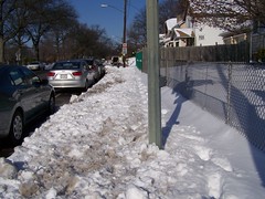
Mother carrying stroller w/baby because the uneven removal of snow made rolling the stroller impossible on Bradley Boulevard in Bethesda, Maryland.

1. Residents with corner lots have the "burden" of needing to shovel snow on two faces. It's a big responsibility. But it comes with the property. Too many people shirk this responsibility.
100_0244.JPG
The front walk of the house on Sheridan Street at 3rd Street NW.

100_0245.JPG
The sidewalk on the 3rd Street side of the house.

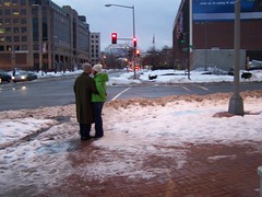
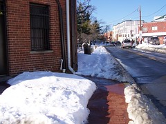
Yesterday, after business at my bank, because the weather was so nice, I decided to walk from Bethesda to Friendship Heights, along the west side of Wisconsin Avenue. There were many examples of people shoveling their front walk and shirking their responsibilities on the Wisconsin Avenue side of their properties. Of course, this is also a problem in Takoma DC and Manor Park, as I discovered walking to the subway station yesterday.

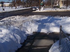
2. Similarly, residents with corner properties ought to shovel a path from the sidewalk to the street. (I used to do this when I lived on Capitol Hill.)
100_0242.JPG
Northeast corner of 3rd Street and North Dakota Avenue NW. (The corner building is an apartment building managed by the Barac Company.)

3. Or if they live next to a mid block alley they should shovel a path across the alley to the next house. (I used to do this when I lived in the H Street neighborhood.)
100_0370.JPG
400 block of Rittenhouse Street NW.

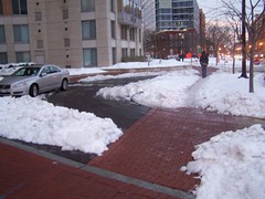
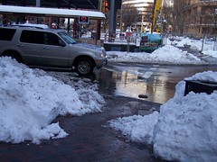
4. Commercial districts need to plan better for snow removal. Especially at intersections.
100_0344.JPG
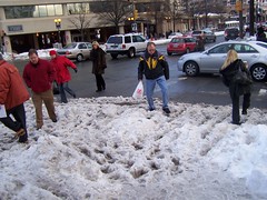
6th and Massachusetts Avenue NW, northeast corner.

100_0317.JPG
Wisconsin Avenue, Friendship Heights, Maryland, adjacent to the M&T Bank.

5. And it occurs to me that it might be as part of "Transportation demand management planning" that businesses might be required to demonstrate that they have snow removal plans because when they don't, it can create traffic problems.

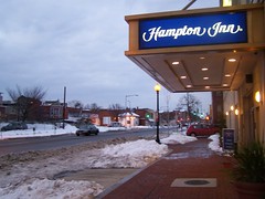
For example, I was "impressed" that the Hampton Inn at the corner of Massachusetts Avenue and 6th Street NW did not clear the snow in front of their entrance, where there is a lane for cars to load and unload. So instead of guests stopping in front of the hotel to drop off their luggage, they pulled into the entranceway for the garage to drop their luggage off on the sidewalk, blocking the sidewalk for pedestrians, and for other cars going into and out of the garage.
100_0347.JPG

And why wouldn't apartment-condominium buildings like 555 Massachusetts Avenue deem it important to clear the snow from their driveway for cars, but not from the sidewalk in front of their building?
100_0346.JPG
Unshoveled front sidewalk, 555 Massachusetts Avenue NW.

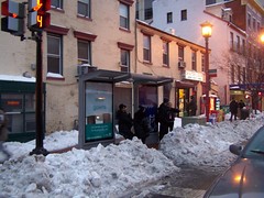
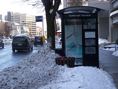
6. And just like there are Walk to School zones, there should be snow removal plans for "Walk to School" and "Walk to Transit" zones, including bus stops. Note that this seems to be a problem throughout the region, in Montgomery County, Baltimore City, and Baltimore County too, not just DC.
100_0339.JPG
Bus stop at 6th and H Streets NW, southwest corner.

100_0312.JPG
RideOn bus stop on Wisconsin Avenue in Friendship Heights, Maryland.

7. And instead of WMATA having to shut down bus service, I have wondered for quite some time why bus routes are not designated high priority for snow removal, in order to maintain service? See the Examiner story, "Metro pulled back in weekend storm, after 2003 mistakes." From the article:

Shortly before noon Saturday, the agency decided to halt buses and rail service to its aboveground stations by 1 p.m. "We could not wait any longer because we could see the weather was getting worse," Taubenkibel said. Buses are at the mercy of how well the roads are plowed. About 17 buses were stuck and 21 were in accidents as of 1:30 p.m., he said.

8. And in DC, the Department of Public Works, which sends out plenty of mail to DC households over the course of the year, ought to develop a brochure on the responsibilities of property owners and renters for snow removal, and send that out to households and other property owners in advance of the winter season.

As an example, check out this one page pdf from Douglas County, Colorado

9. Although responsibilities for snow removal for the DC Government ought not to stop at the roads. Many sidewalks along school and park properties tend not to be shoveled.
100_0251.JPG
Such as the corner park at Blair Road and 4th Street NW.

10. And we need to think about drainage issues (rain and snow related) as they relate to comfortable walking environments. Note the gutter downspout in this photograph. The water comes out of this spout and sprays out onto the sidewalk, creating the potential for dangerous, slippery conditions--such as this morning--when the water freezes and ices up the sidewalk.

I have been thinking about this for a bit, since seeing this article, "Sloppy Bloor St. corners tough on pedestrians," in the Toronto Star, and this intersection in Bethesda yesterday...
100_0273.JPG

These issues will be covered in the bicycle and pedestrian plan that I am working on at present, for a county in the Baltimore region.

Labels: , ,