Rebuilding Place in the Urban Space

"A community’s physical form, rather than its land uses, is its most intrinsic and enduring characteristic." [Katz, EPA] This blog focuses on place and placemaking and all that makes it work--historic preservation, urban design, transportation, asset-based community development, arts & cultural development, commercial district revitalization, tourism & destination development, and quality of life advocacy--along with doses of civic engagement and good governance watchdogging.

Monday, February 17, 2020

I don't understand why this wasn't done before they started constructing the Purple Line light rail

Business open during constructionLiz O. Baylen / Los Angeles Times. DISCUSSION: Construction inspector John J. Lowry III discusses the Gold Line project with business owner Victor Duran (2007).

The Purple Line is a light rail program in Suburban Maryland's Prince George's and Montgomery Counties.

According to an Action Alert from the advocacy group Purple Line Now:
We wanted to alert you to HB 540, a bill that Delegate Jheanelle Wilkins (Montgomery County, District 20) has introduced regarding the State Income and Property Tax Credits – Purple Line Construction Zone.

The House Ways and Means Committee will hear the bill THIS Thursday, February 20, at 1 pm.

The bill allows “certain qualified businesses impacted by the construction of the Purple Line light rail project in Montgomery County and Prince George's County a credit against the State income tax and State property tax; requiring the Department of Transportation to determine the eligible amount of the income tax credit; making the income tax credit refundable; requiring the Department to administer the income tax credit; requiring the Department to make determinations and implement processes relevant to certifying qualified businesses.”
It's a massive failure to not build in programs like this during the planning phase--pre-construction--of transit infrastructure programs. Typically, it's been done for highway construction programs for decades.  And it's not like people in the industry don't know this is going to come up.

-- "Analyzing Effects of Highway Rehabilitation on Businesses," Transportation Research Record, 1993
-- "Gold Line work upsets East L.A. merchants," Los Angeles Times, 2007
-- "7 Tips for When Road Construction Affects Your Business," Inc Magazine
-- Mitigating Construction Impacts on Local Businesses, MnDOT
-- Mitigation of Transportation Construction Impacts on Business, City of Tucson
-- "How to Keep Construction from Killing Businesses," Governing Magazine. 2014

Instead of being reactive once people start complaining, be proactive.

Labels: , , ,

Saturday, June 01, 2019

Shareable pogo sticks: an indicator that micromobility has "jumped the shark" | Pedestrian Road Design/Signature Streets

Jumping the shark is a term invented by Hollywood to describe a moment in a tv show that indicates the show is on its downward spiral and soon to be cancelled.  There was a Happy Days episode where Fonzie was waterskiing? and he jumped over a shark.

Micromobility is the term coined to describe/re-term "new" and old modes that support transit and are sustainable but "individually operated" including bicycling; dockless shared bicycles; dock-based bicycle sharing; electric bicycles; scooters both stand up and sit down; wheels and hoverboards; skateboards; and now pogo sticks.

-- THE MICRO-MOBILITY REVOLUTION: THE INTRODUCTION AND ADOPTION OF ELECTRIC SCOOTERS IN THE UNITED STATES, Populous

While I rue that to most people, bicycles are toys, the fact is that pogo sticks are toys, and shouldn't be considered a realistic and practical transportation mode.

But that doesn't stop "visionaries" and the sloshing around of capital able to fund them.

AFP photo.

According to Local France ("Dockless pogo sticks could be joining scooters on streets of Paris"),  shareable pogo sticks are going to be introduced in Malmo and Stockholm, Sweden later this summer, and the founders are looking to Paris for their first deployment outside of Sweden.

From the article:

Swedish tech start-up Cangaroo has announced that it will be launching a fleet of shared, app-based pogo sticks in Malmo and Stockholm this summer.
It seems a misnomer to call this a fleet. Yes, there are a bunch of toys that people can rent. But even grouped together, they don't rise to the level of what we would term "a mode of transportation."

=======
Expanding micromobility options does increase vulnerability in the roadway network 

One of my lines is that the point of planning is to "design conflict out" rather than to "design conflict in" to the system.  E.g., pedestrians walk about 3 mph, so mixing pedestrians with faster vehicles is problematic.

One of the problems posed by micro-modes with "small points of contact" to the  surfaces  on which they travel--for example, the wheels of a bicycle are much larger than the wheels of a standup scooter--is that they are much more vulnerable to defects in the quality of the surface, especially when combined with the faster speed of electrically powered modes like scooters and e-bikes, which reduces the time to act when faced with complications.

World Resources Institute argues ("Scooter Use Skyrocketing in Cities, But Are They Safe? A Look at the Evidence") that this means that local government agencies need to upgrade the quality of roadways and sidewalks. For example, they write this in response to a study of e-scooter related injuries in Austin, Texas:
… given that 55% of riders were injured on the road, and 50% of interviewed riders believed that pavement surface conditions led to their injuries, it would be useful to conduct analysis of road design, quality and maintenance. It would be interesting, for example, to analyze the relationship between injury locations and infrastructure for riders, such as bike lanes and other design features. A quick visualization of injuries reported in the study overlaid with the city of Austin’s own database on “high comfort” bike infrastructure is a starting point. Most injuries occurred away from protected infrastructure.
While there is no question that cities need more and better micromobility infrastructure, I think it's both unreasonable and unrealistic to expect that roadway and sidewalk pavement quality can be maintained at the level of quality necessary to support "fast" devices with small point of contact "devices" in all situations.

As it is there are plenty of pavement issues when it comes to biking, and bikes are far more versatile at dealing with pavement imperfections.

Yes, pavements should be free of holes and gaps and cracks, but to expect pavements to always be perfect enough for scooters or pogo sticks is a standard of quality/service that is unlikely to be able to be met, let alone maintained.

WRI goes on to make broader points about road design as it relates to modes other than the automobile:
These studies might provide insights on potential scooter design pitfalls or riding at unsafe speeds, which are important safety elements. However, as scooter use grows, city leaders should consider a risk factor external to riders’ control: the way our roads are designed. 
Over the last decade, the number of people struck and killed while walking increased by 35%, while vehicle miles traveled grew steadily. Drivers killed more pedestrians in the United States in 2016 and 2017 than any other year since 1990, and, globally, the numbers are also getting worse.
This point is reasonable. Roads are primarily designed for cars, even in cities where take up of non-automobile modes is considerable.

E-scooters (stand up scooters), Santa MonicaI just don't think that positioning this general argument using scooters (or pogo sticks for that matter) will help us make much headway.

Similarly, sometimes bicyclists try to make the argument that bicycling should be supported because the "quality roads" movement was initiated by bicyclists, before cars even existed.

But that argument carries little weight with automobilists.  It's a waste of time to try to position the argument that way.

Note that I did write about these issues in the entry "Pedestrian fatalities and street design" in March, and separately my "Signature Streets" concept is all about how to position roadway and roadside characteristics for sustainable modes as well as cars, in a manner in which motor vehicle operators are more likely to support the argument.

Signature Streets concept

At the tail end of the development process for the Western County Pedestrian and Bicycle Access Plan, I came up with a concept that I called "Signature Streets" but with less than 10 days to wrap up the project and plan document, I didn't have the time to develop the concept more thoroughly to be able to "sell" it adequately to the advisory committee.

The basic idea was built upon the realization that the set of primary arterials in a community is the foundation of its mobility network and the aesthetic qualities, positive or negative, shape the perceptions of the community.

Since 2010, I have extended these concepts expanding outward from transportation and call it the integrated public realm framework (from David Barth) or the network of civic assets (civic assets network), and recommend that we do integrated and comprehensive planning around public assets as an coordinated system of related and inter-connected facilities, sites, and programs.

This argument has been developed across a number of posts, including:

-- Transit, stations, and placemaking: stations as entrypoints into neighborhoods
-- Public buildings as vehicles for community improvement (continued)
-- A clustering approach to the management of civic assets
-- Civic assets and mixed use
-- The Central Library planning process in DC as another example of gaming the capital improvements planning and budgeting process
-- Another take on municipal capital improvement planning
-- Provision of public services and recreation centers
-- Town-City Management: We are all asset managers now
-- An example of using variegated road material treatments in Bothell, Washington
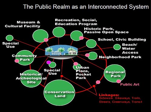
Public Realm as an Interconnected system, Slide from presentation, Leadership and the Role of Parks and Recreation in the New Economy, David Barth
Public Realm as an Interconnected system, Slide from presentation, "Leadership and the Role of Parks and Recreation in the New Economy," David Barth and Carlos Perez, AECOM.
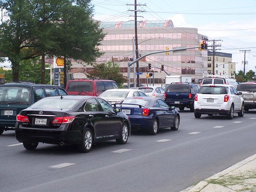
Rockville Pike
Rockville Pike, Montgomery County, Maryland.

Designs for most arterials do not prioritize aesthetic or place considerations.  Note that the "parkway" road type, typical of the 1920s and 1930s is an exception.

The challenge is to balance mobility, commercial, and aesthetic-place priorities in street design, in a land use and transportation planning paradigm that focuses mostly on prioritizing the throughput of automobiles.

Right now I think we can all agree that almost without exception, principal arterials, oriented to facilitating automobile traffic and throughput, are pretty grim places.

Recognizing the privileged position of the automobile, why not acknowledge and address the fact that the road network becomes the primary shaper of a community's identity by enhancing the aesthetic qualities of the road network, and by expanding the mobility qualities of the road network to incorporate sustainable modes.

The key concepts are:

(1)  combine complete streets principles and the concept of defining roadway characteristics, roadside characteristics, and desired operating speed of traffic according to land use context as discussed in the Smart Transportation Guidebook

(2)  with smart growth ideas focusing on inward investment on existing places rather than growing and expanding ever outward

(3)  along with the integrated public realm concepts of David Barth

(4)  by designating a subset of a community's road network as foundational or "signature"

(5)  and upgrading these streets with systematic special and complete treatment so that sustainable transportation modes (walking, biking, transit, etc.) are integrated into the mobility system (also related is Barth's concept that streets should be treated as linear parks), along with streetscape improvements (it happens that Baltimore County already has an excellent streetscape improvement program, just not a focus on sustainable transportation) so that the streets also are a means for strengthening quality of life and "placemaking" for neighborhoods and districts they serve most directly
Cycletrack and sidewalk, Virginia Avenue SE, Capitol Hill, Washington DC
This rebuilt section of Virginia Avenue SE includes a cycletrack and new brick sidewalk.

(6) while incorporating branding and identity systems within the transportation network and the broader network of civic assets in part as a marketing tool

(7)  with all of these elements in combination to support the case for financing using bonds and winning the vote in favor of the bond referendum, therefore raising the funds to pay for the development and enhancement of the upgraded mobility network and acquisition of the necessary right of way.
Fwd: Baltimore County Signs
Unfortunately, my concept for an integrated signage system for county civic assets and facilities didn't go over too well either.  But I attribute that to not having enough time to work through a couple iterations of the concept, to get to a point where people would have become more comfortable with such an approach.  Graphic design concept by Tim Hampton.

In most communities (not DC), to expand the right of way, you have to buy the land.  That's expensive.  The government doesn't want to do it.

But by positioning "Signature Streets" in terms of making the road system better by adding elements that build a more complete mobility network that enhances quality of life and how the county "deserves" a road-mobility system meeting 21st Century needs, and in keeping with the fact that the County is the third largest jurisdiction in the State of Maryland makes this kind of re-thinking achievable.

Looking north along Bothell Way Northeast’s “multiway” boulevard in downtown Bothell.
Looking north along Bothell Way Northeast’s “multiway” boulevard in downtown Bothell. The “multiway” boulevard shows faster traffic and a separated lane used for parking, bicycles and business entrances. Photo: Steve Ringman, Seattle Times. ("Fast lane meets slow lane on Bothell's new 'multiway").


With regard to bond funding, even in bad economic times, parks-related bond initiatives pass overwhelming in most jurisdictions, including Baltimore County.  And this idea of making roadways a type of "linear park" increases the likelihood of a successful referendum.

The model that I suggested was based on Seattle's Bridging the Gap initiative which is now called Move Seattle. It used a levy passed by referendum and other funds to implement a variety of mobility and public space improvements, from road repaving to Safe Routes to Schools initiatives.

Another example is the "Metropolitan Area Projects program in Oklahoma City, which funds various high level capital projects, along the lines of what I call transformational projects action plans ("Downtown Edmonton cultural facilities development as an example of "Transformational Projects Action Planning"").

Street sign topper, Portland, Oregon.  Wikipedia photo.  My idea was to have a "Baltimore County Signature Street" sign topper on street signs for the newly defined Signature Streets sustainable mobility network.

Elected officials and stakeholders need to think much bigger about mobility infrastructure. Elected officials especially need to understand that the mobility system--roads primarily but sidewalks and transit infrastructure too--defines the image and position of the community. They need to take responsibility for managing and shaping that system.

When I wrote a couple of commercial district revitalization framework plans for Brunswick, Georgia and Cambridge, Maryland in 2008 and 2009, I made the point that:
... elected officials need to take their responsibilities as stewards and managers of a community's image very seriously: 
Just as the study team believes that “we are all destination managers now,” elected and appointed officials in particular and in association with other community stakeholders serve as a community’s “brand managers”—whether or not they choose to think of their roles in this manner. 
That means that decision-making on land use and zoning, business issues, infrastructure development (roads, sewers, water, utilities, transit), technology (broadband Internet, etc.) and quality of place factors (arts, culture, historic preservation and heritage, education, public schools and libraries, urban design, etc.) must be consistent and focused on making the right decisions, the decisions that collectively achieve and support the realization of the community’s desired vision and positioning.

Another way to think about this is in terms of branding. How people perceive and think about a community has to do with its reputation and other qualities. Decisions either add or subtract value from the brand, depending on the results.

Typically, elected officials don't think about the sum total of their decisions and outcomes in this way.

Which is why many decisions made by elected officials end up having negative consequences.

Labels: , , , , , ,

Thursday, September 07, 2017

An example of using variegated road material treatments in Bothell, Washington

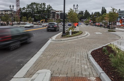
Looking north along Bothell Way Northeast’s “multiway” boulevard in downtown Bothell.
Looking north along Bothell Way Northeast’s “multiway” boulevard in downtown Bothell. The “multiway” boulevard shows faster traffic and a separated lane used for parking, bicycles and business entrances in downtown Bothell. Photo: Steve Ringman, Seattle Times.


The Seattle Times reports ("Fast lane meets slow lane on Bothell's new 'multiway'") about a project on a State Highway that also functions as a city-serving street in the suburb of Bothell, where a five block stretch of street in the Downtown has been reorganized to separate "fast" from "slow" traffic.   From the article:
The city took over the lower five blocks of state Highway 527, put up new signs saying Bothell Way Northeast and created a “multiway” that’s like three parallel streets, totaling as many as 11 lanes — a five-lane main roadway, sandwiched by a slow zone on each side where drivers can park or drop off passengers. ...

"This roadway is designed to knit together the old historic part of downtown with the new downtown. Previously, the highway was a sort of barrier,” said Steven Morikawa, city capital division manager.

Bothell residents said in community meetings they wanted to keep the walkable vibe of old downtown, Tung recalled. “How would we extend that character, and adapt to the fact we would still have automobiles?” the architects wondered. ...

The slow parking zones are built on concrete blocks that resemble giant cobblestones, with sand in the gaps to drain rainwater. The zones are cordoned by dividing curbs, trees and rain gardens where people walking can pause and look for cars. This effectively reduces the most strenuous of the pedestrian crossings to only five lanes.
From the description, we could say instead that "through" or regionally serving traffic is being separated from "local" traffic in a manner that doesn't degrade the urban design and placemaking qualities of the street and roadside in terms of how it serves local needs and conditions.

While the street seems particularly wide, which is counter to the general principles of placemaking in a Downtown, the concept extends and implements principles laid out in at least two planning documents that come to mind, the Smart Transportation Guidebook produced by the Delaware Valley Regional Planning Commission for the States of New Jersey and Pennsylvania, and the Oregon DOT publication, Main Street: When a Highway Runs Through It.

The STG argues one size fits all road construction doesn't make sense, that road and roadside characteristics, desired operating speed, whether or not a road is regionally or local serving, and the land use context ought to shape outcomes in differentiated ways.  In short, it's reasonable for a downtown or urban street to be treated much differently from a suburban arterial or rural road.

Similarly, MS:WAHRTI acknowledges that "state transportation department" concerns about how to operate roads can come into conflict with local land use context, especially in traditional commercial districts, and it lays out a framework where State DOTs and communities can work together to achieve better outcomes.

-- American "multiway" boulevard examples, National Association of City Transportation Officials

What distinguishes the Bothell "multiway" from others is the use of differentiated road treatments, whereby other multiways (parkways) use the same paving material throughout.

In DC, I have suggested for many years that "neighborhood" streets with a primarily residential-serving purpose, and streets in pedestrian-centric areas, such as commercial districts, around transit stations, schools, parks, libraries, and other civic facilities, should be constructed of pavements more in line with the desired operating speed of motor vehicles--25 mph or less--when roads constructed of asphalt or concrete typically allow speeds that are double or triple.

-- "What a "Complete Places" land use and transportation planning philosophy would mean in practice," 2008
-- "Complete Places are more than Complete Streets," 2010
-- "It's time for a new 'City Beautiful' movement in DC," 2011

This also illustrates my more recent concept of "Transportation infrastructure as an element of civic architecture," which is described more completely as a sub-section of this post:

-- "Town-City Management: We are all asset managers now," 2015

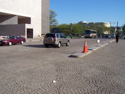
Streets constructed of asphalt block give visual, aural, and physical cues to slow down, such as on 4th Street NW between the east and west wings of the National Gallery of Art.
Stone paver street between the East and West buildings of the National Gallery of Art

While the Bothell roadway isn't fully constructed of block pavers, they are using a mix of roadway treatments, with a block-brick type material to denote "local" streets, in the context of a street that mixes both through and local traffic.  While it's probably not an absolute "first," it's clearly an atypical step forward, and more urban transportation departments need to consider greater use of block pavers--which may be used in crosswalks but not streets, or on streets that are adjacent to heritage buildings, such as Washington's Eastern Market.

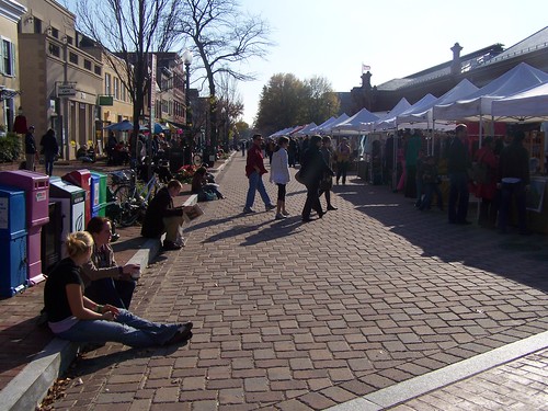
7th Street SE craft market, Eastern Market, Washington, DC
The street in front of Eastern Market is closed on weekends, much to the consternation of the interior food merchants who constantly advocate for the reversal of this decision.

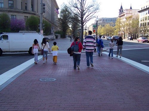
Brick crosswalks on Pennsylvania Avenue NW at 6th Street

While I believe the STG is in need of a serious update to reflect advances in sustainable mobility practice, it's a great starting point for thinking about roads in terms of appropriate land use context.

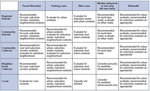
Matrix of Design Values for Regional Arterials, From Smart Transportation Guidebook
Matrix of Design Values for Regional Arterials, From Smart Transportation Guidebook.

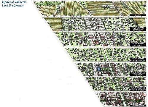
Seven land use contexts for transportation planning, Smart Transportation Guidebook

Cross section elements, Smart Transportation Guidebook

Labels: , , , , ,

Monday, July 06, 2015

Does the focus on big data mean we miss the opportunity for better use of "little data": Part 1--Road Condition Data as an example of failures in presenting data (Information Design)

Big Data--extremely large data sets that are analyzed by computer to reveal patterns, trends, and associations that may not be readily apparently if analyzed on a smaller scale and with a narrower analytical framework--is the rage, getting lots of media coverage, and a lot of focus by government officials.

-- "The power of government big data: It's all in the use cases," Government Computer News
-- "Big Data Could Bring Governments Big Benefits," Government Technology

Yes, it's important to use such approaches to do "deeper dives" into issues and problems, in an attempt to develop better responses that have a greater likelihood of success.

But I have maintained for a long time that most of the time the roadblock in community improvement it isn't a lack of "good" or "better" or "big" data, but is a failure to use the data we have, a failure to properly present the data, or the approach is problematic.

Design method vs. rational planning.  For example, in "All the talk of e-government, digital government, and open source government is really about employing the design method" I wrote about the difference between the design process and rational planning approaches and allowing for iterative learning and prototyping, rather than favoring a more static and constrained approach that defines rational planning.  But at the same time I pointed out that if a government or agency isn't interested in opening up, "Apps for Democracy" won't make a difference.

Process design approaches.  Similarly, in "Creating the right program vs. the hype of big data" I discussed what I see as the broad "failure" to take a process design approach in terms of analyzing how government agencies "produce outcomes," and how we don't ask the right questions on whether or not the outcomes are desired, have we created the right programs and processes, are we providing the necessary resources, and do we remain committed for the many years it will take to right the problem?

It's a structural, systems, and systematic approach to social and behavioral change that seems to elude the thinking of the typical politician.

Government mostly ignores policy research.  I also discussed this general problem in "Helping Government Learn,"  For a variety of reasons, elected officials aren't too interested in policy analysis, and government officials can be very constrained and parochial in their analytical frameworks too.  Often, governments repeat the mistakes they've made before, or refuse to learn from other experiences.

For example, one of my favorite quotes is from Bismarck:
"Fools learn from experience.  I prefer to profit from the experience of others."
That's why I read so much, to absorb the lessons from other people and places, with the aim of bettering practice here as well as generating meta-theory and frameworks for analysis and practice.

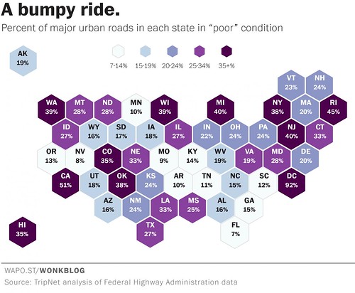
Road Condition Index summary data, state level, US
Road Condition Index summary data, state level, US.  Washington Post graphic.

A report says that DC has the worst roads in the US.  DC's Department of Transportation isn't happy because a study reported on in the Washington Post, "Where America’s worst roads are — and how much they’re costing us," states that DC has the worst roads in the U.S. From the article:
The numbers from TRIP show that 28 percent of the nation's major roadways -- interstates, freeways, and major arterial roadways in urban areas -- are in "poor" condition. This means they have so many major ruts, cracks and potholes that they can't simply be resurfaced -- they need to be completely rebuilt. ...

The worst roads in America are in Washington D.C., where 92 percent of our major roadways are rated as "poor." Conversely, zero percent of D.C.'s roads received a "good" rating in the Federal Highway Administration data analyzed by TRIP. There is almost literally not a single good road in D.C.

But D.C. is a special case, since it is not a state and doesn't have vast stretches of highway like most places in the U.S. do. So among the real states, the worst roads are in California where 51 percent of the highways are rated poor. Rhode Island, New Jersey and Michigan all have "poor" ratings of 40 percent or more. Dang.
But the report seems questionable.  My personal experience as a cyclist, which provides a much more fine-grained experience with road condition quality, makes me think that the data collection and interpretation framework for the report is likely problematic as there is no way that 93% of the city's main roads--freeways and "federal route designated" arterials like Rhode Island, Wisconsin, Connecticut, or Georgia Avenues, or 16th Street, etc.--are in absolute horrid condition.

It's just not true, even if as a cyclist I do ascertain many problems with road condition and quality that would elude a motor vehicle operator cushioned by bigger wheels, weight, air conditioning, and springs.

DC doesn't do a good job of presenting (or using) the data it collects.  This is definitely an issue with the road condition data set.  I have written about my frustration with DDOT's "dashboard," because the majority of the buttons, including the one on road condition quality, fail to provide deeper or actionable data ("Show us the data! DC Government metrics (and comparing DC's presentation to the City of Los Angeles)").

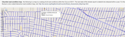
Los Angeles does a much better job.  By contrast, the City of Los Angeles maintains, presents and interprets data (map view, below) on road condition quality for every block of the city's roads, although the data is updated on a three-year cycle.
Los Angeles Road Condition Index, map section

-- 2011 State of the Streets Report, LA Bureau of Street Services
-- City of Los Angeles Road Condition webpage

With complete data, you can develop an objectively defined action agenda to address road quality and the street improvement program in a systematic way.  Although Los Angeles is so poor, one Councilmember proposed a system of neighborhood road improvement districts, to be called "beautification assessment districts," to come up with extra money ("Los Angeles Times).

It turns out that while the DC Transportation Dashboard still doesn't provide actionable or updated information on road conditions--in fact the button hasn't been updated since I wrote the above-cited entry , DDOT has begun to put road condition information up on their website, in the same exact manner as Los Angeles.
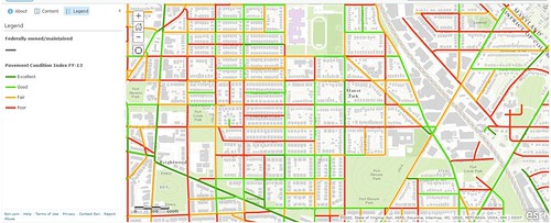
Washington, DC Road Condition Index, map section

-- Pavement Condition Index Map, DC Department of Transportation

But it's just the GIS data on the map, and no interpretational or summary information is presented, including failing to provide summary scores for the different categories of roads.  The newest data presented within the Dashboard is from 2010 (... and it doesn't add up).

However, looking at the map, it doesn't appear as if the FHWA data on DC as reported on by the Washington Post is correct.

What happens in the city now is that we put a wee bit of money towards road reconstruction and resurfacing--not enough to deal with 1,000 miles of roads--and each of the Ward's City Councilmembers fight over who gets what, rather than for the "good of the city" addressing the monies to the worst roads, as determined by an objective and complete measurement system of which the PCI is an example.

Design thinking and information presentation.  This isn't a question of needing "big data."  The "little data" we already have is plenty good to use.  It's just poorly presented.

-- "Information and Presentation Design: Gleanings From a Course With Edward Tufte," Civic Action blog
-- InfoDesign: Understanding by Design blog

For example, the live map ought to allow people to click on a full street, streets should be categorized (arterials, collectors, etc.), so that summary scores can be generated simply and easily.

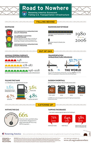
The infographic below (from the Council on Foreign Relations Renewing America Project) is an example of how data can be better communicated. WRT road condition data in DC, a similar nfographic would display data by type of road and ward/neighborhood.
Infrastructure_Scorecard_5

I remember after 9/11 the Wall Street Journal had an important article about the intelligence report given to the President and how the design and organization of the report at the time didn't adequately highlight and call out the most important information.

That article is discussed in a very old  Design Issues column from Communication Arts Magazine, "Guns, Butter and Ballots: Citizens take charge by designing for better government,"

It's great that DDOT provides the GIS data, but because it's a display of all the data without the ability to analyze it (unless you have a copy of ArcGIS and download the file), it isn't fully useful.  For example, while you can look at the whole map, and figure out that the study quoted by the Washington Post isn't probably accurate with regard to DC, you can't respond definitively to the assertions.

Obviously, the explosion of the use of infographics are an expression of this point, that to be useful, data must be summarized and presented in a manner that can be absorbed.

Labels: , , , , ,

Tuesday, October 21, 2014

Are roundabouts an urban or suburban technology?

(The program sure is "neoliberal" in how it stresses technological solutions and the negatives of regulation.  And there sure isn't much opportunity to delve very deeply into any of the issues presented)  One of the people presenting at the Post conference is talking about the time wasted by queuing at intersections.  He lives in a smaller town.

He suggests that compared to traditional intersections, roundabouts work better in terms of faster throughput and increased safety.  Roundabouts are intersections that are made into circles, where for the most part, entry roads into the circle are not signed or signalized or are signed with yield signs.

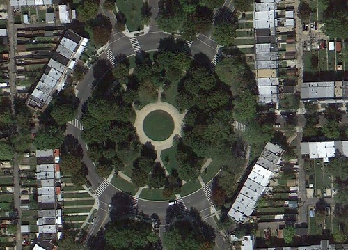
In DC, we have both traffic circles and roundabouts.  Traffic circles are not roundabouts because they have traffic signals.  Examples of a traffic circle would include Dupont Circle, Chevy Chase Circle, Washington Circle, Logan Circle, or Thomas Circle.
sherman-circle, Washington, DC
Sherman Circle, Washington, DC

Roundabouts that you think are traffic circles but isn't because there aren't traffic signals, only yield or stop signs, are Grant Circle and Sherman Circle in the Petworth neighborhood.  There is a more true "roundabout" in terms of size on Brentwood Road NE.
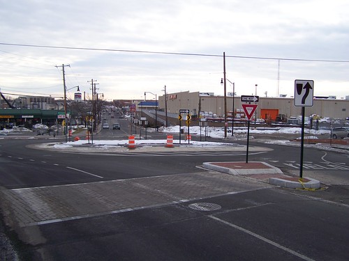
A roundabout has been constructed on Brentwood Road
Brentwood Road NE roundabout

I use these roundabouts regularly and as a pedestrian and cyclist, I find that roundabouts are designed to prioritize vehicular traffic rather than to balance the needs of pedestrians and cyclists with the desire of motor vehicle operators to move quickly.

I rarely feel comfortable going into a circle as a bicyclist because most of the motor vehicle operators don't signalize if they are turning, and in terms of entry, often I have to move to the leftmost part of a lane to ward off traffic coming behind me.

NotionsCapital calls our attention to a couple pieces on the topic, "They're Small But Powerful," from the FHWA magazine Public Roads, and "Evaluating pedestrian and bicyclist risk in Minnesota roundabouts" from the University of Minnesota Center for Transportation Studies (which is a great resource).

The UMN study finds that all is not peachy for pedestrians and cyclists with roundabouts, although the study city in the City of Minneapolis had a greater rate of vehicles yielding to pedestrians and cyclists compared to the suburban site.  From the article:
The research team identified several factors that influence drivers’ yielding behavior. Study results indicate the following trends:
  • Drivers are more likely to yield to pedestrians or bicyclists beginning their crossing in the center island.
  • Vehicles exiting the roundabout are less likely to yield than those entering it.
  • Drivers are more likely to yield to larger groups.
  • Vehicles entering the roundabout at the immediate upstream entrance are more likely to yield than those coming from other entrances.
  • Drivers are less likely to yield if they encounter another vehicle merging into the roundabout immediately before the exit where the pedestrian is trying to cross.
  • Yielding probability decreases with more vehicles present in the roundabout.
I would argue that in an environment where there is a preponderance of pedestrians and cyclists, such as in a city like Washington, that roundabouts aren't the way to move, because they preference motor vehicle traffic over sustainable modes.

Note that the Florida DOT report Roundabouts and Access Management has a review of the literature that goes beyond the above-cited publications.

Labels: , , , ,

Thursday, September 04, 2014

Educating the pedestrian vs. re-engineering road pavements to reduce accidents in pedestrian priority areas

Everything matters car commercial, Mercedes Benz.

But "everything doesn't matter" when it comes to the mobility system.

Enabling fast driving matters more than enabling safe driving.  And by building the mobility system the same way in every place, regardless of land use context, by design, we create the nexus for conflict, accidents, and fatalities.

The Tampa Bay Tribune has an article, "Gulf Boulevard hotels give tourists tips on crossing dangerous street," about a regional traffic safety program designed to reduce pedestrian-automobile accidents on Gulf Boulevard in Pinellas County, Florida.

What the agencies have done is come together to create an information card, presented in hotel rooms, providing pedestrian safety tips.

Gulf Boulevard in St. Petersburg Beach is a road with many hotels and visitors to the city walk along the road and between there and other destinations in the city.

It's been awhile since I've been to Tampa Bay, but Florida is like most of the US, so most people get around by driving, but in tourist areas, there is a preponderance of pedestrians, and therefore a greater opportunity for accidents, because most motor vehicle operators aren't accustomed to having to be concerned about pedestrian-motor vehicle interaction because where they usually drive, people don't walk.

According to the Florida Department of Transportation:
data shows that from 2008 to 2012, there were 119 crashes and six fatalities along Gulf Blvd. The goal of FDOT is to reduce pedestrian fatalities by 20% by 2018, hopefully saving about 15 lives per year.
For many years, I've argued that there is a disconnect between how roads are engineered to enable high speeds for motor vehicle traffic regardless of the land use context. Since most of the country is suburban, with limited numbers of pedestrians, this isn't normally "a crisis."

But where the disconnect is especially apparent is in those places where pedestrians make up a preponderance of the total "traffic" along the road. This is an issue in center city areas that mix residential and commercial uses in particular, but also around schools, parks, libraries, and in those places that are tourist destinations.

Gulf Boulevard, Pinellas County, Florida.

The Pennsylvania/New Jersey Smart Transportation Guidebook makes the point that "roadway characteristics, roadside charateristics, and operating speed regulations" for streets should be based on the land use context and whether the road serves local/community or through traffic.

Similarly, some state transportation departments have published guidebooks on this issue, such as the Oregon publication, Main Street: When a Highway Runs Through It.

Biking on Gulf Boulevard.  Image from the Bicycle Stories blog.

But for the most part, these publications don't address road materials as a key element in creating the opportunity for accidents, because traditional methods and practices call for the use of asphalt and concrete in all instances, even though such materials enable high operating speeds for motor vehicle operators regardless of context and conditions.

This is abetted by the fact that cars are engineered to be able to go very fast.

What is needed is extraordinary guidance that challenges traditional orthodoxy on what materials to use to build roads when the roads are used by all types of users, not just motor vehicles, but by pedestrians, transit users, and bicyclists.

In the past, I've argued that by changing the pavements from asphalt and concrete to bricks and blocks we would provide visual, aural, and physical cues to motor vehicle operators that they should drive more slowly, so that their driving practice better fits the requirements of that area, rather than expect land use contexts to change in order to favor the power of the automobile.

See:
-- Pedestrian safety and the proposed 15mph residential speed limit in DC: Part One
-- Complete Places are more than Complete Streets

I am almost embarrassed to think of some of my writings on this issue in the context of Europe, which until last week, I had never visited.  Certainly, I am familiar with the urban design elements of traditional cities, which have their roots in medieval practices, which have been maintained to some extent in the modern era.  But seeing is believing.

I visited just a couple cities in Germany, but in Hamburg especially, the materials and textures for roads and sidewalks are very nuanced to communicate many things including:
  • intersections
  • driveways
  • sidewalks
  • bikeways
  • turning traffic
  • etc.
For example, this photo shows types of pavement treatment at one small segment of the street, where the:
  • street (asphalt)
  • gutter
  • curb (stone)
  • driveway (stone block)
  • sidewalk (light colored pavers)
  • bikeway (red pavers)
are each defined in a subtle but straightforward fashion.

With the use of such a wide range of materials and textures, in visual and tactile terms, the motor vehicle operator is "instructed" to drive more slowly and pay close attention.

In this manner the speed capability of the motor vehicle is mediated in favor of the pedestrian and bicyclist, which makes sense since pedestrians and bicyclists are much more vulnerable to cars than vice versa.

It's increasingly common in the US to re-engineer crosswalks with special pavement treatments, such as at 7th St. and Pennsylvania Avenue NW in Washington, DC.
People waiting at the crosswalk, 7th St. and Pennsylvania Avenue NW

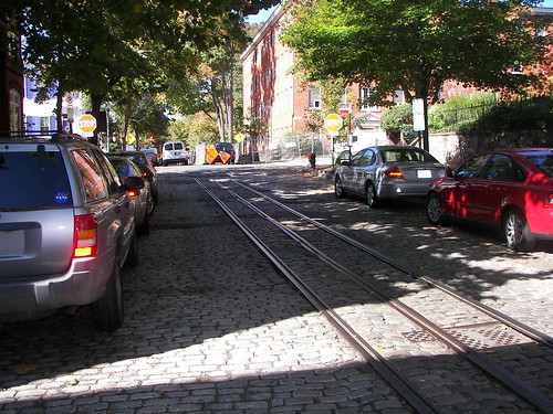
Here and there in the city there are legacy remains of asphalt block paved streets in Capitol Hill, and stone block and cobblestone (they look cool but are a pain to walk on) paved streets in Georgetown. And the city's transportation department agreed to repave one block of 7th Street SE from asphalt to pavers in front of the Eastern Market public market.

This will be extended one block to Pennsylvania Avenue when the Hine school site is redeveloped.  I have also suggested that the treatment be extended south on 7th Street across Pennsylvania Avenue and around the Eastern Market Metro.

Eastern Market
7th Street SE at Eastern Market

P Street NW, Georgetown

The original and best way to do traffic calming, P Street NW in Georgetown

But I argue that we need to re-engineer the pavement for the entire road in pedestrianized areas, just as is done in Europe.  A crosswalk isn't enough.

Right: Crosswalk at the Bilmar Beach Resort, Treasure Island.  Photo:  Jay Conner, Tampa Bay Tribune.

While it's important to educate pedestrians on how to behave safely in traffic--probably the tourists in Tampa Bay don't normally walk much, just as motor vehicle operators are unaccustomed to large numbers of pedestrians--in all likelihood, the best response to "fix" the problem on Gulf Boulevard is to re-engineer the "roadway and roadside characteristics" in such a manner as to reduce pedestrian accidents and fatalities.

Note that the countermeasures prescribed in the protocols specified in the Pedestrian Safety Guide and Countermeasure Selection System and the BIKESAFE: Bicycle Countermeasure Selection System produced for the Federal Highway Administration do not prescribe significant urban design changes that would preference the use of different pavement materials for roads in predominantly pedestrian areas.

By doing this on such a prominent Florida street, the state department of transportation would communicate strongly the importance of pavement types as a way to mediate speed and reduce pedestrian and bicyclist accidents and fatalities.

Note that locally, the Maryland State Highway Administration should do the same kind of treatment in College Park, Maryland, home to the University of Maryland, where a highly trafficked arterial, Route One, splits the campus from the "town," many residential quarters, and the subway station, and has an equally vexing problem of mediating appropriate traffic speed with the land use context which is predominately pedestrian, combining the campus and student serving retail across the street.  See the local tv news story, "College Park to Get Safety Improvements."

Labels: , , , , , , ,

Wednesday, July 23, 2014

Show us the data! DC Government metrics (and comparing DC's presentation to the City of Los Angeles)

DC's Department of Transportation is not happy that an infrastructure investment campaign website for the White House says that 95% of DC's roads are in poor condition.

There's no question that the White House data is wrong, as a bicyclist I have a pretty good sense of road quality.  While there are many high quality roads in the city in terms of pavement quality, there are many roads in seriously poor condition--which can be hyper dangerous for bicyclists, compared to the ride capabilities of a typical motor vehicle.

DDOT counters the White House with a statement based on data using an industry standard measurement system, the Pavement Condition Index (PCI), that says 75% of DC's roads are in fair, good, or excellent condition. See their blog entry, "Three-Quarters of District Roads Are in Fair to Excellent."

First, fair grades, generally considered to be from 26% to 50% aren't considered passing grades.

Second, DDOT isn't providing access to the underlying data, except for summary data, which at least through 2010, doesn't support the DDOT statement, except for the fact that DDOT includes "fair" grades now, when the grades for "good" and "excellent" for most of the city's roads (1016 miles out of 1030) didn't top 58% as of 2010.

I've been meaning to write about this general topic, because of my frustration with the DDOT Dashboard.

While two of the buttons do a great job on providing access to a great deal of information, the other four do not. (I first wrote about this in 2010, in "DC DDOT transportation access portal doesn't really say anything.")

One of the "other four" buttons concerns road pavement quality.  It lists a summary quality score of 64%, but the only data provided to support the claim is four years old, and doesn't back up the claim if you do a calculated weighted average of the reported data.

On the other hand, the City of Los Angeles has a very good metrics webpage, much better than DC's, and for road pavement quality data too.

You can even drill down within the Los Angeles data on a block by block basis, which is far more useful than the data presented by DDOT.

This comes up too, because for awhile there, I was thinking about running for Ward 4 position on DC City Council, figuring that Muriel Bowser will win the Mayoral election, and that I might have a shot in a special election, because the voting conditions are much different than normal, where I would have no chance.

Anyway, I decided not to do it (meeting with people reminded me how much I dislike the people who are into campaigns, plus other people, even those who hold or have held elective office told me it's very difficult to "move a Council to better decision making" and that I could have more effect doing other things), but I had been developing an ideal ward-focused Councilmember platform, and one of the elements would be developing and publicizing ward-specific metrics, including road pavement quality, sidewalk gaps, bike path pavement quality, litter survey data, etc.
Pavement condition measurement on a street in Los Angeles
Pavement condition measurement for a particular street in Los Angeles, from the City of Los Angeles Performance Metrics website.

(That ward-specific platform is only in outline form now.  I will expand it into a position paper of some sort.)

Labels: , , , ,

Tuesday, December 18, 2012

Death of Jane Holtz Kay, author of Asphalt Nation

See the obituary, "Remembering Jane Holtz Kay," in The Nation.

From the New York Times review of the book:

In her book's first section, ''Car Glut: A Nation in Lifelock,'' Kay, the architecture critic for The Nation, reports that more driving does not mean more mobility because the number and length of trips needed for everyday life are increasing; that the elderly and the young, who are unable to drive, have been transformed into virtual prisoners; that the United States gives automobiles at least seven times the subsidies it earmarks for public transportation; that improvements in emission controls have been canceled out by an increase in miles driven; that salt used on ice and snow causes trees and vegetation to wither; and that Americans are fat because they drive rather than walk.  ...


Kay's second section, ''Car Tracks: The Machine That Made the Land,'' explains how the automobile evolved from 1908, when Henry Ford introduced the Model T amid predictions that it would reduce pollution by replacing the horse, to 1954, when the United States became a net importer of oil, to the present, when Americans collectively spend eight billion hours each year stuck in traffic. The third section, ''Car Free: From Dead End to Exit,'' points toward a future when, Kay hopes, the front porch, the corner grocery and pedestrian-friendly streets will be the norm rather than the exception.

To her credit, Kay recognizes that the automobile is not the only culprit. She points out, for example, that Europeans have avoided many American problems not just because of high gasoline taxes and excellent public transportation systems but also because they regard land as a scarce resource to be controlled in the public interest rather than exploited by whoever happens to own it at a particular moment. Thus, European governments have traditionally exercised stringent controls over land development, and they have operated on the theory that the preservation of farms and open space is an appropriate national goal. In Dusseldorf, Germany, possibly the richest city in the world, truck farmers tend their crops within a couple of miles of the city's skyscrapers, not because alternative land uses would not yield a higher return, but because the law prohibits the very possibility of development.

Given that the review is by Kenneth Jackson, one of the leading urban historians of our time, he is critical, writing:

One wishes, however, that Kay had more effectively anticipated and countered the likely questions of the 40-million-member American Automobile Association and the other powerful elements of the highway lobby. What do current gasoline taxes, meager as they are, pay for? Who should pay for the construction and repair of local roads that serve residential areas? If cars are becoming cleaner and more efficient over time, why will pollution not take care of itself? Who gets the bill for the uninsured motorists who cause the innocent to live out their days in wheelchairs? Are there many instances or places where motorists subsidize the general population, as is the case in New York, with its high bridge and tunnel tolls? If so, what has been the result? Why should a driver who never uses buses or subways contribute to their support? Does not the fact that Americans have purchased 250 million vehicles constitute a kind of referendum that government officials should respect? Kay has performed an important service in putting the issue of transportation before a potentially large audience, but she has only continued the debate, not taken it to a higher level.

A lesson in the need to be thorough.  If, one of the goals you're writing for to move social change forward.

The obit mentions that she was one of the founders of WalkBoston, which is one of the best pedestrian advocacy groups in the U.S.  That's an important legacy in and of itself, but she did a lot more.  For example, I didn't realize she was also a preservationist, having authored two books, Lost Boston and Preserving New England, on the subject.

-- First chapter
-- Jane Holtz Kay website

She will be remembered.

Labels: , ,

Sunday, August 08, 2010

Guide for Reviewing Public Road Design and Bicycling Accommodations for Virginia Bicycling Advocates


Fairfax Advocates for Better Bicycling, the bicycling advocacy group in Fairfax County, Virginia, got a grant to produce the aforementioned guide, which was recently published. It was written by Fionnuala Quinn, a civil engineer, and Bruce Wright, the chairman of FABB, so it covers very well both the technical aspects of bicycle facilities as well as the approach advocates should take in moving improvements forward.

-- Webpage, Guide for Reviewing Public Road Design and Bicycling Accommodations for Virginia Bicycling Advocates

The guide is excellent, as it:

(1) outlines the design process for road improvements, which it does in a nice two page outline (pages 4 and 5) listing the 8 stages of the design and construction process;

(2) outlines how to be "productive" in shaping the process towards improvements that accommodate bicyclists

(3) provides checklists to help guide advocates through the processes, and what to look for, and what to advocate for;

(4) provides advice on how to "read and comment on engineering plans" in ways that reach engineers;

(5) outlines general principles for bicycle facilities improvements (this is drawn from standard publications in the field such as the AASHTO Guide to Bicycle Facilities, but is drilled down to the essentials and is very clear);

(6) outlines specific principles for different types of bicycle facilities (in the Western Baltimore County ped and bike access plan I wrote a huge section on this which for the most part was excised, which I think was unfortunate, although I still have the draft);

(7) provides a nice table of authorities, "standards, guidelines, policies and ordinances" that outline the applicable federal, state, and local requirements and policies;

(8) provides additional resources -- "common issues that affect projects", and other resources, definitions, a discussion of "non-standard projects, exceptions and innovations" and what to do in "late stages of the process."

I don't know the issues at the ground level in Virginia, but I will say that I would have added a few things to this guide, because such a guide should also work to move practice and opportunities forward in a significant way.

- there should have been discussion of Complete Streets principles more generally and probably a reference to the Smart Transportation Guide produced by the States of New Jersey and Pennsylvania. This could have included discussions of suburban vs. urban road networks.

This is important because given all the opposition still faced by walking, bicycling, and transit advocates to the creation of a more balanced transportation system and network, we have to continually outline and refer to this broader set of principles (including discussions of placemaking) in order to move this idea forward.

Instead, too often improvements for walking, bicycling, and transit are referred to as "a war on drivers," which puts us at a severe disadvantage.

The STG is probably the best guide right now about implementing complete streets principles in a practical way.

- while there are a few paragraphs in the guide on "innovative bicycling designs", I would have included a more extensive discussion of these facilities, especially cycle tracks, bicycle boulevards, and buffered bicycle lanes, which offer the best opportunities for significantly increasing take up of bicycling on the part of segments other than men under 40 years of age -- although maybe there are fewer opportunities for such facilities in Fairfax County, which has a typical suburban street pattern less conducive to these types of facilities. (Note that the section in Minneapolis Bicycle Plan on innovative facilities is one of the best I've seen -- Chapter 9 – Innovation.)

- I am not sure, again, about issues in Virginia, I know in Baltimore County, wide shoulders, discontinuous shoulders, bridges and interchanges and the ability of bicyclists (and pedestrians) to safely move through them are big issues, and need to be addressed better than they have been. This could have been covered in the guide, which is also intended to serve bicycling advocates throughout Virginia, where these issues are likely to be present.

- while intersection design was covered in a paragraph in the section "common issues that affect projects," -- the guide states, on page 19, that "The design must accommodate turning movements and crossings in many directions with numerous potential conflict points" -- providing more guidance and photographs on treatments such as shifting bike lanes left to separate bicyclists from right turning motorists would have been good to include.

I realize that right now the issue is getting government officials, elected and appointed, to acknowledge bicycle facilities at all, so advocating for "innovative" facilities may be seen as a stretch

- I am not sure if in the preparation of the guide, they referred to the new draft of the AASHTO guide, which admittedly only came out in February. It calls for a 12 foot minimum for shared use paths--in the guide, this width is recommended for heavy traffic, but a 10 feet minimum is stated.

The Shared-Use Path Level of Service Calculator manual, published by the Federal Highway Administration, would have been a good resource to provide a link to, and it calls for an 11 feet minimum. This guide is a good resource for advocates, because it provides an objective method for the justification of wider paths, based on the volume of users. Because wider paths help to minimize conflicts between faster and slower types of traffic along paths, it is important to make sure that elected and appointed officials are clued in to these newer recommendations.

- Another guide I would have considered referencing is Bicycle Safety Countermeasure Selection System: Bikesafe, which is both a printed manual and a software program designed to be used in the analysis of bicycling accidents (there is also a version for pedestrian accidents). Bikesafe makes recommendations for design improvements, based on the type of accident. Again, this provides a more systematic method for improving roadways for bicyclists.

All in all, this is a very good guide and I hope that the bicycling and sustainable transportation community will use this guide and thank Fairfax Advocates for Better Bicycling for taking on this project, finishing it, and providing the wider community access to this quality publication.

Thank you!

Labels: , , , ,

Wednesday, February 10, 2010

Winner of the 2009 Best Article Award: Journal of the American Planning Association

Press release

Safe Urban Form: Revisiting the Relationship Between Community Design and Traffic Safety

Eric Dumbaugh and Robert Rae
Volume 75, issue 3, 2009

The judges decided that Dumbaugh and Rae shatter myths about the safety of suburban road design and associated community design. Their paper is an excellent piece of research that reinforces the notion of evidence-based design. The authors focus on a critical issue associated with urban design, the research design is well-conceived, the statistical analysis is rigorous, and the implications to the practice of urban design are powerful.

Results and conclusions: We find that many of the safety assumptions embedded in contemporary community design practice are not substantiated by the empirical evidence. While disconnecting local street networks and relocating nonresidential uses to arterial thoroughfares can reduce neighborhood traffic volumes, this does not appear to improve safety, but rather substitutes one set of safety problems for another. We found urban arterials, arterial-oriented commercial developments, and big box stores to be associated with increased incidences of traffic-related crashes and injuries, while higher-density communities with more traditional, pedestrian-scaled retail configurations were associated with fewer crashes. We found intersections to have mixed effects on crash incidence. We conclude by discussing the likely reasons for these findings (vehicle operating speeds and systematic design error) and outline three community design strategies that may help improve traffic safety.

Labels: ,

Wednesday, July 22, 2009

Nibbling the sidewalk in favor of cars in Mount Vernon Triangle

100_8107.JPG
Continuous right turn lane at the northwest corner of 4th Street at Massachusetts Avenue NW.

------------
Update: my faulty memory has been corrected in a sub-thread on Greater Greater Washington. Paul stated that:

The slip lane has been there for years. DDOT has a plan to widen this segment of Fourth Street, between Mass and L Street, to change from one way to two way traffic flow. When the upgrade is executed the slip lane will go away.

It turns out he's right. My memory was faulty.

Still, in advance of a street widening, DDOT could have eliminated the right turn lane. After all, they repaved it, which seems like a waste if it's to be eliminated in the future anyway.

Also see the DDOT Mount Vernon Triangle Transportation & Public Realm Design Project final report for more information on streetscape issues in the Mount Vernon Triangle neighborhood.
-----------------

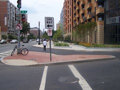
I noticed the other day that at the northwest corner of 4th Street and Massachusetts Avenue NW, DDOT cut a right turn lane into what had been a very wide sidewalk area. This allows a right turn without having to stop at the light. However, the amount of traffic on this road is extremely minimal and the focus on moving traffic at the expense of a quality streetscape seems to be the wrong decision choice.

Ah, I think I figured it out, although I still disagree with the decision. As the two new big buildings--one an office building, the other condominiums/apartments--become utilized, traffic will increase and this continuous right turn lane preferences drivers. The parking garage for the apartment building is entered/exited from 4th Street.

I still don't like it. Better to have added the lane at the intersection, rather than creating a gap between the sidewalk/walkway areas.
100_8104.JPG
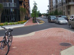
Looking north towards K Street.

Labels: , ,