Rebuilding Place in the Urban Space

"A community’s physical form, rather than its land uses, is its most intrinsic and enduring characteristic." [Katz, EPA] This blog focuses on place and placemaking and all that makes it work--historic preservation, urban design, transportation, asset-based community development, arts & cultural development, commercial district revitalization, tourism & destination development, and quality of life advocacy--along with doses of civic engagement and good governance watchdogging.

Sunday, October 14, 2018

H Street Festival as an opportunity for reflection on how to approach urban revitalization

Yesterday was the H Street Festival.
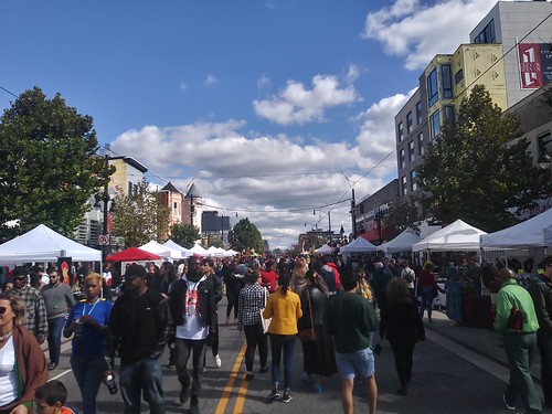
H Street Festival

While it is nowhere true that "everything I learned about urban revitalization I learned on H Street NE," that was where I started my involvement in a deep and focused way.

H Street was a corridor picked by the city for substantive improvement under the first real post-Marion Barry government, under Anthony Williams.

Before suburban out-migration, it was the city's #2 shopping district after Downtown, featuring one of the nation's first Sears Department Stores, the first Hechinger Store (a model for Home Depot), and block after block of shops and small local department stores.

Arguably, one of the first Kay Jeweler stores was located on H St. One of the first People's Drug (as an 800+ store chain, it was sold to CVS).  Herbert Haft, one of the nation's earliest "discount retailers" had his first post-military job as a druggist on H Street.  It had one of the nation's largest Chevrolet dealerships (Ourisman), etc.

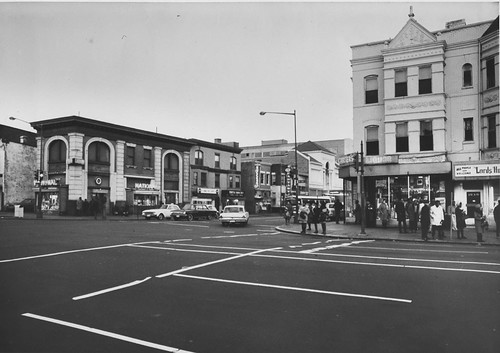
But with suburban out-migration the corridor was declining even before the 1968 riots after the assassination of Dr. Martin Luther King, Jr., and the riots destroyed the corridor.  Various urban renewal efforts aimed at improving the corridor, but those pretty much failed, as they didn't aim to leverage the historicity and architecture of the community.  Instead they focused on the value of land based on its location--near the US Capitol, Downtown, and Union Station.

It happened that simultaneous with the decision by the city to make H Street one of its focus areas was the time I decided to "get involved" because otherwise I didn't think the neighborhood would improve.

I was one of the founders of the Main Street commercial district revitalization program, which leveraged city planning efforts including the H Street Revival land use plan (2002-2003) and the H Street Streetscape and Transportation Study (2003-2004).

And that started me on the path leading to where I am today in terms of how I focus on and think about urban revitalization, sustainable mobility planning, commercial district revitalization, historic preservation, urban design, placemaking, and various elements of cultural planning.

When you learn about a specific place in great detail but you have the capability of generating meta-understanding and meta-theory, you can apply what you learn in one place to others.  In my experience, most practitioners aren't very good at generating meta-theory (which must be why as a skill it doesn't seem to be valued very highly).

Here's some of what I learned then:

-- ""Missing the real point: city (re)development isn't about "gentrification" as much as it is about urbanism and urban design," 2011
-- "It's true that the winners in history revise it: misleading people about the process of change, H Street revitalization edition," 2011
-- "H Street yet again," 2011
-- "The community development approach and the revitalization of DC's H Street corridor: congruent or oppositional approaches?," 2013

Sometimes I joke that my involvement in urban planning to begin with is a form of "blowback" vis-a-vis the H St. Community Development Corporation--where I tried to figure out why H Street NE languished, and what should have been done differently.

Basically, like what drove Jane Jacobs to write Death and Life of the Great American City, it was a repudiation of the urban renewal approach.
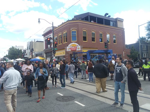
H Street Festival, Ben's Chili Bowl with roof top deckThe H Street Festival, held yesterday, is a good example of the transformation. 

It's now a major city event, drawing more than 100,000 people to the corridor for music, carousing, walking, seeing the wares at various booths, and interacting with nonprofit and city government exhibitors.

My line about when we started is that "we didn't have a consensus on what the corridor should look like at the end, but we all agreed that we weren't satisfied with what it was in the present.  In any case, whatever our expectations were are far exceeded."
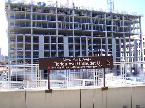
Construction at the New York Avenue Metro StationAlthough note that a major reason for the change wasn't "the H Streetcar" or some of the other investments, but the addition of an infill subway station, the NoMA Metrorail Station, in the northern part of the neighborhood.

The addition of that station changed the willingness of people with choices to live north of H Street, and the changing economic demographics that unleashed helped to drive the change.

Witnessing that impact is what has"driven" me more towards transportation planning as I see it, when done right, as having the fastest and greatest return on public investment in terms of driving neighborhood and commercial district revitalization.

There were a bunch of things I saw yesterday.  Many impressed me greatly.  One saddened me terribly.
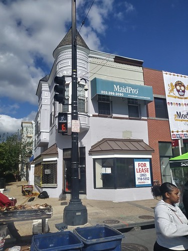
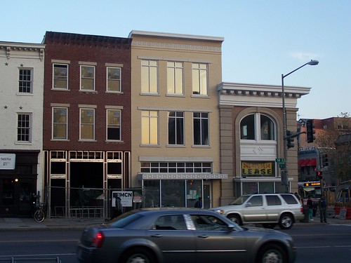
H Street dry cleaners now closedIn terms of being sad, I noticed that the dry cleaners at the corner of 11th and H Streets NE had closed, and the building is up for lease.

The owner of the building and the dry cleaners was an "innovator" in terms of his impact on corridor improvement because he invested in fixing the building, in taking down the plywood off the previously boarded up and empty second floor, fixing the facade, painting it, and renting it out as office space..

As a corner building it has the potential for extranormal impact because it is highly visible--and the improvement communicated that it was a new day on HS Street, that it was possible to move forward instead of continuing to languish.

Like the argument made in Rolf Goetze's Building Neighborhood Confidence, his effort made the point that H Street was worth investing in with your own money.

I used to write a monthly column about H Street for the now defunct Voice of the Hill community newspaper, and the last piece I wrote was about how these kinds of investments--and there were three other comparably important building improvements undertaken around the same time by individuals without government grants or similar supports--were key elements in repositioning how people thought about the opportunities for the corridor.

I just came across c. 2011 panorama photos of each block of H Street by Edward Scott, a neighborhood resident and film documentarian.  This shows what the 1100 block looked like in 2011.  The Dry Cleaners building is the first building on the left.

1100 Block, H Street NE, Washington, DC

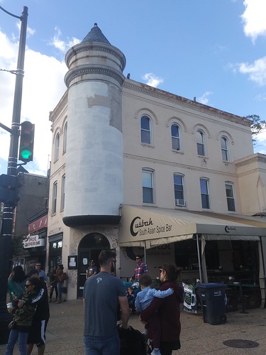
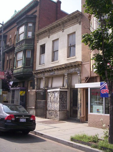
The stuccoed oriel bay building (Casbah) on H Street NESpeaking of the importance of historic preservation congruent improvements to buildings and what they communicate, it's the exact opposite story for the building on the far right of this photograph.

Rather than spend the money to fix the beautiful projecting two-story oriel bay feature of the corner facade, they covered it in stucco, hiding the architectural details and its beauty.

That kind of "investment" was typical of the corridor before its resurgence, and exhibits how the wrong kinds of "improvements" hinder success rather than buoy it.

Between 1968 and 2002, "improvements" in buildings on the corridor were more like this--covering up or even demolishing architecturally significant details--not enhancing them.

And that extends to the zero aesthetic qualities of the buildings put up as part of the post-riot urban renewal program for the corridor.

H Street FestivalNot that many of the new buildings are that great.  Sadly, this terribly cheap building was put up by the guy who manages real estate development for WMATA, but as a separate project.

It doesn't bode well for aesthetic elements of mixed use development at Metrorail sites.

We won't even get into arguments about the streetcar.  I just came across this article in CityLab ("D.C.'s Streetcar Is Doing Fine, But No One Believes It") which says it is a success transit-wise.

While I don't agree, but that's because it needs to be extended further eastward as well as westward to Downtown, Georgetown, and Rosslyn, there's no question it's touched off far more intense development that has more than paid off--another example of the value of investments in transit having the potential for "fast" and high returns.

-- "DC streetcars move to simulated service: passenger service expected within a couple months: DC streetcars part 1," 2015
-- "DC and streetcars #2: STREETCARS ARE ABOUT TRANSIT, just in a different way from how most people are accustomed to thinking about it," 2015
-- "DC and streetcars #3: More discussion (from almost two years ago)," 2015
-- "DC and streetcars #4: from the standpoint of stoking real estate development, the line is incredibly successful and it isn't even in service yet, and now that development is extending eastward past 15th Street," 2015
-- "Update on the DC Streetcar program on the verge of launching Sunday service," 2016
-- "Update/revision of H Street transit oriented real estate development table," 2016

Labels: , , ,

Friday, October 30, 2015

More infrastructure: does desperation for capital push local officials to apply for grants with projects that don't really qualify?

The Pittsburgh Post-Gazette has a story, "Pittsburgh officials fail to secure federal grant for development of Civic Arena site," about how a proposed project in Pittsburgh, decking over Crosstown Boulevard to facilitate the redevelopment of the old hockey arena site in the Hill District, for which there is a plan to put in a street grid, a new headquarters for US Steel, and 1,000 units of housing, wasn't successful in its application for $15 million as part of the US Department of Transportation TIGER grant program, which aims to fund "innovative transportation projects" around the country.


The parking lot is the site of the old arena.  PPG photo by David Sapp.

The story says that the Convention Authority will continue to submit applications to this funding source, and that they don't need to secure funds until 2017, giving them more time.

It is an illustration of the need, maybe, for more funding sources for local infrastructure projects, but it's a small project not requiring a whole lot of money ($21 million is the total needed) and there are other funding sources anyway.

More importantly, this project strikes me as a straight up development project with limited transportation elements--TIGER stands for Transportation Investment Generating Economic Recovery and a cursory review of the projects that were just funded shows that each project has clear transportation components and benefits--and could be funded in a number of ways, including through the creation of an "urban renewal district" or "tax increment financing district," where in either case, financing would be obtained by selling bonds against the anticipated increase in tax revenues generated by the new development.
Alternatively, Community Development Block Grants or loans from HUD are another, in my opinion more appropriate, source of funding for such a project.
Labels: , , ,

Monday, April 13, 2015

Transportation quotes of the day (from 1961)

Image of I-66/E Street Expressway, from aaroads.

Through an odd fluke, last week I found a couple sections of the Washington Post dating to November 5th, 1961.

They aret in bad condition and I can't figure out why the household that tossed them had them to begin with, unless it was because they saved an article, "Future of Travel In Capital Meets Its Day of Decision," about an upcoming vote on the city's proposed freeway plan.
This plan proposed an inner loop freeway east of the White House, around Dupont Circle, an outer loop further out, and other freeways.  After much citizen opposition, eventually most of the freeways proposed for Washington DC were cancelled.  The article didn't include any graphics.

Image from Greater Greater Washington/BeyondDC.

From the article:
Donald C. Hyde, manager of the Cleveland Transit System and a member of the {National Capital Transportation Agency} board:

"I don't feel there was any serious evaluation of the Inter-Loop in our 1959 Mass Transportation Study  It was something we just accepted and built upon.  I have been a supporter of our inter-loop project in Cleveland, primarily because it helped us get rid of slum neighborhoods.  I'm not sure the Cleveland experience is comparable."

District Highway director Harold Aitken:

"Those who are saying let's defer and study are really saying 'let's not build it.'  We know from our projections that there will be a steady build up of traffic into the central area, traffic which cannot be diverted by the Capitol Beltway or handled by mass transit.  We can and should do a better job of designing our freeways so they will not detract from the city's visual qualities.  The new design for the E st. expressway is certainly an example."
Image of DC's Southeast-Southwest Freeway (I-395) from aaroads.

Labels: , , , ,

One hidden element of the revitalization of Pittsburgh's East Liberty neighborhood

The East Liberty neighborhood in Pittsburgh is an interesting urban revitalization case study.

First, it was one of many examples from around the country of using urban renewal to make over and "improve" a neighborhood.  Like most examples of urban renewal, it failed, culminating in the demolition of much of the housing that had been built less than 30 years before and a search for a new solution.

Second, a lot of people in the revitalization world use East Liberty as an example of how distressed areas can attract high quality retailers  ("What drives East Liberty's revitalization efforts?," Pittsburgh Post-Gazette , "A Neighborhood's Comeback," Wall Street Journal).

But the opening there of a wide variety of quality retailers (Whole Foods, Trader Joe's, Borders--now closed, Target, etc.) happened only because the area is adjacent to two of Pittsburgh's most successful neighborhoods--Squirrel Hill and Shadyside--and in those locations there isn't any available land for large scale commercial development.  (As an aside, because of this, Shadyside is one of the only retail districts with a fair amount of second floor retail.  This is an example I've been meaning to write about as relevant to 8th Street SE in Capitol Hill, DC.)

What was appealing wasn't East Liberty per se, but available land and proximity.  Few other distressed neighborhoods possess this combination of development attractiveness, which makes East Liberty an outlier that's hard to generalize from.    

The East Liberty busway isn't particular attractive and is an example of the failure to consider the importance of transit infrastructure as an element of civic architecture and placemaking.  Wikipedia photo.

Third, Pittsburgh has some of the nation's first bus rapid transit lines, which opened in the 1980s, including service from East Liberty--you can get Downtown by bus in under 15 minutes, but for the most part, these lines never sparked ancillary development or residential recruitment.

(And like most bus rapid transit lines, ridership projections never met expectations, although to be fair, they were introduced when Pittsburgh was at its worst economically--as the steel industry was failing.)

But as retail has improved and the Penn Avenue Arts Initiative to the west continues to plug along attracting "creatives," arts anchors like the Pittsburgh Glass Works, and funky retail and restaurants, the East Liberty neighborhood is improving in its own right.

Ridding a neighborhood of crime by buying crime-ridden properties.  It turns out this has been sparked in large part because of a real estate strategy developed by the neighborhood community development corporation, East Liberty Development Inc. which focused on buying out slumlords and and converting problem properties that had been nodes for crime and disorder.

The Pittsburgh Post-Gazette reported ("How did East Liberty become safer? Buying out homes that housed criminals") on this, referencing a study of the program (East Liberty Crime Data Analysis), conducted by a consulting firm, Numeritics, based in the district. From the article:
A map of East Liberty in 2008 shows Negley Avenue running down the length of a curious red blotch between Penn Avenue and East Liberty Boulevard.  By 2012, the red blotch had dimmed to yellow. The change signified a 49 percent drop in the incidence of crime. 
The blotch had covered much of the old residential neighborhood, including Hays, North St. Clair, Mellon and Euclid streets. In the mid-2000s, Eric Jester, then the housing development manager for East Liberty Development Inc., said his and nearby streets were “a steady drumbeat of nonsense. Not just gunfire but street fights, people screaming, hookers propositioning your dinner guests.” He said an identifiable number of properties had reduced quality of life to “an existential threat.” 
“We called the police, but as soon as the police left it started up again,” he said. “We tried code enforcement, we tried yelling, we tried shaming. 
“We finally decided it’s probably better if we owned the properties.” The result of ELDI’s strategic purchase of 200 units from slumlords between 2008 and 2012 is the subject of a 23-page report, released recently by the data analysis firm Numeritics, that reframes East Liberty’s narrative of transformation. ... 
Through the 2000s, ELDI was buying, renovating and replacing properties for mixed-income buyers, but it intensified its efforts in 2008, going after property owners who allowed criminal behavior as long as tenants didn’t complain about lax maintenance.
ELDI’s acquisition of both large and small apartment buildings led to renovations and the hiring of effective property managers and off-duty police officers. At the same time, ELDI kept the same racial composition and low rents, Numeritics reported
According to the report, ELDI acquired about 3% of the residential properties, and according to crime hot spot theory, in problem neighborhoods 3% of properties generate 50% of the crime. While the neighborhood is experiencing rising demand for residential properties and increased prices, there is still plenty of affordable housing.

Safety + location + retail as a winning revitalization combo.  In any case, the redevelopment of the area as a hotbed for retail, and the housing rehabilitation program by ELDI has brought stability to the neighborhood, and it is now in fact, a great example of revitalization ("East Liberty becomes a vibrant community," P-G).

Fundamental to the improvement, as commenter charlie would say, has been to get public safety under control.

One of the people quoted in the article mentions how they used to call 911 all the time, and a couple years ago realized that they had stopped calling because they didn't need to any more.  For example, one of the apartment buildings that ELDI owns and manages now has experienced a 75% drop in incidents.

Ridding a neighborhood of problems by buying and fixing problem properties is a strategy that's extendable.

Labels: , , , , , , ,

Wednesday, August 14, 2013

Public buildings as vehicles for community improvement (continued)

I have a bad habit, as long as my pieces are, of taking some things for granted so I don't write them out.  In the recent entry about the "Reeves Building Myth" ("It's time to retire the old saw about the Reeves Center being a great economic development contribution to U Street"), a comment from Charlie forced the elucidation of the basic point, that when such buildings are produced, the way that their "effectiveness" should be judged is by whether or not the building:

1.  Sparks additional investment in existing privately owned buildings
2.  Sparks private investment in new projects
3.  Sparks additional private investment in terms of the opening of retail businesses
4.  Did it bring real estate valuations up at all?  (One example of this is the NoMA Metro Station, once it opened, over a couple year period, property values for houses north of H Street and south of Florida Avenue went up an average of $200,000, totaling a $350 million property value increase--and prices have since gone up even further)
5. Is the building interesting enough that you want to save it for the future?

So the real issue is not that public buildings "suck" at this, but how to produce buildings that actually contribute to revitalization instead of hinder it.

Basically, on those five points, on each, the Reeves Building has been a failure.

For me, that comes down to urban design and the degree to which the building is designed to connect to the community and the area, what we might call the "landscape" or context component, as opposed to the more traditional components of what the building does on the inside and how it looks on the outside.

Architect's Newspaper had an article about a project in Boston's Dudley Square neighborhood, "Dashing Dudley," about a civic building (pictured left) that is under construction, and is designed to be a benefit to the community, in terms of bringing jobs to the area, sure, in keeping some historic facades (although the building was facadomized, which is not necessarily a good thing), and adding other components that make the building a contribution to revitalization, rather than a hindrance to it.

From the article:

Dudley Square in Boston’s Roxbury neighborhood has always been a crossroads in the city, first traversed by elevated rail lines and now home to the city’s busiest bus depot. It’s fitting then that a new municipal office building designed by Netherlands-based Mecanoo Architecten—the firm’s first U.S. project—and Watertown, Massachusetts-based Sasaki Associates will create a new civic heart for the historically underserved community. ...

“A major concern for the neighborhood was to create activity and energy past 5:00 pm,” said Vizgaitis. Up to 20,000 square feet of retail space surrounds a generous double-height public lobby, what the architects described as “the New Dudley Square.” It is large enough to hold public performances and a monumental public stair that doubles as seating.

The online article has tons of renderings.

It does reiterate the point that the right design and program improves the environment beyond the site, and the wrong design and program does not. 

The Reeves Building has been a lousy building all along in terms of design and program.  It does have retail sure, but the spaces aren't very good and the building is set so far back from the street that it doesn't have much power.  Not to mention that most of the businesses have failed in those spaces, although that was in part because the blocks around Reeves never improved that much, for most of the building's existence.

More importantly, the building was never designed to be used at night, to contribute to the area past 5 pm.  It's interesting to think about if the building had included a performance space, like how auditoriums are included in public libraries (at least the good ones), or how the Signature Theatre is co-located at Arlington County's Shirlington Library.

Mostly we seem to rely on horizontal mixed use--commercial, civic, and residential buildings in close proximity, but each devoted to a single use--to do this when it comes to government buildings.  But maybe, even with typical agency buildings, there is another way.

For example, the Reeves Center could have been built to include waiting areas for transit patrons (yes, I know this has other problems), since the 14th and U Street intersection is the transfer point for two of the city's busiest bus lines.

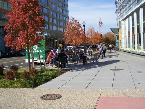
Tables and chairs installed in the streetscape, 4th Street SouthwestRight:  4th Street SW streetscape.

But the office buildings that DC Government leases at the Waterfront Metro Station are not lousy in terms of how they connect to the street, proximity to the Metro, and how workers and the in and out activity of the building when it is open contributes to street vitality in ways that the Reeves Center does not.

Similarly, in smaller communities, combined federal buildings with post offices, such as in Ann Arbor, or courthouses, can have similar functions, in anchoring a community.

So while there is still the loss of agglomeration benefits by deconcentrating government agencies and moving them around the city, when this is done, for "economic development purposes," it is possible  to do this in ways that help to further neighborhood revitalization objectives, and project and extend the quality of the civic identity of the city and the neighborhood.

That we more typically fail at this doesn't have to be the default position.

Labels: , , , , , , , ,

Thursday, August 08, 2013

It's time to retire the old saw about the Reeves Center being a great economic development contribution to U Street

In honor of the City Paper article, "Swap and Go," quoting City Administrator Alan Lew about how moving government agencies, from the Reeves Center, to Anacostia, will make Anacostia better:

1. For 20 years, the nearby properties on the adjoining blocks continued to suck.
2. Few if any new businesses were generated by the existence of the property during its existence
3. Most of the retail businesses operating in the building failed, or certainly, left owing DC Government hundreds of thousands of dollars in back rent.

I first wrote about this in August 2005, energized in part by the failure of the two "government" office buildings on the 600 block of H Street NE to have any more general economic benefit to the greater community, rather than to the community development corporation collecting the rent checks.

Not to mention the issue of degrading agglomeration benefits of keeping government agencies close together, rather than separating them, a phenomenon that I also call intra-city sprawl.

Reeves Center Myth Revisited
Re-reading the Post article ("Williams Proposes Moving Metro Offices to Anacostia") it quotes Mayor Williams as saying he was inspired to suggest this development at the Anacostia Metro Station by the actions of Mayor Barry's building of the Reeves Center.

Reeves CenterThe Reeves Center is pretty typical of the urban brutalist DC urban renewal projects from the mid-1970s onwards.

IT IS A MYTH that the Reeves Center sparked the revitalization of U Street. It is an urban brutalist* monster that sucks the life off of the street. Many of the retail businesses in the Reeves Center have failed--most leaving lease debts in the hundreds of thousands of dollars--debts that the District government had to eat.

The other three corners of the intersection have fast food places or a vacancy. AND, it took more than 10 years after the Reeves Center before "revitalization" started happening--much of it being sparked by the opening of the Green line subway stations. (Granted, the construction of the Metro on U Street contributed to the problems.)

And still, the area around Reeves Center is a vacuum. What life around it has it engendered?

Why is learning from Jane Jacobs and other practitioners of urban vitality so difficult?

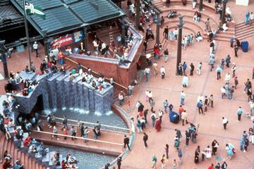
Pioneer Courthouse Square, Portland, ORRight:  Pioneer Courthouse Square, Portland, Oregon. Photo by PPS.

Counter point

One could argue that the movement of the Dept. of Consumer and regulatory Affairs and Office of Planning to offices at the Waterfront Metro station has been key to the increased vitality at that location.

If that is the case, and I would argue that it is, it is because unlike the Reeves Center, these buildings were designed to connect to and strengthen the area around the building. Plus they are part of a mixed use complex, including residences, and an updated Safeway Supermarket.

So the lesson is that if you are gonna do such a move, make the buildings connect, not disconnect. Also see "Development economics and Anacostia."

------
* I know, I know. Reeves Center isn't urban brutalist, but it is hulking and disconnected. More of a superblock styled building.

Labels: , , , , , , ,

Tuesday, February 28, 2012

No matter what you spout off, re/development takes time

Remains of the Deauville Apartment building, Mt. Pleasant neighborhood, DC
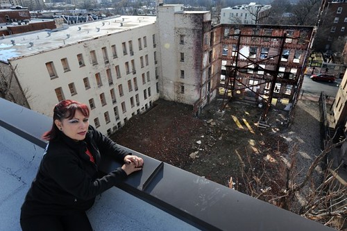
Four years after it was badly burned in a midnight fire, residents of a low-income apartment building on Mount Pleasant Street NW are seeking financial assistance from the District to help rebuild the property, which remains an eyesore in the community. Yasmin Romero-Castillo, Advisory Neighborhood Commissioner for 1D01, sits on a building overlooking what is left of 3145 Mount Pleasant St. NW. Tracy Woodward, Washington Post.

The Post had an article, "Ex-tenants, Mount Pleasant frustrated four years after apartments burned," about one month ago about the frustration in the Mount Pleasant neighborhood over the "inaction" of rehabilitating a building that "burned down" about four years ago, displacing 85 households.

There was a follow up letter to the editor, "Fire swept away the progress," calling this a daily reminder of "the District's lack of action."

Hey, I beat up on "the government" in DC as much as anybody, but the reality is that even in the best of circumstances dealing with something like this can take years.

First, the primary actor responsible for addressing the aftermath is not the DC Government, except through its regulatory powers, it is the property owner. Haggles with the insurance company, getting an architect, coming up with plans, lining up financing all takes time, bidding out the job, selecting contractors and subcontractors, getting building permits, doing construction, etc., takes up a lot of time.

Of course, since the tenants bought the building, they are the ones who now have to come up with the $10 million. And that makes everything that much harder, because tenant-owned properties are harder to finance, and the organization lacks the technical expertise in-house to manage and execute the rebuilding process.

This process takes time, and unless the complainers are ready to step up with multi-million dollar low interest loans, they better develop some patience.

I think about this a lot because, among many examples, of how it will take 12+ years all told to convert the old the Amoco station on the 300 block of H Street NE into a mixed use apartment building with a Giant Supermarket on the site.

(Developing patience is hard, I didn't really start to understand this til I was about 45 years old, and starting to process my various experiences doing revitalization-related work in the H Street neighborhood--the streetscape reconstruction project there was fast-tracked, it'll basically be finished this year, plus one more year for streetcar-related infrastructure. The project started with the planning phase in 2003. That it will be completely done, including a streetcar, in about 12 years is quite good.)

Labels: ,

Thursday, January 12, 2012

Neighborhood change/gentrification

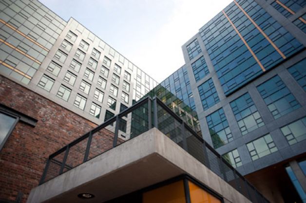
Amazon headquarters, Seattle

The fourth phase of the new headquarters that Vulcan is building for Amazon.com is seen at an unveiling on March 22, 2011 in Seattle's South Lake Union neighborhood. Elliot Suhr/seattlepi.com.

When I write about "gentrification" I make the point that the issue is really about neighborhood change, and that the "new people" are different from the "old people" and that these differences aren't always economic or racial, but can include differences in educational attainment, where you work, etc.

The South Lake Union neighborhood in Seattle is in a long term redevelopment process, not unlike the old urban renewal ideals but with better design, initiated by co-founder of Microsoft Paul Allen, and his Vulcan Realty Group. See "Vulcan completes most of new Amazon headquarters: Developer touts plan for taller buildings elsewhere in South Lake Union" from the Seattle Post-Intelligencer. The streetcar initiative in Seattle was pushed forward to support the intensification of this neighborhood. (South Lake Union streetcar case study, Reconnecting America.)

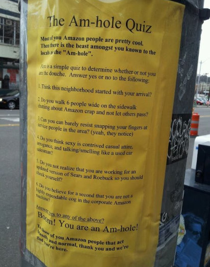
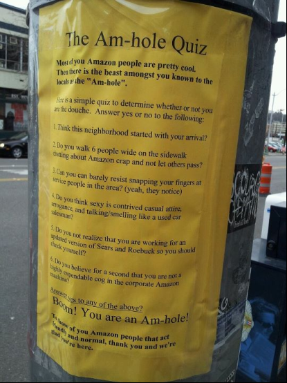
Apparently, not everyone is with the program, according to this piece, "Hey, ‘Am-hole!’ South Lake Union calls out Amazon employees," from the SPI, which describes and pictures a flyer posted around the neighborhood, with criticism of the behavior of workers from Amazon.com's headquarters complex--illustrating the complexity of thinking about and dealing with neighborhood change.
amhole, protest flyer against Amazon workers, Seattle
Photo via reddit user istrebitjel.

Labels: , , ,

Thursday, October 27, 2011

Revitalization in weak real estate markets

I have a hard time reading a lot of the smart growth etc. blather about how to do revitalization based on people's very recent experiences in DC--recent defined as the last few years, since 2004-2006--because DC (and Brooklyn) are outliers nationally in terms of cities that have gone through post WWII decline, and are coming back.

Most other cities have a much harder time and the proscriptions are harder to realize and take even longer. And in DC it took about 25 years after the first opening of the subway system before you could really start to see positive revitalization energy deriving from transit access and proximity. But these days DC is one of the strongest real estate markets in the world, and in the U.S. In most U.S. cities, there is minimal population in-migration--most center cities continue to shrink--and limited amounts of new construction.

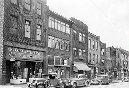
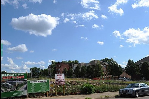
These are two photos of the 1800 block of Centre Avenue in Pittsburgh's Hill District, from 1930 and today, from the Pittsburgh Post-Gazette's "Storefront Project." (Current photo byRebecca Droke of the PPG; historic photo from the University of Pittsburgh.) Tell me "experts" based on your very recent in DC experience, what would you do there?

photo21800 block of Centre Avenue in the Hill District circa 193

1800 block of Centre Avenue in the Hill District, today


Labels: , , ,

Tuesday, October 25, 2011

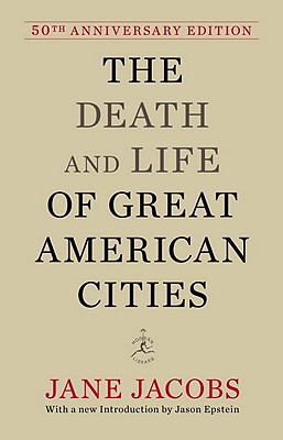
50th anniversary of the publication of Death and Life of Great American Cities by Jane Jacobs

Image from "Downtown is for people," by Jane Jacobs, Fortune Magazine, April 1958.

Christopher reminds us that right around now, 50 years ago, Jane Jacobs' seminal urban studies and planning text, Death and Life of Great American Cities, was first published. The review in the New York Times was published 11/5/1961, and likely that was around when it came out. This is from that review:

Mrs. Jacobs' view is that people like to live, not just be, in such lively neighborhoods. Youngsters and elders alike need such surroundings. But she scoffs at our understanding of these requirements; for we continue to put up civic centers, low density residential areas and housing "projects" segregated by income. All these developments, she complains, combine to produce boring homogeneous cores which generate traffic for limited periods and then lapse afterward into dead or dangerous districts. Worse still, the new buildings with high rents squeeze out the marginal activities, the small business man just getting a start, the colorful shop with strange and exotic waves, the little restaurants and bars, almost everything deviant, bohemian, intellectual or bizarre-- in other words, all that the author believes lends spice, charm and vigor to an area.

To brighten neighborhoods, "unslum" slums and reweave housing projects into the fabric of the city, Mrs. Jacobs proposes that we do most of the things urban experts tell us not to do: attract mixed activities which will generate active cross-use of land; cut the length of blocks; mingle buildings of varying size, type and condition; and encourage dense concentrations of people. Some of the most intriguing parts of this work involve the ingenuity with which she applies her ideas for enlivening districts such as Wall Street or Central Park after dark Greenwich Village where the author lives as her model par excellence. A few other favorite examples include the North End of Boston, Georgetown in Washington, Rittenhouse Square in Philadelphia, the "Back of the Yards" in Chicago, and Telegraph Hill in San Francisco.


Leo Kottke's blog quotes from her 1958 piece, "Downtowns are for people," in Fortune Magazine:

There are, certainly, ample reasons for redoing downtown--falling retail sales, tax bases in jeopardy, stagnant real-estate values, impossible traffic and parking conditions, failing mass transit, encirclement by slums. But with no intent to minimize these serious matters, it is more to the point to consider what makes a city center magnetic, what can inject the gaiety, the wonder, the cheerful hurly-burly that make people want to come into the city and to linger there. For magnetism is the crux of the problem. All downtown's values are its byproducts. To create in it an atmosphere of urbanity and exuberance is not a frivolous aim.
Book cover, The Death and Life of Great American Cities
There has been a lot of reconsideration of Jacobs lately, including revisionism about Robert Moses.

I read a piece, I can't remember where, which made a good point, that maybe in part Death and Life was written at the very peak of the center city--actually the city was declining, and people knew it--but it described ideal community organization as that form of retail business, independent business, was about to shrink drastically as a result of the reorganization of various retail categories on a national scale.

I think the mistake is thinking that Death and Life solves everything. It didn't and that's too big a responsibility for one book. However, her four main precepts:

- density (or concentration) of population and activity enables a great deal of diversity of exchange;
- mixed primary uses enable a great deal of activity and efficient use/ability to share resources (such as parking) across multiple functions and dayparts;
- a network of small blocks and a street grid maximizes the opportunity for exchange and connection;
- a large stock of old buildings, with running costs low because the building is paid off, can be rented/owned cheaply, with the ability; to support innovative, new, start up, creative uses, which at their beginning stages, must minimize costs, including rent;

are key.

In the first chapter, "Jane Jacobs Revisited," of his book Cities in Full: Recognizing and Realizing the Great Potential of Urban America Steve Belmont strengthens JJ's arguments by putting numbers to the ideas, such as explaining why density matters to the success of commercial districts, neighborhoods and housing, transit, and cities and commerce more generally.

Work in urban design, such as by Jan Gehl (Close Encounters with Buildings) and placemaking (e.g., Project for Public Spaces) also amplify the concepts in Death and Life.

Not to mention, consideration of transportation-public transit-bicycling, which isn't addressed to a significant degree by the book, probably because in New York City, the subway service, at least in Manhattan, where she lived, is stellar.

The point is to build on and strengthen the ideas. (Two books that are good at illustrating the ideas are by Roberta Gratz, The Living City and Cities: Back from the Edge. I always say if you only have time to read one book on urbanism, Cities: Back from the Edge is the one to read--it illustrates the ideas of Death and Life through case studies and place profiles and this makes it a bit easier to grasp.

Labels: , , , ,

Saturday, January 15, 2011

East of the River exhibit at the Historical Society

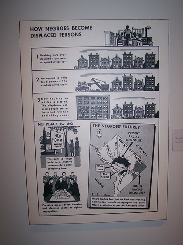
While I don't think it's the most amazing exhibit, the exhibit, "East of the River: Continuity and Change," produced a few years ago by the Smithsonian Anacostia Community Museum and now on display at the Historical Society of Washington til the end of the month, is worth looking at. There are some interesting images, a good explication of the historical themes, and a set of video oral histories on a loop.
012

"How Negroes Become Displaced Persons."  From the National Committee on Segregation in the Nation's Capital.  Segregation in Washington (1948).
"How Negroes Become Displaced Persons." From the National Committee on Segregation in the Nation's Capital. Segregation in Washington (1948).

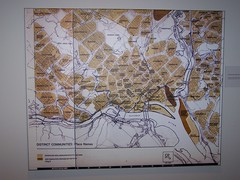
DC Neighborhood place names, from
DC Neighborhood place names.

Labels: , , , ,

Tuesday, January 19, 2010

At best, National Harbor is equivalent to a shopping mall

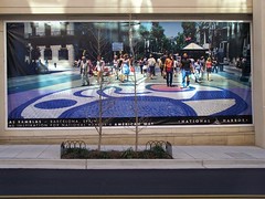
So the claims about the inspiration behind its design being Las Ramblas in Barcelona seem a bit specious.
100_0522.JPG
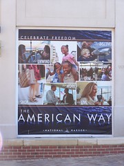
Large storefront sized banners are displayed on storefronts that haven't yet been leased out at National Harbor. This one compares National Harbor to Las Ramblas in Barcelona.

Finally went to National Harbor yesterday. Granted, in the winter there are many fewer people walking around, they aren't on the water so much, and there are few outdoor special events. (Although I imagine it was hopping during the special ice exhibit; "'Ice!' exhibit at National Harbor" from the Post.)

But it felt uncomfortable. Very little there isn't processed--chain restaurants, chain retail, and corporate stores like Peeps. And I can't imagine that any of the art galleries sell much art.
100_0528.JPG
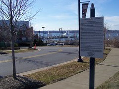
Make sure you follow the rules when you're at National Harbor. (Although to be fair, comparable rules are in place at shopping centers too.)

Afterwards we went to Alexandria, and the contrast was striking. Alexandria is far more interesting. Interestingly, because National Harbor is close to Alexandria and relatively "far" from the core of Washington, the information displays for tourist information, at least in the hotel, are the same ones used in Alexandria, and for the most part, feature attractions in that city, not DC.

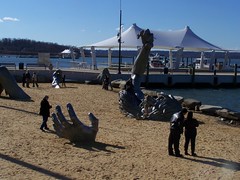
National Harbor, which is marketed as being "Washington, DC" has absolutely nothing related to DC, other than the Potomac River location and the old Awakening sculpture that was at Hains Point. Eventually, it will have DC's Children's Museum too--the museum, after having received tens of millions of dollars of support from DC Government, decamped a few years ago.
100_0493.JPG
The Awakening sculpture on the Potomac River at National Harbor.

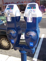
I did like how the parking meters (the complex has tons of parking structures, a couple hotels, and a time share "resort" building) have credit card readers built in.
100_0519.JPG

The commodification and reworking of the normal "National Experience" obtained by visiting to "Washington, DC" to better understand American Government, to instead promote the base sale of goods and service as "celebrating freedom" is pathetic but hardly surprising.
100_0501.JPG
A banner promoting consumerism as the high point of "the American Way." American Way is also the name of "the main street" in the complex.

This visit reinforced my earlier statements that Disney, opening a resort hotel at National Harbor, is doing no favors to DC (despite claims to the contrary by DC tourism officials). It's strictly a move to capture a share of the money people would normally spend traveling to and visiting DC.

Like how the Gaylord Convention Center cross markets the National Harbor property to convention clients that have stayed in their other properties such as in Nashville, like Disney will heavily market their "Prince George's shopping mall is really Washington, DC" location to customers who have visited their other properties, to divert these clients from staying in competitor locations, and spending their money at places like Marriott-branded hotels instead of lining the Disney pockets.
------------
The Las Ramblas comparison is "funny" because that place as an inspiration for National Harbor was suggested in a column in the Washington Post in 2005. The column inspired the following entry: (Why aren't people) Learning from Jane Jacobs, and later this one as a follow up: (Why aren't people) Learning from Jane Jacobs revisited.

This is a reprint of the first entry------------------------------

Michele Dyson is a (once or twice monthly) columnist for the Washington Post, writing about Maryland issues for the back page of the Outlook section. Last Sunday's paper had the column "National Harbor: Think Small to Make It Special," about the gargantuan development coming to Prince George's County along the Potomac River. From her piece:

National Harbor is the largest private investment in the history of Maryland. In essence, it's a $2 billion wager that carries enormous risk. Much of the county's economic future is at stake, along with Peterson's reputation and money. Peterson has said that National Harbor will be his version of Las Ramblas, the grand pedestrian walkway near Barcelona's port district. But Barcelona is Spain's second-largest city. It hosted the 1992 Olympics, and its port is one of the most important in Europe. Along Las Ramblas, a visitor encounters artists, a huge opera house, fabulous food, a red-light district and an open-air pet market. Does this sound like Prince George's County? (...)

Peterson built projects all over the region, but mostly in Northern Virginia. His office park, residential and mixed-use projects have been standard suburban fare -- office buildings off major highways, apartments, condos, townhouses, single-family homes and maybe a church or two. His big-box stores, gas stations and chain restaurants have come accompanied by the inevitable giant slap of a parking lot.


Peterson has built a lot of these cookie-cutter developments, and not much distinguishes one from another. That is until recently. Peterson's work in the revitalized area of downtown Silver Spring has residents and businesses speaking in glowing terms.(**) And his National Harbor model gives reassuring evidence that the prime riverfront property just might be in the right hands. The elaborate 8-by-10-foot model generates excitement.

But if National Harbor is to become a favored destination, like San Francisco's North Beach or Miami Beach's South Beach, it will have to generate a large base of loyal local regulars. It also will need out-of towners who are willing to make a special trip there. People make special trips because they enjoy the ambience and unique qualities of an area. Toward that end, National Harbor should forgo strip mall cuisine. If we are what we eat, National Harbor will be what it serves. Forget Starbucks and ESPN Zone, and think San Francisco's Cafe Trieste and our own Vienna Inn.

Neighborhood vitality and verve can be as long-lived as New York's Greenwich Village or as newly minted as Richmond's Carytown. These places flourish because their status as celebrated destinations helps recruit artisans, artists and small businesses. These in turn plant roots, take risks and build the kinds of enterprises that further enrich the physical setting. National Harbor can do no less. Chain stores won't fill its streets, but an outstanding assortment of accomplished small businesses might.
______
** (Actually I think that the "revitalization" of Silver Spring is no different from traditional urban renewal. It's not pedestrian friendly, and small businesses are losing out, so much so that Montgomery County is suggesting that additional incentives be provided to small businesses to preserve them.)

carytown3
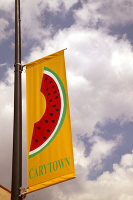
Carytown photo by Steve Pinkus.

Like Ms. Dyson, I like Greenwich Village and Carytown in Richmond. In fact, Carytown is one of the more interesting commercial districts in the region--one that I've written about before. Yesterday's Richmond Times-Dispatch happened to have an interesting article on Carytown, entitled "Carytown: Where Change is Constant," about the ebb and flow of the retail businesses there.

And it included an incredibly important statistic--the average retail rent/square foot--In 1990, Carytown commercial rent was $10 a square foot. It's now about $18 to $20 a square foot.

National Harbor will be all new construction, meaning that prevailing rents will need to be a minimum of $60/sq. ft., and probably much higher (upwards of $120/sq. ft.). This makes it almost impossible to attract small businesses without serious subsidy.

One of the particularly grotesque aspects of the Inner Harbor in Baltimore is how, other than a couple local seafood restaurants like Phillips, it is now all chains--from ESPN Zone to California Pizza Kitchen. National chains, attracted by the large number of people-customers, have crowded out local businesses.

Sure the U.S.S. Constitution offers authenticity, but the Inner Harbor is for and about tourists, with little in the way of other authentic experiences.

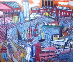
Baltimore.InnerHarbor.jpg
Would that Inner Harbor really looked like this. Title: Inner Harbor Media: Oil on Canvas, 1998. Size: 25" x 30, not framed. By Sy Mohr.

The rent statistic is interesting in another way. Even in "marginal" commercial districts in DC, such as H Street or Brookland, the floor of asking prices for rent is probably greater than $20/sq. ft. And these are for commercial districts far less successful than Carytown. This is why we need to be much more purposive in developing and incubating independent businesses.

One of the four rostrums from Jane Jacob's Death and Life of Great American Cities is the need for "a large stock of old buildings." This isn't because she is a preservationist, but because old buildings have lower carrying costs, particularly debt service, and this allows for the incubation of new businesses--retail, office, and other (it's part of the Richard Florida equation supporting the development of creative businesses).

This gets back to the point I make over and over again--the rule of thumb from the Main Street Approach is that a retail business pays 4%-10% of its annual revenues in rent (restaurants can and do pay slightly more). Figure it out backwards from what businesses can reasonably generate in revenues... yet the asking price for commercial buildings, asking prices for rent, and often the property tax assessments are completely out of whack compared to the revenue stream that successful businesses are likely to be able to generate.

This is why salon shops are dominant in many of the neighborhood commercial district, because they have a customer base that returns again and again, and the average transaction is high (a woman can easily spend $50-$150 getting her hair done) in comparison to the average retail business.

I agree that many of the retail businesses in our commercial districts are marginal, but they need help both to improve to be able to sell more, and the commercial districts need to improve more as well, in order to be able to draw greater numbers of patrons.
hstreetsign2
The place next store is available for rent! 500 block of H Street. Photo by Michael Berman.

Las Ramblas is a real city built up over centuries. When you build a development all at once, you can't have the ebb and flow of innovation, because high rents are the one uniform condition of such development.
carytownbanner
The Carytown Watermelon Festival is a big street festival involving many of the merchants on the street. It's scheduled for Sunday August 10th.

Speaking of rents, last Wednesday's New York Times had an article, "Columbus Ave. Distances Itself From Broadway," comparing Columbus Avenue to Broadway, and how "more personal unique" chains are locating on Columbus vs. the big chains (Barnes and Noble, etc.) on Broadway. The retail rents on Columbus Avenue average $180/sq. foot. That means that for a 2,000 sf. space, the store needs to generate at least $3.6 million in annual sales...

[Added 7/2008, also see the New York Times article, "Offering Big Spaces, Amsterdam Avenue Is Catching More Retailers."]

------------
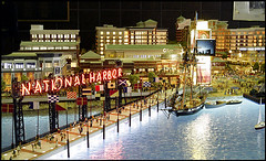
In order to ensure some taste of the center city, National Harbor ought to build and install a model of Washington, DC or some of the monuments and attractions and put it in a window for people to gawk at, just as people were gawking at the model of National Harbor installed in a vacant storefront window on "Fleet Street."
PH2005072201530.jpg
Photo: Preston Keres/The Washington Post. County unveils a $400,000 model of what the National Harbor project will look like.

Labels: , , , ,

Friday, November 27, 2009

Changing the land use development paradigm towards intensification: in the suburbs and in the center city

One of the reasons for the most part I am writing a lot less is that I am more interested in writing "integrative" posts synthesizing a bunch of grand points and ideas, because the day to day stuff tends to illustrate meta-ideas and frameworks that people often fail to perceive--and I have a lot less time because I do a brutal bike-railroad-walk-bus commute to and from work each day that takes hours. (And such posts take a couple hours to write.)

Anyway, I am working in a county in Maryland that definitely has a deconcentrated land use paradigm, despite many progressive land use policies, a place that is traditionally called "sprawl." Its road pattern is based on connections from Baltimore, and these days, when the center city is no longer as central a location for jobs and other activities, there isn't a satisfactory road network that moves people east-west and around the County, other than the Interstates.

In such an environment, promoting walking and bicycling is difficult for at least three reasons. First, the road network is focused on Baltimore and isn't the kind of grid road network that provides a plethora of alternate routes (it's an angled star of routes emanating for the most part from Baltimore), some of which could better accommodate bicycling than others. Second, the roads for the most part are narrow and/or traffic engorged, and it is difficult to find the space to add bicycle lanes. Third, because of the spread of distance between residential areas and amenities and activity centers, even though we can improve the environment for bicycling and walking in many places, the problem is that there aren't amenities present within a couple miles of people's homes.

See, the national research shows that 40% of household trips are 3 miles or less, and the idea in transportationally oriented walking and bicycling is to shift as many of these trips as possible away from the automobile. But if there aren't services and destinations present (other than civic assets such as schools, parks, libraries, and recreational centers) there is less reason to take up utilitarian-oriented walking and biking.
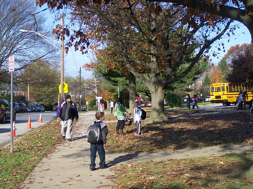
Walking to school, Dumbarton Street, Rodgers Forge Elementary School
But in neighborhoods with the right spatial patterns and accessible amenities, even in what otherwise is termed suburban sprawl, people will walk and bicycle, and kids will even walk to school.

So the whole argument about intensification of land use practices (i.e. "Leggett taking more hands-on approach to growth policy" from the Gazette) in Montgomery County, Maryland is fascinating to me, both in terms of my learnings and understandings based on living in DC for a couple decades, witnessing both the decline and rise of the center city, and my having to deal with this as a planner in the Baltimore region (at least through the course of my project, which ends next July), in a county that is similar to Montgomery, but with an even greater dependence on the automobile, and less in the way of robust transit resources (Montgomery has a number of stations on the high capacity red line subway, which connects to four other lines, and one of the best suburban bus operations in the U.S., plus Metrobus services, even if their County Dept. of Transportation isn't as progressive as we think, "riding" on their two decade old decision to create RideOn ever since).

The Gazette this week is full of letters about how rebuilding the Safeway supermarket in Montgomery County's Wheaton community (last week's article which touched this off, "Planners hope Safeway would revive Wheaton"), a site which is a bit farther from the subway station than the Safeway on Georgia Avenue is from the Petworth station in DC (which I figure is destined for a similar kind of intensification), into a mixed use development with a supermarket on the ground floor (just like at CityVista at 5th and L Streets NW) and apartments-condominiums above, is a disaster of major proportions.
Safeway and apartment building at 5th and L Streets NW, Washington DC
Safeway at 5th and L Streets NW. In October, I was riding by here early one Saturday morning on the way to catch a Chinatown bus to Philadelphia, and there was a guy walking on one of the streets, maybe 4th or 5th, on the other (north) side of New York Avenue, and even though the Avenue is a traffic engorged street, in the area around the Safeway it starts to get calmer. And I was thinking, how great would it be to live on one of these tree lined streets in a nice rowhouse, and be able to walk two blocks to the grocery (especially great now that Safeway has significantly decreased their prices on thousands of items--they used to be much higher priced than Giant), a hardware store, restaurants and other retail shops, and downtown. That adding amenities like this, albeit they come with additional residents, strengthens the city and strengthens neighborhoods, and makes it easier to get around without an automobile.

These are the letters:

- "Wheaton planners' approach myopic"
- "Smart Growth needs common sense"
- "Development running amok "

While I agree with one of the letter writers that having 400 parking places for a 500 unit building is too much, he sees this as leading to more congestion, I see it as way too much space for cars given the proximity to the subway station, and that the real myopia is to continue to plan primarily for automobility.

It makes me think about the various arguments I have to deal with in my own job, but also the difficulties we have in DC, trying to make the same kinds of decisions, not downtown, where intensification is accepted and is having incredible positive benefits, but at subway stations in other parts of the city that have been traditionally much less densely developed.
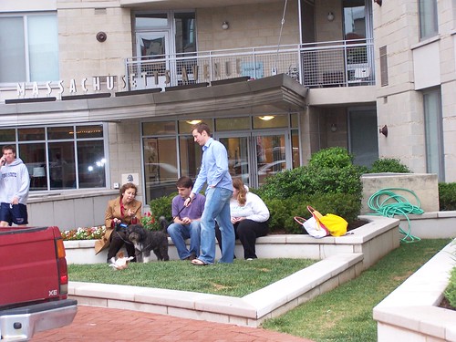
People on the street at 555 Massachusetts Ave. NW
People on the street at 555 Massachusetts Ave. NW. These days people walk up and down Massachusetts Avenue, with dogs and/or children, when less than 10 years ago, it was desolate (true in part because it was being land banked for intensification), with few pedestrians other than those seeking nearby social services, homeless, and people seeking the services of transvestite prostitutes working on K Street NW. Now the area is becoming a desirable place to live.

As Denise Richards would say, "it's complicated."

1. Yes, these outer DC neighborhoods haven't been densely developed historically;
2. But density is a relative concept;
3. DC needs to leverage the location of high capacity transit in order to get return on investment for the billions of dollars spent on the subway system, to get more residents paying income, property, and sales taxes;
4. and to have more residents in neighborhoods supporting local commercial districts, providing eyes on the street, etc.;
5. because in this century, trends and attitudes favor urban living, rather than living in the suburbs and it is an opportunity that the center city can capitalize upon;
6. which is a decidedly different time from when the city was shrinking in population and businesses and the municipal government functioned even worse than it does now;
7. And it is reasonable to reconsider/consider surgical increases in density at subway stations specifically especially in other parts of the city despite overall neighborhood density and historical patterns to reflect this century and the city's needs of this century, rather than how things were being done from 1887 to 1920, as long as it can be done sensitively, in ways that strengthen neighborhoods rather than diminish neighborhoods.
Apartments-condominiums being built across from the Petworth Metro Station, Georgia Avenue
This development is on top of the west side of Georgia Avenue exit for the Petworth Metro station, and had previously served as bus bays.

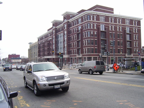
The developments at the Georgia Avenue subway station (Petworth), which are located in a more densely developed area (mostly rowhouses and apartment buildings) of the city, are demonstrating how multiunit buildings can be sensitively and attractively inserted in mid-density areas. And how this contributes to other improvements in the greater neighborhood.
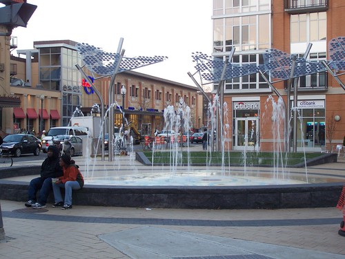
Fountain, Columbia Heights Plaza, 14th Street and Park Road NW, Washington, DC
New neighborhood plaza in Columbia Heights, created as part of a public realm improvements plan associated with new development on 14th Street NW.

But neighborhoods like Brookland and the Fort Totten (Riggs Park, Michigan Park, and other neighborhoods) aren't as populated as neighborhoods in the core of the city, and 5 or 6 story buildings seem out of place in neighborhoods that are mostly two story attached and detached houses, even though such buildings, in areas of the city that have a more variegated building typology (mix of commercial, apartments, medium sized buildings, rowhouses, etc.) are not unusual.

So redevelopment projects targeting Brookland, specifically on deaccessioned land from Catholic University along Monroe Street (see "Brookland and Abdo Getting Closer to New Development" from DC MUD) and eventually at the Brookland subway station, and with the redevelopment of low density garden apartments adjacent to the Fort Totten Metro station are more controversial ("Mixed-use projects in District advance: Retail, housing centers on deck for Fort Totten, Brookland in NE" "An uptown vision for a '50s neighborhood: Foundation plans new housing, retail and arts space near Fort Totten, but tenants are anxious," and the editorial saying don't be scared, "A future for Fort Totten: Shops and housing for a D.C. neighborhood" from the Post).

The reality is that while yes, more traffic is generated when you add population, but it's going to happen anyway but with a robust transit network as is present in DC, as much as 50% of the trips made by people who live within a short distance of the subway system are made via transit, reducing car usage significantly. And with more transit users, adding more transit service becomes possible, further reducing automobile trips.

I see the results of these changes as a regular bicycle rider on the city's streets.

While I don't record my observations on a day to day basis, there is no question that on many of the city's major streets, traffic is less than it was, even though the city's population is increasing. Sure, these days, the recession is impacting traffic. But I have been noticing this for years. Even in dense areas of the city, during rush hour periods, I can ride my bicycle through red lights because of the lack of oncoming traffic. (I am a fervent proponent of the Idaho stop...)

But most people don't seem to see this real and fundamental change, so on a different scale, DC has the same kinds of issues that they have in Montgomery County in terms of changing the land utilization paradigm, and we haven't been very good about educating people, even though the DC Office of Planning has at least one excellent publication that explains many of the issues, Trans-Formation: Recreating Transit-Oriented Neighborhood Centers in Washington, DC.

DC did do station area plans (in the 1970s) in advance of the subway. And in some parts of the city, citizens fought off plans for intensification. The funny thing is that I am glad they did it--then and only then--because the prevailing design sensibility and perceived value of the city was focused around the urban renewal ideal, so new buildings at subway stations would have looked like this (see below) and that wouldn't have strengthened the city or the neighborhoods. Instead it would have created a new kind of blight that would need to be redeveloped now, just as the Waterside Mall and other areas of southwest DC are being redeveloped today--and that area was one of the national pilots for urban renewal planning in general.
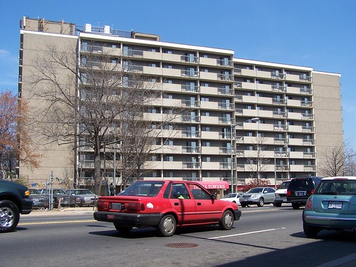
Delta Towers
Delta Towers on Florida Avenue NE in the H Street neighborhood is a senior housing apartment building constructed as a result of the post-riot H Street Urban Renewal Plan. Imagine this in Columbia Heights or Petworth or Takoma.

But now, it's possible--if you demand it, and the jury is out--to get quality design. It's not a regular occurrence, but it does happen. Fort Totten is pretty bad thus far. But the new developments by the Columbia Heights and Petworth stations are pretty good. The developments by the Takoma Metro are about 1/3 each very good, good-acceptable, and abominable.

It is very much dependent on the quality concerns of the developers. Quality design does pay, reaping higher returns, especially in DC, but even in DC the payback period is longer, and developers more focused on the quick return and flipping aren't concerned about the higher paybacks because their business model means that they won't own the property when it starts gushing profit.

This is why developers like Abdo Development, Chris Donatelli, PN Hoffman etc. are to be preferred over most of the others. For the most part, they care about design quality. Too many other developers do not.

I hope that with quality projects, more people will see the value of quality development, and more people will come to understand the link between intensification of land use and the availability of walkable-bikeable-transit accessible amenities within neighborhoods across the city, and accessible by residents from many neighborhoods. (In any case, most DC neighborhoods lack the population density to support complete commercial districts within their neighborhoods as a minimum of 20,000 people is required to support a local commercial district, and 30,000 people are required to support a high quality supermarket and related stores.)

And hopefully they will see how "better" development leveraging access to high quality transit reduces road congestion overall.

And that elected officials, rather than caving in to most demands from developers, will demand excellence instead of mediocrity, and take care to steward the future of the city for generations, not just worry about today's seeming crisis and request from a developer focused on an even shorter time frame than elected officials (4 year terms for elected officials...).
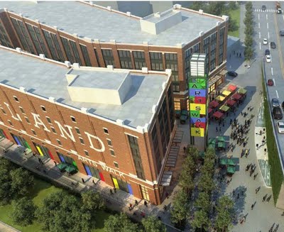
Arts walk building along the railroad tracks, Brookland-Catholic University development by the Abdo Development Company
Rendering, loft style "Arts Walk" building, proposed Brookland-Catholic University development by the Abdo Development Company.

Labels: , , , , , , ,

Thursday, November 26, 2009

It's very very very hard, but sometimes you get quality urban infill

14th and U Streets NW, circa 1950s, Scurlock Studios
14th and U Streets NW, circa 1950s, Scurlock Studios photo, National Museum of American History.

Corner of 14th and P Streets NW
Older intact commercial buildings at 14th and P Streets NW

When I first started being involved in revitalization issues I had plenty to learn. At the outset--remember that it was not until 2003 that "revitalization" within DC really hit its stride--when I would see footings and foundations for new development, I would be positively excited, expecting good things from the investment.

Mostly, I would end up disappointed, because the finished work was usually crap.

Even so most people would argue along the lines of "something is better than nothing" even if that something was very very mediocre.

I would respond that after waiting this long, it makes sense to make things much better, rather than just accept mediocrity. This line:

"Better than concrete block shouldn't be the standard that we are satisfied with" comes from that era.

Given the amount of bad infill in the vicinity of 14th and U Street NW, from the Reeves building to one story commercial junk (in the place of better buildings that were destroyed during the 1968 riots), finally seeing some decent buildings being constructed in the place of empty lots-used car dealerships at the "100% intersection" in the neighborhood is good to see.
101_0013.JPG
The two buildings to the left of the corner building have been constructed over the past 18 months.

It's too bad that I don't have photos of the the west side of the block between T and U on 14th Street, and between 13th and 14th Streets on the south side of U Street, to show the lousy one story buildings next to the Rite Aid.

Partly this is about maximizing the value of the land, and recognizing that building appearance contributes to property value and supports higher rents. The urban renewal era didn't care much about design, according value only to the location.

Labels: , , ,

Thursday, September 17, 2009

Councilmember Bowser puts forward some good legislation on nuisance property taxation

DC has a problem with properties that have mouldered for years--decades in fact--for a variety of reasons, but in any case the properties are disinvested, nuisances, and make neighborhood and commercial district improvement more difficult.

I learned about this first hand in the H Street neighborhood, where I can point to many properties that have been vacant for the entire time that I have lived in the city, which as of this week, is 22 years. (Although two of the properties, old corner stores, that I have always loved, 400 K Street NE, and 500 L Street NE, are finally going through some rehabilitation.)
406 H Street
406 H Street, vacant for more than 20 years.

DC goes through various fits and starts with legislation to address this issue, but one of the most effective techniques has been to increase significantly the property tax rate for vacant properties. There are ways around it--slap up a for lease sign even if the building is uninhabitable and you can get around it, etc.--but for people without unlimited funds this has been an indirect policy initiative which has gotten them off their butts to either improve the property or sell it to someone willing to invest in and fix the problem.

Of course, these days, with a weak real estate market, property owners and developers are on the city to suspend this punitive tax rate, because market conditions are bad and properties are vacant as a result.

And Councilmember Jack Evans, who is always willing to do the bidding of the Building Owners and Developers when it comes to tax breaks of all sorts, is eager to modify the tax code to provide relief to the Class 3 tax classification.

Separately, Councilmember Muriel Bowser of Ward 4, has introduced legislation to create a Class 4 property tax classification, which would apply only to what she calls "blighted" properties. See "A Class 4 tax rate for blight?" from the Washington Business Journal.
-----------
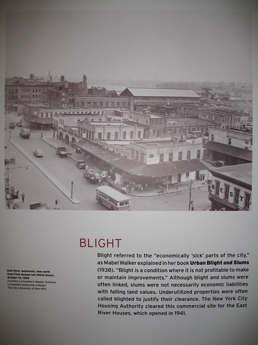
I write from time to time about what I call "the language of revitalization." The real issue is disinvestment. What people call "blight" is a result of disinvestment. Rather than blame the place (I call this "blaming the building"), focus on disinvestment and explain the process.

Too often people are lulled into believing that demolition, especially of historic buildings, is a solution to "blight" when merely it creates a different form of blight, one that is harder and more expensive to correct (building a new building).
----------
I think it is a good idea to better target the Vacant Property tax penalty by creating multiple categories. Persistently vacant nuisance properties need more penalty and punishment.

For past testimony to City Council on this issue (I testified about dealing with vacant and nuisance property issues quite a bit from 2002-2006), see this blog entry, "Receivership for housing."

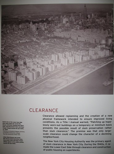
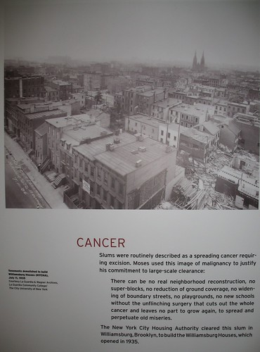
In 2007, Mike F. went up to see the various Robert Moses' exhibits in NYC, and he shared some photos of the exhibit.
Blight, Robert Moses exhibit

Clearance, Robert Moses exhibit

Cancer, Robert Moses exhibit

Labels: , , , , ,