Rebuilding Place in the Urban Space

"A community’s physical form, rather than its land uses, is its most intrinsic and enduring characteristic." [Katz, EPA] This blog focuses on place and placemaking and all that makes it work--historic preservation, urban design, transportation, asset-based community development, arts & cultural development, commercial district revitalization, tourism & destination development, and quality of life advocacy--along with doses of civic engagement and good governance watchdogging.

Thursday, March 19, 2026

Suburban ethnic enclaves

All that's left of DC's Chinatown is this ceremonial gate, a couple restaurants and stores, a nonprofit or two, and a public housing development for Asians with fewer than 300 residents.

Last year I wrote a piece, "Sometimes you've got to recognize reality and let things go: the diminishment of DC's "Chinatown" as an authentic place," saying DC should accept that demographic trends means that the city's "Chinatown," is no more.  

What happened is that over the decades succeeding generations moved to the suburbs, and today new immigrants move to the suburbs directly without first stopping to live in the city.

The decline of ethnic enclaves in cities is widely recognized: few Little Italy's, or Germantowns, or Polish or Irish-dense neighborhoods (there's apparently a great Polish buffet in Chicago, "Just in time for Casimir Pulaski Day: The Red Apple Buffet, filling stretchy pants since 1989," Chicago Tribune), Welsh, etc.

Today, cities, at least those with lagging real estate markets, do see new immigrant enclaves form around Portuguese (Massachusetts), Somali (Minneapolis-St. Paul), and Latino cultures.

One of the things that keeps an enclave going is people continuing to speak their native language.

This isn't entirely new.  Dearborn, not Detroit, is home to an Arab-American majority, the largest outside of the Mideast ("Dearborn, Michigan: A visit to the first Arab-majority city in the US," BBC).

The city of Mississauga, Ontario, has imposed steep fines on the companies that own the plaza for failing to stop gatherings with fireworks and loud music. Nearby residents also complain about heavy traffic.Credit...Ian Willms for The New York Times

Toronto.  The reason I write this is the New York Times has an article ("The suburb that won't sleep") about the Ridgedale community and how a major shopping center there is a focal point for people from the Mideast and near parts of Asia--speaking Arabic and other languages, legacy populations find this unnerving.

A graduate planner who wrote her thesis on the community has an op-ed in the Toronto Star ("This Mississauga plaza has been called ‘chaotic’ and a ‘nuisance.’ Its critics are missing what makes it great").  She makes the point that cities ought to want these kinds of thriving business communities.

A comment on her LinkedIn calls attention to Dragon Centre in Scarborough, now I think it's demolished but over time it became the area's first Chinese-centric mall of significant size and heft.

Note that because of the development of such shopping centers as hubs, there is a planning effort aimed at helping them to strengthen their community hub characteristics ("s").

DC area.  It's seen as an anomaly, but thriving retail districts in these places happen because of immigrant-related commerce.  Decades ago, Washington Post food writer Tim Carman reported on ethnic food finds in obscure shopping centers in the suburbs.  

Later I wrote a couple entries about how buildings are envelopes, that even dull strip shopping centers can have thriving businesses (in fact, a few weeks ago I ate at the only decent Ethiopian restaurant in Salt Lake, located in such a place.

-- "Millennials and suburban hipness and Montgomery County, Maryland," 2013
-- "More thoughts on suburban hipness (it's really about commercial hipness generally, not urban vs. suburban)," 2013

In the DC area, Latinos are especially concentrated in Takoma Langley Crossroads and Wheaton, Asians in Annandale (after a couple stops in Clarendon and Bailey's Crossroads)

Eden Center functions similarly to Ridgeway Plaza, while Ethiopians and Eritreans are more dispersed across DC's suburbs, although Ethiopians first "landed" in DC proper.  

The city still has a number of decent Ethiopian restaurants, even for breakfast.

-- "A New Chapter for the Eden Center?," Arlington Magazine
-- "At the Eden Center, historic businesses stand tall and new ones plant roots, ARLNow
-- "New Tools for Keeping Immigrant-Owned Shops in Place," (University of) Maryland Today

Assemblymember Ash Kalra (D-San José) of the 25th Assembly District, left, and Assemblymember Tri Ta (R-Westminster) of the 70th State Assembly District unveil the Little Saigon Freeway sign at a section of the 405 Freeway Friday, April 18, 2025. (James Carbone)

Orange County, California is home to a large Vietnamese community, strong enough to have had Vietnamese elected to Congress ("CSUF Economists Analyze Little Saigon, Largest Vietnamese Community Outside of Southeast Asia," "Here's a look at the history of Little Saigon," "CSUF report on Little Saigon inspires revitalization and growth," Orange County Register).  From the article:

Orange County’s Little Saigon comprises parts of Westminster, Garden Grove, Santa Ana and Fountain Valley and is the largest Vietnamese community in the United States. Cal State Fullerton’s 2024 profile highlighted data about businesses, employment, education, rents and mortgages, among many other factors that characterize life for the multigenerational residents of Little Saigon.

Data presented in the report was intended to help guide decision-making by community leaders. “It offers cities, small businesses, nonprofits, educators, chambers of commerce and investors credible information to support thoughtful economic development decisions,” Nguyen said.

... Ever since refugee families began arriving in Orange County from Vietnam in 1975 in the first of several waves, Little Saigon has grown organically. The CSUF report now offers a guide for strategic growth for the future of its many communities.

Conclusion.  The paper, "The politics of Chinatown development in American cities" (Journal of Ethnic and Migration Studies) discusses the real estate development dynamics faced by Chinatowns in a set of US cities, creating a set of types, based on the Growth Machine thesis.

I realize the dynamics of ethnic district shrinkage are likely the same for other types of "districts" in cities be they ground-up developed arts districts that lose out to real estate development, working ports that are replaced by waterfront entertainment districts, New York City's garment district, etc.

It would be interesting to develop a similar framework for suburban ethnic enclaves in terms of their development, growth, continued growth, or decline.

Labels: , , , , , ,

Saturday, December 28, 2024

Transit oriented development station typology revisited

The Washington Post ("Welcome to the loneliest Metro stop ") discusses how the Loudoun Gateway Metrorail station is pretty desolate.  There's a decent discussion on Reddit about it.  The main issue is the station is exurban compared to the core of the region and that much of the Silver Line is more like a commuter railroad than a subway line--ridership on the Silver Line is pretty pathetic, when all is said and done.  It reminds me of the UMN Center for Transportation Studies study of the Hiawatha Light Rail Line there, which found that the best ROI is within the first 10 miles of the system.  From the article:

But at Loudoun Gateway, the second-to-last stop on the Silver Line extension, there is never any bustle. This year, an average of 317 people have entered the Loudoun station each day, according to Metro’s rail ridership survey. That’s about 0.08 percent of the system’s daily riders.

What's frustrating to me is the failure to recognize there is a station typology that makes it easier to understand why stations can be successful with TOD and others are much less likely to be so.  You'd think after almost 50 years of experience with Metrorail, this would be better understood.

And it's not like Metrorail hasn't already created a station typology, although it was focused more on bicycle and pedestrian access, it's applicable to TOD questions.

I wrote a summary piece about this a few years ago, "The ability to develop around transit stations is conditional on land use and mobility context" (2021).  From the entry:

Categorizing transit stations in terms of access and the opportunity for development.  Perhaps the best way to think about the opportunity for "transit oriented development" is to consider  how WMATA categorizes its Metrorail stations, as laid out in the Bicycle and Pedestrian Access Improvements Study (2010), in Appendix D.  There are nine categories, based on land use context, from dense/connected/compact to undense/disconnected.

  • High Density Urban Mixed-Use in a Grid Network (21 stations)
  • Urban/Suburban Residential Center -- (12 stations) [opportunity for multiunit buildings close to the station, even if the area is otherwise single family residential)
  • Urban Residential Area with a Bus/Automobile Orientation (5 stations)
  • Campus and Institutional (3 stations)
  • Mixed use in a "pod" layout (13 stations) [isolated, disconnected locations]
  • Long-Term Potential for High Density Transit Oriented Development (TOD) or Planned Unit Development (PUD) (4 stations)
  • Suburban Residential Area (9 stations)
  • Auto Collector/Suburban Freeway -- (5 stations) 
  • Employment Center/Downtown/Urban Core -- (12 stations)
Note that to make this typology work more universally, two more categories need to be added:
  • Smaller Town Center (Suburban/Exurban)
  • Exurban Station (Residential primarily)
Update:  Although with Loudoun Gateway the typology needs to be tweaked to include light industrial.
  • Employment Center/Downtown/Urban Core -- (12 stations)
  • High Density Urban/Suburban* Mixed-Use in a Grid Network (21 stations)
  • Urban/Suburban Residential Center -- (12 stations) [opportunity for multiunit buildings close to the station, even if the area is otherwise single family residential)
  • Urban Residential Area with a Bus/Automobile Orientation (5 stations) -- less dense and usually in what would be thought of as the "outer city" as opposed to the inner city or "core"
  • Campus and Institutional (3 stations)
  • Employment Center/Industrial-Office Park  -- Mixed use in a "pod" layout (13 stations) [isolated, disconnected locations]
  • Long-Term Potential for High Density Transit Oriented Development (TOD) or Planned Unit Development (PUD) (4 stations)
  • Suburban Residential Area (9 stations)
  • Auto Collector/Suburban Freeway -- (5 stations) 
  • Smaller Town Center (Suburban/Exurban)
  • Exurban Station (Residential primarily)
  • Exurban Station (light industrial)
The area around Loudoun Gateway is mostly home to data centers, which take up a lot of space, but have very few employees.

* I added Suburban to the first category "High Density Urban/Suburban* Mixed-Use in a Grid Network" because it better captures large scale Suburban business districts like Silver Spring or Bethesda.

Labels: , , , ,

Tuesday, September 06, 2022

The basic lesson of intensification that government officials and activists don't understand: intensification happens first in high value areas, not low value areas

Illustration from The House Book by Keith DuQuette, showing the intensification of land use as you move from suburban areas to the center city.

Where do I begin?  

This comes up because of the Chicago Sun-Times article, "City’s test of additional dwelling units finds most takers in gentrified wards."  From the article:

This involved allowing additional dwelling units, or ADUs, typically basement or attic apartments or coach houses. The program carries many restrictions, but planners wanted to see if adding a unit here and there would introduce lower rents in expensive neighborhoods, help families or small landlords make extra income and encourage multi-generational housing that’s typically rent-free. Some units are called “granny flats.”

The affordability argument assumes that because of the size and location of the units, rented units would command a lower price than the neighborhood standard.

The city’s Housing Department ran the data and found, at this early stage, the program is working in some ways but is challenged in others. It might just be adding expensive units in already expensive neighborhoods.

Also see "The nature of high value ("strong") residential real estate markets," 2017.

I always say that the first big lesson I have from involvement in DC urban revitalization was that you needed to have plans before they were needed, not after, because once the velocity of development has been unleashed, you can't catch up.

But the second would be that development happens in the high value areas first, because that that's where the most demand is, the most willingness to pay higher rents, and where the most profit is for the seller or landlord.

"Nobody goes there anymore. It's too crowded."
-- Yogi Berra 

I think I figured that out before I read Harvey Molotch's paper (later expanded into the book Urban Fortunes) "City as a Growth Machine: Toward a Political Economy of Place," where the abstract reads:

A city and, more generally, any locality, is conceived as the areal expression of the interests of some land-based elite. Such an elite is seen to profit through the increasing intensification of the land use of the area in which its members hold a common interest. An elite competes with other land-based elites in an effort to have growth-inducing resources invested within its own area as opposed to that of another. Governmental authority, at the local and nonlocal levels, is utilized to assist in achieving this growth at the expense of competing localities. Conditions of community life are largely a consequence of the social, economic, and political forces embodied in this growth machine.

But Molotch explains very well why what happens (intensification) happens.  Intensification makes more money for everybody, especially when it's built in the most desirable places.

New Urban Transect

Relatedly, I once had a conversation with the retail and private equity finance innovator Herbert Haft about creating a coffee shop, and he said that it costs about the same to build and operate a business regardless of where you are located, so you might as well open where you are more likely to make more money ("Herbert Haft, 84; Built and Lost a Business Empire," Los Angeles Times). 

Which is why at a recent community meeting on housing in Salt Lake City, where the city is aiming to open up the single family zoning category to duplexes, triplexes, and quads ("How communities can change the playbook to expand housing options," Salt Lake City), I challenged the statement by a planner, who said that if that happens, it will happen on the Westside first--which is home to more people of color and lower income households--because the properties cost less.

I said, "no.  It will happen in the high value areas first etc."  He was very surprised.


From the Smart Transportation Guidebook.

This jumps off a comment made on an entry about Minneapolis expanding its SFH zones to duplexes ("A short point about why eliminating single family zoning won't result in a rise in "affordable housing" (any time soon) ") where the person made the point that the push for expanding beyond SFH there was driven by people wanting to live in the more desirable areas of Minneapolis, and there "not being enough housing there."

Minneapolis has a false scarcity, in that housing advocates driving the push for density have fixated on densifying a few mature, desirable built out neighborhoods, while ignoring hundreds and hundreds of vacant lots on the other side of town. No one wants to appear to be behind the “G” word, but as this article points out the economics of the redevelopment of premium neighborhoods preclude helping to solve the affordable housing crunch.

It's a similar process to that of the original development of city centers (Downtowns).  Land value was high because of location.  To maximize the value of the property and location, buildings were built taller, and took up as much of the lot as possible.  That's why smaller communities have less intensely developed centers.

And why in some places, proximity to transit has little value premium, so creating transit oriented development is very difficult, time intensive, and requires subsidy ("From the files: transit planning in Baltimore," originally written 2010).

Or how in low income areas, revitalization/intensification is expensive and can take decades and requires scads of subsidy ("Weak markets are really really really hard to develop: Baltimore's Poppleton (... State Center; Park Heights; etc.) neighborhood," 2019, ("Blaming Walmart for Skyland's failure is misdirected," 2016,"For the first time, Skyland Town Center's revitalization might have a chance: creating a community focused retail destination," 2018).

1. The first lesson in urban revitalization is that strong markets are a lot easier in which to spur revitalization than weak markets.

2. It's all relative when it comes to strong and weak markets within communities.

3. Most developers only do development in weak markets once most of the development capacity in the strong markets has been absorbed.

ADUs aren't cheap to build, at least a couple hundred thousand dollars, especially if you have to put in utilities, in particular water and sewer.  That takes a long time to pay off.  So if you're going to make the choice to do it for profit, people with greater resources are going to be the first movers.

Note there is an ADU initiative in Guadalupe, a Hispanic neighborhood of Austin, Texas, focused on supporting extended family living ("As housing costs and economic segregation increase, Austin's granny flats proliferate," Architect's Newspaper).  But it's not so much about lower cost housing, except on a relative basis.

-- Alley Flat Initiative, Guadalupe Neighborhood Development Corporation

If a city like Chicago wants to add accessory dwelling units in lower income areas, especially as a lower cost housing option, they're going to have to provide serious subsidy and other forms of assistance.

-- "Strategies to Help Homeowners Finance Accessory Dwelling Units in Austin A report on findings from a student-led research project,"  CRP 386: Financing Real Estate Projects: Nonprofit and For Profit, University of Texas.

Labels: , , , , , , , , ,

Friday, April 22, 2022

Rents are rising everywhere: with continued supply-demand mismatch, shouldn't renter protections be universal?

The Washington Post has an interactive map where you can see the average rent increase for every county in the US ("Rents are rising everywhere. See how much prices are up in your area").


The media are replete with reports on housing rent increases ("Lack of new construction and corporate landlords contributing to skyrocketing rent," CBS "60 Minutes," "Rent jumped 17% since last year, hitting a new record," CNN, "Rents skyrocket near MBTA stops, new report finds," Boston Globe, "Rents Are Roaring Back in New York City," New York Times), including one instance of a rent increase from year to year of over 100% (" 'Coral Gables Woman Hit With 106% Rent Increase After Property Sold To New Landlord: ‘I Couldn’t Believe It'," ).

Apparently, New Orleanians pay upwards of 60% of household income on rent, and average rent increases are 20%+ ("As rents soar in New Orleans area, friction between tenants, landlords increases," New Orleans Times-Picayune), while some communities face high rates of eviction ("Maryvale is home to rising rents — and many of Phoenix's top evicting apartment complexes," Arizona Republic).

The Post has an article, "Stop blaming millennials for the housing crisis."  Who ever said that millennials are the cause of housing price appreciation? While others believe they will be permanently priced out of owning a house ("Renters are growing pessimistic they will ever own a home as prices keep rising," CNN).

Forbes argues that the supply problem is partly a function of a rise of single person households, which they surmise will drop as people take on roommates to reduce housing cost ("Rising Home Prices And Apartment Rents Will End Soon: The Mystery Of The Missing Roommate").

With the supply-demand mismatch not likely to be slackened anytime soon, all places need some form of renter protections.

For example, Connecticut has created "fair rent commissions" ("As rents rise, Connecticut legislators vote to mandate fair rent commissions in some towns," Hartford Courant).  From the article:

At a time of rising rents, Connecticut legislators voted late Wednesday night to mandate fair rent commissions for all communities with more than 25,000 residents. Currently, the commissions are voluntary, and 24 municipalities statewide already have them, legislators said. The total under the bill would be expanded to 45 communities. 

Democrats said the mandatory commissions are needed now to help renters around the state at a time when many rents are increasing as the coronavirus pandemic continues. 

The commissions would have the power to investigate complaints about rents, convene public hearings, issue subpoenas to force people to appear, and eventually force landlords to lower rents under certain circumstances. The commissions can be created in each municipality through action by the local city council or board of selectmen by July 1, 2023.

Tampa is proposing a 60-day notice for rent increases, but not a cap ("Tampa City Council proposes 60-day notice requirement for rental increases," NewsChannel8).

But more should be done.  I argue in part that controls in rent are justified because limits on housing production create the stage for extranormal rents.

From the previous entry "City Rising PBS SoCal series on gentrification":

1.  Most legacy cities were built out by the 1930s, but since then the nation's population has increased  by 1.5x.  (And communities built out after WWII tend to be built much less densely compared to earlier periods, further restricting housing supply.)

2.  Residents typically fight new development.   Even when new supply is added, typically it's high priced because it's built at today's prices for land, labor, and materials.  And because even with new additions to supply, demand is still unmet, prices for housing don't go down.

3.  So prices rise.

4.  More people want to live in the city, which further drives demand.  And ultimately, people with more money are always able to outbid people with less money.  This raises prices and in later stages of change, pushes displacement.  (Usually in earlier stages of neighborhood change, buildings taken by new residents tended to be vacant, so displacement wasn't an issue.)

5.  Since supply is constrained, it's reasonable to put in rent controls and tenant protections.  When demand is greater than supply, desperate people can be taken advantage of by unscrupulous property owners.

6.  But in return for rent controls, residents must agree to new construction of housing--market rate, accessory dwelling units, infill apartments, etc.

7.  To preserve affordability, governments need to be proactive in terms of purchasing properties, fostering land trusts, cooperatives, and other land tenure forms which prioritize maintaining affordability rather than price escalation.

8.  Ideally, priority for reuse of government-owned land should be 100% affordability, while balancing revitalization and other goals.

9.  Regardless, master planning should include specific planning for "social housing" and allocate lots within the master plan to social housing providers.  (Helsinki does this.  Vienna does a form of this.)


Labels: , , , , , , ,

Wednesday, January 05, 2022

Pontiac Michigan: a lagging African American city in one of the nation's wealthiest counties

I've written about Oakland County, Michigan vis a vis Detroit, and how the multi-decade County Executive, L. Brooks Patterson, spent a lot of time working to keep the county ascendant at the expense of the majority black center city.

-- "The rise of Oakland County is built on Detroit's fall," 2014
-- "One more idea about Detroit: merging not with Wayne County but Oakland County," 2019
-- "Revisiting stories: the death of L. Brooks Patterson, County Executive, Oakland County, Michigan," 2019
-- "Michigan politics as an illustration of the impact of the decline of industry on social capital," 2020

Oakland County has not quite 1.3 million residents and the population is roughly 75% white and 14% black.  Located immediately north of Detroit, later waves of black outmigration from the city led to significant demographic changes in communities like Southfield and Oak Park, which are now majority black.

Built on the earlier success of the auto industry, as of the 2010 Census, Oakland was the seventh wealthiest county in the US--and the second wealthiest, after Fairfax County, Virginia, of places with at least one million residents.

The county has lots of office parks, Oakland University, and an industrial promotion initiative called Automation Alley, aimed at keeping its industrial base competitive.  While definitely a suburban community, it has a number of traditional town centers predating suburbanization, like Royal Oak, Ferndale, and Birmingham, and Pontiac, the county seat.

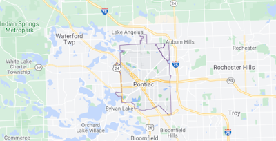
Pontiac, about 20 miles north of Detroit, is the Oakland County seat, but in the 1970s, the county government began relocating most of its facilities to a new automobile-centric headquarters campus in adjacent Waterford Township, with criminal justice facilities (courthouse, jail) remaining in the city.  This removed the valuable energy government office districts can provide to city economic health.

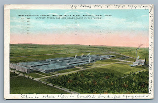
When I lived in Michigan, Pontiac was known for its industry--home to GM's Pontiac Motors division when that brand still had verve, but also GM's extensive medium truck and bus manufacturing operations, and for being a majority black community in a predominately white community.

It was one of the first cities in Michigan to employ busing to achieve school integration, and it was challenged violently, with bombings of buses in 1971.

Pontiac is about 20 square miles, while Oakland County is 907 square miles.  Today the city has about 60,000 residents, down from a peak of 85,000 in 1970.  The population is about 52% black, with over 20% of the population below the poverty line. By contrast, the overall poverty rate in Oakland County is 7.8%.

Deindustrialization.  At its peak, GM had 30,000 employees working at various plants in Pontiac, and was the largest property holder and paid the most in property taxes ("Pontiac, Michigan feels brunt of GM's pain," Reuters).  

But GM's dissolution of the Pontiac brand, the sale of its bus manufacturing operations, and the cessation of the manufacturing of large trucks led all but one of GM's facilities to close there by 2010. 

Now there are a few hundred employees, at a single facility.

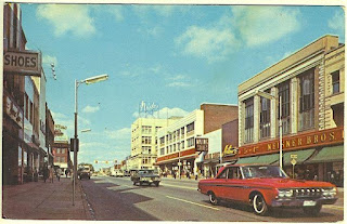
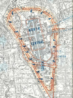
The city also suffered population outmigration and went through some iterations of urban renewal, including the construction of a ring road around the city, to facilitate car-based commuting traffic, at the expense of walkability and the economic health of the Downtown.

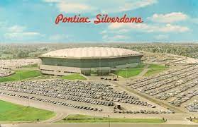
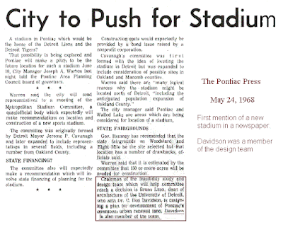
Football stadium. As part of an earlier period of outmigration from the center city, for a time, the Detroit Lions football team relocated to a covered stadium built in Pontiac, called the Silverdome, although the team returned to Detroit in 2002.  

(For a time, the Detroit Pistons basketball team played at a suburban arena in nearby Auburn Hills/Auburn Township.  Chrysler moved from inner city Highland Park to Auburn Township as well.)

Being located on the edge of the city, by freeways, the stadium provided zero energy to Pontiac's core.  

Although Pontiac was hardly an exception, as other suburban stadium and arena projects across the county also had minimal positive impact ("Framework of characteristics that support successful community development in association with the development of professional sports facilities").

Deindustrialization was a problem across the state and the state failed to step up.  Like Detroit and Flint ("The real lesson from Flint is about municipal finance," 2016), Pontiac was one of a set of legacy cities in Michigan that because of the drop in property and income tax revenue from population shrinkage and deindustrialization went into bankruptcy, being the first to do so in 2011.  Plus, the economic multiplier effect.  Each auto job supports 3-4 other jobs.  Not all are local (e.g. parts plants from afar) but many are, furthering job losses and economic decline.

Even when plants stayed open, automation often reduced employment by as much as 75%.  It occurs to me that in multiple cities across Michigan, facing similar problems, not limited to GM or Chrysler or Ford:

  • Battle Creek (Case Equipment moved to Kentucky), Bay City (GM), Benton Harbor, Detroit, Flint (GM, Buick), Jackson, Kalamazoo (Upjohn and GM, see "Former GM plant in Kalamazoo finds second life as successful business park," Kalamazoo Gazette--while successful the industrial park replacing the GM plant has 1/8 of the workforce), Lansing (Oldsmobile), Pontiac (Pontiac, GM Truck), Saginaw (GM)  
that like the Massachusetts Gateway Cities Initiative, the State of Michigan should have developed a state-wide initiative addressing deindustrialization and its impact on center cities across the state ("Growth Ideology in a Period of Decline: Deindustrialization and Restructuring, Flint Style," Social Problems, 1992, "Understanding Resilience Through Regional Responses to Economic Restructuring," dissertation, 2010).

Instead, later Republican administrations focused on cities declaring bankruptcy, fitting their narrative of incapable cities run by Democrats, rather than developing a broader economic revitalization initiative.

Pontiac looks to do Downtown street calming.  A recent article in the Detroit Free Press, "State agrees to unwind Pontiac's Woodward 'Loop' that leaders say strangles their downtown," says that the city is going to get rid of the ring road, in an attempt to reapply more city-centric urban design principles. From the article:

When it opened in 1964, the design of Pontiac’s Woodward Avenue Loop — formerly called Wide Track Drive — was hailed as a triumph.  (Wide Track was named after a Pontiac Motors marketing campaign for its cars.)

Its swaths of one-way pavement unsnarled bottlenecks and shunted GM workers as well as parts-laden tractor-trailers through Pontiac’s downtown and to half a dozen bustling factories. The high-capacity roadway played into the dreams of midcentury designers, on a binge they called urban renewal.

The road re-routing created a set of five one way streets, each five lanes wide.  It was decidedly anti-urban, facilitating car movement over people and a thriving downtown.  

Moving the government center and the creation of Pontiac Mall, on the border of the city and Waterford Township, were other actions that redirected economic activity away from Pontiac's Downtown to other parts of Oakland County. 

Why does Pontiac lag in the midst of great wealth?

And I hate to admit, reading that article, that I hadn't ever really thought about the reality that while Oakland County is wealthy and white, could that wealth have been harnessed to spur the economic revitalization of Pontiac, to reverse the steady drumbeat of decline?

Deindustrialization and outmigration?  It's not just deindustrialization, although that's a factor.  Pontiac was on the decline long before GM shut down its plants, just like many other cities across the state, the Midwest, and the nation.

Lack of political longevity?  The now deceased County Executive L. Brooks Patterson was in office for 27 years.  Certainly, unlike Mayors who are in office for usually no more than 2 terms, he had the opportunity to address Pontiac's poverty over the long term.  (Community revitalization is a multi-decade process, see "Main Street Niches in a Mass Sales World," 2004.)

Lack of attention to revitalization needs in legacy communities?  It's not like Patterson wasn't paying attention to the needs of inner ring suburbs, as Oakland County is the first and only county in the US to have created a county-wide Main Street commercial district revitalization program, which it did in 2000.  Pontiac participates, and has had a Downtown Development Authority for decades.

Tax harmonization.  Could the county have applied various tax harmonization strategies, like what has been done in Greater Minneapolis, or how various counties share sales taxes with legacy communities. (This likely would have required approval by the state legislature.)

Best practice county revitalization initiatives.  To be fair, plenty of counties have areas of persistent poverty.  But should this be the case?   

Are we taking poverty for granted, especially when it is co-terminate with race?

Recently I made this point about Montgomery County, Maryland and how its East County section remains a laggard ("East County, Montgomery County, Maryland: Council redistricting spurs ideas for revitalization | Part 1 -- Overview").  

Fairfax County, Virginia has been working on the revitalization of the Route 1 Corridor for decades ("Fairfax County’s Richmond Highway area ripe for development during next decade," Virginia Business).  And both counties are comparable to Oakland in terms of wealth.

The most typical initiatives focus on inner ring suburbs. But Pontiac is different as it was never a suburb in the traditional sense, but a stand-alone city, secondary to the center city, but significant and unitary, with its own economy, newspaper, civic institutions, etc.

Previous entries call attention to Hennepin County, Minnesota ("A County and Its Cities: the Impact of Hennepin Community Works"Journal of Urban Affairs) and Oklahoma City--not a county exactly, but the city is larger than other city-counties like Philadelphia or San Francisco ("Change isn't usually that simple: The repatterning of Oklahoma City's Downtown Streetscape"). 

Maryland had/has a couple of smart growth related initiatives.  The "Community Legacy Revitalization Program," is a state program funding revitalization planning and projects in existing places, and there was a similar initiative at the county scale in Baltimore County under former County Executive Jim Smith ("Community renaissance set down in writing," Baltimore Sun; "Baltimore County Confronts Suburban Decline").  

Is it racism or the "soft bigotry of low expectations"?

Pontiac is a little place, 60,000 residents and 20 square miles.  In the midst of great wealth. 

From the standpoint of money, political administrative longevity, and political capacity, there's no reason that Pontiac should have continued on its negative trajectory.  Just like the way that cities like Bilbao have been renewed, using an approach that I call "transformational projects action planning." 

-- "Why can't the "Bilbao Effect" be reproduced? | Bilbao as an example of Transformational Projects Action Planning," 2017
-- "Economic restructuring success and failure: Detroit compared to Bilbao, Liverpool, and Pittsburgh," 2014
-- "Minneapolis Super Bowl: Urban Revitalization and Transformational Projects Action Planning," 2018
-- "Downtown Edmonton cultural facilities development as an example of "Transformational Projects Action Planning"," 2018

there's no reason that Pontiac couldn't have been improved similarly.

It seems like economic revitalization there ought to be a straightforward process although granted they went through a bunch of flawed urban renewal iterations and severe deindustrialization

10 Pontiac School District buses were destroyed in an attack by the Ku Klux Klan.  Detroit News photo.

On the other hand, L. Brooks Patterson did start his political career defending opponents to busing and school integration.  In Pontiac! ("RIP, L. Brooks Patterson, Racist," Detroit Metro Times, "Busing set off Democratic debate flare-up, but does it still matter in Detroit?," Detroit News).

While Patterson's campaign "against" Detroit and Wayne County could be termed to be more a kind of "economic county-ism," racism was an issue.

But wrt Pontiac, perhaps it was more about benign neglect in the context of institutionalized and/or structural racism, and the failure of the state to think systematically about deindustrialization and its impact across the state.

The default is to see Pontiac/blacks as perennially poor, as a condition not particularly amenable to change.

While it's rare for counties to develop revitalization programs the way that Hennepin County did--which it did out of desperation, facing severe property tax revenue losses in the face of economic and population decline in Minneapolis--we can raise the bar for counties like Oakland, where overall they are fine economically, but possessing severe pockets of poverty and decline.


Some recommendations.

1.  The State of Michigan should develop a program addressing deindustrialization more systematically, using the Massachusetts Gateway Cities Initiative and "Hennepin County Works" program as models.

2.  Oakland County should make "leveling up" Pontiac its number one economic development priority.

3.  Building on the nascent road dieting effort and examples of successful communities nearby like Royal Oak ("Downtown Royal Oak social district opens this weekend -- Here's what to know," Fox2 Detroit, "Baker College to Build Flagship Metro-Detroit Campus in Downtown Royal Oak," "Royal Oak and Rochester Downtowns Win National Awards," OC Times) and Birmingham, focus on redeveloping the residential and retail possibilities Downtown.

-- Reinventing Suburban Business Districts (ULI)
-- Reinventing America's Suburban Strips
-- Revitalizing Distressed Older Suburbs
-- Putting the Urban in Suburban: Art and Business of Placemaking
-- "The secret to a successful suburb: Lakewood, Cleveland Heights and the Inner-ring Divide," Cleveland Plain Dealer

4.  Develop a revitalization plan using the Transformational Projects Action Plan approach, with Oklahoma City's Metropolitan Area Projects program and the downtown streetscape program as best practice models..

5.  Why not merge Pontiac into Oakland County?  This would make County prioritization of Pontiac revitalization unavoidable.

6.  Baring that, why not consolidate Pontiac and Waterford Township (Michigan makes it almost impossible now for cities to annex townships.  Waterford is 92% white and has 72,000 residents). But combining the two would make it tied as the state's third largest city, and would add the stronger residential tax base of Waterford.

7.  Consider merging the Pontiac School District with adjoining school districts, like Waterford. This is difficult, as communities like local control of schools.  

OTOH, a majority of Oakland County school districts are shrinking and consolidation could be advantageous, especially if combined with a MAP 4 Kids program of construction and other improvements like the second phase MAP program in Oklahoma City ("MAPS for Kids wraps up," Daily Oklahoman).

Labels: , , , , , , ,

Wednesday, March 17, 2021

How tall is tall with infill construction in existing neighborhoods?

The Pleasant Hill City Council on Tuesday approved a proposal from Danville-based developer Blake/Griggs Properties to build 189 apartments at 85 Cleaveland Road in the city’s downtown area. (Rendering by KTGY Architecture + Planning)

There is a headline in a San Jose Mercury News article, "189-unit apartment complex will be East Bay city’s second-tallest building," that caught my attention.  A 4.5 story building is the second tallest building in the East Bay region of Northern California.  That's not tall at all.

Illustration from The House Book by Keith DuQuette, showing the different heights and densities of different types of housing, based on proximity to the core of a metropolitan region.

(This concept is also captured within the Transect of New Urbanism.)

This came up in my DC neighborhood of Takoma, with proposals for redevelopment on part of the Takoma Metrorail site.  

Presently, buildings around the site can be as tall as four stories, but some opponents to new development argued that the site should be developed according to the height of 1.5 story bungalows across the street.  

-- "Takoma's Brookland moment: some opposition to apartment development on the WMATA station site," 2013
-- "The Takoma Metro Development Proposal and its illustration of gaps in planning and participation processes," 2014
-- "Design of the apartment building at the Takoma Metro: offering better design cues," 2014
-- ""Right size" development protest sign, Takoma Metro," 2014
-- "DC Comprehensive Land Use Plan Revision," 2020

I argue that they could be a little taller even, based on proximity to the Metrorail and because this is the center of the neighborhood, where buildings are taller at the core, and shorter outside of it.

This building is on the second block over from the interesection with Kennedy Street NW, 5620 Colorado Avenue NW.

This was also typical in the early days of "transit oriented development" associated with passenger railroad and streetcar services.  

A good example in DC is near the intersection of 14th Street, Kennedy Street, and Colorado Avenue NW, which used to be the terminus of one of the streetcar lines.  

There are "taller" apartment buildings within one block of the intersection, about five stories, shorter apartment buildings the next block, and one and two story houses beyond.

-- Trans-Formation: Recreating Transit-Oriented Neighborhood Centers in Washington, DC: A Design Handbook for Neighborhood Residents, DC Office of Planning, 2002 (out of print)

A four square in Brookland.

Or a DC Court ruling held that the DC Comprehensive Plan language was misleading because "6 story buildings" are really tall in the context of neighborhoods where the tallest residence is about two stories ("Court remands Brookland project to zoning panel in ruling that could set precedent for future development bids," 204, "D.C. court rejects Brookland project for a third and possibly final time," 2016, Washington Business Journal, "A court ruling on a Brookland development could imperil future housing near Metro stations," Greater Greater Washington).

In Salt Lake, where I am living now, people in my neighborhood are roiled about the coming redevelopment of an intersection site on a major street, where the new buildings--the area is zoned commercial--will be 3-5 stories tall, when the neighborhood housing stock is a mix of one and two story single family houses with some duplexes mixed in, and a smattering of apartments that top out at three stories.

The reality is that it won't be that tall in its context, at a major intersection, and it will extend the range of housing types otherwise offered in the neighborhood.

The fact is, the US population is greater today than it was when most cities were developed, before the 1940s.  The cost of land is such that only multiunit housing will be created, except in very particular and unusual situations.

And is it reasonable to define "too tall" in terms of the prevailing definition 90 years ago, and for all locations regardless of land use context.

Like the New Urban Transect, the Smart Transportation Guidebook: Planning and Designing Highways and Streets that Support Sustainable and Livable Communities, produced by the Delaware Valley Regional Planning Commission, serving Greater Philadelphia, laid out an approach for road planning in terms of land use context, defining heights in terms of regional and neighborhood centers.

The Nashville Community Character Manual uses a similar approach (below).

These approaches need to be adopted and communicated more widely, so that people use 21st century appropriate land use development and transportation planning paradigms when considering new development within their communities.

Labels: , , , , , , ,

Wednesday, February 03, 2021

The ability to develop around transit stations is conditional on land use and mobility context

Photo from AA Roads.

The Greater Washington Partnership released a report on how a bunch of transit stations in Maryland ought to be more developed, which the Washington Post wrote about, "Study: Development around Prince George’s, Anne Arundel rail stations needs a boost."  From the article:

The study focused on the following rail stations in Anne Arundel: Odenton, Glen Burnie and Laurel Race Track. In Prince George’s, it centered on New Carrollton, Greenbelt, Morgan Boulevard and Southern Avenue.

The PG County stations are Metrorail stations, although both New Carrollton and Greenbelt also have commuter railroad service--New Carrollton also has Amtrak service, and the Penn Line operates every day.  Seemingly, Southern Avenue is ripe for development, as it is on the DC Line, but the area is not highly urbanized. Morgan Boulevard is an end of the line station.

Glen Burnie is the end of the line station for the Baltimore Light Rail system and some residents see the station as an attractor for crime("Addicts, crooks, thieves’: the campaign to kill Baltimore's light rail," Guardian) .  

Odenton is on the high frequency MARC Penn Line and Laurel Race Track is on the low frequency MARC Camden Line, which doesn't offer weekend service.

I have a great piece about how the New Carrollton area can be revitalized through repatterning around transit service.  New Carrolton will also be the end point for the forthcoming Purple Line light rail.

-- "Setting the stage for the Purple Line light rail line to be an overwhelming success: Part 4 | Making over New Carrollton as a transit-centric urban center and Prince George's County's "New Downtown"," 2014/2017

Transit oriented development.  This desire is nothing new.  It was a priority for Maryland's Democratic governors, who advocated for a Smart Growth agenda--that is, focusing development on existing places rather than sprawl.  Transit oriented development (TOD) is a land use and transportation  planning approach that intensifies development around transit stations.

It's not particularly pathbreaking in that's how development occurred historically, around train stations and later around streetcar lines ("streetcar suburbs") and subway and other heavy rail lines.

I wrote about this a fair amount in terms of Maryland, because I believe that they didn't really understand that just because there is a railroad or transit station station doesn't mean that it possesses great potential for "more urban" development.   

-- "For TOD to be successful, necessary antecedents are required, there's no magic wand," 2011
-- "What matters isn't "transit oriented development": what really matters is compact development and integrating transportation and land use," 2011
-- "What the State of Maryland still doesn't get about smart growth," 2011
-- "Bad Montgomery County policy/law initiative #1: removing density bonuses for building around MARC train stations," 2012
-- "Planning for intensity of land use: the question is at what scale are we planning?," 2012
-- "Prince George's County still doesn't get "transit oriented development" and walkable communities: Greenbelt edition," 2012
-- "Department of Duh: Apartments not always successful next to transit stations," 2018

General planning documents

-- Trans-Formation: Recreating Transit-Oriented Neighborhood Centers in Washington, DC | A Design Handbook for Neighborhood Residents, DC Office of Planning, 2002
-- Ten Principles for Successful Development Around Transit, Urban Land Institute, 2003
-- Station Area Planning: How To Make Great Transit-Oriented Places, Reconnecting America and Center for Transit-Oriented Development
-- Rails to Real Estate: Development Patterns along Three New Transit Lines, CTOD

WRT Metrorail, the heavy rail (subway) line serving Metropolitan Washington, once the service started in 1976, it took 10-20 years (1986-1996) to see substantive improvement in core served areas, in particular Downtown DC and Arlington County's Wilson Boulevard Corridor, mostly centered around commercial office development, although in Arlington, also high density multiunit residential.  

In DC, it took at least another 10 years after that (2006) to see the benefit of Metrorail access on community revitalization outside of the core.

Today, in the core of the city with 31 stations (out of 42 total) virtually all of the areas are economically healthy, when in 1976, most decidedly were not.

Categorizing transit stations in terms of access (and indirectly, the opportunity for development.  Perhaps the best way to think about the opportunity for "transit oriented development" is to consider  how WMATA categorizes its Metrorail stations, as laid out in the Bicycle and Pedestrian Access Improvements Study (2010), in Appendix D.  There are nine categories, based on land use context, from dense/connected/compact to undense/disconnected.

  • High Density Urban Mixed-Use in a Grid Network (21 stations)
  • Urban/Suburban Residential Center -- (12 stations) [opportunity for multiunit buildings close to the station, even if the area is otherwise single family residential)
  • Urban Residential Area with a Bus/Automobile Orientation (5 stations)
  • Campus and Institutional (3 stations)
  • Mixed use in a "pod" layout (13 stations) [isolated, disconnected locations]
  • Long-Term Potential for High Density Transit Oriented Development (TOD) or Planned Unit Development (PUD) (4 stations)
  • Suburban Residential Area (9 stations)
  • Auto Collector/Suburban Freeway -- (5 stations) 
  • Employment Center/Downtown/Urban Core -- (12 stations)
Note that to make this typology work more universally, two more categories need to be added:
  • Smaller Town Center (Suburban/Exurban)
  • Exurban Station (Residential primarily)
Using this typology, the seven stations identified by GWP all have serious problems in terms of sparking development, all are pretty much in undense, automobile centric locations, most are pretty distant from Baltimore or DC.   
This illustration from The House Book by Keith DuQuette shows the "transect" of land use context from less dense and more spread out (rural and suburban) to highly concentrated (urban).

One station not included in the list, the West Hyattsville Station in PG County has had a station area TOD plan for 22 years!!!!!!!!! and the area is just now starting to see development.  

Seemingly it's a good location, about 1.3 miles from the DC/Maryland line, and four miles from the Fort Totten Station, with plenty of land able to be redeveloped and a nearby neighborhood commercial district, and access to trails and parks.  

But until better locations (greater demand, greater economic return) are developed first, the site will continue to lie fallow.


In the Metrorail access study, the difference between the stations is whether or not they are (1) in dense places, either urban or suburban; (2) with an urban form/urban design that prioritizes sustainable mobility (walking, biking, transit); (3) versus a built form that is de-concentrated and automobile-centric; (4) located closer in or farther out in the context of the transit system and the core of a metropolitan area; and (5) end of the line stations.

Stations that are located in deconcentrated places and are car dependent don't particularly lend themselves to compact development.  At best they are pods.  If they do attract residents and tenants, the residents still need a car for most trips and it is difficult for the project to spark further development.

There are many examples of failures to fully leverage transit as a development augur, in places that have better conditions for TOD.  

In DC, the Rhode Island Metrorail station was originally an endpoint station, so commuters drove to the station and parked there.  The area was industrial and when the station was created, the city did not in turn re-plan the area for an urban form more typical of the core of the city.  As a result the station hasn't fully realized its opportunity to reshape the landscape.

It is starting to happen.  The parking lot at the station was redeveloped as apartments (not particularly well, but it did occur), and a nearby shopping center is being redeveloped as a mixed use residential and commercial development.   But this is over a 35-55 year time frame from when the station first opened.  Clearly, a more active station area planning process would have significantly improved the velocity of change.

And the city developed the "Home Depot" shopping center across from the station without replatting the land, thereby failing to fully reap the opportunities presented, and develop it in a more urban and mixed use fashion.

Similarly, most of the developments around Fort Totten Station, also in DC, in an area that was and is comparatively suburban, have failed to take the opportunity to re-plan the area around the station in a more dense, more urban way.

There are plenty of books, studies, journal articles, plans, etc. about TOD.  

What surprised me about advocacy around the Purple Line in 2014, was that it seemed like they were more interested in getting lessons from other light rail systems--because it was the same mode--rather than figuring out very carefully the lessons the Baltimore-Washington area already has to offer, both in terms of creating successful transit networks and the economic development opportunities proximate to transit and how to realize them.

I wrote this piece when I worked for Baltimore County.  I wasn't involved in the master planning process, but I wrote this memo for them, at their request.  (Because it was the Baltimore County Master Plan, I didn't discuss extending the light rail to Columbia in Howard County, another essential step to making the light rail a lot more useful.)


I suggested that they organize the transportation element of the master plan around six principles.  By contrast the county's transportation planner had a pretty convoluted section about fostering TOD through the County Executive's Office. 
  1. Optimal mobility. 
  2. Linking land use and transportation planning. 
  3. Complete streets and facilities.
  4. Transportation Demand Management.
  5. Transit Value Capture/Funding Mechanisms.
  6. Phasing the construction of new infrastructure.
Later in the process I developed my "Signature Streets" concept, but the big point was that to be useful and to make it economically viable to build more densely around transit, the transit system needed to be bigger and better.  It needed to be a network, not a couple of lines, and it needed to serve destinations that are in demand.

Note that Baltimore County is a great example in how transit stations don't automatically create complementary development.  They have three MARC stations on two lines, 11 light rail stations, and three subway stations.  None of the stations is a noteworthy example of TOD.  In fact, the Owings Mills station and adjacent development there is a great example of the difficulty in creating successful TOD at end of the line stations.

Most all of the stations--train, subway and light rail--are located in very undense places or don't directly serve town and employment centers.

Back then I was pretty derisive of what the county had been doing.  But at that time, I didn't really understand how difficult the job of the county's sole transportation planner was, in the context of a county that prioritized the automobile and derided public transit as a service for poor people.  One of the County Executive's top transportation priorities was buying cars for poor people.

WRT what I laid out for Baltimore County, the seven stations listed in the GWP study have similar kinds of issues that hinder the ability to push development forward around those stations.  And like the examples of Rhode Island and Fort Totten Stations in DC, they need to do better physical planning in order to reap the opportunities that could exist.

Note also that creating a regional (Baltimore and Washington) transit system that integrates modes and expands access to service throughout DC and Maryland in this case, but also Virginia with connections to Pennsylvania, Delaware, and West Virginia, makes development at these stations more possible.

Labels: , , , ,

Wednesday, January 13, 2021

I didn't realize Blair Kamin retired as architecture critic for the Chicago Tribune

Blair Kamin received the 1999 Pulitzer Prize for Criticism and the webpage includes a number of his articles including a 1998 series on public space issues concerning the Chicago waterfront.

He's retiring from the Chicago Tribune "Tribune architecture critic Blair Kamin reflects on 28 years of reviewing Chicago’s wonders and blunders, and why such coverage should continue," taking a buyout from the company's venture capital owners ("Chicago Tribune's Pulitzer Prize-winning architecture critic exits," Crain's Chicago Business).

From the article: 

Whether or not you agreed with what I wrote was never the point. My aim was to open your eyes to, and raise your expectations for, the inescapable art of architecture, which does more than any other art to shape how we live. 

So I treated buildings not simply as architectural objects or technological marvels, but also as vessels of human possibility. Above all, my role was to serve as a watchdog, unafraid to bark — and, if necessary, bite — when developers and architects schemed to wreak havoc on the cityscape. 

This was a conversation between you and me, the critic and the readers, and I was often inspired by how you responded. 

Some of you engaged me to talk architecture at spots ranging from the Art Institute to the Belmont Avenue “L” station to O’Hare’s security gates. Many of you wrote letters and emails to express how much you appreciate that the Tribune remains one of the few American newspapers that still covers architecture on a regular basis.

About 20 years ago, when I first started getting involved earnestly in local civic affairs, in particular urban revitalization, newspapers weren't quite the basket case they are now although it was on the horizon, and many newspapers had architecture and/or urban design critics writing weekly or more frequently, along with business beat writers covering development and real estate, art critics writing about museums and culture, and too rarely, good writers on the transportation beat.


I owe a debt to those many writers, including Robert Campbell at the Boston Globe, Blair Kamin at the Chicago Tribune, Whitney Gould at the Milwaukee Journal Sentinel (deceased), Christopher Hume at the Toronto Star, John King at the San Francisco Chronicle and Inga Saffron at the Philadelphia Inquirer, Edwin Heathcote at the Financial Times , Ed Gunts at the Baltimore Sun, (I wasn't enamored of Benjamin Forgey at the Washington Post), Christopher Hawthorne (now working for the City of Los Angeles) and Christopher Knight at the Los Angeles Times, Steve Litt of the Cleveland Plain Dealer, various writers at the Toronto Globe and Mail, Ada Louise Huxtable (deceased) and Michael Lewis at the Wall Street Journal, and others, for helping to educate me about architecture, urban design, cities, and culture.  

-- "Robert Campbell and Inga Saffron win Vincent Scully Prize for architectural criticism," Boston Globe

Similarly, even though it was many years before I put my toe in the water and got involved, in the late 1980s and into the early 1990s, I read the urban design columns by Mark Jenkins in the Washington City Paper.  It helped prepare me for later.

On the architecture and urban design side, Campbell, King, Lewis, Litt and Saffron are still writing.  

Most of them are not, and when they retired in most cases, they weren't replaced. 

This is a great loss for communities, because these writers and coverage of architecture and urban design helps to raise the bar for quality, and attention to how real estate development works, and provides people with a vocabulary they can use when interacting with elected and appointed officials and their fellow citizens.

The Post's Philip Kennicott writes about architecture and the arts--this is the most recent, "Trump decreed that we should worship classical architecture. Then his supporters defiled the Capitol," but not multiple times per week the way that Blair Kamin did or John King, Steven Litt, and Inga Saffron do.

-- 

Labels: , , , , ,