Rebuilding Place in the Urban Space

"A community’s physical form, rather than its land uses, is its most intrinsic and enduring characteristic." [Katz, EPA] This blog focuses on place and placemaking and all that makes it work--historic preservation, urban design, transportation, asset-based community development, arts & cultural development, commercial district revitalization, tourism & destination development, and quality of life advocacy--along with doses of civic engagement and good governance watchdogging.

Wednesday, August 28, 2019

Economic benefits of restaurants: Buffalo Billiards, Dupont Circle, Washington, DC

Economic benefits of restaurants: Buffalo Billiards, Dupont Circle, Washington, DC

Apparently, the building on New Hampshire Avenue in Dupont Circle where Buffalo Billiards and the Front Page restaurants are located was sold to WeWork, and WeWork didn't renew the leases of the resident restaurants.

Buffalo Billiards was there for 25years; the Front Page 32 years (Disclosure: I worked at the Front Page in the past).  (Given that I love newspapers, the fact that the Front Page had many newspaper front pages posted on the walls was a cool feature.)

Buffalo Billiards was a basement-located billiard parlor and bar.

It impressed me because they figured out how to make an otherwise marginal space--how many successful restaurants are below grade in major cities?--quite successful, and they probably were able to do it at a rent rate much less than what businesses pay for ground level space.

As part of their closing events, they produced a banner which among other things listed how much rent they paid; how much sales taxes; and how much was earned in tips.

They could have also included how much wages paid out; income taxes; and property taxes if they paid towards that.

(That being said, I still don't think bar crawls are necessarily a good thing from a public space management perspective.)


Value
Rent $8,034,563.90
Sales Taxes $8,364,339.59
Tips (wages) $13,083,784.00

Labels: , , ,

Tuesday, August 27, 2019

The Brightwood fire as an example of the need for the legalization of a wider range of housing types

Photo from DCist.

Don't know if you heard about the terrible fire on Kennedy Street, an illegal rental, marketed to Ethiopians. The place was divided into a warren of bedrooms, for which residents paid about $300-$350/mo. each, for a room not much bigger than a bed. The house wasn't set up as a legal rental.

Two people died in the fire. And there are lots of stories about it. The mayor is calling for a criminal investigation, etc.

-- "Two People, Including A 9 Year Old, Were Killed In A Fire In An Unlicensed Rental," DCist
-- "Rowhouse where fire killed man and injured child was not approved for rentals, city officials say," Washington Post

To me, it merely reiterates my point that we need to provide different kinds of housing -- a much wider range-array. 

People are desperate.

It would be far better to support the provision of supermicro units in a legal and safe fashion. And that when we don't, we end up with what happened.

Yes, the property owner took huge risks and shouldn't have. But the market can push people in that direction.

 And it happens in other markets with similar conditions, like NYC and London. Probably SF, although they have a serious regulatory regime there. Etc.

-- "The woman who lives in a shed," Guardian
-- "Housing raid finds 26 people living in three-bedroom east London home," Guardian
-- "Man found living in 'coffin-like' cupboard in east London," Guardian

2. Sometimes, besides the promise of extranormal profits, people rent houses illegally because the cost to prepare and maintain a rental unit is high*, especially if it is subject to rent control.

-- "Deeper thinking needed on housing," 2012
-- "Gulyani Sumila, Bassett Ellen M. 2010. “The Living Conditions Diamond: A Theoretical and Analytical Framework for Understanding Slums.” Environment and Planning A 42 (9): 2201–19.

Gulyani and Bassett identify four elements shaping the provision of housing in "slums" in what they call the "living conditions diamond."
The Living Conditions diamond, Nairobi

-- "Benjamin Marx, Thomas Stoker, and Tavneet Suri. "The Economics of Slums in the Developing World," Journal of Economic Perspectives, 27:4 (2013)
-- "BLAKE GUMPRECHT. "FRATERNITY ROW, THE STUDENT GHETTO, AND THE FACULTY ENCLAVE: Characteristic Residential Districts in the American College Town." Journal of Urban History, 32:2 (2006)

Note that I think the literature on Third World slums, which refers to both large districts and the housing within, is relevant to the developed world, especially in terms of the dynamics behind slum "dwellings," "student ghettoes," etc.

For high income neighborhoods and renters, this is less of a big deal, because housing in such neighborhoods commands top rents, and therefore the cost of compliance, while high, is much less than the revenue that will be received.

In areas where renters are less well off, there is greater chance of nonpayment, turnover is high, buildings are subject to extranormal abuse, etc., it's tough to make renting pay.

But it can, at least for awhile, especially if you don't reinvest in maintaining the property.

By contrast, in high income neighborhoods, after initial costs of preparing a dwelling for rent, the average maintenance costs are likely lower, compared to housing in low income districts.

======
* We are doing this now.  Granted many of the things we should have done awhile ago, just as normal maintenance of a house.  But you let things go.  But some of the things required for renting, we wouldn't have done, such as storm windows on basement windows, which is an extra expense of over $2,500.

All told the prep costs will be around $9,000 (and that's with an extremely low priced handyman--the same work would likely cost double if sourced elsewhere.)  It will take  more than a year before those costs are recovered.  (Granted they are deductible expenses, although some have to be amortized.)

Labels: , , , , , , , ,

Reviving DC area bus service: and a counterpoint to the recent Washington City Paper article

-- "What Lessons Can D.C. Glean From Richmond's Bus Overhaul?"

(Metrobus, especially in DC, already does the things that Richmond implemented.)

WMATA train car and Metrobus toys
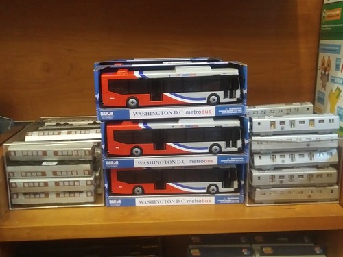
Bus service is the DC area is balkanized.  Cross-jurisdictional services are provided primarily by Metrobus, the bus unit of WMATA, the Washington Metropolitan Area Transit Authority, which runs the Metrorail system, which dominates the agency.

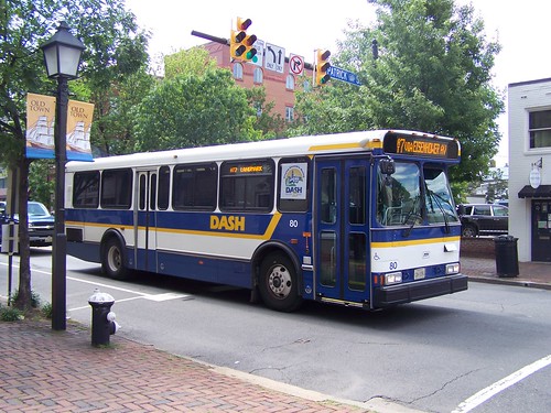
Intra-jurisdictional services are mostly provided by jurisdiction-specific agencies, with the exception of DC and to some extent Prince George's County, Maryland, where a majority of bus service (in terms of number of riders) is provided by Metrobus.

Metrobus service is contracted and paid for by the jurisdictions, and sometimes jurisdictional policy decisions result in disconnections within "the bus service network."

Alexandria Dash busFor example, Maryland Mass Transit Administration, which ultimately makes the decisions about service, pretty much refuses to fund/authorize bus services that cross the DC border, although there are some exceptions.

As an example, this is why the 30s buses stop at Friendship Heights on the DC-Maryland border, rather than continue to Bethesda or further north.

Simultaneous with the recent failures of Metrorail, which have resulted in a loss of about 15% of daily ridership, bus service has also declined significantly, but slightly less, at 12%.

This makes sense, because many daily journeys involve legs on both subway and bus, and a drop off of Metrorail ridership means a concomitant drop in bus ridership.

Every 10-15 years, WMATA does a big bus study.  Previously this had been done in the early part of the 2000s), and the most recent is the "Washington Area Bus Transformation Project," which makes a number of recommendations for improvement.

In various writings I have recommended:

1.  The Metropolitan Planning Organization, not the various transit agencies, should be the primary transit planner, setting master requirements for network breadth, network depth (frequency and levels of service), and levels of quality.

2.  Contract with transit agencies to provide this level of service.

-- "Without the right transportation planning framework, metropolitan areas are screwed, and that includes the DC area," 2011
-- "Metropolitan Transit Planning: Towards a Hierarchical and Conceptual Framework," 2010
-- ""Route 7 BRT proposal communicates the reality that the DC area doesn't adequately conduct transportation planning at the metropolitan-scale," 2016

3.  Define the transit network in terms of networks first at the Metropolitan; Suburban: and Center City scales; and then primary; secondary; and tertiary networks within them, which is particularly relevant to bus service.

-- "The meta-regional transit network," 2009

4.  To best provide service, the DC area should create a German style transport association to better plan and deliver all transit services in a more integrated fashion.

-- "The answer is: Create a single multi-state/regional multi-modal transit planning, management, and operations authority association," 2017

Design scheme for Go Transit bus systems in the Raleigh-Durham region
In Raleigh-Durham, all but one of the bus systems have rebranded as "Go Transit" i.e., GoRaleigh, GoTriangle, etc. with a common design for livery, signage, etc., but each system uses a different color.

5.  The bus services should be integrated better in terms of branding and support, using the model of the services in Raleigh-Durham, North Carolina, where they provide one call center providing information for all the services, have integrated schedules, a common branding system,, etc.

-- "Making bus service sexy and more equitable," 2012
-- "Will buses ever be cool? Boston versus the Raleigh-Durham's GoTransit Model," 2017
-- "Branding's not all you need for transit," 2018

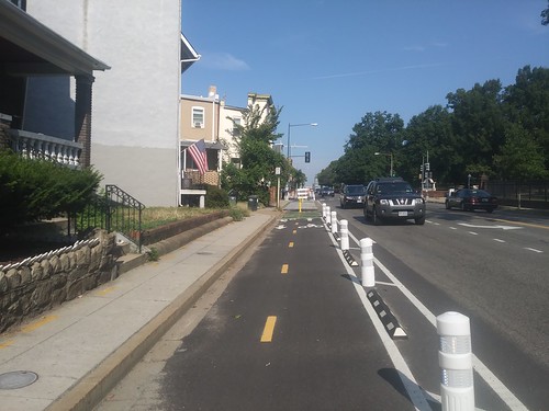
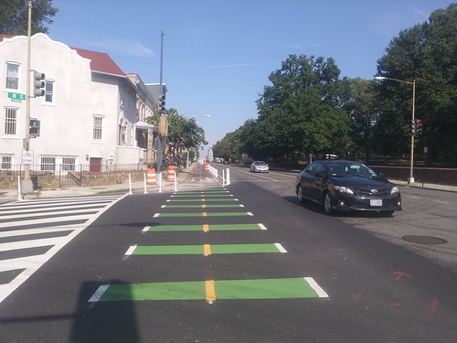
6.  There should be a night network and other improvements, like dedicated transitways, better transit information, etc. (Dedicated transitways are expanding in DC.)
-- "Night and weekend transit/subway service," 2016
-- "Overnight transit service: San Francisco," 2016
-- "Night moves: the need for more night time (and weekend) transit service, especially when the subway is closed"," 2013

Alexandria's wayfinding system includes some great signs about transit options, placed on the Waterfront and at King Street Metro.
Wayfinding sign for Alexandria at the King Street Metro station

Poster promoting new rider-friendlier transit pass product pricing, WMATA/Metrorail, DC area✺ To be fair, except for integration, customer service and branding elements, the DC area is ahead of many jurisdictions in that bus to bus transfers are free across the different agencies, which use the same transit fare card system (using the same card isn't unique, but having free transfers across systems is relatively unique).

✺ Bus fares are "relatively" cheap at $2 or less. (Although some systems elsewhere are even cheaper.  But many are more expensive.)

✺ And effective in FY2020, which started in July, WMATA significantly reduced the price of various pass products, and with some of the Metrorail passes, bundled in bus service, when previously and rigorously, WMATA has required separate fares for each mode.

✺ Plus, because Maryland MTA is one of WMATA's funders, they use the same transit fare card system in Greater Baltimore, which means that the transit fare cards interoperate between DC and Baltimore.

✺ While I argue that the Metrobus designs are dowdy, they are improving and updating bus stop signage and schedule information.  Plus phone-based schedule information is very helpful.

Nationally, bus ridership is in decline
. Bus ridership rose significantly during the recession, aided in part by high gas prices.  As the economy has improved and gas prices have dropped significantly, bus ridership has dropped overall, somewhat less than 2%.

-- "APTA: Public transit ridership down in 2018," Smart Cities Dive
-- "Who's on Board 2019, TransitCenter

But in the DC area specifically, ridership has novedived.  But in some areas, bus ridership has risen.

Redesigning bus networks as a national trend.  Over the past few years, many bus systems, including Houston, Richmond, Philadelphia, and others have reorganized their bus service, often using the services of Jarrett Walker and Associates (Jarrett also blogs at Human Transit and has a book of the same name).

-- "Improving bus service overall vs. reversing falling Metrobus ridership," 2018

Where I use the terms "network breadth" and "network depth", he calls this coverage versus ridership, although he is focusing on total usage, making the point that you ought not to criticize a transit service for providing "coverage" (breadth) and then complain about low ridership.

What he does is pretty straightforward, he puts into place a defined "high frequency network" and tries to reduce the need for transfers between lines.

Many cities have done this already, but many haven't or they haven't defined it (DC in particular has a high frequency network but it isn't defined as such).

But most all of these big redesigns haven't resulted in much increase in ridership.

But some systems have increased ridership in the face of decline. Among the exceptions, there are four that are outliers: Columbus, Ohio; Las Vegas; Richmond, Virginia; and Seattle.

Guess what, it's not rocket science.

Free transitColumbus (a bus exclusive system) has increased ridership significantly because as part of a transportation demand management initiative, they gave free (FREE!!!!!!!!!) transit passes to Downtown workers ("Enrollment now open for free Downtown bus pass program," Columbus Underground).

More service, defined high frequency lines (usually a form of bus rapid transit)Seattle has one of the biggest bus systems in the US, and for a large system, it's one of the only ones that added significant ridership.  Why?  They added service.

Lots of King County Transit buses on Third Avenue, Seattle
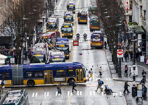
Seattle Times photo.

Interestingly, King County had wacked political requirements on bus service, which required providing equal investment in extra service in the less populated county for every investment in Seattle.

So Seattle residents passed a levy for Seattle-specific service and bus line expansion.

-- Levy to Move Seattle, Seattle SDOT
-- Best Practices in Transit, Seattle Urban Mobility Plan, 2009
-- King County Metro Service Guidelines
-- King County Metro Accountability Center

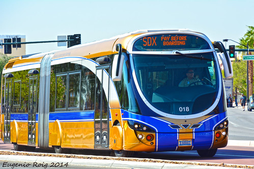
Richmond is a bus exclusive system.  Their story isn't particularly scintillating for big metropolitan area, but there are still some lessons.  Not only did they redefine their network a la Jarrett Walker, they created a highly visible bus rapid transit line called The Pulse, and they used this introduction to do some rebranding of the transit network.
Richmond Pulse BRT
Related to what they did with the Pulse line, something I recommend as part of the creation of new transit services is the creation of a  complementary program of transit network improvements to drive ridership improvements across the transit network:

-- "Setting the stage for the Purple Line light rail line to be an overwhelming success Part 1 | simultaneously introduce improvements to other elements of the transit network," 2017
-- "Using the Silver Line as the priming event, what would a transit network improvement program look like for NoVA?," 2017

Whereas most of these big bus network redesigns have resulted in minimal improvements, just a couple percentage points, the Richmond redesign has resulted in a 17% increase in ridership.

But that's on a small base, because their transit network has been pretty weak.  (It's still crippled by limited interest on the part of the abutting counties to participate in the transit system.)

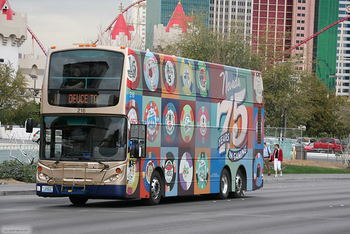
Making transit service more sexy.  When going through some trade magazines I hadn't read, I came across an old article about the bus system in Las Vegas, and the then director made the point that attractive buses are necessary to be able to compete with other mobility services, and their introduction of double deck buses resulted in double digit increases in ridership, and significantly greater revenues, greater than the cost of the service.

-- "Using the Purple Line to rebrand Montgomery and Prince George's Counties as Design Forward," 2017

The Strip & Downtown Express (aka the SDX). Las Vegas Public Bus Transportation.

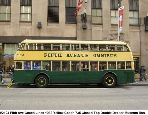
The double deck bus line serves the Strip, and it's a premium service, not unlike how before the MTA, there was a double deck bus service on Fifth Avenue in Manhattan (although that was more about demand).
IMG_8277 copie


Fifth Avenue Double Deck Omnibus (Bus), built by Yellow Coach Company

What the City Paper article missed.  The City Paper suggests that the DC area could learn from what they did in Richmond.  I suppose it's possible.  If only as a reminder of what to do.

For the Bus Transformation Study, I said it would be interesting to analyze the area's high performing bus routes as case studies and use that information as a way to improve under performing lines.

The problem with looking at Richmond is that DC and the DC area for the most part already does the things that Richmond introduced as a new program.  While there are always lots of opportunities for improvement, there is a high frequency network which is quite good, at least in DC.

Although a comparable high frequency network ought to be in place in Maryland and Virginia, and there should be more cross-jurisdictional services, especially along arterials connecting Maryland and DC.

The other problem is that in the areas where transit is most effective, especially in DC's core it's also where other competitive mobility services are offered -- car sharing, bike sharing, dockless scooters, now mopeds too -- plus ride hailing (Uber and Lyft), all of which are drawing customers away from bus (and rail).  (Although some studies find a positive association between bike sharing and rail transit ridership.)

-- "DC is a market leader in Mobility as a Service (MaaS)," 2018

But a major lesson from Richmond in terms of the Pulse BRT service is that you should probably have one unified brand for BRT and/or your "high frequency bus network."

By contrast, the DC area has many: (1) MetroExtra -- limited stop but not BRT; (2) Metroway, a BRT service in Alexandria and Arlington; (3) PikeRide, a branded bus service on Columbia Pike in Arlington; (4) REX, a branded bus service on Richmond Highway; (5) RideOn Extra, a limited stop service in Montgomery County; (6) a separately planned BRT system for Montgomery County; (7) a separately planned BRT line on Leesburg Pike in Fairfax County; etc.

(Sometimes there are advantages to backwardness, a la Gerschenkron's Economic backwardness in historical perspective.)

Other examples of differentiated and clear branding are Metro in Los Angeles' branding of rapid (red) and local (orange) buses, and how MARTA in Atlanta is rebranding as ATL ("MARTA is about to become The ATL. What do you think of the new bus design and logo?," Georgia Sun).

But sure, the DC area needs to (1) better define and integrate the bus network; (2) rebrand the bus agencies and redesign bus livery; (3) market the hell out of it; (4) systematically improve the service; (5) including shifting to double deck buses and other types of design forward buses; (6) defining and providing a night bus network; etc.

And that could probably result in double digit increases in ridership.

Expand the rail network to increase bus ridership. But the biggest thing would be to not only get Metrorail "Back to Good," it would be to expand and intensify Metrorail service, to make it and the transit network more useful, by increasing both its breadth and depth. Bus service complements and extends the subway and (eventually) light rail network.

-- "Redundancy, engineered resilience, and subway systems: Metrorail failures will increase without adding capacity in the core," 2016

Conceptual Future integrated rail transit service network for the Washington DC National Capitol Region. Design by Paul J. Meissner.  Concept by Richard Layman and Paul Meissner.
Conceptual Future integrated rail transit service network for the Washington DC National Capitol Region. Design by Paul J. Meissner. Concept by Richard Layman and Paul Meissner.

Improving bus ridership in the DC area. These were the points I made in "Improving bus service overall vs. reversing falling Metrobus ridership," 2018:

1. The impact of the sustainable mobility platform on use of mass transit services.

2. (As the area improves economically) Is the pool of transit dependent riders shrinking?

3. The DC area bus transit "network" is not perceived as a system/it is illegible.

4. Reposition bus service as a premium (design) product.

5. Rearticulate and reconfigure bus transit across the metropolitan area into one integrated system.

6. Make provision of dedicated bus transitways (and traffic signal prioritization for buses) a priority.

7. Create a overnight transit network at the metropolitan scale.

8. Don't forget bus services when creating HOT Lanes.

9. Rearticulate long distance commuter bus services too.


========
Primary Strategies from the Bus Transformation Study:

1. Customer focused.

2. Prioritizing buses on roads.

3. Frequent, reliable, convenient bus service.

4. Balancing the responsibilities of local and regional providers.

5. Streamlining back office functions and sharing innovation.

6. Transforming and incorporating changes in bus service.

Umm, wow.

Labels: , , , , ,

Monday, August 26, 2019

Friday is National Beach Day

-- National Beach Day website

Many cities have urban beaches, especially those on the coasts, like Santa Monica, New York's Coney Island, Miami Beach, etc.

Other cities on lakes, like Cleveland and Chicago, often have beaches.

Sometimes cities on rivers do too.

I think cities like Washington, that have the opportunity to create an urban beach, like DC has on the Anacostia River side of the RFK Campus, ought to do so, as a way to add urban verve to the city and to increase the opportunity that people have "to touch the water."

See:

-- "Revisiting stories: DC's Waterfront," 2018
-- "Engaging citizens in DC's rivers and waterfronts as a way to drive improvements in water quality," 2019

List of best beaches


FlightNetwork, Canada's largest online travel agency, has a webpage on the World's 400 best beaches, including a subpage on "City Beaches"

My beach-y urban design examples didn't make the list though, including

Paris
Paris-plage

Cleveland, articles from the Cleveland Plain Dealer:
Edgewater Live 2016

-- "Cleveland Metroparks' Edgewater Beach House is the architectural hit of the summer"
-- "See what's popping up on Cleveland's waterfront"
-- "Popular Cleveland script signs to be installed at three postcard-worthy locations"
-- "Cleveland Metroparks turns 100 with beach party of the century"

Chicago
North Avenue Beach, Chicago

New York City
coney island new york

In the DC area, it took me 27 years to learn about Colonial Beach, Virginia, on the Potomac River.  The water is cold...
Boardwalk, Colonial Beach

The beach library in Albena, Bulgaria seems pretty awesome.
Albena, Bulgaria, beach library, Hotel Kaliakra

Labels: , ,

Great transit marketing wrt the price of gas

(Except that long term, gas is likely to be relatively cheap, so long as cheap is defined as less than $3 per gallon.)

blogreader hstll sent this along, which is a promotion by the San Luis Obispo (County) Regional Transportation Authority.


Labels:

Sunday, August 25, 2019

Designing conflict in #2: bar crawls

Bar crawls are designed to promote negative behavior -- basically lots of drinking, inebriation, etc., which usually includes a lot of misbehavior, public drunkenness and nuisance crimes like public urination, vomiting, litter, etc.

So, if you don't want misbehavior, gross public drunkenness, public urination, massive amounts of litter, etc., you probably should outlaw bar crawls, even if it costs bars some business.

This has been a problem in DC and Arlington.

-- "After a Disastrous Halloween, D.C. Bar Crawls Face New Regulations," Washington City Paper, 2016
-- Pub Crawl Applications and Requirements, DC Alcoholic Beverage Regulatory Administration
-- "New rules for St. Patrick's pub crawl in Arlington aim to curb drunken hijinks," 2015

And according to the Guardian, it's a big problem in Prague, "The fall of Prague: 'Drunk tourists are acting like they conquered our city."

This is a classic case of "designing conflict in."

Labels: , , , ,

Designing conflict in versus designing conflict out

From time to time I make the point that "planning and zoning is supposed to improve quality of life," and when routine outcomes from those processes don't do that, it's an indicator that the processes aren't designed properly.

What I say is that the point of planning is supposed to "design conflict out" rather than "design conflict in."  That's one of the justifications for separated uses, which are now excoriated by us pro-urbanists, but have their roots in how residential and industrial areas used to be cheek by jowl in cities, and because of limited environmental regulations at the time, the negative impacts on residential uses were tremendous.  E.g., bad air quality, dust, noise, etc.

0824191621
I went to the 17th Street Festival yesterday -- I like festivals because nonprofits and other civic use functions often have tables -- and one person was carrying a clipboard with a poster about how Ward 2 Councilmember Jack Evans should be recalled, because of various ethical transgressions.

Later I went out to dinner with some people I ran into at the Festival, and we were talking about Jack Evans among other things, how wrt the city transgressions (not the WMATA transgressions), they would have been illegal had he sent the email from his personal account.  One of the people had come across an article damning the Washington Post over its long time support of Evans ("WaPo Complicit in Corruption of DC Council's Corporate 'Concierge'," Counterpunch).

Designing ethical conflicts into City Council

Years ago, blogreader EE shared with us a book published by the World Bank, Corrupt Cities: A Practical Guide to Cure and Prevention and I wrote about it in this 2011 piece, "DC ethics legislation misses the point: focus on what produces corruption as a regular outcome, not monitoring."

In response to the heated discussion about Evans, I said "well in the past plenty of Councilmembers like Jim Graham and David Catania had similar conflicts, as does current sitting Councilmember Anita Bonds." That doesn't even get into people who had to resign because of other transgressions (Kwame Brown) or went to jail (Harry Thomas Jr., Michael Brown).

Potential for ethical failure is built into the position.

This comes about because Councilmembers are allowed to have second jobs. They are supposed to avoid conflicts of interests, but like with "pay to play" in electioneering fundraising, when you allow second jobs, or consulting, it creates opportunity for ethical transgression, because the most motivated of potential employers likely want to leverage the ability of the politician to affect events under the purview.

The one thing I hope comes out of this is a permanent ban on second job income, with the exception of teaching and independent writing.

0824191515Unintended consequences of public funding for DC local elections

We also talked about the various people running for the Ward 2 position, and how the new law providing public financing of for local elections, by providing a 5x match of locally raised funds, could have the consequence of having the opposite effect that was intended.

The idea was to promote a more grassroots approach, with less reliance on donations from corporate sources or out of state interests; but because such large amounts of money are involved now ("Challengers to Jack Evans flex new financial muscle under new D.C. public finance law," Washington Post), it may have the unintended impact of lessening the need to be grassroots, because a relatively small number of donations can trigger such a big return.

Designing conflicts into the 15th Street Cycletrack

The people at dinner are involved in various Dupont Circle/Ward 2 civic matters and we discussed cycletracks among other things.  One that come up is a proposal for one on 17th Street ("17th Street in Dupont could get a protected bikeway," Greater Greater Washington), which even though I am a hardcore cyclist, I disagree that it is needed for one, but also because I have a better way to leverage 17th Street for sustainable mobility purpose.
Basically the idea that we need to remake more streets, at the very least, one in every ward, as sustainable mobility corridors, along the lines of what I suggested for Silver Spring's Fenton Avenue, although with different recommendations for 17th Street (more about that later):

-- PL #5: Creating a Silver Spring "Sustainable Mobility District"
-- "Part 1: Setting the stage"
-- "Part 2: Program items 1- 9"
-- "Part 3: Program items 10-18"
-- "Part 4: Conclusion"

Anyway, they didn't know about the recent study which called attention to engineering design flaws in the 15th Street Cycletrack ("IIHS Study: Some Protected Bike Lanes Leave Cyclists Vulnerable to Injury," press release). The conflicts are that there are a lot of curb cuts/driveways/alleys along the route, and each presents the opportunity for conflict.
15th Street cycletrack, DC

By contrast, most cycletracks are designed to have minimal opportunity for the incursions of curb cuts, driveways, and alleys. Hopefully, the same mistakes won't be made in other settings.

But it's not really correctable because even if the section of the cycletrack from Rhode Island Avenue to U Street functions less well, it's part of a well used cycletrack which in turn is a key element of the growing bikeway network across the city.

It is however, addressable.  I'd probably add sensors and a flashing light set up to the areas that are determined to be key problems, just like pedestrian HAWK signals.

Labels: , , ,

Tuesday, August 20, 2019

Why not elect DC's representatives to the WMATA transit agency board?

2019-08-20_05-00-46The Washington Post editorializes ("Don’t fill Jack Evans’ vacant Metro board seat with another council member") that the replacement on the WMATA board for Jack Evans, the DC Councilmember who has been implicated in various unethical actions representing businesses without disclosure, shouldn't necessarily be a DC councilmember, but someone skilled in transit issues.  From the article:
NO SOONER had D.C. Council member Jack Evans (D-Ward 2) resigned from the Metro board than some of his colleagues started lobbying to succeed him. But the fact that an elected member of the council has traditionally served on the board doesn’t mean that’s the way it must be.  
Indeed, we hope that Council Chairman Phil Mendelson (D) doesn’t limit his search for a replacement to council members, but instead carefully considers what kind of qualifications and experience will best serve the interests of the transit agency and those who depend upon it. …

The Metro board consists of eight principal members, two each from the District, Virginia, Maryland and the federal government. Each jurisdiction determines how it will appoint its representatives, and practices vary.

Maryland, for example, prohibits anyone holding elected office (federal, state or county) from serving, and its required qualifications are written into law. These include experience in transportation, land-use planning, public safety, law, homeland security or engineering. Members also must be regular users of the agency’s bus or rail services. Maryland’s most recent member is state Transportation Secretary Pete K. Rahn.

The District, like Maryland and Virginia, has a substantial financial investment in Metro and rightly wants its interests represented. Surely, though, it can find someone who would also bring relevant experience and added value to the board. ...
It has always been interesting to me that DC's past representatives in positions of authority on the Metropolitan Washington Council of Governments and the WMATA board don't seem to step up and become more knowledgeable on matters of urbanism and urban transportation.

I always was impressed with how former Arlington County Board member Chris Zimmerman wasn't just great on transit and urbanism himself, he brought along the rest of his colleagues, so that all of them were committed to praxis when it came to matters of transportation and urbanism.  Equally, all were great presenters on those topics too.

That never comes across on the part of DC officials, at least to me.

So I can see the argument for a primary representative on the WMATA board representing DC who is totally committed to public transit and urbanism.

BART's board is popularly elected (Director Elections | bart.gov; "Three new directors, one incumbent win BART board seats," San Jose Mercury News).

I think there are other examples of popularly elected transit agency board members, but none others for agencies as large as BART.

The counties that participate in BART have a property tax and maybe sales taxes that support the system, but as a government agency, with taxing and bonding authority of its own, the directors control the funding stream separate from the underlying jurisdictions, unlike how the WMATA system is set up where each of the three "state" jurisdictions provide funds, some based on formulas (how many stations, how much bus service) and some variable.

The justification for appointing at least one councilmember to the WMATA board to represent DC is that DC pays a significant amount of money each year towards the system, an amount that is variable year-by-year, and it makes sense to have a direct connection on the board to the appropriators.

But given that DC clamors to be a state, as I have argued in many other instances, if you want to prove you're deserving, and you believe in democracy, when democracy isn't working, add more democracy rather than reduce it.

1. That would mean switching the DC members of the WMATA Board to popular elections. One position could be up in each election cycle, serving four year terms.

2. DC could create a transportation commission. Like Arlington, Tempe, and others. And the elected WMAtA board members could be ex-officio members.

-- Arlington County Transportation Commission
-- Transportation Commission | City of Tempe, AZ

3.  They would have to be treated seriously by DC Government as elected positions, allocated office space, resources, and support to be proper representatives, and with participation rights in Executive Branch and Legislative Branch deliberations on transit matters.

Labels: ,

Cycletrack under construction on Florida Avenue NE

In April, a bicyclist was killed on Florida Avenue NE, while waiting at an intersection for the light to change.  "Nothing" could have prevented the death, which was caused by a driver of a stolen van driving at a high rate of speed running through a red light, hitting a car, which then careened into the cyclist, killing him ("Bicycle activist killed on bike in crash with stolen van in the District of Columbia<" NBC Washington). While there had been plans to construct a cycletrack there for many years, starting in 2009 ("Initial thoughts following the Dave Salovesh murder," WaschCycle) it became accelerated after the death, as a way for the city to respond.

But... I had communicated with the then director of DC's Department of Transportation in 2005, about the need for a road diet on Florida Avenue NE, because of its width encouraging drivers to operate at a high rate of speed. E.g., one incident included a speed camera clocking a car at 97 mph, albeit late at night.

So should I be heartened that the cycletrack is being constructed now? Or should I be disappointed that it has taken 14 years?

For me, I've moved on to other concerns, deeper learnings, bigger ideas and frameworks. So it's hard to take much comfort in something finally happening now.

Although, again, it's impossible to say whether or not had this been done earlier would it have prevented this particular death.

In any case, the network of cycle infrastructure in this vicinity is expanding greatly, from the cycletrack on 1st Street NE to include cycletracks on 6th St. NE, now Florida Avenue, contraflow lanes on M Street NE and G and I Streets NE, some cycletrack on 4th Street NE connecting Union Market to NoMA and the NoMA Metrorail station and the Metropolitan Branch Trail, etc.

Cycletrack under construction on Florida Avenue NE

Cycletrack under construction on Florida Avenue NE

Labels: , , , ,

A marginally better photo of the CUA urban design failure to better connect the new pedestrian walkway to the Brookland Metrorail Station

New Catholic University pedestrian walkway jogs rather than continues across McCormack Road to the Brookland Metrorail Station

This is looking east toward the station, from the walkway.  McCormack Road separates the walkway from the Metrorail station.

Labels:

Wednesday, August 14, 2019

Infographic, "Help Make San Francisco Streets Safer," Walk San Francisco, 2012

I am trying to reduce the amount of "unnecessary information" I have stuffed in boxes, so I am doing some "processing."  Most of the articles I've clipped no longer seem that necessary.  But I still come across some gems.

I like this infographic from Walk San Francisco, promoting their advocacy for more investment in walking infrastructure.

Speaking of walking, the Toronto 360℉ Wayfinding Strategy Plan is a exemplary document Although the fancy pdf doesn't seem to be available online, the accessible version without graphics is. (Toronto Wayfinding Strategy - Valuing the Benefits).

The webpage for the project links to four related wayfinding programs--Metrolinx, the "underground" pedestrian walkway system called PATH, parks, and cycling.

I haven't read the Implementation Handbook or the 2019 Project Handbook.

And while in Alexandria recently, seeing one of their wayfinding signage setups on Cameron Street by Gadsby Tavern made me realize that the signage "fails" in that it is focused on King Street but doesn't extend outward from King Street as necessary, such as along Washington Boulevard, and in the streets perpendicular and parallel to King Street.

Plus, while the wayfinding program for the Del Ray neighborhood predates the later system in Alexandria, they probably should have been integrated.

Infographic, "Help Make San Francisco Streets Safer," Walk San Francisco, 2012

Labels: , ,

Alexandria has boosted its on-street HOV requirements to 3 persons per vehicle (temporarily)

Alexandria has boosted its on-street HOV requirements to 3 persons per vehicle

Inspired by an op-ed by then Brookland resident and urban planner Patrick Hare in the Washington Post dating to the early 1990s suggesting that DC could implement HOV (High Occupancy Vehicle) lane restrictions on surface streets, for years in my "transportation wish list," I've suggested that DC should do this on streets such as Rhode Island Avenue, Georgia Avenue, etc.

-- "HOV Lanes: Not Just for Highways," Washington Post; Jan 20, 1991; page B.08.
-- "Transportation Wish List: 2015 edition, part one, the original list;" 2015
-- "Transportation Wish List, 2015: part two, new ideas," 2015

Alexandria is one of the only area jurisdictions to have done this ("N.VA. OFFICIALS HOPE NEW SPIRIT OF COOPERATION ON TRANSPORTATION WILL SPREAD," Washington Post, 1988) and interestingly, at the behest of Fairfax County, whose commuters use the streets--Washington Boulevard and Route 1--that have the restrictions, the city downshifted their original requirement of 3 people to two.

When I was in Alexandria a couple weeks ago, I noticed that they shifted their HOV policy to three persons (as well as extending the hours).

From a corridor management standpoint ("Transportation network service interruptions part 3: corridor/commute shed management for Northwest DC and Montgomery County, Maryland," 2016), it's a response to the three month repair-related shutdown of Metrorail stations south of National Airport ("Alexandria changing HOV restrictions in Old Town for Metro closures," Washington Business Journal).

In any case, creation of HOV requirements for surface streets that function as primary commuter arteries is something more jurisdictions should consider, especially DC.

HOV 2 Lane in Alexandria

Labels: ,

Big urban design miss at Catholic University

Lighted M Metrorail sign pylon at the Brookland Metrorail Station, WMATA
While converting the on campus street that extends from the Brookland Metrorail Station into the  Catholic University campus is a big improvement for the pedestrian experience and a win for sustainable mobility, they failed to maximize the opportunity of the project because they did not:

(1) extend this treatment across John McCormack Road to the Metrorail station

(2) by reconfiguring the geometry of the connection from the east side of the street to the west side of the street.  The jog between the campus walkway and the crosswalk from the Metrorail station has been maintained, rather than extending the campus walkway across McCormack Road with a new pathway between the Metrorail station and the campus, rather than maintain the current jog between the two

(3) the enhanced urban design treatment, in particular the brick pavers, should have included the crosswalk.at a minimum.

Granted it probably would have been difficult to work with WMATA as improvements would have required their cooperation, as well as DC Department of Transportation, which controls John McCormack Road.

And fortunately, between Michigan Avenue and this point, the road isn't used by many vehicles, which reduces the chances for conflict between motor vehicles and pedestrians.

New entryway at Catholic University, connecting to the crosswalk to the Brookland Metrorail Station

New entryway at Catholic University, connecting to the crosswalk to the Brookland Metrorail Station

Benches and the Metropolitan Branch Trail adjacent to the Brookland Metrorail Station
Benches and the Metropolitan Branch Trail adjacent to the Brookland Metrorail Station.


Counterpoint.  Years ago, after Howard University built a bunch of new dorms behind the campus, along 4th Street NW, extending the concentration of dormitories there, I suggested to the then DC planning director that the street should be enhanced with pedestrian-focused urban design changes, including special paving treatment for the street and intersection improvememnts.

Howard UniversityShe countered that would mean "Howard University taking over the street."

You could say the same thing with the connection between the CUA campus and the Metrorail station across the street.

But I disagreed with her then because the point ought to be in recognizing land use conditions and seeking the best possible outcome, with the preference on improving and extending the pedestrian experience and character of the city.

In both cases, sustainable mobility choices need to be preferenced, with the aim of discouraging car use and increasing the use of transit, biking, and walking.

Conclusion.  While Catholic University's creation of the pedestrian walk from the Metrorail station is to be commended, it must be acknowledged that they had the opportunity to make it transformative, and they blew that opportunity.

Labels: , , ,

Tuesday, August 13, 2019

Defining National Park Service installations in DC as locally or nationally serving

In this piece, "Washington DC has lots of parks and open space, but it's not the #1 City park system in the US," I wrote that Rock Creek Park could be defined as national serving, but I didn't say why. In response to a comment by Edward Drozd:

I'm curious, other than the National Zoo, how is Rock Creek Park nationally serving? Speaking as a complete layperson about planning and all, but it seems to serve similar purposes as, say, Central Park or Boston's emerald necklace system. In Boston's case there is a Frederick Law Olmsted National Historic Site (which is actually in Brookline, not Boston), but that's orders of magnitude difference from maintaining the system.
I said it was because RCP was one of the earliest parks designated by the federal government, decades before the National Park Service was created. But that is the only reason. It's a locally serving park otherwise.

NPS has a lot of parks, memorials and historic sites in the city. Even their webpage on DC parks doesn't list all the various sites, in particular "circles" and various reservations across the city, although the webpage lists the major sites.

As I argued in the above-cited and other pieces, most of the NPS parks serve local audiences, and restrictions on how these parks can be operated dis-serves the users, in this case, DC residents.  DC should take on the management and operational responsibilities for federally-owned parks that are primarily locally serving.

The list below is not complete.

Park/Site Federal Interest Local
Anacostia Park no yes
Capitol Hill Parks* no yes
C&O Canal National Historic Parkarguable** yes
Circles and reservations outside Downtown***no yes
Columbus Circle**** not as an interest separate from the railroad station Should revert to Union Station
Downtown Parks+ arguable primarily
Fort Circle Parks Fort Stevens***** mostly
Georgetown Waterfront Park no yes
Kenilworth Park & Aquatic Gardensnot really functions as an extension of Anacostia Park
Meridian Hill Park no yes
National Mall and Monuments yes no, except for use as sports fields
President's Park++yes no
Rock Creek Park+++ yes, as part of the history of the creation of the federal park system, no in terms of use yes
Theodore Roosevelt Island as a memorial yes as a park, yes

* Capitol Hill Parks.  What would be large "circles" or squares have been designed as parks: Lincoln Park; Stanton Park; Folger Park; Marion Park; plus Seward Square on Pennsylvania Avenue SE.  Garfield Park is actually under the control of DC. The grounds of the Capitol are under control of the Architect of the Capitol, not NPS.

** C&O Canal.  Many canal parks across the country are operated as state or regional parks.  If C&O Canal Park were to revert to local control, DC and Maryland should create a joint management plan.
Erie Canal Museum Postcard

*** Circles outside of Downtown.  For example, Chevy Chase Circle; Dupont Circle; Grant Circle; Logan Circle; Thomas Circle; Washington Circle
Logan Circle 1

****The area in front of Union Station.  It's a travesty that it serves a transportation purpose but it isn't maintained to support it, such as during snow events.
Union Station changes
Washington Post graphic.

***** Fort Circle Parks.  A system of forts and batteries were created to defend the national capital during the Civil War.  While the majority of the forts and supporting batteries are in DC, some are present in Maryland and Virginia.  In DC, Fort Stevens is the only one that came under direct attack during the Civil War and President Lincoln actually attended part of the battle.  Therefore the argument can be made that this park and the related Battleground National Cemetery on Georgia Avenue, should be classified as federal.  Although note that other forts, such as Fort Totten and Fort Slocum, and batteries, provided artillery support to the battle at Fort Stevens.  So the number of installations that could be determined to have a federal interest could be larger.

Otherwise, if the parks are used it all, it's by local residents.
Abraham Lincoln at the Battle of Fort Stevens and shelling of Gen. Early's forces in Silver Spring, MD July 11-12, 1864 [NARA RG.66]

+ Downtown Squares.  Farragut Square [The Golden Triangle BID does some stuff there]; Franklin Park {there is an MOU between the Park Service and the Downtown BID so that the latter will operate it]; McPherson Square.  You can make the point that since they "complement" the White House as a park system, they could be designated as federal.  But the users of the parks are local.

++ Parks around the White House: what we call Layfayette Square but the Park Service calls Lafayette Park; Ellipse; White House grounds. They function as an extension of the National Mall.

+++ Because Rock Creek Park extends into Maryland, where on the Maryland side the park is run by Montgomery County, a joint management plan would be in order.

Parkways

NPS managed parkways in DC are Shepherd Parkway and Suitland Parkway.  As their primary purpose is transportational, they should revert to DC with the proviso that they be maintained as parkways, not converted into traditional roadways.

A joint management plan with Maryland should be developed when these roadways extend into Maryland.

Same with Rock Creek Parkway as a roadway. The park should be run by DPR, the road by DDOT.  There should be a corridor management plan for the roadway ("Transportation network service interruptions part 3: corridor/commute shed management for Northwest DC and Montgomery County, Maryland," 2016).

The same is true for the parkways in Virginia and Maryland, they should revert to the states, with the one possible exception being Mount Vernon Parkway, which connects to Mount Vernon.

Other Historic Sites

Include the Frederick Douglass House, Carter G. Woodson House, Mary McLeod Bethune Home, Old Stone House in Georgetown, etc.  These sites serve national audiences and should remain under the control of NPS.  Although Old Stone House is arguable.  It does interpret the history of the city before the federal district was created and helps to tell the story of the creation of the federal district (Georgetown predates the creation of DC.)

Show me the money.  The problem is that "Home Rule" is costly.  Were DC to take on the financial responsibilities for these parks, and operate them to the level they ought to be operated, the cost would be many millions of dollars annually.  The city doesn't want to take on these kinds of financial responsibilities.  But if you want to be a state...

Labels: , ,

Sunday, August 11, 2019

One more idea about Detroit: merging not with Wayne County but Oakland County

Vacant houses in Detroit
Rebecca Cook, Reuters.

In the 2014 piece, "The rise of Oakland County is built on Detroit's failure," I did discuss city-county merger as one way to change the trajectory for the City of Detroit, which while revitalizing at its core, faces real long term issues concerning lack of market demand for residential living.

I favor city-county merger for legacy cities like Pittsburgh, St. Louis (it will be on the ballot but I haven't written about it yet), Baltimore ("Opinion: What Baltimore and D.C. can do to start working better together as a region (Baltimore Business Journal op-ed)," 2016), and Detroit, as a way to deal with difficult financing and governance issues ("The real lesson from Flint Michigan is about municipal finance," 2016).

But Detroit's decline has significantly impacted Wayne County too, and the County has other issues besides Detroit, aging infrastructure

Since the tri-counties haven't grown much, there isn't much chance of Detroit's recapturing the lost 1.2 million residents...

That's why after I wrote the 2014 piece, I realized that instead of merging with Wayne County, Detroit should merge with Oakland County, which is the most economically successful county in the Detroit Metropolitan Area.

That would be an unprecedented kind of merger.

But outside of creating more rigorous metropolitan government structures, along the lines in Greater Portland Oregon and Minneapolis-St. Paul, that's maybe the only kind of quantum scale change that could truly change Detroit's trajectory.

All the great media discussion notwithstanding:

-- "12 big developments set to transform Detroit," Curbed Detroit
-- "Detroit's Revival Is in Full Swing, But Some Question Its Future," Barron's
-- "Commentary: How Detroit Became a Model for Urban Renewal," Fortune
-- "Detroit's Big Comeback: Out Of Bankruptcy, A Rebirth," NPR
-- "Is Detroit Really Experiencing a Full Recovery?" CityLab

When I did a tour of New Orleans in 2006, after Katrina when the city was devastated, the native tour guide was outraged, and wanted us to be outraged too. I said, "how is this any different from what happened to Detroit?"

Detroit suffers from racism sure (see the writings of Thomas Sugrue) but it was also the auto industry's plan to break the UAW, which mostly has worked, but at the expense of cities in Michigan, especially Detroit and Flint (Pontiac, Lansing, Bay City, and Saginaw too).

In the 1950s, Detroit had something like 15 auto assembly plants, each of which employed thousands of people, and scads of supplier plants, each of which employed hundreds or thousands of people.  Now Detroit has two assembly plants.

Similarly, Flint at its peak had over 80,000 people employed by GM.  Now it is fewer than 8,000.

So that is why Michigan shifted Republican over the past few decades as auto workers, who tended to vote Democratic (cf. George Wallace, and Reagan Democrats), lost their jobs and left the state.

It's also why I get f*ing tired of reading comments on articles about how Democrats who run cities drive them into the ground.  The issue is far more complicated.

Look at all those robots!  Photo from "10 Auto Industry Jobs that Will Die Due to Automation," MoneyInc.

At the end of the day, locally elected officials have little control over what corporations do and mega economic trends like capital investment, globalization, the replacement of workers with machines, industrial consolidation, etc.

The systems that fund local government were created when the nation was growing rapidly.  We are past that phase now, and in many cases, especially for legacy communities with aging infrastructure and growing pension liabilities, local government funding systems won't generate enough revenue

Labels: , , , , , ,

Revisiting stories: the death of L. Brooks Patterson, County Executive, Oakland County, Michigan

======
Note: I lived in Oakland County roughly from 1971/1972-1978 and the summers of 1979 and 1980.
======

L. Brooks Patterson won 7 terms as County Executive in Oakland County, Michigan, which lies north of Detroit.  Before that he was the tough on crime County Prosecutor for 4 terms.

He was strongly pro-County and pretty much anti-Detroit, as I wrote in this piece from 2014, "The rise of Oakland County is built upon Detroit's fall."

From the Crain's Detroit Business article, "What will happen to Brooks' deputies?":
Patterson was first elected county executive in 1992 after serving four terms as Oakland County prosecutor.

His tenure as Oakland County executive was marked with myriad successes, but also controversy. The county's AAA bond rating has been reaffirmed time and time again under his leadership, and the county has a lauded three-year rolling budget. He instituted the Automation Alley high-tech cluster and the Emerging Sectors program for knowledge-based jobs. Medical Main Street and Main Street Oakland also came into being under his watch. He was honored by Governing magazine in 2013. The University of Detroit graduate and U.S. Army veteran was generally viewed as a business community champion.

While his leadership of Oakland County itself has drawn wide praise, his comments about Detroit and other issues have drawn criticism.

His career had been marked by bitter feuds with Detroit and neighboring counties over a host of issues ranging from transit to the Detroit Water and Sewerage Department. Some viewed him as an obstacle to more robust regional cooperation.
Like Trump's very parochial bilateral "Make America Great Again" push, Patterson was a block to creating more regional approaches to the area's issues.

In e-talking with Nigel, our correspondent from New Zealand, I looked up the demographic data comparing Wayne, Oakland, and Macomb Counties population from 1960 to today.

Overall, there are only about 120,000 more residents in 2018 compared to 1960--although it must be acknowledged that the metropolitan area has grown beyond these three counties.

The difference is that 1.2 million residents from Detroit have been redistributed and Wayne County's population dropped by 900,000, while Oakland and Macomb Counties roughly doubled in population.

Patterson died not quite two weeks ago, and because in the 2016 election, the County shifted from a Republican dominated electorate to a more progressive and Democratic there is jockeying between Democrats as the Party aims to capture the County Executive position.

It's not clear if there will be a special election, which if one is held will be in the 2020 election cycle, for a two-year partial term, as the normal cycle for the office is in the "off year election" from Presidential elections.

Also see:

-- "Commentary: Patterson leaves enduring legacy, but time for region to move on," Crain's Detroit Business
-- "R.I.P. L. Brooks Patterson, A racist," Detroit Metro Times
-- "McGraw: Friends Say Brooks Patterson 'Loved' Detroit, But His Record Shows Otherwise," Deadline Detroit

A couple weeks ago in a post about segregation, I mentioned that I went to school for a time in the Pontiac School District, while the school system was desegregating and where school buses were bombed in protest. It turns out L. Brooks Patterson represented one of the incendiary anti-busing activists, Irene McCabe...

Labels: , , , , , ,

Last week was National Farmers Market Week

-- National Farmers Market Week, August 4th-10th, 2019

I wasn't able to write much last week, because I was preparing for a presentation on an RFP, although it was related to this topic.

I've written posts in the past if you really want to look them up and draw on my experience.

But one little blurb in the Express during the week is worth writing about.  According to the American College of Sports Medicine's 2019 American Fitness Index, DC is ranked #1 in the US in farmers markets per residents.

DC has 57 farmers markets which means that there are 8.2 markets per 100,000 residents.

But I would argue what that means is that DC has too many farmers markets relative to its size, meaning that most farmers markets end up being underpowered.

For example within a two mile radius on Saturday you can go to farmers markets at 14th and U Streets, in Mt. Pleasant, Columbia Heights, Petworth, and 14th Street and Colorado Avenue.  It's convenient for the residents, but not so great for the farmers, who have to represent themselves in multiple markets.  Were people to travel to one market, say in Columbia Heights, likely it could be an awesome market, stronger than any of the five individual markets.

What my experience is with other places is that they have many fewer markets.  Yes that means that people have to go out of their neighborhood sometimes to get to a farmers market.  But at the same time, the likelihood is that the farmers market offerings are much better.

Downtown Salt Lake Saturday Farmers Market
Downtown Salt Lake Saturday Farmers Market.  One of the vendor-sellers is the Salt Lake County Jail, which has a gardening program.

Portland Farmer's Market on PSU Campus
Portland, Oregon

There is no farmers market in DC as good as the Portland Farmers Market or the Downtown Salt Lake City Farmers Market, both on Saturday.  They are huge markets, with an incredible range of offerings, both in fresh and prepared foods, and in supporting innovative offerings, etc.  The Waverly/32nd Street Market in Baltimore also on Saturday is at least as good as the Dupont Circle Farmers Market on Sundays, and might be a little better.

People at the Waverly Market, Baltimore
Waverly Market, Baltimore.

The Baltimore Farmers Market might not be quite as good as those, but supports a range of pricing including lower priced goods, especially for larger quantities, while the pricing at farmers markets in DC tends to be uniformly high, because "out-of-state" farmers and vendors believe, rightly, that they can charge a lot more when selling to mostly higher income DC residents.

That's why vendors travel many hours to sell in DC, because they can get much higher prices than if they were selling locally.
There is a new farmers market in Petworth on Friday </p><p>evenings
Petworth Market.

Labels: , ,